F. Valentijn More Furniture and Collectibles
2
13
to
7
13
13
13
13
13
12
10
10
93
1,018
219
162
141
Creator: F. Valentijn
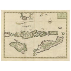
Old Antique Map of the Sumbawa, Flores, Timor in the Banda Region of Indonesia
By F. Valentijn
Located in Langweer, NL
Original antique map titled 'Kaart der Zuyd-Wester Eylanden van Banda'. A fascinating map of the islands in the southwestern part of the Banda Sea including Sumba, Flores and Timor. Published 1724-1726 by Joannes van Braam...
Category
Early 18th Century Antique F. Valentijn More Furniture and Collectibles
Materials
Paper
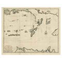
Old Antique Map of the Banda Islands (Southeast), Indonesia & Northern Australia
By F. Valentijn
Located in Langweer, NL
Original antique map titled 'Kaart van de Zuyd-Ooster Eylanden van Banda'. Important map of the seas and islands surrounding the Banda Islands, Indonesia, extending south to northern Australia, east to Papua New Guinea and north to Ceram. Published 1724-1726 by Joannes van Braam...
Category
Early 18th Century Antique F. Valentijn More Furniture and Collectibles
Materials
Paper
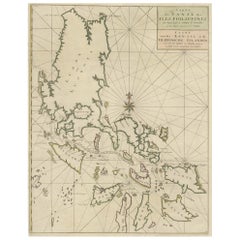
Original Old Map with Many Details Around Manilla in the Philippine Islands
By F. Valentijn
Located in Langweer, NL
Original antique map titled 'Carte du Canal des Iles Philippines (..) - Kaart van het Kanaal in de Filippynsche Eilanden (..)'. Striking and highly detailed chart of the Islands of the Philippines. Shows Islands, bays, reefs, soundings tracks of the Manila Galleon route, etc. Published 1724-1726 by Joannes van Braam...
Category
Early 18th Century Antique F. Valentijn More Furniture and Collectibles
Materials
Paper
Antique Map of Ambon Island by Valentijn, 1726
By F. Valentijn
Located in Langweer, NL
Antique map titled 'Caart van het Eyland Amboina in 't bijsonder'. Map of the Islands Ambon and Timor, one of the Moluccan Islands, Indonesia, with an inset of castle Victoria with t...
Category
Early 18th Century Dutch Antique F. Valentijn More Furniture and Collectibles
Materials
Paper
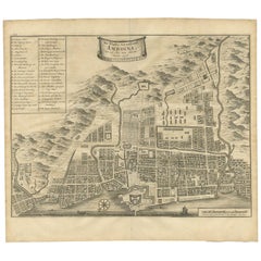
Antique Map of the City of Ambon by Valentijn, 1726
By F. Valentijn
Located in Langweer, NL
Antique map titled 'De Platte Grond van Amboina zoo als het was in den Jaare, 1718'. Antique map depicting the City of Ambon, Indonesia. This print originates from 'Oud en Nieuw Oost...
Category
Early 18th Century Dutch Antique F. Valentijn More Furniture and Collectibles
Materials
Paper
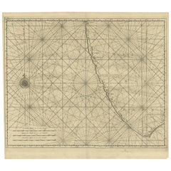
Antique Map of Malabar Coast by Valentijn, 1726
By F. Valentijn
Located in Langweer, NL
Untitled sea chart of the coast of Malabar, India. This print originates from 'Oud en Nieuw Oost-Indiën' by F. Valentijn.
Category
Early 18th Century Dutch Antique F. Valentijn More Furniture and Collectibles
Materials
Paper
Antique Map of Boero in Indonesia by Valentijn, 1726
By F. Valentijn
Located in Langweer, NL
Antique map titled 'Boero-Amblauw'. Detailed map of the Island Ambelau and Buru, Maluku Islands, Indonesia. With an inset of the lake on the Buru mountains. This print originates fro...
Category
Early 18th Century Dutch Antique F. Valentijn More Furniture and Collectibles
Materials
Paper
Antique Print of the Coast of Dabhol 'India', 1726
By F. Valentijn
Located in Langweer, NL
Antique print titled 'De Kust van Dabul'. Antique print of the coastline near Dabhol in India. This print originates from 'Oud en Nieuw Oost-Indiën' by F. Valentijn.
Category
Early 18th Century Dutch Antique F. Valentijn More Furniture and Collectibles
Materials
Paper
Antique Map of Anjouan Island by Valentijn, 1726
By F. Valentijn
Located in Langweer, NL
Antique map titled 'Anzuany'. This map depicts the island of Anjouan, one of the Comoros islands situated between Madagascar and Africa. The map is oriented with north to the left wi...
Category
Early 18th Century Dutch Antique F. Valentijn More Furniture and Collectibles
Antique Map of Ambon and Surroundings by Valentijn '1726'
By F. Valentijn
Located in Langweer, NL
Antique map titled 'De landvoogdy van Amboina met de elf onderhoorige Eylanden'. Decorative map of the eastern tip of the islands of Ambon, Indonesia. This print originates from 'Oud...
Category
Early 18th Century Dutch Antique F. Valentijn More Furniture and Collectibles
Materials
Paper
Antique Map of South East Asia, Australia and the Indian Ocean, 1726
By F. Valentijn
Located in Langweer, NL
Antique map titled 'Tabula Indiae Orientalis'.
Beautiful detailed map of Australia, Southeast Asia and the Indian Ocean. The map features a fine depiction of the outlines of the western two-thirds of Australia, based on the discoveries of explorers working for the Dutch East India Company (the VOC). These include Willem Jansz's discoveries in the Gulf of Carpentaria in 1606; the encounters of Dirk...
Category
Mid-18th Century Dutch Antique F. Valentijn More Furniture and Collectibles
Materials
Paper
Antique Map of Ambon and Boero by Valentijn, 1726
By F. Valentijn
Located in Langweer, NL
Untitled map of the western part of the island Amboina with Boero, Indonesia. This print originates from 'Oud en Nieuw Oost-Indiën' by F. Valentijn.
Category
Early 18th Century Dutch Antique F. Valentijn More Furniture and Collectibles
Materials
Paper
Antique Print of a River in Madagascar by Valentijn, 1726
By F. Valentijn
Located in Langweer, NL
Antique print titled 'Rivier van Maningaar op Madagascar'. Text on verso. This print originates from 'Oud en Nieuw Oost-Indiën' by F. Valentijn. According to Valentijn, there was a D...
Category
Early 18th Century Dutch Antique F. Valentijn More Furniture and Collectibles
Materials
Paper
Related Items
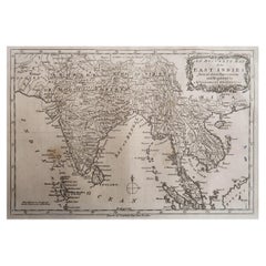
Original Antique Map of India. C.1780
Located in St Annes, Lancashire
Great map of India
Copper-plate engraving
Published C.1780
Three small worm holes to right side of map and one bottom left corner
Unframed.
Category
Early 1800s English Georgian Antique F. Valentijn More Furniture and Collectibles
Materials
Paper
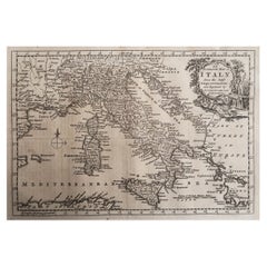
Original Antique Map of Italy. C.1780
Located in St Annes, Lancashire
Great map of Italy
Copper-plate engraving
Published C.1780
Unframed.
Category
Early 1800s English Georgian Antique F. Valentijn More Furniture and Collectibles
Materials
Paper
Original Antique Map of Asia. C.1780
Located in St Annes, Lancashire
Great map of Asia
Copper-plate engraving
Published C.1780
Two small worm holes to right side of map
Unframed.
Category
Early 1800s English Georgian Antique F. Valentijn More Furniture and Collectibles
Materials
Paper
Original Antique Map of Ancient Greece, Achaia, Corinth, 1786
Located in St Annes, Lancashire
Great map of Ancient Greece. Showing the region of Thessaly, including Mount Olympus
Drawn by J.D. Barbie Du Bocage
Copper plate engraving by P.F Tardieu
Original hand color...
Category
1780s French Other Antique F. Valentijn More Furniture and Collectibles
Materials
Paper
Antique 18th Century Map of the Province of Pensilvania 'Pennsylvania State'
Located in Philadelphia, PA
A fine antique of the colony of Pennsylvania.
Noted at the top of the sheet as a 'Map of the province of Pensilvania'.
This undated and anonymous map is thought to be from the Gentleman's Magazine, London, circa 1775, although the general appearance could date it to the 1760's.
The southern boundary reflects the Mason-Dixon survey (1768), the western boundary is placed just west of Pittsburgh, and the northern boundary is not marked.
The map has a number of reference points that likely refer to companion text and appear to be connected to boundaries. The western and southern boundaries are marked Q, R, S, for example. A diagonal line runs from the Susquehanna R to the Lake Erie P. A broken line marked by many letters A, B, N, O, etc., appears in the east.
There are no latitude or longitude markings, blank verso.
Framed in a shaped contemporary gilt wooden frame and matted under a cream colored matte.
Bearing an old Graham Arader Gallery...
Category
18th Century British American Colonial Antique F. Valentijn More Furniture and Collectibles
Materials
Paper
H 10.25 in W 13.25 in D 0.5 in
Original Antique Map of The World by Thomas Clerk, 1817
Located in St Annes, Lancashire
Great map of The Eastern and Western Hemispheres
On 2 sheets
Copper-plate engraving
Drawn and engraved by Thomas Clerk, Edinburgh.
Published by Mackenzie And Dent, 1817
...
Category
1810s English Antique F. Valentijn More Furniture and Collectibles
Materials
Paper
Original Antique Map of Spain and Portugal, circa 1790
Located in St Annes, Lancashire
Super map of Spain and Portugal
Copper plate engraving by A. Bell
Published, circa 1790.
Unframed.
Category
1790s English Other Antique F. Valentijn More Furniture and Collectibles
Materials
Paper
Original Antique Map of Ancient Greece- Boeotia, Thebes, 1787
Located in St Annes, Lancashire
Great map of Ancient Greece. Showing the region of Boeotia, including Thebes
Drawn by J.D. Barbie Du Bocage
Copper plate engraving by P.F T...
Category
1780s French Other Antique F. Valentijn More Furniture and Collectibles
Materials
Paper
Original Antique English County Map, Suffolk, J & C Walker, 1851
Located in St Annes, Lancashire
Great map of Suffolk
Original colour
By J & C Walker
Published by Longman, Rees, Orme, Brown & Co. 1851
Unframed.
Category
1850s English Other Antique F. Valentijn More Furniture and Collectibles
Materials
Paper
No Reserve
H 13.75 in W 17.25 in D 0.07 in
Original Antique Map of South America. C.1780
Located in St Annes, Lancashire
Great map of South America
Copper-plate engraving
Published C.1780
Two small worm holes to left side of map
Unframed.
Category
Early 1800s English Georgian Antique F. Valentijn More Furniture and Collectibles
Materials
Paper
City View of Nuremberg, Germany: An 18th Century Hand-Colored Map by M. Seutter
By Matthew Seutter
Located in Alamo, CA
An 18th century hand-colored city view of Nuremburg, Germany entitled "Geometrischer Grundris der des Heiligen Römischen Reichs Freyen Stadt Nürnberg" by Matthaus Seutter from his "A...
Category
Mid-18th Century German Antique F. Valentijn More Furniture and Collectibles
Materials
Paper
H 22 in W 24.25 in D 0.13 in
Original Antique Map of Ireland- Kerry. C.1840
Located in St Annes, Lancashire
Great map of Kerry
Steel engraving
Drawn under the direction of A.Adlard
Published by How and Parsons, C.1840
Unframed.
Category
1840s English Antique F. Valentijn More Furniture and Collectibles
Materials
Paper
F. Valentijn more furniture and collectibles for sale on 1stDibs.
F. Valentijn more furniture and collectibles are available for sale on 1stDibs. These distinctive items are frequently made of paper and are designed with extraordinary care. There are many options to choose from in our collection of F. Valentijn more furniture and collectibles, although beige editions of this piece are particularly popular. If you’re looking for additional options, many customers also consider more furniture and collectibles by Isaak Tirion, Nicolaes Visscher II, and Gerard Mercator. Prices for F. Valentijn more furniture and collectibles can differ depending upon size, time period and other attributes — on 1stDibs, these items begin at $130 and can go as high as $5,597, while a piece like these, on average, fetch $513.
