Items Similar to Antique Map of Bali 'Indonesia' by Bellin, 'c.1750'


Want more images or videos?
Request additional images or videos from the seller
1 of 5
Antique Map of Bali 'Indonesia' by Bellin, 'c.1750'
About the Item
Antique map titled 'Ile de Baly ou petite Java'. Map of Bali, Indonesia. The map depicts the island from the north with Java to the right and Lombok to the left. Illustrated with an inset of the Royal Palace and a Balinese temple. Engraved by J.N. Bellin, published circa 1750.
- Dimensions:Height: 8.86 in (22.5 cm)Width: 10.44 in (26.5 cm)Depth: 0.02 in (0.5 mm)
- Materials and Techniques:
- Period:
- Date of Manufacture:circa 1750
- Condition:General age-related toning, original folding lines. Minor wear, blank verso. Please study image carefully.
- Seller Location:Langweer, NL
- Reference Number:
About the Seller
5.0
Platinum Seller
These expertly vetted sellers are 1stDibs' most experienced sellers and are rated highest by our customers.
Established in 2009
1stDibs seller since 2017
1,933 sales on 1stDibs
Typical response time: <1 hour
- ShippingRetrieving quote...Ships From: Langweer, Netherlands
- Return PolicyA return for this item may be initiated within 14 days of delivery.
More From This SellerView All
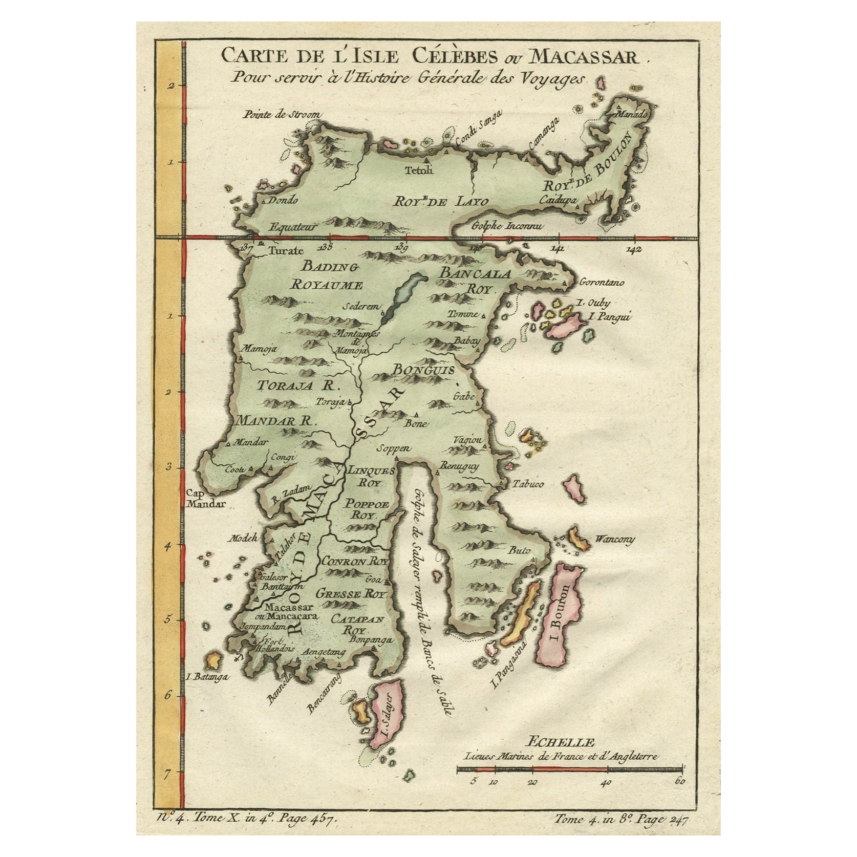
- Antique Map of Celebes 'Sulawesi', Island in Indonesia, c.1750By Jacques-Nicolas BellinLocated in Langweer, NLAntique map titled 'Carte De L'Isle Celebes ou Macassar'. Detailed copper engraved map of Celebes (Sulawesi, Indonesia), showing Makassar, which was the most important trading city o...Category
Antique 18th Century Maps
MaterialsPaper
- Antique Map of the Maluku Islands by Bellin, c.1750By Jacques-Nicolas BellinLocated in Langweer, NLAntique map titled 'Carte Particuliere des Isles Moluques'. This map depicts the islands of Herij, Ternate, Tidor, Pottebackers, Timor, Machian and Bachian. The Moluccan islands were...Category
Antique 18th Century Maps
MaterialsPaper
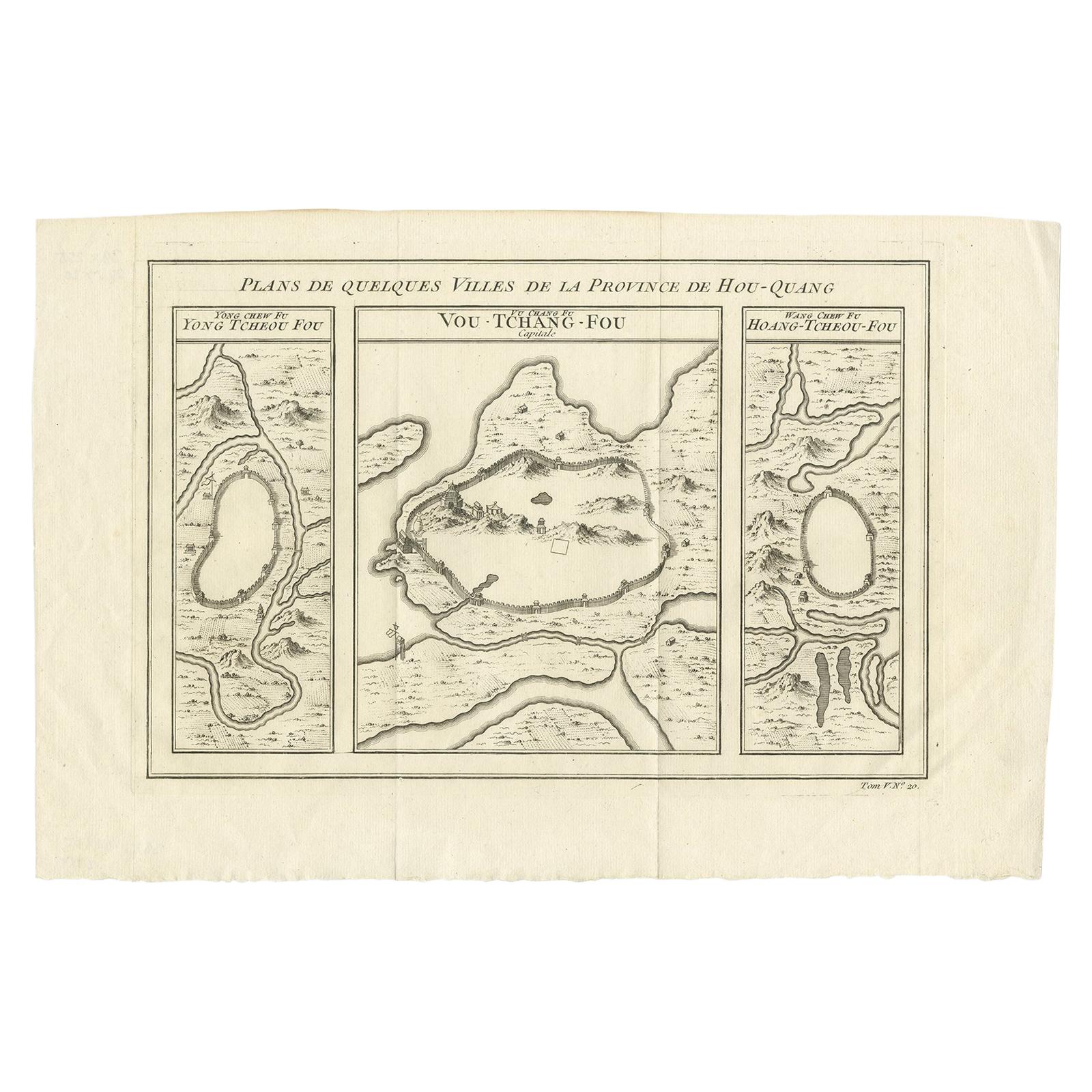
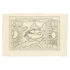
- Antique Map of Three Cities of China's Hubei and Hunan Provinces by BellinBy Jacques-Nicolas BellinLocated in Langweer, NLAntique print titled 'Plans de Quelques villes de la province de Hou-Quang.' Three bird's-eye view plans of walled cities in what are now China's Hubei (Hou-Quang) and Hunan Province...Category
Antique Mid-18th Century Maps
MaterialsPaper
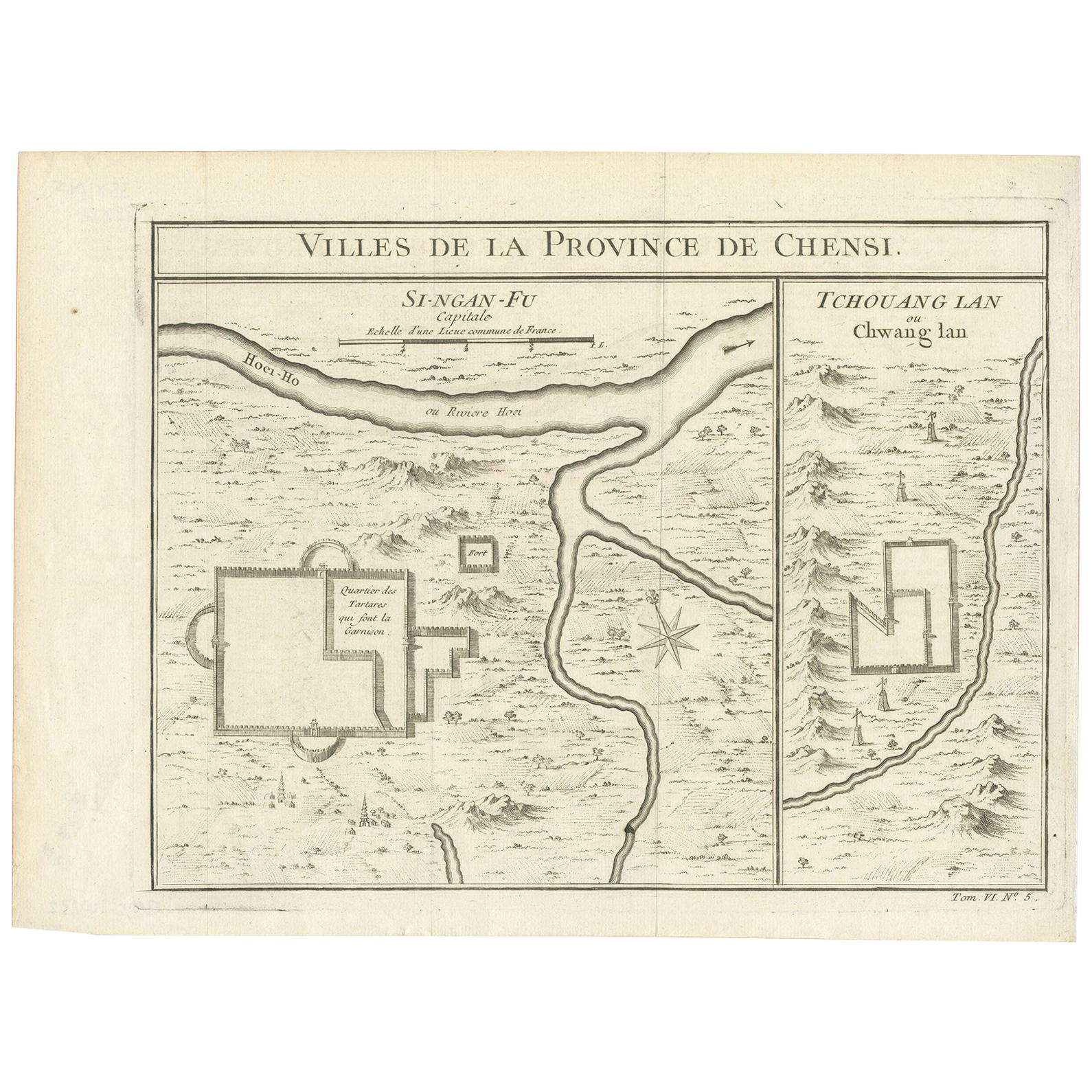
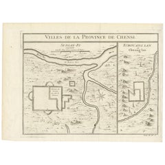
- Antique Map of Si-Ngan-fu and Tchang Lan 'China' by Bellin '1748'By Jacques-Nicolas BellinLocated in Langweer, NLAntique map China titled ‘Villes de la Province de Chensi’. Interesting set of two local town plans of "Si-Ngan-Fu: Capitale, Hoofdstad." and "Tchang...Category
Antique Mid-18th Century Maps
MaterialsPaper
- Antique Map of Celebes 'Sulawesi, Indonesia' by Bellin, ciarca 1755By Jacques-Nicolas BellinLocated in Langweer, NLAntique map titled 'Carte de l'Isle Celebes ou Macassar'. Map of Celebes (Sulawesi, Indonesia), showing Makassar, which was the most important trading city of eastern Indonesia in th...Category
Antique Mid-18th Century European Maps
MaterialsPaper
- Antique Map of Tartary and Northeast Asia by Bellin, circa 1750By Jacques-Nicolas BellinLocated in Langweer, NLAntique map titled 'Carte de la Tartarie Occidentale'. Map of Tartary and northeast Asia, from Lake Baykal, Partie du Siberia in the north, Pays des Kalkas at the center, as well as ...Category
Antique Mid-18th Century European Maps
MaterialsPaper


You May Also Like
- Original Antique Map of Indonesia, 1861Located in St Annes, LancashireGreat map of Indonesia Drawn and engraved by Edward Weller Original color Published in The Weekly Dispatch Atlas, 1861 Repairs to minor e...Category
Antique 1860s English Victorian Maps
MaterialsPaper

- Original Antique Map of Missouri, 1889Located in St Annes, LancashireGreat map of Missouri Drawn and Engraved by W. & A.K. Johnston Published By A & C Black, Edinburgh. Original colour Unframed.Category
Antique 1880s Scottish Victorian Maps
MaterialsPaper

- Large Original Antique Map of Australia by Sidney Hall, 1847Located in St Annes, LancashireGreat map of Australia Drawn and engraved by Sidney Hall Steel engraving Original colour outline Published by A & C Black. 1847 Unframed Free shipping.Category
Antique 1840s Scottish Maps
MaterialsPaper
- Large Original Antique Map of Europe by Sidney Hall, 1847Located in St Annes, LancashireGreat map of Europe Drawn and engraved by Sidney Hall Steel engraving Original colour outline Published by A & C Black. 1847 Unframed Free shipping.Category
Antique 1840s Scottish Maps
MaterialsPaper
- Large Original Antique Map of Ireland by Sidney Hall, 1847Located in St Annes, LancashireGreat map of Ireland Drawn and engraved by Sidney Hall Steel engraving Original colour outline Published by A & C Black. 1847 Unframed Free shipping.Category
Antique 1840s Scottish Maps
MaterialsPaper
- Large Original Antique Map of Poland by Sidney Hall, 1847Located in St Annes, LancashireGreat map of Poland Drawn and engraved by Sidney Hall Steel engraving Original colour outline Published by A & C Black. 1847 Unframed ...Category
Antique 1840s Scottish Maps
MaterialsPaper


Recently Viewed
View AllMore Ways To Browse
Antique Indonesia
Indonesia Antique
Indonesian Antiques
Antiques From Indonesia
Furniture From Bali
18th Century Indonesian
18th Century Indonesia
Indonesia Map
Antique Map Indonesia
Antique Maps Indonesia
Bali Antique
Antique Bali Furniture
Java Map
Bali Map
Balinese Antique Furniture
Bali Temple
Balinese Antique
Antique Map Bali