Items Similar to Antique Map of Celebes 'Sulawesi', Island in Indonesia, c.1750

Want more images or videos?
Request additional images or videos from the seller
1 of 5
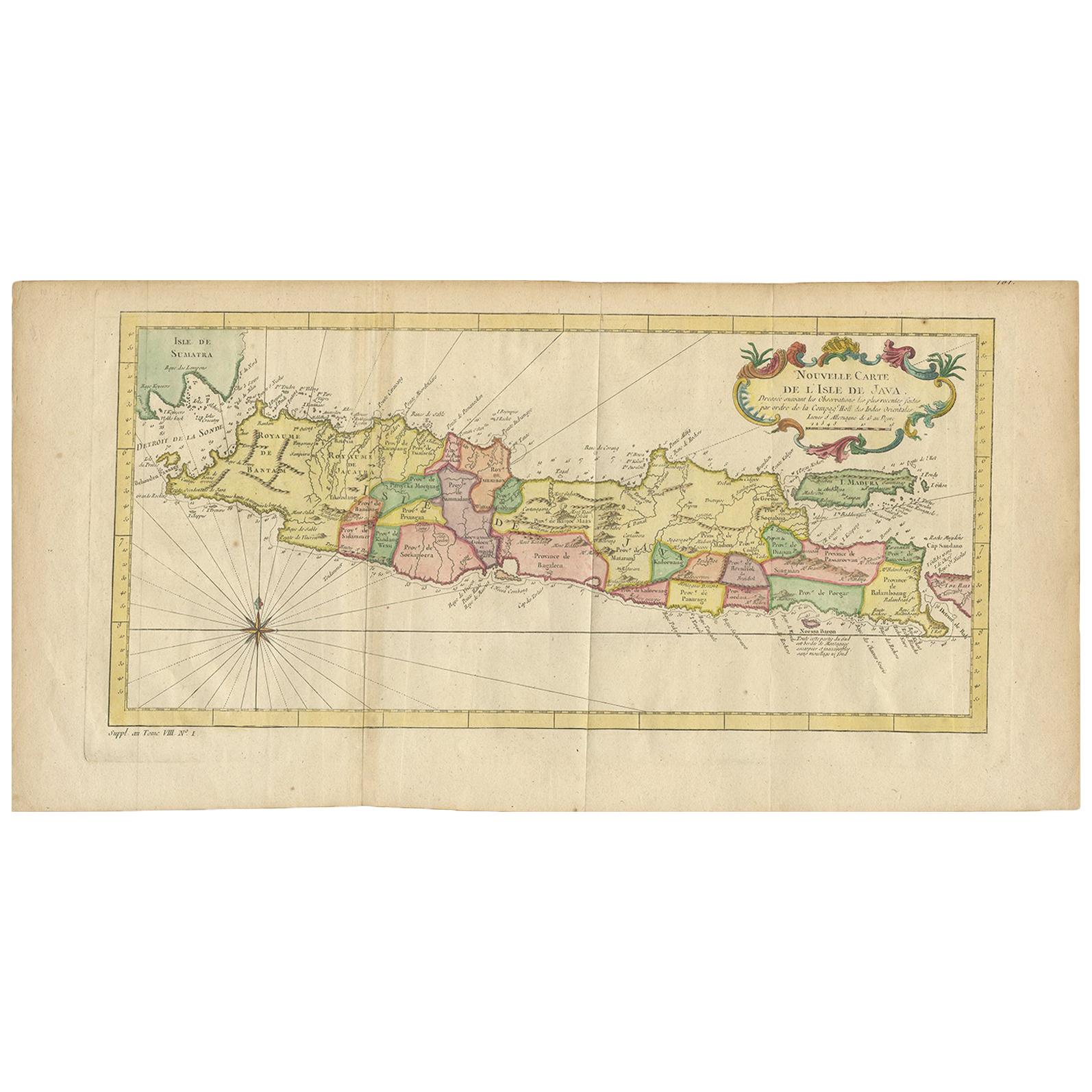
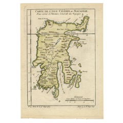
Antique Map of Celebes 'Sulawesi', Island in Indonesia, c.1750
About the Item
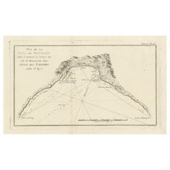
Antique map titled 'Carte De L'Isle Celebes ou Macassar'. Detailed copper engraved map of Celebes (Sulawesi, Indonesia), showing Makassar, which was the most important trading city of eastern Indonesia in the sixteenth century. Makassar traded in spices, pearls, gold and copper, with the Chinese and Arabs; the first colonial powers were the Portuguese, who were replaced by the Dutch in the late 1600s. A Dutch fortress is indicated.
Artists and Engravers: Jacques-Nicolas Bellin (1703 - 1772) was one of the most important cartographers of the 18th century. With a career spanning some 50 years, Bellin is best understood as geographe de cabinet and transitional mapmaker spanning the gap between 18th and early 19th century cartographic styles. His long career as Hydrographer and Ingénieur Hydrographe at the French Dépôt des cartes et plans de la Marine resulted in hundreds of high quality nautical charts of practically everywhere in the world. A true child of the Enlightenment Era, Bellin's work focuses on function and accuracy tending in the process to be less decorative than the earlier 17th and 18th century cartographic work. Unlike many of his contemporaries, Bellin was always careful to cite his references and his scholarly corpus consists of over 1400 articles on geography prepared for Diderot's Encyclopedie. Bellin, despite his extraordinary success, may not have enjoyed his work, which is described as "long, unpleasant, and hard." In addition to numerous maps and charts published during his lifetime, many of Bellin's maps were updated (or not) and published posthumously. He was succeeded as Ingénieur Hydrographe by his student, also a prolific and influential cartographer, Rigobert Bonne.
Condition: Good, given age. One minor spot, hardly visible. General age-related toning and/or occasional minor defects from handling. Please study image carefully.
Date: c.1750
Overall size: 19 x 24.5 cm.
Image size: 14.7 x 20.7 cm.
We sell original antique maps to collectors, historians, educators and interior decorators all over the world. Our collection includes a wide range of authentic antique maps from the 16th to the 20th centuries. Buying and collecting antique maps is a tradition that goes back hundreds of years. Antique maps have proved a richly rewarding investment over the past decade, thanks to a growing appreciation of their unique historical appeal. Today the decorative qualities of antique maps are widely recognized by interior designers who appreciate their beauty and design flexibility. Depending on the individual map, presentation, and context, a rare or antique map can be modern, traditional, abstract, figurative, serious or whimsical. We offer a wide range of authentic antique maps for any budget.
- Creator:Jacques-Nicolas Bellin (Artist)
- Dimensions:Height: 9.65 in (24.5 cm)Width: 7.49 in (19 cm)Depth: 0 in (0.01 mm)
- Materials and Techniques:
- Period:
- Date of Manufacture:circa 1750
- Condition:
- Seller Location:Langweer, NL
- Reference Number:
About the Seller
5.0
Platinum Seller
These expertly vetted sellers are 1stDibs' most experienced sellers and are rated highest by our customers.
Established in 2009
1stDibs seller since 2017
1,916 sales on 1stDibs
Typical response time: <1 hour
- ShippingRetrieving quote...Ships From: Langweer, Netherlands
- Return PolicyA return for this item may be initiated within 14 days of delivery.
More From This SellerView All
- Antique Map of Celebes 'Sulawesi', Island in Indonesia, 1754By Jacques-Nicolas BellinLocated in Langweer, NLAntique map titled 'Carte De L'Isle Celebes ou Macassar'. Detailed copper engraved map of Celebes (Sulawesi, Indonesia), showing Makassar, which was the most important trading city o...Category
Antique 18th Century Maps
MaterialsPaper
- Antique Map of Celebes 'Sulawesi, Indonesia' by Bellin, ciarca 1755By Jacques-Nicolas BellinLocated in Langweer, NLAntique map titled 'Carte de l'Isle Celebes ou Macassar'. Map of Celebes (Sulawesi, Indonesia), showing Makassar, which was the most important trading city of eastern Indonesia in th...Category
Antique Mid-18th Century European Maps
MaterialsPaper
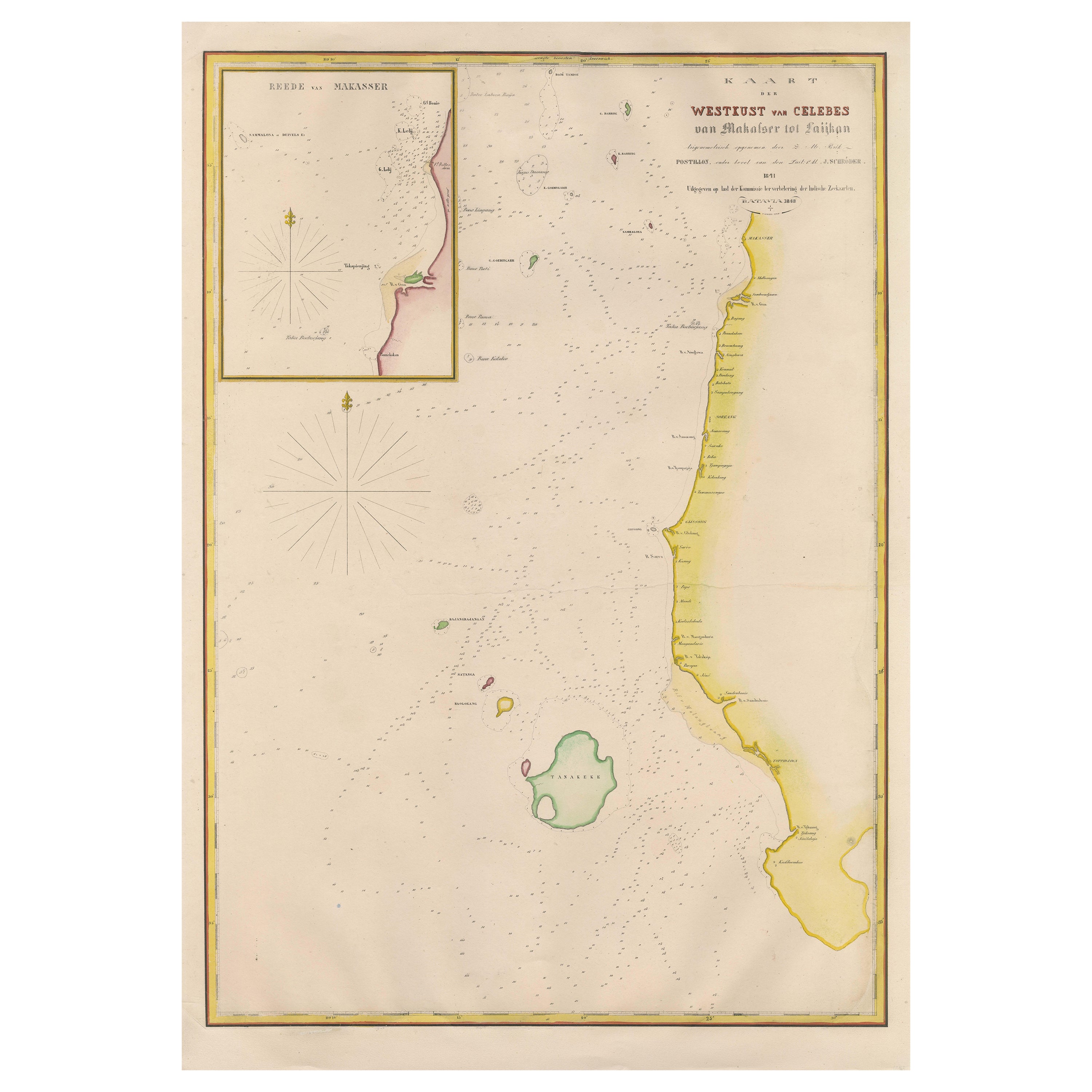
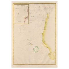
- Large Antique Map of the west coast of Celebes, Sulawesi, IndonesiaLocated in Langweer, NLOriginal antique map titled 'Kaart der Westkust van Celebes van Makasser tot Laijkan'. This large map shows the west coast of Celebes, Sulawesi, Indonesia. It covers the region of Makassar to Cikoang. Inset map of the coast of Selat (Strait) Makassar, also showing the Dutch Fort Rotterdam, to day Fort Ujung Pandang. With historical traces dating back to the Kingdom of Gowa from the 16th century to colonization by the Dutch, this Fort has silently witnessed many episodes in Makassar’s history, playing a most essential role in its development. Originally called Benteng or Fort Jumpandang or Ujung Pandang, the huge complex was first built in 1545 in the era of Imanrigau Daeng Bonto Karaeng Lakiung or Karaeng Tunipalangga Ulaweng, the tenth King of Gowa. Initially, the fort was made from a mixture of Stone and burnt clay, and took the shape of a typical square Portuguese architectural...Category
Antique Mid-19th Century Maps
MaterialsPaper
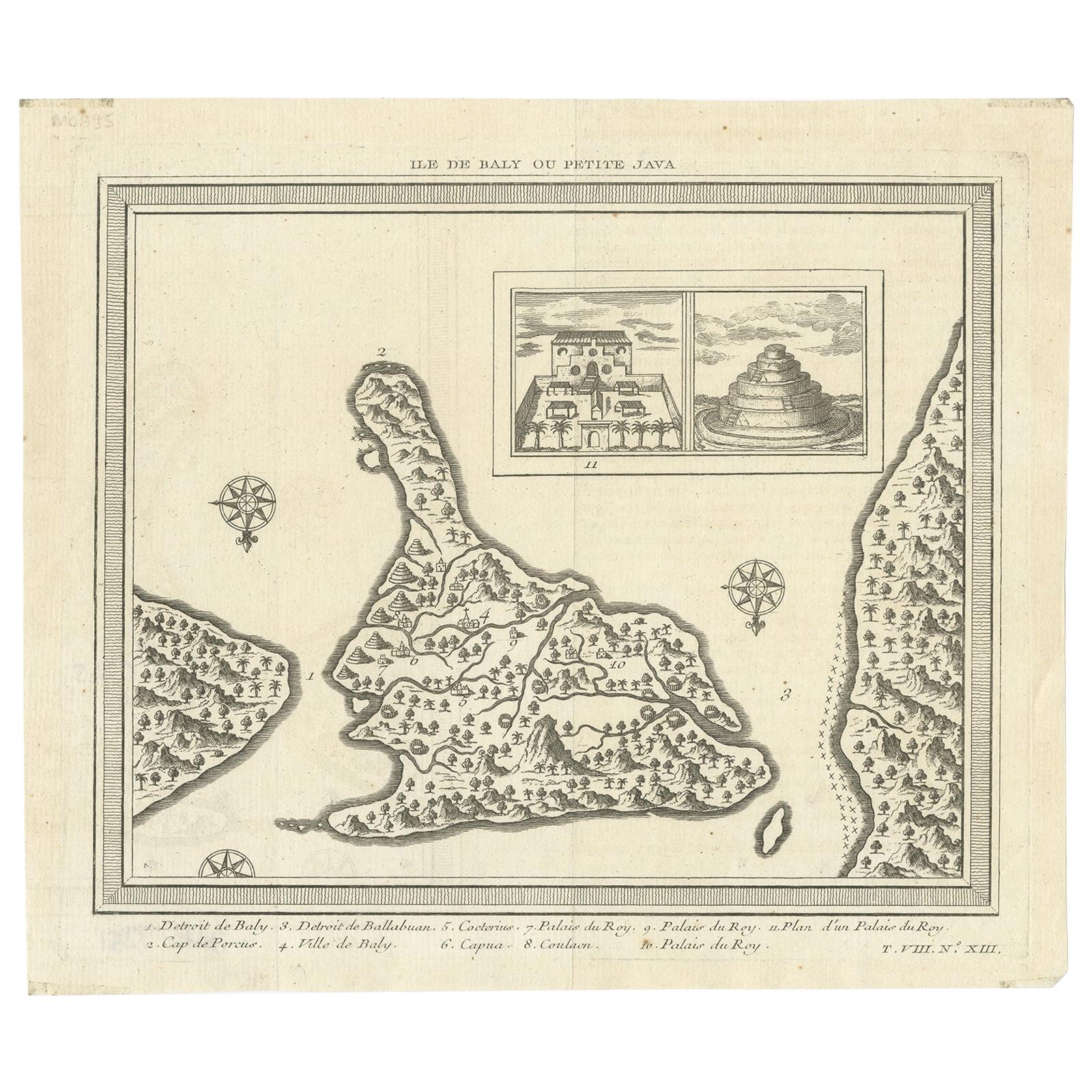
- Antique Map of Bali 'Indonesia' by Bellin, 'c.1750'Located in Langweer, NLAntique map titled 'Ile de Baly ou petite Java'. Map of Bali, Indonesia. The map depicts the island from the north with Java to the right and Lombok to the...Category
Antique Mid-18th Century Maps
MaterialsPaper
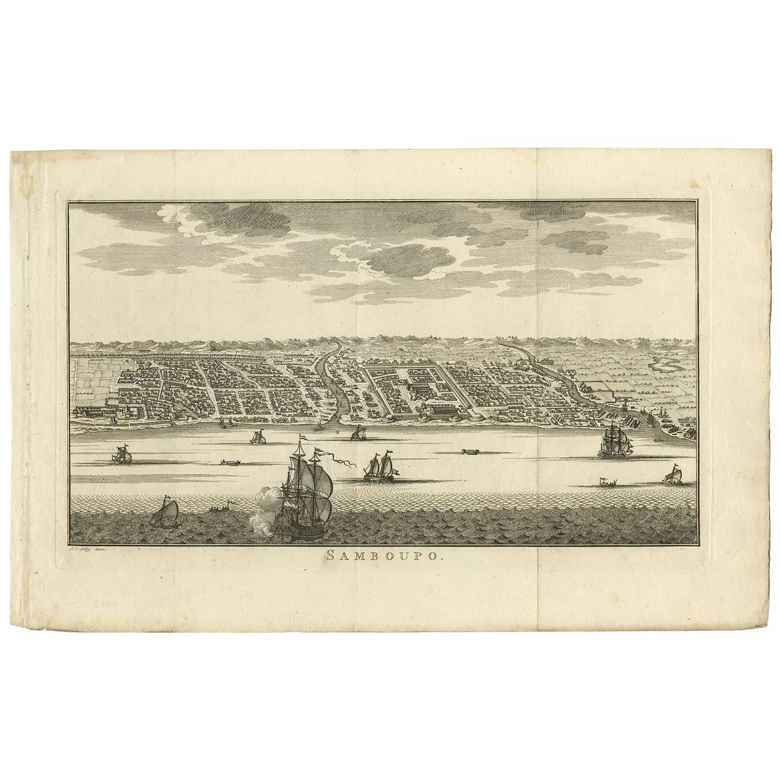
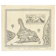
- Antique Map of Bonthain Bay, Sulawesi, CelebesLocated in Langweer, NLAntique map titled 'Vue de la Baye de Bonthain (..)'. Map of the island Sulawesi (Celebes), Indonesia that Philip Carteret rested his crew and made repairs to his ship the Swallow fo...Category
Antique Late 18th Century Maps
MaterialsPaper
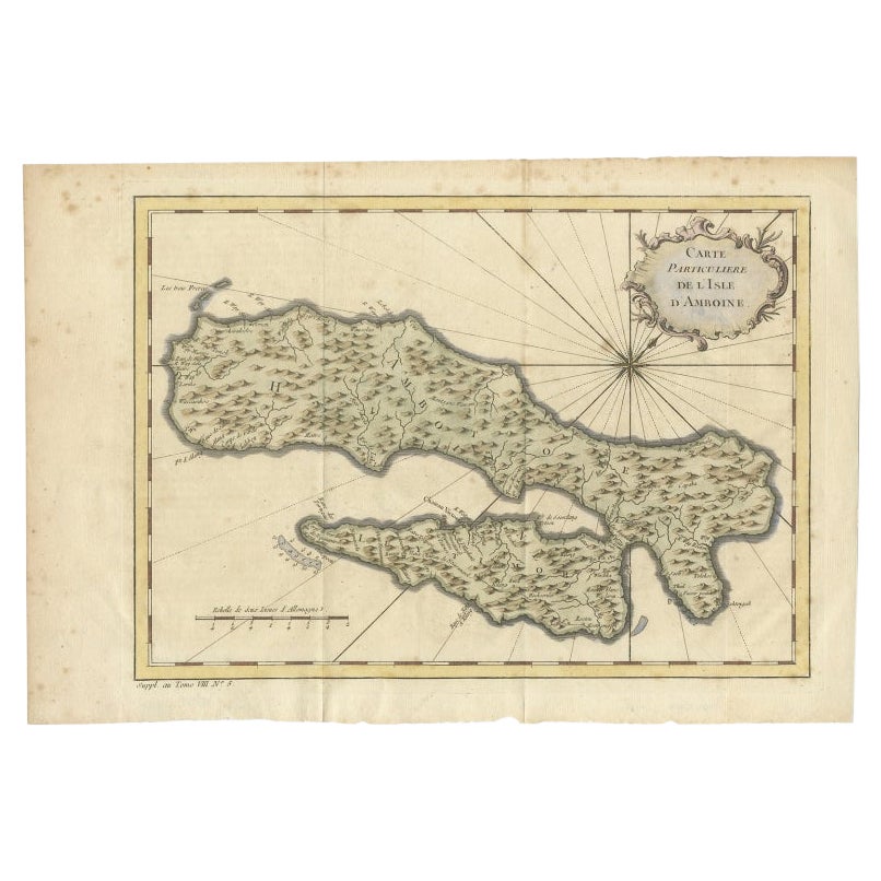
- Antique Map of Ambon Island in the Moluccas, Indonesia, c.1760Located in Langweer, NLAntique map Ambon titled 'Carte Particuliere de l 'Isle Amboine'. Old map showing Ambon, in the Moluccas Islands, better known as the Spice Islands. Ambon was the headquarters of the...Category
Antique 18th Century Maps
MaterialsPaper

You May Also Like
- Large Original Antique Map of Rhode Island, USA, C.1900Located in St Annes, LancashireFabulous map of Rhode Island Original color Engraved and printed by the George F. Cram Company, Indianapolis. Published, C.1900 Unframed Free ...Category
Antique 1890s American Maps
MaterialsPaper
- Large Original Vintage Map of British Island Possessions, circa 1920Located in St Annes, LancashireGreat map of British Island Possessions Original color. Good condition Published by Alexander Gross Unframed.Category
Vintage 1920s English Maps
MaterialsPaper
- Large Original Vintage Map of The Pacific Islands Including HawaiiLocated in St Annes, LancashireGreat map of The Pacific Islands Unframed Original color By John Bartholomew and Co. Edinburgh Geographical Institute Published, circa 1...Category
Vintage 1920s British Maps
MaterialsPaper
- Large Original Vintage Map of New Zealand, South Island, circa 1920Located in St Annes, LancashireGreat map of South Island, New Zealand Original color. Good condition / repair to a minor tear on right edge Published by Alexander Gross Unframed.Category
Vintage 1920s English Edwardian Maps
MaterialsPaper
- Original Antique Map of Missouri, 1889Located in St Annes, LancashireGreat map of Missouri Drawn and Engraved by W. & A.K. Johnston Published By A & C Black, Edinburgh. Original colour Unframed.Category
Antique 1880s Scottish Victorian Maps
MaterialsPaper

- Original Antique Map of Cyprus. Circa 1880Located in St Annes, LancashireGreat map of Cyprus Drawn and Engraved by R.Walker Published W.Mackenzie, London Original colour Unframed.Category
Antique 1880s English Maps
MaterialsPaper


Recently Viewed
View AllMore Ways To Browse
Long Island Furniture
Long Island Used Furniture
French Antique Island
Antique Indonesia
Indonesian Antiques
Indonesia Antique
Used Office Furniture Long Island
Antiques From Indonesia
Long Island Artists
18th C Dutch
Dutch Indonesia
Indonesian Dutch
18th 19th C Cabinet
Marine Collectibles
Copper Map
Antique Maps And Charts
18th C Copper
18th Century Indonesia