Antique Maps And Charts

23
to
98
420
142
372
280
157
102
79
70
56
42
42
40
36
36
24
22
16
15
14
13
10
10
10
8
8
7
7
7
6
6
6
5
5
5
4
4
4
4
4
3
3
3
2
2
2
1
1
1
29
12
10
9
6
Sort By
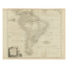
Rare Map of South America of Chili, La Plata, Paraguay, Brazil, Peru, c.1775
Located in Langweer, NL
Antique map titled 'South America agreeable to the most approved maps and charts'. Rare map of
Category

1770s Antique Maps And Charts

Materials

Paper

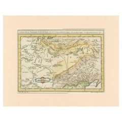
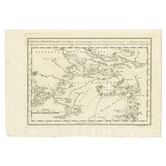
Antique Map of Tartary and Northeast Asia with Hand Coloring
Located in Langweer, NL
maps and charts were finely engraved and produced, and set a high standard of accuracy.
Category

Mid-18th Century Antique Maps And Charts

Materials

Paper

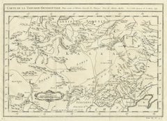
Antique Map of Tartary and Northeast Asia, c.1750
Located in Langweer, NL
events in the Americas. His maps and charts were finely engraved and produced, and set a high standard of
Category

18th Century Antique Maps And Charts

Materials

Paper

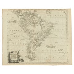
Antique Map of South America by Conder, c.1775
Located in Langweer, NL
Antique map titled 'South America agreeable to the most approved maps and charts'. Rare map of
Category

18th Century Antique Maps And Charts

Materials

Paper

Antique Map of the Bukhari and Surroundings by Bellin, 1749
Located in Langweer, NL
work, which is described as "long, unpleasant, and hard." In addition to numerous maps and charts
Category

18th Century Antique Maps And Charts

Materials

Paper

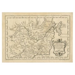
Antique Map of Northern China and Eastern Russia by Bellin, 1757
Located in Langweer, NL
maps and charts published during his lifetime, many of Bellin's maps were updated (or not) and
Category

18th Century Antique Maps And Charts

Materials

Paper

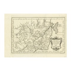
Antique Map of Northern China and Eastern Russia by Bellin, 1754
Located in Langweer, NL
described as "long, unpleasant, and hard." In addition to numerous maps and charts published during his
Category

18th Century Antique Maps And Charts

Materials

Paper

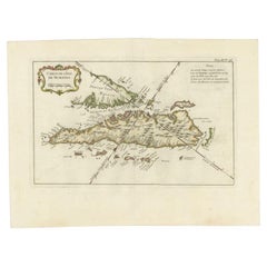
Antique Map of Sumatra by Bellin, 1764
Located in Langweer, NL
charts published during his lifetime, many of Bellin's maps were updated (or not) and published
Category

18th Century Antique Maps And Charts

Materials

Paper

Antique Map of Sumatra by Bellin, 1764
H 12.8 in W 17.13 in D 0 in
Antique Map Centered on Turkestan, Including the Black and Caspian Seas, 1749
Located in Langweer, NL
, and hard."" In addition to numerous maps and charts published during his lifetime, many of Bellin's
Category

18th Century Antique Maps And Charts

Materials

Paper

Antique Map of the Maluku Islands or Moluccas, Indonesia
Located in Langweer, NL
, and hard." In addition to numerous maps and charts published during his lifetime, many of Bellin's
Category

Mid-18th Century Antique Maps And Charts

Materials

Paper

Original Antique Map of the Maluku Islands or Moluccas, Indonesia
Located in Langweer, NL
, and hard." In addition to numerous maps and charts published during his lifetime, many of Bellin's
Category

Mid-18th Century Antique Maps And Charts

Materials

Paper

Antique Map of Hangzhou, Capital of the Province of Zheijang, China, c.1750
Located in Langweer, NL
, and hard." In addition to numerous maps and charts published during his lifetime, many of Bellin's
Category

1750s Antique Maps And Charts

Materials

Paper

Antique Map of Northern China and Far Eastern Russia Around the Amur River, 1754
Located in Langweer, NL
work, which is described as "long, unpleasant, and hard." In addition to numerous maps and charts
Category

1750s Antique Maps And Charts

Materials

Paper

Antique Map of Hangzhou, Capital of the Province of Zheijang, China, 1748
Located in Langweer, NL
maps and charts published during his lifetime, many of Bellin's maps were updated (or not) and
Category

1740s Antique Maps And Charts

Materials

Paper

Antique Tidal Chart and Botanical Map, 1843
Located in Langweer, NL
Two antique world maps on one sheet. The upper map is a tidal chart of the world and shows the
Category

19th Century Antique Maps And Charts

Materials

Paper

Old Map of Turkmenistan, Uzbekistan, Afghanistan, Tajikistan, Kyrgyzstan, 1757
Located in Langweer, NL
charts published during his lifetime, many of Bellin's maps were updated (or not) and published
Category

1750s Antique Maps And Charts

Materials

Paper

Antique Map of the Tunquin River and Bay, Siam, 1757
Located in Langweer, NL
, and hard." In addition to numerous maps and charts published during his lifetime, many of Bellin's
Category

18th Century Antique Maps And Charts

Materials

Paper

Original Antique Map of Tartary 'Northern China & Far Eastern Russia', 1757
Located in Langweer, NL
maps and charts published during his lifetime, many of Bellin's maps were updated (or not) and
Category

1750s Antique Maps And Charts

Materials

Paper

Old Map of The Kurile Islands, from Hokkaido, Japan to Kamchatka, Russia, c.1750
Located in Langweer, NL
maps and charts published during his lifetime, many of Bellin's maps were updated (or not) and
Category

1750s Antique Maps And Charts

Materials

Paper

Original Antique Map of the Empire of Japan, Centered on the Bay of Osaka, c1752
Located in Langweer, NL
described as "long, unpleasant, and hard." In addition to numerous maps and charts published during his
Category

1750s Antique Maps And Charts

Materials

Paper

Nice Antique Map of the Empire of Japan. Centered on the Bay of Osaka, ca.1752
Located in Langweer, NL
, and hard." In addition to numerous maps and charts published during his lifetime, many of Bellin's
Category

1750s Antique Maps And Charts

Materials

Paper

Charting Eastern Tartary: An 18th-Century Jesuit and English Collaboration, 1757
Located in Langweer, NL
described as "long, unpleasant, and hard." In addition to numerous maps and charts published during his
Category

Mid-18th Century Antique Maps And Charts

Materials

Paper

Antique Map of Turkmenistan, Uzbekistan, Tajikistan and Kyrgyzstan, 1749
Located in Langweer, NL
hard." In addition to numerous maps and charts published during his lifetime, many of Bellin's maps
Category

18th Century Antique Maps And Charts

Materials

Paper

Antique Map of the Coast of China by Bellin, 1752
By Jacques-Nicolas Bellin
Located in Langweer, NL
numerous maps and charts published during his lifetime, many of Bellin's maps were updated (or not) and
Category

18th Century Antique Maps And Charts

Materials

Paper

West Coast of Africa, Guinea & Sierra Leone: An 18th Century Map by Bellin
By Jacques-Nicolas Bellin
Located in Alamo, CA
important cartographers of the 18th century. He served for a number of years as map and chart maker, as well
Category

Mid-18th Century French Antique Maps And Charts

Materials

Paper

St. Christophe 'St. Kitts' Island: An 18th Century Hand-colored Map by Bellin
By Jacques-Nicolas Bellin
Located in Alamo, CA
century. He served for a number of years as map and chart maker, as well hydrographer to the King of
Category

Mid-18th Century French Antique Maps And Charts

Materials

Paper

University Chart “Black Map of North America
Located in Chillerton, Isle of Wight
University Chart “Black Map of North America W&A K Johnston’s Charts of Physical Maps By G W
Category

Early 20th Century Industrial Antique Maps And Charts

Materials

Linen

Antique Map of the Coast of Southern Brazil by Bellin, c.1755
By Jacques-Nicolas Bellin
Located in Langweer, NL
numerous maps and charts published during his lifetime, many of Bellin's maps were updated (or not) and
Category

18th Century Antique Maps And Charts

Materials

Paper

Antique Map of the City of Hangzhou by Bellin, 1748
By Jacques-Nicolas Bellin
Located in Langweer, NL
numerous maps and charts published during his lifetime, many of Bellin's maps were updated (or not) and
Category

18th Century Antique Maps And Charts

Materials

Paper

Antique Map of Anjouan or Ndzuani, Island of The Comoros, 1748
Located in Langweer, NL
, and hard."" In addition to numerous maps and charts published during his lifetime, many of Bellin's
Category

18th Century Antique Maps And Charts

Materials

Paper

Antique Map of Celebes 'Sulawesi', Island in Indonesia, 1754
By Jacques-Nicolas Bellin
Located in Langweer, NL
, and hard." In addition to numerous maps and charts published during his lifetime, many of Bellin's
Category

18th Century Antique Maps And Charts

Materials

Paper

Antique Map of the Maluku Islands by Bellin, c.1750
By Jacques-Nicolas Bellin
Located in Langweer, NL
maps and charts published during his lifetime, many of Bellin's maps were updated (or not) and
Category

18th Century Antique Maps And Charts

Materials

Paper

Antique Map of Celebes 'Sulawesi', Island in Indonesia, c.1750
By Jacques-Nicolas Bellin
Located in Langweer, NL
, and hard." In addition to numerous maps and charts published during his lifetime, many of Bellin's
Category

18th Century Antique Maps And Charts

Materials

Paper

Antique Map of Saldanha Bay 'Near Cape Town, South Africa' by Bellin, 1750
By Jacques-Nicolas Bellin
Located in Langweer, NL
described as "long, unpleasant, and hard." In addition to numerous maps and charts published during his
Category

18th Century Antique Maps And Charts

Materials

Paper

Antique Map of Two Cities in the Province of Shanxi or Chensi, China, 1748
By Jacques-Nicolas Bellin
Located in Langweer, NL
numerous maps and charts published during his lifetime, many of Bellin's maps were updated (or not) and
Category

18th Century Antique Maps And Charts

Materials

Paper

Antique Map of the Mouth of the Chiang River by Bellin, 1764
By Jacques-Nicolas Bellin
Located in Langweer, NL
Province de Fokyen en Chine’. This impressive map or sea chart details the mouth of the Chiang River in the
Category

18th Century Antique Maps And Charts

Materials

Paper

Old Map of Cook's Discovery and Charting of the East Coast of Australia, 1803
Located in Langweer, NL
Antique map titled 'Kaart van Nieuw Zuid Wales of de Oostlyke Kust van Nieuw Holland ontdekt en
Category

Early 1800s Antique Maps And Charts

Materials

Paper

Original Old Composite of Several Maps of the Ancient World on One Sheet, 1880
Located in Langweer, NL
distinguish different regions or nations. It’s composed of several smaller maps and charts, each focusing on
Category

1880s Antique Maps And Charts

Materials

Paper

Charting the Course of Empire: Bonne's 1770 Masterpiece Maps of the Indian Ocean
Located in Langweer, NL
A voyage through history with an exquisite collection of Rigobert Bonne's 1770 maps, as featured in
Category

1770s Antique Maps And Charts

Materials

Paper

Old Print of Fort James on Kunta Kinteh Island on the Gambia River, Africa, 1746
Located in Langweer, NL
maps and charts published during his lifetime, many of Bellin's maps were updated (or not) and
Category

1740s Antique Maps And Charts

Materials

Paper

Original Antique Map of the West Indies by J. Arrowsmith, 1842
Located in Langweer, NL
maps and charts which were highly praised for their accuracy and craftsmanship. Arrowsmith's maps
Category

Early 19th Century Antique Maps And Charts

Materials

Paper

Antique Print with Charts of York's Bay and Surroundings
Located in Langweer, NL
Antique map titled 'Côte depuis la Baye d'York (..)'. Charts of York's Bay, Haven of the Three
Category

Late 18th Century Antique Maps And Charts

Materials

Paper

Large Chart of the island and sea of Java, Indonesia
Located in Langweer, NL
Antique map titled 'Carte Esférica de la Isla Y Mar de Java'. Large chart of the island and sea of
Category

Mid-19th Century Antique Maps And Charts

Materials

Paper

Northwest Coast and Isle of Man Map
Located in Cheshire, GB
Greenville Collins Northwest Coast and Isle of Man. hand coloured chart, encased in an ebonised
Category

Early 20th Century British Antique Maps And Charts

Materials

Paper

Northwest Coast and Isle of Man Map
H 26.5 in W 30 in D 1 in
Chart of the Harbour of Liverpool
Located in Cheshire, GB
PL Burdett A Chart of the Harbour of Liverpool hand coloured. Encased in an ebonised frame
Category

Early 20th Century British Antique Maps And Charts

Materials

Paper

Chart of the Harbour of Liverpool
H 23.5 in W 28 in D 1 in
Antique Zoological Chart of the World, 1854
Located in Langweer, NL
Antique map titled 'Zoological Chart of the World'. Total of six maps and insets. Insets of the
Category

19th Century Antique Maps And Charts

Materials

Paper

Antique Chart of Dundee, Aberdeen and Montrose in Scotland, C.1774
By Captain Greenvile Collins
Located in Langweer, NL
Antique map titled 'To the Honble the Magistrates of the Citty of Aberdeene'. Sea chart of Tay
Category

18th Century Antique Maps And Charts

Materials

Paper

Large University Chart “Africa Physical ” by Bacon
Located in Chillerton, Isle of Wight
Large University chart “Africa Physical ” by Bacon W&A K Johnston’s charts of physical maps by G
Category

Early 20th Century Beaux Arts Antique Maps And Charts

Materials

Linen

Navigational Chart of Mexico's Coast, with Acapulco and Port Marquis, 1748
Located in Langweer, NL
Antique map titled 'The Form of cruising off Acapulca on the Coast of Mexico in the South Seas in
Category

1740s Antique Maps And Charts

Materials

Paper

Pl. 36A Antique Chart of US Farms, Agriculture and Crops '1874'
Located in Langweer, NL
Antique chart titled 'Improved land in farms. Total agricultural production. Corn. Dairy products
Category

Late 19th Century Antique Maps And Charts

Materials

Paper

Antique Chart of the Pacific Coast '1874'
Located in Langweer, NL
Antique chart titled 'Maps of the Pacific Coast exhibiting various subjects. Compiled from the
Category

Late 19th Century Antique Maps And Charts

Materials

Paper

Antique Chart of the Pacific Coast '1874'
H 21.66 in W 16.15 in D 0.02 in
Rare Chart of Indonesia Including Borneo, Java, Celebes, Ceram and More, 1779
Located in Langweer, NL
Antique map titled 'Carte de la Navigation de Batavia a Amboina'. Rare chart of Indonesia
Category

1770s Antique Maps And Charts

Materials

Paper

1865 Chart of the Islands of Madeira
Located in Norwell, MA
Rare James Imray chart from 1865 titled "Chart of the Islands of Madeira, Porto Santo and Dezerea
Category

1860s European Antique Maps And Charts

Materials

Paper

Mariners Chart of Quicks Hole and Tarpaulin Cove by George Eldridge 1901
Located in Norwell, MA
Nautical chart showing the harbor and local waters of Naushon Island Quick Holes. The chart display
Category

Early 1900s North American Antique Maps And Charts

Materials

Paper

1918 George Eldridge Chart of Massachusetts Bay
Located in Norwell, MA
Rare early twentieth century chart of Cape Cod bay by George Eldridge showing Massachusetts Bay
Category

1910s North American Antique Maps And Charts

Materials

Paper

Original Chart Showing the Region between Cape Grenville and Cape Suckling, 1803
Located in Langweer, NL
Antique map titled 'Kaart van Cook's Rivier in het N.O. gedeelte van Amerika'. Chart showing
Category

Early 1800s Antique Maps And Charts

Materials

Paper

Old Map of the Chinese Empire and Japan, 1882
Located in Langweer, NL
coast of China are well-charted. This map likely reflects the geopolitical boundaries of the time
Category

1880s Antique Maps And Charts

Materials

Paper

Old Map of the Chinese Empire and Japan, 1882
No Reserve
H 14.97 in W 22.45 in D 0 in
1726 Valentyn's Map of Bali and Lombok, Original Engraving
Located in Langweer, NL
This antique map is a detailed 18th-century chart of the island of Bali, one of the many islands of
Category

Early 18th Century Antique Maps And Charts

Materials

Paper

Antique Chart of the World by Johnston '1909'
Located in Langweer, NL
Antique map titled 'Chart of the World on Mercator's Projection Showing the directions of the
Category

Early 20th Century Antique Maps And Charts

Materials

Paper

Antique Chart of the World by Johnston '1909'
H 19.49 in W 24.41 in D 0.02 in
Chart of the Coast of Cochinchina' and 'Plan of Pulo Condor', Vietnam, 1778
Located in Langweer, NL
Antique map titled 'A Chart of a part of the Coast of Cochinchina' and 'Plan of Pulo Condor
Category

1770s Antique Maps And Charts

Materials

Paper

  • 1
Get Updated with New Arrivals
Save "Antique Maps And Charts", and we’ll notify you when there are new listings in this category.

Antique Maps And Charts For Sale on 1stDibs

There is a range of antique maps and charts for sale on 1stDibs. Each of these unique antique maps and charts was constructed with extraordinary care, often using paper, fabric and linen. Antique maps and charts have been produced for many years, with earlier versions available from the 18th Century and newer variations made as recently as the 20th Century. There are many kinds of antique maps and charts to choose from, but at 1stDibs, Folk Art and Industrial antique maps and charts are of considerable interest. Captain Greenvile Collins, Arent Roggeveen and Frederick de Wit each produced beautiful antique maps and charts that are worth considering.

How Much are Antique Maps And Charts?

Antique maps and charts can differ in price owing to various characteristics — the average selling price at 1stDibs is $640, while the lowest priced sells for $158 and the highest can go for as much as $65,000.

Read More

Pamela Shamshiri Shares the Secrets behind Her First-Ever Book and Its Effortlessly Cool Interiors

The sought-after designer worked with the team at Hoffman Creative to produce a monograph that beautifully showcases some of Studio Shamshiri's most inspiring projects.

Moroccan Artworks and Objects Take Center Stage in an Extraordinary Villa in Tangier

Italian writer and collector Umberto Pasti opens the doors to his remarkable cave of wonders in North Africa.

Montecito Has Drawn Royalty and Celebrities, and These Homes Are Proof of Its Allure

Hollywood A-listers, ex-pat aristocrats and art collectors and style setters of all stripes appreciate the allure of the coastal California hamlet — much on our minds after recent winter floods.

Whaam! Blam! Pow! — a New Book on Pop Art Packs a Punch

Publishing house Assouline and writer Julie Belcove have teamed up to trace the history of the genre, from Roy Lichtenstein, Andy Warhol and Yayoi Kusama to Mickalene Thomas and Jeff Koons.

The Sparkling Legacy of Tiffany & Co. Explained, One Jewel at a Time

A gorgeous new book celebrates — and memorializes — the iconic jeweler’s rich heritage.

What Makes a Gem-Encrusted Chess Set Worth $4 Million?

The world’s most opulent chess set, weighing in at 513 carats, is literally fit for a king and queen.

Tauba Auerbach’s Geometric Pop-Up Book Is Mighty Rare, Thanks to a Hurricane

This sculptural art book has an epic backstory of its own.

Step inside the Storied Mansions of Palm Beach’s Most Effervescent Architect

From Spanish-style courtyards to fanciful fountains, these acclaimed structures abound in surprising and elegant details.