Items Similar to Charting the Course of Empire: Bonne's 1770 Masterpiece Maps of the Indian Ocean

Want more images or videos?
Request additional images or videos from the seller
1 of 11
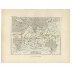
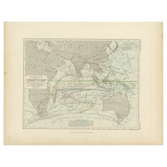
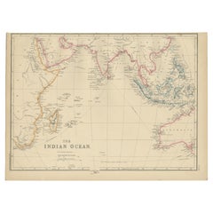
Charting the Course of Empire: Bonne's 1770 Masterpiece Maps of the Indian Ocean
About the Item
A voyage through history with an exquisite collection of Rigobert Bonne's 1770 maps, as featured in the coveted Atlas Moderne circa 1770. Each map, a cartographic treasure, captures the intricate dance of land and sea across the Indian subcontinent and its surrounding waters. These are not mere maps; they are windows into the past, detailing the Malabar and Coromandel coasts, the ethereal Maldives, the storied isle of Ceylon (Sri Lanka), and beyond to the Andaman Islands, Sumatra, and the veiled mysteries of Southeast Asia.
Expertly crafted by the distinguished Royal Hydrographer, these maps boast an array of rhumb lines and wind arrows, vividly portraying the vital trade winds that propelled the storied vessels of the 18th century along their lucrative routes. Each map serves as a testament to the era's indomitable spirit of exploration and commerce that shaped our modern world.
This collection is an ode to the artistry and precision of historical mapmaking, offering an unparalleled level of detail and accuracy. The maps' dimensions, standing at a display-worthy 11.7 inches by 16.5 inches, make them perfect for the collector, the connoisseur of history, or as a statement piece for any library, study, or office.
Let the "Charting the Course of Empire" collection transport you to an age where the map was a key to untold riches and uncharted lands. These are not just maps; they are artifacts of human endeavor, ambition, and the eternal allure of the unknown. Secure your piece of history today, and own a legacy of the world's maritime heritage that continues to inspire and awe.
More in detail:
This is a set of two maps from Rigobert Bonne's 1770 decorative map of India, which were intended for Jean Lattre's Atlas Moderne around 1775. These maps are examples of 18th-century cartography and show northern and southern India, along with notable features like the Malabar and Coromandel coasts, the Maldives, Ceylon (now known as Sri Lanka), the Andaman Islands, and parts of Sumatra and Southeast Asia.
Rigobert Bonne was a significant figure in the field of cartography in the 18th century, known for his detailed and precise maps. As the Royal Hydrographer, his work was particularly valuable for maritime navigation. The Atlas Moderne was a comprehensive collection of maps covering various parts of the world and was an important publication for expanding geographic knowledge during the Age of Enlightenment.
The dimensions provided indicate that the original maps are relatively modest in size, suitable for inclusion in a published atlas of the period. Collectors and historians value such maps for their aesthetic and historical significance, as they represent not only the geographic knowledge of the time but also the artistry involved in mapmaking before the advent of modern printing technology.
- Dimensions:Height: 14.18 in (36 cm)Width: 20.28 in (51.5 cm)Depth: 0 in (0.02 mm)
- Sold As:Set of 2
- Materials and Techniques:Paper,Engraved
- Period:1770-1779
- Date of Manufacture:1770
- Condition:Good. Some light offset and one brown spot in the lower map. General age-related toning and/or occasional minor defects from handling. Please study scans carefully. Middle folds as issued.
- Seller Location:Langweer, NL
- Reference Number:
About the Seller
5.0
Platinum Seller
These expertly vetted sellers are 1stDibs' most experienced sellers and are rated highest by our customers.
Established in 2009
1stDibs seller since 2017
1,922 sales on 1stDibs
Typical response time: <1 hour
- ShippingRetrieving quote...Ships From: Langweer, Netherlands
- Return PolicyA return for this item may be initiated within 14 days of delivery.
More From This SellerView All
- Antique Map of the Russian Empire by R. Bonne, 1780Located in Langweer, NLAntique map titled 'Carte de l'Empire de Russie.' Drawn by R. Bonne for G. Raynal’s Atlas de Toutes les Parties Connues du Globe Terrestre, Dressé pour l'Histoire Philosophique et Po...Category
Antique Late 18th Century Maps
MaterialsPaper
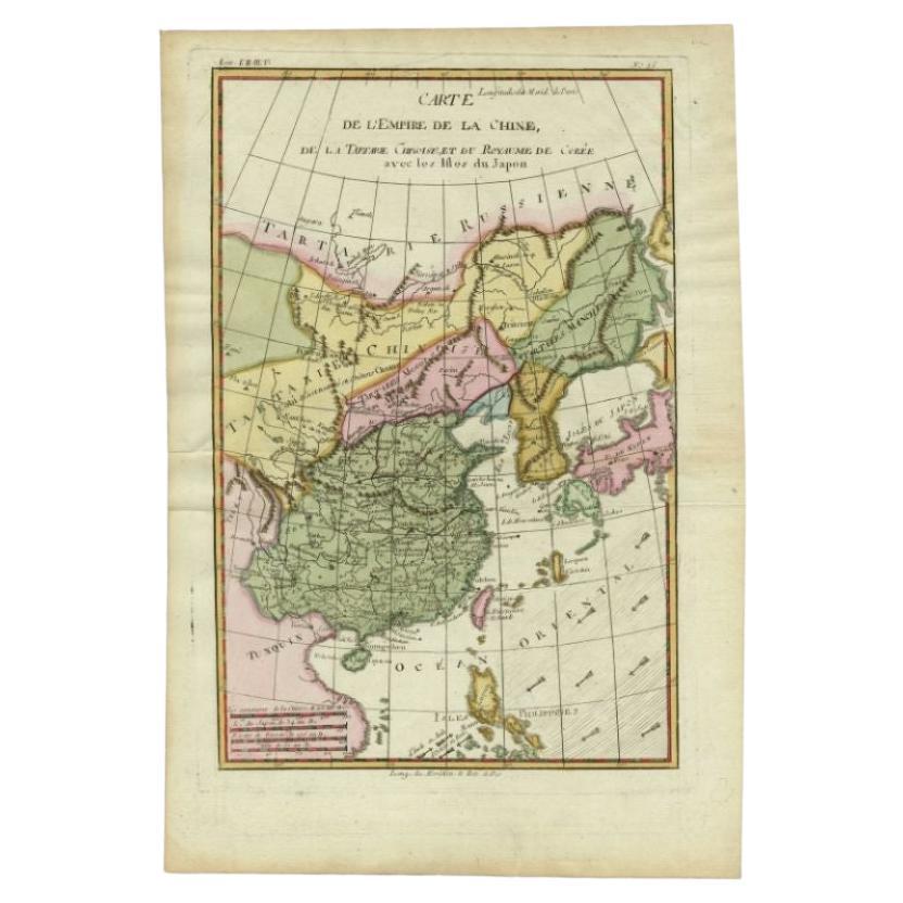
- Antique Map of the Empire of China by Bonne, c.1780By Rigobert BonneLocated in Langweer, NLAntique map titled 'Carte de L'Empire de la Chine.' Decorative map of the Empire of China, depicting China, Corea ( Korea ), Japan, Tonquin and the Philippine island Lucon. Source un...Category
Antique 18th Century Maps
MaterialsPaper
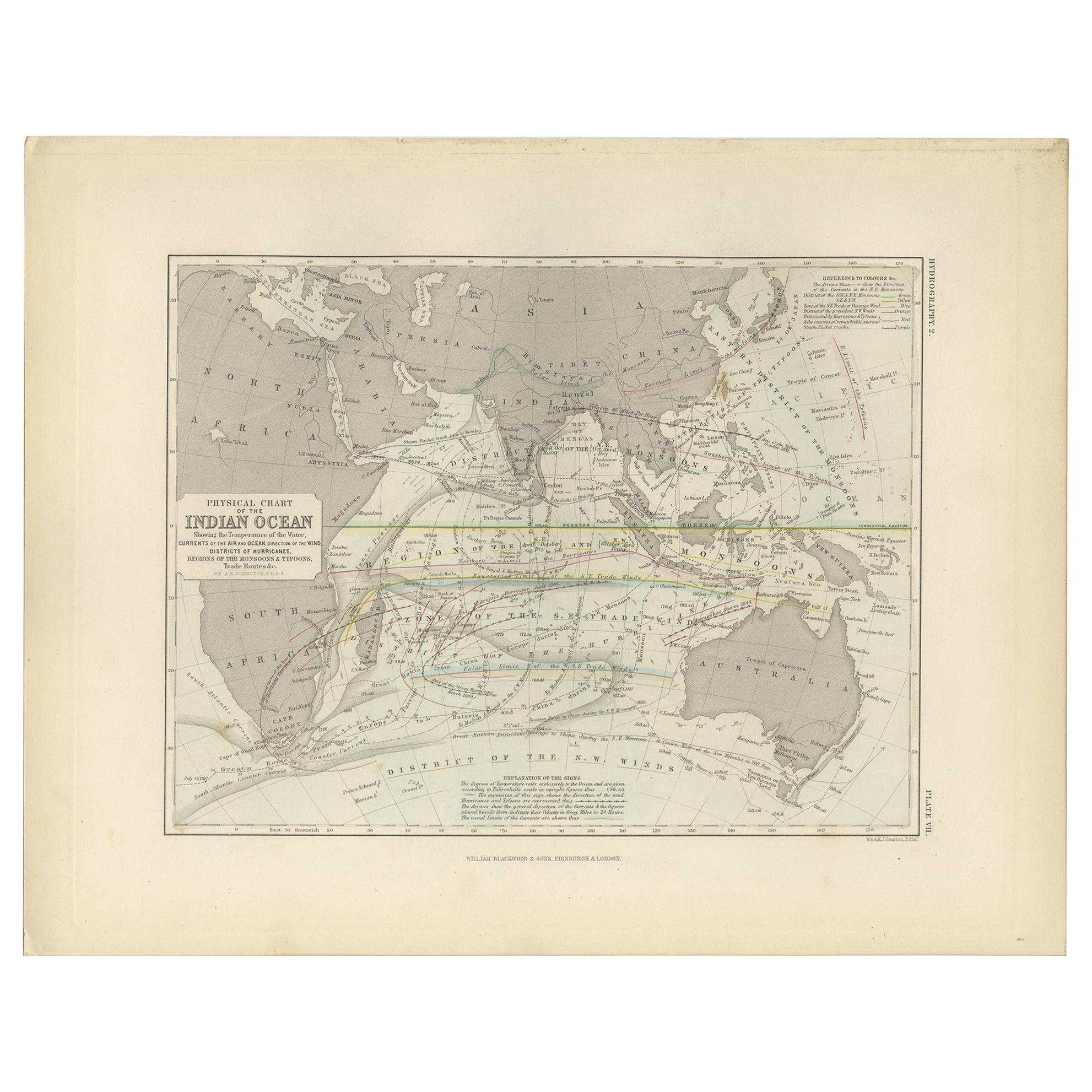
- Antique Physical Chart of the Indian Ocean by Johnston '1850'Located in Langweer, NLAntique map titled 'Physical Chart of the Indian Ocean showing the temperature of the water'. Original antique chart of the Indian Ocean. This map originates from 'The Physical Atlas...Category
Antique Mid-19th Century Maps
MaterialsPaper
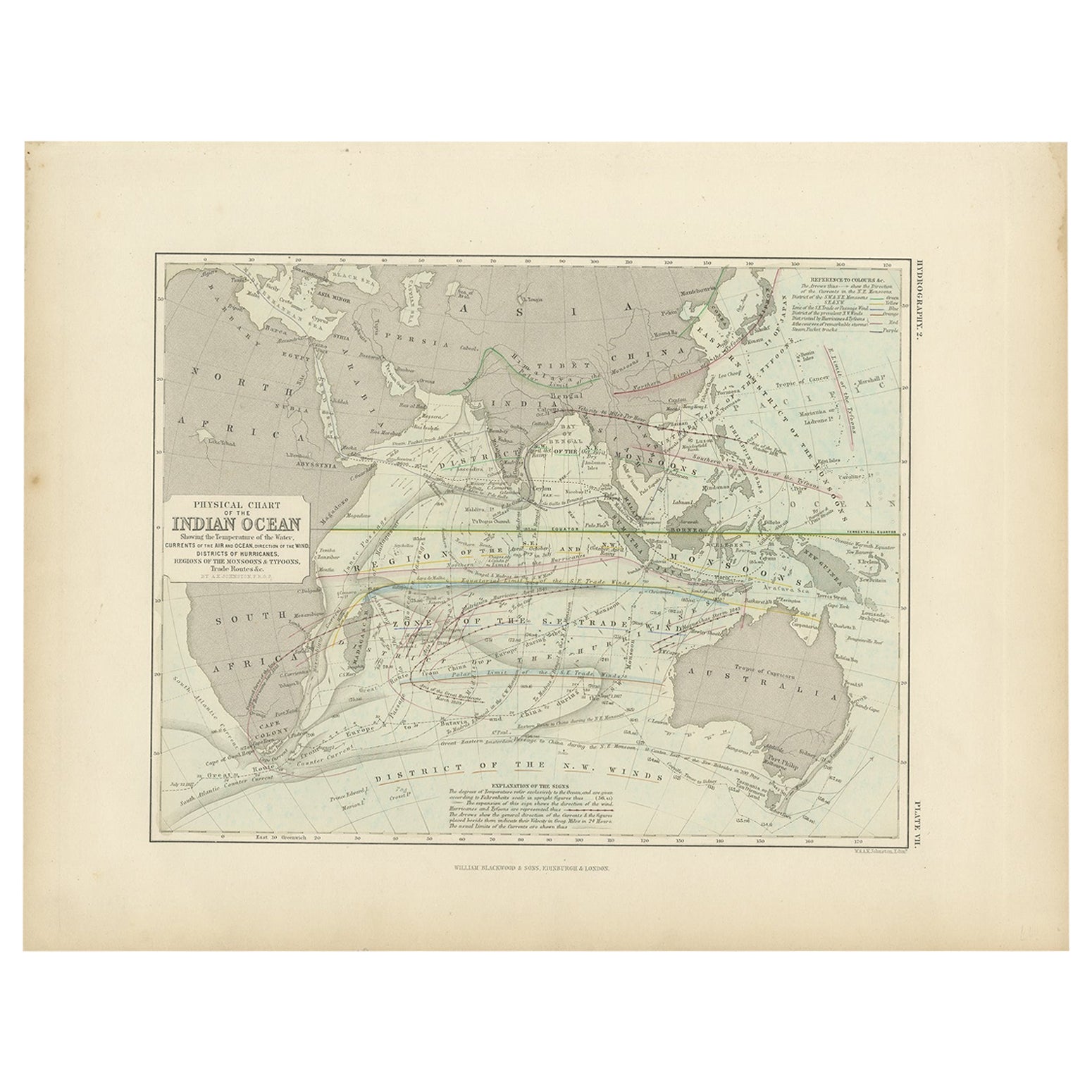
- Antique Physical Chart of the Indian Ocean by Johnston, 1850Located in Langweer, NLAntique map titled 'Physical Chart of the Indian Ocean'. This map shows the temperature of the water, currents of the air and ocean, direction of the wind, districts of hurricanes, t...Category
Antique 19th Century Maps
MaterialsPaper
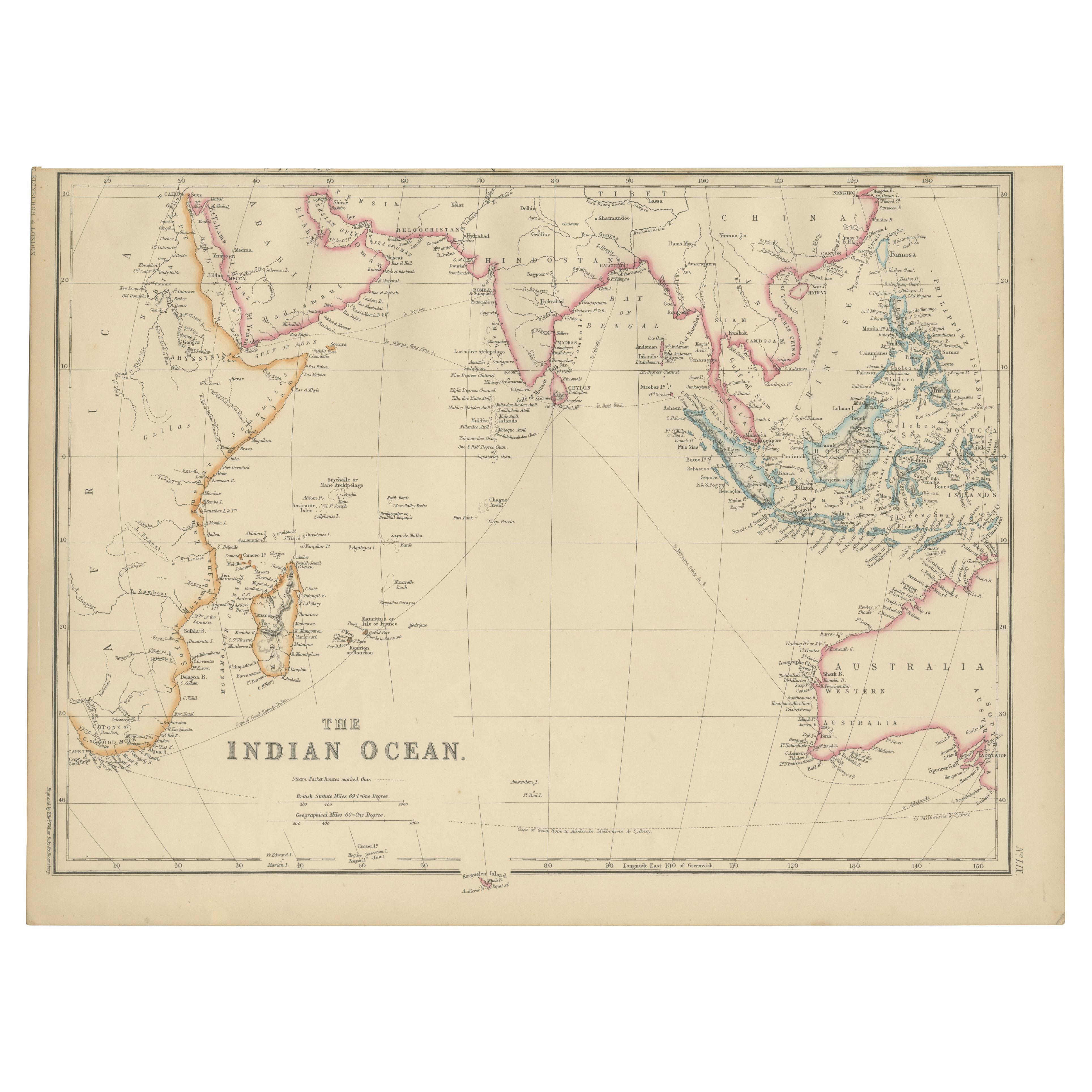
- Antique Map of the Indian Ocean by W. G. Blackie, 1859Located in Langweer, NLAntique map titled 'The Indian Ocean'. Original antique map of the Indian Ocean. This map originates from ‘The Imperial Atlas of Modern Geography’. Published by W. G. Blackie, 1859.Category
Antique Mid-19th Century Maps
MaterialsPaper
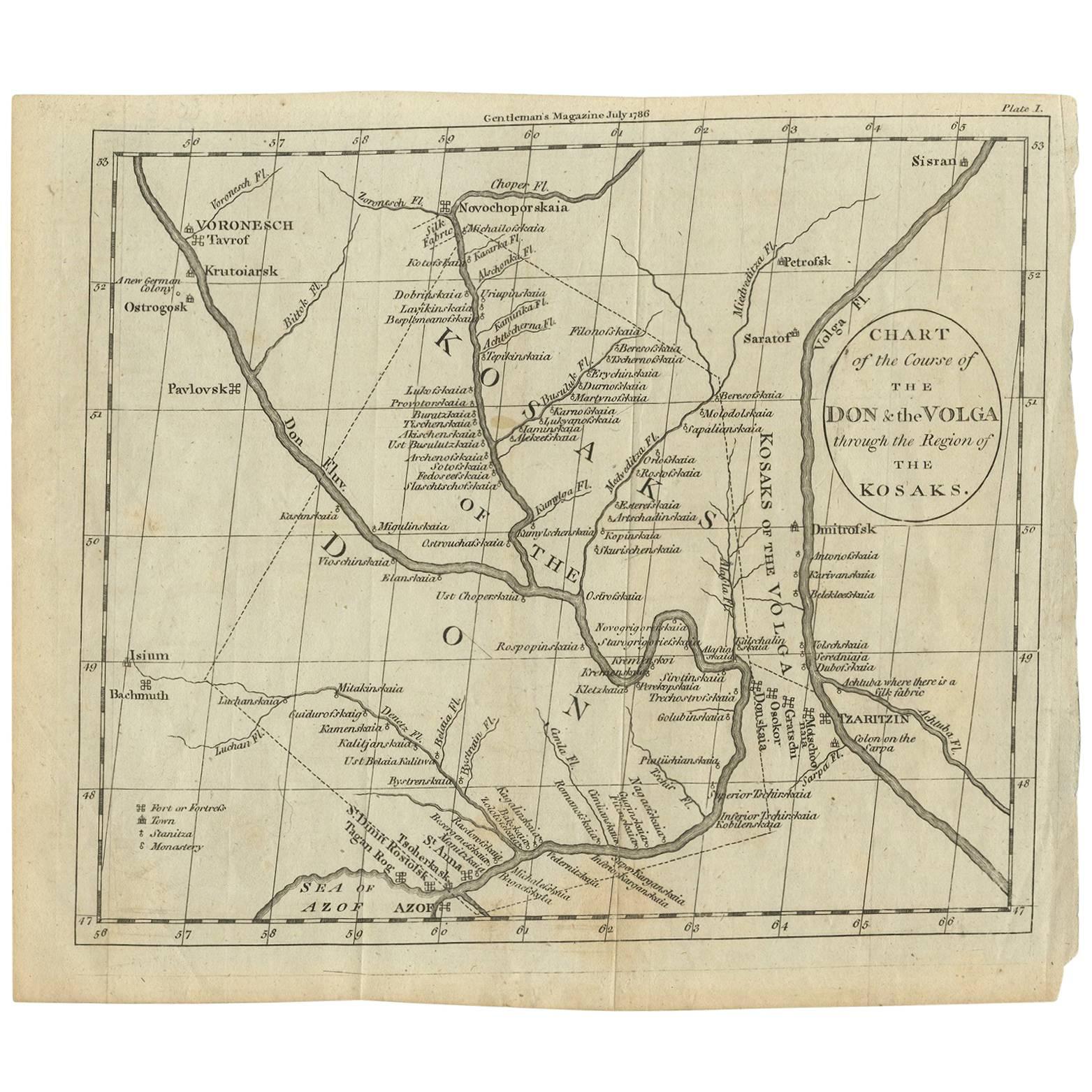
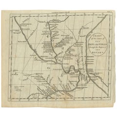
- Antique Map of the course of the Don & Voga riversLocated in Langweer, NLAntique map titled 'Chart of the Course of The Don & the Volga through the Region of The Kosaks'. SW Russia & Ukraine: interesting map showing the course of the Don & Voga rivers thr...Category
Antique Late 18th Century Maps
MaterialsPaper


You May Also Like
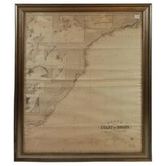
- Imray Ocean Chart of the Coast of Brazil 1876Located in Norwell, MAImray & Son 1876 Nautical chart of the Coast of Brazil between Cape Frio and the River Plate. Nicely framed. Overall Dimensions: 46" H x 56" W.Category
Antique 1870s Nautical Objects
MaterialsPaper
- University Chart “Black Map of North AmericaLocated in Chillerton, Isle of WightUniversity Chart “Black Map of North America W&A K Johnston’s Charts of Physical Maps By G W Bacon, This is a Black Physical map of North A...Category
Early 20th Century Industrial Maps
MaterialsLinen
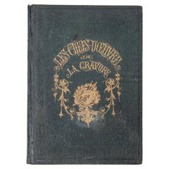
- "The Masterpieces of Engraving"By Eugene Maxime ValléeLocated in Alessandria, PiemonteO/7821 - interesting French book that I saved from ruin: they are usually dismembered to make prints to sell individually. This one is intact, with its 24 printed plates. Nice to ...Category
Antique Mid-19th Century French Other Books
MaterialsPaper
- School Chart or Pull Down Map of Geography of the Netherlands, 1950sLocated in Hemiksem, VANA beautiful old school map of the Netherlands, painted on linen. The map shows the 3 different reliefs (low, middle, high) of the Netherlands. The beau...Category
Vintage 1950s Belgian Mid-Century Modern Maps
MaterialsLinen, Paint
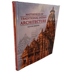
- Masterpieces of Traditional Indian Architecture Art BookLocated in North Hollywood, CAMASTERPIECES OF TRADITIONAL INDIAN ARCHITECTURE Satish Grover. Publisher: India: Lustre Press/Roli Books Publication Date: 2004 Binding: Hardcover B...Category
20th Century Indian Tribal Books
MaterialsPaper
- Large Original Antique Map of The Pacific Ocean, Fullarton, C.1870Located in St Annes, LancashireGreat map of The Pacific Ocean From the celebrated Royal Illustrated Atlas Lithograph by Swanston. Original color. Published by Fullarton,...Category
Antique 1870s Scottish Maps
MaterialsPaper