Items Similar to Antique Physical Chart of the Indian Ocean by Johnston, 1850

Want more images or videos?
Request additional images or videos from the seller
1 of 6
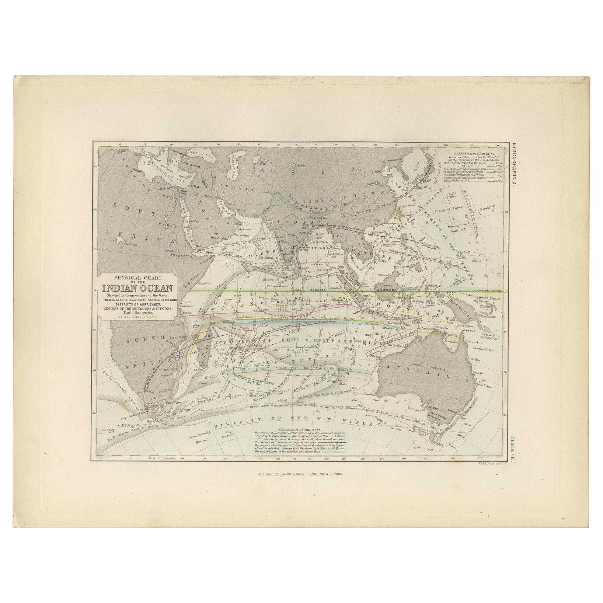
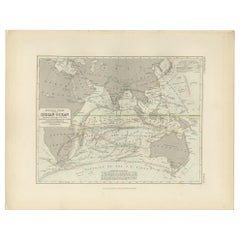
Antique Physical Chart of the Indian Ocean by Johnston, 1850
About the Item
Antique map titled 'Physical Chart of the Indian Ocean'. This map shows the temperature of the water, currents of the air and ocean, direction of the wind, districts of hurricanes, trade routes and more. Originates from Johnston's 'Physical Atlas of Natural Phenomena'.
Artists and Engravers: Published by William Blackwood & Sons, Edinburgh and London.
Condition: Very good, general age-related toning. Please study image carefully.
Date: 1850
Overall size: 36 x 28 cm.
Image size: 26 x 20 cm.
We sell original antique maps to collectors, historians, educators and interior decorators all over the world. Our collection includes a wide range of authentic antique maps from the 16th to the 20th centuries. Buying and collecting antique maps is a tradition that goes back hundreds of years. Antique maps have proved a richly rewarding investment over the past decade, thanks to a growing appreciation of their unique historical appeal. Today the decorative qualities of antique maps are widely recognized by interior designers who appreciate their beauty and design flexibility. Depending on the individual map, presentation, and context, a rare or antique map can be modern, traditional, abstract, figurative, serious or whimsical. We offer a wide range of authentic antique maps for any budget.
- Dimensions:Height: 11.03 in (28 cm)Width: 14.18 in (36 cm)Depth: 0 in (0.01 mm)
- Materials and Techniques:
- Period:
- Date of Manufacture:1850
- Condition:Condition: Very good, general age-related toning. Please study image carefully.
- Seller Location:Langweer, NL
- Reference Number:
About the Seller
5.0
Platinum Seller
These expertly vetted sellers are 1stDibs' most experienced sellers and are rated highest by our customers.
Established in 2009
1stDibs seller since 2017
1,928 sales on 1stDibs
Typical response time: <1 hour
- ShippingRetrieving quote...Ships From: Langweer, Netherlands
- Return PolicyA return for this item may be initiated within 14 days of delivery.
More From This SellerView All
- Antique Physical Chart of the Indian Ocean by Johnston '1850'Located in Langweer, NLAntique map titled 'Physical Chart of the Indian Ocean showing the temperature of the water'. Original antique chart of the Indian Ocean. This map originates from 'The Physical Atlas...Category
Antique Mid-19th Century Maps
MaterialsPaper
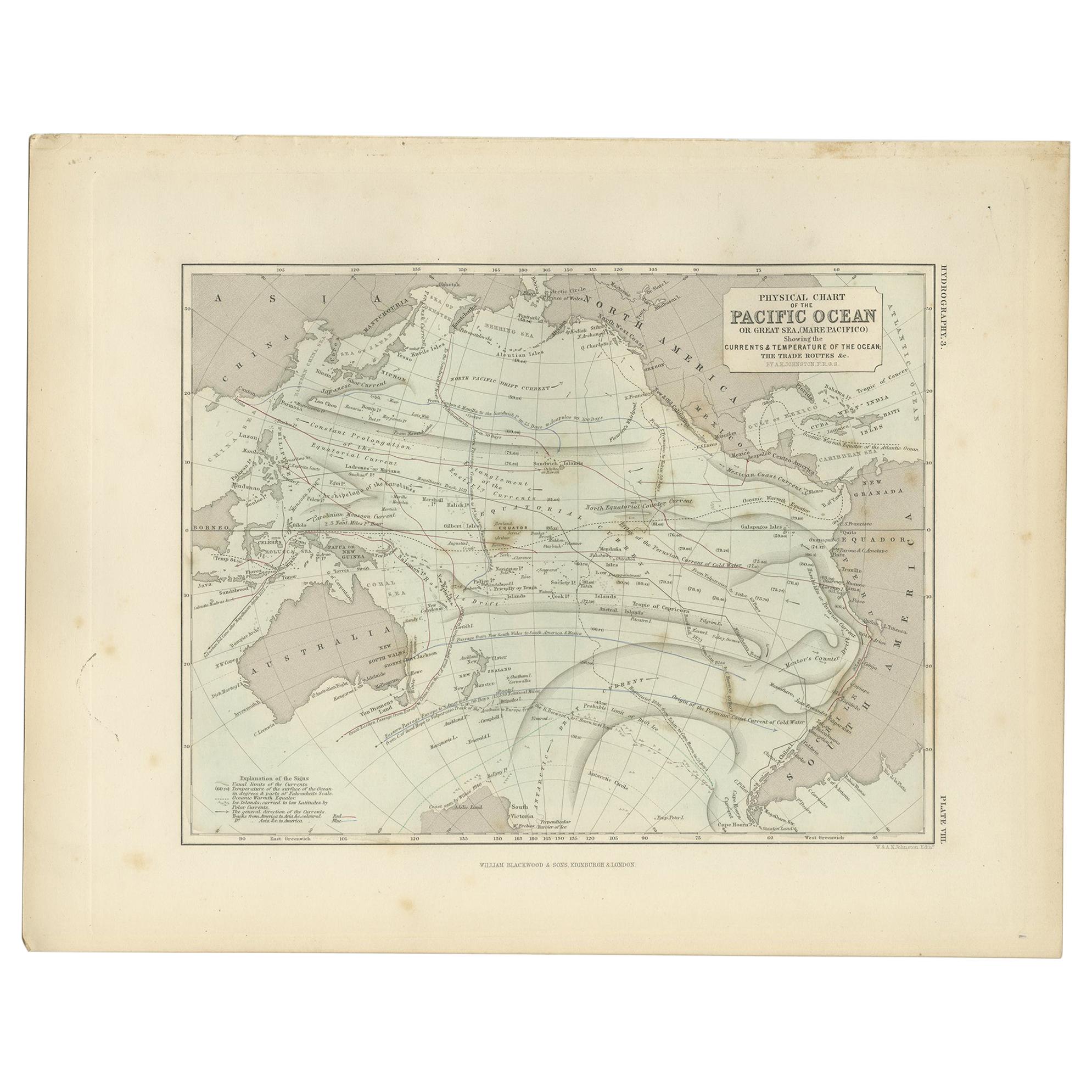
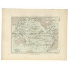
- Antique Physical Chart of the Pacific Ocean by Johnston, '1850'Located in Langweer, NLAntique map titled 'Physical Chart of the Pacific Ocean showing the currents and temperature of the ocean'. Original antique chart of the Pacific Ocean. This map originates from 'The...Category
Antique Mid-19th Century Maps
MaterialsPaper
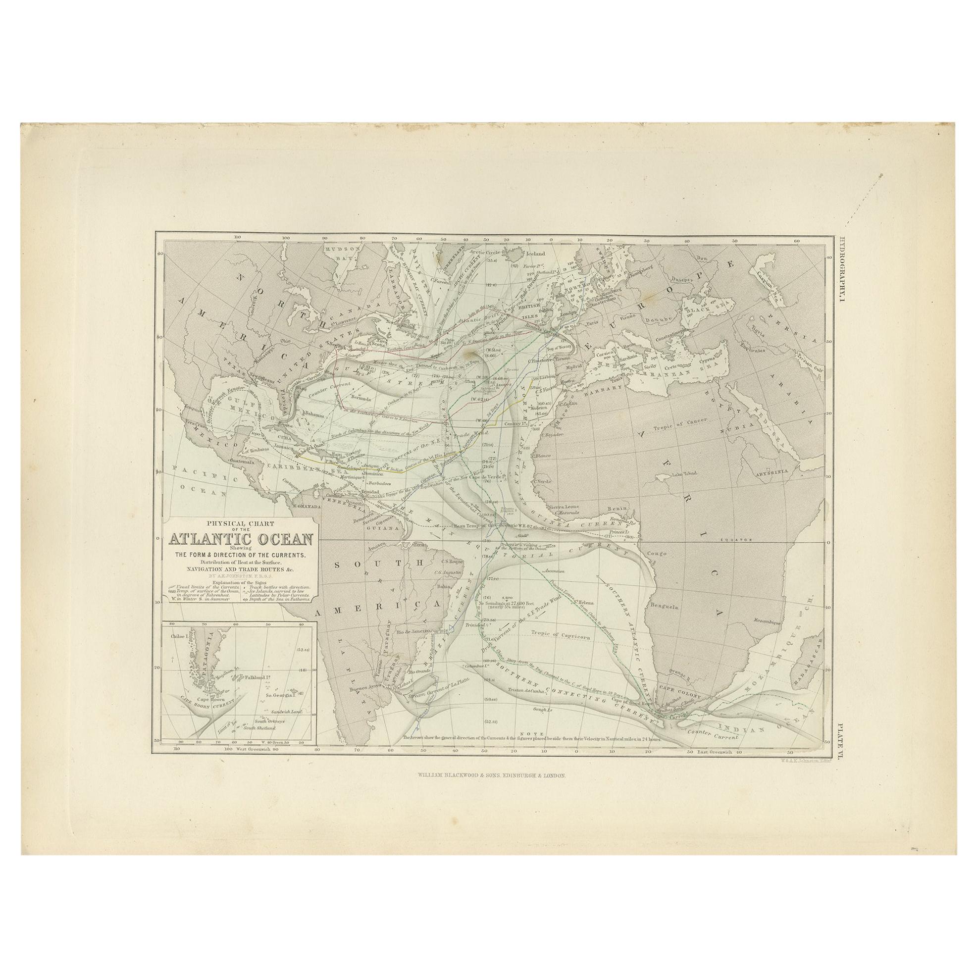
- Antique Physical Chart of the Atlantic Ocean by Johnston '1850'Located in Langweer, NLAntique map titled 'Physical Chart of the Atlantic Ocean showing the form and direction of the currents'. Original antique chart of the Atlantic Ocean. This map originates from 'The ...Category
Antique Mid-19th Century Maps
MaterialsPaper
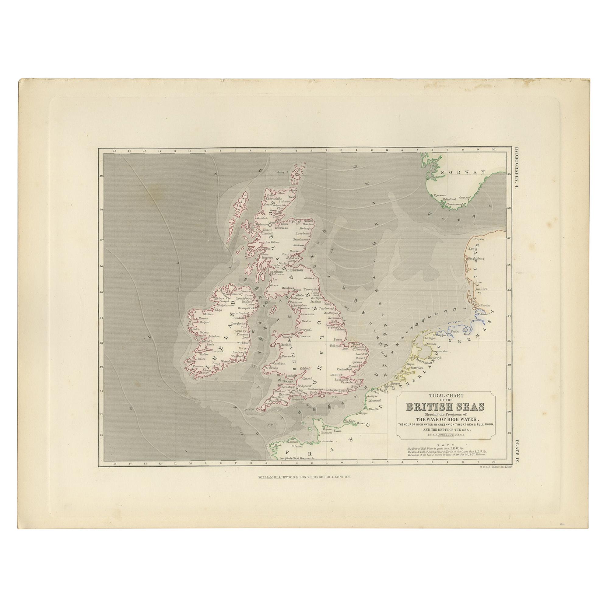
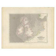
- Antique Tidal Chart of the British Seas by Johnston, '1850'Located in Langweer, NLAntique map titled 'Tidal Chart of the British Seas showing the progress of the wave of high water'. Original antique tidal chart of the British Seas. This map originates from 'The P...Category
Antique Mid-19th Century Maps
MaterialsPaper
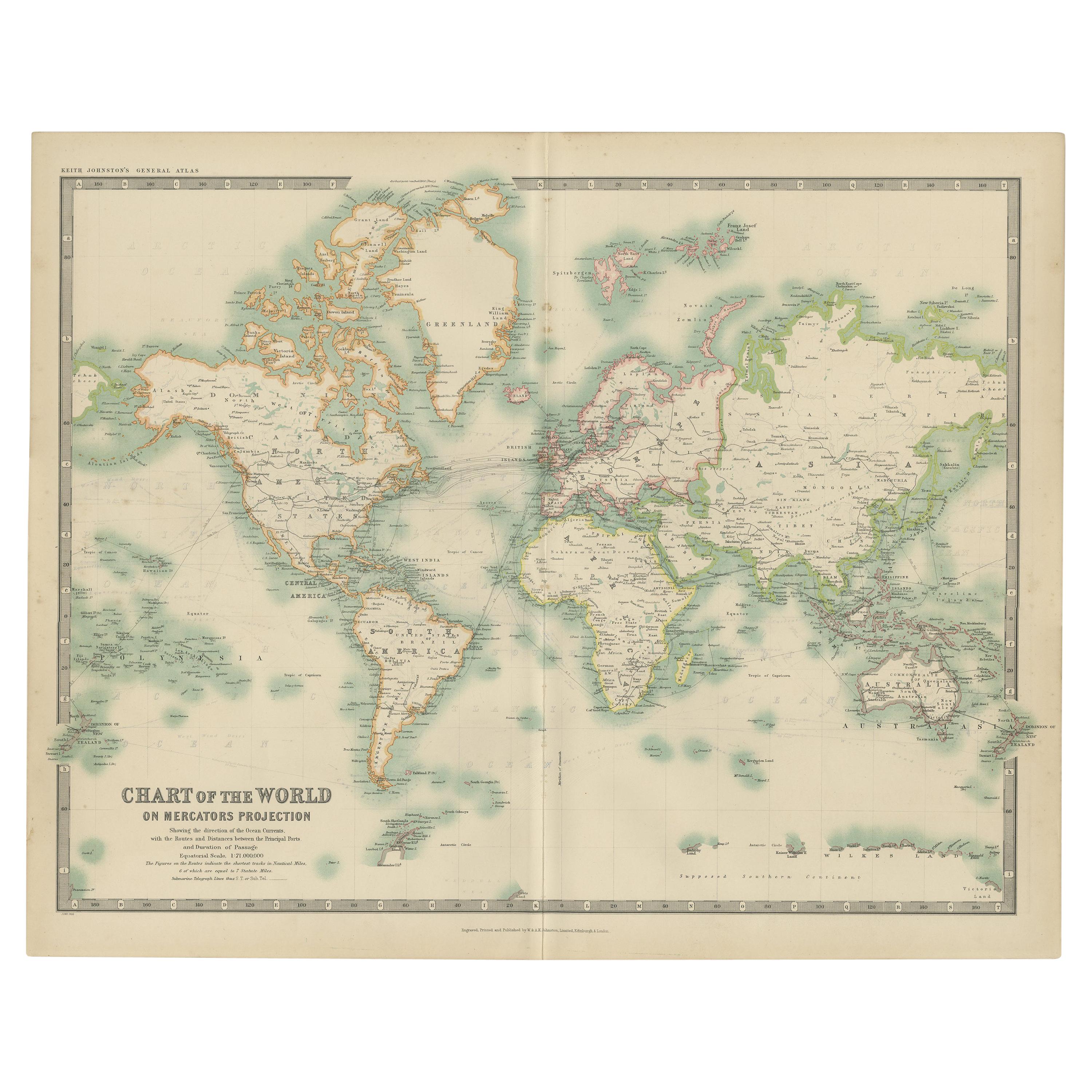
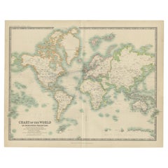
- Antique Chart of the World by Johnston '1909'Located in Langweer, NLAntique map titled 'Chart of the World on Mercator's Projection Showing the directions of the Oceans Currents with the Routes and Distances Between Principal Ports'. Detailed map of ...Category
Early 20th Century Maps
MaterialsPaper
- Antique Rain Map of the World by Johnston '1850'Located in Langweer, NLAntique map titled 'Hyetographic or Rain Map of the World'. Original antique rain map of the world. This map originates from 'The Physical Atlas of Natural Phenomena' by A.K. Johnsto...Category
Antique Mid-19th Century Maps
MaterialsPaper


You May Also Like
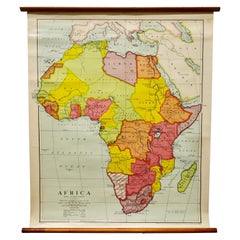
- Large University Chart “Africa Physical ” by BaconLocated in Chillerton, Isle of WightLarge University chart “Africa Physical ” by Bacon W&A K Johnston’s charts of physical maps by G W Bacon, This is a Physical map of Africa, it is lithograph set on Linen mounte...Category
Early 20th Century Beaux Arts Maps
MaterialsLinen
- Large University Chart “Physical Map of Africa” by BaconLocated in Chillerton, Isle of WightLarge university chart “Physical Map of Africa” by Bacon W&A K Johnston’s Charts of Physical Maps By G W Bacon, This is colorful Physical map of North America, it is large lithograph set...Category
Early 20th Century Folk Art Posters
MaterialsLinen
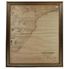
- Imray Ocean Chart of the Coast of Brazil 1876Located in Norwell, MAImray & Son 1876 Nautical chart of the Coast of Brazil between Cape Frio and the River Plate. Nicely framed. Overall Dimensions: 46" H x 56" W.Category
Antique 1870s Nautical Objects
MaterialsPaper
- Chart of the Harbour of LiverpoolLocated in Cheshire, GBPL Burdett A Chart of the Harbour of Liverpool hand coloured. Encased in an ebonised frame. Dimensions Height 23.5 Inches Width 28 Inches Depth 1 InchesCategory
Early 20th Century British Maps
MaterialsPaper
- 1865 Chart of the Islands of MadeiraLocated in Norwell, MARare James Imray chart from 1865 titled "Chart of the Islands of Madeira, Porto Santo and Dezerea" drawn from the survey made by Captain Ate Vidal Royal Navy, London. Published by Ja...Category
Antique 1860s European Maps
MaterialsPaper
- Antique Anatomical Wall Chart Depicting the Human SkeletonLocated in Berghuelen, DEA rare 19th century anatomical wall chart depicting the human skeleton. On the sides On the sides are detailed description in German language. The wall...Category
Early 20th Century German Victorian Prints
MaterialsPaper


Recently Viewed
View AllMore Ways To Browse
Leicestershire Antique Map
Alabama Antique Map
Antique Alabama Map
Berkshire Antique Map
Ontario Map
Warwickshire Antique Map
Antique Map Of Alabama
Heinrich Kiepert On Sale
Hertfordshire Antique Map
Poired Metal
Ruscelli Map
Antique Map Kentucky
Antique Map Tennessee
Antique Maps Of Tennessee
Huntingdonshire Antique Map
Mappemonde Antique
Tennessee Map
Antique Bermuda Maps