Items Similar to 1865 Chart of the Islands of Madeira


Want more images or videos?
Request additional images or videos from the seller
1 of 14
1865 Chart of the Islands of Madeira
About the Item
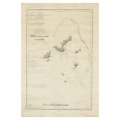
Rare James Imray chart from 1865 titled "Chart of the Islands of Madeira, Porto Santo and Dezerea" drawn from the survey made by Captain Ate Vidal Royal Navy, London. Published by James Imray and Son 89 and 102 Minories 1865. Awesome nautical chart. Matted and framed.
Weight: 14 lbs.
Overall Dimensions: 35"H x 42"L
Made: England
Material: Paper
Date: 1865
- Dimensions:Height: 35 in (88.9 cm)Width: 42 in (106.68 cm)Depth: 3 in (7.62 cm)
- Materials and Techniques:
- Place of Origin:
- Period:
- Date of Manufacture:1865
- Condition:
- Seller Location:Norwell, MA
- Reference Number:
About the Seller
5.0
Vetted Seller
These experienced sellers undergo a comprehensive evaluation by our team of in-house experts.
Established in 1967
1stDibs seller since 2015
346 sales on 1stDibs
Typical response time: 2 hours
- ShippingRetrieving quote...Ships From: Norwell, MA
- Return PolicyThis item cannot be returned.
More From This SellerView All
- Long Island Chart from 1828Located in Norwell, MARare original chart of Long Island Sound by E + G Blunt of New York, 179 Water St. "Surveyed in the years 1828, 29 & 30" Exceedingly rare and early chart, titled Long Island Sound fr...Category
Antique 1830s Nautical Objects
MaterialsPaper
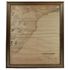
- Imray Ocean Chart of the Coast of Brazil 1876Located in Norwell, MAImray & Son 1876 Nautical chart of the Coast of Brazil between Cape Frio and the River Plate. Nicely framed. Overall Dimensions: 46" H x 56" W.Category
Antique 1870s Nautical Objects
MaterialsPaper
- 1898 Chart of Boston BayLocated in Norwell, MAOriginal 1898 chart showing Massachusetts Bay with the coast from Cape Ann to Cape Cod. This is a U.S. Navy Geodetic survey chart. All towns are noted along the coast. Framed with gl...Category
Antique 1890s Nautical Objects
MaterialsPaper
- Chart of Boston's North ShoreLocated in Norwell, MARarely found restrike of an 1804 chart by Nathanael Bowditch of the Harbors of Salem, Marblehead, Beverly, and Manchester. Showing the Islands of Great Misery, Satan, Cuney, Winter,...Category
Vintage 1980s North American Maps
MaterialsPaper
- 19th Century Nautical Chart of MartiniqueLocated in Norwell, MAOriginal map of Martinique from 1887 with chartered waters around the island. Prepared from a French survey, completed in 1825, showing town, ports, rivers and tributaries. Published...Category
Antique 19th Century Nautical Objects
- 1918 George Eldridge Chart of Massachusetts BayLocated in Norwell, MARare early twentieth century chart of Cape Cod bay by George Eldridge showing Massachusetts Bay, and the coast from Chatham to Gloucester 1918. Signed George Eldridge. This great ch...Category
Vintage 1910s North American Maps
MaterialsPaper


You May Also Like
- Antique Chart of the Banda Islands or The Spice Islands, Indonesia, 1726Located in Langweer, NLAntique map titled 'Nieuwe Caart der Eylanden van Banda'. Beautiful chart of the Banda Islands including Banda Api, Banda Neira, Banda Besar, Pulau Hatta (Rosengain), Pulau Ai an...Category
Antique 1720s Maps
MaterialsPaper
- Large Sea Chart of the British Islands, 1918Located in Langweer, NLAntique map titled 'The British Islands'. Large sea chart of the British Islands. It shows Ireland, Scotland, England, the Shetland Islands and part of Fra...Category
Vintage 1910s Maps
MaterialsPaper
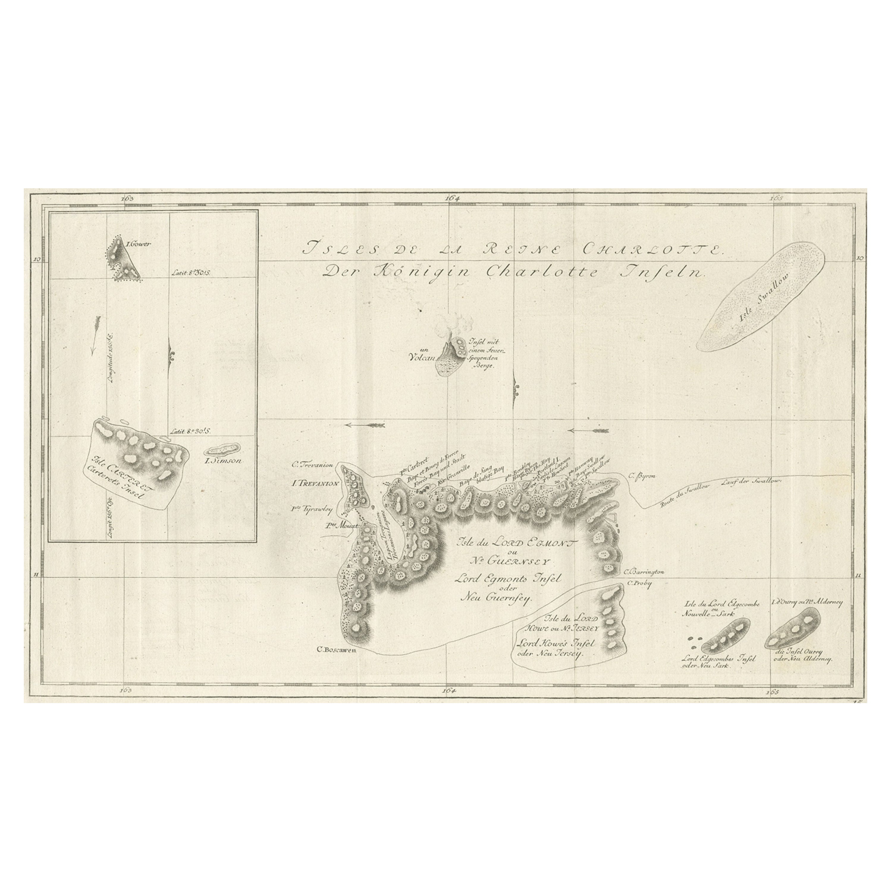
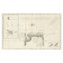
- Original Antique Chart of the Santa Cruz Islands, 1774Located in Langweer, NLAntique print titled 'Isles de la Reine Charlotte (..)'. A detailed chart of the Santa Cruz islands, to the north of the New Hebrides, with Carte...Category
Antique 1770s Maps
MaterialsPaper
- Large Chart of the island and sea of Java, IndonesiaLocated in Langweer, NLAntique map titled 'Carte Esférica de la Isla Y Mar de Java'. Large chart of the island and sea of Java, Indonesia. Beautiful nautical chart, published 1863 in Spain.Category
Antique Mid-19th Century Maps
MaterialsPaper
- Antique Sea Chart of the Shetland Islands, Scotland, ca.1745Located in Langweer, NLAntique map of Scotland titled 'Nieuwe Paskaard van Hitland met de daar omleggende eylanden na de nieuwe aftekening gemaakt by den Lofwaarden en onvermoeyden Hit en Zeeman Ian Bruyst...Category
Antique 1740s Maps
MaterialsPaper
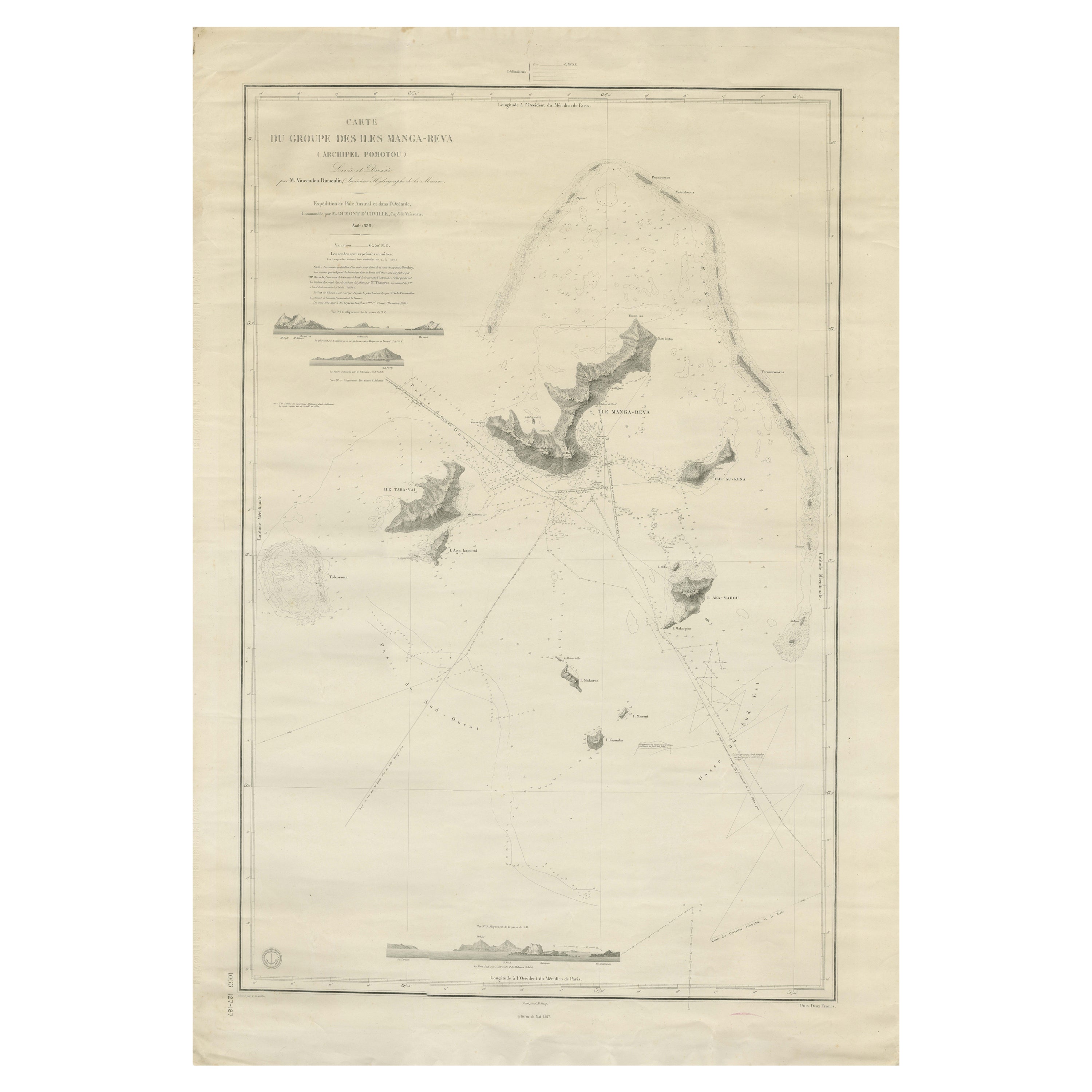
- Large Chart of the Gambier Islands, Tuamotu Archipelago, French PolynesiaLocated in Langweer, NLAntique map titled 'Carte du Groupe des Iles Manga-Reva (Archipel Pomotou)'. Large chart of the Tuamotu Archipelago, French Îles Tuamotu, also called Paumotu, island group of French ...Category
Antique Mid-19th Century Maps
MaterialsPaper


Recently Viewed
View AllMore Ways To Browse
Pero India
Yorkshire Ridings Map
Willem Jacobus Albert
Canadian Railway Map
Cincinnati Map
Abraham Ortelius On Sale
Antique Map Of Republic Of Texas
Dan Rizzi
E H Fletcher
Giovanni Maria Cassini On Sale
Kiribati Islands Map
Map Of Kiribati Islands
Vintage Schoolroom
Atlas School Supply
Denver Map
Map Of Denver
Marthas Vineyard Map
Menorca Map