1860s Maps
3
25
to
3
18
7
25
25
25
3
2,897
2,121
415
5
230
32
11
85
7
59
7
3
3
4
5
2
25
2
1
1
5
5
5
2
2
Period: 1860s
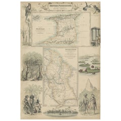
British Possessions on the North West Coast of South America, 1860
Located in Langweer, NL
The antique print is a page from an 1860 A Fullarton atlas, providing a comprehensive view of the British possessions on the northwest coast of South America during that time. It fea...
Category
Antique 1860s Maps
Materials
Paper
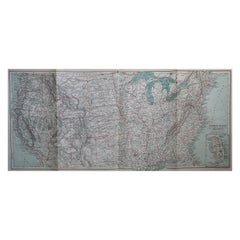
1866 Ensign & Bridgman's Rail Road Map of the United States
Located in Colorado Springs, CO
Presented is an 1866 issue of “Ensign & Bridgeman’s Rail Road Map of the United States, showing Depots & Stations.” First published in 1856, this is the third edition, following anot...
Category
American Late Victorian Antique 1860s Maps
Materials
Paper
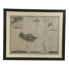
1865 Chart of the Islands of Madeira
Located in Norwell, MA
Rare James Imray chart from 1865 titled "Chart of the Islands of Madeira, Porto Santo and Dezerea" drawn from the survey made by Captain Ate Vidal Royal Navy, London. Published by Ja...
Category
European Antique 1860s Maps
Materials
Paper
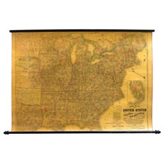
1863 "Lloyd's New Map of the United States, the Canadas, and New Brunswick"
Located in Colorado Springs, CO
Presented is “Lloyd's New Map of the United States, the Canadas and New Brunswick, From the latest Surveys, Showing Every Railroad & Station Finished to June 1863, and the Atlantic and Gulf Coasts.” A large, Civil War-era hanging map of the United States and adjacent territories, this map covers the area from the Atlantic Ocean and extends as far west as the 103 meridian, to “Dacotah,” Nebraska, Kansas, "Indian Territory," and Texas. The southern continuation of Florida is shown in an inset map along the right margin. This map was published by J. T. Lloyd, in New York, in 1863. According to the publisher’s marking at lower right, this map was originally issued in two states: "in Sheets, Colored" for 50 cents, and "Varnished nicely, with Rollers" for $1.
Throughout the map, the counties are colored and the towns and cities well labeled. A reference key in the bottom margin provides symbols for railroads, turnpikes and wagon roads, state capitals, cities and towns, and village post offices. As emphasized in the map’s title, this map is especially notable for the countless railway lines and stations depicted, with distances noted between points, listing “every railroad and finished station to June 1863.” Additionally, two shipping agents and their routes are drawn out of New York City. The map includes details of the steamship routes into New York and Philadelphia from Liverpool and on to California and Oregon via an overland Nicaraguan trek, presumably to assist gold rush emigrants.
This expansive and impressive map depicts the eastern half of the United States in the third year of the Civil War. In order not to recognize the legitimacy of the Confederate States of America, each state is shown in the same manner as the Union states. The only indication that the American Civil War was in progress when this map was published is a printed notice that Gideon Wells, Secretary of the Navy, wishes to acquire a quote on 100 copies of Lloyd’s Mississippi River map...
Category
American Antique 1860s Maps
Materials
Linen, Wood, Paper
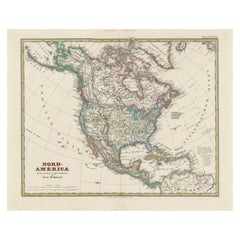
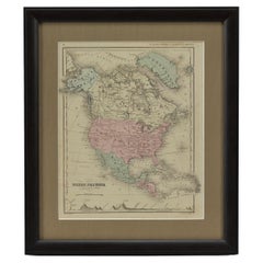
Old German Map of Northern America with Attractive Hand Colouring, 1864
Located in Langweer, NL
Interesting German map of Northern America in a handsome coloring.
Genuine antique hand colored map of North America, with handsome detail, in German detai...
Category
Antique 1860s Maps
Materials
Paper
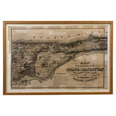
1868 Map of the Upper Part of the Island of Manhattan Above 86th Street
Located in San Francisco, CA
This wonderful piece of New York City history is over 150 years old. It depicts 86th street and above. It was lithographed by WC Rogers and company. It was made to show what was the Battle of Harlem during the Revolutionary war...
Category
American American Colonial Antique 1860s Maps
Materials
Paper
Original Large Antique Map of Paris, France by John Dower, 1861
Located in St Annes, Lancashire
Fabulous monochrome map of Paris.
Vignettes of St Germain En Laye, Saint Cloud, Versailles and Fontainbleau.
Unframed.
Drawn by J.Dower.
Lithography by Weller. 4 sheets j...
Category
English Victorian Antique 1860s Maps
Materials
Paper
Original Antique Map of Indonesia, 1861
Located in St Annes, Lancashire
Great map of Indonesia
Drawn and engraved by Edward Weller
Original color
Published in The Weekly Dispatch Atlas, 1861
Repairs to minor e...
Category
English Victorian Antique 1860s Maps
Materials
Paper
Old Map the United States and Central America, Including Mexico, ca.1860
Located in Langweer, NL
Antique map titled 'Vereinigte Staaten von Nord America und Mexico'.
Old map the United States and Central America, including Mexico. This print originates from 'Stieler's Schul-...
Category
Antique 1860s Maps
Materials
Paper
Map of Southern Italy inlcluding Sardinia and Inset of the Bay of Naples, c.1860
Located in Langweer, NL
Antique map titled 'South Italy and the Island of Sardinia'.
Old map of Southern Italy and the island of Sardinia. With an inset map of the B...
Category
Antique 1860s Maps
Materials
Paper
Superb, Large Map of British India, Chinese Empire, Indochina, Malaysia, 1860
Located in Langweer, NL
Antique map titled 'Indes, colonies Anglaises.'
Large map of the East Indies, British Colonies. A superb, large-scale map of British India, the Chinese Empire, Indochina, the Malay Peninsula, and parts of Sumatra and Borneo. This large original antique map originates from: 'Atlas Universel Physique, Historique et Politique de Geeographie Ancienne et Moderne ' by H. Dufour. Published 1860.
Artists and Engravers: Made by 'Charles Dyonnet' after 'Dufour'. Charles Dyonnet (1822 - c. 1880) was an extremely active Paris based engraver working in the mid to late 19th century. From his offices at 220 Rue St. Jacques, Paris, Dyonnet engraved numerous maps for many of the most prominent 19th French cartographic publishers including Vuillemin, Dufour, Fremin and Duvotenay. From 1850-1861, he held the coveted position of 'Graveur du Depot de la Marine' and in this position engraved numerous French naval and military maps...
Category
Antique 1860s Maps
Materials
Paper
Old Hand-Colored Engraving of a Farmer's Wife from Fribourg, Switzerland, c.1860
Located in Langweer, NL
Antique costume print titled 'Fribourg'.
This print depicts a farmer's wife from Fribourg, Switzerland. Source unknown, to be determined.
Artists and Engravers: Anonymous.
Category
Antique 1860s Maps
Materials
Paper
Nice Antique Print of a Breton Cow, a French Cattle Breed from Brittany, 1862
Located in Langweer, NL
Antique print titled 'Vache Bretonne' - This rare plate shows a Breton Cow, a French cattle breed from Brittany. From: 'Les Races bovines au concours universel agricole de Paris en 1...
Category
Antique 1860s Maps
Materials
Paper
Old Map of Russia Originating from the 'Weekly Dispatch Atlas', ca.1865
Located in Langweer, NL
Antique map titled 'Russia in Asia, E Sheet'.
Old map of Russia originating from the 'Weekly Dispatch Atlas'.
Artists and Engravers: Engraved by J.W. Lowry.
Category
Antique 1860s Maps
Materials
Paper
Original Antique Print of the Port of Calais, France, ca.1860
Located in Langweer, NL
Antique print titled 'Calais Entrée du Port'.
Original antique print of the port of Calais, France. This print originates from 'France en miniature'. Published circa 1860.
Art...
Category
Antique 1860s Maps
Materials
Paper
Beautiful Original Antique Print of Indian Decorative Art, 1869
Located in Langweer, NL
Old print of Indian decorative art. This print originates from 'L'Ornement polychrome'. A beautiful work containing about 2000 patterns of all the st...
Category
Antique 1860s Maps
Materials
Paper
Château de Versailles 'Paris, France' with a View from the Park/Garden, 1861
Located in Langweer, NL
Antique print titled 'Château de Versailles'.
This print depicts Versailles (Paris, France) with a view from the park/garden. This print originates from 'Paris dans sa splendeur'...
Category
Antique 1860s Maps
Materials
Paper
Old Coloure Map of North & Central Italy & Corsica with an Inset of Rome, c.1860
Located in Langweer, NL
Antique map titled 'North & Central Italy and the Island of Corsica'.
Old map of North and Central Italy, and the island of Corsica. With an inset map of the region of Rome. Orig...
Category
Antique 1860s Maps
Materials
Paper
Old View of the January 1851 Floods in Bommelerwaard, the Netherlands, 1861
Located in Langweer, NL
Antique print titled 'De Overstrooming in den Bommelerwaard, Januarij 1861'.
View of the floods in Bommelerwaard, the Netherlands.
Artists and Engravers: Engraved by C.C.A. L...
Category
Antique 1860s Maps
Materials
Paper
Antique Print of the Province of Friesland, The Netherlands, 1868
Located in Langweer, NL
Antique map titled 'Provincie Friesland'.
Map of Friesland, the Netherlands. This map originates from 'Gemeente-Atlas van Nederland' by J. Kuyper.
Artists and Engravers: Publ...
Category
Antique 1860s Maps
Materials
Paper
Rare Map of the Bay of St. Vladimir 'Russia' Showing the Route of J. Ward, 1869
Located in Langweer, NL
Antique map titled 'Côte est de Tartarie Baie St. Vladimir'.
Map of the Bay of St. Vladimir (Russia) showing the route of J. Ward. Including a coastal view. Source unknown, to be...
Category
Antique 1860s Maps
Materials
Paper
German Globe by C. Abel-Klinger, Nuremberg, circa 1860
Located in Milano, IT
Terrestrial globe
Artistic company C. Abel - Klinger
Nuremberg, circa 1860
H cm 31 x 22 cm (12.20 x 8.66 in); sphere 14 cm (5.51 in) in diameter
lb 2.30 (kg 1.04)
State of conservation: good. On the sphere there are slight visible signs of accidental bumping at the poles, as well as on New Guinea and England (vertical and more visible); some ink stains, especially at the South Pole and on the meridian that crosses North America.
The globe is composed of twelve whole gores of printed paper, juxtaposed and glued on a sphere made with a chalky base mixture.
The circle of the meridian, made of brass...
Category
German Other Antique 1860s Maps
Materials
Wood, Paper
1864 Map of North America, Antique Hand-Colored Map, by Adolphe Hippolyte Dufour
Located in Colorado Springs, CO
Offered is a map of North America entitled Amerique du Nord from 1864. This rare, separately published wall map was produced by Adolphe Hippolyte Dufour. This map includes vibrant an...
Category
French Antique 1860s Maps
Materials
Paper
1861 Topographical Map of the District of Columbia, by Boschke, Antique Map
Located in Colorado Springs, CO
Presented is an original map of Albert Boschke's extremely sought-after "Topographical Map of the District of Columbia Surveyed in the Years 1856 ...
Category
American Antique 1860s Maps
Materials
Paper
Civil War Panorama of the Seat of War by John Bachmann, Antique Print circa 1864
Located in Colorado Springs, CO
Panorama of the seat of war. Bird's-eye View of Virginia, Maryland, Delaware and the District of Columbia.
This third state of this fascinating bird's eye view of the northernmost p...
Category
American Antique 1860s Maps
Materials
Paper
Related Items
Original Antique Map of The United States of America, circa 1890
Located in St Annes, Lancashire
Great map of the USA
By The Stanford's Geographical Establishment
Original colour
Unframed.
Category
English Victorian Antique 1860s Maps
Materials
Paper
"The Second World War, " by Winston Churchill
Located in Austin, TX
The Second World War by Winston Churchill from Houghton-Mifflin Company, Boston.
A vintage edition of Winston Churchill's six-volume memoir, The Second World War, for which he was a...
Category
American Modern 1860s Maps
Materials
Paper
Antique Federal Eagle American 50 Star Flag with Brass Eagle Pole, 19th Century
Located in Oklahoma City, OK
Monumental 50 star American Flag with antique Federal Eagle brass and wood pole. A patriotic piece suitable for any home. This set includes both ...
Category
American Federal Antique 1860s Maps
Materials
Brass, Bronze
H 66 in W 69 in D 1.25 in
Antique Hand-Carved Meerschaum Smoking Pipe of Napoleon Bonaparte & Case
Located in Hamilton, Ontario
This antique well executed hand-carved meerschaum pipe was made by the Drown Pipe company of Vienna Austria and dates to approximately 1900 and done in a Renasissance Revival style. ...
Category
Austrian Renaissance Revival 1860s Maps
Materials
Clay
Antique Map of The United States of North America, 1882
Located in Langweer, NL
This is a historical map titled "The United States of North America, Central Part" from the 1882 Blackie Atlas. It depicts the continental United States with a high level of detail, ...
Category
Antique 1860s Maps
Materials
Paper
Pair 19th Century Victorian Eastlake Free Mason Throne Chairs w/ Symbolism
Located in Savannah, GA
Victorian Eastlake large upholstered solid oak throne chairs from Masonic Lodge with lots of detailed carving. The pair consists of one with the plumb bob sy...
Category
American Eastlake Antique 1860s Maps
Materials
Velvet, Oak
17th Century Hand-Colored Map of West Africa by Mercator/Hondius
Located in Alamo, CA
A 17th century hand-colored map entitled "Guineae Nova Descriptio" by Gerard Mercator and Jodocus Hondius, published in their 'Atlas Minor' in Amsterdam in 1635. It is focused on the...
Category
Dutch Antique 1860s Maps
Materials
Paper
Large Original Antique Map of the United States of America. 1891
Located in St Annes, Lancashire
Fabulous map of The United States
Original color
By Rand, McNally & Co.
Dated 1891
Unframed
Free shipping.
Category
American Antique 1860s Maps
Materials
Paper
No Reserve
H 20.5 in W 13.5 in D 0.07 in
Original Antique Hand-colored Map of the United States, circa 1845
Located in Langweer, NL
Antique map titled 'United States'. Old map of the United States, includes the last part of the North West Territory (present day Wisconsin and part of Minnesota). It also marks Ft. Crawford at the confluence of the Mississippi River and the Ouisconsin River (present day Wisconsin River). Published by Orr & Company; Amen Corner...
Category
Antique 1860s Maps
Materials
Paper
1 Volumes. George Catlin, North American Indians.
Located in New York, NY
1 Volumes. George Catlin, North American Indians. Bound in 3/4 brown calf and marbled boards. The covers and raised band spine are gilt-tooled with red and black morocco labels. All ...
Category
English Antique 1860s Maps
Materials
Leather
46-Star American Flag, Antique Printed on Silk, Early 20th Century
Located in Colorado Springs, CO
This is an original 46-star American parade flag, printed on silk. Each star represents a state in the Union at the time. The official flag design would update every July 4th, to inc...
Category
American Antique 1860s Maps
Materials
Silk
New Map of North America from the Latest Discoveries, 1763
Located in Philadelphia, PA
A fine antique 18th century map of the North American seaboard.
Entitled "A New Map of North America from the Latest Discoveries 1763".
By the Cartographer/Engraver - John Spil...
Category
English Georgian Antique 1860s Maps
Materials
Paper
Previously Available Items
1864 "North America" by J. Wells
Located in Colorado Springs, CO
Presented is an original 1864 map of “North America.” The map was issued as “Map No. 3” in McNall’s System of Geography. It was drawn by J. Wells and engraved by George E. Sherman, i...
Category
Antique 1860s Maps
Materials
Paper
Desk Globe by Smith and Son, circa 1860
By Charles Smith & Son
Located in London, GB
A handsome Smith's terrestrial globe, circa 1835. Mounted on a brass semi-meridian that sits on a turned wooden upright and circular base. Printed in several colours, the globe compr...
Category
British Antique 1860s Maps
Materials
Brass
1864s Paravia Milano Antique Rare Physical and Political Terrestrial Globe
Located in Milan, IT
Extremely rare physical and political Terrestrial globe according to the most recent discoveries published by G.B. Paravia and Comp. Rome - Turin - Milan - Florence in 1864. This glo...
Category
Antique 1860s Maps
Materials
Paper
Original Antique Steel Engraving of the City Lemberg or Lviv, Ukraine, ca.1860
Located in Langweer, NL
Antique print titled 'Lemberg'.
Steel engraving of the city of Lviv, Ukraine. Published for Herrmann J. Meyer.
Artists and Engravers: Herrmann Julius Meyer (April 4, 1826 – M...
Category
Antique 1860s Maps
Materials
Paper
Free Shipping
H 7.29 in W 10.63 in D 0 in
Old Hand-Colored Steel Engraving of Buenos Aires, Argentina, ca.1860
Located in Langweer, NL
Antique print titled 'Buenos Ayres (Amérique Meridionale)'.
Steel engraving with a view looking from the Rio de la Plata towards Buenos Aires, Argenti...
Category
Antique 1860s Maps
Materials
Paper
Old Hand-Colored Steel Engraving of the City of Rio de Janeiro, Brazil. ca.1865
Located in Langweer, NL
Antique print titled 'Rio-Janeiro'.
Old steel engraving of the city of Rio de Janeiro, Brazil. Also depicted are several ships.
Artists and Engravers: Made after the Rouargue...
Category
Antique 1860s Maps
Materials
Paper
H 6.5 in W 9.65 in D 0 in
Rare 19th Century Lithograph of Havana, Capital of Cuba, Caribbean, c.1860
Located in Langweer, NL
Colored lithograph by Asselineau after Bachmann bei Wild, around 1860.
Havana. "Vue generale de la Havane". Overall view from an elevated point of view.
On strong wove paper. 3...
Category
Antique 1860s Maps
Materials
Paper
H 18.9 in W 26.78 in D 0 in
Original Antique Map of the Great Lakes, Canada by T. Ettling, 1861
Located in St Annes, Lancashire
Great map of The Great Lakes
Steel engraving with original color outline
Drawn and engraved by T. Ettling
Published in the weekly Dispatch Atlas, 1861
Unframed.
Category
English Other Antique 1860s Maps
Materials
Paper
Free Shipping
H 19 in W 13 in D 0.07 in
Original Antique Map of Canada by T. Ettling, 1861
Located in St Annes, Lancashire
Great map of Canada
Steel engraving with original color outline
Drawn and engraved by T. Ettling
Published in the weekly dispatch Atlas, 1861
...
Category
English Other Antique 1860s Maps
Materials
Paper
Original Antique Map of New York and Adjacent States by T. Ettling, 1861
Located in St Annes, Lancashire
Great map of North East United States
Steel engraving with original color outline
Drawn and engraved by T. Ettling
Published in the weekly Dispatch Atlas, 1861
Some minor...
Category
English Other Antique 1860s Maps
Materials
Paper
Free Shipping
H 19 in W 13 in D 0.07 in
Large Original Antique Map of Switzerland, 1861
Located in St Annes, Lancashire
Great map of Switzerland
Drawn and engraved by Edward Weller
Original color outline
Published in The Weekly Dispatch Atlas, 1861
A couple of repairs to some tiny edge tea...
Category
English Victorian Antique 1860s Maps
Materials
Paper
Large Original Antique Map of Victoria, Australia, 1861
Located in St Annes, Lancashire
Great map of Victoria
Drawn and engraved by Edward Weller
Original color outline
Published in The Weekly Dispatch Atlas, 1861
A couple of r...
Category
English Victorian Antique 1860s Maps
Materials
Paper
Recently Viewed
View AllMore Ways To Browse
Greek Asia Minor
Antique Maps Canada
Antique Map Canada
Canada Antique Map
West Indies Map
Map Huge
Antique Portuguese Plates
Antique Maps Of Canada
Bali Map
Antique Map South Africa
Antique Map Of South Africa
Map Of West Indies
South Africa Antique Map
Belgium Army
Sweden Antique Map
Belgian Army
Cornelius Company
Antique Nautical Maps
