Items Similar to Antique Map of The United States of North America, 1882


Want more images or videos?
Request additional images or videos from the seller
1 of 7
Antique Map of The United States of North America, 1882
About the Item
This is a historical map titled "The United States of North America, Central Part" from the 1882 Blackie Atlas. It depicts the continental United States with a high level of detail, including state boundaries, cities, rivers, and the topography indicated by hachure marks.
The map shows a network of railways crisscrossing the country, reflecting the importance of rail travel and transport during the late 19th century. The map also includes the Gulf of Mexico and parts of adjacent countries such as Canada and Mexico, with less detail, highlighting the focus on the U.S.
Significant geographical features, like the Mississippi River system, the Rocky Mountains, and the Great Plains are well-represented, showing the varied landscapes across the country. The Great Lakes are also prominently featured in the upper right portion of the map.
The detail of the map, including city names and topographical features, suggests it was a comprehensive educational or navigational tool for its time. The map's scale and grid of latitude and longitude lines would have been essential for planning travel or understanding the country's geography.
The map shows the United States as it would have appeared in 1882. This was a significant period in American history, occurring in the latter part of what is known as the Gilded Age, a time marked by rapid economic growth, especially in the North and West, following the Civil War.
Here are some key aspects of the United States during the 1882 timeframe:
1. **Industrialization**: The US was undergoing rapid industrialization, with advances in technology and an expanding railroad network which contributed to the growth of industries like steel and manufacturing.
2. **Railroads**: The completion of the Transcontinental Railroad in 1869 dramatically changed the nation, making travel and the transportation of goods across the continent much quicker and easier. By 1882, additional rail lines had been constructed, further expanding the network.
3. **Immigration**: There was a significant increase in immigration during this period, with many people coming from Europe to the United States. The immigrants provided a labor force for the growing industries and also settled in the expanding territories out West.
4. **Urbanization**: With the growth of industry came the growth of cities as centers of commerce and work. There was a significant movement of the population from rural areas to urban centers.
5. **Westward Expansion**: The American frontier was still open, and many people moved westward in search of land, opportunity, and gold. The Homestead Act of 1862 had accelerated this movement by allowing people to claim land for farming.
6. **Native American Displacement**: This period was also marked by conflict and displacement of Native American tribes. As settlers moved west, they encroached on Native American lands, leading to battles and ultimately the forced relocation of many tribes.
7. **Reconstruction Era**: The country was still dealing with the aftermath of the Civil War, particularly in the Southern states. The Reconstruction era was coming to an end, with federal troops withdrawing from the South and the beginning of the Jim Crow era of racial segregation laws.
8. **Economic Disparity**: Although this period was marked by prosperity for many, it also saw the beginning of significant economic disparity and the rise of the so-called "Robber Barons," wealthy industrialists and financiers who amassed great wealth.
The map itself would show the states and territories of the time, with many of the western regions not yet achieving statehood. The intricate detailing of the railway lines would be a testament to their importance and prevalence. The geographical features, such as the Mississippi River and the Rocky Mountains, would be key natural landmarks shaping the economic and social development of the nation.
- Dimensions:Height: 14.97 in (38 cm)Width: 22.45 in (57 cm)Depth: 0 in (0.02 mm)
- Materials and Techniques:
- Period:
- Date of Manufacture:1882
- Condition:Good condition, folding line in the middle. The outer borders are slightly discolored due to age, but not the image. Study the image carefully.
- Seller Location:Langweer, NL
- Reference Number:
About the Seller
5.0
Platinum Seller
These expertly vetted sellers are 1stDibs' most experienced sellers and are rated highest by our customers.
Established in 2009
1stDibs seller since 2017
1,916 sales on 1stDibs
Typical response time: <1 hour
- ShippingRetrieving quote...Ships From: Langweer, Netherlands
- Return PolicyA return for this item may be initiated within 14 days of delivery.
More From This SellerView All
- Antique Map of the United States of North America, c.1882Located in Langweer, NLAntique map titled 'United States of North America'. Old map of the United States of North America. This map originates from 'The Royal Atlas of Modern Geography, Exhibiting, in a Se...Category
Antique 1880s Maps
MaterialsPaper
- Antique Map of The United States of North America, Pacific States, 1882Located in Langweer, NLThe map is from the same 1882 Blackie Atlas and focuses on the Pacific States of the United States of America during that period. Here are some details and historical context about t...Category
Antique 1880s Maps
MaterialsPaper
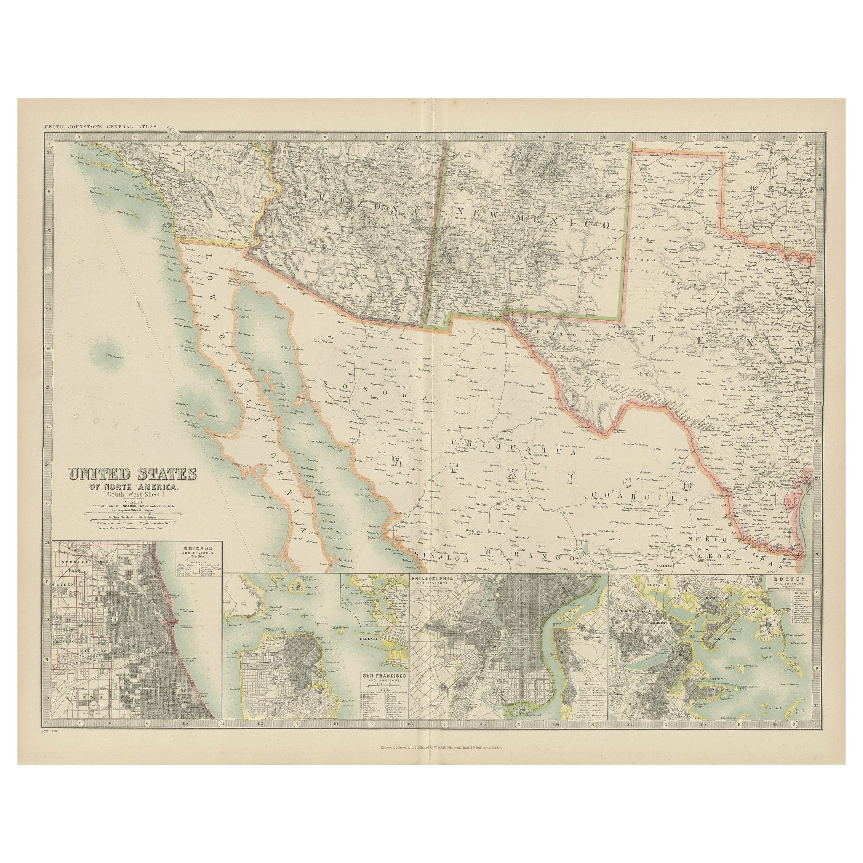
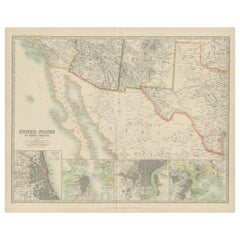
- Antique Map of the United States of North America by Johnston '1909'Located in Langweer, NLAntique map titled 'United States of North America'. Original antique map of United States of North America ( South West Sheet ). With inset maps of Chicago...Category
Early 20th Century Maps
MaterialsPaper
- Antique Map of the United States of North America by Wyld '1845'Located in Langweer, NLAntique map titled 'Map of The United States of North America'. Original antique map of the United States of North America. This map originates from 'An Atlas of the World, Comprehen...Category
Antique Mid-19th Century Maps
MaterialsPaper
- Antique Map Colton's United States of AmericaLocated in Langweer, NLAntique map titled 'Colton's United States of America'. Show railroads, canals, state capitals, major cities and towns, military posts, historic trails, Pony Express and U.S. mail routes; Dakota [Territory] extending deep into Nebraska, and Idaho [Territory] encompassing [modern day] Montana and Wyoming; Indian Territory...Category
Antique Mid-19th Century Maps
MaterialsPaper
- Antique Map of North America by Johnston, 1882By Alexander Keith JohnstonLocated in Langweer, NLAntique map titled 'North America'. Old map of North America. This map originates from 'The Royal Atlas of Modern Geography, Exhibiting, in a Series of Entirely Original and Authen...Category
Antique 19th Century Maps
MaterialsPaper


You May Also Like
- Original Antique Map of The United States of America, circa 1890Located in St Annes, LancashireGreat map of the USA By The Stanford's Geographical Establishment Original colour Unframed.Category
Antique 1890s English Victorian Maps
MaterialsPaper
- Large Original Antique Map of the United States of America. 1891By Rand McNally & Co.Located in St Annes, LancashireFabulous map of The United States Original color By Rand, McNally & Co. Dated 1891 Unframed Free shipping.Category
Antique 1890s American Maps
MaterialsPaper
- 1859 "Map of the United States of America..." by J. H. ColtonBy J.H. ColtonLocated in Colorado Springs, COPresented is an 1859 “Map of the United States of America, the British Provinces, Mexico, the West Indies and Central America with Part of...Category
Antique 1850s American Maps
MaterialsPaper
- English Engraved Hand Colored Map of the North Eastern United States, circa 1817Located in Hollywood, SCEnglish copper engraved hand colored map of the North Eastern United States matted under glass in a gilt frame, Early 19th Century. Drawn and Engraved for Thomson's New General Atlas...Category
Antique 1810s English George III Maps
MaterialsGlass, Giltwood, Paint, Paper
- Framed 1820s Hand Colored Map of the United StatesLocated in Stamford, CTFramed 1820s hand colored map photos of North America and South America. As found framed in giltwood frame.Category
Antique 1820s American Spanish Colonial Maps
MaterialsGiltwood, Paper, Glass
- Framed 1839 Hand Colored Map of the United StatesLocated in Stamford, CTFramed hand colored map of the United States of America from 1839. Newly framed in a giltwood frame.Category
Antique 1830s American American Classical Maps
MaterialsGiltwood, Paper, Glass


