Items Similar to Rare Map of the Bay of St. Vladimir 'Russia' Showing the Route of J. Ward, 1869

Want more images or videos?
Request additional images or videos from the seller
1 of 5
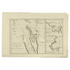
Rare Map of the Bay of St. Vladimir 'Russia' Showing the Route of J. Ward, 1869
About the Item
Antique map titled 'Côte est de Tartarie Baie St. Vladimir'.
Map of the Bay of St. Vladimir (Russia) showing the route of J. Ward. Including a coastal view. Source unknown, to be determined.
Artists and Engravers: Engraved by Kautz. Published by Lemercier et Cie, Paris.
Condition:
Very good, minor defects from handling. Please study image carefully.
- Dimensions:Height: 26.38 in (67 cm)Width: 19.3 in (49 cm)Depth: 0 in (0.02 mm)
- Materials and Techniques:
- Period:
- Date of Manufacture:1869
- Condition:Condition: Very good, minor defects from handling. Please study image carefully.
- Seller Location:Langweer, NL
- Reference Number:
About the Seller
5.0
Platinum Seller
These expertly vetted sellers are 1stDibs' most experienced sellers and are rated highest by our customers.
Established in 2009
1stDibs seller since 2017
1,916 sales on 1stDibs
Typical response time: <1 hour
- ShippingRetrieving quote...Ships From: Langweer, Netherlands
- Return PolicyA return for this item may be initiated within 14 days of delivery.
More From This SellerView All
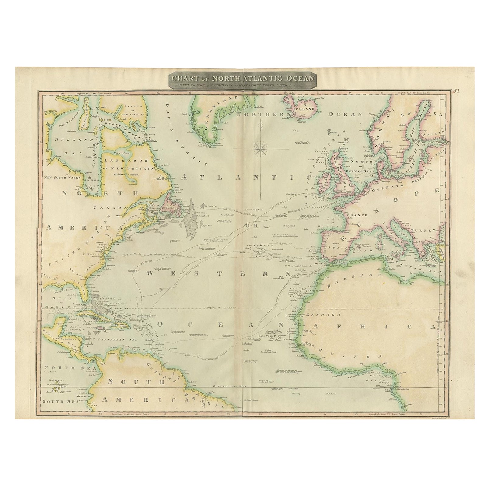
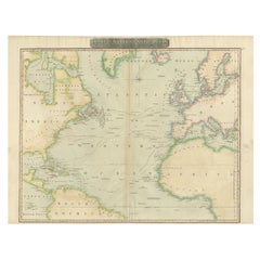
- Interesting Map of the Atlantic Showing Nelson's and Trade Routes, 1817By John ThomsonLocated in Langweer, NLAntique map titled 'Chart of the North Atlantic Ocean with Tracks of the Shipping to West Indies, North America, &cc'. Large map of the Atlantic, showing the tracks of the ships trad...Category
Antique 19th Century Maps
MaterialsPaper
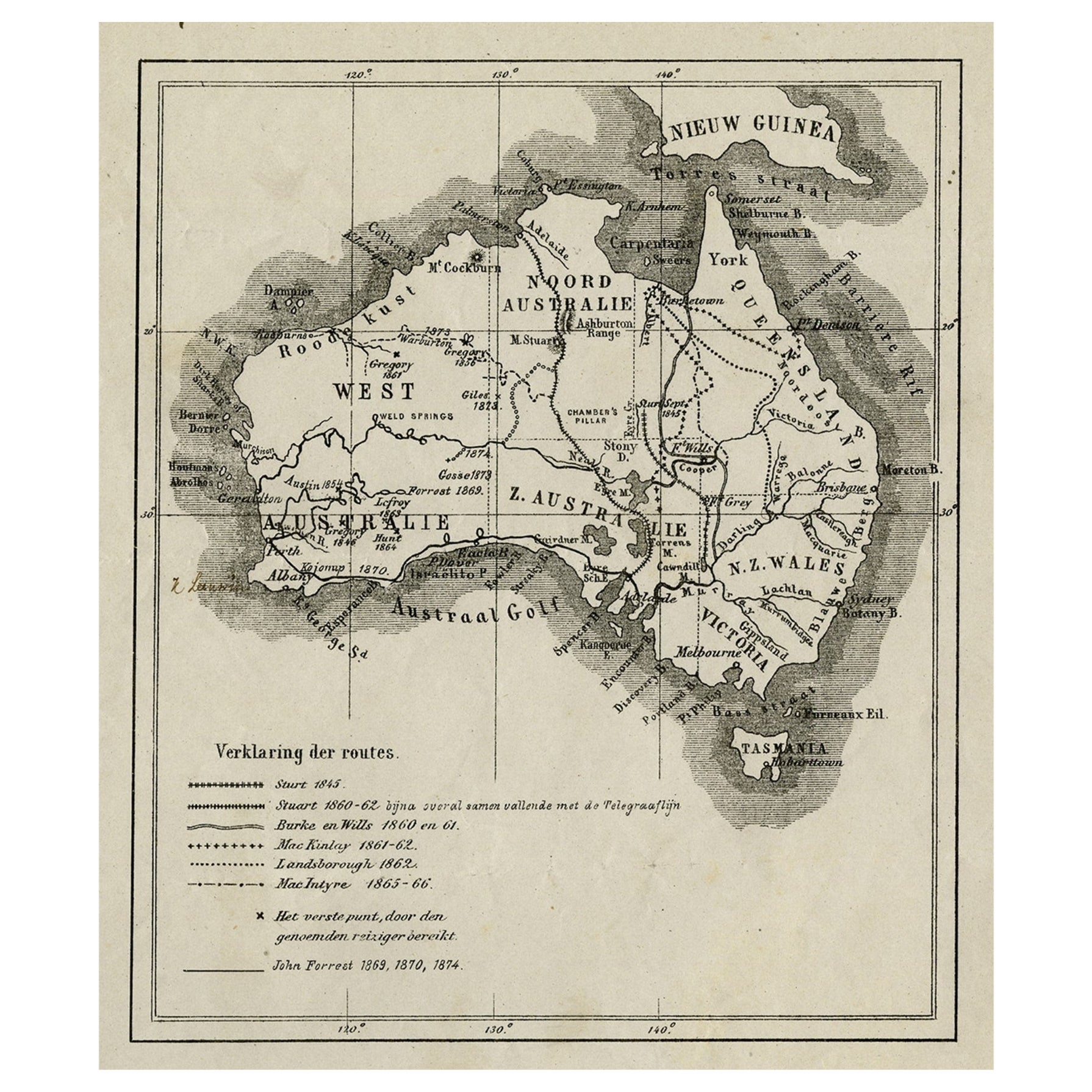
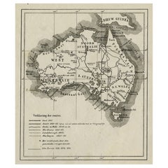
- Old Map of Australia Showing The Routes of the Main Explorers, ca.1900Located in Langweer, NLAntique print, untitled. This map shows Australia with the routes of explorers in the continent and marking the furthest point reached.. Source unknown, to be determined. Artists ...Category
Antique Early 1900s Maps
MaterialsPaper
- Detailed Map of New Zealand Showing the Route of Capt. Cook's First Voyage, 1803Located in Langweer, NLAntique map New Zealand titled 'De Rivier de Theems en Mercurius Baai in Nieuw Zeeland'. Detailed map of New Zealand showing the route of Capta...Category
Antique 19th Century Maps
MaterialsPaper
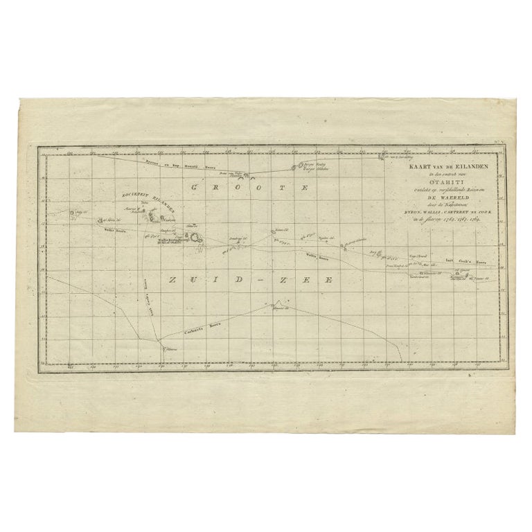
- Antique Map of French Polynesia by Cook Showing His Route, 1803Located in Langweer, NLAntique map Tahiti titled 'Kaart van de Eilanden in den omtrek van Otahiti (..)'. Antique map of French Polynesia with the tracks around the island of Tahiti by Captain Byron, Wallis...Category
Antique 19th Century Maps
MaterialsPaper
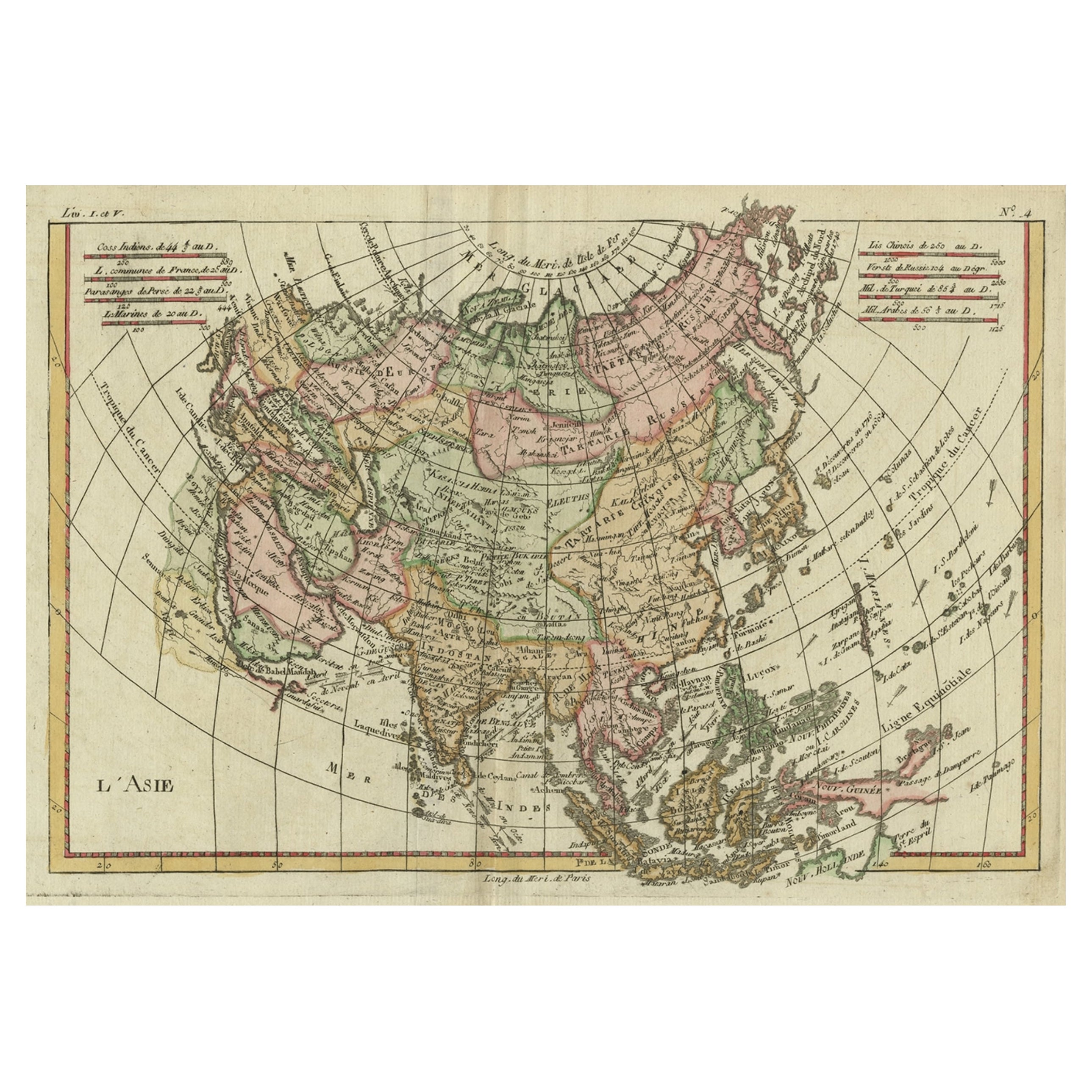
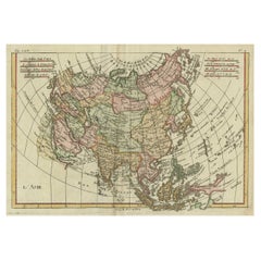
- Antique Map of Asia, Showing Tradewinds, Silke Route Cities Etc, c.1780Located in Langweer, NLAntique map titled 'L'Asie.' Map of Asia. Offers considerable detail considering the size, showing the tradewinds in the Pacific and Indian Oceans as well as numerous Silk Route citi...Category
Antique 18th Century Maps
MaterialsPaper
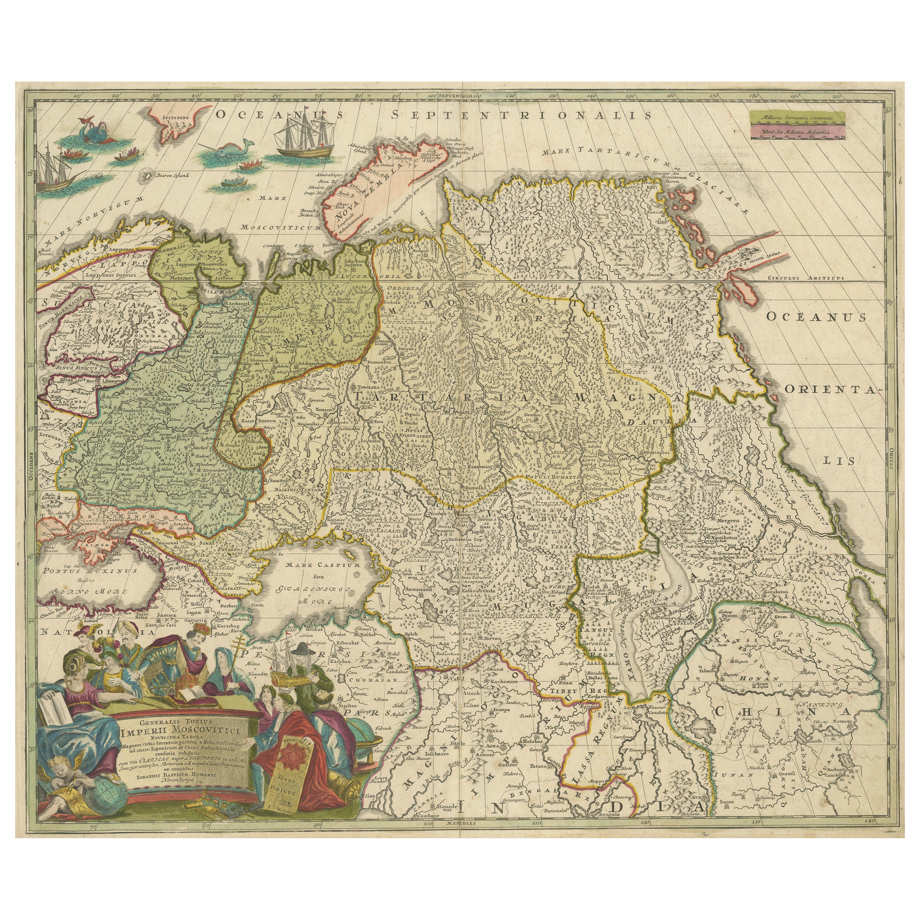
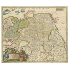
- Antique Map of Russia and Central Asia, showing the Northeast PassageLocated in Langweer, NLAntique map titled 'Generalis Totius Imperii Moscovitici (..)'. Decorative map of Russia and Central Asia, showing the Northeast Passage. The map covers the entirety of the Russian Empire at the time, stretching from the Arctic Circle in the north to the "Oceanus Orientalis" and the northern parts China (Chinae Septentrionalis confinia), Mongolia and India in the south. Published by J.B. Homann, circa 1730. Johann Baptist Homann was born 1664 in Oberkammlach. He founded his business 1702 in Nuremberg, Germany. After a long period of Dutch domination in map publishing, the Homann publishing house became the most important map...Category
Antique Mid-18th Century Maps
MaterialsPaper
You May Also Like
- 1856 U.S. Coast Survey Map of Chesapeake Bay and Delaware BayLocated in Colorado Springs, COPresented is U.S. Coast Survey nautical chart or maritime map of Chesapeake Bay and Delaware Bay from 1856. The map depicts the region from Susquehanna, Maryland to the northern Oute...Category
Antique 1850s American Maps
MaterialsPaper
- 1814 Map of "Russian Empire" Ric.r032Located in Norton, MA1814 Map of "Russian Empire" Ric.r032 Russian Empire. Description: This is an 1814 John Thomson map of the Russian Empire. The map depicts the region from the Baltic Sea, Prussia, and Sweden to the Aleutian Islands and from the Arctic Ocean to the Yellow River. Highly detailed, myriad cities, towns, and villages are labeled throughout, including St. Petersburg, Moscow, Minsk, Kiev, and Kharkov. Rivers and mountain ranges are also identified, as are islands and numerous locations along the coastlines. It is important to note that the long-disputed sea between Korea and Japan is identified as the 'Sea of Japan. Historical Context: In 1815, Tsarist Russia emerged from the Napoleonic Wars economically insolvent and politically fearful of the Revolutionary fervor that had just swept through Europe. In order to shore up Russia's economic position, the Tsars began an aggressive series of expansions into the Caucuses and Central Asia that would vastly increase the landmass of the Russian Empire. Publication History Thomson maps are known for their stunning color, awe inspiring size, and magnificent detail. Thomson's work, including this map, represents some of the finest cartographic art...Category
Antique 19th Century Unknown Maps
MaterialsPaper
- 1849 Map of "Europaische Russland", 'Meyer Map of European Russia', Ric. R017Located in Norton, MA1849 Map of "Europaische Russland" ( Meyer Map of European Russia) Ric.r017 A lovely map of European Russia dating to 1849 by Joseph Meyer. It covers the European portions of...Category
Antique 19th Century Unknown Maps
MaterialsPaper
- Original Antique Map of Russia By Arrowsmith. 1820Located in St Annes, LancashireGreat map of Russia Drawn under the direction of Arrowsmith Copper-plate engraving Published by Longman, Hurst, Rees, Orme and Brown, 1820 Unframed.Category
Antique 1820s English Maps
MaterialsPaper
- 1869-86 The Novels of William Makepeace ThackerayBy William Makepeace ThackerayLocated in Bath, GBA nicely bound fully illustrated collection of the works of William Makepeace Thackeray. Complete in twenty-four volumes. Volume I, 'Vanity Fair Volume I', published in 1869. Illustrated by the author with a frontispiece, a vignette title page, and nineteen plates. Collated, complete. Volume II, 'Vanity Fair Volume II', published in 1869. Illustrated by the author with a frontispiece, and eighteen plates. Collated, complete. Volume III, 'The History of Pendennis Volume I', published in 1869. Illustrated by the author with a frontispiece, vignette title page, and twenty-two plates. Collated, complete. Volume IV, 'The History of Pendennis Volume II', published in 1869. Illustrated by the author with a frontispiece, a vignette title page, and twenty-two plates. Collated, complete. Volume V, 'The Newcomers Volume I', published in 1869. Illustrated by Richard Doyle...Category
Antique Late 19th Century British Books
MaterialsPaper
- The Life of Emma, Lady Hamilton by J T Herbert Baily, 1st EdLocated in valatie, NYThe Life of Emma, Lady Hamilton by J T Herbert Baily. Published by Menzies London, 1905. 1st Ed hardcover no dust jacket as published. 137 untrimmed pages with all 23 portraits of Lady Hamilton each with a tissue guard. Dame Emma Hamilton...Category
Antique Early 1900s English Books
MaterialsPaper