Items Similar to 1868 Map of the Upper Part of the Island of Manhattan Above 86th Street


Want more images or videos?
Request additional images or videos from the seller
1 of 11
1868 Map of the Upper Part of the Island of Manhattan Above 86th Street
$475
£360.77
€416.81
CA$665.73
A$745.08
CHF 388.87
MX$9,086.09
NOK 4,977.04
SEK 4,711.41
DKK 3,110.62
Shipping
Retrieving quote...The 1stDibs Promise:
Authenticity Guarantee,
Money-Back Guarantee,
24-Hour Cancellation
About the Item
This wonderful piece of New York City history is over 150 years old. It depicts 86th street and above. It was lithographed by WC Rogers and company. It was made to show what was the Battle of Harlem during the Revolutionary war. The blue area depicts the American troops and the red the British. It is in fair condition with some paper loss around outside border of map, but map image itself is intact. The paper measures 24 5/8 inches wide by 15 10/16 high. The frame measures 27 1/4 wide by 18 1/8 high.
- Dimensions:Height: 15.5 in (39.37 cm)Width: 24.6 in (62.49 cm)Depth: 1 in (2.54 cm)
- Style:American Colonial (Of the Period)
- Materials and Techniques:Paper,Engraved
- Place of Origin:
- Period:
- Date of Manufacture:1868
- Condition:Wear consistent with age and use. Minor losses. Minor structural damages.
- Seller Location:San Francisco, CA
- Reference Number:1stDibs: LU5199224813762
About the Seller
5.0
Gold Seller
Premium sellers maintaining a 4.3+ rating and 24-hour response times
Established in 1985
1stDibs seller since 2020
386 sales on 1stDibs
Typical response time: 2 hours
- ShippingRetrieving quote...Shipping from: San Francisco, CA
- Return Policy
Authenticity Guarantee
In the unlikely event there’s an issue with an item’s authenticity, contact us within 1 year for a full refund. DetailsMoney-Back Guarantee
If your item is not as described, is damaged in transit, or does not arrive, contact us within 7 days for a full refund. Details24-Hour Cancellation
You have a 24-hour grace period in which to reconsider your purchase, with no questions asked.Vetted Professional Sellers
Our world-class sellers must adhere to strict standards for service and quality, maintaining the integrity of our listings.Price-Match Guarantee
If you find that a seller listed the same item for a lower price elsewhere, we’ll match it.Trusted Global Delivery
Our best-in-class carrier network provides specialized shipping options worldwide, including custom delivery.More From This Seller
View AllMid-18th Century Hand Drawn English Farm Map on Vellum, circa 1740s
Located in San Francisco, CA
Mid-18th century hand drawn English farm map on Vellum circa 1740s
Henry Maxted & Isaac Terry, Surveyors.
A Map of a Farm in the Parish of Blean in the County of KENT: Belonging to Mrs Elizabeth Hodgson circa 1743.
A beautiful hand drawn map...
Category
Antique Mid-18th Century English Maps
Materials
Lambskin

A Variety of Eleven Wonderful Old Maps, Framed
Located in San Francisco, CA
A Variety of Eleven Wonderful Old Maps, Framed
Category
20th Century Decorative Art
Materials
Paper
"The Annals of San Francisco" Leather Bound Book, 1855
Located in San Francisco, CA
"The Annals of San Francisco" Leather Bound Book, 1855
Published by Appleton & Co, NY First Edition
By Frank Soule, John H. Giron, MD, and James Nisbet
Category
Antique 1850s Books
Materials
Leather
19th-Early 20th Century S.F Bay Area Leather Bound Business Journals
Located in San Francisco, CA
19th-early 20th century S.F Bay Area Leather Bound Business Journals
One journal is mostly filled in. The other is mostly empty.
The dates are circa 1880s-1910s
An interesti...
Category
Antique Late 19th Century American Books
Materials
Paper
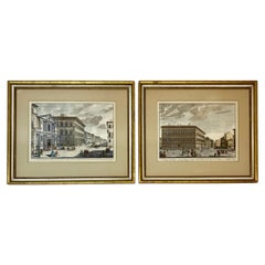
19th Century Pair of Framed Italian Hand Colored Engravings
Located in San Francisco, CA
19th century pair of framed Italian hand colored engravings
One engraving depicts a scene from Florence, Italy
The other depicts a sc...
Category
Antique Late 19th Century Italian Prints
Materials
Paper
Walton Family Genealogy "Ancestors of Adelaide Bereman Walton", Los Angeles 1908
Located in San Francisco, CA
Walton Family Genealogy antique handmade book
Walton Family Genealogy "Ancestors of Adelaide Bereman Walton", Los Angeles circa 1908
This is really a fascinating book. A labor ...
Category
Early 20th Century American Historical Memorabilia
Materials
Paper
You May Also Like
Vintage Oversized New York City Lower Manhattan 1840s Map Print
Located in Dayton, OH
Vintage late 20th century reproduction print of New York City featuring lower Manhattan in 1840.
Category
Late 20th Century Victorian Maps
Materials
Paper

$800 Sale Price
20% Off
Original Antique Map of the American State of New York ( Southern Part ) 1903
Located in St Annes, Lancashire
Antique map of New York ( Southern Part )
Published By A & C Black. 1903
Original colour
Good condition
Unframed.
Free shipping
Category
Antique Early 1900s English Maps
Materials
Paper

1858 Colton's Map of New York, Ric.B011
Located in Norton, MA
An 1858 Colton's map of New York
Ric.b011
Colton’s New York, 1858 - A large original color engraved and very detailed map of the state of New York,...
Category
Antique 19th Century Unknown Maps
Materials
Paper

1855 "New-York City & County Map" by Charles Magnus
By Charles Magnus
Located in Colorado Springs, CO
This is a beautiful hand-colored map titled “New York City & County Map with Vicinity entire Brooklyn, Williamsburgh, Jersey City &c.” The work was published in 1855 by Charles Magnu...
Category
Antique 1850s American Maps
Materials
Paper

Antique Map of New York by Johnson '1872'
Located in Langweer, NL
Antique map titled 'Johnson's New York'. Original map showing New York, with an inset map of Long Island. This map originates from 'Johnson's New Il...
Category
Antique Late 19th Century Maps
Materials
Paper

$237 Sale Price
20% Off
Original Antique Map of the American State of New York ( Western Part ) 1903
Located in St Annes, Lancashire
Antique map of New York ( Western Part )
Published By A & C Black. 1903
Original colour
Good condition
Unframed.
Free shipping
Category
Antique Early 1900s English Maps
Materials
Paper

More Ways To Browse
Antique Rogers
Antique Maps Of New York City
Harlem Furniture
Colonial Mfg Co
Antique Marine Maps
Antique Indian Maps
Antique Maps Of Wales
Antique Map Denmark
Antique World Globe Map
Hemispheres Map
Map New Holland
Treasure Map
Caribbean Antiques
19th Century Map Of Africa
Antique Malaysia
Antique Map Of Ireland
Ships Log
Map Of Egypt