19th Century Map Of Africa
2
to
30
193
18
104
87
81
36
26
26
18
13
13
12
8
8
7
7
6
5
5
3
3
3
2
2
2
2
2
1
1
1
1
1
42
42
7
3
2
Sort By
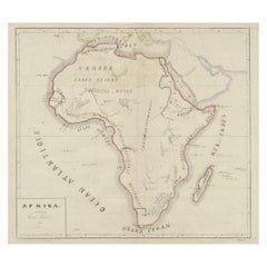
Original Antique Map of Africa
Located in Langweer, NL
Antique map titled 'Afrika'. Original antique map of Africa, drawn by Van Beusekom. Published by
Category
Antique Late 19th Century Maps
Materials
Paper
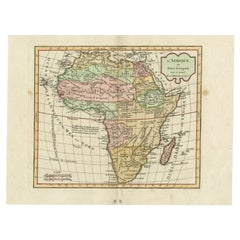
Antique Map of Africa by Delamarche, 1806
Located in Langweer, NL
firm continued to publish maps and globes until the middle part of the 19th century.
Condition: Good
Category
Antique 19th Century Maps
Materials
Paper
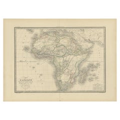
Antique Map of Africa by Lapie, 1842
Located in Langweer, NL
Antique map titled 'Carte d'Afrique'. Map of Africa. This map originates from 'Atlas universel de
Category
Antique Mid-19th Century Maps
Materials
Paper
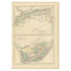
Antique Map of North Africa and South Africa by Black, 1854
Located in Langweer, NL
Antique map titled 'Africa north part - Africa south part'. Old map of Africa showing the region of
Category
Antique 19th Century Maps
Materials
Paper
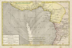
Antique Map of the Coast of Guinea, Africa, 1820
Located in Langweer, NL
Antique map Africa titled 'Carte de la Haute et de la Basse Guinée'. Map of the Coast of Guinea
Category
Antique 19th Century Maps
Materials
Paper
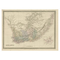
Antique Map of South Africa by Wyld '1845'
Located in Langweer, NL
Antique map titled 'South Africa'. Original antique map of South Africa.
This decorative original
Category
Antique Mid-19th Century Maps
Materials
Paper
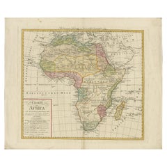
Antique Map of Africa by Homann Heirs, '1804'
Located in Langweer, NL
Antique map titled 'Charte von Africa'. Large, original antique map of Africa by Franz Ludwig
Category
Antique Early 19th Century Maps
Materials
Paper
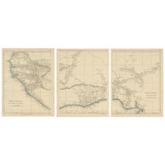
Antique Map of West Africa by Lowry, 1852
Located in Langweer, NL
Antique map titled 'West Africa'. Three individual sheets of West Africa. This map originates from
Category
Antique Mid-19th Century Maps
Materials
Paper
Antique Map of South Africa by Lowry, 1852
Located in Langweer, NL
Antique map titled 'South Africa'. Two individual sheets of South Africa. This map originates from
Category
Antique Mid-19th Century Maps
Materials
Paper
Antique Map of North Africa by Lowry '1852'
Located in Langweer, NL
Antique map titled 'North Africa Marocco Algiers & Tunis'. Two individual sheets of North Africa
Category
Antique Mid-19th Century Maps
Materials
Paper
Antique Map of Africa by Levasseur 'c.1840'
Located in Langweer, NL
Antique map titled 'Afrique'. Original antique map of Africa. Decorative map of the continent
Category
Antique Mid-19th Century Maps
Materials
Paper
Antique Map of Southern Africa by Levasseur, 1875
Located in Langweer, NL
Antique map titled 'Afrique Méridionale'. Large map of Southern Africa. This map originates from
Category
Antique Late 19th Century Maps
Materials
Paper
Antique Map of Northern Africa by Levasseur, '1875'
Located in Langweer, NL
Antique map titled 'Carte de l'Afrique Septentrionale'. Large map of Northern Africa. This map
Category
Antique Late 19th Century Maps
Materials
Paper
Antique Map of Western Africa by Levasseur '1875'
Located in Langweer, NL
Antique map titled 'Carte de la Senegambie Soudan et Guinée'. Large map of Western Africa. This map
Category
Antique Late 19th Century Maps
Materials
Paper
Antique Map of Africa by Dufour, circa 1834
Located in Langweer, NL
Antique map titled 'Afrique'. Uncommon map of Africa. Published by or after A.H. Dufour, circa 1834
Category
Antique Mid-19th Century Maps
Materials
Paper
Antique Map of Northern Africa by Perthes, 1848
Located in Langweer, NL
Antique map titled 'Africa Propria (..)'. Old map of North Africa and the region of Babylon
Category
Antique 19th Century Maps
Materials
Paper
Antique Map of Africa and Arabia with Inset Map of Ethiopia and Eritrea, 1845
Located in Langweer, NL
Antique map titled 'Mittel- und Nord-Africa (östl. Theil) und Arabien'. This map depicts North and
Category
Antique 19th Century Maps
Materials
Paper
H 14.18 in W 17.33 in D 0 in
Antique Map of North Africa including the Sahara Desert
Located in Langweer, NL
Antique map titled 'Charte von Nord-Africa'. Scarce map of North Africa. Includes a fantastic
Category
Antique Early 19th Century Maps
Materials
Paper
Antique Map of Africa by A & C, Black, 1870
Located in Langweer, NL
Antique map titled 'Africa'. Original antique map of Africa. This map originates from ‘Black's
Category
Antique Late 19th Century Maps
Materials
Paper
Antique Map of Africa with European Language Borders, 1852
Located in Langweer, NL
Antique map titled 'Afrika'. Map of Africa. This map originates from 'School-Atlas van alle deelen
Category
Antique 19th Century Maps
Materials
Paper
Antique Map of Africa by Bordiga Fratelli 'circa 1818'
Located in Langweer, NL
Antique map titled 'Carta dell Africa'. Large and quite scarce Italian map of Africa, reflecting
Category
Antique Early 19th Century Maps
Materials
Paper
Antique Map of the Coast of Northwest Africa by Dien, 1820
Located in Langweer, NL
Antique map Africa titled 'Partie Occidentale de l'Ancien Continent, depuis Lisbonne jusquá la
Category
Antique 19th Century Maps
Materials
Paper
Set of Three Antique Maps of Africa by Colton (circa 1855)
Located in Langweer, NL
Set of three individual maps of Africa including 'North West Africa', 'North Eastern Africa' and
Category
Antique Mid-19th Century Maps
Materials
Paper
Antique Map of Africa with Decorative Vignette of Saint Helena, 1880
Located in Langweer, NL
Antique map titled 'Afrique'. Old map of Africa, covering the African continent. With decorative
Category
Antique 19th Century Maps
Materials
Paper
Antique Map of Europe and Part of Asia and Africa, 1848
Located in Langweer, NL
centuries. Buying and collecting antique maps is a tradition that goes back hundreds of years. Antique maps
Category
Antique 19th Century Maps
Materials
Paper
Antique Map of North and South Africa by Johnston, 1882
Located in Langweer, NL
Two antique maps on one sheet titled 'N.W. Africa, Marocco, Algeria & Tunis' and 'Southern Africa
Category
Antique 19th Century Maps
Materials
Paper
French Antique Map of Northern Africa and Libya, c.1840
Located in Langweer, NL
Antique map titled 'Marok, Alger et Tunis - Etat de Tripoli'. Map of Northern Africa and Libya
Category
Antique 19th Century Maps
Materials
Paper
Decorative Antique Map of the Southern Part of Africa, 1806
Located in Langweer, NL
publications in the mid-19th century. The firm continued to publish maps and globes until the middle part of
Category
Antique Early 1800s Maps
Materials
Paper
Antique Map of South Africa showing the Travels of Truter and Somerville
Located in Langweer, NL
Antique map titled 'Charte von Süd-Afrika'. Original antique map of South Africa showing the
Category
Antique Early 19th Century Maps
Materials
Paper
H 12.6 in W 16.93 in D 0.02 in
Antique Map of Spain and Part of Africa by Kiepert, C.1870
Located in Langweer, NL
"Antique map titled 'Hispania Mauretania et Africa'. Old map of Spain, also depicting part of
Category
Antique 19th Century Maps
Materials
Paper
Antique Map of Northern Africa from a Rare Dutch Atlas, 1825
Located in Langweer, NL
Antique map titled 'Africa'. Old map of the African continent originating from 'Atlas der Oude
Category
Antique 19th Century Maps
Materials
Paper
Antique Map of Tunis and Tripoli in Northern Africa, circa 1880
By J. Migeon
Located in Langweer, NL
includes a wide range of authentic antique maps from the 16th to the 20th centuries. Buying and collecting
Category
Antique 19th Century Maps
Materials
Paper
Antique Map of Eastern Africa, Engraved by a German Missionary, 1858
Located in Langweer, NL
Original antique map of Eastern Africa. This map originates from 'Reisen in Ost-Afrika, ausgeführt
Category
Antique 19th Century Maps
Materials
Paper
Antique Decorative Coloured Map of South Africa and Madagascar, 1882
Located in Langweer, NL
the 19th century.
2. **Geographical Detail**: It displays the topographical features of South Africa
Category
Antique 1880s Maps
Materials
Paper
Free Shipping
H 14.97 in W 22.45 in D 0 in
Western Africa Antique Map by W. G. Blackie, 1859
Located in Langweer, NL
features, boundaries, and notable locations within the region during the mid-19th century. Maps from this
Category
Antique Mid-19th Century Maps
Materials
Paper
Antique Lithography Map, West Africa, English, Framed, Cartography, Victorian
Located in Hele, Devon, GB
was considered as one of the best map makers of the mid 19th century, working in conjunction with John
Category
Antique Mid-19th Century British Early Victorian Maps
Materials
Wood
H 17.52 in W 19.89 in D 0.79 in
Antique Map of Spain, Mauritia and Africa by H. Kiepert, circa 1870
By Heinrich Kiepert
Located in Langweer, NL
Antique map titled 'Hispania, Mauretania et Africa'. This map originates from 'Atlas Antiquus
Category
Antique Late 19th Century Maps
Materials
Paper
Antique Map of North and West Africa by J.B. Elwe, 1792
Located in Langweer, NL
Beautiful richly engraved map of North and West Africa, based upon the earlier maps of De L'Isle
Category
Antique Late 19th Century Maps
Materials
Paper
Antique Map of the African Continent with Inset of the Nile River Delta, c.1870
Located in Langweer, NL
Antique map titled 'Africa'. Old map of the African continent. This map originates from 'H
Category
Antique 19th Century Maps
Materials
Paper
H 13.78 in W 17.56 in D 0 in
Antique Map of North-Western and South Africa by A.K. Johnston, 1865
Located in Langweer, NL
Two maps on one sheet titled 'North-Western Africa' and 'Southern Africa'. Depicting Morocco
Category
Antique Mid-19th Century Maps
Materials
Paper
Mediterranean Tapestry: A 19th Century Map of the Mediterranean Shores, 1882
Located in Langweer, NL
Europe down to the northern coastlines of Africa.
The map is a vivid document of the time, with each
Category
Antique 1880s Maps
Materials
Paper
H 11.03 in W 14.97 in D 0 in
Antique Map of the Dutch Gold Coast in Africa by Van den Bosch '1818'
Located in Langweer, NL
Antique map titled 'Kaart van de Goud-Kust of Kust van Guina'. A rare and attractive early 19th
Category
Antique Early 19th Century Maps
Materials
Paper
H 18.12 in W 22.84 in D 0.02 in
Antique Map of Northern Africa "Barbary Coast" by R. Bonne, circa 1780
Located in Langweer, NL
A fine example of Rigobert Bonne and Guilleme Raynal’s 1780 map of northwestern Africa or the
Category
Antique Late 18th Century Maps
Materials
Paper
H 10.24 in W 15.08 in D 0.02 in
Antique Map of Saldanha Bay 'Near Cape Town, South Africa' by Bellin, 1750
By Jacques-Nicolas Bellin
Located in Langweer, NL
Navigateurs’. Detailed plan of Saldanha Bay, northwest of Cape Town, South Africa. This map originates from
Category
Antique 18th Century Maps
Materials
Paper
H 8.86 in W 11.42 in D 0.01 in
Antique Map of the Sinai Peninsula, '1895'
Located in Langweer, NL
Antique map titled 'Peninsula of Sinaï'. Lithographed map of the Sinai Peninsula, a peninsula in
Category
Antique Late 19th Century Maps
Materials
Paper
Antique Map of Bourbon, or Reunion, Colony of France
Located in Langweer, NL
Original antique map titled 'Ile de la Réunion'. This is a fascinating map of the French department
Category
Antique Mid-19th Century Maps
Materials
Paper
Antique Map of German Colonies by Meyer, 1895
Located in Langweer, NL
Antique map titled 'Deutsche Kolonien.' Lithographed map of the German Colonies. German East-Africa
Category
Antique 19th Century Maps
Materials
Paper
Antique Map of Asia by A. Blondeau, circa 1800
Located in Langweer, NL
Africa and the Mediterranean east to the Bering Sea and south as far as Java and New Guinea. This map is
Category
Antique Early 19th Century Maps
Materials
Paper
Original Steel Engraved Map of French Colonies in America, 1854
Located in Langweer, NL
**: The map offers a detailed depiction of the French colonies in America during the mid-19th century
Category
Antique Mid-19th Century Maps
Materials
Paper
Free Shipping
H 13.12 in W 18.71 in D 0.02 in
Antique Map of Bourbon/Reunion 'France' by V. Levasseur, 1854
By Victor Levasseur
Located in Langweer, NL
Antique map titled 'Ile de la Réunion'. Map of the French department of Ile. Bourbon or Reunion
Category
Antique Mid-19th Century Maps
Materials
Paper
Antique Map of the region near Annesley Bay by Wagner, 1870
Located in Langweer, NL
Antique print titled 'Map of the Country between Annesley Bay and Senafe'. Map of the region near
Category
Antique Mid-19th Century Maps
Materials
Paper
Antique Map of the French Colonies in Senegal and Madagascar by V. Levasseur
By Victor Levasseur
Located in Langweer, NL
French colonies located in Senegal and Madagascar within Africa. Surrounding the map are captivating
Category
Antique Mid-19th Century Maps
Materials
Paper
H 13.98 in W 20.67 in D 0.02 in
Detailed Map of the Island of Gorée off of the Coast of Dakar, Senegal, 1747
Located in Langweer, NL
, opposite Dakar. From the 15th to the 19th century, it was the largest slave-trading centre on the African
Category
Antique 1740s Maps
Materials
Paper
H 10.75 in W 15.16 in D 0 in
Original Old Composite of Several Maps of the Ancient World on One Sheet, 1880
Located in Langweer, NL
its scholarly accuracy and was widely used for educational purposes in the 19th century.
This
Category
Antique 1880s Maps
Materials
Paper
Free Shipping
H 15.56 in W 18.51 in D 0 in
Ancient Realms of Northeast Africa: Arabia, Ethiopia, and Egypt, Published 1880
Located in Langweer, NL
Northeast Africa and the Near East.
The period represented by the map is likely during the classical
Category
Antique 1880s Maps
Materials
Paper
Free Shipping
H 15.56 in W 18.51 in D 0 in
Copper Engraved Grenada Map by John Thompson Published in 1810
Located in Langweer, NL
geography and cartographic techniques prevalent during the early 19th century in the West Indies.
Grenada's
Category
Antique Early 19th Century Maps
Materials
Paper
Antique Map Showing the Religions Around the World by Johnston '1854'
Located in Langweer, NL
and Pagans. Three side maps show the distribution of missions in India, South Africa and Canada. Two
Category
Antique Mid-19th Century Maps
Materials
Paper
No Reserve
H 21.66 in W 26.38 in D 0.02 in
Antique Decorative Coloured Map Marocco, Algeria and Tunis, 1882
Located in Langweer, NL
regions as understood in the late 19th century.
**Map of Morocco, Algeria, and Tunis:**
This map details
Category
Antique 1880s Maps
Materials
Paper
Free Shipping
H 14.97 in W 22.45 in D 0 in
Antique Decorative Coloured Map Egypt, Nubia, Abyssinia and more, 1882
Located in Langweer, NL
of the late 19th century, which often featured detailed engravings and fine detail. They provide a
Category
Antique 1880s Maps
Materials
Paper
Free Shipping
H 14.97 in W 22.45 in D 0 in
Road Map, John Ogilby, No 54, London, Yarmouth, Britannia
By John Ogilby
Located in BUNGAY, SUFFOLK
series of maps published before the 19th century, depicting the English countryside, available to the
Category
Antique 1670s English Baroque Maps
Materials
Paper
- 1
Get Updated with New Arrivals
Save "19th Century Map Of Africa", and we’ll notify you when there are new listings in this category.
19th Century Map Of Africa For Sale on 1stDibs
Find many varieties of an authentic 19th century map of africa available at 1stDibs. Each 19th century map of africa for sale was constructed with extraordinary care, often using paper. You’ve searched high and low for the perfect 19th century map of africa — we have versions that date back to the 19th Century alongside those produced as recently as the 19th Century are available. You’ll likely find more than one 19th century map of africa that is appealing in its simplicity, but Henry Schenck Tanner, Heinrich Kiepert and Victor Levasseur produced versions that are worth a look.
How Much is a 19th Century Map Of Africa?
A 19th century map of africa can differ in price owing to various characteristics — the average selling price 1stDibs is $336, while the lowest priced sells for $145 and the highest can go for as much as $2,181.
More Ways To Browse
Custom Engraved Rolex
Rolex Air King Second Hand
Map Of Los Angeles
Meridian Clock
Cream Of Wheat
Antique Yarmouth
Rolex Framed Art
Windsor Wheel
Ancient Egypt Map
Statutes And Sculptures
Painting Including Frame 31 Inches Wide
Map San Francisco
Map Of San Francisco
White Metal Trash Can Retro
Cream Of Wheat Paintings
Hampton China
South Pacific Map
Antique Canadian Maps
