Items Similar to Antique Map of North Africa and South Africa by Black, 1854


Want more images or videos?
Request additional images or videos from the seller
1 of 5
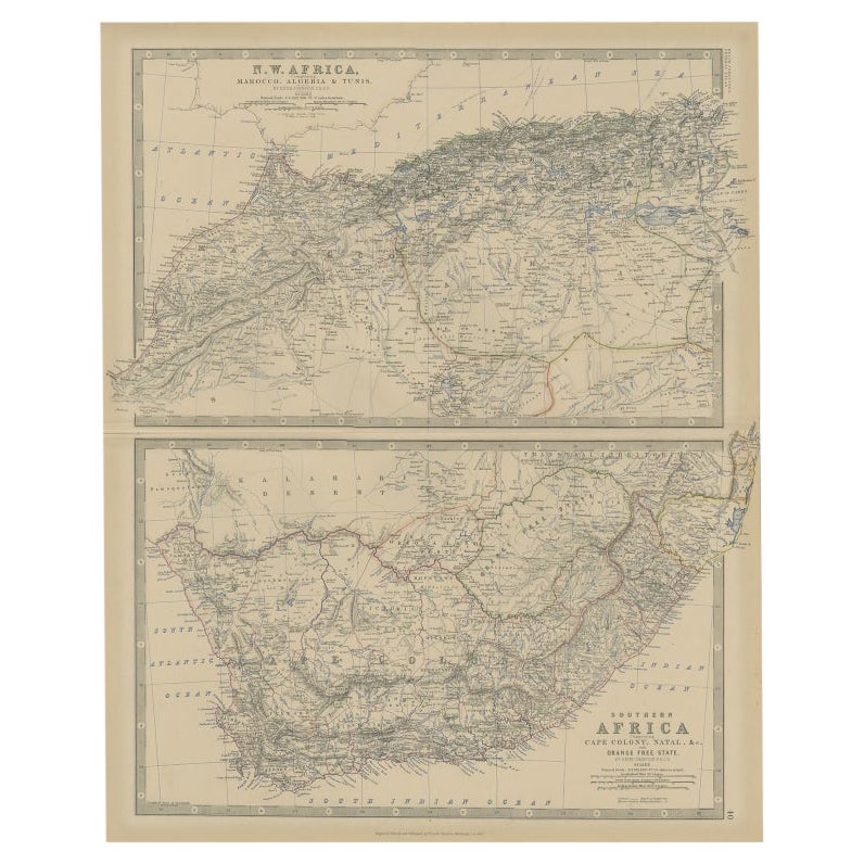
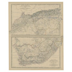
Antique Map of North Africa and South Africa by Black, 1854
About the Item
Antique map titled 'Africa north part - Africa south part'. Old map of Africa showing the region of Morocco, Algeria and South Africa. This map orginates from 'General Atlas Of The World: Containing Upwards Of Seventy Maps (..)' by Adam & Charles Black. Artists and Engravers: Engraved by S. Hall.
Artist: Engraved by S. Hall.
Condition: Good, general age-related toning. Please study image carefully.
Date: 1854
Overall size: 31.1 x 44.1 cm.
Image size: 0.001 x 26.1 x 37.8 cm.
- Dimensions:Height: 12.25 in (31.1 cm)Width: 17.37 in (44.1 cm)Depth: 0 in (0.01 mm)
- Materials and Techniques:
- Period:
- Date of Manufacture:1854
- Condition:
- Seller Location:Langweer, NL
- Reference Number:
About the Seller
5.0
Platinum Seller
These expertly vetted sellers are 1stDibs' most experienced sellers and are rated highest by our customers.
Established in 2009
1stDibs seller since 2017
1,922 sales on 1stDibs
Typical response time: <1 hour
- ShippingRetrieving quote...Ships From: Langweer, Netherlands
- Return PolicyA return for this item may be initiated within 14 days of delivery.
More From This SellerView All
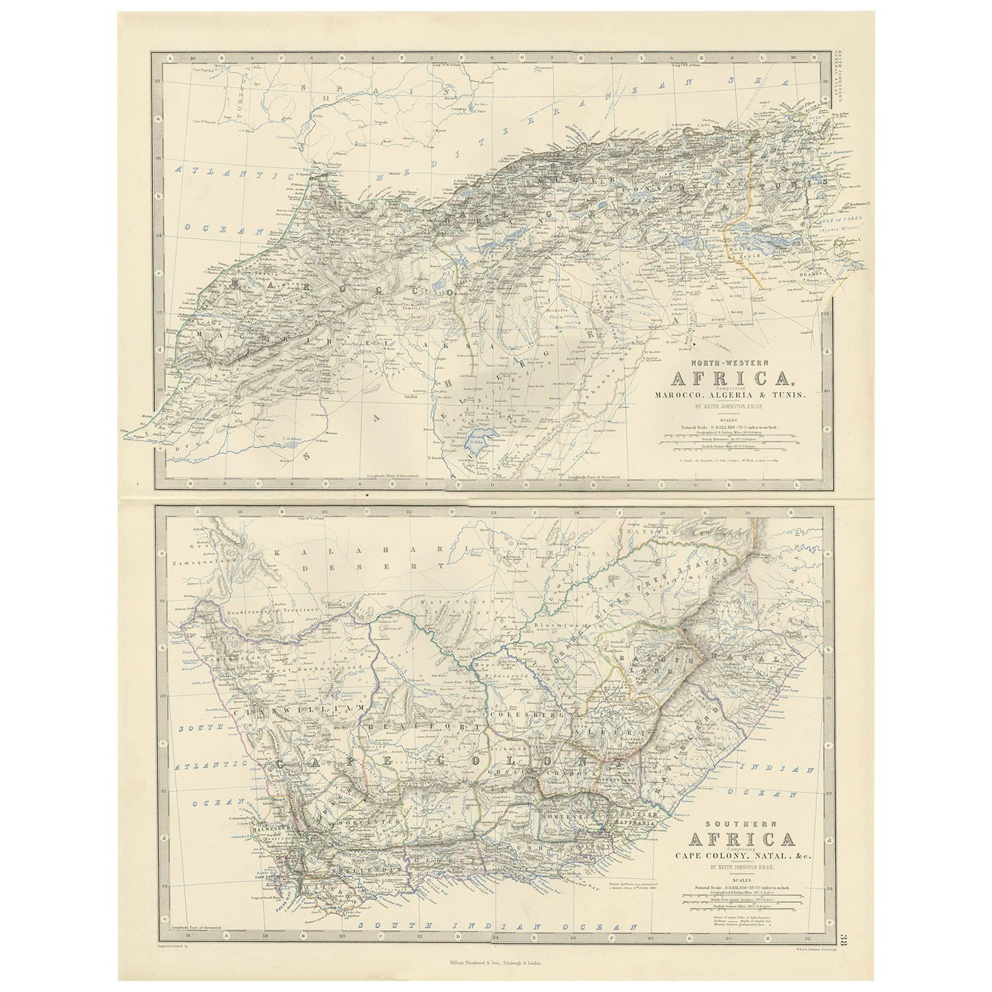
- Antique Map of North and South Africa by Johnston, 1882Located in Langweer, NLTwo antique maps on one sheet titled 'N.W. Africa, Marocco, Algeria & Tunis' and 'Southern Africa, comprising Cape Colony, Natal & c'. This map originates from 'The Royal Atlas of ...Category
Antique 19th Century Maps
MaterialsPaper
- Antique Map of North-Western and South Africa by A.K. Johnston, 1865Located in Langweer, NLTwo maps on one sheet titled 'North-Western Africa' and 'Southern Africa'. Depicting Morocco, Algeria, Tunis, Cape Colony, Natal and more. This map originates from the ‘Royal Atlas o...Category
Antique Mid-19th Century Maps
MaterialsPaper
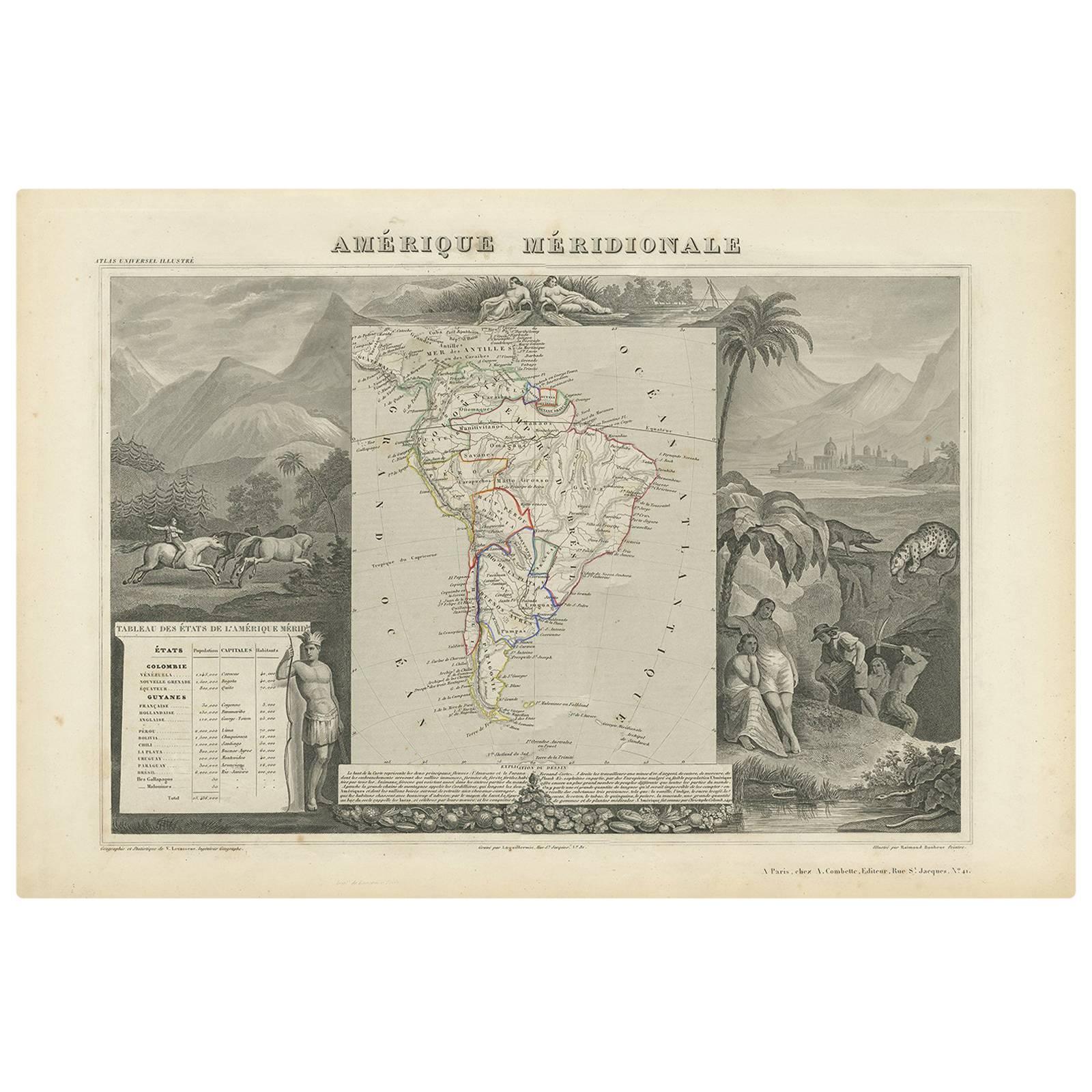
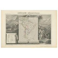
- Antique Map of South America by V. Levasseur, 1854By Victor LevasseurLocated in Langweer, NLAntique map titled 'Amérique Méridionale'. Map shows South America, beautiful surrounded by typical scenes of natives and their life. Depicting Colombia, Brazil, Chile, Bolivia and m...Category
Antique Mid-19th Century Maps
MaterialsPaper
- Antique Map of North Africa by Lowry '1852'Located in Langweer, NLAntique map titled 'North Africa Marocco Algiers & Tunis'. Two individual sheets of North Africa. This map originates from 'Lowry's Table Atlas constructed and engraved from the most...Category
Antique Mid-19th Century Maps
MaterialsPaper
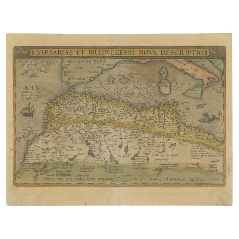
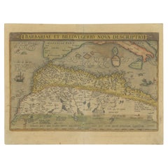
- Antique Map of North Africa by Ortelius, c.1580Located in Langweer, NLAntique map titled 'Barbariae et Biledulgerid Nova Descriptio'. Original antique map of North Africa. The map covers the regions of Barbaria and Biledulgerid, essentially the territo...Category
Antique 16th Century Maps
MaterialsPaper
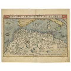
- Antique Map of North Africa by Ortelius, c.1600Located in Langweer, NLAntique map titled 'Barbariae et Biledulgerid nova descriptio'. Old map of coastal North Africa and the Mediterranean. The map extends from Morocco and the Sahara to Libya and sh...Category
Antique 17th Century Maps
MaterialsPaper


You May Also Like
- 1854 Map of Massachusetts, Connecticut and Rhode Island, Antique Wall MapLocated in Colorado Springs, COThis striking wall map was published in 1854 by Ensign, Bridgman & Fanning and has both full original hand-coloring and original hardware. This impression is both informative and highly decorative. The states are divided into counties, outlined in red, green, and black, and subdivided into towns. Roads, canals, and railroad lines are prominently depicted, although they are not all labeled. The mapmakers also marked lighthouses, banks, churches, and prominent buildings, with a key at right. The map is an informative and comprehensive overview of the infrastructural development of New England prior to the Civil War. Physical geographies depicted include elevation, conveyed with hachure marks, rivers and lakes. The impression features an inset map of Boston...Category
Antique 19th Century American Maps
MaterialsPaper
- Large Original Vintage Map of South Africa, circa 1920Located in St Annes, LancashireGreat map of South Africa Original color. Good condition / repair to a minor edge tear middle bottom Published by Alexander Gross Unframed. ...Category
Vintage 1920s English Edwardian Maps
MaterialsPaper
- Large Antique 1859 Map of North AmericaLocated in Sag Harbor, NYThis Map was made by Augustus Mitchell in 1859 It is in amazing condition for being 163 years old. This price is for the rolled up easy to ship version of this piece. I will be Frami...Category
Antique Mid-19th Century American Maps
MaterialsCanvas, Paper

- University Chart “Black Map of North AmericaLocated in Chillerton, Isle of WightUniversity Chart “Black Map of North America W&A K Johnston’s Charts of Physical Maps By G W Bacon, This is a Black Physical map of North A...Category
Early 20th Century Industrial Maps
MaterialsLinen
- 1864 Map of North America, Antique Hand-Colored Map, by Adolphe Hippolyte DufourLocated in Colorado Springs, COOffered is a map of North America entitled Amerique du Nord from 1864. This rare, separately published wall map was produced by Adolphe Hippolyte Dufour. This map includes vibrant an...Category
Antique 1860s French Maps
MaterialsPaper
- Original Antique Map of South America. C.1780Located in St Annes, LancashireGreat map of South America Copper-plate engraving Published C.1780 Two small worm holes to left side of map Unframed.Category
Antique Early 1800s English Georgian Maps
MaterialsPaper


Recently Viewed
View AllMore Ways To Browse
South Africa
South African Antique
19th Century Africa Collectibles
Map South Africa
Map Of South Africa
North Africa Map
Morocco Map
19th Century Map Of Africa
Antique Africa Maps And Atlases Africa Maps
Antique Map South Africa
Antique Map Of South Africa
South Africa Antique Map
Algeria Antique Map
General Empire
Wood And Sons Plate
Antique Caribbean
Holland Utrecht
Large World Map