Map Of South Africa
7
to
25
235
98
186
139
71
49
43
41
38
37
25
23
23
20
18
17
16
14
11
10
9
8
8
8
8
7
6
4
3
3
3
3
3
3
2
2
2
2
2
2
1
1
1
1
1
1
1
1
1
1
1
1
1
42
42
7
7
4
Sort By
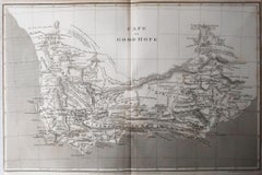
Original Antique Map of South Africa, Arrowsmith, 1820
Located in St Annes, Lancashire
Great map of South Africa.
Drawn under the direction of Arrowsmith.
Copper-plate engraving
Category
Antique 1820s English Maps
Materials
Paper
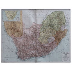
Large Original Vintage Map of South Africa, circa 1920
Located in St Annes, Lancashire
Great map of South Africa
Original color.
Good condition / repair to a minor edge tear middle
Category
Vintage 1920s English Edwardian Maps
Materials
Paper
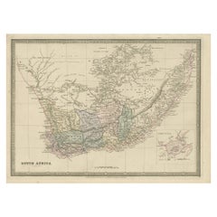
Antique Map of South Africa by Wyld '1845'
Located in Langweer, NL
Antique map titled 'South Africa'. Original antique map of South Africa.
This decorative original
Category
Antique Mid-19th Century Maps
Materials
Paper
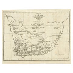
Antique Map of South Africa showing the Travels of Truter and Somerville
Located in Langweer, NL
Antique map titled 'Charte von Süd-Afrika'. Original antique map of South Africa showing the
Category
Antique Early 19th Century Maps
Materials
Paper
H 12.6 in W 16.93 in D 0.02 in
Original Copperplate Engraved Detailed Map of South Africa, ca.1680
Located in Langweer, NL
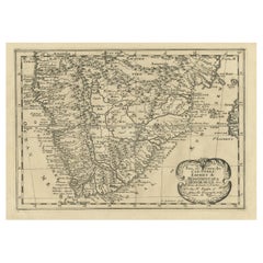
South Africa. Engraved by Antoine d'Winter for a Dutch edition of Sanson's pocket atlas.
Artists and
Category
Antique 1680s Maps
Materials
Paper
Antique Decorative Coloured Map of South Africa and Madagascar, 1882
Located in Langweer, NL
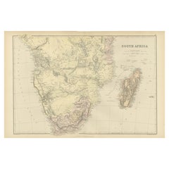
The map of South Africa is from the Blackie & Son Atlas, published in 1882. This historical map is
Category
Antique 1880s Maps
Materials
Paper
Free Shipping
H 14.97 in W 22.45 in D 0 in
Antique Map of South Africa by Lowry, 1852
Located in Langweer, NL
Antique map titled 'South Africa'. Two individual sheets of South Africa. This map originates from
Category
Antique Mid-19th Century Maps
Materials
Paper
Post World War II South African Hebrew Inscribed Metal School Supply Box
Located in New York, NY
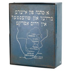
(DP) camp in Austria, 1947.
Painted blue and white with the map of South Africa, and Hebrew
Category
Vintage 1940s South African Decorative Boxes
Materials
Metal
Antique Map of North Africa and South Africa by Black, 1854
Located in Langweer, NL
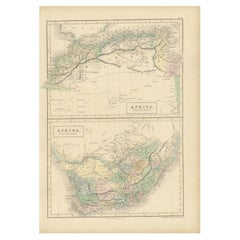
Antique map titled 'Africa north part - Africa south part'. Old map of Africa showing the region of
Category
Antique 19th Century Maps
Materials
Paper
Antique Map of North and South Africa by Johnston, 1882
Located in Langweer, NL
Two antique maps on one sheet titled 'N.W. Africa, Marocco, Algeria & Tunis' and 'Southern Africa
Category
Antique 19th Century Maps
Materials
Paper
Antique Map of the Orange River Colony in South Africa, 1901
Located in Langweer, NL
colony ceased to exist in 1910, when it was absorbed into the Union of South Africa as Orange Free State
Category
Early 20th Century Maps
Materials
Paper
Antique Map of South American, The West Indies & Most of Africa, Ca.1775
Located in Langweer, NL
du Commerce des Europeens dans les deux Indes'.
This map is roughly centered on South America
Category
Antique 1770s Maps
Materials
Paper
H 15.04 in W 19.77 in D 0 in
Very Attractive Map of North and South America and Western Part of Africa, 1744
Located in Langweer, NL
western part of Africa and south west Europe. With full contemporary hand colouring. This map originates
Category
Antique 18th Century Maps
Materials
Paper
H 16.34 in W 21.26 in D 0 in
Antique Map of North-Western and South Africa by A.K. Johnston, 1865
Located in Langweer, NL
Two maps on one sheet titled 'North-Western Africa' and 'Southern Africa'. Depicting Morocco
Category
Antique Mid-19th Century Maps
Materials
Paper
Antique Map of Saldanha Bay 'Near Cape Town, South Africa' by Bellin, 1750
By Jacques-Nicolas Bellin
Located in Langweer, NL
Navigateurs’. Detailed plan of Saldanha Bay, northwest of Cape Town, South Africa. This map originates from
Category
Antique 18th Century Maps
Materials
Paper
H 8.86 in W 11.42 in D 0.01 in
Old Map of the Namibia and South Africa Coasts & Inset of Saldanha Bay, ca.1700
Located in Langweer, NL
and South Africa. With an inset map of Saldanha Bay.
Artists and Engravers: Published by H
Category
Antique Early 1700s Maps
Materials
Paper
H 24.81 in W 20.87 in D 0 in
Antique Map of the Coast of Angola Up to Port Elizabeth in South Africa, 1675
Located in Langweer, NL
map depicts the coast of Angola, South-West Africa and South Africa up to Port Elizabeth. The
Category
Antique 1670s Maps
Materials
Paper
H 21.26 in W 24.41 in D 0 in
Antique Map of North Africa by Ortelius, c.1580
Located in Langweer, NL
Africa. The map covers the regions of Barbaria and Biledulgerid, essentially the territories north and
Category
Antique 16th Century Maps
Materials
Paper
Original Detailed Antique Map of the East Coast of Africa, 1747
Located in Langweer, NL
'.
Original antique map of the east coast of Africa. Reaches from Cape of Good Hope and the land of the
Category
Antique 1740s Maps
Materials
Paper
Antique Hand-Coloured Map of North and South America, ca.1765
Located in Langweer, NL
Description: Antique map titled 'Nieuwe Kaart van Amerika.' Attractive map of North and South
Category
Antique 1760s Maps
Materials
Paper
Antique Old Map of Africa with Insets of Mauritius, Reunion and Natal, 1882
Located in Langweer, NL
The uploaded image is a historical map of Africa from the 1882 atlas by Blackie & Son. The map
Category
Antique 1880s Maps
Materials
Paper
Free Shipping
H 14.97 in W 22.45 in D 0 in
Antique Map of Africa with a Decorative Dedication to the Dauphin, 1717
Located in Langweer, NL
Decouvertes (..).'
This map is a reduced derivative of De Fer's wall map of Africa (1696-98) with its
Category
Antique 18th Century Maps
Materials
Paper
Antique Map of the Coast of Zanguebar and Madagascar 'Africa' by J. van Schley
Located in Langweer, NL
Decorative map of the area between the east coast of South Africa, the Seychelles, Mauritius and
Category
Antique Mid-18th Century Maps
Materials
Paper
H 10.24 in W 12.8 in D 0.02 in
Dutch Antique Map of the West Coast of Africa, to the Cape of Good Hope, 1747
Located in Langweer, NL
west coast of Africa, from 11 degrees south latitude to the Cape of Good Hope. This map originates from
Category
Antique 1740s Maps
Materials
Paper
H 10.63 in W 12.6 in D 0 in
Authentic Map of the Coast from Cape Formosa to the Dony River, Africa, 1732
Located in Langweer, NL
Antique map titled 'The New Correct Mapp of Calbar River vulgarly call'd Calabar (..)'.
An
Category
Antique 1730s Maps
Materials
Paper
No Reserve
H 12.76 in W 17.25 in D 0 in
Africa: A Large 17th Century Hand-Colored Map by Sanson and Jaillot
By Nicolas Sanson
Located in Alamo, CA
This large original hand-colored copperplate engraved map of Africa entitled "L'Afrique divisee
Category
Antique 1690s French Maps
Materials
Paper
Old Print with a View of the Cape of Good Hope and Table Bay, South Africa, 1750
Located in Langweer, NL
Antique print titled 'Gezigt van de Kaap de Goede-Hoop'.
Old print with a view of the Cape of Good Hope and Table Bay. Engraved by J. van Schley for a Dutch edition of 'l'Histoir...
Category
Antique 1750s Maps
Materials
Paper
H 9.93 in W 7.17 in D 0 in
Sea Chart Titled 'Baya de Saldanha' with Robben Island in South Africa, 1726
Located in Langweer, NL
Antique map titled 'Baya de Saldanha'.
Sea chart covering the South African coast from the Cape
Category
Antique 1720s Maps
Materials
Paper
H 13.39 in W 15.95 in D 0 in
Bay of Arguin, West Coast of Africa from Cape Blanco to Tanit, Africa, 1747
Located in Langweer, NL
Arguin on the West Coast of Africa from Cape Blanco in the north to Tanit in the south. This map
Category
Antique 1740s Maps
Materials
Paper
H 10.75 in W 8.19 in D 0 in
Antique Map of the Sinai Peninsula, '1895'
Located in Langweer, NL
the north and the Red Sea to the south, and is a land bridge between Asia and Africa. Published by D
Category
Antique Late 19th Century Maps
Materials
Paper
Antique Map of Northern Natal by Stanford, 1900
Located in Langweer, NL
British colony in south-eastern Africa. It was proclaimed a British colony on 4 May 1843 after the British
Category
Early 20th Century Maps
Materials
Paper
Antique Map of Asia by A. Blondeau, circa 1800
Located in Langweer, NL
Africa and the Mediterranean east to the Bering Sea and south as far as Java and New Guinea. This map is
Category
Antique Early 19th Century Maps
Materials
Paper
Original Steel Engraved Map of French Colonies in America, 1854
Located in Langweer, NL
Antique map titled 'Colonies Francaises (en Amerique)'. Detailed map bordered by vignettes showing
Category
Antique Mid-19th Century Maps
Materials
Paper
Free Shipping
H 13.12 in W 18.71 in D 0.02 in
Antique Map of Edom, an Ancient Kingdom in Transjordan, 1773
Located in Langweer, NL
Antique print titled 'Idumea, of thet Land der Philistynen'. Old map of Edom, an ancient kingdom in
Category
Antique 18th Century Maps
Materials
Paper
Antique Map of Mozambique Channel with Madagascar and Inset of Cape Region, 1780
Located in Langweer, NL
Cape of Good Hope to Melinde. The inset map shows the Cape region in South Africa with False Bay
Category
Antique 18th Century Maps
Materials
Paper
H 14.97 in W 10.24 in D 0 in
Antique Map of the Harbour of Praia, Santiago Island, Cape Verde, c.1750
Located in Langweer, NL
colonisation of Africa and South America by the Portuguese. With 817,845 metric tonnes of cargo and 85,518
Category
Antique 18th Century Maps
Materials
Paper
Antique Map of the region near Annesley Bay by Wagner, 1870
Located in Langweer, NL
Annesley Bay (Gulf of Zula, Bay of Arafali), Eritrea, Africa. The bay is located about 30 miles south of
Category
Antique Mid-19th Century Maps
Materials
Paper
Antique Map of the Southern Part of the Orange River Colony by Stanford, 1901
Located in Langweer, NL
colony ceased to exist in 1910, when it was absorbed into the Union of South Africa as Orange Free State
Category
Early 20th Century Maps
Materials
Paper
H 7.88 in W 7.88 in D 0.02 in
Antique Map of Mozambique and Cape of Good Hope with Kingdom Monomotapa, 1780
Located in Langweer, NL
, details the Dutch claims in the western of South Africa from the Cape of Good Hope north as far as St
Category
Antique 18th Century Maps
Materials
Paper
H 14.69 in W 10.44 in D 0 in
Puzzle Atlas with Maps, Italy, circa 1900
Located in Milan, IT
of Italy, Europe, North America, South America, Asia and Africa. Models for teaching class. G.B
Category
Early 20th Century Italian Maps
Materials
Wood, Paper
Old Map of the Sinai Peninsula Showing the Mediterranean and the Red Sea, 1773
Located in Langweer, NL
the south.
The map is decorated with images of a Persian wheel and a view of a village near the
Category
Antique 1770s Maps
Materials
Paper
H 17.05 in W 21.19 in D 0 in
Antique Map Showing the Religions Around the World by Johnston '1854'
Located in Langweer, NL
and Pagans. Three side maps show the distribution of missions in India, South Africa and Canada. Two
Category
Antique Mid-19th Century Maps
Materials
Paper
No Reserve
H 21.66 in W 26.38 in D 0.02 in
St. Christophe 'St. Kitts' Island: An 18th Century Hand-colored Map by Bellin
By Jacques-Nicolas Bellin
Located in Alamo, CA
Jacques Bellin's copper-plate map of the Caribbean island of Saint Kitts entitled "Carte De De
Category
Antique Mid-18th Century French Maps
Materials
Paper
H 10 in W 14.25 in D 0.07 in
Ancient Cartography of the Indian Subcontinent, Published in 1880
Located in Langweer, NL
Africa.
5. **Latin Labels**: Following the convention of the time it was created, the map uses Latin for
Category
Antique 1880s Maps
Materials
Paper
Free Shipping
H 15.56 in W 18.51 in D 0 in
The History of the Royal Canadian Mounted Police, Published in 1966
Located in Langweer, NL
. He moved to Africa and was stationed in Cape Town, South Africa during World War II. It was during
Category
Vintage 1960s Maps
Materials
Paper
Very Large Hand-Drawn View of St Iago Cape Verde, by Frederici, 1783
Located in Amsterdam, NL
The largest recorded early modern panoramic view of Cape Verde, by “the best VOC map maker in South
Category
Antique Late 18th Century Cape Verdean Dutch Colonial Maps
Materials
Paper
Free Shipping
H 11.62 in W 47.45 in D 0.08 in
Original Antique Sea Chart of the Coastline from England to Gibraltar, ca.1700
Located in Langweer, NL
Antique map titled 'A Chart of the Sea-Coast from England to the Streights.'
Original antique map
Category
Antique Early 1700s Maps
Materials
Paper
No Reserve
H 18.47 in W 23.55 in D 0 in
View of the Island Onrust Near Batavia 'Jakarta', Indonesia, 1739
Located in Langweer, NL
this tradition when they interned Chris Soumokil president of the Republic of South Maluku. On 12 April
Category
Antique 1730s Maps
Materials
Paper
Pair of Miniature Globes Lane’s on Tripod Bases, London post 1833, ante 1858
By Lane's
Located in Milano, IT
Much of central Africa is empty and the great lakes Tanganyika and Victoria are not marked (Europeans
Category
Antique 1840s English Early Victorian Maps
Materials
Paper, Wood
Miniature Terrestrial Globe Newton & Son London, Post 1833, Ante 1858
By Newton and Son
Located in Milano, IT
1831 and the "Land of Enderby" which he discovered on the coast of Antarctica, south of Africa, are
Category
Antique 1840s English Early Victorian Maps
Materials
Bronze
Antique Map of the Southern Oceans, South America and Africa
Located in Larchmont, NY
Antique Map of the South Atlantic, c. 1800s
Engraving
20 x 28 in.
Framed: 25 3/4 x 33 3/4 in.
Category
19th Century Realist Figurative Prints
Materials
Engraving
H 25.75 in W 33.75 in D 0.75 in
Original Vintage Illustrated Map Poster Union Of South Africa MacDonald Gill
By "Leslie MacDonald ""Max"" Gill"
Located in London, GB
Original vintage illustrated map poster for the Union of South Africa - Philips pictorial map based
Category
Vintage 1950s British Posters
Materials
Paper
H 33.08 in W 42.52 in D 0.04 in
Original Vintage Poster Union Of South Africa Map Natural & Industrial Resources
Located in London, GB
Original vintage illustrated map poster for the Union of South Africa Her Natural and Industrial
Category
Vintage 1940s British Posters
Materials
Paper
H 19.69 in W 29.53 in D 0.04 in
Late 20th Century Educational Geographic Map - South African Topography (1728.4)
Located in Hook, Hampshire
Late 20th Century Educational Geographic Map – South African Topography (1728.4)
Late 20th Century
Category
Late 20th Century Czech Posters
Materials
Cotton
H 70.48 in W 45.28 in D 0.4 in
Late 20th Century Educational Geographic Map - South African Topography (1728.5)
Located in Hook, Hampshire
Late 20th Century Educational Geographic Map – South African Topography (1728.5)
Late 20th Century
Category
Late 20th Century Czech Posters
Materials
Cotton
H 64.18 in W 45.28 in D 0.4 in
"Choke II: Cape of Good Hope (South Africa) II" - ceramic - map - black & white
By Gregor Turk
Located in Atlanta, GA
This ceramic wall sculpture features a topographic map in black and white.
Gregor is inspired by
Category
2010s Abstract Sculptures
Materials
Ceramic
Countrycore Mural Vintage Map Wall Chart Rollable Poster Central South Africa
Located in Berghuelen, DE
The cottagecore pull-down mural map depicts Middle and South Africa. Published by Westermann
Category
Vintage 1970s German Country Posters
Materials
Canvas, Wood, Paper
H 68.51 in W 83.86 in D 0.79 in
Original Vintage Travel Poster Rhodesia Pictorial Map Southern Africa Zimbabwe
Located in London, GB
decorative compass point. A smaller framed map below marking the area and the South Atlantic Ocean and Indian
Category
Vintage 1930s British Posters
Materials
Paper
H 39.38 in W 24.41 in D 0.04 in
Original Vintage Travel Poster Sloman Line Mediterranean Map Spain Italy Africa
Located in London, GB
with the bold text and route map below showing ports along the coast of Italy Spain France and Africa
Category
Vintage 1930s German Posters
Materials
Paper
H 23.23 in W 16.54 in D 0.04 in
"Choke II: Cook Strait (North & South Island, New Zealand)" - ceramic - map
By Gregor Turk
Located in Atlanta, GA
This ceramic wall sculpture features a topographic map in black and white.
Gregor is inspired by
Category
2010s Abstract Sculptures
Materials
Ceramic
- 1
Get Updated with New Arrivals
Save "Map Of South Africa", and we’ll notify you when there are new listings in this category.
Map Of South Africa For Sale on 1stDibs
Find many varieties of an authentic map of south africa available at 1stDibs. A map of south africa — often made from paper — can elevate any home. You’ve searched high and low for the perfect map of south africa — we have versions that date back to the 18th Century alongside those produced as recently as the 20th Century are available. A map of south africa is a generally popular piece of furniture, but those created in styles are sought with frequency. You’ll likely find more than one map of south africa that is appealing in its simplicity, but Jacques-Nicolas Bellin produced versions that are worth a look.
How Much is a Map Of South Africa?
Prices for a map of south africa can differ depending upon size, time period and other attributes — at 1stDibs, they begin at $60 and can go as high as $2,325, while the average can fetch as much as $342.
More Ways To Browse
Tiffany Setting Band Width
18 Kt White And Yellow Gold Band
Tiffany Platinum Aquamarine Ring
Vintage Style Peridot Rings
Diamond Dome Rings 18 Kt
Tiffany Fancy Yellow Ring
Tiffany Fancy Yellow Diamond Ring
Tiffany 1837 Band
Ruby Solitaire Necklace
Aquamarine Solitaire Necklace
Ruby Dinner Ring
15 Carat Fancy Yellow Diamond Ring
Tiffany 3 Ring Necklace
Tiffany Aquamarine Necklace
Tiffany And Co Paloma Picasso X Necklace
15 Carat Ruby Engagement Ring
Tiffany Solitaire Necklace
Tiffany Diamond Solitaire Necklace
