Items Similar to Antique Map of the Orange River Colony in South Africa, 1901


Want more images or videos?
Request additional images or videos from the seller
1 of 6
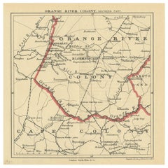
Antique Map of the Orange River Colony in South Africa, 1901
About the Item
Antique map titled 'Orange River Colony, northern part'. Lithograph of the northern part of the Orange River Colony, Africa. The Orange River Colony was the British colony created after Britain first occupied (1900) and then annexed (1902) the independent Orange Free State in the Second Boer War. The colony ceased to exist in 1910, when it was absorbed into the Union of South Africa as Orange Free State Province.
- Dimensions:Height: 7.88 in (20 cm)Width: 11.62 in (29.5 cm)Depth: 0.02 in (0.5 mm)
- Materials and Techniques:
- Period:
- Date of Manufacture:1901
- Condition:General age-related toning, original folding lines. Narrow margins, blank verso. Please study images carefully.
- Seller Location:Langweer, NL
- Reference Number:
About the Seller
5.0
Platinum Seller
These expertly vetted sellers are 1stDibs' most experienced sellers and are rated highest by our customers.
Established in 2009
1stDibs seller since 2017
1,919 sales on 1stDibs
Typical response time: <1 hour
- ShippingRetrieving quote...Ships From: Langweer, Netherlands
- Return PolicyA return for this item may be initiated within 14 days of delivery.
More From This SellerView All
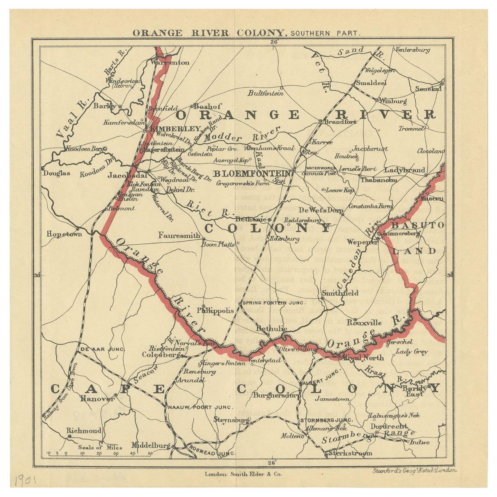
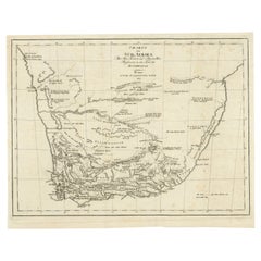
- Antique Map of the Southern Part of the Orange River Colony by Stanford, 1901Located in Langweer, NLAntique map titled 'Orange River Colony, southernpart'. Lithograph of the southern part of the Orange River Colony, Africa. The Orange River Colony was the British colony created aft...Category
Early 20th Century Maps
MaterialsPaper
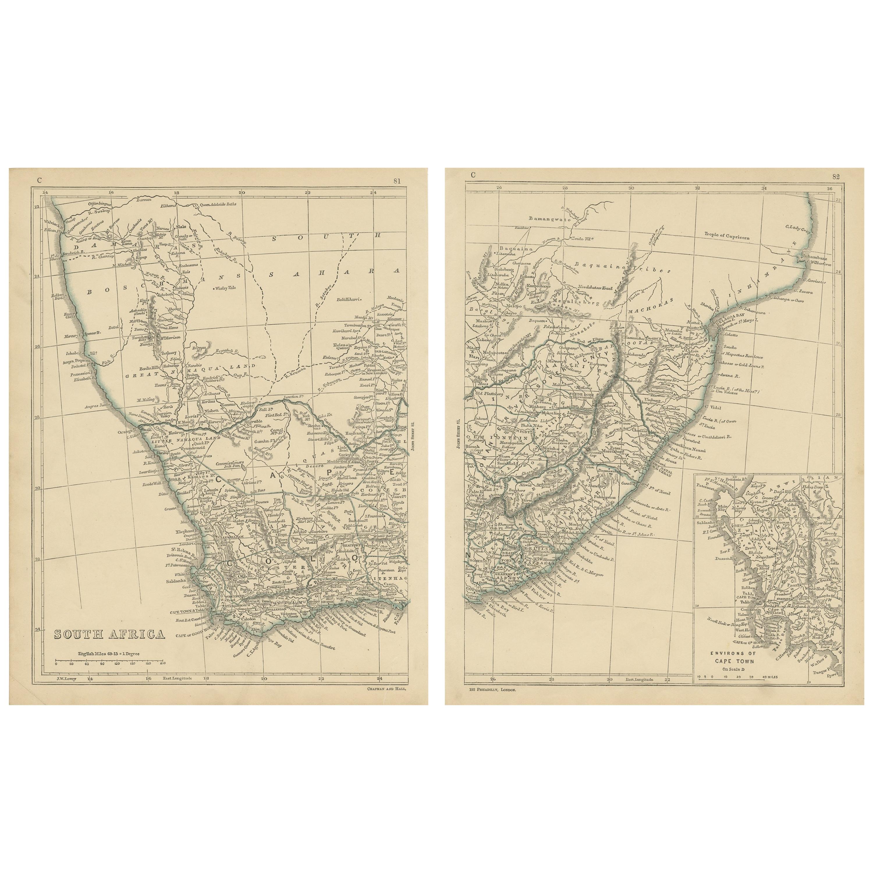
- Antique Map of South Africa by Lowry, 1852Located in Langweer, NLAntique map titled 'South Africa'. Two individual sheets of South Africa. This map originates from 'Lowry's table Atlas constructed and engraved from the most recent authorities' by ...Category
Antique Mid-19th Century Maps
MaterialsPaper
- Antique Map of South Africa by Wyld '1845'Located in Langweer, NLAntique map titled 'South Africa'. Original antique map of South Africa. This decorative original old map originates from 'An Atlas of th...Category
Antique Mid-19th Century Maps
MaterialsPaper
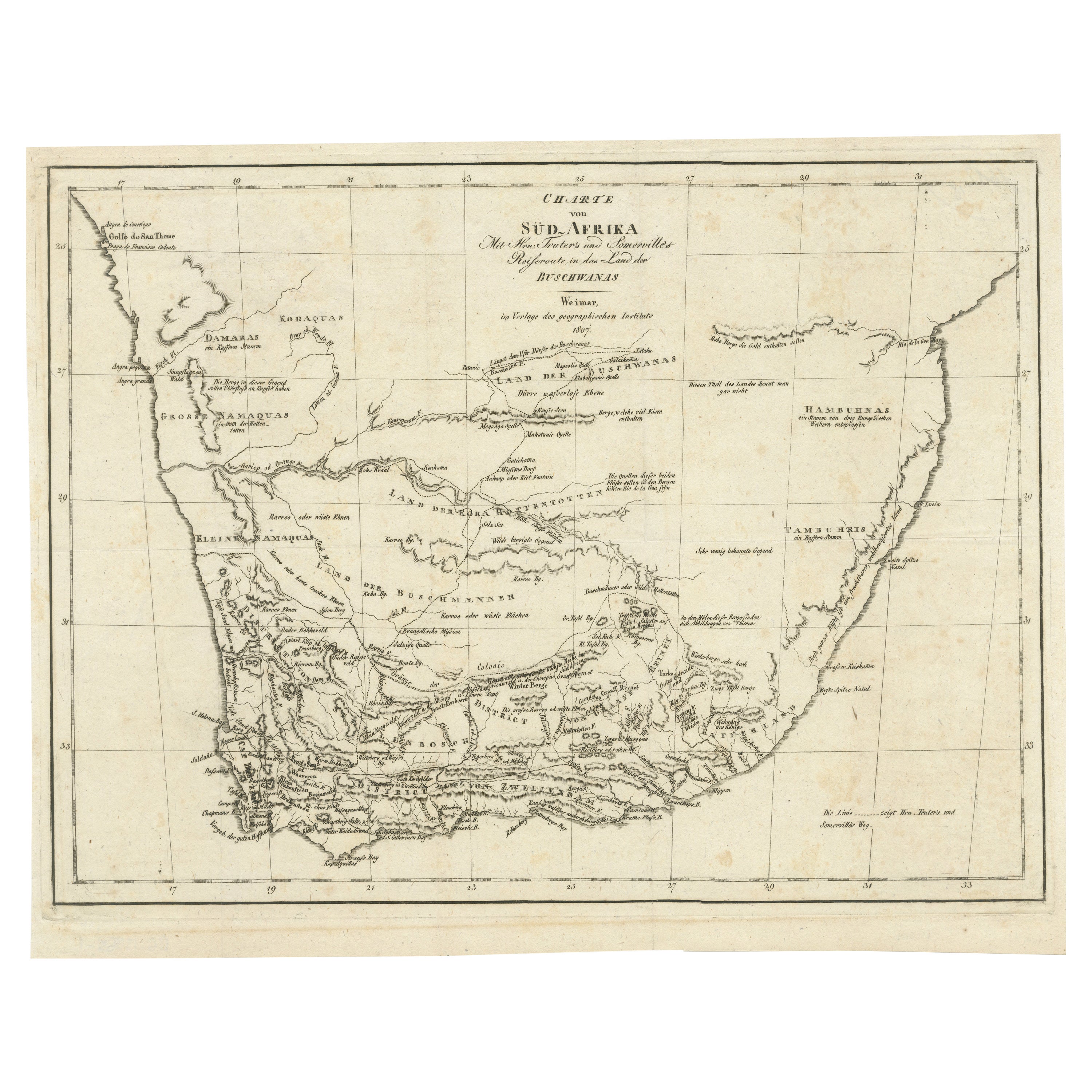
- Antique Map of South Africa showing the Travels of Truter and SomervilleLocated in Langweer, NLAntique map titled 'Charte von Süd-Afrika'. Original antique map of South Africa showing the travels of Truter and Somerville. Published ci...Category
Antique Early 19th Century Maps
MaterialsPaper
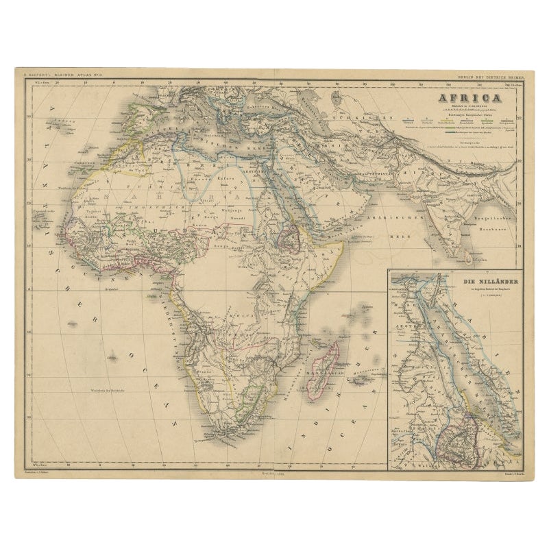
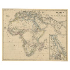
- Antique Map of the African Continent with Inset of the Nile River Delta, c.1870Located in Langweer, NLAntique map titled 'Africa'. Old map of the African continent. This map originates from 'H. Kiepert's Kleiner Atlas der Neueren Geographie für Schule...Category
Antique 19th Century Maps
MaterialsPaper
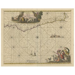
- Antique Map of the Coast of Angola Up to Port Elizabeth in South Africa, 1675Located in Langweer, NLAntique map titled 'Cimbebas et Caffariae Littora a Catenbela ad Promontorium Bonae Spei'. This map depicts the coast of Angola, South-West Africa and South Africa up to Port Elizabeth...Category
Antique 1670s Maps
MaterialsPaper


You May Also Like
- Original Antique Map of South Africa, Arrowsmith, 1820Located in St Annes, LancashireGreat map of South Africa. Drawn under the direction of Arrowsmith. Copper-plate engraving. Published by Longman, Hurst, Rees, Orme and Br...Category
Antique 1820s English Maps
MaterialsPaper
- Original Antique Map of South America. C.1780Located in St Annes, LancashireGreat map of South America Copper-plate engraving Published C.1780 Two small worm holes to left side of map Unframed.Category
Antique Early 1800s English Georgian Maps
MaterialsPaper
- Antique 1901 National Publishing Company's Road Map of New Jersey GeologicalLocated in Dayton, OHThe National Publishing Company's road map of New Jersey, showing all county and township divisions, cities villages and post-offices, railroads, ste...Category
Antique Early 1900s Victorian Prints
MaterialsPaper
- Original Antique Map of South America, circa 1830Located in St Annes, LancashireGreat map of South America Copper plate engraving Published by Butterworth, Livesey & Co., circa 1830 Unframed.Category
Antique Early 1800s English Other Maps
MaterialsPaper
- Original Antique Map of South East Asia, Arrowsmith, 1820Located in St Annes, LancashireGreat map of South East Asia Drawn under the direction of Arrowsmith Copper-plate engraving Published by Longman, Hurst, Rees, Orme and Brown, 1820 Unframed.Category
Antique 1820s English Maps
MaterialsPaper
- Original Antique Map of South America by Thomas Clerk, 1817Located in St Annes, LancashireGreat map of South America Copper-plate engraving Drawn and engraved by Thomas Clerk, Edinburgh. Published by Mackenzie And Dent, 1817 Unframed.Category
Antique 1810s English Maps
MaterialsPaper


Recently Viewed
View AllMore Ways To Browse
British Antique Collectables
River Map
Britain Map
Map Of Britain
Antique South Africa
Antique State Maps
Antique British Maps
Antique Maps Of Britain
Antique War Maps
Antique Furniture In South Africa
Stanford Furniture
Map South Africa
Map Of South Africa
Stanford Used Furniture
Antique Map Britain
Antique Britain Map
Antique War Map
Antique Map South Africa