Antique State Maps
49
to
66
409
186
293
262
123
107
107
100
94
77
64
59
38
32
26
23
21
19
17
17
15
14
11
11
10
9
9
9
8
7
7
6
5
5
5
5
4
4
4
4
3
3
2
2
2
2
2
2
2
1
1
1
29
22
14
9
5
Sort By
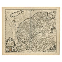
Beautiful First State Map of Friesland, the Netherlands, c.1665
Located in Langweer, NL
Antique map titled 'Dominii Frisiae Tabula, inter Flevum et Lavicam'. Beautiful first state map of
Category
17th Century Antique State Maps
Materials
Paper
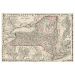
Large Antique Map of New York State with Inset Maps
Located in Langweer, NL
Antique map titled 'Johnson's New York' Large map of New York State. With insets of Albany, Oswego
Category
Mid-19th Century Antique State Maps
Materials
Paper
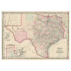
Large Antique Map of the State of Texas, 1861
Located in Langweer, NL
Antique map titled 'Johnson's New Map of the State of Texas' Large map of Texas, shows railroads
Category
Mid-19th Century Antique State Maps
Materials
Paper
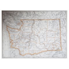
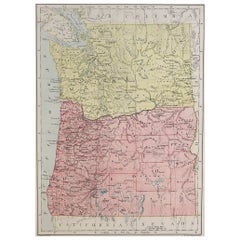
Large Original Antique Map of Washington, 'State', USA, 1894
By Rand McNally & Co.
Located in St Annes, Lancashire
Fabulous map of Washington.
Original color.
By Rand, McNally & Co.
Published, 1894
Category
1890s American Antique State Maps
Materials
Paper
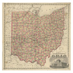
Antique Map of the State of Ohio by Titus '1871'
Located in Langweer, NL
Antique map titled 'Railroad & Township Map of the State of Ohio'. Original antique map of the
Category
Late 19th Century Antique State Maps
Materials
Paper
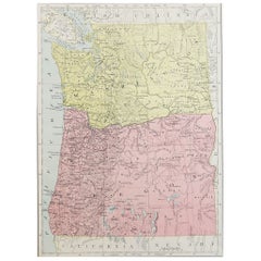
Original Antique Map of the American State of Washington, 1889
Located in St Annes, Lancashire
Great map of Washington
Drawn and Engraved by W. & A.K. Johnston
Published By A & C Black
Category
1880s Scottish Victorian Antique State Maps
Materials
Paper
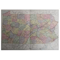
Original Antique Map of the American State of Pennsylvania, 1889
Located in St Annes, Lancashire
Great map of Pennsylvania
Drawn and Engraved by W. & A.K. Johnston
Published By A & C Black
Category
1880s Scottish Victorian Antique State Maps
Materials
Paper
No Reserve
H 10.75 in W 15.75 in D 0.07 in
Original Antique Map of the American State of Oregon, 1889
Located in St Annes, Lancashire
Great map of Oregon
Drawn and Engraved by W. & A.K. Johnston
Published By A & C Black, Edinburgh
Category
1880s Scottish Victorian Antique State Maps
Materials
Paper
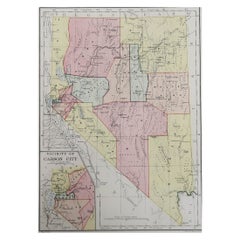
Original Antique Map of the American State of Nevada, 1889
Located in St Annes, Lancashire
Great map of Nevada
Drawn and Engraved by W. & A.K. Johnston
Published By A & C Black
Category
1880s Scottish Victorian Antique State Maps
Materials
Paper
Antique 18th Century Map of the Province of Pensilvania 'Pennsylvania State'
Located in Philadelphia, PA
A fine antique of the colony of Pennsylvania.
Noted at the top of the sheet as a 'Map of the
Category
18th Century British American Colonial Antique State Maps
Materials
Paper
H 10.25 in W 13.25 in D 0.5 in
Original Antique Map of the State of New Jersey Published in France
Located in Langweer, NL
the earliest obtainable maps of the State of New Jersey published outside of the United States. The
Category
Early 19th Century Antique State Maps
Materials
Paper
1859 "Colton's New Map of the State of Texas..." by Johnson & Browning
Located in Colorado Springs, CO
Presented is "Colton's New Map of the State of Texas Compiled from De Cordova's Large Map
Category
1850s American Antique State Maps
Materials
Paper
H 27.75 in W 38.5 in D 1.38 in
1908 "Map of Texas" by The Kenyon Company
Located in Colorado Springs, CO
Presented is an antique map of the state of Texas, printed as a pocket map in 1908 by The Kenyon
Category
Early 1900s American Antique State Maps
Materials
Paper
1837 Mitchell's "Tourist's Pocket Map of the State of Virginia" by J.H. Young
Located in Colorado Springs, CO
This is J. H. Young's pocket map of the Virginia, which shows county development current to 1835
Category
1830s American Antique State Maps
Materials
Paper
H 24.25 in W 25.75 in D 1.75 in
Old Antique Map of the Province of Friesland, the Netherlands, c.1580
Located in Langweer, NL
map. Based on a manuscript map made by Sibrandus Leonis (Leo Sybrands). First state map by Ortelius
Category
16th Century Antique State Maps
Materials
Paper
1907 Map of Colorado, Antique Topographical Map, by Louis Nell
Located in Colorado Springs, CO
This highly detailed pocket map is a topographical map of the state of Colorado by Louis Nell from
Category
Early 1900s American Antique State Maps
Materials
Paper
"Clason's Guide Map of Montana" by The Clason Map Company, Circa 1920s
Located in Colorado Springs, CO
roads” are identified in red snaking lines across the state. The map also shows various oil dome
Category
1920s American Art Deco Antique State Maps
Materials
Paper
H 23.13 in W 33.88 in D 1.5 in
Antique Map of Alaska '1904'
Located in Langweer, NL
An antique map titled 'Map of Alaska Compiled Under the Direction of R.U. Goode, Geographer,' which
Category
Early 20th Century Antique State Maps
Materials
Paper
1864 Map of North America, Antique Hand-Colored Map, by Adolphe Hippolyte Dufour
Located in Colorado Springs, CO
Offered is a map of North America entitled Amerique du Nord from 1864. This rare, separately
Category
1860s French Antique State Maps
Materials
Paper
H 44.5 in W 33 in D 1.5 in
Colored wall map of the WORLD
By Chambon
Located in ZWIJNDRECHT, NL
huge wall map of the world in two hemispheres printed on two sheets, depicting the Eastern and Western
Category
Mid-18th Century French French Provincial Antique State Maps
Materials
Wood, Paper
1812 United States Map, by Pierre Tardieu, Antique French Map Depicting the U.S.
By Pierre François Tardieu
Located in Colorado Springs, CO
Map by Tardieu
This attractive map, published in Paris in 1812, is one of the most rare large
Category
1810s French Antique State Maps
Materials
Paper
H 43.5 in W 48 in D 2.25 in
Antique Map Colton's United States of America
Located in Langweer, NL
Antique map titled 'Colton's United States of America'. Show railroads, canals, state capitals
Category
Mid-19th Century Antique State Maps
Materials
Paper
Antique Map of Prussia by Janssonius, 1628
Located in Langweer, NL
Antique map titled 'Prussia'. Original antique map of Prussia, a historically prominent German
Category
Mid-17th Century Antique State Maps
Materials
Paper
Original Antique Map of Prussia, ca.1630
Located in Langweer, NL
Antique map titled 'Prussia - Preussen'. Original map of Prussia, a historically prominent German
Category
1630s Antique State Maps
Materials
Paper
Original Decorative Antique Map of Prussia, 1628
Located in Langweer, NL
Antique map titled 'Prussia'. Original antique map of Prussia, a historically prominent German
Category
1620s Antique State Maps
Materials
Paper
Antique Map of Friesland, The Netherlands, 1638
Located in Langweer, NL
Antique map titled 'Frisia Occidentalis'.
Original antique map of Friesland, the Netherlands
Category
17th Century Antique State Maps
Materials
Paper
Antique Map of Asia by Guthrie, 1787
Located in Langweer, NL
Antique map titled 'Asia from the best Authorities'. Old map of the Asian continent. This map
Category
18th Century Antique State Maps
Materials
Paper
Antique Decorative Coloured Map of North America, 1882
Located in Langweer, NL
. **Development**: The map reflects the state of development and settlement in North America, with cities and
Category
1880s Antique State Maps
Materials
Paper
Antique Map of the Region near Cologne, Germany
Located in Langweer, NL
Antique map titled 'Carte de la Belgique d'après Ferraris'. Original antique map of the region near
Category
Mid-19th Century Antique State Maps
Materials
Paper
Antique Map of the Netherlands by Guicciardini, 1582
Located in Langweer, NL
in the 2nd state, numbered 30 bottom right. This map originates from 'Description de touts les Pais
Category
16th Century Antique State Maps
Materials
Paper
1858 Colton's Map of New York, Ric.B011
Located in Norton, MA
engraved and very detailed map of the state of New York, with seven insets: Oswego, Buffalo, Rochester
Category
19th Century Unknown Antique State Maps
Materials
Paper
Antique Map of New Zealand by Arrowsmith '1844'
Located in Langweer, NL
Antique map titled 'Map of the colony of New Zealand from official documents'. A scarce map of New
Category
Mid-19th Century Antique State Maps
Materials
Paper
Antique Map of Prussia by Blaeu, circa 1635
By Willem Blaeu
Located in Langweer, NL
Antique map titled 'Prussiae Nova Tabula'. Rare early edition of Blaeu's map of Prussia
Category
Mid-17th Century Antique State Maps
Materials
Paper
Antique Map of South America by Buchon, 1825
Located in Langweer, NL
text about the state or territory depicted, as well as a map of the area. The French edition is
Category
19th Century Antique State Maps
Materials
Paper
Striking Antique Map Centered on the Malay Peninsula
By Pieter Van Der Aa
Located in Langweer, NL
Antique map titled 'D'Indiaanze Landschappen Zeen en Eylanden, van Couchin af tot in de Moluccos
Category
Early 18th Century Antique State Maps
Materials
Paper
Antique Map of Prussia by Blaeu, c.1680
Located in Langweer, NL
Antique map titled 'Prussiae nova Tabula'. Later edition of Blaeu's map of Prussia, embellished
Category
17th Century Antique State Maps
Materials
Paper
Antique Decorative Coloured Map Marocco, Algeria and Tunis, 1882
Located in Langweer, NL
The maps is from the 1882 atlas by Blackie & Son and offers a detailed view of the North African
Category
1880s Antique State Maps
Materials
Paper
Free Shipping
H 14.97 in W 22.45 in D 0 in
Colton's Map of Illinois, with an Inset of Chicago
Located in Langweer, NL
Antique map titled 'Colton's Illinois'. Antique map of Illinois, a state in the Midwestern United
Category
Mid-19th Century Antique State Maps
Materials
Paper
Original Antique Hand- Map of Africa by Allard '1697'
Located in Langweer, NL
is the 3rd state of the map, with climate notation added in border (1697, Betz 162, Norwich 54). Very
Category
Late 17th Century Antique State Maps
Materials
Paper
Antique Map of Africa Made after Hondius, circa 1655
Located in Langweer, NL
example is based upon the second state of Janssonius' map of 1623. The later states of the map do not
Category
Mid-17th Century Antique State Maps
Materials
Paper
Extremele Rare, Original Miniature Map of Prussia, ca.1640
Located in Langweer, NL
Antique map titled 'Prussia'. Extremele rare, original miniature map of Prussia, a historically
Category
1640s Antique State Maps
Materials
Paper
French Geographical, Statistical and Historical Map of Pensylvania, 1825
Located in Langweer, NL
1825 French Map of Pennsylvania, with a List of Prominent Rivers, Descriptions of Mountains, Climate
Category
1820s Antique State Maps
Materials
Paper
H 20.08 in W 25.99 in D 0 in
Map Bedfordshire WilliamSchmollinger Dunstable Priory Woburn Abbey Moules Gothic
Located in BUNGAY, SUFFOLK
Artist William Schmollinger (1811-1869)
London : George Virtue, 1832. A highly attractive map in
Category
19th Century English Victorian Antique State Maps
Materials
Paper
H 37 in W 29 in D 2 in
Map Bedfordshire WilliamSchmollinger Dunstable Priory Woburn Abbey Moules Gothic
Located in BUNGAY, SUFFOLK
ARTIST William Schmollinger (1811-1869)
London : George Virtue, 1832. A highly attractive map in
Category
19th Century English Victorian Antique State Maps
Materials
Paper
H 14.18 in W 11.03 in D 0.79 in
Antique Map of the East Indies by Guthrie, 1787
Located in Langweer, NL
Antique map titled 'East Indies from the best Authorities'. Old map of the East Indies, depicts the
Category
18th Century Antique State Maps
Materials
Paper
Antique Map of Friesland, A Dutch Province, c.1780
Located in Langweer, NL
Antique map titled 'Dominii Frisiae (..)'. Original antique map of Friesland. 3rd state, most
Category
18th Century Antique State Maps
Materials
Paper
Rare Antique Map of Calcutta 'Kolkata' in India, 1893
Located in Langweer, NL
Chicago, and maps of every state and territory of the United States and Canada, and general maps of the
Category
19th Century Antique State Maps
Materials
Paper
Antique Geographical, Historical and Statistical Map of Massachusetts, 1822
Located in Langweer, NL
This attractive map of Massachusetts presents a finely detailed overview of the state in the first
Category
1820s Antique State Maps
Materials
Paper
H 17.13 in W 21.46 in D 0 in
Antique Map of Friesland by De Wit, c.1690
Located in Langweer, NL
Netherlands. With a small inset map of the Wadden area. Third state of the map by Schotanus and De Wit
Category
17th Century Antique State Maps
Materials
Paper
Antique Map of South America Depicting Guayana, c.1780
Located in Langweer, NL
Mayapa, a Brazilian state, and Cap de Nord in the south. This map originates from G. Raynal's 'Atlas de
Category
18th Century Antique State Maps
Materials
Paper
1859 Antique Swiss Panorama: Blackie's Detailed Map of Switzerland
Located in Langweer, NL
Geography', this map holds significant historical value, representing the state of geographical knowledge
Category
Mid-19th Century Antique State Maps
Materials
Paper
Antique Map of Herefordshire 'England' by R. Morden, 1708
Located in Langweer, NL
This antique County map of Herefordshire by Robert Morden was first published in 1701 in a work
Category
Early 18th Century Antique State Maps
Materials
Paper
Antique Map of Germany by T. Kitchin, circa 1780
Located in Langweer, NL
Attractive map with decorative cartouche from "A New Geographical, Historical, and Commercial
Category
Late 18th Century Antique State Maps
Materials
Paper
1866 Ensign & Bridgman's Rail Road Map of the United States
Located in Colorado Springs, CO
Presented is an 1866 issue of “Ensign & Bridgeman’s Rail Road Map of the United States, showing
Category
1860s American Late Victorian Antique State Maps
Materials
Paper
Ancient Iberia: Hispania Map from Spruner-Menke Atlas Antiquus, 1880
Located in Langweer, NL
explicitly stated on the map, but based on the provincial divisions and the style of Roman road networks, it
Category
1880s Antique State Maps
Materials
Paper
No Reserve
H 15.56 in W 18.51 in D 0 in
1865 "Johnson's Nebraska, Dakota, Colorado, Idaho & Kansas" Map, Johnson & Ward
Located in Colorado Springs, CO
.” The map is engraved, with attractive hand coloring and a decorative strapwork border. The state of
Category
Mid-19th Century Antique State Maps
Materials
Paper
H 18.5 in W 21.38 in D 0.75 in
Antique Decorative Coloured Map Egypt, Nubia, Abyssinia and more, 1882
Located in Langweer, NL
, the maps serve as historical documents showing the geopolitical state of the region just before a
Category
1880s Antique State Maps
Materials
Paper
Free Shipping
H 14.97 in W 22.45 in D 0 in
Antique Map of the Holy Land with Picture Frame Border
Located in Langweer, NL
Antique map titled 'Terre Sainte Suivant les Nouvelles Observations (..)'. Original old map of the
Category
Early 18th Century Antique State Maps
Materials
Paper
Original Antique Map of the Holy Land with Decorative Cartouche
Located in Langweer, NL
Antique map titled 'Totius Terrae Sanctae'. Original old map of the Holy Land, with a large
Category
Late 17th Century Antique State Maps
Materials
Paper
Antique Map of Greece from Ortelius's Theatrum Orbis Terrarum, 1595
Located in Langweer, NL
enthusiasts of historical maps:
1. **Athens (Athenae)** - The historic city-state, known for its rich
Category
16th Century Antique State Maps
Materials
Paper
Free Shipping
H 17.92 in W 21.86 in D 0 in
- 1
- ...
Get Updated with New Arrivals
Save "Antique State Maps", and we’ll notify you when there are new listings in this category.
Antique State Maps For Sale on 1stDibs
There is a range of antique state maps for sale on 1stDibs. Each of these unique antique state maps was constructed with extraordinary care, often using paper, animal skin and fabric. There are all kinds of antique state maps available, from those produced as long ago as the 18th Century to those made as recently as the 20th Century. Antique state maps bearing Victorian hallmark is very popular at 1stDibs. Many antique state maps are appealing in their simplicity, but Charles Desilver, Samuel Augustus Mitchell and Willard Richardson produced popular antique state maps that are worth a look.
How Much are Antique State Maps?
Prices for antique state maps start at $25 and top out at $14,500 with the average selling for $25.
More Ways To Browse
West Country Settle
Map Of Michigan
Map Of Jerusalem Antique
Croatia Antique Map
Erie Canal
Antique Maine Maps
Antique Maine Map
Antique Map Maine
Map Venezuela
Still Novo
Used Office Furniture King Of Prussia
Kansas Map
Antique South Carolina Maps
Antique Map New Orleans
Antique Map Of New Orleans
Antique Maps Of New Orleans
New Orleans Antique Maps
Madagascar Antique Map
