Items Similar to Ancient Iberia: Hispania Map from Spruner-Menke Atlas Antiquus, 1880


Want more images or videos?
Request additional images or videos from the seller
1 of 7
Ancient Iberia: Hispania Map from Spruner-Menke Atlas Antiquus, 1880
About the Item
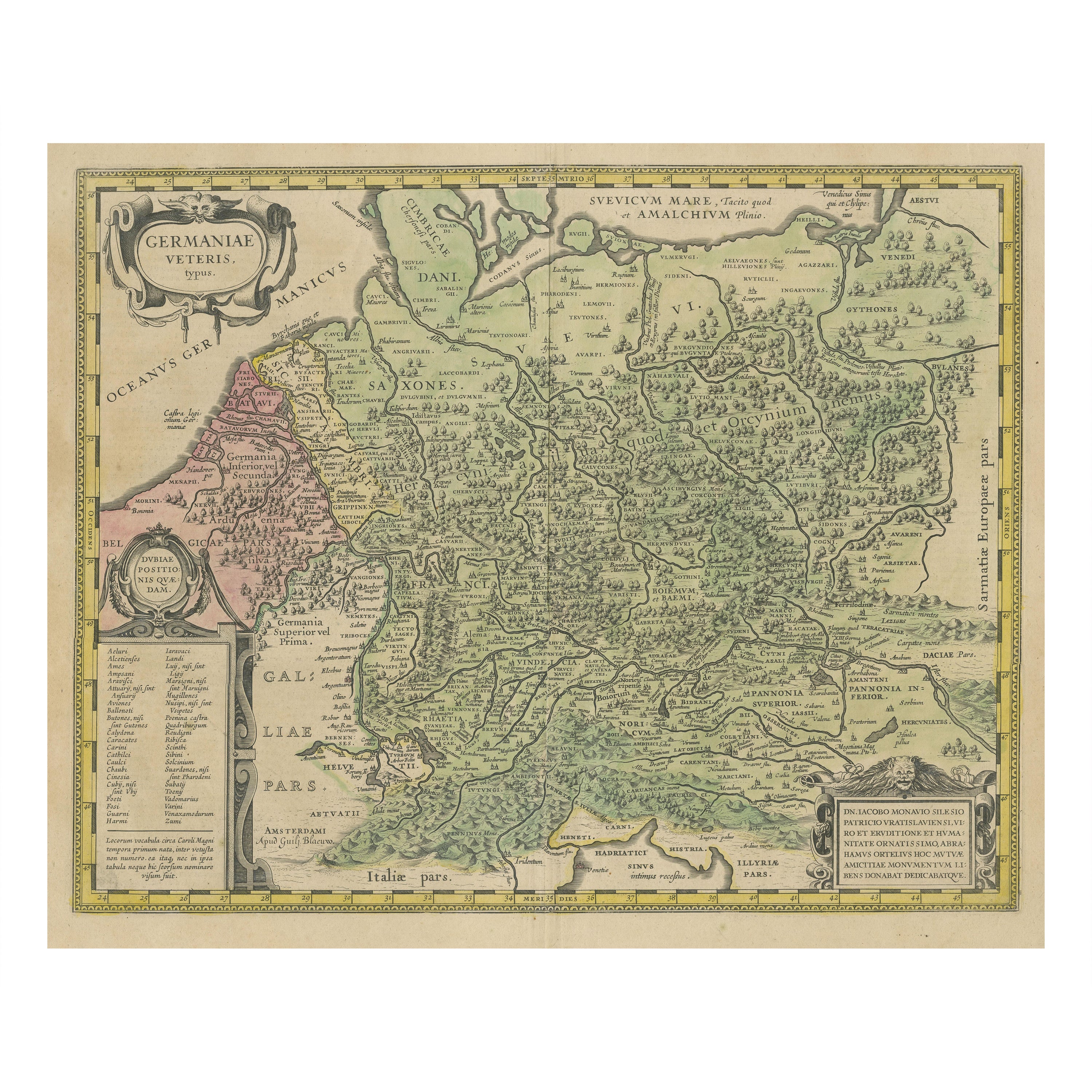
This map is titled "HISPANIA," indicating it is a historical map of ancient Spain.
It is an original antique map from the "Spruner-Menke Atlas Antiquus," a 19th-century historical atlas. The maker of the original atlas is Karl Spruner von Merz, with later editions edited by Theodorus Menke. This particular map showcases the Iberian Peninsula with its ancient Roman provincial divisions, topographical features, and possibly includes significant Roman roads, settlements, and cities. The atlas is known for its detailed and scholarly approach to historical cartography.
This map of "Hispania" is particularly interesting due to several factors:
1. **Historical Detail**: It represents the Iberian Peninsula during the period of Roman rule. The map outlines the provincial divisions used by the Romans, such as Hispania Baetica, Hispania Tarraconensis, and Lusitania.
2. **Geographical Accuracy**: The map includes detailed depictions of mountain ranges like the Pyrenees and the Sierra Nevada, river systems such as the Ebro (Iberus Fluvius) and the Tagus (Tagus Fluvius), and the intricate coastline, which would have been essential for maritime trade and military movements.
3. **Roman Infrastructure**: It shows the network of Roman roads that facilitated the Roman Empire's administrative control, commerce, and military logistics, which were crucial to integrating the diverse regions of the peninsula.
4. **Latin Labels**: The use of Latin for all place names and descriptions provides an authentic feel and reflects the scholarly rigor of the time.
5. **Inset Maps**: Insets like the "Baleares Insulae," representing the Balearic Islands, offer additional detail about significant locations under Roman control.
6. **Cultural Significance**: The Iberian Peninsula was a melting pot of cultures, including various Iberian tribes, Celts, Phoenicians, Carthaginians, and Romans, each leaving a rich historical legacy.
The period represented is not explicitly stated on the map, but based on the provincial divisions and the style of Roman road networks, it is likely to depict Hispania during the Roman Empire's Principate period, which spanned from 27 BC (when Octavian became Augustus Caesar) to the 3rd century AD. This was a time of consolidation and relative peace within the Roman Empire, known as the Pax Romana. The map would be of great interest to those studying Roman provincial administration, ancient geography, and the Romanization of the Iberian Peninsula.
- Dimensions:Height: 15.56 in (39.5 cm)Width: 18.51 in (47 cm)Depth: 0 in (0.02 mm)
- Materials and Techniques:
- Period:
- Date of Manufacture:1880
- Condition:Good, given age. General age-related toning, especially around the edges. Vertical folding line as issued. Please study scan carefully.
- Seller Location:Langweer, NL
- Reference Number:Seller: BG-13686-2-131stDibs: LU3054338540612
About the Seller
5.0
Platinum Seller
These expertly vetted sellers are 1stDibs' most experienced sellers and are rated highest by our customers.
Established in 2009
1stDibs seller since 2017
1,932 sales on 1stDibs
Typical response time: <1 hour
- ShippingRetrieving quote...Ships From: Langweer, Netherlands
- Return PolicyA return for this item may be initiated within 14 days of delivery.
Auctions on 1stDibs
Our timed auctions are an opportunity to bid on extraordinary design. We do not charge a Buyer's Premium and shipping is facilitated by 1stDibs and/or the seller. Plus, all auction purchases are covered by our comprehensive Buyer Protection. Learn More
More From This SellerView All
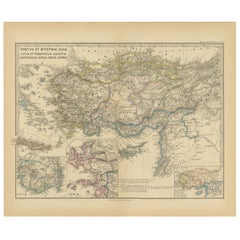
- Asia Minor and Provinces: A Roman Empire Map from Spruner-Menke Atlas, 1880Located in Langweer, NLThis authentic map of the 19th century, titled "PONTUS ET BITHYNIA, ASIA, LYCIA ET PAMPHYLIA, GALATIA, CAPPADOCIA, SYRIA, CRET, CYPRVS," details the regions of Asia Minor and surroun...Category
Antique 1880s Maps
MaterialsPaper
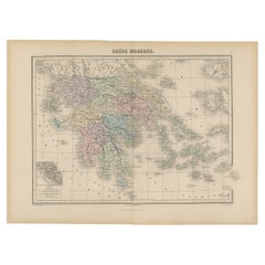
- Antique Map of Greece from an Old French School Atlas, 1880Located in Langweer, NLAntique map titled 'Grèce Moderne '. Old map of Greece and surroundings. This map originates from 'Géographie Universelle Atlas-Migeon' by J. Migeon. Artists and Engravers: Published...Category
Antique 19th Century Maps
MaterialsPaper
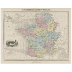
- Antique Map of France in Ancient Roman Times, 1880Located in Langweer, NLAntique map titled 'Gaule indépendante et Romaine'. Old map of Gaul or France in ancient Roman times. The map covers from the southern part of England (Britannia) to the north of S...Category
Antique 19th Century Maps
MaterialsPaper
- Antique Map of Asia from a German School Atlas, c.1870Located in Langweer, NLAntique map titled 'Asien'. Old map of the Asian continent. This map originates from 'H. Kiepert's Kleiner Atlas der Neueren Geographie für Schule und Haus'. Artists and Engravers:...Category
Antique 19th Century Maps
MaterialsPaper
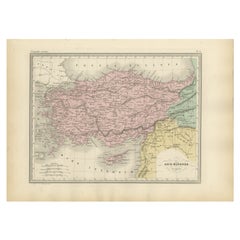
- Antique Map of Asia Minor Showing Turkey in Ancient Times, 1880Located in Langweer, NLMap Pl. 9: 'Asie Mineure.' This map shows Asia Minor / Turkey in ancient times. This original antique map originates from 'Atlas de la Geographie Universelle ou Description de toutes...Category
Antique 19th Century Maps
MaterialsPaper
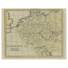
- Antique Map of Germany from an Old English Atlas, c.1802Located in Langweer, NLAntique map titled 'Germany'. Antique map of Germany engraved for 'Atlas to Walker's Geography'. Artists and Engravers: Engraved by W. Darton. Artist: Engraved by W. Darton. Co...Category
Antique 19th Century Maps
MaterialsPaper

You May Also Like
- Framed Mercator Hondius Hispania Nova Atlas Minor MapLocated in Stamford, CTFramed colored example of this decorative and important minature map. Newly framed in brown wood frame with gold trim. Mercator Hondius “Atlas Minor” pu...Category
Antique 17th Century Dutch Spanish Colonial Maps
MaterialsGlass, Wood, Paper
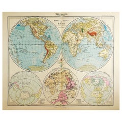
- 1900s Stielers Hand Atlas 100 MapsLocated in Seguin, TXStielers Hand Atlas, Gotha: Justus Perthes, Germany, circa 1905. Linen covered wood box containing 100 folded individual loose leaf maps of the world, text in german. Box made to loo...Category
Early 20th Century German Victorian Maps
MaterialsPaper
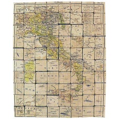
- Puzzle Atlas with Maps, Italy, circa 1900Located in Milan, IT80 little wooden cubes covered with printed paper that depending on which side they form the maps of Italy, Europe, North America, South America, Asia and Africa. Models for teaching...Category
Early 20th Century Italian Maps
MaterialsWood, Paper
- 1880s Map of The Italian Alps from Milan to Lake GardaLocated in Roma, ITGeographical Map of the Profile and Elevation of the Italian Alps from Milano to Lake Garda. The map features the name of each peak and key cities including Monza, Brescia and Bergam...Category
Antique 1880s Italian Maps
MaterialsParchment Paper
- The Windsor Style by Suzy Menkes (Book)Located in North Yorkshire, GBThe Windsor Style is the first book to look at the luxurious post-war life of the Duke and Duchess at home in their Paris mansion and at play at their converted mill-house in the Fre...Category
Mid-20th Century Books
MaterialsPaper

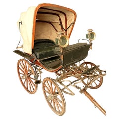
- Ancient original carriage from the 1800sLocated in Cesena, FCOriginal Italian carriage from around 1870-80. Four-wheeled carriage equipped with a large foldable canvas bellows, with a two-seat seat for passengers and fitted with a higher seat ...Category
Antique 1870s Italian Historical Memorabilia
MaterialsMetal