Items Similar to Original Hand-Colored Antique Map of Ancient Germany, circa 1630


Want more images or videos?
Request additional images or videos from the seller
1 of 6
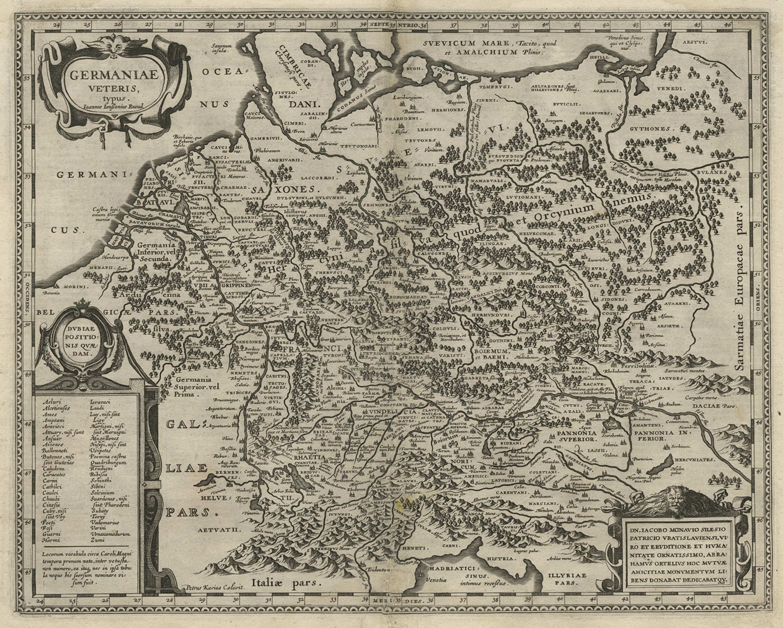
Original Hand-Colored Antique Map of Ancient Germany, circa 1630
About the Item
Antique map titled 'Germaniae Veteris typus'. Very attractive map of ancient Germany. Published by G. Blaeu after A. Ortelius, circa 1630.
Willem Janszoon Blaeu (1571-1638) was a prominent Dutch geographer and publisher. Born the son of a herring merchant, Blaeu chose not fish but mathematics and astronomy for his focus. He studied with the famous Danish astronomer Tycho Brahe, with whom he honed his instrument and globe making skills. Blaeu set up shop in Amsterdam, where he sold instruments and globes, published maps, and edited the works of intellectuals like Descartes and Hugo Grotius. In 1635, he released his atlas, Theatrum Orbis Terrarum, sive, Atlas novus.
- Dimensions:Height: 18.9 in (48 cm)Width: 21.5 in (54.6 cm)Depth: 0.02 in (0.5 mm)
- Materials and Techniques:
- Period:Mid-17th Century
- Date of Manufacture:c.1630
- Condition:Age-related toning. Original folding line with large split affecting image. Shows some wear and soiling. Few defects in margins. Dutch text on verso. Please study image carefully.
- Seller Location:Langweer, NL
- Reference Number:Seller: BG-13441-21stDibs: LU3054335886502
About the Seller
5.0
Platinum Seller
These expertly vetted sellers are 1stDibs' most experienced sellers and are rated highest by our customers.
Established in 2009
1stDibs seller since 2017
1,919 sales on 1stDibs
Typical response time: <1 hour
- ShippingRetrieving quote...Ships From: Langweer, Netherlands
- Return PolicyA return for this item may be initiated within 14 days of delivery.
Auctions on 1stDibs
Our timed auctions are an opportunity to bid on extraordinary design. We do not charge a Buyer's Premium and shipping is facilitated by 1stDibs and/or the seller. Plus, all auction purchases are covered by our comprehensive Buyer Protection. Learn More
More From This SellerView All
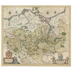
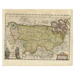
- Antique Hand-colored Map of Brandenburg, GermanyLocated in Langweer, NLAntique map titled 'Marchionatus Brandenburgicus'. Original antique map of Brandenburg, with Königsberg and Stettin, Germany. Published by J. Janssonius, circ 1650. Jan Janssonius ...Category
Antique Mid-17th Century Maps
MaterialsPaper
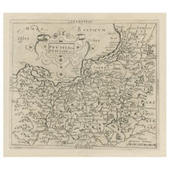
- Original Antique Map of Prussia, ca.1630Located in Langweer, NLAntique map titled 'Prussia - Preussen'. Original map of Prussia, a historically prominent German state that originated in 1525 with a duchy centered on...Category
Antique 1630s Maps
MaterialsPaper
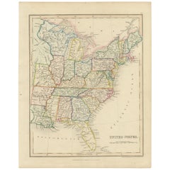
- Original Antique Hand-colored Map of the United States, circa 1845Located in Langweer, NLAntique map titled 'United States'. Old map of the United States, includes the last part of the North West Territory (present day Wisconsin and part of Minnesota). It also marks Ft. Crawford at the confluence of the Mississippi River and the Ouisconsin River (present day Wisconsin River). Published by Orr & Company; Amen Corner...Category
Antique Mid-19th Century Maps
MaterialsPaper
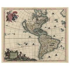
- Original Hand-Colored Antique Map of America by Danckerts, circa 1680Located in Langweer, NLAntique map titled 'Novissima et Accuratissima Totius Americae Descriptio per I. Danckerts'. Striking map of America. California is shown as an island, Based Upon Sanson's model. The Great Lakes are shown with an open western coastline. No Northwestern Coast beyond 40 degrees. The seven cities of Cibola appear in the Southwestern US. The conception of the Mississippi River is still very vague and pushed far west of its true mouth. The large lake in the Southeastern US first seen on Le Moyne's map is still present. South America retains its excessively wide format. A hopeful extension from Button's Bay is shown portending a possible Northwest Passage. The map is richly embellished with two cartouches, 9 sailing vessels and elaborate vignettes of native villages, native warriors...Category
Antique Late 17th Century Maps
MaterialsPaper
- Antique Map of Flanders, Belgium, 1630Located in Langweer, NLAntique map titled 'Comitatus Flandria'. Original antique map of Flanders, Belgium. This map originates from 'Vyerige Colom verthonende de 17 Nederlandsche Provintien' published 1630...Category
Antique 17th Century Maps
MaterialsPaper
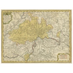
- Original Hand-Colored Antique Regional Map of Switzerland, 1753Located in Langweer, NLAntique map Switzerland titled 'Territorium Reipublicae liberae Helveticae Scaphusiensis (..)'. Regional map of Switzerland. Artists and En...Category
Antique 1750s Maps
MaterialsPaper
You May Also Like
- Antique 1630 Colored Belgium Map Flandria Gallica Flanders Henricus HondiusLocated in Dayton, OH"Antique hand colored map of Flanders, Belgium, circa 1630, engraved by Henricus Hondius. “Henricus Hondius II (1597 – 16 August 1651) was a Dutch eng...Category
Antique Early 17th Century Renaissance Maps
MaterialsPaper
- Antique Hand Colored Framed Map of EuropeLocated in West Palm Beach, FLAntique reproduction copied from an edition dated 1595 by Ortelius.Category
Antique Late 19th Century Maps
- 1864 Map of North America, Antique Hand-Colored Map, by Adolphe Hippolyte DufourLocated in Colorado Springs, COOffered is a map of North America entitled Amerique du Nord from 1864. This rare, separately published wall map was produced by Adolphe Hippolyte Dufour. This map includes vibrant an...Category
Antique 1860s French Maps
MaterialsPaper
- 17th Century Hand-Colored Map of a Region in West Germany by JanssoniusBy Johannes JanssoniusLocated in Alamo, CAThis attractive highly detailed 17th century original hand-colored map is entitled "Archiepiscopatus Maghdeburgensis et Anhaltinus Ducatus cum terris adjacentibus". It was published ...Category
Antique Mid-17th Century Dutch Maps
MaterialsPaper
- 18th Century Hand-Colored Homann Map of Germany, Including Frankfurt and BerlinBy Johann Baptist HomannLocated in Alamo, CAAn 18th century hand-colored map entitled "Tabula Marchionatus Brandenburgici et Ducatus Pomeraniae quae sunt Pars Septentrionalis Circuli Saxoniae Superioris" by Johann Baptist Homa...Category
Antique Early 18th Century German Maps
MaterialsPaper
- Staffordshire 1645 Hand Colored Antique Print Staffordiensis Comitatvs MapLocated in GBWe are delighted to offer for sale this lovely antique Atlas page map of Staffordshire printed in 1645 Amsterdam Staffordiensis Comitatvs Vulgo This o...Category
Antique Early 1800s English Georgian Maps
MaterialsPaper


Recently Viewed
View AllMore Ways To Browse
Maps Of Sea
Pakistan Antique Map
Johannes Janssonius On Sale
Bolivia Antique Map
Albania Map
Wyld Globes
Ecuador Antique Map
Stock Charts
Antique Arkansas Maps
Antique Barbie Furniture
Carte Egypte Antique
La Syrie Antique
Antique Map Of Puerto Rico
Map Of Wyoming
Antique Citroen
Staffordshire Antique Map
Staffordshire Map
Nicolas De Fer