Items Similar to Antique Hand-colored Map of Brandenburg, Germany


Want more images or videos?
Request additional images or videos from the seller
1 of 6
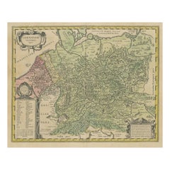
Antique Hand-colored Map of Brandenburg, Germany
About the Item
Antique map titled 'Marchionatus Brandenburgicus'. Original antique map of Brandenburg, with Königsberg and Stettin, Germany. Published by J. Janssonius, circ 1650.
Jan Janssonius (also known as Johann or Jan Jansson or Janszoon) (1588-1664) was a renowned geographer and publisher of the seventeenth century, when the Dutch dominated map publishing in Europe. Born in Arnhem, Jan was first exposed to the trade via his father, who was also a bookseller and publisher. In 1612, Jan married the daughter of Jodocus Hondius, who was also a prominent mapmaker and seller. Jonssonius’ first maps date from 1616.
In the 1630s, Janssonius worked with his brother-in-law, Henricus Hondius. Their most successful venture was to reissue the Mercator-Hondius atlas. Jodocus Hondius had acquired the plates to the Mercator atlas, first published in 1595, and added 36 additional maps. After Hondius died in 1612, Henricus took over publication; Janssonius joined the venture in 1633. Eventually, the atlas was renamed the Atlas Novus and then the Atlas Major, by which time it had expanded to eleven volumes. Janssonius is also well known for his volume of English county maps, published in 1646.
Janssonius died in Amsterdam in 1664. His son-in-law, Johannes van Waesbergen, took over his business. Eventually, many of Janssonius’ plates were sold to Gerard Valck and Pieter Schenk, who added their names and continued to reissue the maps.
- Dimensions:Height: 19.97 in (50.7 cm)Width: 23.51 in (59.7 cm)Depth: 0.02 in (0.5 mm)
- Materials and Techniques:
- Period:Mid-17th Century
- Date of Manufacture:c.1650
- Condition:Repaired: The map shows some very professional repairs including a large vertical repair running near the compass rose top right. Also a few small repairs in margins and an extended lower margin. General age-related toning. Dutch text on verso.
- Seller Location:Langweer, NL
- Reference Number:
About the Seller
5.0
Platinum Seller
These expertly vetted sellers are 1stDibs' most experienced sellers and are rated highest by our customers.
Established in 2009
1stDibs seller since 2017
1,919 sales on 1stDibs
Typical response time: <1 hour
- ShippingRetrieving quote...Ships From: Langweer, Netherlands
- Return PolicyA return for this item may be initiated within 14 days of delivery.
More From This SellerView All
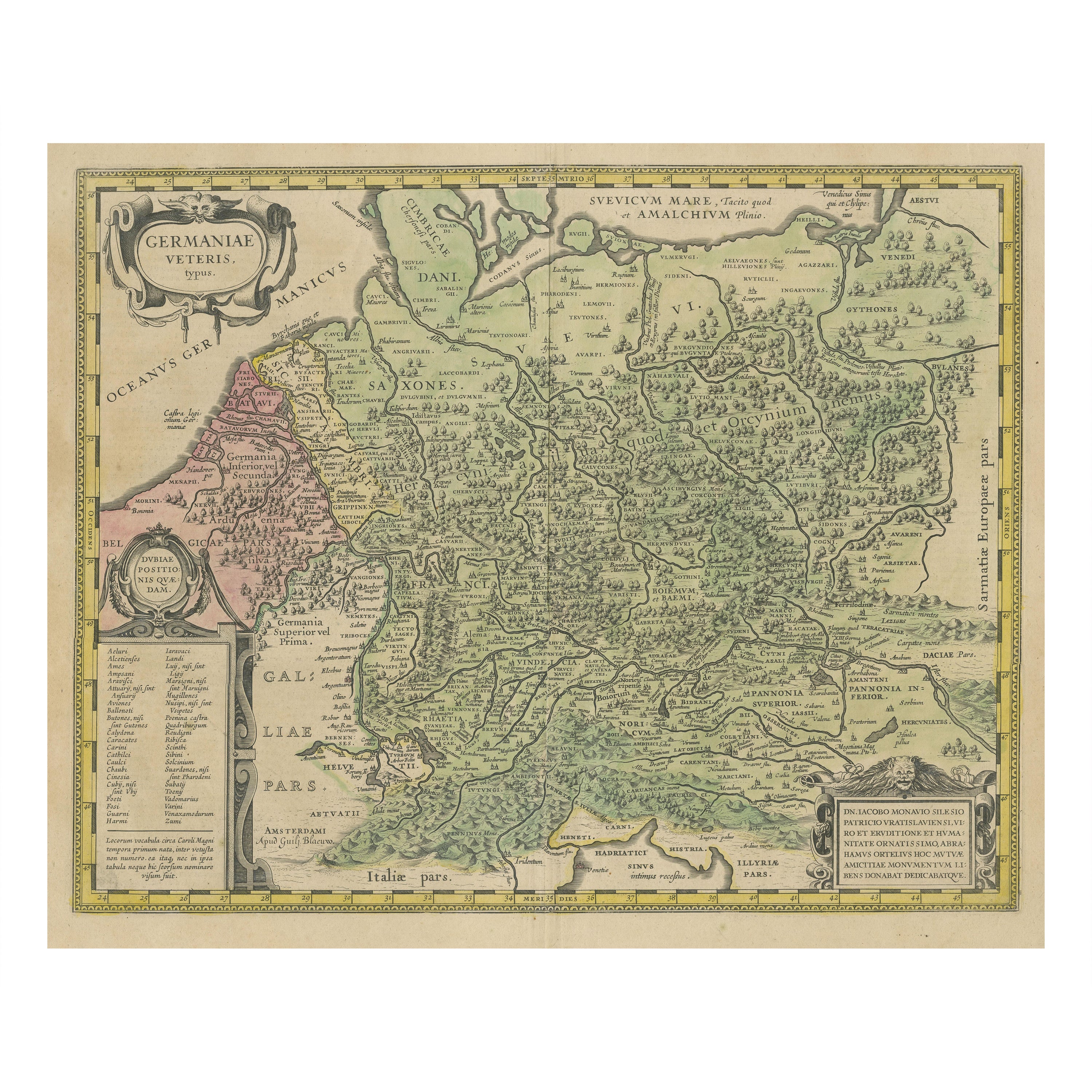
- Original Hand-Colored Antique Map of Ancient Germany, circa 1630Located in Langweer, NLAntique map titled 'Germaniae Veteris typus'. Very attractive map of ancient Germany. Published by G. Blaeu after A. Ortelius, circa 1630. Willem Jans...Category
Antique Mid-17th Century Maps
MaterialsPaper
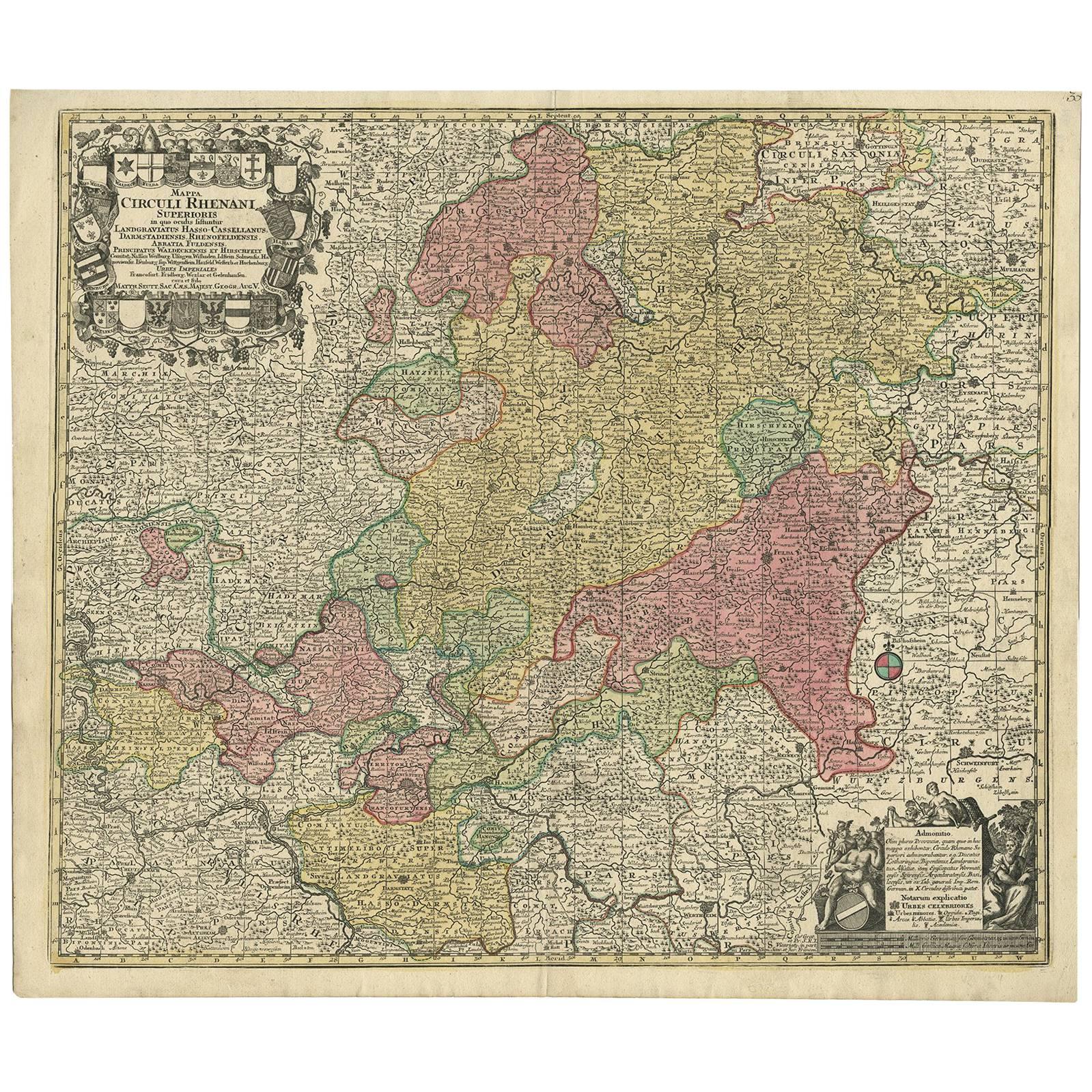
- Hand-Colored Antique Map of part of Germany by M. Seutter, c. 1730By Matthew SeutterLocated in Langweer, NLAntique map titled 'Mappa Circuli Rhenani Superioris (..). Original map with hand coloring of part of Germany. It includes the region of Kassel, Göttingen, Eisenach, Schweinfurt, Wer...Category
Antique Mid-18th Century Maps
MaterialsPaper
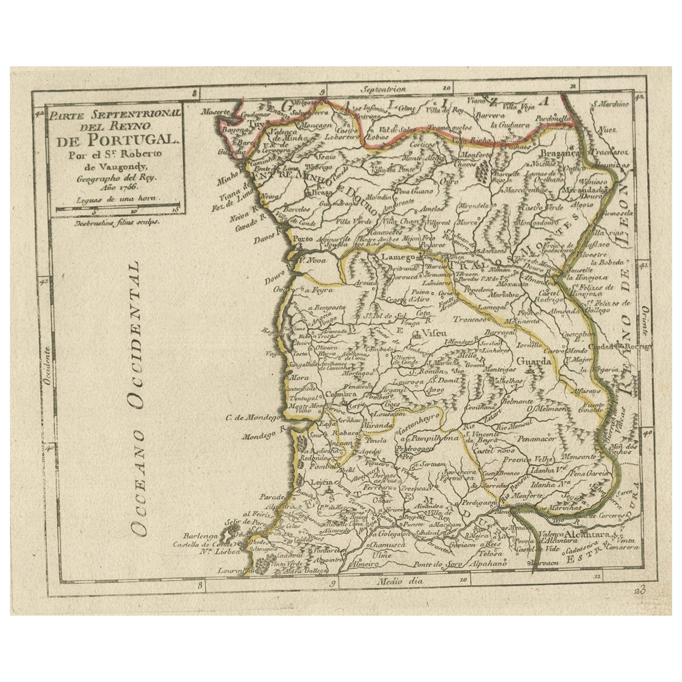
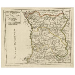
- Antique Hand-Colored Map of Northern Portugal, 1756Located in Langweer, NLAntique map Portugal titled 'Parte Sepentrional del Reyno de Portugal'. Antique map of Northern Portugal. This map originates from 'Atlas Port...Category
Antique 1750s Maps
MaterialsPaper
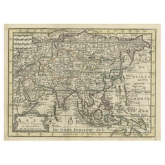
- Rare Hand-Colored Antique Map of Asia, 1788Located in Langweer, NLAntique map titled 'Kaartje van Asia'. Original antique map of Asia. This map originates from 'Nieuwe Natuur- Geschied- en Handelkundige Zak- en Reisatlas' by N.T. Gravius, 1788....Category
Antique 1780s Maps
MaterialsPaper
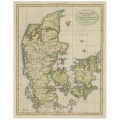
- Antique Hand-Colored Engraved Map of Denmark, 1790Located in Langweer, NLPublished by Russell (J. C.). Denmark. Divided into Dioceses and Prefectures compiled from the best Authorities, 1790, hand-coloured engraved map on handmade paper with watermark. 41...Category
Antique 1790s Maps
MaterialsPaper
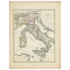
- Antique Map of Italy with Hand-Colored Borders, 1852Located in Langweer, NLAntique map titled 'Italië'. Map of Italy. This map originates from 'School-Atlas van alle deelen der Aarde' by Otto Petri. Artists and Engravers: Published by A. Baedeker (Otto Petr...Category
Antique 19th Century Maps
MaterialsPaper
You May Also Like
- Antique Hand Colored Framed Map of EuropeLocated in West Palm Beach, FLAntique reproduction copied from an edition dated 1595 by Ortelius.Category
Antique Late 19th Century Maps
- 1864 Map of North America, Antique Hand-Colored Map, by Adolphe Hippolyte DufourLocated in Colorado Springs, COOffered is a map of North America entitled Amerique du Nord from 1864. This rare, separately published wall map was produced by Adolphe Hippolyte Dufour. This map includes vibrant an...Category
Antique 1860s French Maps
MaterialsPaper
- 17th Century Hand-Colored Map of a Region in West Germany by JanssoniusBy Johannes JanssoniusLocated in Alamo, CAThis attractive highly detailed 17th century original hand-colored map is entitled "Archiepiscopatus Maghdeburgensis et Anhaltinus Ducatus cum terris adjacentibus". It was published ...Category
Antique Mid-17th Century Dutch Maps
MaterialsPaper
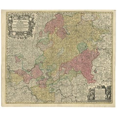
- 18th Century Hand-Colored Homann Map of Germany, Including Frankfurt and BerlinBy Johann Baptist HomannLocated in Alamo, CAAn 18th century hand-colored map entitled "Tabula Marchionatus Brandenburgici et Ducatus Pomeraniae quae sunt Pars Septentrionalis Circuli Saxoniae Superioris" by Johann Baptist Homa...Category
Antique Early 18th Century German Maps
MaterialsPaper
- Staffordshire 1645 Hand Colored Antique Print Staffordiensis Comitatvs MapLocated in GBWe are delighted to offer for sale this lovely antique Atlas page map of Staffordshire printed in 1645 Amsterdam Staffordiensis Comitatvs Vulgo This o...Category
Antique Early 1800s English Georgian Maps
MaterialsPaper
- Germany West of the Rhine: A Hand-colored 18th Century Map by de WitBy Frederick de WitLocated in Alamo, CAThis original 18th century hand-colored map of the county of Moers, Germany entitled "Illustrissimo Celsissmo Principi GUILIELMO HENRICO D.G. Arausionum Principi Domino suo Clementis...Category
Antique Early 18th Century Dutch Maps
MaterialsPaper


Recently Viewed
View AllMore Ways To Browse
Antique Map Of Sri Lanka
Globes Antique Terrestre
Antique Map New Orleans
Antique Maps Of New Orleans
Antique Maps Yorkshire
Shetland Map
Antique Map Iceland
Antique Map Of Iceland
Iraq Map
Taiwan Antique Map
Antique Illinois Map
Cuban Map
Map Of Cuba
Vietnam Map
Kansas Map
Map Of Puerto Rico
Nova Scotia Map
Bahamas Map