
Antique Map New Orleans

1863 "Lloyd's New Map of the United States, the Canadas, and New Brunswick"
Located in Colorado Springs, CO
Presented is “Lloyd's New Map of the United States, the Canadas and New Brunswick, From the latest
Category

1860s American Antique Map New Orleans

Materials

Linen, Wood, Paper

Original Steel Engraved Map of French Colonies in America, 1854
Located in Langweer, NL
remained strong in the region, particularly in New Orleans and surrounding areas. 4. **Québec**: This
Category

Mid-19th Century Antique Map New Orleans

Materials

Paper

Antique Original Steel Engraved Map of French Colonies in America, 1854
Original Steel Engraved Map of French Colonies in America, 1854
Free Shipping
H 13.12 in W 18.71 in D 0.02 in
Louisiana: A Framed 19th Century Map by O. W. Gray
By Gray and Co
Located in Alamo, CA
Mexico and towns and cities, such as New Orleans, Baton Rouge and Lafayette. Ormando Wyllis (O.W.) Gray
Category

Mid-19th Century American Other Antique Map New Orleans

Materials

Paper

1899 Poole Brothers Antique Railroad Map of the Illinois Central Railroad
Located in Colorado Springs, CO
lead to the creation of the Louisville, New Orleans, and Texas Railway. This map was first produced by
Category

1890s American Antique Map New Orleans

Materials

Paper

1842 Wall Map of the United States by J. H. Young, Published by S. A. Mitchell
Located in Colorado Springs, CO
city map insets of the vicinities around Boston, New York, Philadelphia, Baltimore and Washington
Category

1840s American Antique Map New Orleans

Materials

Paper

Plan de la Nouvelle Orléans - Original Lithograph - 1880
Located in Roma, IT
toponomastic map of the city of New Orleans, theatre of the Battle of Liberty Place, or Battle of Canal Street
Category

1880s Modern Antique Map New Orleans

Materials

Lithograph

Louisiana. USA Century Atlas state antique vintage map
Located in Melbourne, Victoria
'The Century Atlas. Louisiana' Inset map of 'New Orleans and Vicinity'. Original antique map, 1903
Category

Early 20th Century Victorian Antique Map New Orleans

Materials

Lithograph

Louisiana: A Framed 19th Century Map by O.W. Gray
Located in Alamo, CA
Mexico and towns and cities, such as New Orleans, Baton Rouge and Lafayette. Ormando Wyllis (O.W.) Gray
Category

1870s Antique Map New Orleans

Materials

Engraving

19th Century Animalier Bronze entitled "Panthere de l’Inde" by Antoine L Barye
By Antoine-Louis Barye
Located in London, GB
the army’s topographic brigade where he used clay to model raised relief maps. When the empire fell
Category

Mid-19th Century French Art Nouveau Antique Map New Orleans

Materials

Bronze

19th Century Animalier Bronze Study entitled "Jaguar Debout" by Antoine L Barye
By Antoine-Louis Barye
Located in London, GB
the army’s topographic brigade where he used clay to model raised relief maps. When the empire fell
Category

Late 19th Century French Art Nouveau Antique Map New Orleans

Materials

Bronze

Animalier Bronze Sculpture "Theseus & The Centaur" by Antoine L Barye
By Antoine-Louis Barye
Located in London, GB
army’s topographic brigade where he used clay to model raised relief maps. When the empire fell, Barye
Category

Mid-19th Century French Art Nouveau Antique Map New Orleans

Materials

Bronze

19th Century Animalier Bronze Sculpture "Group de Lapins" by Antoine L Barye
By Antoine-Louis Barye
Located in London, GB
the army’s topographic brigade where he used clay to model raised relief maps. When the empire fell
Category

Mid-19th Century French Art Nouveau Antique Map New Orleans

Materials

Bronze

French Late 19th Century Animalier Bronze "Tortue" by Antoine L Barye
By Antoine-Louis Barye
Located in London, GB
the army’s topographic brigade where he used clay to model raised relief maps. When the empire fell
Category

Mid-19th Century French Art Nouveau Antique Map New Orleans

Materials

Bronze

19th Century Art Nouveau Bronze "Panthère de L'Inde No.1" by Antoine L Barye
By Antoine-Louis Barye
Located in London, GB
brigade where he used clay to model raised relief maps. When the empire fell, Barye briefly studied with
Category

Mid-19th Century French Art Nouveau Antique Map New Orleans

Materials

Bronze

19th Century French Animalier "Guerrier du Caucase" by Antoine L Barye
By Antoine-Louis Barye
Located in London, GB
army’s topographic brigade where he used clay to model raised relief maps. When the empire fell, Barye
Category

19th Century French Art Nouveau Antique Map New Orleans

Materials

Bronze

Mid-19th Century French Bronze Entitled "Deux Chiens en Arret" by A L Barye
By Antoine-Louis Barye
Located in London, GB
relief maps. When the empire fell, Barye briefly studied with the sculptor François-Joseph Bosio, then
Category

Mid-19th Century French Art Nouveau Antique Map New Orleans

Materials

Bronze

"Cerf Qui Marche" by A L Barye
By Antoine-Louis Barye
Located in London, GB
seventeen, he joined the army’s topographic brigade where he used clay to model raised relief maps. When the
Category

Mid-19th Century French Art Nouveau Antique Map New Orleans

Materials

Bronze

"Cerf Qui Marche" by A L Barye
H 7.49 in W 8.67 in D 0 in
19th Century Bronze entitled "Famille de Cerf" by Antoine Barye
By Antoine-Louis Barye
Located in London, GB
seventeen, he joined the army’s topographic brigade where he used clay to model raised relief maps. When the
Category

Late 19th Century French Art Nouveau Antique Map New Orleans

Materials

Bronze

People Also Browsed

"Boy on Carousel" large oil painting
By Helen Rayburn Caswell
Located in San Francisco, CA
This artwork "Boy on Carousel" c.1970 is an oil painting on canvas by noted California artist, Helen Rayburn Caswell, 1923-2018. It is signed at the right bottom corner by the artist...
Category

Late 20th Century American Impressionist Antique Map New Orleans

Materials

Oil

Henri Matisse (After) - Lithograph - Woman with Flowers in Her Hair
By (after) Henri Matisse
Located in Collonge Bellerive, Geneve, CH
after Henri MATISSE (1869-1954) Lithograph Signed in the plate Vélin Paper Dimensions: 32 x 24 cm (12 x 9") This lithograph is one of a rare edition made during the Second World War ...
Category

1940s Modern Antique Map New Orleans

Materials

Lithograph

English 18th Century Oak Dresser Base with 6 Drawers & 2 Cabinet Doors
Located in Atlanta, GA
Street 48 Society St. 300 W 14th St. Ste. 202 374 Broome St. Apt. 3N 3325B Sacramento St. Ste. 200 4310 Abbott Ave. 2171 Kingston Ct. Ste. A 3003 Larimer St. 2206 Pearl St. 44 River ...
Category

18th Century English Antique Map New Orleans

Materials

Oak

English Pocket Globe, London, Circa 1775-1798
By Herman Moll
Located in Milano, IT
Pocket globe London, between 1775 and 1798 Re-edition of the globe of Hermann Moll (1678-1732) dated 1719 The globe is contained in its original case, which itself is covered in sh...
Category

Late 18th Century English George III Antique Map New Orleans

Materials

Shagreen, Paper

Aesthetics Movement Antique Faux Bamboo Stool
Located in Norwood, NJ
English Aesthetics movement faux bamboo gilt stool. Finest quality spoke and ship wheel or wagon wheel aesthetic design.
Category

Late 19th Century English Aesthetic Movement Antique Map New Orleans

Materials

Upholstery, Wood

Life of Napoleon Bonaparte by William Milligan Sloan, in Four Volumes, 1896
Located in Colorado Springs, CO
Sloane, William Milligan. The Life of Napoleon Bonaparte. New York: Century Co, 1896. Four volume quarto set. Handsomely bound in half red Moroccan leather and cloth boards, spines r...
Category

1890s American Antique Map New Orleans

Materials

Paper

Ulysses S. Grant Signed Presidential Appointment, Dated February 28, 1871
By Ulysses S. Grant
Located in Colorado Springs, CO
Presented is an original Ulysses S. Grant signed Presidential Appointment, dating to February 28, 1871. Signed during the first term of Grant's presidency, the document appoints "Rob...
Category

1870s American Antique Map New Orleans

Materials

Paper

Miniature Terrestrial Globe Newton & Son London, Post 1833, Ante 1858
By Newton and Son
Located in Milano, IT
Miniature Terrestrial Globe Newton & Son London, post 1833, ante 1858 Paper, papier-mâché, bronze and wood It measures: sphere diameter 2.95 in (7.6 cm); diameter of the wooden b...
Category

1840s English Early Victorian Antique Map New Orleans

Materials

Bronze

Antique Map of North and East Asia, 1751
Located in Langweer, NL
Map 2: 'Carte des parties nord et est de L'Asie'. (Map of the Northern parts and East Asia.) Five maps on one sheet, showing California, Alaska and Siberia, Korea and Japan. South to...
Category

18th Century Antique Map New Orleans

Materials

Paper

Antique Map of North and East Asia, 1751
H 18.35 in W 14.97 in D 0 in
Smith Rock
By Nancy Merkle
Located in San Francisco, CA

Artist Comments
Smith Rock is a nationally known rock climbing destination in the high desert of Central Oregon, a hub of outdoor recreation. As I walked the trail that circ...

Category

21st Century and Contemporary Abstract Impressionist Antique Map New Orleans

Materials

Acrylic

Smith Rock
Smith Rock
H 20 in W 20 in D 0.75 in
Dreaming Away - Highly Textured Dream-like Painting with Surreal Nautical Theme
By Victor Wang
Located in Chicago, IL
Victor Wang's subject is a female seemingly caught in a contemplative moment yet a war rages behind her. She dons a hat shaped as a boat and carries and oar as if to "Dream Away" th...
Category

21st Century and Contemporary Contemporary Antique Map New Orleans

Materials

Canvas, Mixed Media, Oil

Ruins of Central City, Vintage 1935 Framed Colorado Modernist Landscape
By Vance Kirkland
Located in Denver, CO
Vintage lithograph titled "Ruins of Central City 31/70" is a modernist landscape with decaying buildings and mountains by Vance Hall Kirkland, from 1935. Presented in a custom black ...
Category

1930s American Modern Antique Map New Orleans

Materials

Paper, Lithograph

Encounter at Lituya Bay: French Explorers Among the Tlingit, 1786
Located in Langweer, NL
The uploaded authentic engraving for sale portrays a scene of interaction between European explorers and indigenous peoples, identified by the caption as occurring at "Port des Franç...
Category

Late 18th Century Antique Map New Orleans

Materials

Paper

17th Century Portuguese Tile Panel
By Europa Antiques
Located in Madrid, ES
17th century Portuguese Tile Panel Restored Measures: 56cm x 56cm 14cm x 14cm tiles With certificate of authenticity and export issued by the Directorate General of Portuguese Cultu...
Category

17th Century Portuguese Baroque Antique Map New Orleans

Materials

Porcelain

17th Century Portuguese Tile Panel
H 22.05 in W 22.05 in D 3.15 in
1859 "Map of the United States of America..." by J. H. Colton
By J.H. Colton
Located in Colorado Springs, CO
Presented is an 1859 “Map of the United States of America, the British Provinces, Mexico, the West Indies and Central America with Part of New Granada and Venezuela” by John Hutchins...
Category

1850s American Antique Map New Orleans

Materials

Paper

18th Century George III Mahogany Tripod Table, Circa 1770
By Thomas Chippendale
Located in Oxfordshire, United Kingdom
18th Century George III Cuban Mahogany Chippendale Period Tripod Table, Circa 1770. England. The circular one piece top is raised on a turned baluster centre column and cabriole l...
Category

18th Century English George III Antique Map New Orleans

Materials

Mahogany

Recent Sales

1762 Map of North America
By Thomas Kitchin
Located in New York, NY
", the Grand Banks and more. The insert shows a chart Mississippi River from New Orleans to the Gulf of
Category

1760s Realist Antique Map New Orleans

Materials

Engraving

Painting of a Cotton Picker by William Aiken Walker
By William Aiken Walker
Located in Alexandria, VA
split his residence between Charleston and Baltimore. However, on a visit to New Orleans in that year
Category

1870s American Antique Map New Orleans

Materials

Composition

Pair of Topographical Portraits of the Pavillion and Village of Vaux-Sur-Seine
Located in London, Middlesex
would appear to have been set further back from the new house and with a fountain in front. The whole
Category

Early 18th Century French Louis XIV Antique Map New Orleans

Materials

Canvas

1846 "Traveller's Guide and Map of the United States" Antique Wall Map by Ensign
Located in Colorado Springs, CO
the vicinities of New York City, Philadelphia, Boston, Baltimore, New Orleans, Mobile, Cincinnati, St
Category

1840s American Antique Map New Orleans

Materials

Paper

1845 United States Hanging Wall Map by T & E. H. Ensign
Located in Colorado Springs, CO
the vicinities of New York City, Philadelphia, Boston, Baltimore, New Orleans, Mobile, Cincinnati, St
Category

1840s American Antique Map New Orleans

Materials

Paper

"Southern Gentleman" Unusal White Subject. Known for his African American
By William Aiken Walker
Located in San Antonio, TX
preparing maps for the Confederacy. From 1876 to 1905, Walker regarded New Orleans as his home. There he
Category

1870s Realist Antique Map New Orleans

Materials

Oil

1864s Paravia Milano Antique Rare Physical and Political Terrestrial Globe
Located in Milan, IT
territorial map, the globe shows the routes of famous navigators: The first voyage of Christopher Columbus
Category

1860s Antique Map New Orleans

Materials

Paper

Original Antique City Plan of New Orleans, USA, 1894
By Rand McNally & Co.
Located in St Annes, Lancashire
Fabulous colorful map of New Orleans Original color By Rand, McNally & Co. Published, 1894
Category

1890s American Antique Map New Orleans

Materials

Paper

Original Antique City Plan of New Orleans, USA, 1894
1 bid
No Reserve
H 20.5 in W 13.25 in D 0.07 in
Original Antique City Plan of New Orleans, USA, circa 1900
By Rand McNally & Co.
Located in St Annes, Lancashire
Fabulous colorful map of New Orleans Original color By Rand, McNally & Co. Published
Category

Early 1900s American Antique Map New Orleans

Materials

Paper

Original Antique City Plan of New Orleans, USA, circa 1900
Free Shipping
H 20.5 in W 14 in D 0.07 in
Antique Map of the Southern Pacific Railroad, circa 1880
Located in Langweer, NL
Francisco to San Diego. By 1883, the line extended all the way to New Orleans. This map was published as a
Category

Late 19th Century Antique Map New Orleans

Materials

Paper

Framed 19th Century Colton Map of Mexico, Texas, California and US Territories
By J.H. Colton
Located in Alamo, CA
in New York in 1855 in his General Atlas of the World on page No. 54 in volume 1. The map includes
Category

Mid-19th Century American Other Antique Map New Orleans

Materials

Paper

American Cities Maps - Black and White Etching on Paper - 1835
Located in Roma, IT
, Charleston and vicinity, Savannah and vicinity, New Orleans and vicinity, Saint Louis and vicinity
Category

1830s Antique Map New Orleans

Materials

Etching

Antoine-Louis Barye Bronze Elephant Du Senegal
By Antoine-Louis Barye
Located in Dallas, TX
used clay to model raised relief maps. When the Empire fell, Barye briefly studied with the sculptor
Category

1890s French Beaux Arts Antique Map New Orleans

Materials

Bronze

Late 19th Century French Animalier bronze entitled "Cerf La Jambe Levée" byBarye
By Antoine-Louis Barye
Located in London, GB
used clay to model raised relief maps. When the empire fell, Barye briefly studied with the sculptor
Category

Late 19th Century French French Provincial Antique Map New Orleans

Materials

Bronze

“Lion au Serpent” Important Animalier Bronze by Antoine L Barye, circa 1860
By Antoine-Louis Barye
Located in London, GB
relief maps. When the empire fell, Barye briefly studied with the sculptor François-Joseph Bosio, then
Category

Mid-19th Century French Art Nouveau Antique Map New Orleans

Materials

Bronze

After Henri Matisse - Blue Nude
By (after) Henri Matisse
Located in Collonge Bellerive, Geneve, CH
times. The coming of the railway had put Bohain on the industrial map, but people still traveled
Category

1920s Abstract Impressionist Antique Map New Orleans

Materials

Lithograph

Henri Matisse - The Saint Michel Bridge - Original Etching
By Henri Matisse
Located in Collonge Bellerive, Geneve, CH
on the industrial map, but people still traveled everywhere on foot or horseback. Matisse’s father
Category

1920s Modern Antique Map New Orleans

Materials

Etching

Vegetables
By (after) Henri Matisse
Located in Collonge Bellerive, Geneve, CH
on the industrial map, but people still traveled everywhere on foot or horseback. Matisse’s father
Category

1920s Modern Antique Map New Orleans

Materials

Lithograph

Vegetables
Vegetables
H 31.5 in W 23.63 in D 0.04 in
Antique Map of the Southern United States with Inset Map of New Orleans
Located in Langweer, NL
Antique map titled 'Die Staaten von Arkansas Mississippi, Louisiana & Alabama'. Detailed map of the
Category

Mid-19th Century Antique Map New Orleans

Materials

Paper

1762 Map of North America
By Thomas Kitchin
Located in New York, NY
", the Grand Banks and more. The insert shows a chart Mississippi River from New Orleans to the Gulf of
Category

1760s Realist Antique Map New Orleans

Materials

Engraving

Get Updated with New Arrivals
Save "Antique Map New Orleans", and we’ll notify you when there are new listings in this category.

Antique Map New Orleans For Sale on 1stDibs

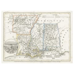
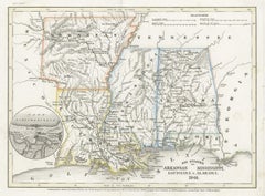
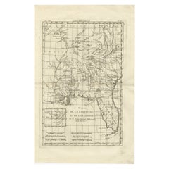
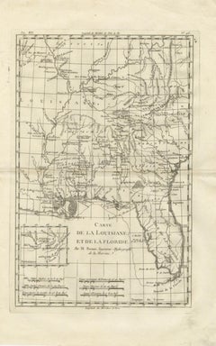
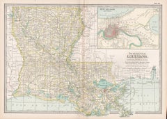
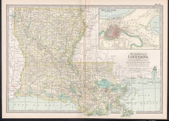
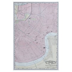
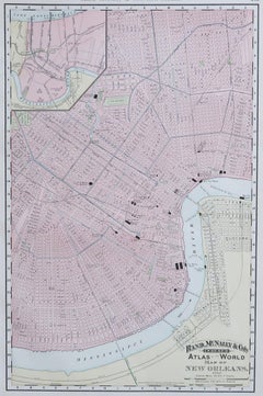
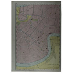
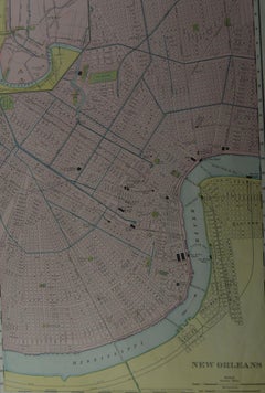
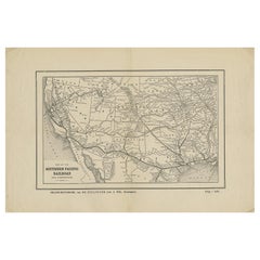
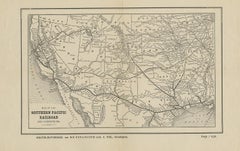
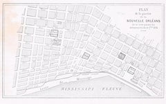
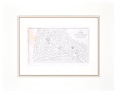
There is a range of antique map new orleans for sale on 1stDibs. Each of these unique antique map new orleans was constructed with extraordinary care, often using paper, bronze and metal. Antique map new orleans have been made for many years, and versions that date back to the 18th Century alongside those produced as recently as the 20th Century. Art Nouveau antique map new orleans are consistently popular styles. There have been many well-made antique map new orleans over the years, but those made by Antoine-Louis Barye, Gray and Co and Rand McNally & Co. are often thought to be among the most beautiful.

How Much are Antique Map New Orleans?

Prices for antique map new orleans can differ depending upon size, time period and other attributes — at 1stDibs, antique map new orleans begin at $85 and can go as high as $9,800, while the average can fetch as much as $1,500.