
Vintage Atlas Maps

2
to
7
26
20
102
85
15
11
11
6
5
4
4
4
3
3
3
2
2
2
2
2
1
1
1
1
1
5
3
1
1
1
Sort By
Vintage Map of the Greater Antilles and Lesser Antilles
Located in Langweer, NL
Vintage map titled 'Antilles'. Original map of the Antilles. Shows the Cayman Islands, Cuba
Category

20th Century Maps

Materials

Paper

Vintage Reproduction 17th Century Map of Europe, American, Cartography, Blaeuw
Located in Hele, Devon, GB
This is a vintage reproduction map of Europe. An American, paper stock cartography print in frame
Category

Late 20th Century Central American Mid-Century Modern Maps

Materials

Glass, Wood, Paper

1859 Vintage Map of Holland and Belgium: Blackie's Imperial Geographic Insight
Located in Langweer, NL
The "Antique Map of Holland and Belgium" from 'The Imperial Atlas of Modern Geography', published
Category

Antique Mid-19th Century Maps

Materials

Paper

1859 Vintage Maps of England and Wales: Blackie's Imperial Geographic Detail
Located in Langweer, NL
The "Antique Map of England & Wales" from 'The Imperial Atlas of Modern Geography', published by W
Category

Antique Mid-19th Century Maps

Materials

Paper

Staffordshire 1645 Hand Colored Antique Print Staffordiensis Comitatvs Map
Located in GB
We are delighted to offer for sale this lovely antique Atlas page map of Staffordshire printed in
Category

Antique Early 1800s English Georgian Maps

Materials

Paper

Antique Map of Southern Italy by J. Tallis, circa 1851
Located in Langweer, NL
world atlas. The Northern Italy map was typical of the many fine ones that appeared in this work with
Category

Antique Mid-19th Century Maps

Materials

Paper

Colourful Old Detailed Map of Northern Carolina, United States of America
Located in Langweer, NL
Vintage map titled 'The Geographical Publishing Company's Premier Map of North Carolina'. Beautiful
Category

Early 20th Century Maps

Materials

Paper

Original Antique Map of the West Indies by J. Arrowsmith, 1842
Located in Langweer, NL
Title: "J. Arrowsmith's 19th Century Map of the West Indies" This original antique map, crafted by
Category

Antique Early 19th Century Maps

Materials

Paper

Double Sided Northamptonshire 1645 Hand Colored Antique Print Map Rare Find
Located in GB
We are delighted to this lovely antique Atlas page map of Northamptonshire printed in 1645
Category

Antique Early 1800s English Georgian Maps

Materials

Paper

Fine French Antique 1856 Hand Watercolour Map of Dept Des Hautes Pyrenees
Located in GB
We are delighted to offer for sale this stunning 1856 hand watercolour map of the Austrian Alps
Category

Antique 1850s French Early Victorian Maps

Materials

Paper

London 1744 Published Watercolour Antique Map of East Africa by Eman Bowen
Located in GB
We are delighted to offer for sale this New and Accurate Map of Nubia & Abissinia, together with
Category

Antique 1740s English George III Maps

Materials

Paper

Fine Antique 1856 Hand Watercolour Map of Dept Des Hautes Alpes by Levasseur's
Located in GB
We are delighted to offer for sale this stunning 1856 hand watercolour map of the Austrian Alps
Category

Antique 1850s French Early Victorian Maps

Materials

Paper

Beautiful Colour French Antique 1856 Hand Watercolour Map of Dept Des La Corse
Located in GB
We are delighted to offer for sale this stunning 1856 hand watercolour map of the Austrian Alps
Category

Antique 1850s French Early Victorian Maps

Materials

Paper

Double Sided and Glazed Cheshire 1645 Hand Colored Antique Print Map Rare Find
Located in GB
We are delighted to offer for sale this lovely antique Atlas page map of Cheshire printed in 1645
Category

Antique Early 1800s English Georgian Maps

Materials

Paper

Old Map of Turkey in Asia with Mosul Environs and Assyrian Ruins Inset , 1859
Located in Langweer, NL
original antique map from W. G. Blackie's esteemed 1859 publication, 'The Imperial Atlas of Modern
Category

Antique Mid-19th Century Maps

Materials

Paper

Vintage Geographic Splendor: 1859 Spain and Portugal
Located in Langweer, NL
The "Vintage Geographic Splendor: 1859 Spain and Portugal" map is an original antique piece from
Category

Antique Mid-19th Century Maps

Materials

Paper

Vintage Geographic Splendor: 1859 Spain and Portugal
No Reserve
H 14.57 in W 21.26 in D 0.02 in
Vintage Cartographic Collection Set of India Explored - W. G. Blackie's 1859
Located in Langweer, NL
Provinces, straits settlements. This map originates from ‘The Imperial Atlas of Modern Geography’. Published
Category

Antique Mid-19th Century Maps

Materials

Paper

Denmark. Century Atlas antique vintage map
Located in Melbourne, Victoria
'The Century Atlas. Denmark' Original antique map, 1903. Inset maps of 'Faroe Islands', 'Iceland
Category

Early 20th Century Victorian More Prints

Materials

Lithograph

Mexico. Century Atlas antique vintage map
Located in Melbourne, Victoria
'The Century Atlas. Mexico.' Original antique map, 1903. Central fold as issued. Map name and
Category

Early 20th Century Victorian More Prints

Materials

Lithograph

Africa. Central. Century Atlas antique vintage map
Located in Melbourne, Victoria
'The Century Atlas. Africa. Central' Inset map of 'Madagascar'. Original antique map, 1903
Category

Early 20th Century Victorian More Prints

Materials

Lithograph

Quebec. Canada. Century Atlas antique vintage map
Located in Melbourne, Victoria
'The Century Atlas. Quebec' Original antique map, 1903. Inset maps 'Sketch Map of Quebec', Quebec
Category

Early 20th Century Victorian More Prints

Materials

Lithograph

Central America. Century Atlas antique vintage map
Located in Melbourne, Victoria
'The Century Atlas. Central America.' Original antique map, 1903. Inset maps of 'The Country
Category

Early 20th Century Victorian More Prints

Materials

Lithograph

North America. Century Atlas antique vintage map
Located in Melbourne, Victoria
'The Century Atlas. North America' Original antique map, 1903. Central fold as issued. Map name
Category

Early 20th Century Victorian More Prints

Materials

Lithograph

Tennessee. USA Century Atlas state antique vintage map
Located in Melbourne, Victoria
'The Century Atlas. Tennessee' Original antique map, 1903. Central fold as issued. Map name and
Category

Early 20th Century Victorian More Prints

Materials

Lithograph

Maine. USA Century Atlas state antique vintage map
Located in Melbourne, Victoria
'The Century Atlas. Maine' Original antique map, 1903. Central fold as issued. Map name and
Category

Early 20th Century Victorian More Prints

Materials

Lithograph

Louisiana. USA Century Atlas state antique vintage map
Located in Melbourne, Victoria
'The Century Atlas. Louisiana' Inset map of 'New Orleans and Vicinity'. Original antique map, 1903
Category

Early 20th Century Victorian More Prints

Materials

Lithograph

Africa. Southern Part. Century Atlas antique vintage map
Located in Melbourne, Victoria
'The Century Atlas. Africa. Southern Part' Original antique map, 1903. Inset maps of 'Cape Town
Category

Early 20th Century Victorian More Prints

Materials

Lithograph

Alaska, North America. Century Atlas antique vintage map
Located in Melbourne, Victoria
'The Century Atlas. Alaska, North America.' Original antique map, 1903. Inset maps of 'Sitka
Category

Early 20th Century Victorian More Prints

Materials

Lithograph

Florida. USA Century Atlas state antique vintage map
Located in Melbourne, Victoria
'The Century Atlas. Florida' Original antique map, 1903. Central fold as issued. Map name and
Category

Early 20th Century Victorian More Prints

Materials

Lithograph

Mississippi. USA Century Atlas state antique vintage map
Located in Melbourne, Victoria
'The Century Atlas. Mississippi' Original antique map, 1903. Central fold as issued. Map name and
Category

Early 20th Century Victorian More Prints

Materials

Lithograph

Alabama. USA Century Atlas state antique vintage map
Located in Melbourne, Victoria
'The Century Atlas. Alabama' Original antique map, 1903. Central fold as issued. Map name and
Category

Early 20th Century Victorian More Prints

Materials

Lithograph

Kentucky. USA. Century Atlas state antique vintage map
Located in Melbourne, Victoria
'The Century Atlas. Kentucky' Original antique map, 1903. Central fold as issued. Map name and
Category

Early 20th Century Victorian More Prints

Materials

Lithograph

Georgia. USA Century Atlas state antique vintage map
Located in Melbourne, Victoria
'The Century Atlas. Georgia' Original antique map, 1903. Central fold as issued. Map name and
Category

Early 20th Century Victorian More Prints

Materials

Lithograph

Montana. USA. Century Atlas state antique vintage map
Located in Melbourne, Victoria
'The Century Atlas. Montana' Original antique map, 1903. Central fold as issued. Map name and
Category

Early 20th Century Victorian More Prints

Materials

Lithograph

Virginia. USA. Century Atlas state antique vintage map
Located in Melbourne, Victoria
'The Century Atlas. Virginia' Original antique map, 1903. Central fold as issued. Map name and
Category

Early 20th Century Victorian More Prints

Materials

Lithograph

Indiana. USA. Century Atlas state antique vintage map
Located in Melbourne, Victoria
'The Century Atlas. Indiana.' Original antique map, 1903. Central fold as issued. Map name and
Category

Early 20th Century Victorian More Prints

Materials

Lithograph

Washington. USA. Century Atlas state antique vintage map
Located in Melbourne, Victoria
'The Century Atlas. Washington' Original antique map, 1903. Central fold as issued. Map name and
Category

Early 20th Century Victorian More Prints

Materials

Lithograph

Arkansas. USA. Century Atlas state antique vintage map
Located in Melbourne, Victoria
'The Century Atlas. Arkansas.' Original antique map, 1903. Central fold as issued. Map name and
Category

Early 20th Century Victorian More Prints

Materials

Lithograph

Colorado. USA. Century Atlas state antique vintage map
Located in Melbourne, Victoria
'The Century Atlas. Colorado.' Original antique map, 1903. Central fold as issued. Map name and
Category

Early 20th Century Victorian More Prints

Materials

Lithograph

Nebraska. USA. Century Atlas state antique vintage map
Located in Melbourne, Victoria
'The Century Atlas. Nebraska.' Original antique map, 1903. Central fold as issued. Map name and
Category

Early 20th Century Victorian More Prints

Materials

Lithograph

Minnesota. USA. Century Atlas state antique vintage map
Located in Melbourne, Victoria
'The Century Atlas. Minnesota.' Original antique map, 1903. Central fold as issued. Map name and
Category

Early 20th Century Victorian More Prints

Materials

Lithograph

Italy, Northern Part. Century Atlas antique vintage map
Located in Melbourne, Victoria
'The Century Atlas. Italy, Northern Part.' Original antique map, 1903. Central fold as issued
Category

Early 20th Century Victorian More Prints

Materials

Lithograph

Canada and Newfoundland. Century Atlas antique vintage map
Located in Melbourne, Victoria
'The Century Atlas. Dominion of Canada and Newfoundland.' Original antique map, 1903. Central
Category

Early 20th Century Victorian More Prints

Materials

Lithograph

South America, Eastern Part. Century Atlas antique vintage map
Located in Melbourne, Victoria
'The Century Atlas. South America. Eastern Part' Original antique map, 1903. Inset map 'Rio de
Category

Early 20th Century Victorian More Prints

Materials

Lithograph

Africa. North-East Part. Century Atlas antique vintage map
Located in Melbourne, Victoria
'The Century Atlas. Africa. North-East Part' Original antique map, 1903. Inset map of 'Nile Delta
Category

Early 20th Century Victorian More Prints

Materials

Lithograph

Africa. North-West Part. Century Atlas antique vintage map
Located in Melbourne, Victoria
'The Century Atlas. Africa. Southern Part' Original antique map, 1903. Central fold as issued
Category

Early 20th Century Victorian More Prints

Materials

Lithograph

West Virginia. USA. Century Atlas state antique vintage map
Located in Melbourne, Victoria
'The Century Atlas. West Virginia' Original antique map, 1903. Central fold as issued. Map name
Category

Early 20th Century Victorian More Prints

Materials

Lithograph

New Jersey. USA Century Atlas state antique vintage map
Located in Melbourne, Victoria
'The Century Atlas. New Jersey' Original antique map, 1903. Central fold as issued. Map name and
Category

Early 20th Century Victorian More Prints

Materials

Lithograph

North Carolina. USA. Century Atlas state antique vintage map
Located in Melbourne, Victoria
'The Century Atlas. North Carolina' Original antique map, 1903. Central fold as issued. Map name
Category

Early 20th Century Victorian More Prints

Materials

Lithograph

South Dakota. USA. Century Atlas state antique vintage map
Located in Melbourne, Victoria
'The Century Atlas. South Dakota.' Original antique map, 1903. Central fold as issued. Map name
Category

Early 20th Century Victorian More Prints

Materials

Lithograph

German Empire, Northern Part. Century Atlas antique vintage map
Located in Melbourne, Victoria
'The Century Atlas. German Empire, Northern Part.' Original antique map, 1903. Central fold as
Category

Early 20th Century Victorian More Prints

Materials

Lithograph

Austria-Hungary, Western Part. Century Atlas antique vintage map
Located in Melbourne, Victoria
'The Century Atlas. Austria-Hungary, Western Part' Original antique map, 1903. Central fold as
Category

Early 20th Century Victorian More Prints

Materials

Lithograph

German Empire, Southwestern Part. Century Atlas antique vintage map
Located in Melbourne, Victoria
'The Century Atlas. German Empire, Southwestern Part' Original antique map, 1903. Central fold as
Category

Early 20th Century Victorian More Prints

Materials

Lithograph

Pennsylvania, Eastern Part. USA. Century Atlas state antique vintage map
Located in Melbourne, Victoria
'The Century Atlas. Pennsylvania, Eastern Part.' Original antique map, 1903. Central fold as
Category

Early 20th Century Victorian More Prints

Materials

Lithograph

Russia, Western and Southern Part. Century Atlas antique vintage map
Located in Melbourne, Victoria
'The Century Atlas. Russia, Western and Southern Part' Original antique map, 1903. Inset map
Category

Early 20th Century Victorian More Prints

Materials

Lithograph

California, Northern Part. USA Century Atlas state antique vintage map
Located in Melbourne, Victoria
'The Century Atlas. California, Northern Part' Inset maps of 'Yosemite Valley' and 'San Francisco
Category

Early 20th Century Victorian More Prints

Materials

Lithograph

Pennsylvania, Western Part. USA Century Atlas state antique vintage map
Located in Melbourne, Victoria
'The Century Atlas. Pennsylvania, Western Part' Original antique map, 1903. Central fold as
Category

Early 20th Century Victorian More Prints

Materials

Lithograph

Michigan, Northern Part. USA. Century Atlas state antique vintage map
Located in Melbourne, Victoria
'The Century Atlas. Michigan, Northern Part' Original antique map, 1903. Central fold as issued
Category

Early 20th Century Victorian More Prints

Materials

Lithograph

Nevada and Utah. USA. Century Atlas state antique vintage map
Located in Melbourne, Victoria
'The Century Atlas. Nevada and Utah' Original antique map, 1903. Central fold as issued. Map name
Category

Early 20th Century Victorian More Prints

Materials

Lithograph

Illinois, Northern Part. USA. Century Atlas state antique vintage map
Located in Melbourne, Victoria
'The Century Atlas. Illinois, Northern Part' Original antique map, 1903. Central fold as issued
Category

Early 20th Century Victorian More Prints

Materials

Lithograph

  • 1
Get Updated with New Arrivals
Save "Vintage Atlas Maps", and we’ll notify you when there are new listings in this category.

Vintage Atlas Maps For Sale on 1stDibs

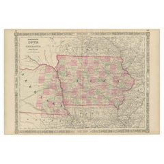
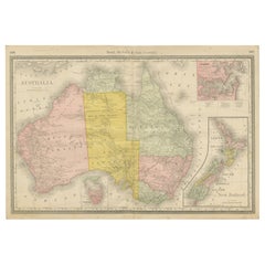
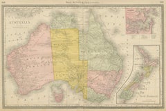
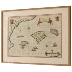
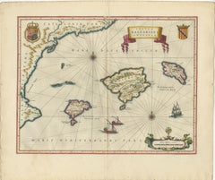
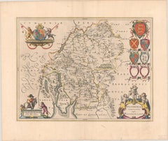
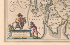
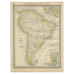
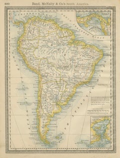
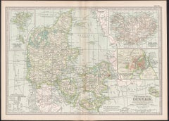
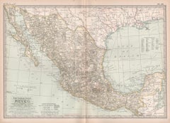
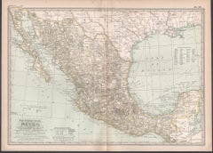
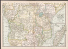
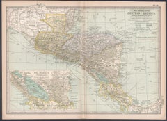
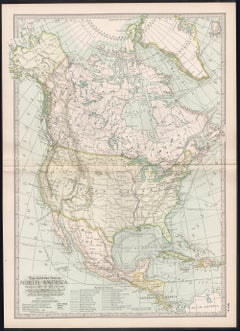
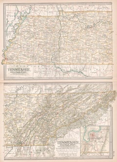
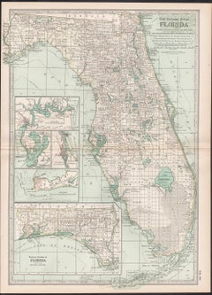
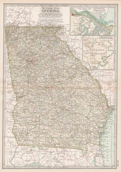
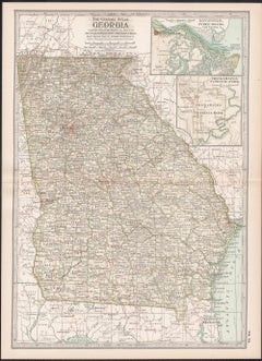
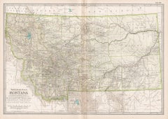
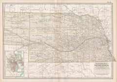
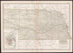
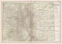
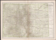
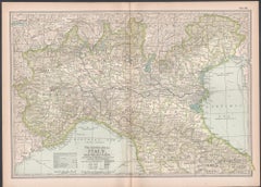
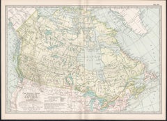
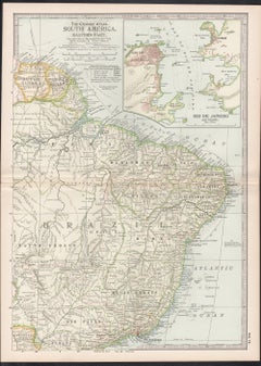
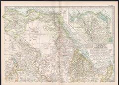
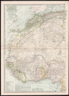
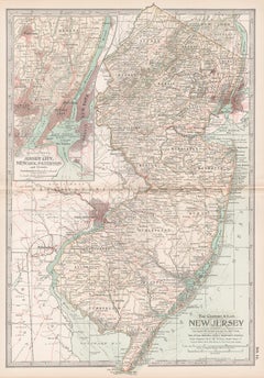
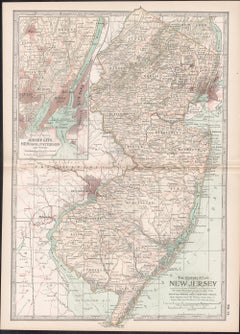
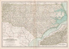
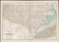
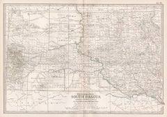
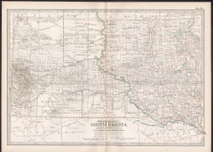
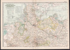
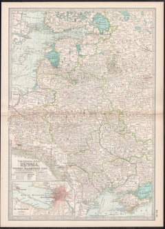
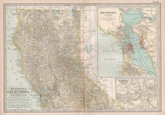
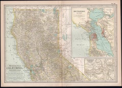
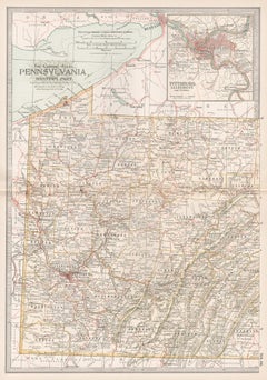
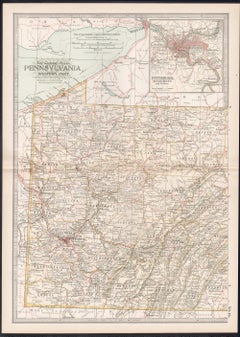
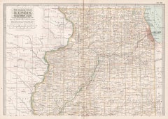
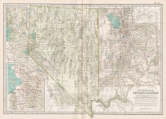
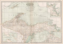
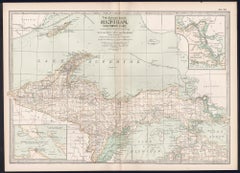
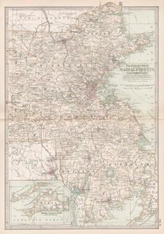
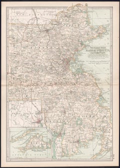
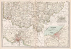
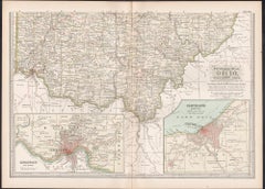
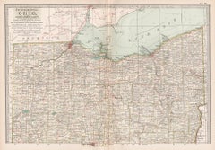
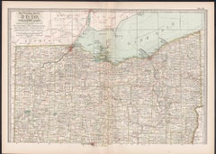
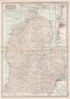
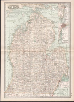
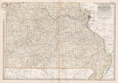
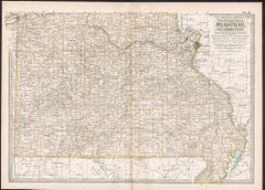
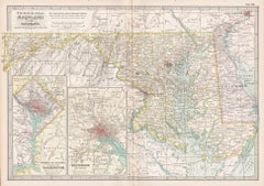
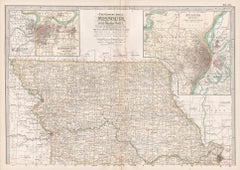
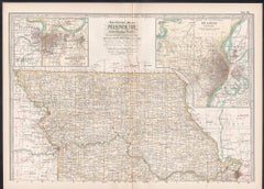
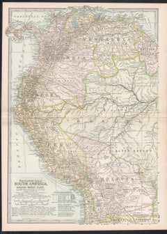
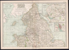
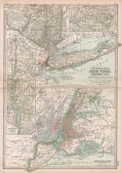
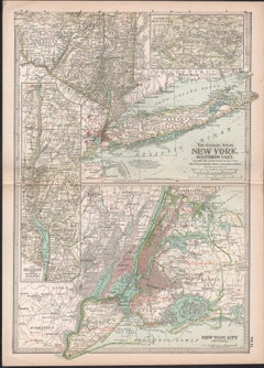
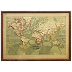
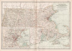
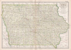
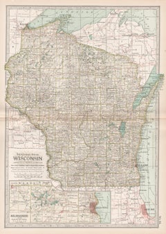
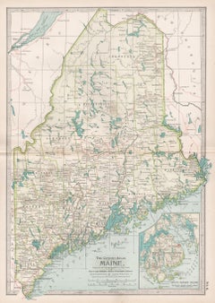
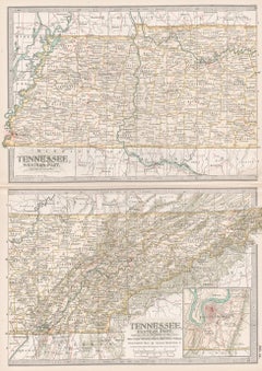
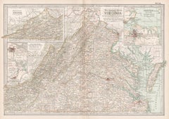
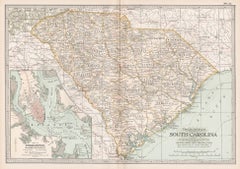
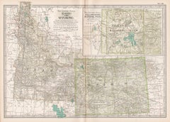
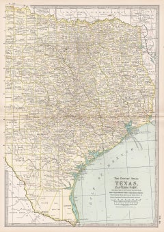
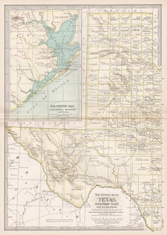
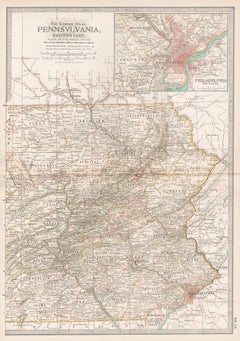
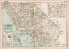
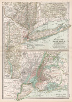
Find a variety of vintage atlas maps available on 1stDibs. The range of distinct vintage atlas maps — often made from paper, oak and wood — can elevate any home. Vintage atlas maps have long been popular, with older editions for sale from the 20th Century and newer versions made as recently as the 20th Century. Vintage atlas maps bearing Industrial hallmark is very popular at 1stDibs. Many vintage atlas maps are appealing in their simplicity, but Robert Falcucci produced popular vintage atlas maps that are worth a look.

How Much are Vintage Atlas Maps?

Prices for vintage atlas maps can differ depending upon size, time period and other attributes — at 1stDibs, vintage atlas maps begin at $85 and can go as high as $1,101, while the average can fetch as much as $85.