
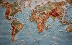
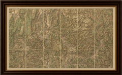
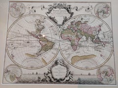
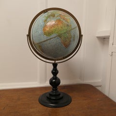
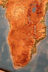
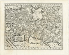
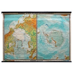
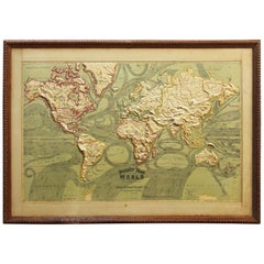
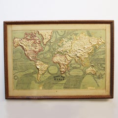
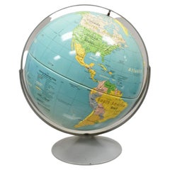
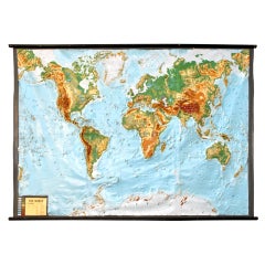
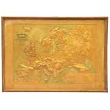
World Relief Map
$2,100
World Relief Map
Located in Antwerp, BE
Large world relief map. Measures: Width 232 cm. Height 158 cm.
Category
Mid-20th Century German Mid-Century Modern Maps
Materials
Acrylic
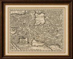
$2,100
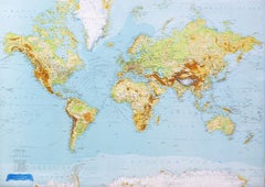
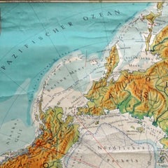
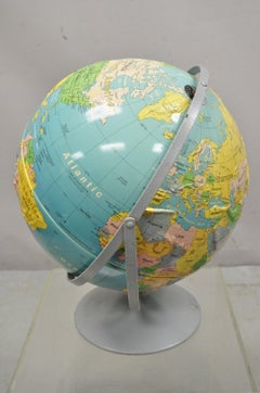
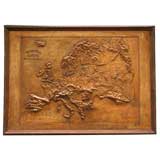
World Relief Map
Located in Antwerp, BE
Large world relief map. Measures: Width 232 cm. Height 158 cm.
Acrylic
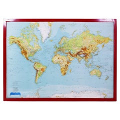
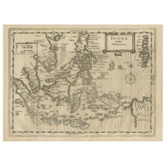
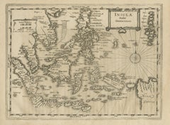
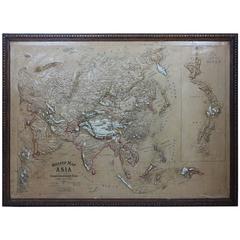
George Philip's Large Relief Map of the World 150x110cm
By George Philip & Son
Located in Linkebeek, BE
George Philip's Large Relief Map of the World 150x110cm PHILIP, George Relief Map of the World.
Plastic, Wood
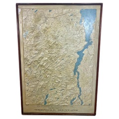
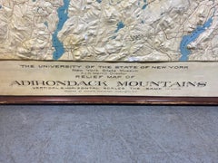
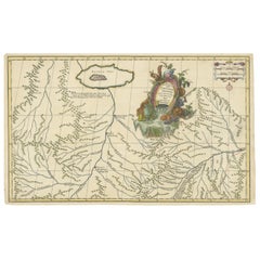
Rare and Early Plaster Relief Map of Adirondack Mountains by F J H Merrill
By P.F. Howells, E. W. Merrill
Located in Buffalo, NY
Rare and Early Monumental Plaster Relief Map of Adirondack Mountains by The University of the State of New York, New York State Museum..F J H Merrill director,,,modeled by Howell's ...
Plaster, Wood
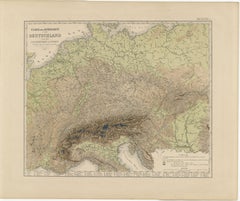
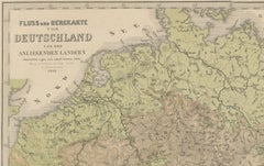
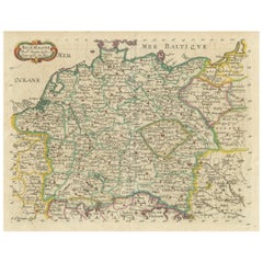
1855 Relief Map of Germany and the Alps Showing Rivers and Terrain
Located in Langweer, NL
1855 Engraved Map of Switzerland with Cantonal Borders by Stülpnagel This finely detailed antique map of Switzerland, titled "Die Schweiz," was published in 1855 by the renowned Ger...
Paper
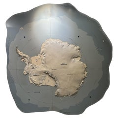
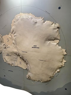
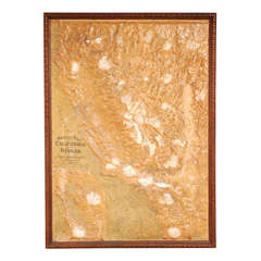
Topographic Three-Dimensional Relief Map of Antarctica
Located in Dallas, TX
An amazing topographic wall mounted three-dimensional map of Antarctica. Midcentury. This incredible map shows off elevation, ice shelves, and scale of the continent. Some texts show...
Plaster, Wood
$342Sale Price|65% Off
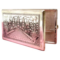
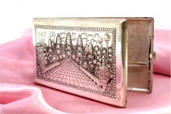
Silver case with floral and Taj Mahal reliefs, map on reverse
Located in Porto, PT
Description: Silver cigarette case with floral and Taj-Mahal reliefs and reverse mapped with various Asian countries.
Silver
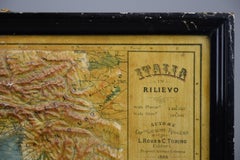
1889 Map of Italy in 3D Relief
Located in Weesp, NL
Measuring 54 x 59 cm / 21.259 x 23.228 inches, this embossed map showcases Italy’s topography in stunning 3D relief, allowing you to feel the mountainous terrain of the Alps and the ...
Paper
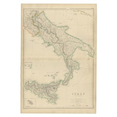
Italy (South Part), Sicily and Malta, Antique Hand-Colored Map, 1860
Located in Langweer, NL
The map covers southern mainland Italy from Naples and Calabria down to the toe of the peninsula, with Sicily shown prominently below, including Mount Etna and the island’s rugged in...
Paper
Antique French Alps Map of Albertville & Briançon, Edward Stanford 1908
Located in Langweer, NL
Technique: Color lithograph with relief shading on paper, issued as a folding map.
Paper

Antique Map of the Antilles and Central America – 1872
Located in Langweer, NL
Andriveau-Goujon, is complemented by subtle hand-coloring that enhances the relief and topographical details. This map was printed by Librairie de L.
Paper
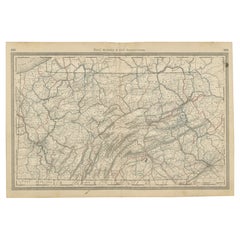

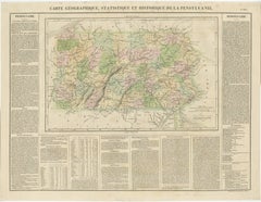
Antique Pennsylvania Map Wall Art – Railroads, Mountains & Cities, Rand McNally
Located in Langweer, NL
The restrained palette and finely engraved relief give the map a refined, almost architectural appearance that translates beautifully into wall art.
Paper
$448Sale Price|20% Off
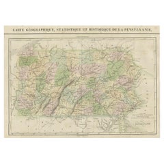
French Geographical, Statistical and Historical Map of Pensylvania, 1825
Located in Langweer, NL
Carez in Paris. (1825) Hand colored engraved map. Relief shown by hachures. Text and tables at sides and bottom.
Paper

Decorative Hand-Colored Map of Germany by Nicolas Sanson, 1648
Located in Langweer, NL
It features the boundaries of various regions, major cities, towns, villages, rivers, mountains, and other geographical features, with relief depicted pictorially. The map is hand-c...
Paper
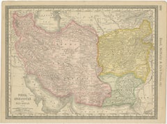
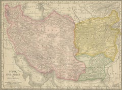
Antique Persia Map Wall Art – Iran Afghanistan Beluchistan, Rand McNally, c.1888
Located in Langweer, NL
Soft pastel color washes clearly define political boundaries, while dense engraved place names and subtle relief shading give the map depth and texture without visual heaviness.
Paper

$4,201Sale Price|20% Off
Original Antique Hand-colored World Map with or without Frame, '1696'
Located in Langweer, NL
Beautiful original antique world map. Relief shown pictorially. Includes illustrations and 4 small hemispherical polar projections.
Paper
$429Sale Price|20% Off
Early Original Antique Map of South East Asia with Large Parts Still Unknown
Located in Langweer, NL
Shows towns, villages, landmarks, mountains, and rivers. Relief shown pictorially. This map originates from 'Teatro Belgico, o vero Ritratti historici, chronologici, politici, e geog...
Paper


Antique Map of North East Borneo and North Sulawesi by P.M.G. Vandermaelen
Located in Langweer, NL
Contemporary colored lithographed map. Relief shown pictorially and by hachures. Covers North Eastern Borneo and part of Northern Sulawesi.
Paper
$410Sale Price|20% Off
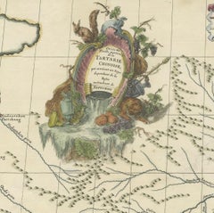
Original Antique Engrving of Chinese Tartary in the 18th Century, 1737
Located in Langweer, NL
Source; Map of the Chinese Tartary. Relief shown pictorially.
Paper
$1,245 / item
Wilderness Wallpanel by Made by Choice
Located in Geneve, CH
Her design solution presents an abstract relief map, digitally generated 3D landscape using solid wood and mirror – a representation of a bird’s eye view of the Land of the Thousand ...
Brass
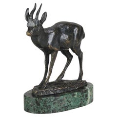
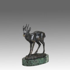
Mid 19th Century French Animalier Bronze entitled "Kevel" by Antoine L Barye
By Antoine-Louis Barye
Located in London, GB
When he was called up at seventeen, he joined the army’s topographic brigade where he used clay to model raised relief maps. When the empire fell, Barye briefly studied with the scul...
Marble, Bronze
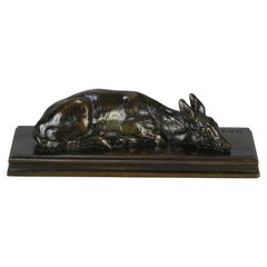
Mid 19th Century Animalier Bronze Study entitled "Reclining Doe" by A L Barye
By Antoine-Louis Barye
Located in London, GB
When he was called up at seventeen, he joined the army’s topographic brigade where he used clay to model raised relief maps. When the empire fell, Barye briefly studied with the scul...
Bronze
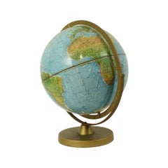
Double Axis Scan Globe A/S with Raised Topography A good quality Desk Globe
By Danemark
Located in Godshill, Isle of Wight
Double Axis Scan Globe A/S with Raised Topography A good quality Desk Scan Globe A/S (©Replogle Chicago, Hassing Kopenhagen Corporation) in Denmark, with a double axis, rotating prot...
Paper
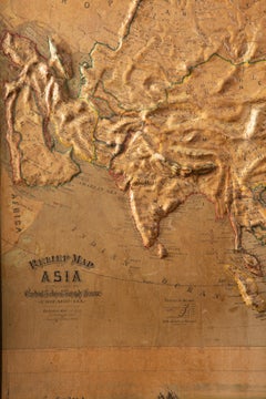
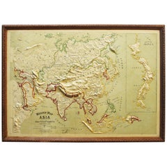
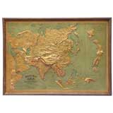
Large 1900s Relief Map of Asia
Located in Chicago, IL
Large 1900s relief map of Asia in original oak frame.
Oak, Paper
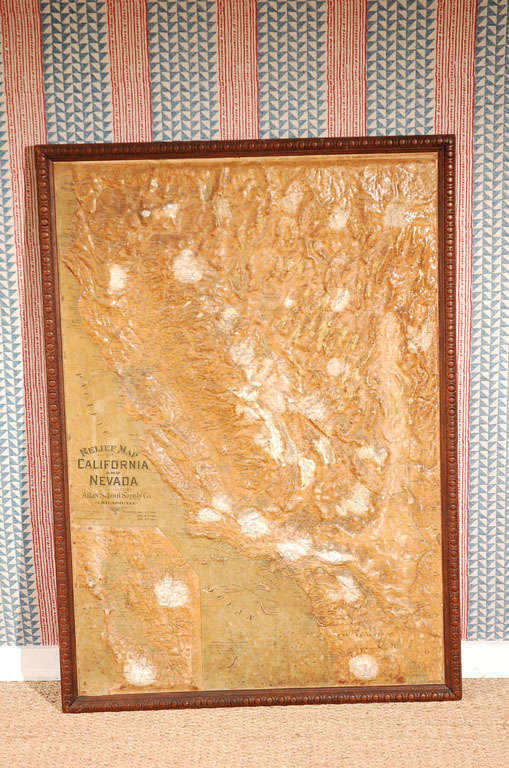
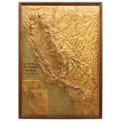
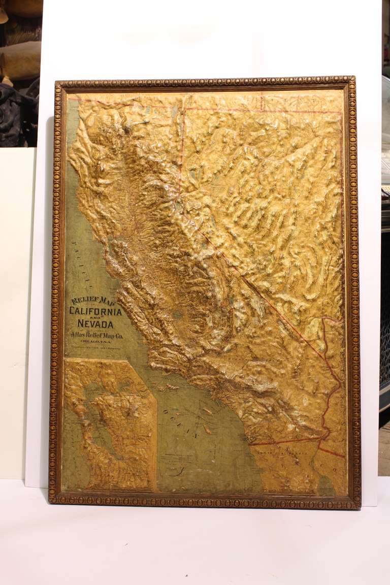
Relief Map of California and Nevada
Located in Los Angeles, CA
Lovely vintage relief map in the original frame. Great sepia colors
Paper, Wood
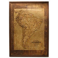
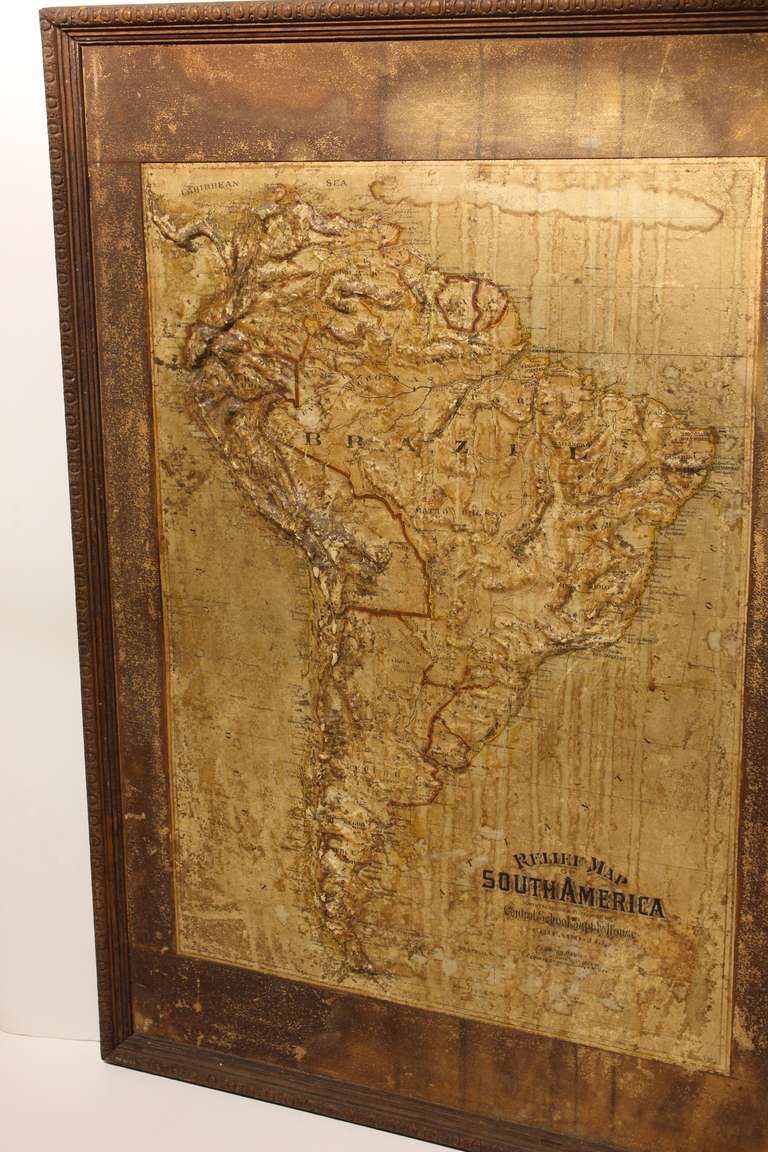
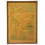
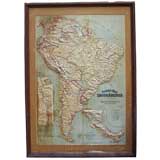
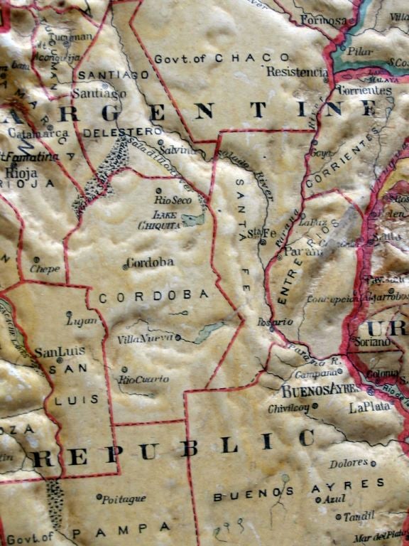
Large Late 1800's Raised Relief Map Of South America
Located in Chicago, IL
Large Late 1800's raised Relief Map of South America by Central School Supply House in Chicago.
Paper, Wood
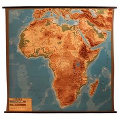
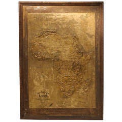
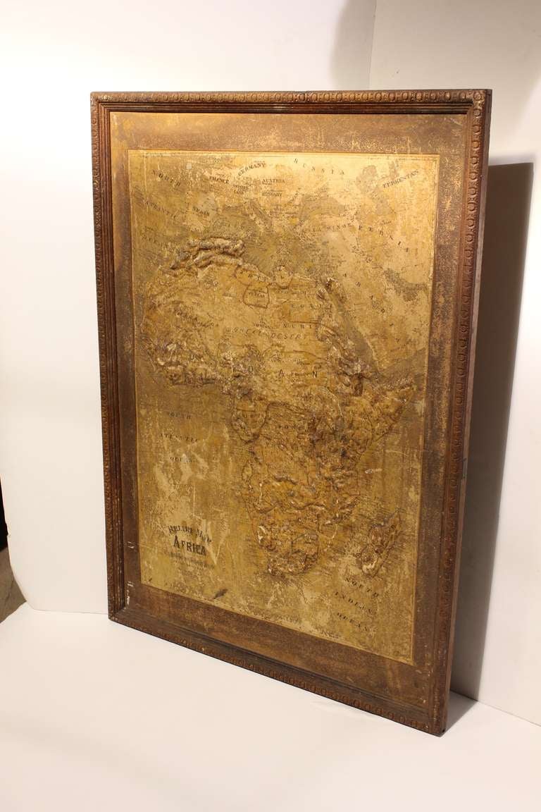
Vintage Relief Map of Africa, 1970s
Located in Antwerp, BE
Vintage relief map of Africa, 1970s. Good original condition with great relief.
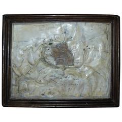
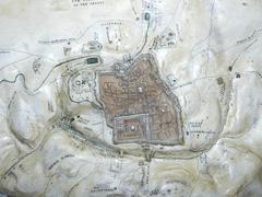
19th Century, Relief Map, Plaster, Jerusalem
Located in Biarritz, FR
Relief map of Old City in Jérusalem. Impressive topographic model of the city and its surroudings hand-painted and decorated plaster casting with "trompe l'œil frame".
Plaster
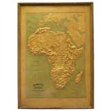
Interesting Large Victorian Relief Map of Africa
Located in Stamford, CT
Good relief map with a great patina and original oak frame
Wood
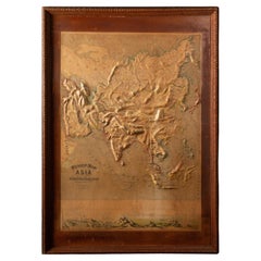

Early 20th C. Relief Maps: Asia Wood and Leather Frames
Located in New York, NY
This early 20th-century set of three relief maps offers a captivating glimpse into the geographical features of Asia.
Leather, Wood, Paper
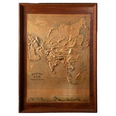
Early 20th C. Relief Maps: Asia Wood and Leather Frames
Located in New York, NY
This early 20th-century set of three relief maps offers a captivating glimpse into the geographical features of South America, Asia, and Africa.
Leather, Wood, Paper
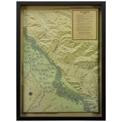
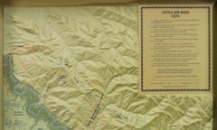
"Little Big Horn, 1876" Raised Relief Map, 1989
Located in Colorado Springs, CO
This is a striking raised relief model map. The model map shows positions and movements of the Battle of Little Bighorn, June 25th, 1876.
Plastic
Sold
H 36.62 in W 51.19 in D 0.79 in
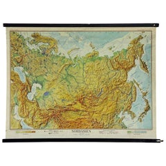
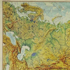
Vintage Relief Map Pull-Down Wall Chart North Asia Russia China Poster Print
Located in Berghuelen, DE
A classical rollable school map or vintage wall chart showing the Northern Asian continent with Russia and China. Published by Wenschow. Colorful print on paper reinforced with canva...
Canvas, Wood, Paper

Sold
H 10.12 in W 12.84 in D 0.01 in
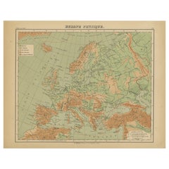
Relief Atlas Map of Europe by Hachette – Antique French Map c.1883
Located in Langweer, NL
Antique Map of Europe – Physical Relief Map by Hachette, circa 1883 Description: This antique map titled “Europe Physique” was published by Hachette in Paris around 1883 and origina...
Paper
Sold
H 10.12 in W 12.84 in D 0.01 in
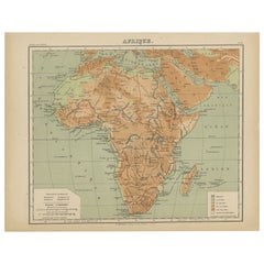
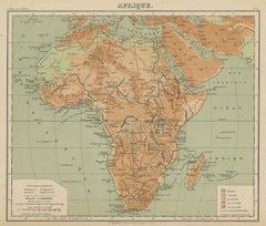
Relief Atlas Map of Africa by Hachette – Antique c.1883 French Map
Located in Langweer, NL
Antique Map of Africa – Relief Atlas Map by Hachette, circa 1880 Description: This is an attractive antique map titled “Afrique,” published by Hachette in Paris around 1880.
Paper
Sold
H 10.12 in W 12.84 in D 0.01 in
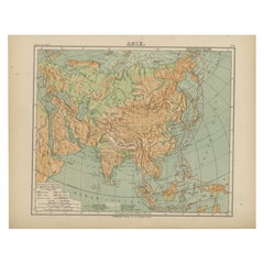
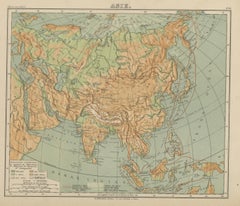
Relief Atlas Map of Asia by Hachette – Antique French Map, circa 1883
Located in Langweer, NL
Antique Map of Asia – Relief Atlas Map by Hachette, circa 1883 Description: This antique map titled “Asie” was published by Hachette in Paris around 1883 and originates from their e...
Paper
Cluver Persia Map with Armenia & Mesopotamia, Leiden, 1697
Located in Langweer, NL
Although issued uncolored, the map possesses a strong graphic quality due to its crisp engraving, dramatic relief work, and balanced composition.
Paper
Antique Map of Mexico by G. Mercator, 1637
Located in Langweer, NL
Mexico City located on the banks of a lake. Relief shown pictorially. This map originates from 'Historia mundi: or Mercator's atlas.
Paper
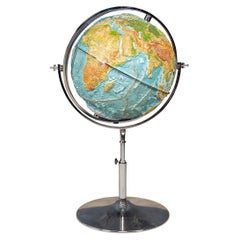

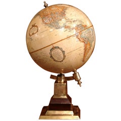
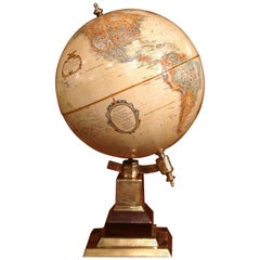
Rare German Relief Globe on a Chrome Stand by Geo-Institut
Located in Royal Tunbridge Wells, Kent
A very rare and unusual relief globe by Geo-Institut, Columbus GmbH. Although the globe is of recent production, the company traded for 75 years before closing down permanently and t...
Chrome
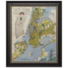
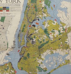
1939 Vintage Map "The City of New York" by Richard Edes Harrison
By Richard Harrison
Located in Colorado Springs, CO
Produced as an Emergency Relief Project, those 1933 maps illustrated the distribution of living and working populations, the age, type, and rental of buildings, and the use of land, ...
Paper

Vintage World Globe Gyroscopic Globe With Relief 1960s
Located in Poperinge, BE
Vintage Dutch globe, globe with relief map and gold-colored metal base, by Replogle, Denmark 1960s.
Metal
Sold
H 47.25 in W 67.33 in D 0.79 in
Vintage Map North Pole South Pole Polar Region Rollable Wall Chart
Located in Berghuelen, DE
A classical pull-down wall chart map illustrating the North and South polar region, published by Wenschow relief maps.
Canvas, Wood, Paper

Map of France from Eternit
By Eternit
Located in Copenhagen K, DK
France map in relief, made by Eternit. The map is made of fiber cement, fibrociment in French and is framed in a wooden frame.
Cement
Sold
H 36 in W 108 in D 4 in
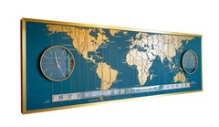
1960s Braniff Airlines World Map Doomsday Clock with Programmable Lighting
Located in Dallas, TX
From the Braniff Place World Headquarters in Dallas, Texas comes this massive, one of a kind low-relief 9’ world map. It has a functional Derby Clock on the left side and a thermomet...
Aluminum
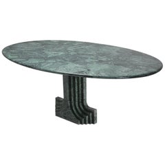

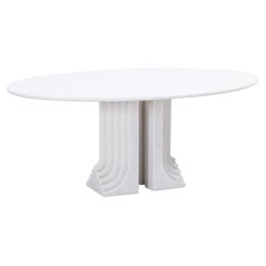
Carlo Scarpa Dining Table 'Samo' in a Rare Green Marble
By Carlo Scarpa
Located in Antwerp, BE
Part of the ‘Ultrarazionale’ collection by Simon, the base is formed of two pillars of marble, layered like map contours in relief. The oval tabletop floats of this marble monolith. ...
Marble
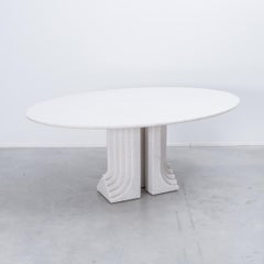
Grey Marble 'Samo' Table by Carlo Scarpa, 1970s
By Carlo Scarpa
Located in Antwerp, BE
Part of the ‘Ultrarazionale’ collection by Simon, the base is formed of two pillars of marble, layered like map contours in relief. The oval tabletop floats of this marble monolith.
Marble
Sold
H 29.14 in W 70.08 in D 49.22 in
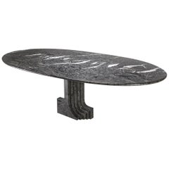
Carlo Scarpa White Naxos Marble Samo Table for Simon, Italy, 1970
By Simon Collezione, Carlo Scarpa
Located in London, GB
Part of the ‘Ultrarazionale’ collection by Simon, the base is formed of two pillars of Naxos marble, layered like map contours in relief. The oval tabletop floats of this marble mono...
Marble
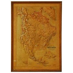

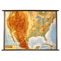
1906 Framed Relief Map of North America
By Atlas School Supply
Located in Rio Vista, CA
Early 1900s relief map of North America including Canada, Greenland, Mexico and Central America.
Wood, Paper
Sold
H 34 in W 48 in D 2.5 in
Large 1907 Vintage Relief Map of World by Atlas School Supply of Chicago
By Atlas School Supply
Located in Lafayette, IN
Remarkably original, 1907 relief map of world by the Atlas School Supply Co. of Chicago, Illinois.
Oak, Paper

Large 1907 Vintage Relief Map of Asia by Atlas School Supply of Chicago
By Atlas School Supply
Located in Lafayette, IN
Remarkably original, 1907 Relief map of Asia by the Atlas School Supply Co. of Chicago, Illinois.
Oak, Paper

Sold
H 34 in W 48 in D 2.5 in
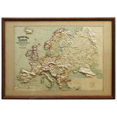
Large 1907 Vintage Relief Map of Europe by Atlas School Supply of Chicago
By Atlas School Supply
Located in Lafayette, IN
Remarkably original, 1907 Relief map of Europe by the Atlas School Supply Co. of Chicago, Illinois.
Oak, Paper


Sold
H 48 in W 34 in D 2.5 in
Large 1907 Vintage Relief Map of Africa by Atlas School Supply of Chicago
By Atlas School Supply
Located in Lafayette, IN
Remarkably original, 1907 Relief map of Africa by the Atlas School Supply Co. of Chicago, Illinois.
Oak, Paper

Sold
H 34 in W 48 in D 2.5 in
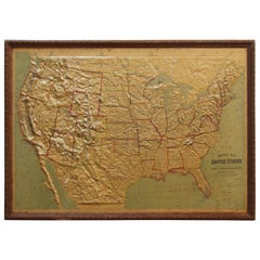
Large 1907 Vintage Relief Map of United States by Atlas School Supply of Chicago
By Atlas School Supply
Located in Lafayette, IN
Remarkably original, 1907 Relief map of the United States by the Atlas School Supply Co. of Chicago, Illinois.
Oak, Paper

Sold
H 10.12 in W 12.84 in D 0.01 in
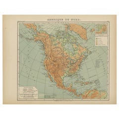
Antique Map of North America – Physical Relief Map by Hachette c.1883
Located in Langweer, NL
Antique Map of North America – Physical Relief Map by Hachette c.1883 Description: This antique map titled “Amérique du Nord” was published around 1883 by E.
Paper
Sold
H 10.12 in W 12.84 in D 0.01 in
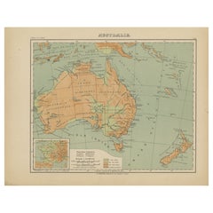
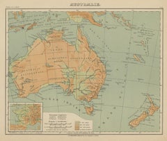
Antique Map of Australia and Oceania – Physical Relief Map by Hachette, c.1883
Located in Langweer, NL
Antique Map of Australia and Oceania – Physical Relief Map by Hachette, c.1883 Description: This antique map titled “Australie” was published circa 1883 by Hachette in Paris as part...
Paper

Sold
H 10.12 in W 12.84 in D 0.01 in
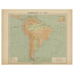
Relief Atlas Map of South America by Hachette – Antique French Map c.1883
Located in Langweer, NL
Antique Map of South America – Physical Relief Map by Hachette, c.1883 Description: This antique map titled “Amérique du Sud” was published circa 1883 by Hachette in Paris as part o...
Paper
Vintage Nystrom Readiness World Globe Blue Relief Spin and Tilt
By A.J. Nystrom & Co
Located in Philadelphia, PA
Vintage Nystrom 16" readiness world globe blue relief spin and tilt. Item features a raised terrain, spin and tilt brackets, original stamp, very nice vintage item. circa Mid to late...
Metal
Sold
H 11.82 in Dm 11.42 in
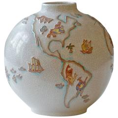
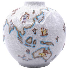
Mid-Century Majolica Karlsruhe Vase with Artistic World Map in Bas-Relief, 1950
By Karl-Heinz Feisst, Majolica Manufactory of Karlsruhe
Located in Berlin, DE
Mid-Century vase with artistic world map in bas-relief and crackele glaze. Designed by Karl-Heinz Feisst and manufactured in the 1950s by Majolika, Keramik-Manufaktur, Karlsruhe, Ger...
Majolica
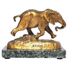
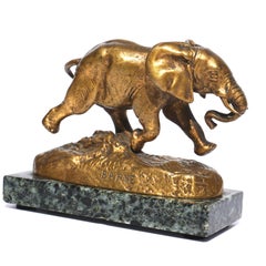
Antoine-Louis Barye Bronze Elephant Du Senegal
By Antoine-Louis Barye
Located in Dallas, TX
When he was called up at seventeen, he joined the army’s topographic brigade where he used clay to model raised relief maps. When the Empire fell, Barye briefly studied with the scul...
Bronze
Sold
H 7.09 in W 6.3 in D 2.37 in
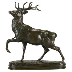
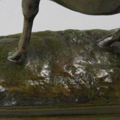
Late 19th Century French Animalier bronze entitled "Cerf La Jambe Levée" byBarye
By Antoine-Louis Barye
Located in London, GB
When he was called up at seventeen, he joined the army’s topographic brigade where he used clay to model raised relief maps. When the empire fell, Barye briefly studied with the scul...
Bronze

Sold
H 10.83 in W 9.45 in D 9.45 in
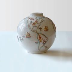
Vintage Majolica vase with world map, by Karl-Heinz Feisst, Germany, 1955
By Karl-Heinz Feisst
Located in Roma, IT
The brick-red shards are enameled with gray crackles and decorated with a "world map" in relief. Designed, circa 1955. Relief stamp of the Karlsruhe A.G. with all-round letters "R...
Majolica

Sold
H 7.49 in W 11.03 in D 5.91 in
“Lion au Serpent” Important Animalier Bronze by Antoine L Barye, circa 1860
By Antoine-Louis Barye
Located in London, GB
When he was called up at seventeen, he joined the army’s topographic brigade where he used clay to model raised relief maps. When the empire fell, Barye briefly studied with the scul...
Bronze
Sold
H 3.13 in Dm 2.88 in
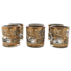
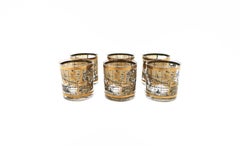
World Globe Rocks' Cocktail Glasses in Black and Gold, circa 1960s, Set of 6
Located in New York, NY
Beautiful glasses with a raised relief of the world map in black and gold. Dimensions: 2.88" diameter x 3.13" height.
Glass

Late 20th Century American Terrestrial Globe on Brass Base by Leroy M. Tolman
Located in Dallas, TX
Sitting on a patinated brass base, this terrestrial globe has a very detailed map in relief, in a muted, neutral palette of green and yellow and is signed Tolman.
Brass

Mid-20th Century American Terrestrial Globe on Brass Base by LeRoy M. Tolman
Located in Dallas, TX
Sitting on a patinated brass base, this terrestrial globe has a very detailed map in relief, in a muted, neutral palette of green and yellow and is signed Tolman.
Brass

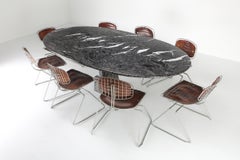
Samo Marble Table by Carlo Scarpa for Simon, Italy, 1970
By Simon Collezione, Carlo Scarpa
Located in London, GB
Part of the ‘Ultrarazionale’ collection by Simon, the base is formed of two pillars of Carrara marble, layered like map contours in relief. The oval tabletop floats of this marble mo...
Marble
Sold
H 2.17 in W 5.52 in D 5.71 in
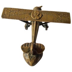
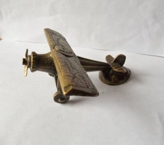
Bronze Airplane 1927 Spirit of St Louis Car Mascot, Hood Ornament Automobilia
By Bousquet
Located in Buenos Aires, Olivos
It has the Lindbergh bust medallion in relief on the top of the wings, plus also showing a map in relief detailing the route from New York to Paris in French.
Bronze
Large 1800's Raised Relief Map Of Africa
Located in Chicago, IL
Large late 1800's raised relief map of Africa made by Central School Supply House.
Paper, Wood
Large Early 1900's Raised Relief Map Of California & Nevada
Located in Chicago, IL
Large early 1900's raised relief map of California & Nevada by Atlas Relief Map Company.
Wood, Cardboard

1970s World Relief Map
Located in Alhambra, CA
World classroom map. Molded plastic shows relief.
Plastic
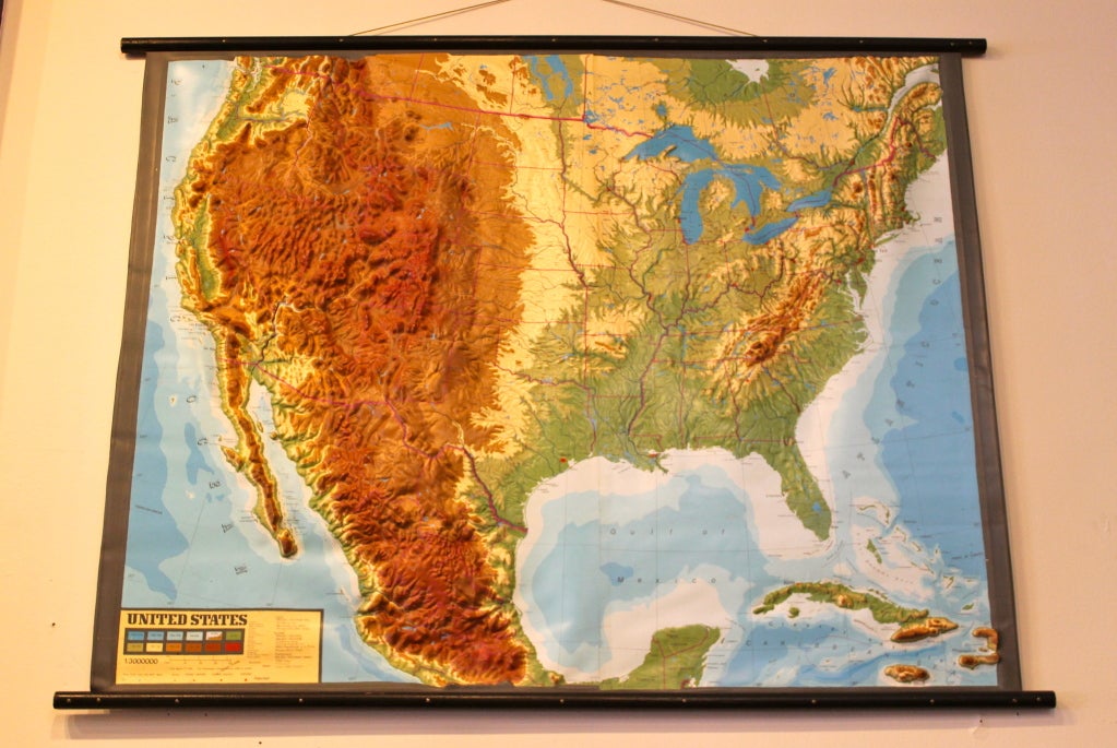
United States Relief Map
Located in Alhambra, CA
1970's classroom wall map. Molded plastic illustrates topographical relief.

1907 Papier Mache' Relief Map of Europe
Located in Treasure Island, CA
Hard to find papier mache' relief map of Europe. This old time teacher's aid is in it's original frame.

1907 Papier Mache' Relief Map of Europe
Located in Treasure Island, CA
Hard to find papier mache' relief map of Europe. This old time teacher's aid is in it's original frame.


Sold
H 32 in W 26 in D 1 in
Rare Raised-Relief Map of London, Published by the Ordnance Survey Office 1876
Located in Bedford, Bedfordshire
Director General, March 1876, the whole surviving from high Victorian England. The map is scarce being in three-dimensional or high relief form, with maps and globes usually prese...
Paper

Papier Mache' Relief Map of Asia
Located in Treasure Island, CA
Rare, fascinating item, China is referred to as the "Chinese Empire" and lots of other interesting name changes. Turn of the century teacher's aid.

Papier Mache' Relief Map of Africa
Located in Treasure Island, CA
Rare, fascinating item (South Africa is still called the "Cape Colony"), lots of political and geographical name changes on this one. Turn of the century teacher's aid.
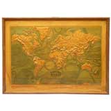
Papier Mache' Relief Map of the World
Located in Treasure Island, CA
Hard to find, fascinating item. Lots of geographical and political name changes since this was made. Former classroom item.

Papier Mache' Relief Map of South America
Located in Treasure Island, CA
Hard to find, fascinating item. Turn of the century teacher's aid.
Papier Mache' Relief Map of South America
Located in Treasure Island, CA
Hard to find, fascinating item. Turn of the century teacher's aid.

Turn of the Century Relief Map of Canada
Located in Treasure Island, CA
Paper mache' relief of Canada. These former school teaching aids are extremely scarce. Original frame with brass label. Dated 1909.
$1,650 / item
H 16.1 in Dm 11.5 in
'Plissé White Edition' Pleated Textile Table Lamp by Folkform for Örsjö
By Örsjö Industri AB
Located in Glendale, CA
'Plissé White Edition' pleated textile table lamp by Folkform for Örsjö. This unique table lamp was awarded “Lighting of the Year 2022” by Residence Magazine Sweden, who called it “...
Textile
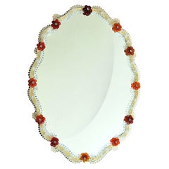
Rosso Wall Mirror
By Specchi Veneziani
Located in Milan, IT
Crafted in the finest Murano tradition, this exquisite Venetian mirror is a true work of art. Assembled with crystal and gold elements, and adorned with red glass flowers, each piece...
Glass
$920
H 48 in W 36 in D 2 in
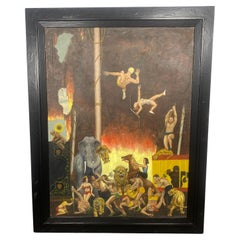
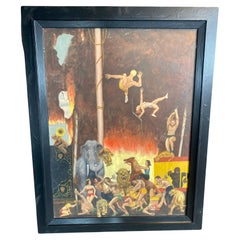
Large Folk art /surrealist Oil painting on canvas.. Circus scene. " Burning Tent
Located in Buffalo, NY
Large Folk art / surrealist Oil painting on canvas.. depicting circus scene. "Burning Tent".. Very well executed.. amazing detail..
Canvas, Wood, Paint