Items Similar to Antique Map of Southern India by Andree, 1904
Want more images or videos?
Request additional images or videos from the seller
1 of 5
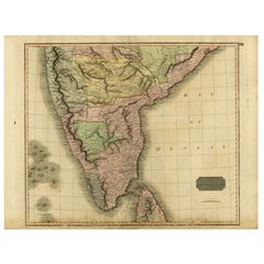
Antique Map of Southern India by Andree, 1904
About the Item
"Antique map titled 'Vorderindien, sudlicher Teil'. Map of India, southern part. This map originates from 'Andrees Allgemeiner Handatlas in 126 Haupt-Und 139 Nebenkarten', Bielefeld; Leipzig: Velhagen & Klasing 1899. Andrees Allgemeiner Handatlas was a major cartographic work published in several German and foreign editions 1881-1937. It was named after Richard Andree (1835-1912) and published by Velhagen & Klasing, Bielefeld and Leipzig, Germany. By using chromolithography, rather than copper plate engraving, but reproducing the maps from zinc plates that were etched in relief (just like letterpress printing), V & K was able to offer detailed maps at a much lower price than competing works, such as the 7th and 8th editions of Stielers Handatlas. Artists and Engravers: Richard Andree (1835 - 1912) was, like his father Karl Andree, a German geographer noted for devoting himself especially to ethnography. His main work, however, is his Allgemeiner Handatlas (Leipzig, first edition 1881, final edition 1937), one of the most comprehensive world atlases of all times. The early editions of the Times Atlas of the World (1895-1900) are based on this atlas, as was Cassell's Universal Atlas.
Artist: Richard Andree (1835 - 1912) was, like his father Karl Andree, a German geographer noted for devoting himself especially to ethnography. His main work, however, is his Allgemeiner Handatlas (Leipzig, first edition 1881, final edition 1937), one of the most comprehensive world atlases of all times. The early editions of the Times Atlas of the World (1895-1900) are based on this atlas, as was Cassell's Universal Atlas.
Condition: Good, general age-related toning and slight soiling. Please study image carefully.
Antique prints have long been appreciated for both their aesthetic and investment value. They were the product of engraved, etched or lithographed plates. These plates were handmade out of wood or metal, which required an incredible level of skill, patience and craftsmanship. Whether you have a house with Victorian furniture or more contemporary decor an old engraving can enhance your living space. We offer a wide range of authentic antique prints for any budget.".
- Dimensions:Height: 17.33 in (44 cm)Width: 10.83 in (27.5 cm)Depth: 0 in (0.01 mm)
- Materials and Techniques:
- Period:
- Date of Manufacture:1904
- Condition:Condition: Good, general age-related toning and slight soiling. Please study image carefully.
- Seller Location:Langweer, NL
- Reference Number:
About the Seller
5.0
Platinum Seller
These expertly vetted sellers are 1stDibs' most experienced sellers and are rated highest by our customers.
Established in 2009
1stDibs seller since 2017
1,933 sales on 1stDibs
Typical response time: <1 hour
- ShippingRetrieving quote...Ships From: Langweer, Netherlands
- Return PolicyA return for this item may be initiated within 14 days of delivery.
More From This SellerView All
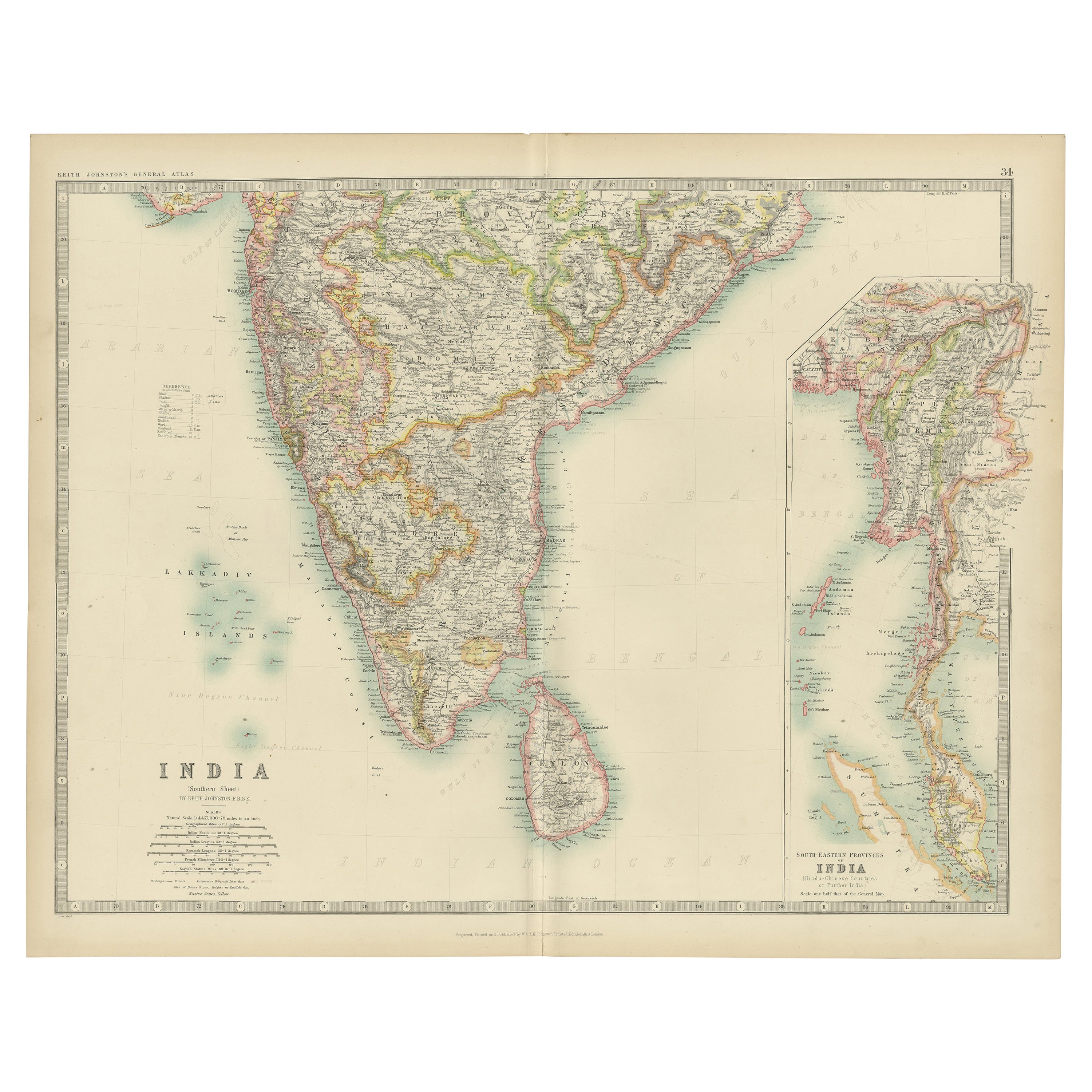
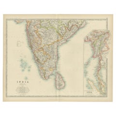
- Antique Map of India ( Southern ) by Johnston (1909)Located in Langweer, NLAntique map titled 'India'. Original antique map of India Southern sheet. With inset maps of south eastern provinces of India. This map originates from the ‘Royal Atlas of Modern Geo...Category
Early 20th Century Maps
MaterialsPaper
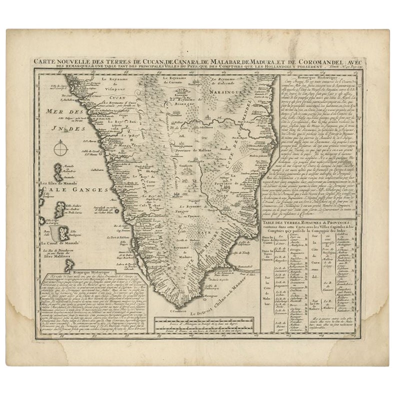
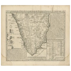
- Antique Map of Southern India by Chatelain, c.1720Located in Langweer, NL"Antique map titled 'Carte Nouvelle des Terres de Cucan, de Canara, de Malabar, de Madura, et de Coromandel'. Map of the southern portion of India, originating from Chatelain's 'Atla...Category
Antique 18th Century Maps
MaterialsPaper
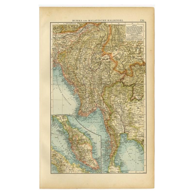
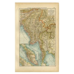
- Antique Map of Burma and the Malayan Peninsula by Andree, 1904Located in Langweer, NLAntique map titled 'Burma und Malayische Halbinsel'. Map of Burma / Myanmar and the Malayan peninsula. This map originates from 'Andrees Allgemeiner Handatlas in 126 Haupt-Und 139 Ne...Category
20th Century Maps
MaterialsPaper
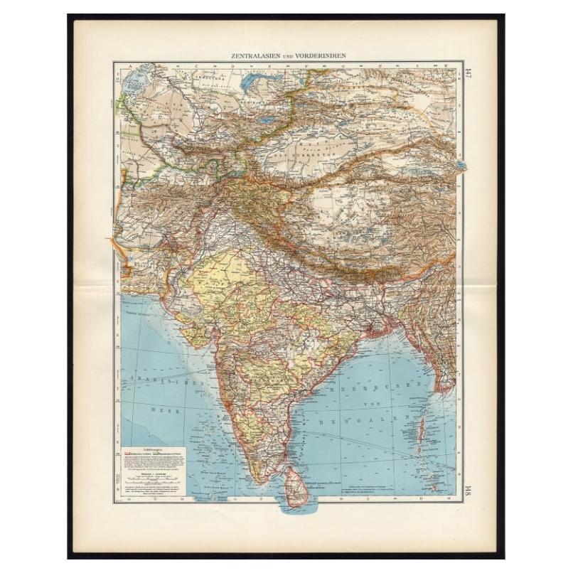
- Antique Map of Central Asia and India, 1904Located in Langweer, NLAntique map titled 'Zentralasien und Vorderindien'. Map of Central Asia and India. This large antique map is taken from; 'Andrees Allgemeiner Handatlas in 126 Haupt-Und 139 Nebenkart...Category
20th Century Maps
MaterialsPaper
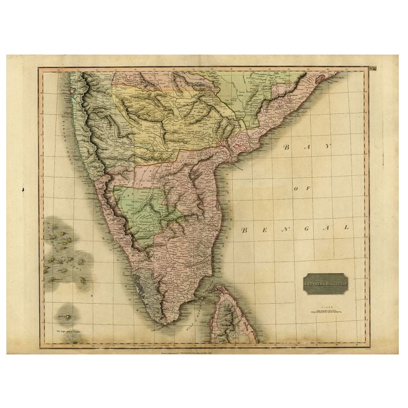
- Antique Map of Southern India and Ceylon by Thomson, 1816Located in Langweer, NL"Antique map titled 'Southern Hindostan'. A map of Southern India and the North of Ceylon. From Thomson's 'New General Atlas', 1816. Artists and Engravers: Engraved by Neele. Arti...Category
Antique 19th Century Maps
MaterialsPaper
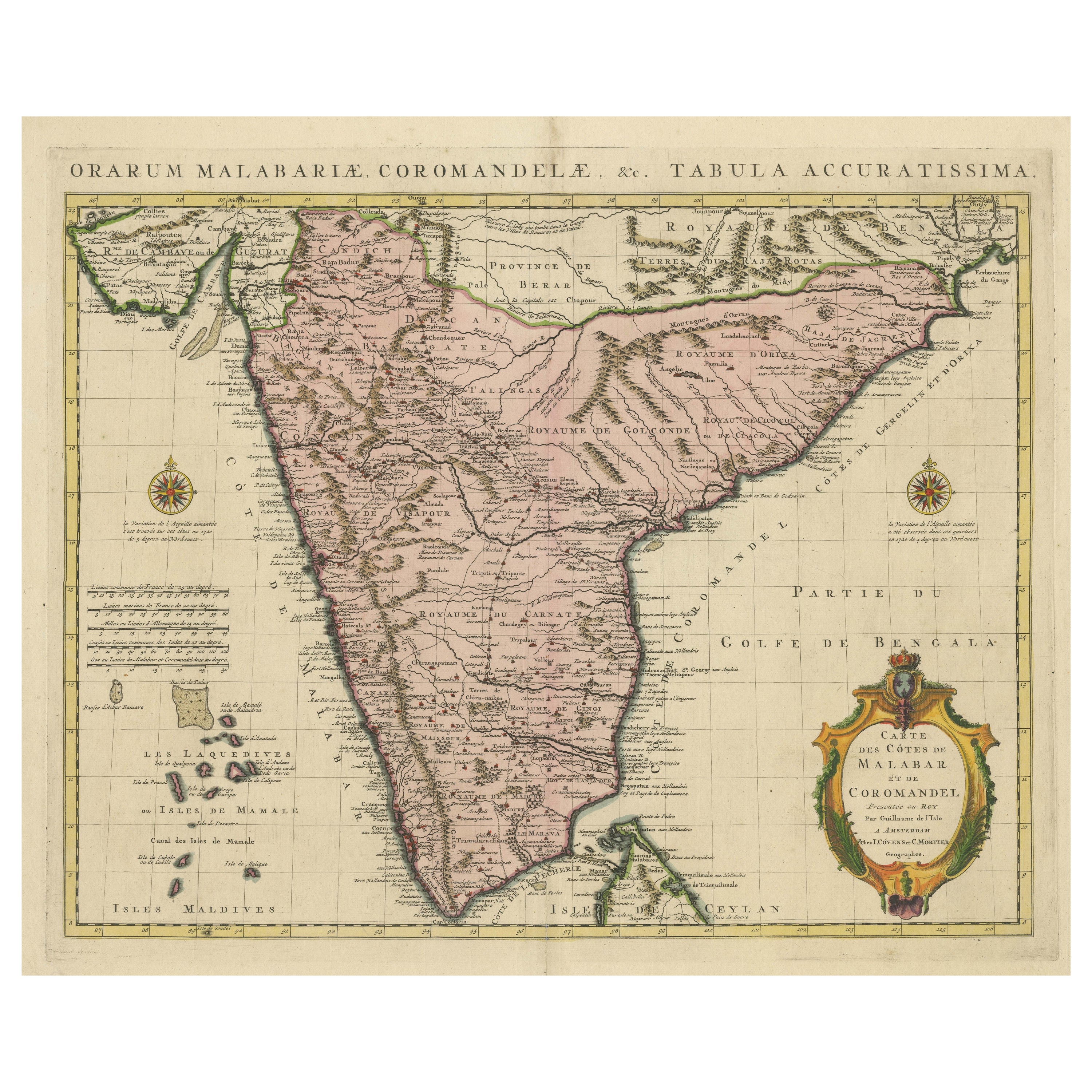
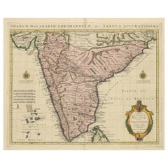
- Original Hand-colored Antique Map of the Southern Part of IndiaLocated in Langweer, NLAntique map titled 'Orarum Malabariae, Coromandelae &c Tabula Accuratissima - Carte des Cotes de Malabar et de Coromandel'. Beautiful map of the southern part of India. It focuses on...Category
Antique Early 18th Century Maps
MaterialsPaper

You May Also Like
- Original Antique Map of India. C.1780Located in St Annes, LancashireGreat map of India Copper-plate engraving Published C.1780 Three small worm holes to right side of map and one bottom left corner Unframed.Category
Antique Early 1800s English Georgian Maps
MaterialsPaper

- Antique French Map of Asia Including China Indoneseia India, 1783Located in Amsterdam, Noord HollandVery nice map of Asia. 1783 Dedie au Roy. Additional information: Country of Manufacturing: Europe Period: 18th century Qing (1661 - 1912) Condition: Overall Condition B (Good Used)...Category
Antique 18th Century European Maps
MaterialsPaper
- Antique 1803 Italian Map of Asia Including China Indoneseia IndiaLocated in Amsterdam, Noord HollandAntique 1803 Italian Map of Asia Including China Indoneseia India Very nice map of Asia. 1803. Additional information: Type: Map Country of Manufacturing: Europe Period: 19th centu...Category
Antique 19th Century European Maps
MaterialsPaper
- Large Original Vintage Map of India, circa 1920Located in St Annes, LancashireGreat map of India Original color. Good condition / repair to some minor damage just above Sri Lanka. Shown in the last image. Published by Alexander Gross Unframed.Category
Vintage 1920s English Maps
MaterialsPaper
- 18th Century Map of the Southern Balkans by Giovanni Maria CassiniBy Giovanni Maria CassiniLocated in Hamilton, Ontario18th century map by Italian engraver Giovanni Maria Cassini (Italy 1745-1824). Map of the Southern Balkans: Rome. Hand colored and copper engraved print done in the year 1788. It in...Category
Antique 18th Century Italian Maps
MaterialsPaper
- Map Southern Scotland Thomas Conder Alex Hogg 1795Located in BUNGAY, SUFFOLKA new map of the southern part of Scotland containing the counties of Stirling, Lanerk, Renfrew, Linlithgow, Edinburgh, Peebles, Haddingtoun, Berwick, Selkirk, Roxburgh, Dumfries, Wigtoun, Kirkudbright & Air Published by Alex Hogg at the Kings Arms...Category
Antique 18th Century English Georgian Maps
MaterialsPaper


Recently Viewed
View AllMore Ways To Browse
Southern Used Furniture
Antiques Of India
India Plates
Vintage Decor Collectibles
Victorian India
Vintage Collectibles India
India Decor
Old Vintage India
The World Map Vintage
Map Of World Vintage
Map Of The World Vintage
Southern Germany
India Engraving
Antique German Decor
Germany Vintage Map
Vintage German Map
Vintage Map Of Germany
Vintage World Atlas