Items Similar to Antique Map of Burma and the Malayan Peninsula by Andree, 1904


Want more images or videos?
Request additional images or videos from the seller
1 of 5
Antique Map of Burma and the Malayan Peninsula by Andree, 1904
About the Item
Antique map titled 'Burma und Malayische Halbinsel'. Map of Burma / Myanmar and the Malayan peninsula. This map originates from 'Andrees Allgemeiner Handatlas in 126 Haupt-Und 139 Nebenkarten', Bielefeld; Leipzig: Velhagen & Klasing 1899. Andrees Allgemeiner Handatlas was a major cartographic work published in several German and foreign editions 1881-1937. It was named after Richard Andree (1835-1912) and published by Velhagen & Klasing, Bielefeld and Leipzig, Germany. By using chromolithography, rather than copper plate engraving, but reproducing the maps from zinc plates that were etched in relief (just like letterpress printing), V & K was able to offer detailed maps at a much lower price than competing works, such as the 7th and 8th editions of Stielers Handatlas.
Artists and Engravers: Richard Andree (1835 - 1912) was, like his father Karl Andree, a German geographer noted for devoting himself especially to ethnography. His main work, however, is his Allgemeiner Handatlas (Leipzig, first edition 1881, final edition 1937), one of the most comprehensive world atlases of all times. The early editions of the Times Atlas of the World (1895-1900) are based on this atlas, as was Cassell's Universal Atlas.
Condition: Good, a small tear in lower margin, reinforced with acid free archival tape. General age-related toning and occasional light stains from handling.
We sell original antique maps to collectors, historians, educators and interior decorators all over the world. Our collection includes a wide range of authentic antique maps from the 16th to the 20th centuries. Buying and collecting antique maps is a tradition that goes back hundreds of years. Antique maps have proved a richly rewarding investment over the past decade, thanks to a growing appreciation of their unique historical appeal. Today the decorative qualities of antique maps are widely recognized by interior designers who appreciate their beauty and design flexibility. Depending on the individual map, presentation, and context, a rare or antique map can be modern, traditional, abstract, figurative, serious or whimsical. We offer a wide range of authentic antique maps for any budget.
- Dimensions:Height: 17.45 in (44.3 cm)Width: 11.03 in (28 cm)Depth: 0.01 in (0.2 mm)
- Materials and Techniques:
- Period:
- Date of Manufacture:1904
- Condition:Condition: Good, a small tear in lower margin, reinforced with acid free archival tape. General age-related toning and occasional light stains from handling.
- Seller Location:Langweer, NL
- Reference Number:
About the Seller
5.0
Platinum Seller
These expertly vetted sellers are 1stDibs' most experienced sellers and are rated highest by our customers.
Established in 2009
1stDibs seller since 2017
1,932 sales on 1stDibs
Typical response time: <1 hour
- ShippingRetrieving quote...Ships From: Langweer, Netherlands
- Return PolicyA return for this item may be initiated within 14 days of delivery.
More From This SellerView All
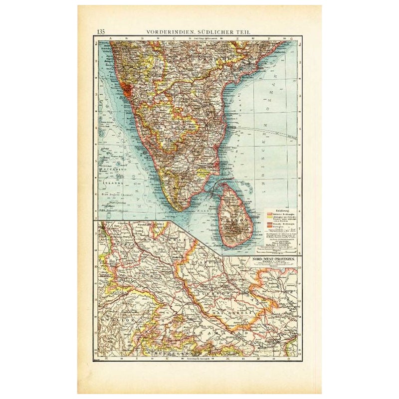
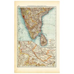
- Antique Map of Southern India by Andree, 1904Located in Langweer, NL"Antique map titled 'Vorderindien, sudlicher Teil'. Map of India, southern part. This map originates from 'Andrees Allgemeiner Handatlas in 126 Haupt-Und 139 Nebenkarten', Bielefeld;...Category
20th Century Maps
MaterialsPaper
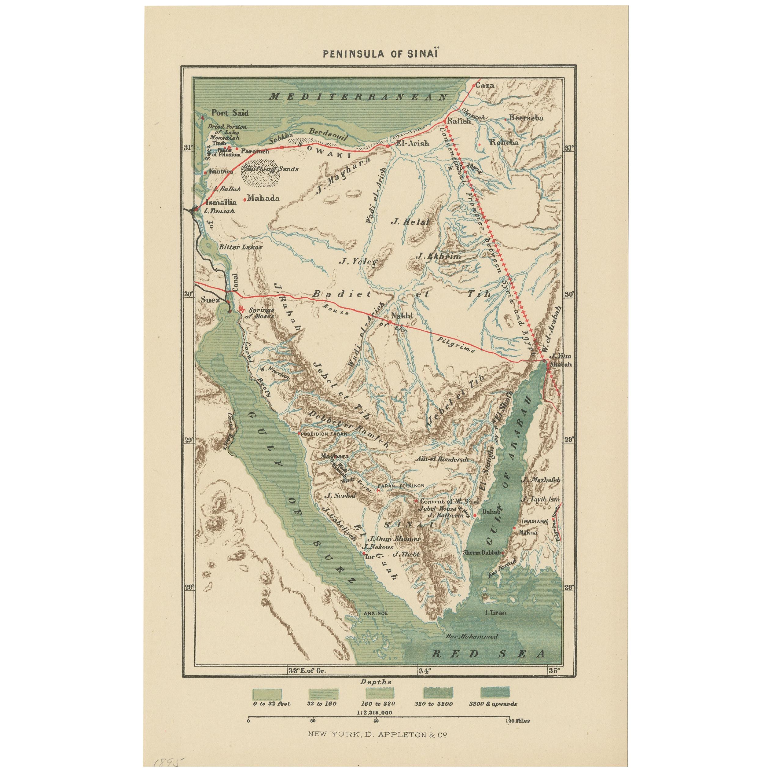
- Antique Map of the Sinai Peninsula, '1895'Located in Langweer, NLAntique map titled 'Peninsula of Sinaï'. Lithographed map of the Sinai Peninsula, a peninsula in Egypt, and the only part of the country located in Asia. It is situated between the M...Category
Antique Late 19th Century Maps
MaterialsPaper
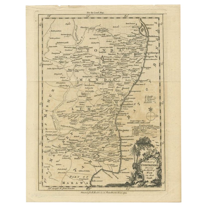
- Antique Map of the Coromandel Peninsula, 1754Located in Langweer, NLAntique map titled 'A map of Coromandel shewing the Seat of War on that coast'. Rare map of Coromandel printed for the London Magazine. Artists and Engravers: This map is not attr...Category
Antique 18th Century Maps
MaterialsPaper
- Antique Map of the Arabian Peninsula by Bonne 'c.1780'Located in Langweer, NLAntique map titled 'Carte de l'Arabie, du Golfe Persique, et de la Mer Rouge (..)'. Original antique map of the Arabian Peninsula, including the horn...Category
Antique Late 18th Century Maps
MaterialsPaper
- Antique Map of the Arabian Peninsula by Bonne 'c.1780'Located in Langweer, NLAntique map titled 'Carte de l'Arabie, du Golfe Persique, et de la Mer Rouge (..)'. Original antique map of the Arabian Peninsula, including the horn...Category
Antique Late 18th Century Maps
MaterialsPaper
- Antique Map of the Arabian Peninsula by Franceschini, '1739'Located in Langweer, NLAntique map titled 'Conventus et Residentiae'. Rare map of the Arabian Peninsula. This map originates from 'Provinciarum et Conventum Fratrum Discalc...Category
Antique Mid-18th Century Maps
MaterialsPaper


You May Also Like
- 1861 Topographical Map of the District of Columbia, by Boschke, Antique MapLocated in Colorado Springs, COPresented is an original map of Albert Boschke's extremely sought-after "Topographical Map of the District of Columbia Surveyed in the Years 1856 ...Category
Antique 1860s American Historical Memorabilia
MaterialsPaper
- Antique Carte de L'Inde Myanmar, Malaysia Vietnam Map of Asia the Chinese EmpireLocated in Amsterdam, Noord HollandAntique Carte de L'Inde Myanmar, Malaysia Vietnam Map of Asia the Chinese Empire Very nice map of Asia. Additional information: Type: Map Country of Man...Category
Antique 18th Century European Maps
MaterialsPaper
- Original Antique Map of The World by Thomas Clerk, 1817Located in St Annes, LancashireGreat map of The Eastern and Western Hemispheres On 2 sheets Copper-plate engraving Drawn and engraved by Thomas Clerk, Edinburgh. Published by Mackenzie And Dent, 1817 ...Category
Antique 1810s English Maps
MaterialsPaper
- 1907 Map of Colorado, Antique Topographical Map, by Louis NellLocated in Colorado Springs, COThis highly detailed pocket map is a topographical map of the state of Colorado by Louis Nell from 1907. The map "has been complied from all availabl...Category
Antique Early 1900s American Maps
MaterialsPaper
- History of the War in the Peninsula by W.F.P. Napier with Lord Elgin ProvenanceBy W.F.P. Napier, C.B.Located in valatie, NYA complete set of "History of the War in the Peninsula" by W.F.P. Napier, in 6 volumes, numbered 1-6. London: Thomas & William Boone all volumes are published in different years from 1828-1840 and are all 1st Ed's. 3/4 leather and marbled board hard covers. The history of the war in the Iberian Peninsula and in the South of France, from 1807 to the 1846 written by W.F.P. Napier, C.B., Colonel H.P. Forty-Third Regiment, and a member of the Royal Swedish Academy of Military Sciences. The wars describe the military conflict between Napoleon's Empire and Bourbon Spain. The United Kingdom of Great Britain and Ireland allied with the Kingdom of Portugal, for control of the Iberian Peninsula during the Napoleonic wars. The volumes have illustrated fold out maps portraying various battles. The set was owned originally by Colonel Thomas Bruce (Lord Elgin) the 7th Earl of Elgin. He sold the "Elgin Marbles" taken from the Parthenon to the British government in 1816. The books were later owned by George Woods...Category
Antique Early 19th Century English Books
MaterialsPaper
- Original Antique Map of The Netherlands, Engraved by Barlow, Dated 1807Located in St Annes, LancashireGreat map of Netherlands Copper-plate engraving by Barlow Published by Brightly & Kinnersly, Bungay, Suffolk. Dated 1807 Unframed.Category
Antique Early 1800s English Maps
MaterialsPaper


Recently Viewed
View AllMore Ways To Browse
The Vintage Map
Map Light
The World Map Vintage
Map Of World Vintage
Map Of The World Vintage
Vintage Map Design
Copper Map
Germany Vintage Map
Vintage German Map
Vintage Map Of Germany
Vintage World Atlas
Antique Presentation Plates
Map With Relief
Copper Map Plate
Richard Stain
Letterpress Furniture
Copper Printing Plate
Relief Map