Map Light
7
to
103
941
696
993
632
388
249
231
150
149
90
89
73
47
47
40
38
37
37
36
31
31
24
22
21
19
18
15
14
13
13
10
9
9
9
8
7
7
7
7
6
5
5
5
4
4
4
4
3
3
3
3
3
3
3
2
1
1
1
1
1
108
65
52
42
42
Sort By
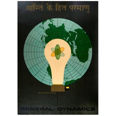
Original Vintage Poster General Dynamics Electrodynamics Atomic Energy Map Light
By Erik Nitsche
Located in London, GB
Nitsche (1908-1998) promoting Electrodynamics. Great illustration featuring the atom symbol inside a light
Category
Vintage 1950s Swiss Posters
Materials
Paper
H 50.4 in W 35.44 in D 0.04 in
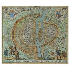
French Map of Paris, Musuem Carnavalet Rossingol University Map, 1576
Located in Gardena, CA
French Map of Paris, Musuem Carnavalet Rossingol University Map, 1576.
Map of Paris, France
Category
Antique 16th Century French Maps
Materials
Paper
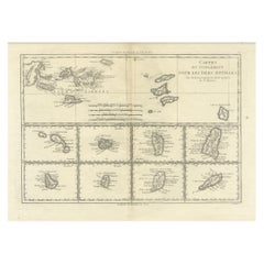
18th Century Antique Map of the Virgin Islands and Caribbean Inset Maps
Located in Langweer, NL
A fascinating piece of cartographic history! The map, titled "Carte du supplément pour les Isles
Category
Antique Late 18th Century Maps
Materials
Paper
Free Shipping
H 12.68 in W 18 in D 0.02 in
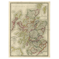
Antique Map of Scotland With an Inset Map of the Shetland Islands, 1854
Located in Langweer, NL
Stunning Map of Scotland that will look beautiful in any setting framed on the wall.
Description
Category
Antique 1850s Maps
Materials
Paper
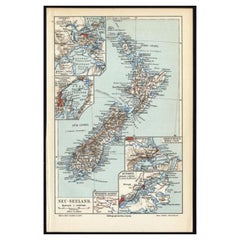
Antique Map of New Zealand, 1895
Located in Langweer, NL
Antique map titled 'Neu-Seeland.' Map of New Zealand. With inset maps of the large cities. This
Category
Antique 19th Century Maps
Materials
Paper
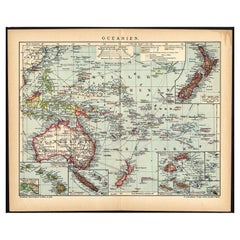
German Antique Map of Oceania, 1895
Located in Langweer, NL
Antique map titled 'Oceanie.' Map of Oceania. This attractive original old antique print / plate
Category
Antique 19th Century Maps
Materials
Paper
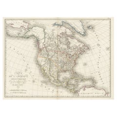
Antique Map of North America, 1821
Located in Langweer, NL
Antique map of America titled 'Carte de l'Amerique septentrionale'. Scarce map of North America
Category
Antique 19th Century Maps
Materials
Paper
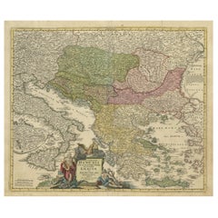
Antique Map of Greece with an Inset Map of the Upper Danube Region, c.1720
Located in Langweer, NL
Antique map titled 'Fluviorum in Europa principis Danubii cum adiacentibus Regnis.'
Detailed map
Category
Antique 18th Century Maps
Materials
Paper
H 21.07 in W 25.2 in D 0 in
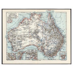
German Antique Map of Australia, Meyers, 1885
Located in Langweer, NL
Australien.' (Map of Australia. With inset maps of the large cities and Tasmania.) This attractive
Category
Antique 19th Century Maps
Materials
Paper
Antique Map of China by Larousse, 1897
By Pierre Larousse
Located in Langweer, NL
Sheet: Front: 'Chine.' (China map). Verso: 'China.' (China views, nature, animals, costume). This
Category
Antique 19th Century Maps
Materials
Paper
Antique Map of Friesland by Guicciardini, 1613
Located in Langweer, NL
Antique map titled 'Frisia Occidenta.' (Map of the province of Friesland, the Netherlands.) This
Category
Antique 17th Century Maps
Materials
Paper
Antique Map of France by Cluver, 1685
Located in Langweer, NL
Antique map titled 'Galliae Veteris Descriptio.' Charming miniature map of France from the pocket
Category
Antique 17th Century Maps
Materials
Paper
Antique Map of Overijssel by Colom, 1635
Located in Langweer, NL
Antique map titled 'Ditio Trans-Isulana'. Original antique map of the province of Overijssel, the
Category
Antique 17th Century Maps
Materials
Paper
Antique Map of the Baarderadeel Township, 1718
Located in Langweer, NL
Antique map Friesland titled 'Baardera Deel de Vierde Grietenije van Wester Goo (..)'. Old map of
Category
Antique 18th Century Maps
Materials
Paper
Antique Map of Stavoren by Blaeu, 1649
Located in Langweer, NL
Antique map titled 'Staveren'. Original antique map of the city of Stavoren, Friesland, The
Category
Antique 17th Century Maps
Materials
Paper
Antique Map of the Palembang Area, c.1900
Located in Langweer, NL
Antique map titled 'Palembang.' This map shows the Palembang area on the Indonesian island of
Category
Antique 19th Century Maps
Materials
Paper
1908 "Map of Texas" by The Kenyon Company
Located in Colorado Springs, CO
Presented is an antique map of the state of Texas, printed as a pocket map in 1908 by The Kenyon
Category
Antique Early 1900s American Maps
Materials
Paper
Antique Map of Herefordshire by Morden, c.1700
Located in Langweer, NL
Antique map titled 'Herefordshire'. Detailed map of the county of Herefordshire embellished with a
Category
Antique 18th Century Maps
Materials
Paper
Old Map of Java, Indonesia by Stemler, 1875
By Stemler
Located in Langweer, NL
Antique map titled 'Hoofddriehoeken - Java en madoera.' (Main triangles measured by the
Category
Antique 19th Century Maps
Materials
Paper
Antique Map of German Colonies by Meyer, 1895
Located in Langweer, NL
Antique map titled 'Deutsche Kolonien.' Lithographed map of the German Colonies. German East-Africa
Category
Antique 19th Century Maps
Materials
Paper
Antique Map of France with Decorative Border, 1766
Located in Langweer, NL
Antique map titled 'La France, divisée en ses quarante Gouvernemens Généraux.' Attractive map of
Category
Antique 18th Century Maps
Materials
Paper
Antique Map of Novaya Zemlya by Bellin, 1758
Located in Langweer, NL
Antique map titled 'Partie de la Mer Glaciale Contenant la Nouvelle Zemle et le Pais des Samoiedes
Category
Antique 18th Century Maps
Materials
Paper
Antique Map of Part of Russia, c.1740
Located in Langweer, NL
Antique map titled 'Ienisensis Provinicia cum adjacentibus Toboliensis & Irkutensis'. Old map of
Category
Antique 18th Century Maps
Materials
Paper
Antique Map of Southeast Asia by Larousse, 1897
Located in Langweer, NL
"Front: 'Carte Generale des Indes.' (General map of India / The Indies / Thailand / Malaysia). Rear
Category
Antique 19th Century Maps
Materials
Paper
Antique Map of Turkey in Asia 'Asia Minor', 1841
Located in Langweer, NL
Antique map titled 'Turkey in Asia'. Original antique map of Asia Minor (Turkey). Source unknown
Category
Antique 19th Century Maps
Materials
Paper
Antique Map of the Holy Land by Schut, 1710
Located in Langweer, NL
Antique map of the Holy Land titled 'Het Beloofde Landt Canaan.' Very detailed and decorative map
Category
Antique 18th Century Maps
Materials
Paper
German Antique Map of the Indian Oceaan, Meyers, 1895
Located in Langweer, NL
This attractive original old antique print / plate / map originates from 1885-1907 editions of a
Category
Antique 19th Century Maps
Materials
Paper
Antique Map of Persia, Georgia and Kazakhstan, ca.1780
Located in Langweer, NL
Antique map titled 'Carte de la Perse, de la Georgie, et de la Tartarie Independante'.
Map of
Category
Antique 1780s Maps
Materials
Paper
Antique Map of Taluti Bay by Stemler, C.1875
Located in Langweer, NL
Antique map titled 'Kaart der Teloeti Baai op Ceram.' This scarce map shows the Taluti Bay on the
Category
Antique 19th Century Maps
Materials
Paper
Antique Map of Gelderland and Overijssel by Guicciardini, 1613
Located in Langweer, NL
Antique map titled 'Geldria et Transisulania.' (Map of the provinces of Gelderland and Overijssel
Category
Antique 17th Century Maps
Materials
Paper
Antique Map of Lower Saxony in Germany, c.1740
Located in Langweer, NL
Antique map titled 'Nieuwe Kaart van de Neder Saxise Kreits (..).' Attractive detailed map showing
Category
Antique 18th Century Maps
Materials
Paper
Antique Map of Sulawesi by Winkler Prins, c.1900
Located in Langweer, NL
Antique map titled 'Celebes.' (Sulawesi .) This map shows the Indonesian island of Sulawesi, one of
Category
20th Century Maps
Materials
Paper
Antique Map of Southeast Asia by Chatelain, c.1732
Located in Langweer, NL
"Antique map titled 'La Royaume de Siam avec les Royaumes qui luy sont Tributaires et les Isles de
Category
Antique 18th Century Maps
Materials
Paper
Antique 19th Century Map of China by Blackie & Son, 1882
Located in Langweer, NL
the north, depicted in a light yellow shade. The map shows a diverse range of topographical details
Category
Antique 1880s Maps
Materials
Paper
Antique Map of Spain and Portugal by Thomson, 1815
Located in Langweer, NL
Antique map titled 'Spain & Portugal.' Map of Spain and Portugal. From Thomson's 'New General Atlas
Category
Antique 19th Century Maps
Materials
Paper
1865 "Johnson's California, Utah, Nevada, Colorado, New Mexico, Arizona" Map
Located in Colorado Springs, CO
, New Mexico, and Arizona” map. First published in 1864, this map was issued as pages 66 and 67 in the
Category
Antique Mid-19th Century Maps
Materials
Paper
H 22.5 in W 30.5 in D 0.75 in
Antique Map of the Bonin Islands by Hawks, 1856
Located in Langweer, NL
Antique map titled 'Chart of the Bonin Group of Islands.' The Bonin Islands, known in Japan as the
Category
Antique 19th Century Maps
Materials
Paper
Antique Map of Westfriesland in Ancient Times by Alting, 1697
Located in Langweer, NL
Antique map titled 'Frisiae Liberae quae Westfresia Post eluviones seculi XIII'. Map of
Category
Antique 17th Century Maps
Materials
Paper
Antique Map of Vlaams-Brabant by Homann Heirs, c.1720
By Homann Heirs
Located in Langweer, NL
in 1750 with 20 maps.
Condition: Good, given age. Light staining and soiling in the margins. A few
Category
Antique 18th Century Maps
Materials
Paper
Antique Map of the Arabian Desert by Cellarius, 1731
Located in Langweer, NL
Antique map titled 'Arabia Petraea et Deserta.' Arabian desert with present day Israel, Jordania
Category
Antique 18th Century Maps
Materials
Paper
Antique Map of the Kai Islands by Stemler, c.1875
Located in Langweer, NL
Antique map titled 'De Kei- of Evar eilanden.' (Kai Islands.) This map shows the Indonesian Kai
Category
Antique 19th Century Maps
Materials
Paper
Antique Map of the Region of Batavia by Conrade, 1782
Located in Langweer, NL
Antique map titled 'Carte des environs de Batavia.' (Map of Batavia and its surroundings.) Map of
Category
Antique 18th Century Maps
Materials
Paper
Antique Map of the Island of Java by Conrade, 1782
Located in Langweer, NL
Antique map titled 'Nouvelle Carte de l' Isle de Java.' (New Map of Java.) This very detailed map
Category
Antique 18th Century Maps
Materials
Paper
Antique Map of the Maluku Islands 'Ambon' by Stemler, 1874
Located in Langweer, NL
Antique map titled 'Peta deri Poeloe Poeloe Ambon ...' (The Island of Ambon.) This very scarce map
Category
Antique 19th Century Maps
Materials
Paper
Antique Map of the Region of Oostergo by Colom, 1635
Located in Langweer, NL
Antique map titled 'Ooster-Goe'. Original antique map of the region of Oostergo, Friesland, the
Category
Antique 17th Century Maps
Materials
Paper
Antique Map of the Franekeradeel Township 'Friesland' by Halma, 1718
Located in Langweer, NL
Antique map Friesland titled 'De Grietenije van Franeker Deel (..) '. Old map of Friesland, the
Category
Antique 18th Century Maps
Materials
Paper
Antique Map of the Lemsterland Township 'Friesland' by Halma, 1718
Located in Langweer, NL
Antique map Friesland titled 'Lemsterland de Seste Grietenije der Zevenwolden (..)'. Old map of
Category
Antique 18th Century Maps
Materials
Paper
Antique Map of the Region of Ooststellingwerf by Schotanus, 1664
By B. Schotanus
Located in Langweer, NL
Antique map titled 'De Grietenije van Stellingwerf oost eynde (..).' Map of the Grietenij of
Category
Antique 17th Century Maps
Materials
Paper
Antique Folding London Map, English, Cartography, Historic, Georgian, Dated 1783
Located in Hele, Devon, GB
This is an antique folding London map. An English, paper on linen cartographical study of the
Category
Antique Late 18th Century British Georgian Maps
Materials
Linen, Paper
H 6.3 in W 6.11 in D 0.6 in
Antique Map of Drenthe, a Province of The Netherlands, 1635
Located in Langweer, NL
Antique map titled 'Drentiae'. Original antique map of the province of Drenthe, the Netherlands
Category
Antique 17th Century Maps
Materials
Paper
Antique Map of the Region of Opsterland by Schotanus, 1664
By B. Schotanus
Located in Langweer, NL
Antique map titled 'De Grietenie van Opsterlandt : waer over d'e. heer Martinus Fockens altans
Category
Antique 17th Century Maps
Materials
Paper
Antique Map of the City of Muiden by Merian, 1659
Located in Langweer, NL
Antique map titled 'Muyden'. Original antique map of the city of Muiden, the Netherlands. This map
Category
Antique 17th Century Maps
Materials
Paper
Antique Map of the Region of Menaldumadeel by Schotanus, 1664
By B. Schotanus
Located in Langweer, NL
Antique map titled 'De Grietenie van Menaldema Deel (..)'. Very decorative regional map of the
Category
Antique 17th Century Maps
Materials
Paper
Antique Map of Eastern Russia in Asia by Kuyper, 1880
Located in Langweer, NL
Antique map titled 'Aziatisch Rusland. Oost'. Original antique map of Eastern Russia in Asia. This
Category
Antique 19th Century Maps
Materials
Paper
Antique Map of Drenthe, a Province in The Netherlands, 1658
Located in Langweer, NL
Antique map titled 'Drentia comitatus (..)'. Copper engraved contemp. hand coloured map of Drenthe
Category
Antique 17th Century Maps
Materials
Paper
Antique Map of The Harbour of Acapulco in Mexico, 1749
Located in Langweer, NL
Description: Antique map titled 'Plan van de Haven van Acapulco (..) - Plan du Port d'Acapulco
Category
Antique 1740s Maps
Materials
Paper
Antique Map of Flanders, Belgium by Homann Heirs, c.1735
Located in Langweer, NL
of Silesia in 1750 with 20 maps.
Condition: Good, given age. Light staining and soiling in the
Category
Antique 18th Century Maps
Materials
Paper
Antique Map of the Gulf of Cambay, Gujarat, India, 1725
By Pieter Van Der Aa
Located in Langweer, NL
Antique map titled 'Le Golfe de Cambaye at la Rade de Suratt.' (The gulf of Cambay and the coast of
Category
Antique 18th Century Maps
Materials
Paper
Antique Map of Belgium and Luxembourg by Homann Heirs, 1747
Located in Langweer, NL
Antique map titled 'Belgium Catholicum seu Decem provinciae Germaniae Inferioris cum confiniis
Category
Antique 18th Century Maps
Materials
Paper
Louisiana: A Framed 19th Century Map by O. W. Gray
By Gray and Co
Located in Alamo, CA
.
The map is presented in a light brown distressed bleached wood frame with a cream mat. The frame
Category
Antique Mid-19th Century American Other Maps
Materials
Paper
- 1
- ...
Get Updated with New Arrivals
Save "Map Light", and we’ll notify you when there are new listings in this category.
Map Light For Sale on 1stDibs
With a vast inventory of beautiful furniture at 1stDibs, we’ve got just the map light you’re looking for. Each map light for sale was constructed with extraordinary care, often using metal, paper and brass. If you’re shopping for a map light, we have 7 options in-stock, while there are 1 modern editions to choose from as well. Your living room may not be complete without a map light — find older editions for sale from the 20th Century and newer versions made as recently as the 21st Century. When you’re browsing for the right map light, those designed in Mid-Century Modern styles are of considerable interest. JRO-Verlag each produced at least one beautiful map light that is worth considering.
How Much is a Map Light?
A map light can differ in price owing to various characteristics — the average selling price 1stDibs is $1,173, while the lowest priced sells for $239 and the highest can go for as much as $7,286.
