Items Similar to French Map of Paris, Musuem Carnavalet Rossingol University Map, 1576


Want more images or videos?
Request additional images or videos from the seller
1 of 9
French Map of Paris, Musuem Carnavalet Rossingol University Map, 1576
About the Item
French Map of Paris, Musuem Carnavalet Rossingol University Map, 1576.
Map of Paris, France - English: Map of Paris (1576) / museum Carnavalet Rossignol, it is the true fortrict of the City, City, University of Paris.
Additional information:
City: Paris
Topic: Maps
Year: 1576
Language: French
Educational Level:University
Dimension: Height 14.5 inches x 16.5 inches (19 inches x 21 inches -framed)
Condition: Some water damage, not removed from the frame. Very slight foxing at the edges. Light and bright colors. Frame in excellent condition, bright display wear.
- Dimensions:Height: 21 in (53.34 cm)Width: 19 in (48.26 cm)Depth: 1 in (2.54 cm)
- Materials and Techniques:
- Place of Origin:
- Period:
- Date of Manufacture:1576
- Condition:Minor structural damages.
- Seller Location:Gardena, CA
- Reference Number:
About the Seller
5.0
Gold Seller
These expertly vetted sellers are highly rated and consistently exceed customer expectations.
1stDibs seller since 2022
46 sales on 1stDibs
Typical response time: 5 hours
- ShippingRetrieving quote...Ships From: Gardena, CA
- Return PolicyA return for this item may be initiated within 7 days of delivery.
More From This SellerView All
- European Wood Iron and Metal Model Cannon with Coat of ArmsLocated in Gardena, CAEuropean Wood Iron and Metal Model Cannon with Coat of Arms Vintage European wood, iron, and metal model cannon. Ornate decoration to cannon featuring a coat of arms. The base the...Category
Antique Late 19th Century Arms, Armor and Weapons
MaterialsWood
- Mark Twain's Sketches, New and Old by Mark Twain *First Edition, 1875Located in Gardena, CAMark Twain's Sketches, new and old by Mark Twain *First Edition, 1875 Additional information: Binding: Hardcover Year Printed: 1875 Special Attribute...Category
Antique 19th Century Books
MaterialsPaper
- Hand Carved Figural Bear Tobacco and Pipe Stand, c1900Located in Gardena, CAHand carved figural bear Tobacco and Pipe stand, c1900 Stand modeled as a bear pipe and tobacco stand with 3 holders for pipes. The head opening contai...Category
Antique 19th Century Tobacco Accessories
MaterialsDriftwood
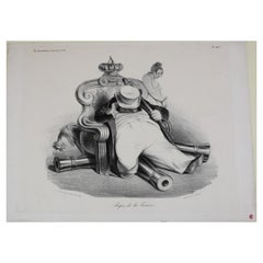
- Lithograph Titled Rest of France Print by Honore DaumierBy Honoré DaumierLocated in Gardena, CADaumier, Honore (France 1808-1879) Lithograph, Titled "Repos de la france". Published in La Caricature August 28, 1834. Stamped GL for George Longstreet. The print shows a tired ...Category
Antique 19th Century Prints
MaterialsPaper
- Denuelle France Hand Painted Porcelain Portrait of Plato Cabinet Plate, c 1820Located in Gardena, CADenuelle France Hand Painted Porcelain Portrait of Plato Cabinet Plate, circa 1820 A gilt ground to the edge chased with flowerheads and trellis, a finely painted portrait of a yo...Category
Antique 19th Century French Porcelain
MaterialsPorcelain
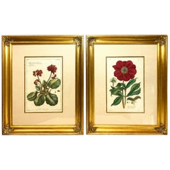
- Pair of Pierre Joseph Buchoz 'French' Botanical Engravings, 18th CenturyLocated in Gardena, CAPair of Pierre Joseph Buchoz (French) Botanical Engravings, 18th century. Floral prints from "Histoire Universelle Du Regne Vegetal", Published in Paris, 1775-1778. Artist signed ...Category
Antique 18th Century Paintings
MaterialsPaper


You May Also Like
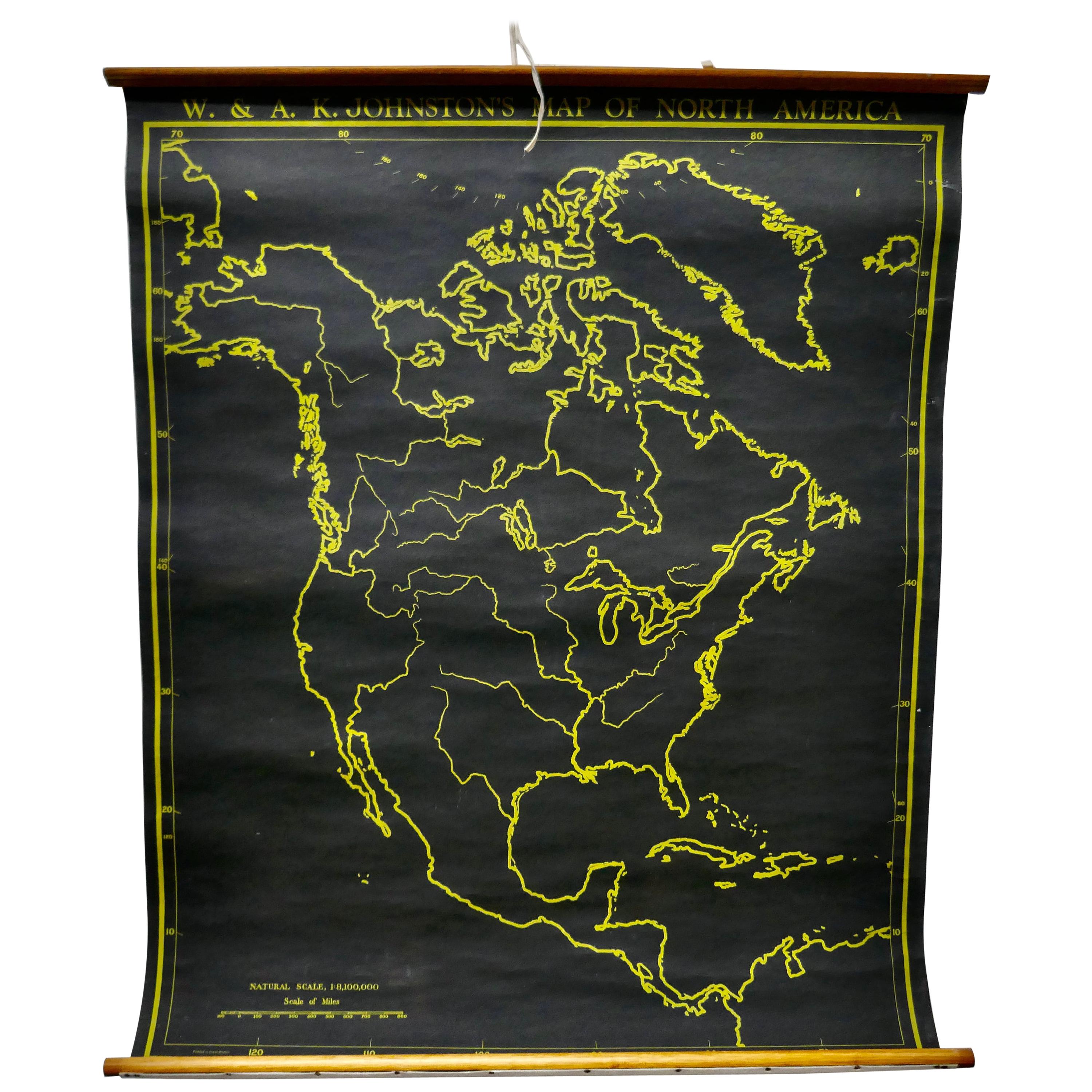
- University Chart “Black Map of North AmericaLocated in Chillerton, Isle of WightUniversity Chart “Black Map of North America W&A K Johnston’s Charts of Physical Maps By G W Bacon, This is a Black Physical map of North A...Category
Early 20th Century Industrial Maps
MaterialsLinen
- Large University Chart “Physical Map of Africa” by BaconLocated in Chillerton, Isle of WightLarge university chart “Physical Map of Africa” by Bacon W&A K Johnston’s Charts of Physical Maps By G W Bacon, This is colorful Physical map of North America, it is large lithograph set...Category
Early 20th Century Folk Art Posters
MaterialsLinen
- Large University Chart “Political Map of North America” by BaconLocated in Chillerton, Isle of WightLarge University Chart “Political Map of North America” by Bacon W&A K Johnston’s Charts of Physical Maps By G W Bacon, This is colourful Physical map ...Category
Early 20th Century American Empire Posters
MaterialsLinen
- Large University Chart “Political Map of North America” by BaconLocated in Chillerton, Isle of WightLarge University chart “Political Map of North America” by Bacon W&A K Johnston’s Charts of Political Maps by G W Bacon, This is colorful Physical ...Category
Early 20th Century American Empire Posters
MaterialsLinen
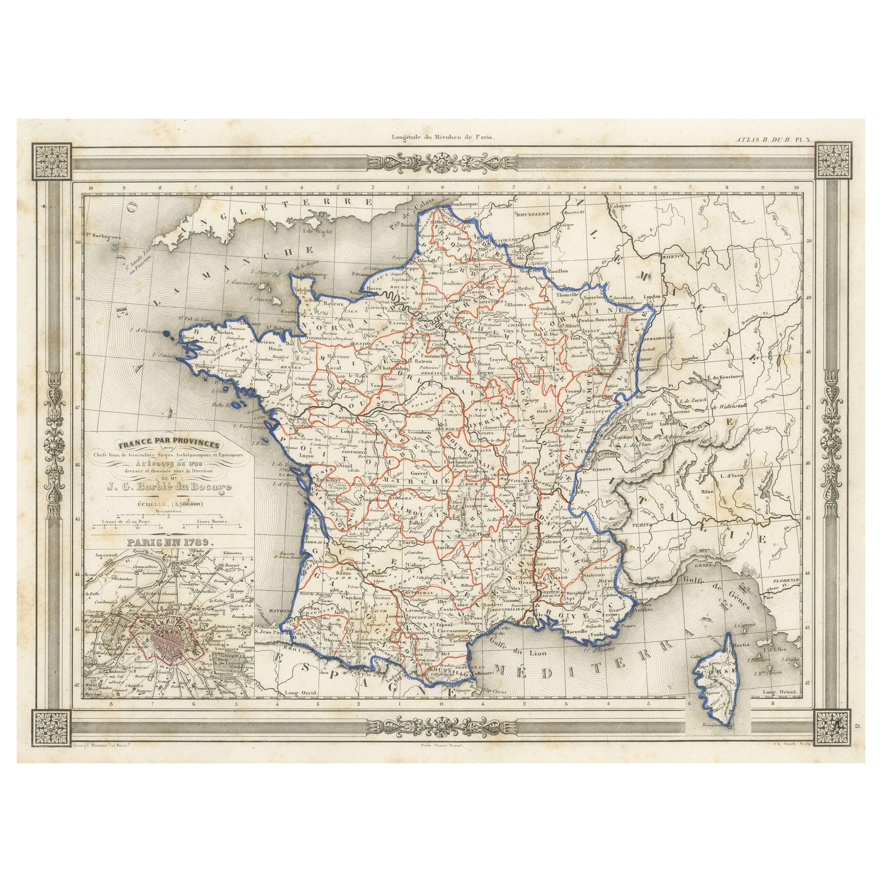
- Antique Map of France in Provinces, with Inset of ParisLocated in Langweer, NLAntique map titled 'France par Provinces'. Original antique map of France in Provinces. It covers from the Flanders in the north to Roussillon in the south and from Brittany in the w...Category
Antique Mid-19th Century Maps
MaterialsPaper
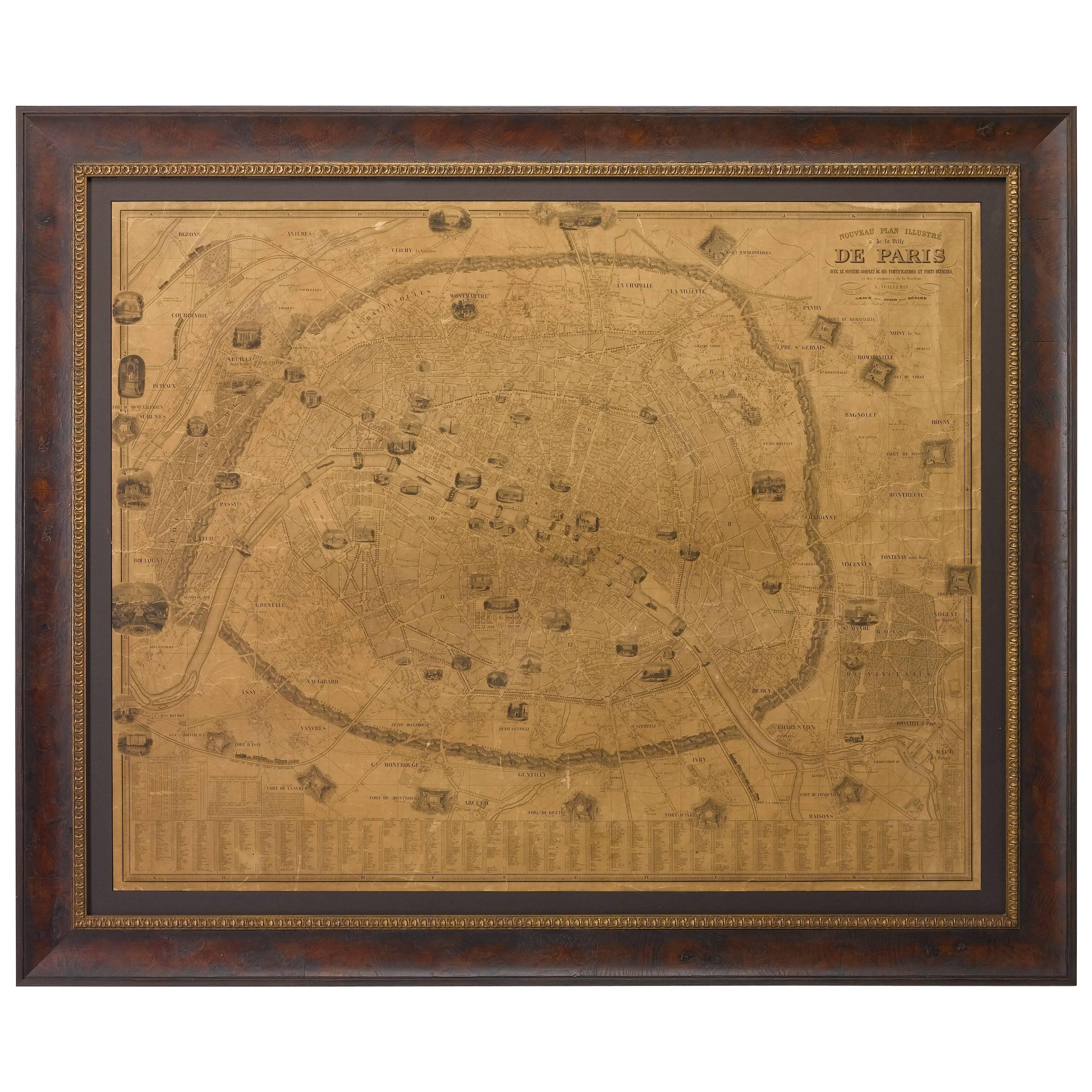
- Plan of Paris, France, by A. Vuillemin, Antique Map, 1845Located in Colorado Springs, COThis large and detailed plan of Paris was published by Alexandre Vuillemin in 1845. The map conveys a wonderful amount of information and is decorated throughout with pictorial vigne...Category
Antique 1840s American Maps
MaterialsPaper


Recently Viewed
View AllMore Ways To Browse
16th Century English
English 16th Century Furniture
Paris City Maps
Framed Map Of Paris
Hand Painted Antique Map
Antique Furniture Depot
Antique Road Maps
Antique Road Map
17th Century Scottish
Antique Maps Of Mexico
Antique Style Atlas
Nautical Map
Nautical Maps
Antique Map Of Mexico
Pacific Map
Antique Ship Decor
Coastal Maps
Antique Maps Mexico