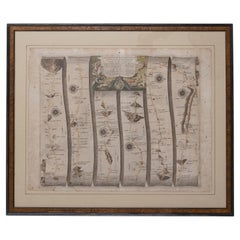
Antique Road Maps

13
to
43
208
100
138
96
76
76
60
60
59
41
31
28
20
20
16
15
13
10
9
8
7
7
6
5
5
5
4
3
3
3
2
2
2
2
1
1
1
1
1
1
1
1
4
3
2
2
2
Sort By
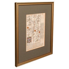
Antique Coaching Road Map, Devon, English, Regional Cartography, Georgian, 1720
Located in Hele, Devon, GB
This is an antique coaching road map of Devon. An English, framed lithograph engraving of regional
Category

Early 18th Century British Georgian Antique Road Maps

Materials

Wood

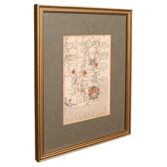
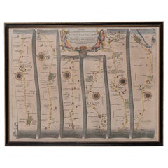
Antique Coaching Road Map, South Devon, English, Framed, Cartography, Georgian
Located in Hele, Devon, GB
This is an antique coach road map of South Devon. An English, framed lithograph engraving of
Category

Early 18th Century British Georgian Antique Road Maps

Materials

Wood

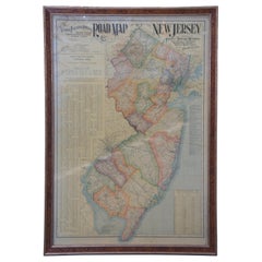
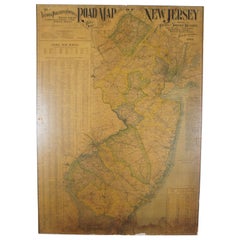
1903 Antique National Publishing Road Map of New Jersey Geological Survey
Located in Dayton, OH
1903 antique New Jersey road map by The National Publishing Company of Boston Massachusettes, No
Category

Early 1900s Victorian Antique Road Maps

Materials

Paper

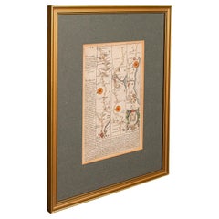
Antique Coach Road Map, East Devon, English, Framed, Cartography, Georgian, 1720
Located in Hele, Devon, GB
This is an antique coach road map of East Devon. An English, framed lithograph engraving of
Category

Early 18th Century British Georgian Antique Road Maps

Materials

Wood

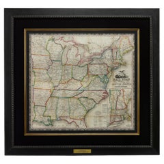
1866 Ensign & Bridgman's Rail Road Map of the United States
Located in Colorado Springs, CO
Presented is an 1866 issue of “Ensign & Bridgeman’s Rail Road Map of the United States, showing
Category

1860s American Late Victorian Antique Road Maps

Materials

Paper

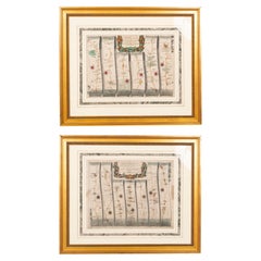
Pair of Road Maps of England by John Ogilby
Located in Essex, MA
The first road maps of England. London to Holyhead and London to Carlisle. Nicely framed and matted
Category

1690s English Antique Road Maps

Materials

Paper

Road Map, John Ogilby, No 54, London, Yarmouth, Britannia
By John Ogilby
Located in BUNGAY, SUFFOLK
Europe. It was composed of maps of seventy-three major roads and cross-roads, presented in a continuous
Category

1670s English Baroque Antique Road Maps

Materials

Paper

Antique 1901 National Publishing Company's Road Map of New Jersey Geological
Located in Dayton, OH
The National Publishing Company's road map of New Jersey, showing all county and township divisions
Category

Early 1900s Victorian Antique Road Maps

Materials

Paper

Road Map Britannia No 32 the Road from London to Barnstable John Ogilby Framed
By John Ogilby
Located in BUNGAY, SUFFOLK
A road map from Britannia, by John Ogilby Esq., Cosmographer and Geographick Printer to Charles II
Category

Late 17th Century English Charles II Antique Road Maps

Materials

Paper

Road Map, John Ogilby, London, Barwick, York, Chester, Darlington, Durham Framed
By John Ogilby
Located in BUNGAY, SUFFOLK
The continuation of the road from London to Barwick beginning at York and extending to Chester in
Category

1670s English Baroque Antique Road Maps

Materials

Paper

Road Map John Ogilby No 75 Kings Lyn Harwich, Britannia Framed Wallhanging
By John Ogilby
Located in BUNGAY, SUFFOLK
Europe. It was composed of maps of seventy-three major roads and cross-roads, presented in a continuous
Category

1670s European Baroque Antique Road Maps

Materials

Paper

Road Map No43 London to Kings Lynn, Royston to Downham, John Ogilby, Britannia
By John Ogilby
Located in BUNGAY, SUFFOLK
John Ogilby (British 1600-1676) Cosmographer and Geographick Printer to Charles II. A road map
Category

Late 17th Century British Charles II Antique Road Maps

Materials

Paper

Road Map John Ogilby London St David's Britannia No 15 Abingdon Monmouth Framed
By John Ogilby
Located in BUNGAY, SUFFOLK
John Ogilby (British 1600-1676) Cosmographer and Geographick Printer to Charles II. A road map from
Category

1670s English Baroque Antique Road Maps

Materials

Paper

Road Map Britannia 1675/6 No 5 Road London to Barwick, London Stilton Grey Frame
By John Ogilby
Located in BUNGAY, SUFFOLK
John Ogilby (British 1600-1676) cosmographer and geographick printer to Charles II. A road map from
Category

Late 17th Century British Charles II Antique Road Maps

Materials

Paper

Road Map Britannia No 15 London to St Davids John Ogilby Brown Gilt Frame
By John Ogilby
Located in BUNGAY, SUFFOLK
Lechlade, to Fairford, to Barnsley to Gloucester showing Monmouth as the destination. A road map from
Category

Late 17th Century British Charles II Antique Road Maps

Materials

Paper

Road Map Britannia No 25 London to the Lands End, John Ogilby Brown Gilded Frame
By John Ogilby
Located in BUNGAY, SUFFOLK
Senan in Cornwall. By John Ogilby His Majesties Cosmographer. A road map from Britannia, 1675/6. No 25
Category

Late 17th Century British Charles II Antique Road Maps

Materials

Paper

Antique Rand McNally & Company Schoolmap. Ancient Oriental Empires. Historical
By Rand McNally & Co.
Located in ROTTERDAM, ZH
fan of history and ancient empires. Rand McNally published its first road map, the New Automobile
Category

1920s American American Classical Antique Road Maps

Materials

Fabric, Paper

Antique Map of Paris, "Carte Routiere des Environs de Paris" 1841
Located in Colorado Springs, CO
This beautiful hand-colored road map of Paris was published in 1841. The map shows Paris and the
Category

1840s French Antique Road Maps

Materials

Paper

Antique Map Made After a Roman Papyrus Travel Map, Known as Peutinger Map, 1773
Located in Langweer, NL
as Peutinger's Tabula or Peutinger Table, is an illustrated itinerarium (ancient Roman road map
Category

18th Century Antique Road Maps

Materials

Paper

Map Road John Ogilby Britannia No 74 Ipswich to Norwich Cromer Framed
By John Ogilby
Located in BUNGAY, SUFFOLK
national road-atlas of any country in Western Europe. It was composed of maps of seventy-three major roads
Category

1670s English Baroque Antique Road Maps

Materials

Paper

Map Road Strip Britannia Sheet 2 John Ogilby London Aberistwith Islip Bramyard
By John Ogilby
Located in BUNGAY, SUFFOLK
national road-atlas of any country in Western Europe. It was composed of maps of seventy-three major roads
Category

17th Century English Baroque Antique Road Maps

Materials

Paper

Original Antique Map of the Road from Bristol to Weymouth
Located in Langweer, NL
Antique map titled 'The Road from Bristol to Weymouth (..)'. Original antique map of the road from
Category

Late 17th Century Antique Road Maps

Materials

Paper

Original Antique Map of the Road from Andover to Crewkerne
Located in Langweer, NL
Antique map titled 'The Continuations of the Road from London to the Lands End'. Original antique
Category

Late 17th Century Antique Road Maps

Materials

Paper

Original Antique Map of the Road from London to Bensington
Located in Langweer, NL
Antique map titled 'The Road from London to St. Davids in com: Pembroke (..)'. A strip map of the
Category

Late 17th Century Antique Road Maps

Materials

Paper

Original Antique Map of the Road from Marlborough to Huntspil
Located in Langweer, NL
Antique map titled 'The Continuation of the Road from London to Bristol (..)'. A strip map of the
Category

Late 17th Century Antique Road Maps

Materials

Paper

Antique Map of the Main Roads of Palembang by Stemler, c.1875
Located in Langweer, NL
.' This scarce map shows the main roads in Palembang on the Indonesian island of Sumatra. Originates from
Category

19th Century Antique Road Maps

Materials

Paper

Antique Map of the Road Between Semarang & Kartosuro by F. Valentijn, 1726
Located in Langweer, NL
tusschen Samarang en Cartasoera. ' A map of the road between Semarang and Kartosuro (Java, Indonesia), made
Category

Early 18th Century Antique Road Maps

Materials

Paper

Antique Map of Martinique, Showing Roads, Houses, Sugar Plantations, etc. c.1750
Located in Langweer, NL
Antique map titled 'Carte de l'Isle de la Martinique'. Detailed map of Martinique. Shows hilly
Category

18th Century Antique Road Maps

Materials

Paper

"Clason's Guide Map of Montana" by The Clason Map Company, Circa 1920s
Located in Colorado Springs, CO
roads” are identified in red snaking lines across the state. The map also shows various oil dome
Category

1920s American Art Deco Antique Road Maps

Materials

Paper

1854 Map of Massachusetts, Connecticut and Rhode Island, Antique Wall Map
Located in Colorado Springs, CO
This striking wall map was published in 1854 by Ensign, Bridgman & Fanning and has both full
Category

19th Century American Antique Road Maps

Materials

Paper

Antique Map of New Jersey
Located in Langweer, NL
Antique map titled 'Colton's New Jersey'. This rare hand colored map of New Jersey is a copper
Category

Mid-19th Century Antique Road Maps

Materials

Paper

Antique Map of New Jersey
H 17.52 in W 13.59 in D 0.02 in
Antique Map of Britain in Roman Times
Located in Langweer, NL
register of the stations and distances along the various roads of the Roman empire. This map originates
Category

Early 19th Century Antique Road Maps

Materials

Paper

Antique Map of Britain in Roman Times
H 17.6 in W 11.07 in D 0.02 in
1851 Map of "Independent Tartary", Ric. R018
Located in Norton, MA
1851 Map of Independent Tartary "Russia" Ric.r018 A highly decorative 1851 map of
Category

19th Century Unknown Antique Road Maps

Materials

Paper

Antique Map of London by Tirion '1754'
Located in Langweer, NL
Antique map titled 'Kaart van Londen enz. en van het naby gelegen land ruim een Uur gaans rondsom
Category

Mid-18th Century Antique Road Maps

Materials

Paper

Antique Map of London by Tirion '1754'
H 12.8 in W 18.31 in D 0.02 in
Antique County Map of Leicestershire, England, 1804
Located in Langweer, NL
Antique county map of Leicestershire first published c.1800. Villages, towns, and cities
Category

Early 1800s Antique Road Maps

Materials

Paper

Antique Map of Sweden by Bowen, 1747
Located in Langweer, NL
Antique map titled 'A New & Accurate Map of Sweden'. This map covers Sweden and Finland (shown as
Category

18th Century Antique Road Maps

Materials

Paper

Antique Map of Sweden by Bowen, 1747
H 14.57 in W 10.24 in D 0 in
Antique Map of Champagne and surrounding Regions, France
Located in Langweer, NL
Antique map titled 'Carte de la Champagne et des Pays Voisins (..)'. Detailed map of Champagne and
Category

Mid-18th Century Antique Road Maps

Materials

Paper

Historical Map Depicting the Continent of Asia, 1882
Located in Langweer, NL
This 1882 map presents a meticulously detailed representation of the continent of Asia, a testament
Category

1880s Antique Road Maps

Materials

Paper

1908 "Map of Texas" by The Kenyon Company
Located in Colorado Springs, CO
Presented is an antique map of the state of Texas, printed as a pocket map in 1908 by The Kenyon
Category

Early 1900s American Antique Road Maps

Materials

Paper

Antique Decorative County Map of Lincolnshire, England, 1804
Located in Langweer, NL
Antique county map of Lincolnshire first published circa 1800 Cities illustrated include Grantham
Category

Early 1800s Antique Road Maps

Materials

Paper

Antique Decorative County Map of Huntingdonshire, England, 1804
Located in Langweer, NL
Antique county map of Huntingdonshire first published c.1800. Cities illustrated include Kimbolton
Category

Early 1800s Antique Road Maps

Materials

Paper

Large Antique Map of the State of Texas, 1861
Located in Langweer, NL
Antique map titled 'Johnson's New Map of the State of Texas' Large map of Texas, shows railroads
Category

Mid-19th Century Antique Road Maps

Materials

Paper

Large Antique Map of the State of Texas, 1861
Free Shipping
H 18.04 in W 26.58 in D 0.02 in
Antique Map of the Nassau Region in Western Germany
Located in Langweer, NL
Antique map titled 'Nassovia Principatus (..)'. Detailed map of the Nassau region in western
Category

Early 18th Century Antique Road Maps

Materials

Paper

Antique Map of the Nassau Region in Western Germany
No Reserve
H 20.67 in W 24.1 in D 0.02 in
Antique Map of Zeeland, The Netherlands, by Jaillot, 1693
Located in Langweer, NL
Antique map titled 'Le Comte de Zeelande (..).' Detailed map of the province of Zeeland, The
Category

17th Century Antique Road Maps

Materials

Paper

Madrid 1901: A Historical Map of Spain's Capital Province
Located in Langweer, NL
The map is of the province of Madrid, the capital region of Spain, as it appeared in 1901. Here are
Category

Early 1900s Antique Road Maps

Materials

Paper

Madrid 1901: A Historical Map of Spain's Capital Province
Free Shipping
H 20.08 in W 14.77 in D 0 in
Antique Map of Moscovy 'Russia' by E. Bowen, 1747
Located in Langweer, NL
Beautiful map of European Russia by the English cartographer Emmanuel Bowen. It depicts the
Category

Mid-18th Century Antique Road Maps

Materials

Paper

Original Antique Map of Malabar, Coromandel 'India' and Ceylon
Located in Langweer, NL
map includes towns, roads, rivers, mountains, lakes, etc. An explanation of the map includes notations
Category

Mid-18th Century Antique Road Maps

Materials

Paper

Antique Map of Sarthe 'France' by V. Levasseur, 1854
By Victor Levasseur
Located in Langweer, NL
Antique map titled 'Dépt. de la Sarthe'. The north-west France Department of Sarthe is in the Pays
Category

Mid-19th Century Antique Road Maps

Materials

Paper

Antique Map of South America by Wyld, circa 1850
By J. Wyld
Located in Langweer, NL
Beautiful folding map of South America titled 'Colombia Prima or South America Drawn from the Large
Category

Mid-19th Century British Antique Road Maps

Materials

Paper

1859 Antique Swiss Panorama: Blackie's Detailed Map of Switzerland
Located in Langweer, NL
map might also detail the transportation networks of the time, including roads and possibly the early
Category

Mid-19th Century Antique Road Maps

Materials

Paper

1859 Classic Map of France: Blackie's Imperial Geographic Masterpiece
Located in Langweer, NL
The "Antique Map of France" from 'The Imperial Atlas of Modern Geography', published in 1859 by W
Category

Mid-19th Century Antique Road Maps

Materials

Paper

Ancient Iberia: Hispania Map from Spruner-Menke Atlas Antiquus, 1880
Located in Langweer, NL
explicitly stated on the map, but based on the provincial divisions and the style of Roman road networks, it
Category

1880s Antique Road Maps

Materials

Paper

Topographical and Infrastructure Map of the Province of Valencia, 1901
Located in Langweer, NL
boundaries are clearly outlined, and various types of roads and railways are indicated, suggesting the map
Category

Early 1900s Antique Road Maps

Materials

Paper

Antique Decorative Coloured Map of South Africa and Madagascar, 1882
Located in Langweer, NL
. **Transportation**: Any rail lines, roads, ports, and other infrastructure depicted on the map would show the
Category

1880s Antique Road Maps

Materials

Paper

1865 "Johnson's Nebraska, Dakota, Colorado, Idaho & Kansas" Map, Johnson & Ward
Located in Colorado Springs, CO
Presented is an original 1865 "Johnson's Nebraska, Dakota, Colorado, Idaho & Kansas” map. This map
Category

Mid-19th Century Antique Road Maps

Materials

Paper

Antique Map of Western Tartary, with Information from Kyrkov's Surveys
Located in Langweer, NL
Antique map titled 'Carte de la Tartarie Occidentale'. This map covers western Tartary with a focus
Category

Mid-18th Century Antique Road Maps

Materials

Paper

1865 "Johnson's Missouri and Kansas" Map by Johnson and Ward
Located in Colorado Springs, CO
Iowa, Illinois, and Arkansas. The map is beautifully detailed, with railroads, roads, rivers and creeks
Category

Mid-19th Century Antique Road Maps

Materials

Paper

Anrtique Map of the Province of Valladolid, Central Spain, 1902
Located in Langweer, NL
Origen). The map likely shows a network of roads and railways as they existed in the early 20th century
Category

Early 1900s Antique Road Maps

Materials

Paper

Burgos 1902: Geographic Map of Castile's Historic Heartland in Spain
Located in Langweer, NL
The map of the province of Burgos in the autonomous community of Castile and León in Spain, dated
Category

Early 1900s Antique Road Maps

Materials

Paper

Antique Decorative Map of The County of Nottinghamshire, England, 1804
Located in Langweer, NL
Antique county map of Nottinghamshire first published c.1800. Villages, towns, and cities
Category

Early 1800s Antique Road Maps

Materials

Paper

  • 1
Get Updated with New Arrivals
Save "Antique Road Maps", and we’ll notify you when there are new listings in this category.

Antique Road Maps For Sale on 1stDibs

There is a range of antique road maps for sale on 1stDibs. Each of these unique antique road maps was constructed with extraordinary care, often using paper, fabric and linen. Antique road maps have been produced for many years, with earlier versions available from the 18th Century and newer variations made as recently as the 20th Century. Antique road maps bearing Baroque or Victorian hallmarks are very popular at 1stDibs.

Finding the Right collectibles-curiosities for You

Antique and vintage collectibles and curiosities can bring whimsy and wonder to any interior. 

Decorating with old scientific instruments, historical memorabilia and vintage musical instruments, as well as other authentic collectibles and curiosities that can be found on 1stDibs, presents an opportunity to create a unique, natural history museum-like atmosphere in your home that can provoke conversation as often as it pays tribute to how far we’ve come in understanding our world. 

And bringing collectibles and curiosities into your space is actually on trend — Wunderkammern, or curiosity cabinets, were all the rage in Europe during the 1500s and continued to have adherents there and in the U.S. in the following centuries. Today, however, they’re experiencing a real surge in popularity and influencing how many interior designers are furnishing and decorating homes — combining contemporary with antique, scientific with tribal, earthly with extraterrestrial, Les Lalanne tables with Flemish tapestries.

The original Wunderkammern were entire rooms filled with objects demonstrating their owners’ worldly knowledge: A proper one included artificiala or preciosa (objets d’art); naturalia (such as skeletons, shells, minerals); exotica (taxidermy or dried plants); and scientifica (scientific instruments), frequently alongside religious relics and ancient artifacts.

Pay tribute to a history of rich and diverse musical traditions that have taken shape all over the world by decorating your home with a collection of antique and vintage musical instruments — with a little help from strong hanging wire or some wall hooks, vintage brass instruments such as a gong, French horn or trumpet can help elevate a home office or complement the efforts you’ve made to ensure a welcoming vibe in your home’s entryway. Bells or antique wind instruments can add provocative metallic contrasts to dark woods as tabletop decorative objects.  

Create an intriguing focal point with Georgian scientific instruments, such as stick barometers with mahogany cases or lacquered brass telescopes. These items stem from an era named for the monarchies of the four King Georges, who ruled England in succession starting in 1714 (plus King William’s reign, which lasted until 1837). Just as there was beautiful jewelry produced during the period that today is coveted by collectors, there is much to be found in the collectibles and curiosities realm too.

Wanderlust, nostalgia and a shared love of good design are contributing factors to certain trends in decorating — just as vintage trunks and luggage have reappeared as furniture or home accents in a bedroom or foyer, decorating with globes, maps or nautical objects is similarly rooted in the allure of travel and a penchant for the stylish finishing touch that collectibles bring to our homes.

Find a wide range of antique and vintage collectibles and curiosities on 1stDibs.

Read More

Pamela Shamshiri Shares the Secrets behind Her First-Ever Book and Its Effortlessly Cool Interiors

The sought-after designer worked with the team at Hoffman Creative to produce a monograph that beautifully showcases some of Studio Shamshiri's most inspiring projects.

Moroccan Artworks and Objects Take Center Stage in an Extraordinary Villa in Tangier

Italian writer and collector Umberto Pasti opens the doors to his remarkable cave of wonders in North Africa.

Montecito Has Drawn Royalty and Celebrities, and These Homes Are Proof of Its Allure

Hollywood A-listers, ex-pat aristocrats and art collectors and style setters of all stripes appreciate the allure of the coastal California hamlet — much on our minds after recent winter floods.

Whaam! Blam! Pow! — a New Book on Pop Art Packs a Punch

Publishing house Assouline and writer Julie Belcove have teamed up to trace the history of the genre, from Roy Lichtenstein, Andy Warhol and Yayoi Kusama to Mickalene Thomas and Jeff Koons.

The Sparkling Legacy of Tiffany & Co. Explained, One Jewel at a Time

A gorgeous new book celebrates — and memorializes — the iconic jeweler’s rich heritage.

What Makes a Gem-Encrusted Chess Set Worth $4 Million?

The world’s most opulent chess set, weighing in at 513 carats, is literally fit for a king and queen.

Tauba Auerbach’s Geometric Pop-Up Book Is Mighty Rare, Thanks to a Hurricane

This sculptural art book has an epic backstory of its own.

Step inside the Storied Mansions of Palm Beach’s Most Effervescent Architect

From Spanish-style courtyards to fanciful fountains, these acclaimed structures abound in surprising and elegant details.