Items Similar to Antique Map of Champagne and surrounding Regions, France

Want more images or videos?
Request additional images or videos from the seller
1 of 6
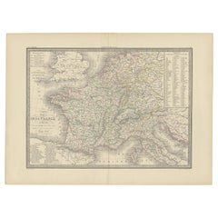
Antique Map of Champagne and surrounding Regions, France
About the Item
Antique map titled 'Carte de la Champagne et des Pays Voisins (..)'. Detailed map of Champagne and surrounding regions of Chalons and Soissons, Reims, Vedun, Mouzon, Sean, Charlemont, etc. Highly detailed, showing fortified cities, roads, towns, rivers, lakes, forests, etc. By Guillaume Delisle, published circa 1745.
- Dimensions:Height: 20.24 in (51.4 cm)Width: 26.89 in (68.3 cm)Depth: 0.02 in (0.5 mm)
- Materials and Techniques:
- Period:
- Date of Manufacture:circa 1745
- Condition:Original/contemporary hand coloring. Original folding line. General age-related toning. Please study image carefully.
- Seller Location:Langweer, NL
- Reference Number:
About the Seller
5.0
Platinum Seller
These expertly vetted sellers are 1stDibs' most experienced sellers and are rated highest by our customers.
Established in 2009
1stDibs seller since 2017
1,928 sales on 1stDibs
Typical response time: <1 hour
- ShippingRetrieving quote...Ships From: Langweer, Netherlands
- Return PolicyA return for this item may be initiated within 14 days of delivery.
More From This SellerView All
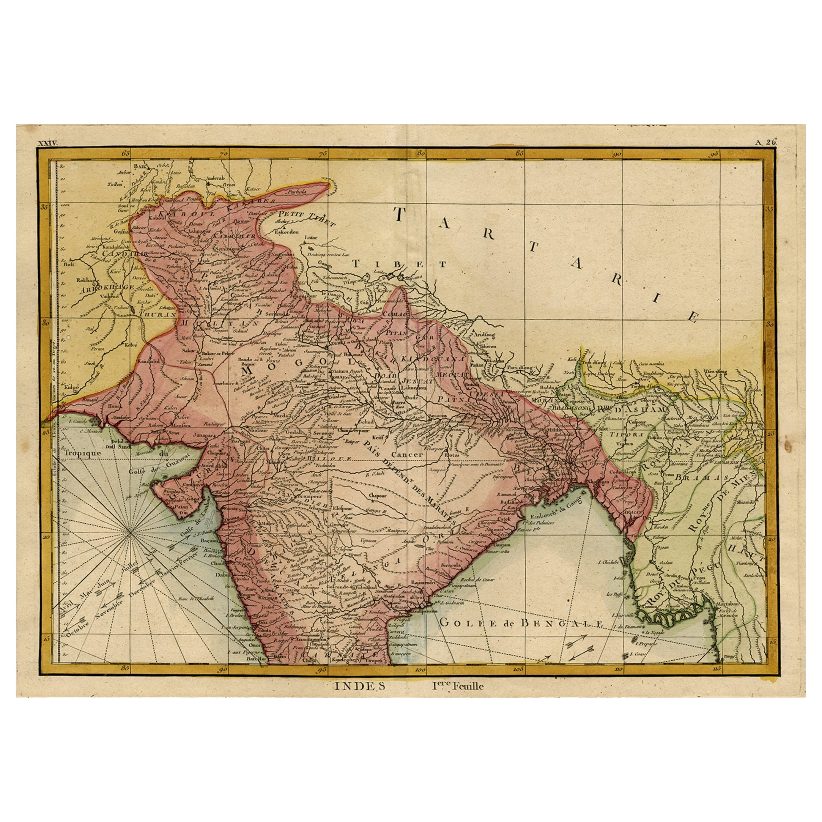
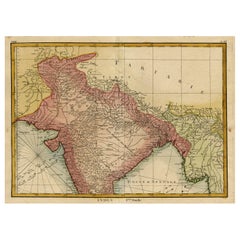
- Original and Colourful Map of Northern India with Surrounding Regions, 1783Located in Langweer, NLAntique map titled 'Indes'. A map of Northern India with surrounding regions. From Lattre's 'Atlas moderne ou collection de cartes sur toutes les parties du globe terrestre...Category
Antique 1780s Maps
MaterialsPaper
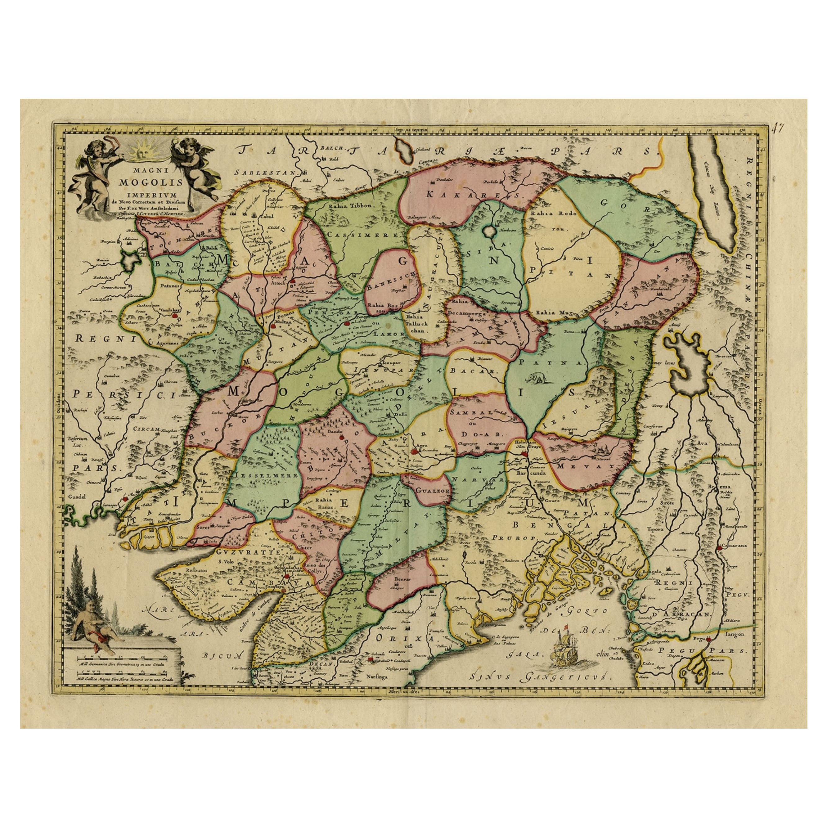
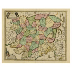
- Map of Northern India & Surrounding Regions, incl Kabul, Candahar & Bhutan, 1710Located in Langweer, NLAntique map titled 'Magni Mogolis Imperium de Novo Correctum et Divisum Per F. de Witt Amstelodami.' Map of Northern India and surrounding regions. This includes Kabul and Candah...Category
Antique 1710s Maps
MaterialsPaper
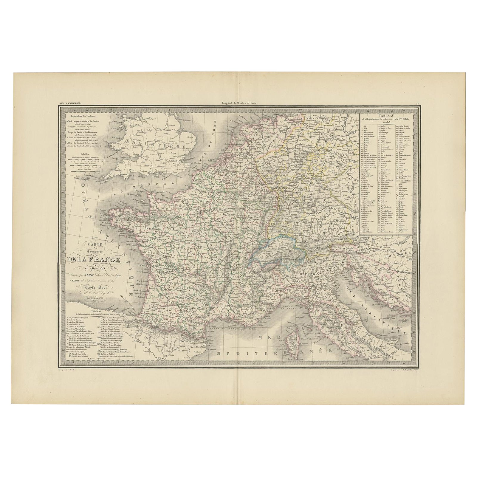
- Antique Map of France with Surrounding Countries, 1842Located in Langweer, NLAntique map titled 'Carte comparée de la France en 1789 et 1813'. Map of France. This map originates from 'Atlas universel de géographie ancienne et moderne (..)' by Pierre M. Lapie ...Category
Antique 19th Century Maps
MaterialsPaper
- Antique Map of the Arctic Regions by Lowry '1852'Located in Langweer, NLAntique map titled 'Arctic Regions'. Original map of the Arctic Regions. This map originates from 'Lowry's Table Atlas constructed and engraved from the most recent Authorities' by J...Category
Antique Mid-19th Century Maps
MaterialsPaper
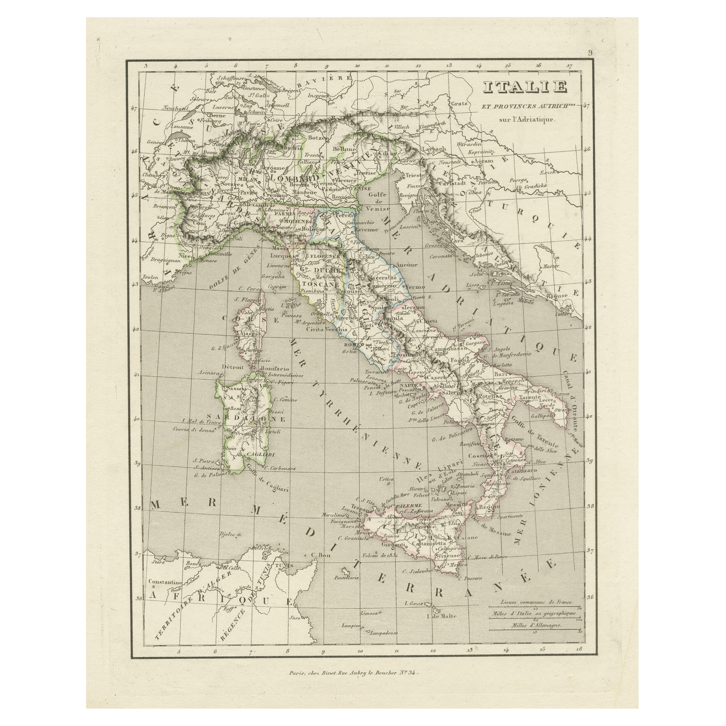
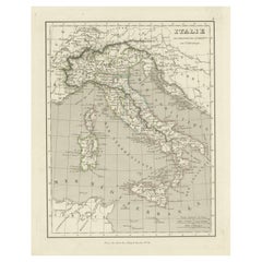
- Antique Map of Italy and Other Regions Near the Adriatic SeaLocated in Langweer, NLAntique map titled 'Italie et Provinces Autrichnes sur l'Adriatique'. Original old map of Italy and surroundings. Also shows Sicily and Sardinia. Ori...Category
Antique Mid-19th Century Maps
MaterialsPaper
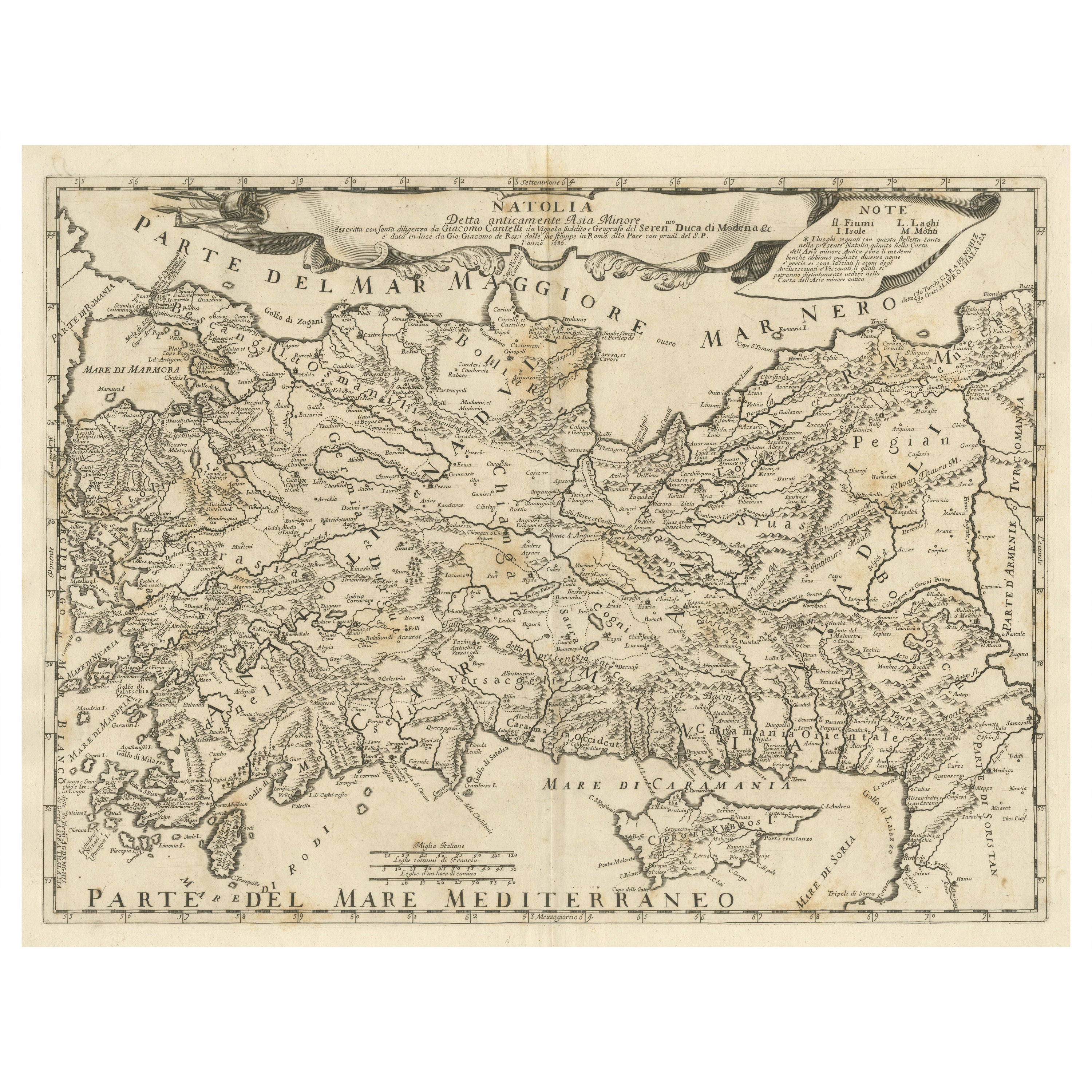
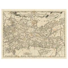
- Original Italian Antique Map of Asia Minor and Cyprus and Neighboring RegionsLocated in Langweer, NLAntique map titled 'Natolia detta anticamente Asia Minor (..)'. Rare map of Asia Minor (Turkey) and Cyprus and neighboring regions. The map provides one of the most detailed and up t...Category
Antique Late 17th Century Maps
MaterialsPaper

You May Also Like
- Original Antique Map of France, Arrowsmith, 1820Located in St Annes, LancashireGreat map of France Drawn under the direction of Arrowsmith. Copper-plate engraving. Published by Longman, Hurst, Rees, Orme and Brown, 1820 Unframed.Category
Antique 1820s English Maps
MaterialsPaper
- Antique Map of Principality of MonacoBy Antonio Vallardi EditoreLocated in Alessandria, PiemonteST/619 - "Old Geographical Atlas of Italy - Topographic map of ex-Principality of Monaco" - ediz Vallardi - Milano - A somewhat special edition ---Category
Antique Late 19th Century Italian Other Prints
MaterialsPaper
- 17th Century Topographical Map, French Champagne Region, Epernay, Iohan PeetersLocated in New York, NYFine topographical 17th century map by Iohan Peeters of the towns of Epernay and Lametz in the Champagne Region of North Eastern France. Fabulous period engraving for a Wine Cellar,...Category
Antique 17th Century Dutch Maps
MaterialsPaper
- Original Antique Map of France, Sherwood, Neely & Jones, Dated 1809Located in St Annes, LancashireGreat map of France Copper-plate engraving by Cooper Published by Sherwood, Neely & Jones. Dated 1809 Unframed.Category
Antique Early 1800s English Maps
MaterialsPaper
- Original Antique Map of Spain and Portugal, circa 1790Located in St Annes, LancashireSuper map of Spain and Portugal Copper plate engraving by A. Bell Published, circa 1790. Unframed.Category
Antique 1790s English Other Maps
MaterialsPaper
- Original Antique Map of Ireland- Tipperary and Waterford. C.1840Located in St Annes, LancashireGreat map of Tipperary and Waterford Steel engraving Drawn under the direction of A.Adlard Published by How and Parsons, C.1840 Unframed.Category
Antique 1840s English Maps
MaterialsPaper


