Antique Map Of Cuba
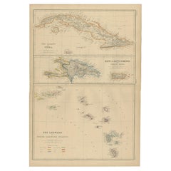
Antique Map of Cuba, Haiti and Porto Rico by W. G. Blackie, 1859
Located in Langweer, NL
Antique map titled 'The Leeward or North Caribbean Islands'. Original antique map of Cuba, Haiti
Category
Mid-19th Century Antique Map Of Cuba
Materials
Paper
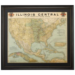
1899 Poole Brothers Antique Railroad Map of the Illinois Central Railroad
Located in Colorado Springs, CO
destination and distance, along with routes originating from Havana. Inset at bottom left is a map of Cuba; an
Category
1890s American Antique Map Of Cuba
Materials
Paper
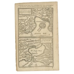
Antique Map of Fort Saint Louis and Santiago de Cuba, 1748
Located in Langweer, NL
St Domingo / A plan of the town and bay of St. Jago, in the Isle if Cuba'. Two woodcut maps on one
Category
18th Century Antique Map Of Cuba
Materials
Paper
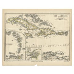
Antique Map of the Antilles by Meyer, 1878
Located in Langweer, NL
Bahamas and Cuba. With inset maps of the Lesser Antilles and Havana. This map originates from Meyer's
Category
19th Century Antique Map Of Cuba
Materials
Paper
Antique Map of the West Indies by Wyld '1845'
Located in Langweer, NL
, including Cuba, the Bahamas, the Antilles and surrounding islands. This map originates from 'An Atlas of the
Category
Mid-19th Century Antique Map Of Cuba
Materials
Paper
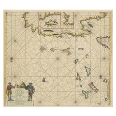
Original Antique Sea Chart of the Northern Part of Hispaniola, Western Cuba
Located in Langweer, NL
northern part of Hispaniola, western Cuba. The map includes the Turks & Caicos Islands and southern part of
Category
Late 17th Century Antique Map Of Cuba
Materials
Paper
H 21.26 in W 24.02 in D 0.02 in
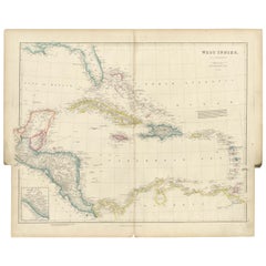
Original Antique Map of the West Indies by J. Arrowsmith, 1842
Located in Langweer, NL
Title: "J. Arrowsmith's 19th Century Map of the West Indies"
This original antique map, crafted by
Category
Early 19th Century Antique Map Of Cuba
Materials
Paper
No Reserve
H 20.87 in W 27.17 in D 0 in
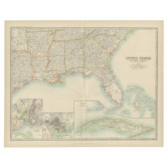
Antique Map of the United States ' South East ' by Johnston '1909'
Located in Langweer, NL
America ( South East Sheet ). With inset maps of New York, Washington and Cuba. This map originates from
Category
Early 20th Century Antique Map Of Cuba
Materials
Paper
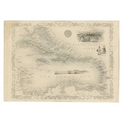
Engraving by Tallis and Rapkin of Map of the West Indies in The Caribbean, 1851
Located in Langweer, NL
:** John Rapkin (engraved by)
**Publisher:** John Tallis
**Date:** 1851
The map spans from Cuba and
Category
Mid-19th Century Antique Map Of Cuba
Materials
Paper
H 10.44 in W 14.57 in D 0 in
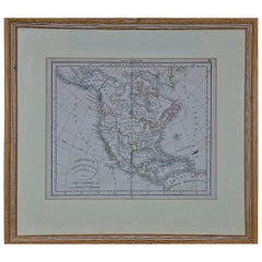
America "Amérique Septentrionale": A 19th Century French Map by Delamarche
By Maison Delamarche 1
Located in Alamo, CA
This framed mid 19th century map of North America entitled "Amérique Septentrionale" by Felix
Category
Mid-19th Century American Other Antique Map Of Cuba
Materials
Paper
H 20 in W 22.63 in D 0.88 in
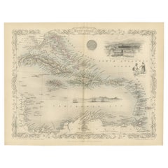
Ornate Cartography of Colonial Grandeur: The West India Islands around 1851
Located in Langweer, NL
but also historical artifacts and works of art.
The map includes islands such as Cuba, Jamaica
Category
1850s Antique Map Of Cuba
Materials
Paper
No Reserve
H 10.71 in W 14.26 in D 0 in
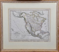
North America: A Framed Hand-colored 19th Century German Map by Adolph Stieler
By Adolf Stieler
Located in Alamo, CA
and The Osage District. The map does include Canada, Mexico, Central America, Cuba, Jamaica, Haiti
Category
1830s Antique Map Of Cuba
Materials
Engraving
H 19.5 in W 22 in D 0.88 in
A truly delightful miniature terrestrial pocket globe
By Nathaniel Mills
Located in ZWIJNDRECHT, NL
turning overhead. In line with its counterpart, the terrestrial globe, celestial globes are mapped by a
Category
Mid-18th Century British Dutch Colonial Antique Map Of Cuba
Materials
Other
People Also Browsed
Antique American Empire Card/ Games Table in West Indies Mahogany with Pedestal
Located in Miami, FL
An American Empire games or card table with cylinder column resting on quatre-form base terminating with turned feet on casters. Swivel-top opens to a square with storage compartment...
Category
1830s American American Empire Antique Map Of Cuba
Materials
Mahogany
H 30 in W 36 in D 17 in
Engraving of a Map of Florida, the Gulf Coast, Caribbean & Central America, 1728
Located in Langweer, NL
This exceptional antique map, titled "Nouvelle Carte Marine de Toute les Cotes de l´Amerique" and alternatively known as "Nieuwe groote en seer Curieuse Paskaart van Geheel-WestIndie...
Category
Mid-18th Century European Antique Map Of Cuba
Materials
Paper
Free Shipping
H 24.61 in W 40.56 in D 0.02 in
2nd World War Military Campaign Steamer Trunk Owner Major McGregor Medical Corps
Located in High Wycombe, GB
A Well Preserved British 2nd World War Military Campaign Steamer Trunk. Owner Major RM McGregor. Medical Corps
27 Bridge Street Hawick
At No 27 is the long-established Deans Chartere...
Category
Early 20th Century English Campaign Antique Map Of Cuba
Materials
Brass
H 48.04 in W 21.66 in D 25.6 in
"Boy on Carousel" large oil painting
By Helen Rayburn Caswell
Located in San Francisco, CA
This artwork "Boy on Carousel" c.1970 is an oil painting on canvas by noted California artist, Helen Rayburn Caswell, 1923-2018. It is signed at the right bottom corner by the artist...
Category
Late 20th Century American Impressionist Antique Map Of Cuba
Materials
Oil
Cuban Vintage Film Poster -Retrospective Movies & Plays- Silkscreen Reboiro 1980
Located in Miami, FL
Cuban Pop Op Art poster for the retrospective of Cuban director Santiago Alvarez ‘s works held in Havana 1980, silkscreen by Antonio Fernández Reboiro.
“SANTIAGO ALVAREZ 1961-1979 –...
Category
1980s Cuban Modern Antique Map Of Cuba
Materials
Paper
H 28 in W 18 in D 0.13 in
English 18th Century Oak Dresser Base with 6 Drawers & 2 Cabinet Doors
Located in Atlanta, GA
Street
48 Society St.
300 W 14th St. Ste. 202
374 Broome St. Apt. 3N
3325B Sacramento St. Ste. 200
4310 Abbott Ave.
2171 Kingston Ct. Ste. A
3003 Larimer St.
2206 Pearl St.
44 River ...
Category
18th Century English Antique Map Of Cuba
Materials
Oak
Historical American Civil War Era Wire Frame Magnifying Eye Glass Spectacles
Located in Philadelphia, PA
A delicate pair of handmade magnifying wire rim eye glasses from the American Civil War era, circa 1860.
A great looking historical conversation piece or decor item. Use this pair ...
Category
Mid-19th Century American American Classical Antique Map Of Cuba
Materials
Metal
H 1.25 in W 5.5 in D 7 in
79 Springtimes 1970 Cuban Film Poster
Located in New York, NY
Original 1970 Cuban poster by Antonio Fernandez Reboiro for the film 79 Springtimes (79 primaveras) directed by Santiago Alvarez with Ho Chi Minh. Very Good condition, rolled with re...
Category
1970s South American Antique Map Of Cuba
Materials
Paper
Vintage Map of the Greater Antilles and Lesser Antilles
Located in Langweer, NL
Vintage map titled 'Antilles'. Original map of the Antilles. Shows the Cayman Islands, Cuba, Hispaniola (subdivided into the nations of the Dominican Republic and Haiti), Jamaica, an...
Category
20th Century Antique Map Of Cuba
Materials
Paper
Original Antique Map of Martinique Island In The West Indies by Bonne, circa1780
Located in Langweer, NL
Antique map titled 'Carte de l'Isle de la Martinique Colonie Francoise dans les Isles Antilles'. Detailed map of the French Island of Martinique.
Many towns and harbours, anchor pl...
Category
18th Century Antique Map Of Cuba
Materials
Paper
H 13.59 in W 10.04 in D 0 in
Large Collage Painting Miami Outsider Artist Purvis Young Abstract Outsider Art
By Purvis Young
Located in Surfside, FL
Purvis Young (1943-2010)
Mixed media collage oil on poster board painting. Painted atop a voting advertisement sign.
Signed in multiple places on piece "Young".
Purvis Young (1943...
Category
1990s Outsider Art Antique Map Of Cuba
Materials
Paint, Mixed Media, Cardboard
Original Engraving of the West Indies, Gulf of Mexico, Antilles, Caribbean, 1780
Located in Langweer, NL
Rigobert Bonne and G. Raynal's 1780 map of the West Indies, Gulf of Mexico, Antilles, and the Caribbean stands as a remarkable cartographic piece, offering a detailed and expansive v...
Category
Late 18th Century Antique Map Of Cuba
Materials
Paper
H 9.85 in W 15.16 in D 0 in
Smith Rock
By Nancy Merkle
Located in San Francisco, CA
Artist Comments
Smith Rock is a nationally known rock climbing destination in the high desert of Central Oregon, a hub of outdoor recreation. As I walked the trail that circ...
Category
21st Century and Contemporary Abstract Impressionist Antique Map Of Cuba
Materials
Acrylic
Original Antique Map of the Island of Dominica in the West Indies, 1794
Located in Langweer, NL
MAP OF THE ISLAND OF DOMINICA for the History of the West Indies, by Bryan Edwards. Esq.
Dominica, an island renowned for its lucrative exports of sugar, cocoa, and coffee, operated...
Category
1790s Antique Map Of Cuba
Materials
Paper
Spirit of St Louis Signed Fabric with Certificate of Authenticity
Located in Jersey, GB
The largest piece of original Spirit of St Louis fabric we have seen
Signed by Charles Lindbergh
Provenance from the collection of James E. Morrow - a member of the welcoming commi...
Category
1920s Antique Map Of Cuba
Materials
Canvas
Free Shipping
H 3 in W 2 in D 0.1 in
The Large Green Parrot of The West Indies Hand-Colored and Engraved, 1749
Located in Langweer, NL
This is an 18th-century hand-colored engraving from Johann Michael Seligmann's collection, displaying a parrot species. Here’s the transcription and translation of the visible text:
...
Category
1740s Antique Map Of Cuba
Materials
Paper
Free Shipping
H 14.57 in W 9.85 in D 0 in
Recent Sales
'The Coast of Newfoundland from Placencia to Cape Bonavista [...].
By Edmond Halley
Located in Zeeland, Noord-Brabant
- A Draught of the River Plata in South America.
Four maps on one sheet: a map of Avalon Peninsula
Category
Early 18th Century Antique Map Of Cuba
Materials
Engraving
Sea chart of Santa Domingo and its surroundings - Engraving - 18th century
Located in Zeeland, Noord-Brabant
pour servir aux Vaisseaux du Roy [...]' - (Reduced map of the island of Santa Domingo and surroundings
Category
1750s Old Masters Antique Map Of Cuba
Materials
Engraving
Painting of a Cotton Picker by William Aiken Walker
By William Aiken Walker
Located in Alexandria, VA
visited New York and Cuba but was back in Baltimore by 1871, when he began the series of paintings that
Category
1870s American Antique Map Of Cuba
Materials
Composition
Pair of Classical Lyre-Back Mahogany Side Chairs with Paw Feet, Phyfe school
Located in Providence, RI
, grace and beauty to live with. This pair is composed of heavy Cuban mahogany and beautifully carved
Category
1810s American American Classical Antique Map Of Cuba
Materials
Mahogany
West Indies, 1606
By Gerard Mercator
Located in Houston, TX
"CUBA INSULA, HISPANIOLA INSULA," Gerardus Mercator, Amsterdam.
Featuring the islands of Cuba
Category
Early 1600s Belgian Antique Map Of Cuba
1857 Wall Map of the United States by Fanning, Bridgman & Ensign
By Thayer, Bridgman and Fanning
Located in Colorado Springs, CO
, Cuba, and Central America as far as Panama. Inset maps in the lower left illustrate the World on a
Category
1850s American Antique Map Of Cuba
Materials
Paper
Antique Map of the West India Islands and Central America by Johnston '1909'
Located in Langweer, NL
Rico, Antilles, Cuba, Honduras and more. This map originates from the ‘Royal Atlas of Modern Geography
Category
Early 20th Century Antique Map Of Cuba
Materials
Paper
H 19.49 in W 24.41 in D 0.02 in
Mitchell's New National Wall Map Exhibiting the United States, circa 1856
Located in Colorado Springs, CO
"Mitchell's New National Map of the United States, North American British Provinces, Sandwich
Category
1850s American Antique Map Of Cuba
Gulf of Mexico, Florida, C. America, Cuba: 18th C. Hand-colored Map by Bellin
By Jacques-Nicolas Bellin
Located in Alamo, CA
This beautiful 18th century hand-colored map entitled "Carte du Golphe du Mexique et des Isles de
Category
1750s Antique Map Of Cuba
Materials
Engraving
Crayon or Pastel on Muslin Naive Map of America
Located in York County, PA
NAÏVE MAP OF AMERICA, CRAYON OR PASTEL ON MUSLIN, CA 1920-30, WITH A MYRIAD OF INTERESTING
Category
Early 20th Century Antique Map Of Cuba
Materials
Cotton
Rare Engraved "Map of North America", Emanuel Bowen & John Gibson Published 1776
By Emanuel Bowen
Located in Shippensburg, PA
"An Accurate Map Of North America. Describing and distinguishing the British and Spanish Dominions
Category
18th Century British Neoclassical Antique Map Of Cuba
Materials
Wood, Paper, Glass
H 46.63 in W 51.75 in D 1.38 in
"Southern Gentleman" Unusal White Subject. Known for his African American
By William Aiken Walker
Located in San Antonio, TX
preparing maps for the Confederacy.
From 1876 to 1905, Walker regarded New Orleans as his home. There he
Category
1870s Realist Antique Map Of Cuba
Materials
Oil
Large Original Antique Map of Cuba, 1894
By Rand McNally & Co.
Located in St Annes, Lancashire
Fabulous map of Cuba
Original color.
By Rand, McNally & Co.
Published, 1894.
Unframed.
Category
1890s American Antique Map Of Cuba
Materials
Paper
Large Original Antique Map of Cuba, 1894
By Rand McNally & Co.
Located in St Annes, Lancashire
Fabulous map of Cuba
Original color.
By Rand, McNally & Co.
Published, 1894.
Unframed.
Free
Category
1890s American Antique Map Of Cuba
Materials
Paper
James Imray & Son of London Map of Cuba 1894, Monumental
Located in Miami, FL
James Imray & Son of London Map of Cuba 1894, Monumental
Offered for sale is a monumental map of
Category
Late 19th Century English Antique Map Of Cuba
Materials
Plexiglass, Wood, Paper
Antique Map of Cuba, Haïti, Jamaica, Puerto Rico and St Margareta, Havanna, 1630
Located in Langweer, NL
Title: "Cuba Insula" - "Hispaniola Insula".
2 old colors copper engraved maps of Cuba and Haïti
Category
1630s Antique Map Of Cuba
Materials
Paper
H 18.51 in W 22.45 in D 0 in
Gulf of Mexico, Florida, C. America, Cuba, etc.: 18th C. Hand-colored Bellin Map
By Jacques-Nicolas Bellin
Located in Alamo, CA
This beautiful 18th century hand-colored map entitled "Carte du Golphe du Mexique et des Isles de
Category
Mid-18th Century French Antique Map Of Cuba
Materials
Paper
H 12.63 in W 18 in D 0.13 in
Antique Map of the West Indies, with Frame Style Border
Located in Langweer, NL
Antique map titled 'Antilles ou Indes Occidentales'. Attractive map of the West Indies. Covers from
Category
Mid-19th Century Antique Map Of Cuba
Materials
Paper
Antique Map of the West India Islands and Central America by A.K. Johnston
Located in Langweer, NL
Rico, Antilles, Cuba, Honduras and more. This map originates from the ‘Royal Atlas of Modern Geography
Category
Mid-19th Century Antique Map Of Cuba
H 19.1 in W 24.41 in D 0.02 in
Old Print Showing New Zealand, Cuba, Iceland etc. Lakes, Mountains, Rivers, 1851
Located in Langweer, NL
Mountains in the Western Hemisphere'. This map depicts the islands of New Zealand, Cuba, Iceland etc., the
Category
1850s Antique Map Of Cuba
Materials
Paper
H 14.57 in W 10.24 in D 0 in
West-Indies Herman Moll William Paterson Spanish Trade Routes Gold
By Herman Moll
Located in BUNGAY, SUFFOLK
A rare map of the West-Indies or the islands of America in the North Sea with ye adjacent countries
Category
18th Century Central American Baroque Antique Map Of Cuba
Materials
Paper
Map of the West Indies
By Thomas Conder
Located in Saint Augustine, FL
. c. 1768 - 1825), titled "An Accurate Map of the West Indies" published June 2nd, 1794. Engraved by
Category
18th Century and Earlier Other Art Style Antique Map Of Cuba
Materials
Copper
Early View of HAVANA HARBOR, Cuba
By Elias Durnford
Located in Santa Monica, CA
responded by sending an expedition of 15,000 regular and colonial soldiers from Canada to capture Cuba
Category
1760s Old Masters Antique Map Of Cuba
Materials
Engraving
The Atlantic Ocean, Americas, Africa and Europe: Hand-colored 18th C. Bowen Map
Located in Alamo, CA
This is an original 18th century hand-colored map entitled "A New & Accurate Chart of the The
Category
Mid-18th Century Old Masters Antique Map Of Cuba
Materials
Engraving
J.H. Colton & Co. Hand Colored Engraved Map of Cuba, Jamaica, & Puerto Rico
By J.H. Colton
Located in Atlanta, GA
19th century circa 1850s hand colored engraved map of Cuba, Jamaica, and Puerto Rico, Published by
Category
19th Century American Antique Map Of Cuba
Materials
Paper
H 14 in W 16.75 in L 14 in
A Late 17th Century Handcolored Map of the Caribbean
By Nicolas Joannes Piscator
Located in New York, NY
A late 17th century Dutch handcolored map centered on the Caribbean islands and Cuba. The map
Category
18th Century and Earlier Dutch Antique Map Of Cuba
Materials
Paper
Danckerts Map of Florida, the West Indies and the Caribbean.
Located in Coral Gables, FL
often speculative detailed.
The West India Islands, centered on Cuba, are mapped with
Category
18th Century and Earlier Dutch Antique Map Of Cuba
Carta General de la Republica Mexicana, Formada Por Antonio Garcia Y Cubas, 1863
Located in La Jolla, CA
The first wall map of the Mexican Republic published in Mexico.
Antonio Garcia y Cubas' map of
Category
1860s Mexican American Empire Antique Map Of Cuba
Materials
Paper
H 50 in W 58.5 in D 1 in
Early 19th Century Folio Cabinet
Located in Los Angeles, CA
This English folio cabinet is made of beautiful sculpted Cuban Mahogany. The center doors open to
Category
19th Century English Antique Map Of Cuba
Materials
Mahogany
1778 Map of Plans of Cities and Harbours. including Havana, Cuba."
By Thomas Conder
Located in New York, NY
", and "Plan of the City & Harbour of Havana, Capital of Cuba". Each map is very detailed with city plans
Category
1770s Realist Antique Map Of Cuba
Materials
Engraving
Map of Neuve Castille
By Alain Manesson Mallet
Located in New York, NY
Published in 1685 this hand-colored map was created by Alain Manesson Mallet. Also shows Puerto
Category
18th Century and Earlier Realist Antique Map Of Cuba
Materials
Engraving
Carte de la Nouvelle France (Map of New France)
By Henri-Abraham Chatelain
Located in New York, NY
New Mexico, and "New Spain" and south from Cuba north to Hudson Day. The map's upper right depicts
Category
1710s Realist Antique Map Of Cuba
Materials
Engraving
Get Updated with New Arrivals
Save "Antique Map Of Cuba", and we’ll notify you when there are new listings in this category.
Antique Map Of Cuba For Sale on 1stDibs
Choose from an assortment of styles, material and more with respect to the antique map of cuba you’re looking for at 1stDibs. Frequently made of paper, glass and wood, every antique map of cuba was constructed with great care. There are many kinds of the antique map of cuba you’re looking for, from those produced as long ago as the 18th Century to those made as recently as the 20th Century. When you’re browsing for the right antique map of cuba, those designed in neoclassical styles are of considerable interest. Many designers have produced at least one well-made antique map of cuba over the years, but those crafted by Jacques-Nicolas Bellin, Emanuel Bowen and Maison Delamarche are often thought to be among the most beautiful.
How Much is a Antique Map Of Cuba?
The average selling price for an antique map of cuba at 1stDibs is $875, while they’re typically $85 on the low end and $9,800 for the highest priced.
More Ways To Browse
Men Cuban Chain
Antique Hawaii Map
Antique Map Of Dublin
Antique Map Of Hawaii
Antique Maps Of Maryland
Moller 84
Antique Hawaii Maps
Antique Maps Hawaii
Antique Maps Of Hawaii
Antique Map Hawaii
Louisiana Map
Rendering Easel
Howell Mountain
Antique Map Of Jersey
Map Of Naples
Mexican Fountain
Antique Horse Plow
Antique Duncan Phyfe Chairs

![cape bonavista cuba Antique 'The Coast of Newfoundland from Placencia to Cape Bonavista [...].](https://a.1stdibscdn.com/archivesE/upload/a_5923/1509100438016/IMG_0346_2_master.jpg?width=240)
