Antique Maps Hawaii
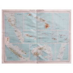
Large Original Vintage Map of The Pacific Islands Including Hawaii
Located in St Annes, Lancashire
Great map of The Pacific Islands
Unframed
Original color
By John Bartholomew and Co
Category
1920s British Antique Maps Hawaii
Materials
Paper
No Reserve
H 18 in W 23 in D 0.07 in
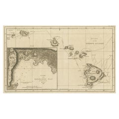
Map of the Hawaiian Islands with a Large Inset of Karakakooa Bay, 1803
Located in Langweer, NL
Antique map titled 'Kaart van de Sandwich Eilanden'.
Map of the Hawaiian Islands with a large
Category
Early 1800s Antique Maps Hawaii
Materials
Paper
No Reserve
H 11.82 in W 19.1 in D 0 in
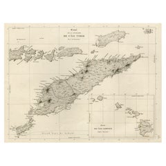
Rare Antique Map with Timor and Nearby Islands Plus an Inset of Hawaii, 1825
Located in Langweer, NL
Antique map titled 'Essai sur la Geographie de l'Ile Timor.'
A map showing Timor and the
Category
1820s Antique Maps Hawaii
Materials
Paper
H 13.39 in W 19.69 in D 0 in
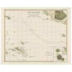
Antique Map of Eastern Polynesia, 1849
Located in Langweer, NL
Antique map titled 'Ost-Polynesien'. Interesting variant issue, with large detailed insets top
Category
Mid-19th Century Antique Maps Hawaii
Materials
Paper
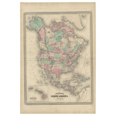
Antique Map of North America by Johnson, '1872'
Located in Langweer, NL
the Hawaiian group or Sandwich Islands. This map originates from 'Johnson's New Illustrated Family
Category
Late 19th Century Antique Maps Hawaii
Materials
Paper
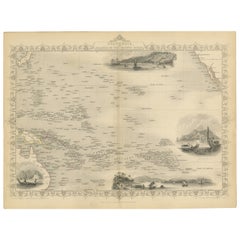
Map of Polynesia Highlighting Cultural Landscapes and Maritime Activities, 1851
Located in Langweer, NL
John Tallis & Company was a London-based map publisher that flourished during the 19th century
Category
1850s Antique Maps Hawaii
Materials
Paper
H 10.71 in W 14.26 in D 0 in
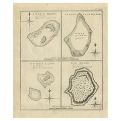
Antique Map of Harvey Island and Surroundings by Cook, 1803
Located in Langweer, NL
largely uncharted areas of the globe. He mapped lands from New Zealand to Hawaii in the Pacific Ocean in
Category
19th Century Antique Maps Hawaii
Materials
Paper
Free Shipping
H 13.19 in W 16.34 in D 0 in
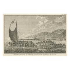
The King of Owyhee, Sandwich Isles 'Hawaii' with Gifts for Captain Cook, 1803
Located in Langweer, NL
Antique print Hawaï titled 'Terreeoboo, Koning van Owhijee, Kapitein Cook geschenken brengende'.
Antique print depicting Tereoboo, King of Owyhee, bringing presents to Captain Co...
Category
Early 1800s Antique Maps Hawaii
Materials
Paper
H 11.03 in W 16.74 in D 0 in
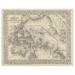
Old Map of the Pacific, Incl Australia, Polynesia, Melanesia and Malaysia, 1872
Located in Langweer, NL
Antique map Oceania titled 'Map of Oceanica exhibiting its various divisions, island groups & c
Category
1870s Antique Maps Hawaii
Materials
Paper
No Reserve
H 12.21 in W 15.16 in D 0 in
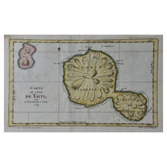
Captain Cook's Exploration of Tahiti 18th C. Hand-Colored Map by Bellin
By Jacques-Nicolas Bellin
Located in Alamo, CA
This beautiful 18th century hand-colored copper plate engraved map is entitled "Carte de l'Isle de
Category
Mid-18th Century French Antique Maps Hawaii
Materials
Paper
H 11.38 in W 17.5 in D 0.13 in
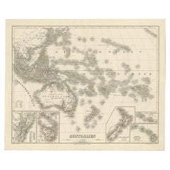
Map of Australia, New Zealand, Part of China, Japan and Southeast Asia, 1857
Located in Langweer, NL
German Antique map titled 'Australien'. Map of Australia, New Zealand, part of China, Japan and
Category
19th Century Antique Maps Hawaii
Materials
Paper
No Reserve
H 23.23 in W 27.96 in D 0 in
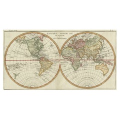
Very Decorative Original Antique Map of the World, Published in France in c.1780
By Rigobert Bonne
Located in Langweer, NL
Antique map titled 'L'Ancien Monde Et Le Nouveau en Deux Hemispheres' - Double hemisphere map of
Category
18th Century Antique Maps Hawaii
Materials
Paper
H 10.24 in W 17.6 in D 0 in
Old Map Showing the Tracks of Cook Between North America and Asia's Coast, 1803
Located in Langweer, NL
Description: Antique map titled 'Kaart van de Noord-West kust van Amerika en de Noord-Oost kust van
Category
Early 1800s Antique Maps Hawaii
Materials
Paper
H 20.87 in W 29.14 in D 0 in
Final Voyage: The Death of Captain Cook at Kealakekua Bay, Hawaii, 1779
Located in Langweer, NL
This engraving for sale depicts a scene of Karakakooa Bay in Owyhee (Hawaii), where Captain James Cook
Category
1770s Antique Maps Hawaii
Materials
Paper
Captain Cook's Exploration of Tahiti: 18th C. Hand-colored Map by Bellin
By Jacques-Nicolas Bellin
Located in Alamo, CA
This beautiful 18th century hand-colored copper plate engraved map is entitled "Carte de l'Isle de
Category
Late 18th Century Antique Maps Hawaii
Materials
Engraving
Antique Print of a Fortress in Guangzhou in China, c.1850
Located in Langweer, NL
various areas in the Pacific – the Hawaiian Islands, China, and Cochin China, to extend protection to a
Category
19th Century Antique Maps Hawaii
Materials
Paper
Antique Print of a Garden in Guangzhou in China, circa 1850
Located in Langweer, NL
the French flag in various areas in the Pacific – the Hawaiian Islands, China, and Cochin China, to
Category
19th Century Antique Maps Hawaii
Materials
Paper
Antique Print of a Street Kitchen in Guangzhou in China, circa 1850
Located in Langweer, NL
the French flag in various areas in the Pacific – the Hawaiian Islands, China, and Cochin China, to
Category
19th Century Antique Maps Hawaii
Materials
Paper
Antique Print of European Factories in Guangzhou in China, circa 1850
Located in Langweer, NL
nature; to show the French flag in various areas in the Pacific – the Hawaiian Islands, China, and Cochin
Category
19th Century Antique Maps Hawaii
Materials
Paper
Le Coste Nord Ovest Dell' America E Nord Est Dell' Asia Delineate Sulle Ultime O
Located in Bristol, CT
Map Sz: 14 1/2"H x 19 7/8"W
Frame Sz: 21"H x 26 3/8"W
A fine example of Cassini's 1798 map of
Category
1790s Antique Maps Hawaii
Materials
Paper
Pocket Globe, Nicholas Lane, London, post 1779
By Nicholas Lane
Located in Milano, IT
, 1779, as his place of death, Kealakekua Bay in the Hawaiian Islands, is marked on the map. It is indeed
Category
1780s English Other Antique Maps Hawaii
Materials
Leather, Wood, Paper
Rare Antique Engraving of a Beautiful Woman of Eaoo in Tonga, by Cook, 1803
By Cook
Located in Langweer, NL
Pacific objects to be brought back to Europe. He was killed in Hawaii in 1779.
John Webber was the artist
Category
19th Century Antique Maps Hawaii
Materials
Paper
H 9.45 in W 5.32 in D 0 in
Cemetery on Amsterdam Island, French Territory in the Indian Ocean, ca.1785
Located in Langweer, NL
a British explorer, navigator, cartographer, and captain in the Royal Navy. Cook made detailed maps
Category
1780s Antique Maps Hawaii
Materials
Paper
H 9.85 in W 15.36 in D 0 in
Captain James Cook: 18th C. Portrait by William Hodges After Cook's 2nd Voyage
By William Hodges
Located in Alamo, CA
Ocean and discovered many island groups, including the Hawaiian islands, which he named the Sandwich
Category
1770s Antique Maps Hawaii
Materials
Engraving
Original Engraving of Rotterdam Island, Nowadays Nomuka, Kingdom of Tonga, c1800
Located in Langweer, NL
, and noted in his maps the indigenous name of Amamocka, a misspelling of ?a Nomuka, ?a being a subject
Category
Early 1800s Antique Maps Hawaii
Materials
Paper
H 11.62 in W 14.77 in D 0 in
People Also Browsed
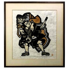
Yoshitoshi Mori Signed Limited Edition Japanese Woodblock Stencil Print, 1969
By Yoshitoshi Mori
Located in Studio City, CA
A large, earthly toned, dramatically composed print, with just the right touch of humor, is by Japanese master printmaker Yoshitoshi Mori who was famed for his kappazuri stencil prin...
Category
1960s Japanese Showa Antique Maps Hawaii
Materials
Paper
H 29 in W 27 in D 0.75 in
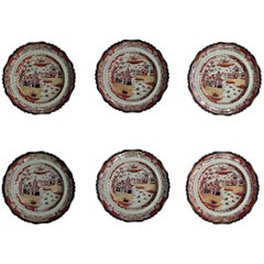
Set of SIX Mason's Dinner Plates Ashworth's Ironstone Large, Circa 1865
By Ashworth Ironstone
Located in Lincoln, Lincolnshire
These are a beautiful set of SIX Large Dinner Plates by Mason's ironstone made during the mid-19th century, when Mason's was owned by Ashworth Brothers, circa 1865.
These Dinner Pla...
Category
Mid-19th Century English Victorian Antique Maps Hawaii
Materials
Ironstone
George Washington by Henry Sadd, Antique Engraving, circa 1844
Located in Colorado Springs, CO
This is an 1844 engraving of President George Washington. The print was issued by G. Stuart in Albion, New York and engraved by H. S. Sadd.
This standing portrait shows President Ge...
Category
1840s American Antique Maps Hawaii
Materials
Paper
Tadashi Nakayama Signed Limited Edition Japanese Woodblock Print Herd of Horses
By Tadashi Nakayama
Located in Studio City, CA
This wonderfully designed, abstract work by esteemed Japanese printmaker Tadashi Nakayama. The print is pencil signed, numbered (46/65) and dated 1963 by the artist. A fairly uncommo...
Category
1960s Japanese Showa Antique Maps Hawaii
Materials
Paper
H 17 in W 36.5 in D 1 in
"Elephant Safari" Hand Painted Presentation Bowl Master Eva Fritz-Lindner
Located in South Burlington, VT
This is the only known example of this -Elephants Safari- Monumental Presentation Bowl & Master Work- Hand Painted by Eva Fritz-Lindner (1933-2017)
This is a wonderful handmade, ha...
Category
Mid-20th Century German Antique Maps Hawaii
Materials
Ceramic, Pottery
1970s Blue and Brown Ceramic Vase by Diane Love
By Diane Love
Located in New York, NY
Handmade and hand-painted dark blue and brown glazed ceramic spherical bud vase by artist/designer Diane Love for Mikasa. Japan, circa 1970. Marked with brand stamp at underside.
Category
1970s Japanese Mid-Century Modern Antique Maps Hawaii
Materials
Ceramic
Surfing Florida Style by Al Satterwhite, 1969, Archival Pigment Print
By Al Satterwhite
Located in Dallas, TX
Surfing Florida Style by Al Satterwhite depicts a young man surfing on the water. He holds a rope attached to a car, which tows him through the water as the car drives on the shoreli...
Category
1960s Contemporary Antique Maps Hawaii
Materials
Archival Pigment
H 11 in W 14 in D 0.1 in
Yoshitoshi Tsukioka Signed Japanese Woodblock Print Samurai Warrors on Horseback
By Tsukioka Yoshitoshi
Located in Studio City, CA
A wonderful, powerful, and visually striking Meiji Period woodblock print by revered Japanese artist/ printmaker Yoshitoshi Tsukioka (1839 - 1892 ) featuring two fierce Samurai warr...
Category
19th Century Japanese Meiji Antique Maps Hawaii
Materials
Paper
H 21.5 in W 16.25 in D 0.75 in
Yoshitoshi Mori Signed Large Limited Edition Japanese Stencil Print, 1985
By Yoshitoshi Mori
Located in Studio City, CA
A quite large and engaging fine print by famed Japanese printmaker Yoshitoshi Mori. The print portrays an ancient Samurai, one of Mori's favorite subjects, with an arrowhead in hand....
Category
20th Century Japanese Showa Antique Maps Hawaii
Materials
Paper
The Dole Map of the Hawaiian Islands.
Located in New York, NY
Original color lithograph. Honolulu. Hawaiian Pineapple Company, 1950.
Category
1950s Antique Maps Hawaii
Materials
Paper
Marcello Fantoni Cylindrical Ceramic Bottle Vase, Glazed Stoneware, circa 1960s
By Marcello Fantoni
Located in New York, NY
Italian artist Marcello Fantoni cylindrical ceramic bottle vase is glazed stoneware made circa 1960s. This piece was acquired directly from the artist by the seller, who was a person...
Category
20th Century Italian Mid-Century Modern Antique Maps Hawaii
Materials
Ceramic
Paul Soldner Abstract Expressionist Studio Ceramic Vase
By Paul Soldner
Located in Phoenix, AZ
Paul Soldner (1921-2010) abstract expressionist pottery vase.
Glaze in black and brown, partly unglazed.
Excellent design, mint condition.
Signed Soldner on the bottom.
Measures:...
Category
Mid-20th Century Antique Maps Hawaii
Materials
Clay
Marcello Fantoni Small Ceramic Vases, circa 1960s - 1970s
By Marcello Fantoni
Located in New York, NY
Italian artist Marcello Fantoni's Small Ceramic Vases are being offered as a collection. These pieces were acquired directly from the artist by the seller, who was a personal friend ...
Category
20th Century Italian Mid-Century Modern Antique Maps Hawaii
Materials
Ceramic
Japanese Asian Ceramic Wall Plaque Painting Utagawa Kuniyoshi Subduing Whale
Located in Studio City, CA
A truly wonderful and eye-catching large framed glazed ceramic art wall relief/plaque based on master Japanese artist/printmaker Utagawa Kuniyoshi's famous Ukiyo-e triptych (three-pi...
Category
20th Century Japanese Showa Antique Maps Hawaii
Materials
Metal
H 26 in W 44.5 in D 1 in
Aerial View of Surfers Waiting for Waves, Color Photography, Horizontal
By Drew Doggett
Located in US
"Line Up"
The jewel-toned sea always seems to be alive beneath the surfers as they patiently wait their turn in the line up for their chance at a wave.
The print series Swell: End...
Category
2010s Contemporary Antique Maps Hawaii
Materials
Archival Pigment
H 18 in W 27 in D 0.1 in
Dangae do tosei gusoku A blue-laced samurai armor with cuirass of double style
Located in Milano, IT
Dangae do tosei gusoku
A blue-laced samurai armor with cuirass of double style
Edo Period, 18th century
Kabuto [helmet]: Black lacquered eboshi-nari kabuto, in the form of this ...
Category
18th Century Antique Maps Hawaii
Materials
Iron
Free Shipping
H 59.06 in W 39.38 in D 19.69 in
Recent Sales
Rare 1790s Russian Map of the World
Located in La Jolla, CA
published at the end of the 18th century.
The maps show Hawaii, but Tasmania (Van Diemens Land) is still
Category
1790s Russian Antique Maps Hawaii
Materials
Paper
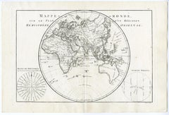
Map of the Eastern Hemisphere by Bonne - Engraving - 18th Century
Located in Zeeland, Noord-Brabant
(…).' - Handsome map of the Eastern Hemisphere, illustrating the cartographic updates provided by Cook, including
Category
1780s Contemporary Antique Maps Hawaii
Materials
Engraving
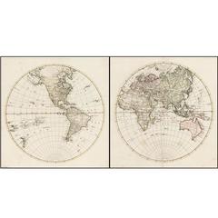
Map of the Western Hemisphere by Bonne - Engraving - 18th Century
Located in Zeeland, Noord-Brabant
.' - Detailed map of the Western Hemisphere, illustrating the cartographic updates provided by Cook, including
Category
1780s Contemporary Antique Maps Hawaii
Materials
Engraving
1858 "Mitchell's New National Map Exhibiting the United States" Hanging Wall Map
By Samuel Augustus Mitchell 1
Located in Colorado Springs, CO
Presented is a beautifully engraved, large hanging wall map of the United States, Mexico, and West
Category
1850s American Antique Maps Hawaii
Materials
Paper
H 84 in W 80.5 in D 6 in
Mitchell's New National Wall Map Exhibiting the United States, circa 1856
Located in Colorado Springs, CO
and the World on Globular Projection, and Hawaii (The Sandwich Islands).
The map was one of the
Category
1850s American Antique Maps Hawaii
Antique Map of Islands in the Pacific Ocean, Centered on Hawaï, 1844
Located in Langweer, NL
Antique map titled 'Islands in the Pacific Ocean'.
Detailed map of the Pacific, centered on
Category
19th Century Antique Maps Hawaii
Materials
Paper
Antique Engraving of the Cemetery of Tongatapu, Friendly Islands, 1785
Located in Langweer, NL
Tongatapu, Friendly Islands. This map originates from volume 1 of 'Troisième voyage de Cook, ou, Voyage à
Category
1780s Antique Maps Hawaii
Materials
Paper
Antique Print of British Explorer Captain James Cook, 1779
Located in Langweer, NL
Pacific Ocean and to Australia in particular. He made detailed maps of Newfoundland prior to making three
Category
1770s Antique Maps Hawaii
Materials
Paper
Original Antique Map of Hawaii and Hispaniola, 1889
Located in St Annes, Lancashire
Great map of Hawaii and Hispaniola
Drawn and Engraved by W. & A.K. Johnston
Published By A
Category
1880s Scottish Victorian Antique Maps Hawaii
Materials
Paper
Antique Map of the Philippine Islands and Hawaii, 1903
Located in Langweer, NL
Colorful double page map, centre fold as issued. Map number and title on verso. Published in
Category
Early 20th Century Antique Maps Hawaii
Antique Map of Hawaii, New Zealand, Fiji and Surrounding Islands
Located in Langweer, NL
Original antique map of Hawaii, New Zealand, Fiji, Tonga, Samoa, French Polynesia, Marquesas, and
Category
Late 19th Century Antique Maps Hawaii
Materials
Paper
Large Original Vintage Map of The Pacific Islands Including Hawaii
Located in St Annes, Lancashire
Great map of The Pacific Islands
Unframed
Original color
By John Bartholomew and Co
Category
1920s British Antique Maps Hawaii
Materials
Paper
1 bid
No Reserve
H 18 in W 23 in D 0.07 in
Antique Map of Australia by C. Gräf, 1857
Located in Langweer, NL
Antique map titled 'Australien'. Map of Australia, New Zealand, part of China, Japan and Southeast
Category
Mid-19th Century Antique Maps Hawaii
Materials
Paper
Coastal Views from Captain Cook's Travels, with the Coastline of Hawaii, 1803
Located in Langweer, NL
the coastline of Hawaii. Originates from 'Reizen Rondom de Waereld door James Cook (..)'.
Artists
Category
Early 1800s Antique Maps Hawaii
Materials
Paper
H 10.24 in W 17.33 in D 0 in
Antique Map of the Environs of Macao by Cook, c.1784
By James Cook
Located in Langweer, NL
Antique map titled 'Sketch of the Typa and Macao'. The environs of Macao, with a small plan of the
Category
18th Century Antique Maps Hawaii
Materials
Paper
Hawaii Our New Possessions by Musick First Edition
Located in Dallas, TX
A Map Of The Hawaiian Islands, Published by Funk & Wagnalls Company, New York and London , Copyright
Category
Late 19th Century American Country Antique Maps Hawaii
Materials
Paper
Antique Chart of The East Coast of Australia by Cook, C.1770
Located in Langweer, NL
Antique map titled 'Chart of Part of the Coast of New South Wales from Cape Tribulation to
Category
18th Century Antique Maps Hawaii
Materials
Paper
"A Map of Honolulu and the Sandwich Islands"" Vintage Original Hawaii Poster
Located in Boston, MA
A spectacular rarity from the early days of Hawaiian travel. This large map of Honolulu is
Category
1920s Realist Antique Maps Hawaii
Materials
Lithograph
Set of 5 maps of the World and Continents
Located in Los Angeles, CA
Original set of world and continent maps by Clouet. These maps present a fascinating snapshot of
Category
18th Century and Earlier French Antique Maps Hawaii
Get Updated with New Arrivals
Save "Antique Maps Hawaii", and we’ll notify you when there are new listings in this category.
Antique Maps Hawaii For Sale on 1stDibs
At 1stDibs, there are many versions of the ideal antique maps hawaii for your home. Each antique maps hawaii for sale was constructed with extraordinary care, often using paper and plaster. There are many kinds of the antique maps hawaii you’re looking for, from those produced as long ago as the 18th Century to those made as recently as the 19th Century. An antique maps hawaii is a generally popular piece of furniture, but those created in Georgian styles are sought with frequency. Many designers have produced at least one well-made antique maps hawaii over the years, but those crafted by Jacques-Nicolas Bellin, Cook and James Cook are often thought to be among the most beautiful.
How Much is a Antique Maps Hawaii?
An antique maps hawaii can differ in price owing to various characteristics — the average selling price 1stDibs is $433, while the lowest priced sells for $145 and the highest can go for as much as $19,500.
More Ways To Browse
Kansas Map
Northwest Native American Stone
Antique Furniture Western Cape
Antique Navy Buttons
Antique Map New South Wales
Pp75 Table
Hawaii Diamond Head
Antique Uniform Buttons
Greenland Map
Nevada Antique Map
Utah Map
Floris Antiques
Flying Cloud Clipper Ship
Edward Goral
Nebraska Map
Clipper Ship Flying Cloud
Antique Arizona Map
Topcoat Men
