Canada Map
Price
Shipping Options
Sort By
Original Antique Map of Canada by T. Ettling, 1861
Located in St Annes, Lancashire
Great map of Canada
Steel engraving with original color outline
Drawn and engraved by T. Ettling
Published in the weekly dispatch Atlas, 1861
Unframed.
Category
Antique 1860s English Other Maps
Materials
Paper
H 19 in. W 13 in. D 0.07 in.
Antique Map of Northeastern Canada by Lotter 'circa 1760'
Located in Langweer, NL
Antique map titled 'Partie Orientale de la Nouvelle France ou du Canada avec l'Isle de Terre-Neuve et de Nouvelle Escosse, Acadie et Nouv. Angleterre avec Fleuve de St. Laurence'. Or...
Category
Antique Mid-18th Century Maps
Materials
Paper
H 20.87 in. W 23.82 in. D 0.02 in.
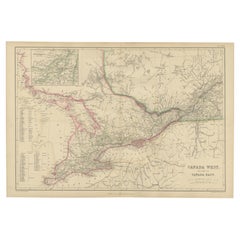
Original Antique Map of the Great Lakes, Canada by T. Ettling, 1861
Located in St Annes, Lancashire
Great map of The Great Lakes
Steel engraving with original color outline
Drawn and engraved by T. Ettling
Published in the weekly Dispatch Atlas, 1861
Unframed.
Category
Antique 1860s English Other Maps
Materials
Paper
H 19 in. W 13 in. D 0.07 in.
Antique Map of Canada, New Brunswick and Nova Scotia by Lowry, 1852
Located in Langweer, NL
Antique map titled 'Canada, New Brunswick & Nova Scotia'. Two individual sheets of Canada, New Brunswick and Nova Scotia. This map originates from 'Lowry's table Atlas constructed an...
Category
Antique Mid-19th Century Maps
Materials
Paper
H 12.21 in. W 9.65 in. D 0.02 in.
Antique Railway Map of North America, Canada and Mexico by Ravenstein, '1882'
Located in Langweer, NL
Antique folding map titled 'Eisenbahn-Karte der Vereinigten-Staaten von Nord-Amerika, British Canada & Mexico'. Large railway map of North America, Canada and Mexico. Published by Ja...
Category
Antique Late 19th Century Maps
Materials
Paper
H 26.38 in. W 44.49 in. D 0.2 in.
Antique Map of the Province of Canada 'East' by A.K. Johnston, 1865
Located in Langweer, NL
Antique map titled 'Province of Canada (Eastern Sheet)'. Depicting New Brunswick, Newfoundland, Cape Breton Island, Prince Edward Island, Nova Scotia and more. This map originates fr...
Category
Antique Mid-19th Century Maps
Materials
Paper
H 19.1 in. W 24.41 in. D 0.02 in.
Antique Map of New England and Part of Canada by Vaugondy 'circa 1755'
Located in Langweer, NL
Antique map titled 'Partie de l'Amérique septent qui comprend la nouvelle France ou le Canada'. Decorative and highly detailed map of New England and part of Canada, extending east t...
Category
Antique Mid-18th Century Maps
Materials
Paper
H 20.08 in. W 25.99 in. D 0.02 in.
Antique Map of New England and Eastern Canada by Homann Heirs, circa 1755
Located in Langweer, NL
Antique map titled 'Partie Orientale de la Nouvelle France ou du Canada (..)'. Original antique map of New England and Eastern Canada made after J.N. Bellin. The map extends from Lak...
Category
Antique Mid-18th Century Maps
Materials
Paper
H 21.07 in. W 24.22 in. D 0.02 in.
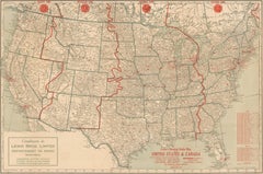
Map of United States, World War II Vintage Pictorial Map, circa 1943
Located in Colorado Springs, CO
A striking pictorial map by Stanley Turner, published in 1943. The map presents the United States during World War II and is so titled “United States at War.” Around the map’s edges ...
Category
Vintage 1940s Canadian Maps
Materials
Paper
H 33 in. W 26.5 in. D 1 in.
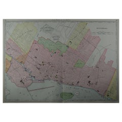
Large Original Antique City Plan of Montreal, Canada, circa 1900
By Rand McNally & Co.
Located in St Annes, Lancashire
Fabulous colorful map of Montreal
Original color
By Rand, McNally & Co.
Published, circa 1900
Unframed
Free shipping.
Category
Antique Early 1900s American Maps
Materials
Paper
H 20.5 in. W 27.5 in. D 0.07 in.
Antique Sea Chart of Hudson Bay and Arctic Canada by Van Keulen, circa 1681
Located in Langweer, NL
Antique map titled 'Pascaarte vande Noorderzee Custen van America (..)'. Sea chart of Hudson Bay and Arctic Canada. Compass roses, loxodromic lines, and ships decorate the oceans and...
Category
Antique Late 17th Century Maps
Materials
Paper
H 20.87 in. W 23.82 in. D 0.02 in.
Antique Map of the Canadian Northern Railway, 1911
Located in Langweer, NL
Antique map titled 'Map of the Canadian Northern Railway System'. Lithographed map of the Canadian Northern Railway. Shows railroad of British Colombia, Alberta, Saskatchewan, Manito...
Category
Early 20th Century Maps
Materials
Paper
H 10.83 in. W 34.65 in. D 0.02 in.
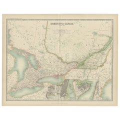
Antique Map of the Province of Canada ‘West’ by A.K. Johnston, 1865
Located in Langweer, NL
Antique map titled 'Province of Canada (Western Sheet)'. Depicting Quebec, Lake Ontario and more. This map originates from the ‘Royal Atlas of Modern Geography’ by Alexander Keith Jo...
Category
Antique Mid-19th Century Maps
Materials
Paper
H 19.1 in. W 24.41 in. D 0.02 in.
1862 Colton's "New Railroad & County Map of the United States and the Canadas"
Located in Colorado Springs, CO
This expansive and impressive 19th century map depicts the eastern half of the United States, in the second year of the Civil War. Starting on the eastern coast, the map extends to t...
Category
Antique 1860s American Maps
Materials
Paper
H 52.5 in. W 46.5 in. D 2.5 in.
Newfoundland Map Hooked Grenfell Mat
Located in Essex, MA
A Grenfell Newfoundland Hooked Mat, Grenfell Labrador Industries, Newfoundland and Labrador, early 20th century, composed of bleached and dyed rayon, cotton, and silk strips hooked o...
Category
Early 20th Century Canadian More Folk Art
Materials
Cotton
H 15.5 in. W 12.88 in. D 1 in.
Canada Map For Sale on 1stDibs
At 1stDibs, there are many versions of the ideal Canada map for your home. Frequently made of paper, every Canada map was constructed with great care. Your living room may not be complete without a Canada map — find older editions for sale from the 18th Century and newer versions made as recently as the 20th Century. When you’re browsing for the right Canada map, those designed in styles are of considerable interest. Rand McNally & Co. each produced at least one beautiful Canada map that is worth considering.
How Much is a Canada Map?
Prices for a Canada map can differ depending upon size, time period and other attributes — at 1stDibs, they begin at $102 and can go as high as $5,793, while the average can fetch as much as $425.
Read More

Why ‘Nest’ Was Best: The Rule-Breaking Interiors Mag Gets a Second Act
Designer Todd Oldham takes a loving look back at the shelter pub whose eclectic style and substance inspired so much about the way we live now.

Alex Assouline Shows Us How to Curate the Perfect Private Library
The publishing scion has crafted a surprisingly successful business out of designing high-end book displays.