Greenland Map
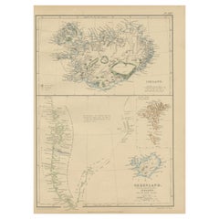
1859 Antique Arctic Vista: Greenland, Iceland and Faroe Islands, Blackie's Atlas
Located in Langweer, NL
The "1859 Antique Arctic Vista: Greenland, Iceland, and Faroe Islands" is an original antique map
Category
Antique Mid-19th Century Maps
Materials
Paper
H 14.57 in W 10.63 in D 0.02 in
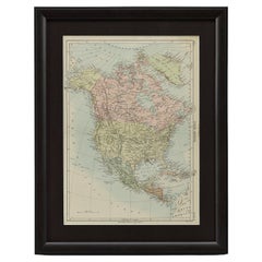
1875 "North America" Map by J. Bartholomew
Located in Colorado Springs, CO
mapmaker John Bartholomew. The map depicts North America, to include Greenland, the Dominion of Canada, the
Category
Antique 1870s Scottish Maps
Materials
Paper
Very Large Vintage Map of Canada, German, Education, Institution, Cartography
Located in Hele, Devon, GB
This is a very large vintage map of Canada. A German, quality printed educational or institution
Category
Mid-20th Century German Maps
Materials
Paper
H 77.56 in W 85.04 in D 1.19 in
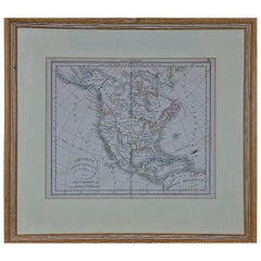
America "Amérique Septentrionale": A 19th Century French Map by Delamarche
By Maison Delamarche 1
Located in Alamo, CA
This framed mid 19th century map of North America entitled "Amérique Septentrionale" by Felix
Category
Antique Mid-19th Century American Other Maps
Materials
Paper
H 20 in W 22.63 in D 0.88 in
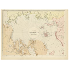
Arctic Exploration: An Original Map of the North Circumpolar Regions, 1882
Located in Langweer, NL
This map, extracted from the 1882 atlas by Blackie & Son, presents the North Circumpolar Regions in
Category
Antique 1880s Maps
Materials
Paper
H 11.03 in W 14.97 in D 0 in
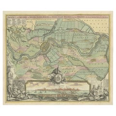
Large Antique Map of the City of Bremen and Surroundings, Germany
Located in Langweer, NL
Original antique map titled 'Prospect und Grundris der Keiserl Freyen Reichs und Ansee Stadt Bremen
Category
Antique Early 18th Century Maps
Materials
Paper
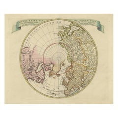
Beautiful Antique Map of the Northern Hemisphere with California as an Island
By Isaak Tirion
Located in Langweer, NL
Antique map titled 'Nieuwe Kaart van de Noord Pool na de alderlaatste ontdekking int licht gebracht
Category
Antique Mid-18th Century Maps
Materials
Paper
H 13.98 in W 18.9 in D 0.02 in
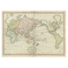
Very Attractive Antique Map of the World as Planisphere, Shows Cook's Voyages
Located in Langweer, NL
Antique map titled 'Chart of the World, according to Mercators Projection'. This world map shows
Category
Antique Late 18th Century Maps
Materials
Paper
No Reserve
H 16.15 in W 20.08 in D 0.02 in
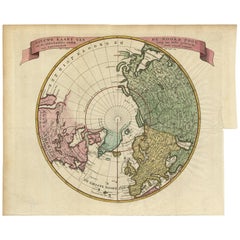
Antique Map of the Northern Hemisphere and North Pole by Tirion, circa 1754
Located in Langweer, NL
Antique map titled 'Nieuwe Kaart van de Noord Pool na de alderlaatste ondekking int licht gebracht
Category
Antique Mid-18th Century Maps
Materials
Paper
H 12.8 in W 14.77 in D 0.02 in
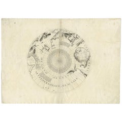
Antique Map of the North Pole by V.M. Coronelli, circa 1692
By Vincenzo Coronelli
Located in Langweer, NL
Globe gore by Vincenzo Maria Coronelli shows the North Pole with the coasts of Canada, Greenland
Category
Antique Late 17th Century Maps
Materials
Paper
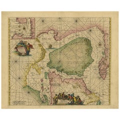
Antique Sea Chart of North America by Ottens, circa 1745
Located in Langweer, NL
Antique map titled 'Septemtrionaliora Americae a Groenlandia (..)'. Sea chart of the northern
Category
Antique Mid-18th Century Maps
Materials
Paper
Free Shipping
H 21.46 in W 25.99 in D 0.02 in
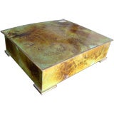
Bronze Box with a Map of Gronland ‘Greenland’ on the Lid
Located in NYC, NY
A bronze box with a map of Greenland (Cronland in Danish) incised into the top of the box lid, with
Category
Early 20th Century Danish Boxes
Materials
Bronze
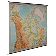
Canada Greenland North America Map Vintage Mural Rollable Wall Chart Countrycore
Located in Berghuelen, DE
A classical pull-down map of Canada and Greenland (North American Continent). Used as teaching
Category
Vintage 1970s German Country Posters
Materials
Canvas, Wood
H 74.81 in W 79.14 in D 0.79 in
Denmark Greenland Faroe Islands the North Atlantic Vintage Mural Map Wall Chart
Located in Berghuelen, DE
The vintage pull-down mural map illustrates Denmark with Greenland, the Faroe Islands and the North
Category
Vintage 1970s German Country Posters
Materials
Canvas, Wood, Paper
H 75.6 in W 81.5 in D 0.79 in
Antique Print of a Winter House in Greenland, 1768
By Prevost
Located in Langweer, NL
in Greenland. This print originates from volume 18 of 'Histoire generale des voyages (..)' by Antoine
Category
Antique 18th Century Prints
Materials
Paper
Danish Royal Copenhagen 1978 Christmas Glazed Porcelain Plate Greenland Scenery
By Royal Copenhagen
Located in London, GB
Royal Copenhagen 1978 Christmas Plate - Greenland Scenery designed by Kai Lange. The scene on this
Category
Vintage 1970s Danish Porcelain
Materials
Porcelain
Vinland Map and the Tartar Relation
By Thomas E. Marston, George D. Painter, R.A. Skelton
Located in valatie, NY
The Vinland Map and the Tartar Relation. New Haven: Yale University Press, 1965. First edition
Category
20th Century American Books
Materials
Paper
Pocket Globe, Nicholas Lane, London, post 1779
By Nicholas Lane
Located in Milano, IT
inaccurately: Alaska is barely described, and the northeastern coasts appear to be connected to Greenland
Category
Antique 1780s English Other Models and Miniatures
Materials
Leather, Wood, Paper
A truly delightful miniature terrestrial pocket globe
By Nathaniel Mills
Located in ZWIJNDRECHT, NL
turning overhead. In line with its counterpart, the terrestrial globe, celestial globes are mapped by a
Category
Antique Mid-18th Century British Dutch Colonial Globes
Materials
Other
People Also Browsed
7 Royal Copenhagen Figurines by Carl Martin-Hansen Amager Children
By Carl Martin-Hansen
Located in Bridgeport, CT
Included in this fine group:
Amager Boy in typical costume designed by Carl Martin-Hansen circa 1906 - 1925. From the Danish National Costume series by Carl Martin-Hansen. Figurine ...
Category
20th Century Danish Mid-Century Modern Figurative Sculptures
Materials
Porcelain
Antique Navajo Regional Rug
Located in Milan, IT
An antique Navajo rug from southwest America distinguished by an allover pattern of cruciform elements on a soft grey background. Rugs if this type have been collected for their auth...
Category
Vintage 1920s American Navajo North and South American Rugs
Materials
Wool
Antique Persian Bidjar Willow Tree Rug
Located in New York, NY
Stunning room size Persian Bidjar rug with an all-over repetitive willow tree motif
Measures: 8'4'' x 12'5''
Bidjar rugs, produced in Northwest Iran are among the finest of Pe...
Category
Antique 19th Century Persian Bakshaish Persian Rugs
Materials
Wool
Catalina Island, Original oil Painting, Ready to Hang
By Vahe Yeremyan
Located in Granada Hills, CA
Artist: Vahe Yeremyan
Work: Original Oil Painting, Handmade Artwork, One of a Kind
Medium: Oil on Canvas
Year: 2021
Style: Impressionism,
Subject: Catalina Island,
Size: 9.5" x 2...
Category
2010s Impressionist Landscape Paintings
Materials
Oil, Canvas
Antique Persian Sarouk Rug, circa 1920
Located in Evanston, IL
Made in Persia, circa 1920s, in perfect condition.
The source of this important provenance has been in the village of Sarouk. North of Arak (formerly Sultanabad). Sarouks are known t...
Category
Early 20th Century Persian Sarouk Farahan Persian Rugs
Materials
Wool
Celebrate Nature's Beauty: Taxidermy Atlantic Puffin Bird
Located in New York, NY
Meticulously crafted Taxidermy Atlantic Puffin Bird (Fratercula arctica), also known as the common puffin, a remarkable specimen from the auk family. This exquisite avian creation sh...
Category
21st Century and Contemporary Icelandic Taxidermy
Materials
Leather, Feathers
Vintage Map of Nantucket Town by Ruth Haviland Sutton, 1946
Located in Nantucket, MA
Vintage Map of Nantucket Town by Ruth Haviland Sutton, 1946, a classic vintage tourist map of Nantucket Island showing historic landmarks and geographic details along with decorative...
Category
Vintage 1940s American Other Maps
Materials
Paper
Yellow Spike - British 60's Abstract art blue red grey COBRA Scottish artist
By William Gear
Located in London, GB
An original silkscreen print by Scottish COBRA listed artist William Gear. An internationally famous abstract artist, Gear was a member of the COBRA group which was famous in the fif...
Category
20th Century Abstract Abstract Prints
Materials
Screen
Time Span
Located in Aberdeen Dyce, GB
ALISTAIR MACK (1955-)
Scottish painter and print maker. He trained at Edinburgh College of Art after working as a lab technician for 12 years and his artistic work is often inspired ...
Category
20th Century Other Art Style Figurative Paintings
Materials
Screen
19th c. English Beer Engine by A. Reynolds & Co., Leeds
By A. Reynolds & Co.
Located in New York, NY
Nineteenth century English pub beer engine with a rectilinear wooden stand topped with four brass and porcelain spigots, two white, one red, and one green. The piece is marked "A. Re...
Category
Antique 19th Century British Barware
Materials
Brass
Alphonse Mucha Figures Decoratives Poster Plate 7
By Alphonse Mucha
Located in Dallas, TX
A framed Art Nouveau lithograph collotype poster by Alphone Mucha from 1905 representing the artist’s sketches of nudes, women and beautiful ladies in red umber and white pigments on...
Category
Antique Early 1900s French Art Nouveau Posters
Materials
Paper
Worn-In Distressed Antique Persian Karaja Heriz Rug with Rustic Style
Located in Dallas, TX
72988 Worn-In Distressed Antique Persian Karaja Heriz Rug with Rustic Style. This hand-knotted wool distressed antique Persian Karaja Heriz rug with Mid-Century Modern style features...
Category
Early 20th Century Persian Rustic Persian Rugs
Materials
Wool
Hanging Mughal Deccani Bronze Oil Lamp in the Shape of a Bird India
Located in North Hollywood, CA
Antique hanging cast bronze oil lamp in the shape of a beautiful mythical bird peacock figure with hanger chain.
The body of the bird acts as a reservoir for oil while the spout at t...
Category
Antique Late 19th Century Indian Agra Metalwork
Materials
Bronze
1908 "Map of Texas" by The Kenyon Company
Located in Colorado Springs, CO
Presented is an antique map of the state of Texas, printed as a pocket map in 1908 by The Kenyon Company. The state map is brightly colored by county, with principal cities and towns...
Category
Antique Early 1900s American Maps
Materials
Paper
Antique French Louis Revival Marquetry Commode, 19th Century
Located in London, GB
This is a stunning antique walnut, marquetry and ormolu mounted Louis Revival serpentine fronted commode, circa 1880 in date.
The chest has a gonzalo alves cross banded top with d...
Category
Antique 1880s French Commodes and Chests of Drawers
Materials
Ormolu
1854 Map of Massachusetts, Connecticut and Rhode Island, Antique Wall Map
Located in Colorado Springs, CO
This striking wall map was published in 1854 by Ensign, Bridgman & Fanning and has both full original hand-coloring and original hardware. This impression is both informative and hig...
Category
Antique 19th Century American Maps
Materials
Paper
H 38.13 in W 45 in D 3.5 in
Recent Sales
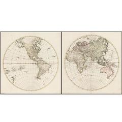
Rare 1790s Russian Map of the World
Located in La Jolla, CA
Rare set of Eastern Hemisphere and Western Hemisphere maps, with place names in Cyrillic, likely
Category
Antique 1790s Russian Prints
Materials
Paper
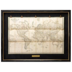
1837 "Mercator Projection" Map of the World by James Wyld
Located in Colorado Springs, CO
This Mercator style projection world map was published in London by James Wyld in 1837. Typical for
Category
Antique 1830s English Maps
1864 "North America" by J. Wells
Located in Colorado Springs, CO
Presented is an original 1864 map of “North America.” The map was issued as “Map No. 3” in McNall’s
Category
Antique 1860s Maps
Materials
Paper
Framed Pair of Vintage Mid Century Soviet Maps of a Section of Greenland
Located in London, GB
A pair of maps detailing an Eastern section of Greenland. The maps were drawn and produced by the
Category
Mid-20th Century Russian Mid-Century Modern Paintings
Materials
Glass, Oak, Paper
H 25.99 in W 21.46 in D 1.19 in
1906 Framed Relief Map of North America
By Atlas School Supply
Located in Rio Vista, CA
Early 1900s relief map of North America including Canada, Greenland, Mexico and Central America
Category
20th Century American Maps
Materials
Paper, Wood
Antique World Map on Mercator's Projection, 1782
Located in Langweer, NL
Antique map titled 'Carte Reduite des Terres et des Mers du Globe Terrestre.'
World map on
Category
Antique 1780s Maps
Materials
Paper
Antique Map of Scandinavia by G.A. Magini, 1596
Located in Langweer, NL
Striking example of Magini's modern map of Scandinavia and the North Atlantic regions. Magini bases
Category
Antique 16th Century Maps
Materials
Paper
Large Original Antique Map of Russia and the Arctic Ocean, 1821
Located in Langweer, NL
Antique map titled 'Carte Générale de la Russie d'Asie et des régions polaires boréales'.
Large
Category
Antique 1820s Maps
Materials
Paper
1 bid
No Reserve
H 20.67 in W 27.17 in D 0 in
Important Historical Desk of Admiral Markham
Located in Benington, Herts
order to stop book/maps etc sliding off in rough seas. This removes to reveal a central drawer screwed
Category
Antique 19th Century English Victorian Desks and Writing Tables
Materials
Leather, Mahogany
Set of 5 maps of the World and Continents
Located in Los Angeles, CA
including a large eastern sea, typical for french maps of that period.
Note Greenland`s connection to
Category
Antique 18th Century and Earlier French Decorative Art
Planiglobii Terrestris
Located in Florham Park, NJ
map publishers of their time. Founded in 1702, the Nuremberg firm at first relied on Homann’s skill
Category
Antique 18th Century and Earlier Prints
Get Updated with New Arrivals
Save "Greenland Map", and we’ll notify you when there are new listings in this category.
Greenland Map For Sale on 1stDibs
With a vast inventory of beautiful furniture at 1stDibs, we’ve got just the greenland map you’re looking for. Frequently made of paper, wood and bronze, every greenland map was constructed with great care. Your living room may not be complete without a greenland map — find older editions for sale from the 18th Century and newer versions made as recently as the 20th Century. Many designers have produced at least one well-made greenland map over the years, but those crafted by George D. Painter, Maison Delamarche and R.A. Skelton are often thought to be among the most beautiful.
How Much is a Greenland Map?
A greenland map can differ in price owing to various characteristics — the average selling price 1stDibs is $975, while the lowest priced sells for $69 and the highest can go for as much as $2,950.
More Ways To Browse
Norway Map
8 Ft Table
Japanese Articulated
World Map Table
18th Century Canadian Furniture
Large Russian Maps
Antique Brass Door Stop
Antique Brass Door Stops
Brass Door Stops Antique
Door Stop Antique Brass
Door Stops Antique Brass
William Spencer
Hudson Bay Furniture
Canada Map
Antique Table Mats
Maps Canada
Naval Table
Map Of Canada
