Items Similar to Large Antique Map of the City of Bremen and Surroundings, Germany


Want more images or videos?
Request additional images or videos from the seller
1 of 6
Large Antique Map of the City of Bremen and Surroundings, Germany
About the Item
Original antique map titled 'Prospect und Grundris der Keiserl Freyen Reichs und Ansee Stadt Bremen (..)'. This is a superb chart of the city of Bremen and the surrounding small villages with particular emphasis on the many rivers and canals in the area. At bottom is a panoramic view of Bremen surrounded by two allegorical scenes representing the city's importance to trade in the region. On the right is an open atlas showing Greenland and Spitzbergen in Norway, alluding to the possessions of the Hanse. Above the view is a coat-of-arms of the city. The legend in the upper left corner identifies 33 locations.
Published by J.B. Homann, circa 1720. Johann Baptist Homann was a German geographer and cartographer, who also made maps of the Americas.
- Dimensions:Height: 21.07 in (53.5 cm)Width: 24.22 in (61.5 cm)Depth: 0.02 in (0.5 mm)
- Materials and Techniques:
- Period:
- Date of Manufacture:circa 1720
- Condition:Repaired. Wear consistent with age and use. Original/contemporary hand coloring. Original folding line, with repairs in bottom margin. Few small holes/defects in center of the map. General age-related toning, blank verso. Some wear and soiling, please study images carefully.
- Seller Location:Langweer, NL
- Reference Number:
About the Seller
5.0
Platinum Seller
These expertly vetted sellers are 1stDibs' most experienced sellers and are rated highest by our customers.
Established in 2009
1stDibs seller since 2017
1,933 sales on 1stDibs
Typical response time: <1 hour
- ShippingRetrieving quote...Ships From: Langweer, Netherlands
- Return PolicyA return for this item may be initiated within 14 days of delivery.
More From This SellerView All
- Antique Map of Belgium and Surroundings, 1692Located in Langweer, NLAntique map titled 'Provincie Meridionali de Paesi Bassi Intese sotto nome di Fiandra overo Li Paesi Bassi Cattolici con li confini di Francia di Allemagna et di Hollanda'. Uncommon map of Belgium...Category
Antique 17th Century Maps
MaterialsPaper
- Antique Map of Afghanistan and Surroundings, '1845'Located in Langweer, NLAntique map titled 'Map of Persia and Caubul'. Original antique map of Afghanistan and surroundings. This map originates from 'An Atlas of the World, Comprehending Separate Maps of...Category
Antique Mid-19th Century Maps
MaterialsPaper
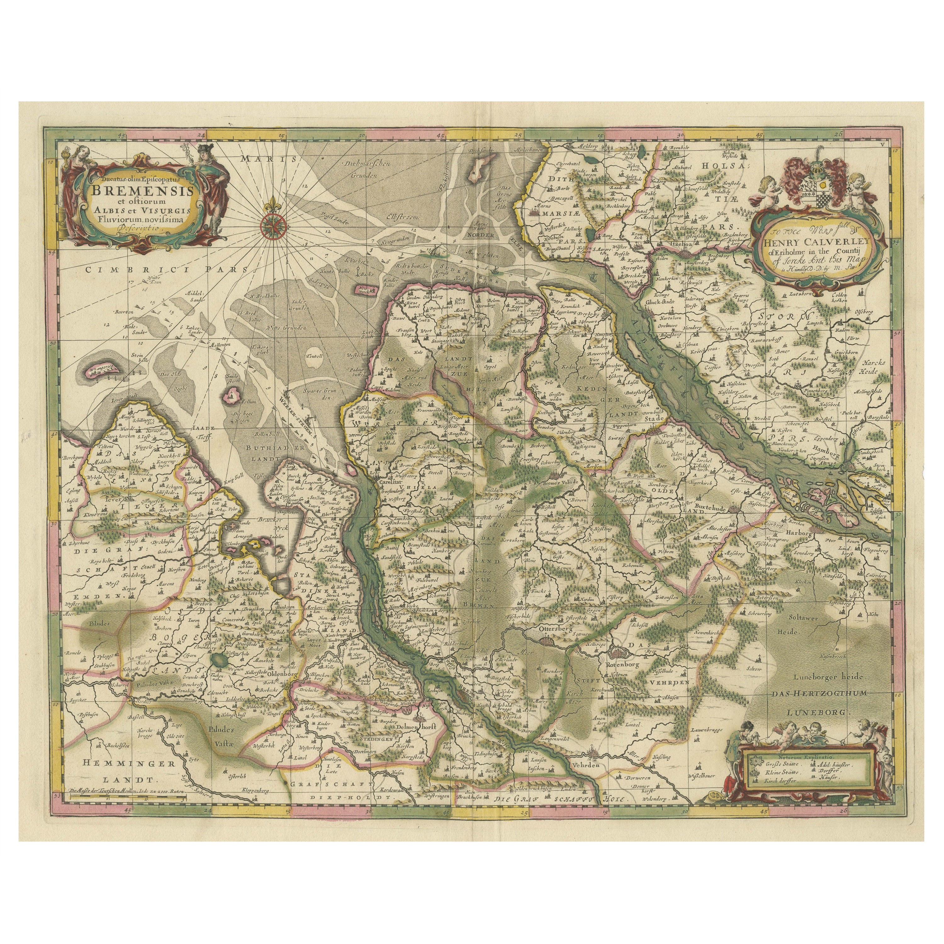
- Original Antique Map of the Area of Bremen and Lower SaxonyBy Johannes JanssoniusLocated in Langweer, NLAntique map titled 'Ducatus olim Episcopatus Bremensis et ostiorum Albis et Visurgis Fluviorum novissima Descriptio'. Original old map of the area of ??Bremen and Lower Saxony. Uncom...Category
Antique Mid-17th Century Maps
MaterialsPaper
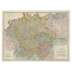
- Large Antique Map of the German EmpireLocated in Langweer, NLAntique map titled 'A Map of Germany (..)'. Large antique map of the German Empire, highly detailed. Engraved by T. Kitchin. Published J. Blair, cir...Category
Antique Late 18th Century Maps
MaterialsPaper
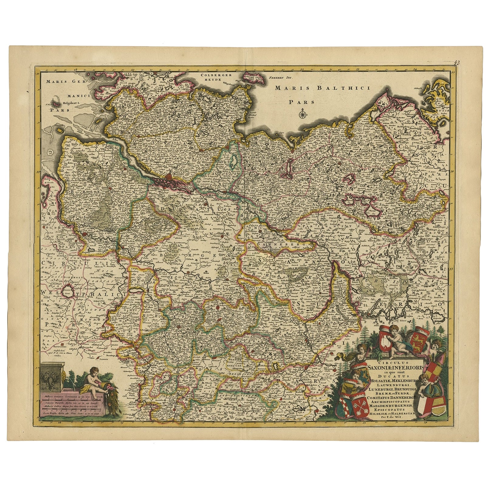
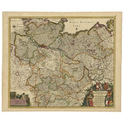
- Large Map of Germany with Berlin, Bremen, Hamburg, Osnabruck & Magdeburg, c.1680Located in Langweer, NLAntique map titled 'Circulus Saxoniae Inferioris in quo sunt Ducatus holsatiae, Meklenburg, Lauwenburgi, Luneburgi, Brunsuigi, Bremae et Ferdae (..)'. Large and detailed map fill...Category
Antique 1680s Maps
MaterialsPaper
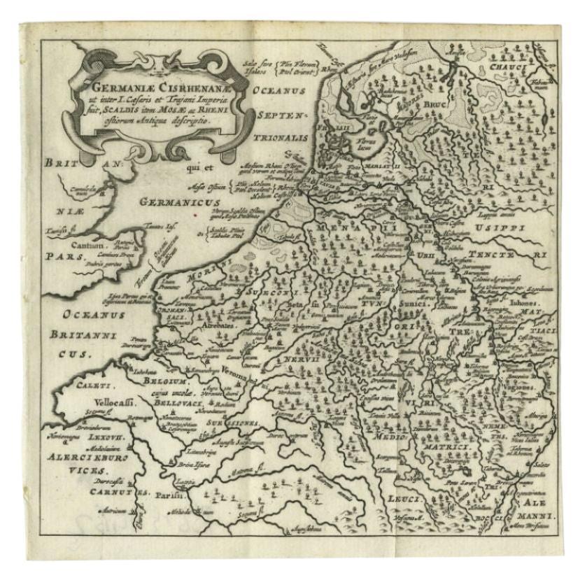
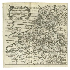
- Antique Map of the Low Countries and Surroundings in Europe, 1685By Philipp ClüverLocated in Langweer, NLAntique map titled 'Germaniae Cisrhenanae ut ineter I Caesaris et Traiani Suit imperia Scaldis Item Mose ac Rheni.' Miniature map of the Low Countries and part of Germany and France....Category
Antique 17th Century Maps
MaterialsPaper


You May Also Like
- Large Antique 1859 Map of North AmericaLocated in Sag Harbor, NYThis Map was made by Augustus Mitchell in 1859 It is in amazing condition for being 163 years old. This price is for the rolled up easy to ship version of this piece. I will be Frami...Category
Antique Mid-19th Century American Maps
MaterialsCanvas, Paper

- Original Antique Map / City Plan of Brussels by Tallis, circa 1850Located in St Annes, LancashireGreat map of Brussels. Steel engraving. Published by London Printing & Publishing Co. (Formerly Tallis), C.1850 Free shipping.Category
Antique 1850s English Maps
MaterialsPaper
- City View of Nuremberg, Germany: An 18th Century Hand-Colored Map by M. SeutterBy Matthew SeutterLocated in Alamo, CAAn 18th century hand-colored city view of Nuremburg, Germany entitled "Geometrischer Grundris der des Heiligen Römischen Reichs Freyen Stadt Nürnberg" by Matthaus Seutter from his "A...Category
Antique Mid-18th Century German Maps
MaterialsPaper
- Map of the Republic of GenoaLocated in New York, NYFramed antique hand-coloured map of the Republic of Genoa including the duchies of Mantua, Modena, and Parma. Europe, late 18th century. Dimension: 25...Category
Antique Late 18th Century European Maps
- Antique Map of Principality of MonacoBy Antonio Vallardi EditoreLocated in Alessandria, PiemonteST/619 - "Old Geographical Atlas of Italy - Topographic map of ex-Principality of Monaco" - ediz Vallardi - Milano - A somewhat special edition ---Category
Antique Late 19th Century Italian Other Prints
MaterialsPaper
- Original Antique Map of The World by Thomas Clerk, 1817Located in St Annes, LancashireGreat map of The Eastern and Western Hemispheres On 2 sheets Copper-plate engraving Drawn and engraved by Thomas Clerk, Edinburgh. Published by Mackenzie And Dent, 1817 ...Category
Antique 1810s English Maps
MaterialsPaper


Recently Viewed
View AllMore Ways To Browse
Antique City Views
Large Coat Of Arms
18th Century City View
18th Century Allegorical
Antique Norway
Norway Map
Map Of Norway
Norway Antique Map
Greenland Map
Victorian Fence
Battle Maps
Russian Antique Plates
Floor Vase Wood
Map Print Set
Mariner Furniture
Antique World Globe Map
Antique Blackwood
Antique Furniture Missouri