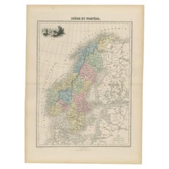
Norway Map
7
to
10
216
29
126
98
63
54
31
26
25
20
20
19
13
11
10
9
8
8
6
6
5
5
5
5
4
4
3
2
2
2
1
1
1
1
1
1
1
1
1
1
1
54
42
42
5
4
Sort By
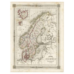
Antique Map of Scandinavia: Norway, Sweden and Denmark
Located in Langweer, NL
Antique map titled 'Suède, Norwège & Danemark'. Attractive map of Scandinavia, with Sweden, Norway
Category
Antique Mid-19th Century Maps
Materials
Paper
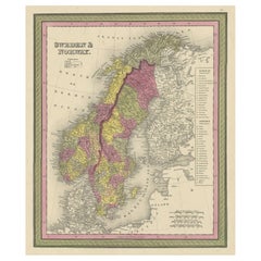
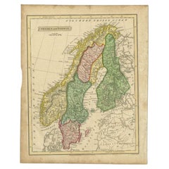
Old Colourful Map of Sweden and Norway, 1846
Located in Langweer, NL
Antique map titled 'Sweden & Norway'. Old map of Sweden and Norway.
This map originates from 'A
Category
Antique 1840s Maps
Materials
Paper
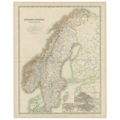
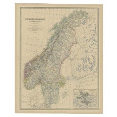
Antique Map of Sweden and Norway by Johnston (1909)
Located in Langweer, NL
Antique map titled 'Sweden and Norway'. Original antique map of Sweden and Norway. With inset maps
Category
Early 20th Century Maps
Materials
Paper
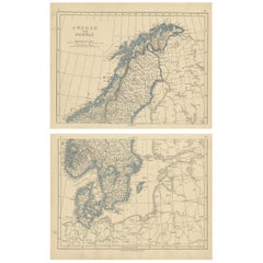
Antique Map of Sweden and Norway by Lowry, '1852'
Located in Langweer, NL
Antique map titled 'Sweden and Norway'. Two individual sheets of Sweden and Norway. This map
Category
Antique Mid-19th Century Maps
Materials
Paper
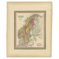
Antique Map of Sweden and Norway by Mitchell, 1846
Located in Langweer, NL
Antique map titled 'Sweden & Norway'. Old map of Sweden and Norway. This map originates from 'A New
Category
Antique 19th Century Maps
Materials
Paper
Antique Map of Sweden and Norway by Russell, 1814
Located in Langweer, NL
Antique map Scandinavia titled 'Sweden & Norway'. Antique map of Scandinavia with a focus on Sweden
Category
Antique 19th Century Maps
Materials
Paper
Antique Map of Sweden and Norway by Johnston, 1882
Located in Langweer, NL
Antique map titled 'Sweden & Norway (Scandinavia)'. Old map of Sweden and Norway, with inset map of
Category
Antique 19th Century Maps
Materials
Paper
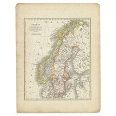
Antique Map of Sweden and Norway by Petri, 1852
Located in Langweer, NL
Antique map titled 'Zweden en Noorwegen'. Map of Sweden and Norway. This map originates from
Category
Antique 19th Century Maps
Materials
Paper
Antique Map of Sweden and Norway by Migeon, 1880
Located in Langweer, NL
Antique map titled 'Suède et Norvége'. Old map of Sweden and Norway. With decorative vignette of
Category
Antique 19th Century Maps
Materials
Paper
Antique Map of Southern Norway by Janssonius, c.1650
Located in Langweer, NL
"Antique map titled 'Nova et Accurata Tabula Episcopatuum Stavangriensis et Asloiensis'. Old map of
Category
Antique 17th Century Maps
Materials
Paper
Large Original Vintage Map of Sweden and Norway circa 1920
Located in St Annes, Lancashire
Great map of Sweden and Norway
Original color. Good condition
Published by Alexander Gross
Category
Vintage 1920s English Victorian Maps
Materials
Paper
Antique Map of Sweden & Norway by A.K. Johnston '1865'
Located in Langweer, NL
Antique map titled 'Sweden & Norway (Scandinavia)'. With an inset map of Stockholm and environments
Category
Antique Mid-19th Century Maps
Materials
Paper
Antique Map of Sweden, Norway and Denmark by Johnson, 1872
Located in Langweer, NL
World," by A.J. Johnson, dated 1872. This particular map offers a depiction of Sweden and Norway on one
Category
Antique Late 19th Century Maps
Materials
Paper
Antique Map of Sweden and Norway by Petri, c.1873
Located in Langweer, NL
Antique map titled 'Zweden en Noorwegen'. Old map depicting Sweden and Norway. This map originates
Category
Antique 19th Century Maps
Materials
Paper
Antique Map of Sweden and Norway by W. G. Blackie, 1859
Located in Langweer, NL
Antique map titled 'Sweden and Norway'. Original antique map of Sweden and Norway. This map
Category
Antique Mid-19th Century Maps
Materials
Paper
Original Antique Map of Sweden and Norway, Grattan and Gilbert, 1843
Located in St Annes, Lancashire
Great map of Sweden and Norway
Drawn and engraved by Archer
Published by Grattan and Gilbert
Category
Antique 1840s English Other Maps
Materials
Paper
No Reserve
H 11.75 in W 10.25 in D 0.07 in
Antique Map of Sweden and Norway by H. Moll, circa 1715
Located in Langweer, NL
Beautiful and rare map of Sweden and Norway including English text. This map most likely originates
Category
Antique Early 18th Century Maps
Materials
Paper
Antique Map of the Kingdoms of Sweden and Norway by Wyld '1845'
Located in Langweer, NL
Antique map titled 'Kingdoms of Sweden and Norway'. Original antique map of the Kingdoms of Sweden
Category
Antique Mid-19th Century Maps
Materials
Paper
Antique Map of the North Sea From the English Channel to Norway & Sweden, 1746
Located in Langweer, NL
Coast of Normandy in France'.
This map depicts the region from the English Channel to Norway and
Category
Antique 1740s Maps
Materials
Paper
H 20.08 in W 15.75 in D 0 in
Antique Map of the Kingdom of Sweden and Norway by Keizer & de Lat, 1788
Located in Langweer, NL
Kingdom of Sweden and Norway. This map originates from 'Nieuwe Natuur- Geschied- en Handelkundige Zak- en
Category
Antique Late 18th Century Maps
Materials
Paper
H 10.63 in W 7.88 in D 0.02 in
Old Map of The Southern Part of Norway, Covering the Region Around Bergen, c1650
Located in Langweer, NL
Antique map titled 'Nova et Accurata Tabula Episcopatuum Stavangriensis et Asloiensis'.
Old map
Category
Antique 1650s Maps
Materials
Paper
H 15.75 in W 19.49 in D 0 in
Antique Map of Scandinavia by Lapie, 1842
Located in Langweer, NL
Danemark'. Map of Scandinavia including Sweden, Norway and Denmark. With inset maps of Iceland and the
Category
Antique Mid-19th Century Maps
Materials
Paper
Antique Map of Scandinavia by T. Jefferys, circa 1750
Located in Langweer, NL
Antique map titled 'Sweden, Denmark, Norway & Finland'. An original mid-18th century copper
Category
Antique Mid-18th Century Maps
Materials
Paper
Antique Map of Northern Europe by Bonne, c.1780
Located in Langweer, NL
Antique map titled 'Le Nord de L'Europe, Contenant Le Danemark, La Norwege; La Suede et La Laponie
Category
Antique 18th Century Maps
Materials
Paper
Antique Map of Scandinavia by Van der Aa 'circa 1710'
Located in Langweer, NL
with two maps on one sheet. The upper map depicts Northern Scandinavia with Norway, Sweden and Finland
Category
Antique Early 18th Century Maps
Materials
Paper
Antique Map of Northern Europe and European Russia, ca.1780
Located in Langweer, NL
Antique map titled 'Le Nord de L'Europe, Contenant Le Danemark, La Norwege; La Suede et La Laponie
Category
Antique 1780s Maps
Materials
Paper
Old Sea Chart of Northern Norway, also depicting Part of Lapland & Russia, 1702
Located in Langweer, NL
Antique map titled 'The Coast of Norway and Lapland, from North kyn to the River Kola'.
Sea
Category
Antique Early 1700s Maps
Materials
Paper
H 17.33 in W 21.66 in D 0 in
Interesting Map of Great Britain and Northern Europe with various Illustrations
Located in Langweer, NL
Antique map titled 'Itinera Varia Auctoris'. Very interesting map of Great Britain and Northern
Category
Antique Mid-18th Century Maps
Materials
Paper
H 11.23 in W 8.9 in D 0.02 in
Large Antique Map of the City of Bremen and Surroundings, Germany
Located in Langweer, NL
Original antique map titled 'Prospect und Grundris der Keiserl Freyen Reichs und Ansee Stadt Bremen
Category
Antique Early 18th Century Maps
Materials
Paper
Antique Map of Scandinavia and the Baltic Region by Valk, circa 1690
Located in Langweer, NL
Antique map titled 'Sueciae Magnae, totius orbis regni antiquissimi (..)'. Map of Scandinavia and
Category
Antique Late 17th Century Maps
Materials
Paper
Colorful Detailed Antique Map of The British Islands and `The North Sea, 1882
Located in Langweer, NL
Discover 'The British Islands and The North Sea' Map with Insets of Orkney, Shetland, and Channel
Category
Antique 1880s Maps
Materials
Paper
H 14.97 in W 22.45 in D 0 in
Persia, Armenia & Adjacent Regions: A 17th Century Hand-colored Map by De Wit
By Frederick de Wit
Located in Alamo, CA
attractive map of Scandinavia, which includes the Baltic Sea, Norway, Sweden, Finland, Denmark and portions
Category
Antique Late 17th Century Dutch Maps
Materials
Paper
H 23.5 in W 27 in D 1.325 in
Pl. 28 Antique Chart of British American, English (..) US Population, 1874
Located in Langweer, NL
Antique chart titled 'Maps showing the distribution, within the territory of the United States
Category
Antique Late 19th Century Maps
Materials
Paper
H 21.66 in W 16.15 in D 0.02 in
Original Antique Poster Norvege Norway Midnight Sun Stavkirke Church Travel Map
Located in London, GB
Original antique travel poster for Norway with French text The Land of the Midnight Sun / Norvege
Category
Antique 1610s Norwegian Posters
Materials
Paper
H 38.98 in W 25.6 in D 0.04 in
Vintage Rollable Mural Map Wall Chart Print Scandinavia Norway Sweden Finland
Located in Berghuelen, DE
A great impressive cottagecore map illustrating Scandinavia (Norway, Sweden, Finland, Denmark and
Category
Mid-20th Century German Country Prints
Materials
Canvas, Wood, Paper
H 83.47 in W 73.63 in D 0.79 in
Original Antique Poster Midnight Sun Norway Travel Gronoy Bolgen Mountain View
Located in London, GB
Original antique travel poster issued by Norwegian State Railways for Norway The Land of the
Category
Antique Early 1900s Norwegian Posters
Materials
Paper
H 38.98 in W 25.99 in D 0.04 in
Westnofa Norwegian Black Leather and Red Wool Reversible Chaise Lounge
By Ingmar Relling, Göte Möbler Nässjö, Westnofa Furniture
Located in Chattanooga, TN
manufacturers. Their innovative, contemporary designs put Norway on the map as one of the best sources of fine
Category
Vintage 1970s Norwegian Mid-Century Modern Lounge Chairs
Materials
Leather, Canvas, Hardwood, Fabric
Original Antique Engraving of Christian, 6th King of Norway, 1735
Located in Langweer, NL
Norway, Denmark etc. This print originates from the 7th-volume of 'Hedendaagsche Historie of
Category
Antique 18th Century Prints
Materials
Paper
Great Britain Scandinavia Northern France Netherland Germany Mural Map
Located in Berghuelen, DE
The vintage pull-down cottagecore mural map illustrates the North Sea countries with Great Britain
Category
Vintage 1970s German Country Posters
Materials
Canvas, Wood, Paper
H 81.89 in W 88.19 in D 0.79 in
Rare Antique Engraving of the City of Stockholm, Norway, ca.1720
Located in Langweer, NL
G. Bodenehr.
Artists and Engravers: Gabriel Bodenehr, a German map maker and member of a famous
Category
Antique 18th Century Prints
Materials
Paper
Original Vintage Poster Svenska Lloyd Travel London Paris Norway Sweden Denmark
Located in London, GB
full steam ahead powering the ship to the destinations marked on the map in the background showing the
Category
Vintage 1930s Swedish Posters
Materials
Paper
H 39.38 in W 27.56 in D 0.04 in
Original Vintage Travel Poster See The Lands Of The Vikings Atlantic Sailing Map
By Benjamin Blessum
Located in London, GB
Original vintage travel poster for the Nordic countries marked on a map - Christiania (Oslo) Norway
Category
Vintage 1930s Swedish Posters
Materials
Paper
H 39.38 in W 24.81 in D 0.04 in
Just Keep Going Until You Find me - British Abstract oil painting city map red
By Stanza
Located in London, GB
created by our living actions or agency. They all have in common that they depict maps with layers of data
Category
21st Century and Contemporary Abstract Abstract Paintings
Materials
Canvas, Paint, Acrylic, Oil
Original psychedelic travel poster for SAS to promote its travels to Scandinavia
Located in PARIS, FR
its travels to Scandinavia.
Airline Company - Tourism - Map
Scandinavian Airlines - Found space
Category
1960s Prints and Multiples
Materials
Paper, Lithograph
Antique Print of a Malayan Houses in Sumatra, Indonesia, 1881
Located in Langweer, NL
.
Artists and Engravers: Carl Alfred Bock (17 September 1849 – 10 August 1932) was a Norwegian government
Category
Antique 19th Century Prints
Materials
Paper
Pair of All Wood AV35 Side Chairs - Oak - by Anderssen & Voll for &Tradition
Located in Dubai, AE
Torbjørn Anderssen and Espen Voll have been instrumental in putting Norway on the global design map ever
Category
2010s Danish Scandinavian Modern Side Chairs
Materials
Oak
H 31.74 in W 19.06 in D 21.07 in
Original Imray & Son Chart of North Atlantic, 1876
Located in Norwell, MA
Scotia), Europe (England, Ireland, Norway, Denmark, France and Spain), African coast (including Morocco
Category
Antique 1870s Nautical Objects
Materials
Paper
Antique Print of a Tring Dayak Woman from Borneo Island, Indonesia, 1881
Located in Langweer, NL
- 1932) was a Norwegian government official, author, naturalist and explorer.
Technic: Lithograph on
Category
Antique 19th Century Prints
Materials
Paper
Pair of VilleAV33 Outdoor Side Chairs-Bronze Green-by Anderssen & Voll for &T
By &Tradition
Located in Dubai, AE
have been instrumental in putting Norway on the global design map ever since they joined forces in 2009
Category
2010s Danish Scandinavian Modern Side Chairs
Materials
Steel
H 31.11 in W 23.23 in D 20.48 in
Pair of VilleAV33 Outdoor Side Chairs-Teak/Warm Black-by Anderssen & Voll for &T
By &Tradition
Located in Dubai, AE
have been instrumental in putting Norway on the global design map ever since they joined forces in 2009
Category
2010s Danish Scandinavian Modern Side Chairs
Materials
Steel
H 31.11 in W 23.23 in D 20.48 in
The Kiss II. Self Nude Portrait Color Photograph.
By Maria José Arjona
Located in Miami Beach, FL
exhibition in New York at the Art Space Location One, in 2012. The Kiss maps a system uniting two bodies. It
Category
2010s Contemporary Portrait Photography
Materials
Archival Pigment, Color
H 39.38 in W 55.12 in D 0.12 in
The Kiss I. Self Nude Portrait Color Photograph.
By Maria José Arjona
Located in Miami Beach, FL
exhibition in New York at the Art Space Location One, in 2012. The Kiss maps a system uniting two bodies. It
Category
2010s Contemporary Portrait Photography
Materials
Archival Pigment, Color
H 39.38 in W 55.12 in D 0.12 in
The Kiss Group of 8. Self Nude Portrait Color Photograph.
By Maria José Arjona
Located in Miami Beach, FL
maps a system uniting two bodies. It is a gesture magnified by the use of sound emerging from the
Category
2010s Contemporary Portrait Photography
Materials
Archival Pigment, Color
H 42.52 in W 94.49 in D 0.12 in
Unique Signed Table by Jörg Pietschmann
By Jörg Pietschmann
Located in Geneve, CH
Unique signed table by Jörg Pietschmann
Materials: Norway maple, Padouk
Measures: H 38 x W 84 x D
Category
2010s German Organic Modern Coffee and Cocktail Tables
Materials
Maple, Padouk
Vessel 1305 by Jörg Pietschmann
By Jörg Pietschmann
Located in Geneve, CH
Vessel 1305 by Jörg Pietschmann
Dimensions: D 46 x W 47 x H 143 cm
Materials: Norway maple
Category
2010s German Organic Modern Vases
Materials
Wood, Maple
Unique Signed Chair by Jörg Pietschmann
By Jörg Pietschmann
Located in Geneve, CH
Unique signed chair by Jörg Pietschmann
Materials: Norway Maple
Measures: H 78 x D 50 cm
Category
2010s German Organic Modern Chairs
Materials
Maple
Unique Signed Bench by Jörg Pietschmann
By Jörg Pietschmann
Located in Geneve, CH
Unique signed bench by Jörg Pietschmann
Bench: Norway maple, Padouk
Measures: H 38 x W 154 x D 37
Category
2010s German Organic Modern Benches
Materials
Padouk
Unique Signed Bowl by Jörg Pietschmann
By Jörg Pietschmann
Located in Geneve, CH
Unique signed bowl by Jörg Pietschmann
Vessel sculpture· Norway maple
Measures: H 143 x W 47 x D 46
Category
2010s German Organic Modern Vases
Materials
Maple
Design for St Nicholas House, High Street, Bristol by Edmund J Thring
Located in London, GB
bombing German warships in Norwegian fjords found maps almost useless, so carried cardboard models of the
Category
20th Century Landscape Drawings and Watercolors
Materials
Gouache
H 18.12 in W 21.26 in
"The Kiss III"- Location One, NYC. Self Nude Portrait Color Photograph, Framed.
By Maria José Arjona
Located in Miami Beach, FL
. The Kiss maps a system uniting two bodies. It is a gesture magnified by the use of sound emerging from
Category
2010s Contemporary Portrait Photography
Materials
Archival Pigment, Color
- 1
Get Updated with New Arrivals
Save "Norway Map", and we’ll notify you when there are new listings in this category.
Norway Map For Sale on 1stDibs
Find many varieties of an authentic Norway map available at 1stDibs. A Norway map — often made from paper, canvas and fabric — can elevate any home. Whether you’re looking for an older or newer Norway map, there are earlier versions available from the 18th Century and newer variations made as recently as the 20th Century. A Norway map, designed in the style, is generally a popular piece of furniture.
How Much is a Norway Map?
A Norway map can differ in price owing to various characteristics — the average selling price 1stDibs is $320, while the lowest priced sells for $102 and the highest can go for as much as $1,703.
More Ways To Browse
Silk Pictures On Canvas Antique
80s Dior Clothing
Villa Stuck
Calder Blue Sun
Cast Iron Money Box
Vintage Easter Plates
Vintage Easter Plate
Pigeon Cage
Plates Anna W
Orient Express Poster
Broken Egg Vintage
Cow Pitcher
Lemon Pitcher
Matisse Danse
Fencing Poster
Music Note Pin
Vintage Cast Iron Hat Stand
Vintage Style Suitcase Set
