Items Similar to Antique Map of Scandinavia: Norway, Sweden and Denmark


Want more images or videos?
Request additional images or videos from the seller
1 of 6
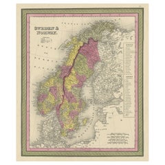
Antique Map of Scandinavia: Norway, Sweden and Denmark
About the Item
Antique map titled 'Suède, Norwège & Danemark'. Attractive map of Scandinavia, with Sweden, Norway and Denmark. With an inset map of Iceland and the Faroe Islands. This map originates from Maison Basset's 1852 edition of 'Atlas Illustre Destine a l'enseignement de la Geographie elementaire'.
- Dimensions:Height: 13.31 in (33.8 cm)Width: 10.12 in (25.7 cm)Depth: 0.02 in (0.5 mm)
- Materials and Techniques:
- Period:
- Date of Manufacture:1852
- Condition:General age-related toning. Shows soiling and foxing, blank verso. Please study image carefully.
- Seller Location:Langweer, NL
- Reference Number:
About the Seller
5.0
Platinum Seller
These expertly vetted sellers are 1stDibs' most experienced sellers and are rated highest by our customers.
Established in 2009
1stDibs seller since 2017
1,922 sales on 1stDibs
Typical response time: <1 hour
- ShippingRetrieving quote...Ships From: Langweer, Netherlands
- Return PolicyA return for this item may be initiated within 14 days of delivery.
More From This SellerView All
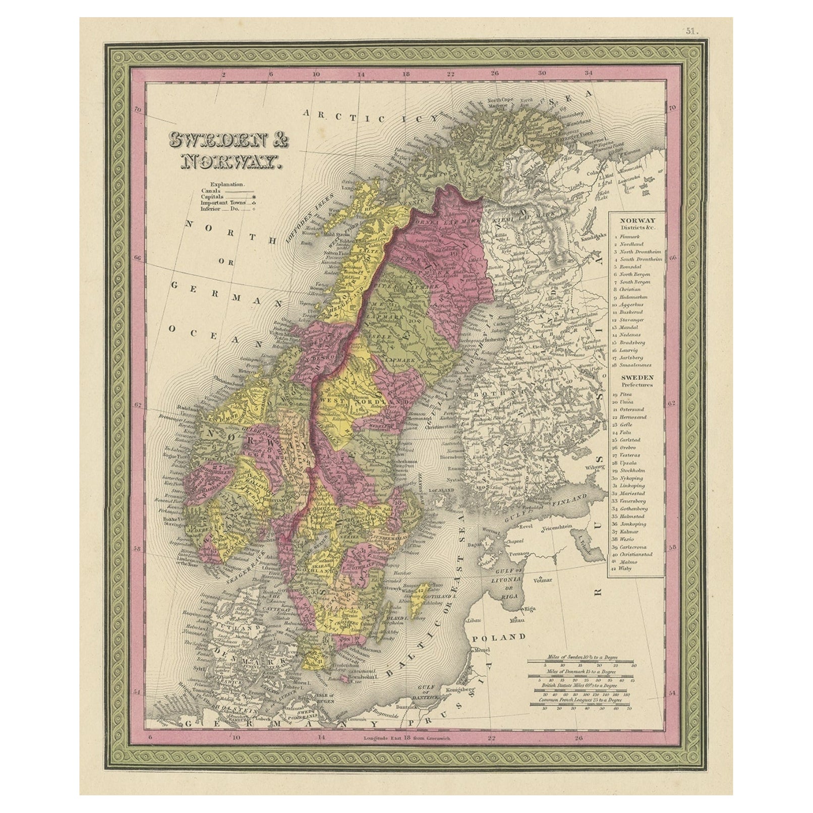
- Antique Map of Sweden and Norway by W. G. Blackie, 1859Located in Langweer, NLAntique map titled 'Sweden and Norway'. Original antique map of Sweden and Norway. This map originates from ‘The Imperial Atlas of Modern Geography’. Published by W. G. Blackie, 1859.Category
Antique Mid-19th Century Maps
MaterialsPaper
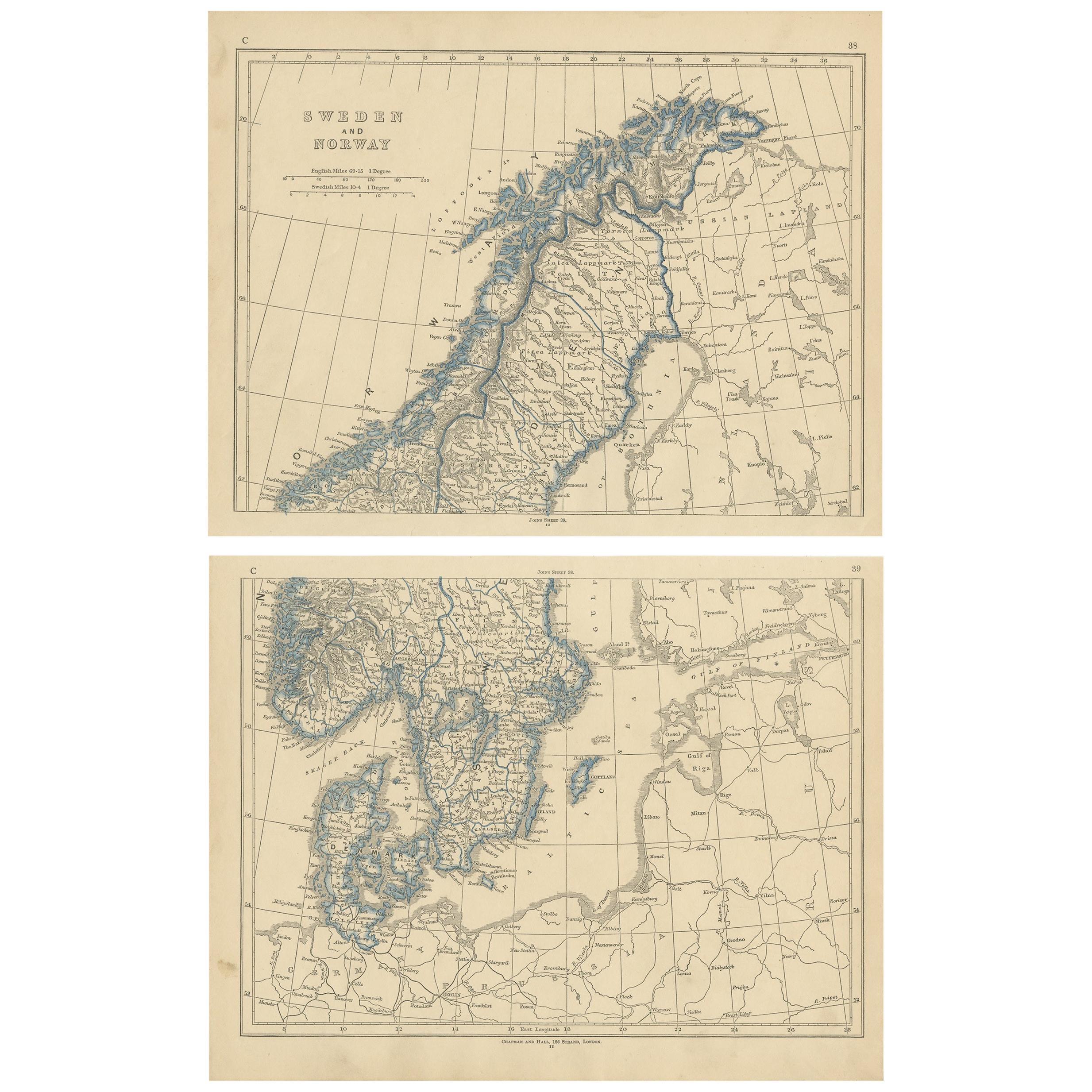
- Antique Map of Sweden and Norway by Lowry, '1852'Located in Langweer, NLAntique map titled 'Sweden and Norway'. Two individual sheets of Sweden and Norway. This map originates from 'Lowry's Table Atlas constructed and engraved from the most recent Author...Category
Antique Mid-19th Century Maps
MaterialsPaper
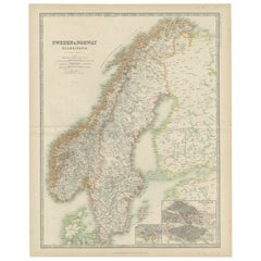
- Antique Map of Sweden and Norway by Johnston (1909)Located in Langweer, NLAntique map titled 'Sweden and Norway'. Original antique map of Sweden and Norway. With inset maps of Christiania and Stockholm. This map originates from...Category
Early 20th Century Maps
MaterialsPaper
- Antique Map of South Sweden 'Scandinavia' by F. de Wit, 1680Located in Langweer, NLAntique map titled 'Accurata Scaniae, Blekingae et Hallandiae Descriptio per F. de Wit Amstelodami'. This map shows South Sweden with an inset of Halmstad and vicinity. Contemporary ...Category
Antique Late 17th Century Maps
MaterialsPaper
- Old Colourful Map of Sweden and Norway, 1846Located in Langweer, NLAntique map titled 'Sweden & Norway'. Old map of Sweden and Norway. This map originates from 'A New Universal Atlas Containing Maps of the various Em...Category
Antique 1840s Maps
MaterialsPaper
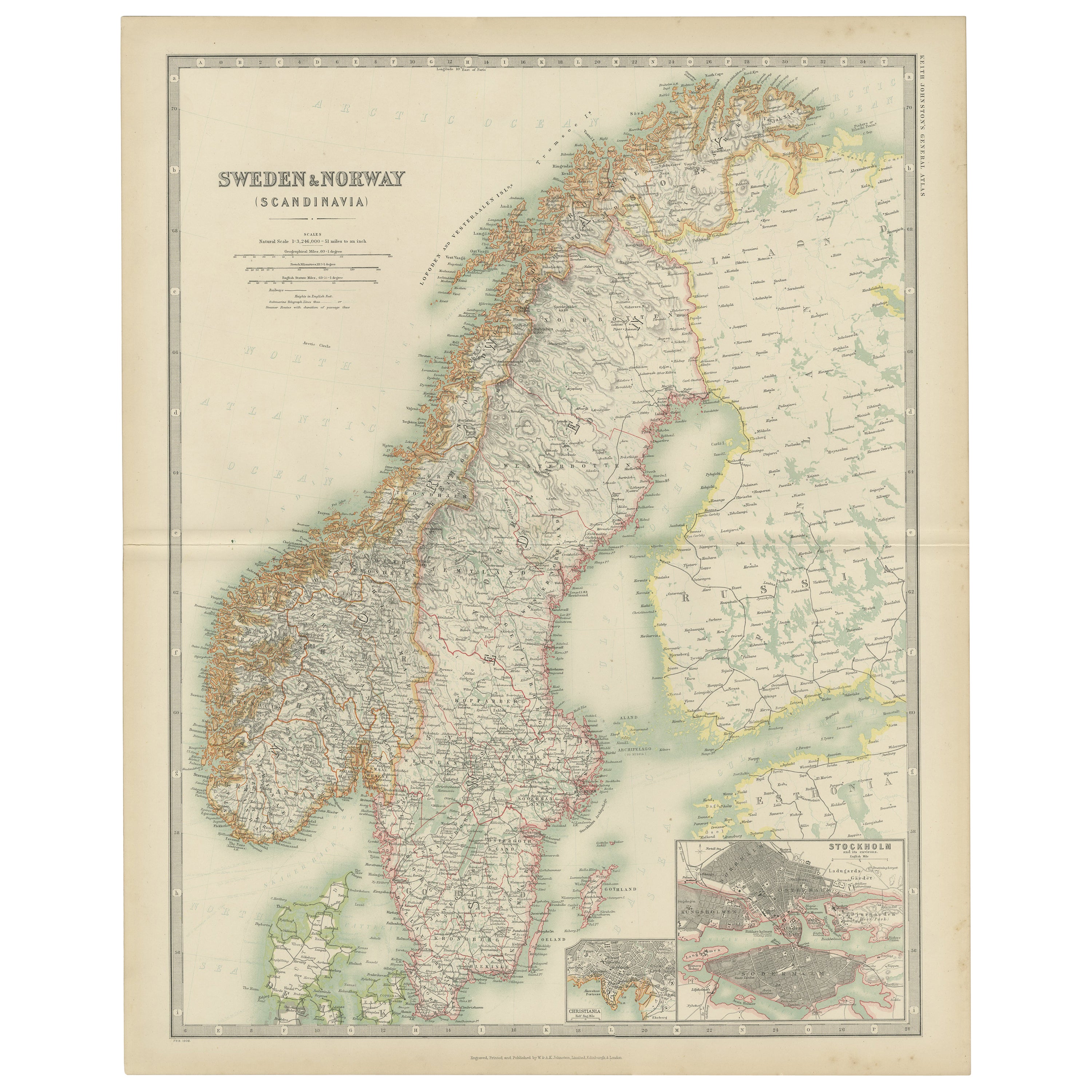
- Antique Map of Sweden & Norway by A.K. Johnston '1865'Located in Langweer, NLAntique map titled 'Sweden & Norway (Scandinavia)'. With an inset map of Stockholm and environments. This map originates from the ‘Royal Atlas of Modern Geography’ by Alexander Keith...Category
Antique Mid-19th Century Maps
MaterialsPaper


You May Also Like
- Original Antique Map of Sweden and Norway, Grattan and Gilbert, 1843Located in St Annes, LancashireGreat map of Sweden and Norway Drawn and engraved by Archer Published by Grattan and Gilbert Original color Unframed.Category
Antique 1840s English Other Maps
MaterialsPaper
- Sweden & Adjacent Portions of Scandinavia: A Hand-Colored 18th C. Map by HomannBy Johann Baptist HomannLocated in Alamo, CAThis hand-colored map of Sweden and adjacent portions of Scandinavia entitled "Regni Sueciae in Omnes suas Subjacentes Provincias accurate divisi Tabula Generalis" was created by Joh...Category
Antique 1720s German Maps
MaterialsPaper
- Original Antique Map of Sweden, Engraved by Barlow, 1806Located in St Annes, LancashireGreat map of Sweden Copper-plate engraving by Barlow Published by Brightly & Kinnersly, Bungay, Suffolk. 1806 Unframed.Category
Antique Early 1800s English Maps
MaterialsPaper
- Scandinavia & Portions of Eastern Europe: 18th Century Hand-Colored Homann MapBy Johann Baptist HomannLocated in Alamo, CAAn early 18th century hand-colored copper-plate map entitled "Regni Sueciae in omnes suas Subjacentes Provincias accurate divisi Tabula Generalis" by Johann Baptist Homann (1663-1724...Category
Antique Early 18th Century German Maps
MaterialsPaper
- Antique Map of Principality of MonacoBy Antonio Vallardi EditoreLocated in Alessandria, PiemonteST/619 - "Old Geographical Atlas of Italy - Topographic map of ex-Principality of Monaco" - ediz Vallardi - Milano - A somewhat special edition ---Category
Antique Late 19th Century Italian Other Prints
MaterialsPaper
- Original Antique Map of Spain and Portugal, circa 1790Located in St Annes, LancashireSuper map of Spain and Portugal Copper plate engraving by A. Bell Published, circa 1790. Unframed.Category
Antique 1790s English Other Maps
MaterialsPaper


Recently Viewed
View AllMore Ways To Browse
Map Scandinavia
Antique Maps Scandinavia
Antique Map Iceland
Antique Map Of Iceland
Antique Map Scandinavia
Iceland Map
Faroe Islands
Antique Map Bahamas
Antique Map Ontario
Antique Maps Ontario
Map Lebanon
Antique Map Montreal
Antique Maps San Diego
Lebanon Antique Map
Montreal Map
Antique Furniture Perth Australia
Antique Maps Perth
Barbados Map