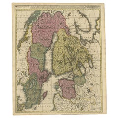
Map Scandinavia
2
to
9
35
14
24
16
13
12
11
10
10
8
7
5
5
4
3
3
3
2
2
2
1
1
1
1
1
1
1
1
1
1
1
12
4
4
1
1
Sort By
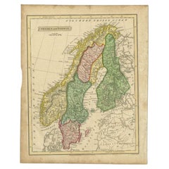
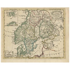
Antique Map of Sweden and Norway by Russell, 1814
Located in Langweer, NL
Antique map Scandinavia titled 'Sweden & Norway'. Antique map of Scandinavia with a focus on Sweden
Category
Antique 19th Century Maps
Materials
Paper
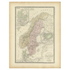
Antique Map of Scandinavia by Levasseur, 1875
Located in Langweer, NL
Scandinavia. This map originates from 'Atlas de Géographie Moderne Physique et Politique' by A. Levasseur
Category
Antique Late 19th Century Maps
Materials
Paper
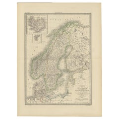
Antique Map of Scandinavia by Lapie, 1842
Located in Langweer, NL
Danemark'. Map of Scandinavia including Sweden, Norway and Denmark. With inset maps of Iceland and the
Category
Antique Mid-19th Century Maps
Materials
Paper
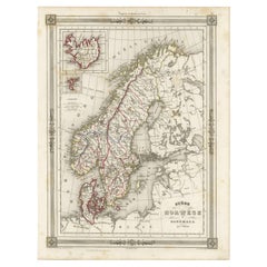
Antique Map of Scandinavia: Norway, Sweden and Denmark
Located in Langweer, NL
Antique map titled 'Suède, Norwège & Danemark'. Attractive map of Scandinavia, with Sweden, Norway
Category
Antique Mid-19th Century Maps
Materials
Paper
Antique Map of Scandinavia by T. Jefferys, circa 1750
Located in Langweer, NL
engraved antique map of Scandinavia by Thomas Jefferys. Published circa 1750 by Thomas Salmon in his
Category
Antique Mid-18th Century Maps
Materials
Paper
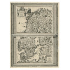
Antique Map of Scandinavia by Van der Aa 'circa 1710'
Located in Langweer, NL
with two maps on one sheet. The upper map depicts Northern Scandinavia with Norway, Sweden and Finland
Category
Antique Early 18th Century Maps
Materials
Paper
Scandinavia & Portions of Eastern Europe: 18th Century Hand-Colored Homann Map
By Johann Baptist Homann
Located in Alamo, CA
in Nuremberg, Germany, initially in 1710 and again in 1730. The map depicts Scandinavia, including
Category
Antique Early 18th Century German Maps
Materials
Paper
H 20.75 in W 23.5 in D 0.07 in
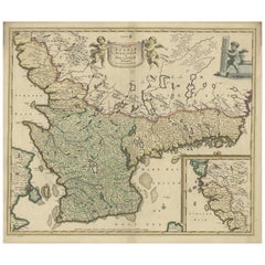
Antique Map of South Sweden 'Scandinavia' by F. de Wit, 1680
Located in Langweer, NL
Antique map titled 'Accurata Scaniae, Blekingae et Hallandiae Descriptio per F. de Wit Amstelodami
Category
Antique Late 17th Century Maps
Materials
Paper
Antique Map of Scandinavia and the Baltic Region by Valk, circa 1690
Located in Langweer, NL
Antique map titled 'Sueciae Magnae, totius orbis regni antiquissimi (..)'. Map of Scandinavia and
Category
Antique Late 17th Century Maps
Materials
Paper
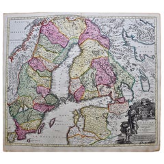
Sweden & Adjacent Portions of Scandinavia: A Hand-Colored 18th C. Map by Homann
By Johann Baptist Homann
Located in Alamo, CA
This hand-colored map of Sweden and adjacent portions of Scandinavia entitled "Regni Sueciae in
Category
Antique 1720s German Maps
Materials
Paper
H 21 in W 23.38 in D 0.07 in
Antique Map of Northwest Europe by Kiepert, c.1870
Located in Langweer, NL
United Kingdom, Ireland, the Netherlands, Germany, Scandinavia and surroundings. This map originates from
Category
Antique 19th Century Maps
Materials
Paper
1633 Map Entitled "Beauvaisis Comitatus Belova Cium, Ric.0002
Located in Norton, MA
the Elder (see under Gerard Mercator (Atlas Minor) for further detail) * 1613 Map of Scandinavia
Category
Antique 17th Century Dutch Maps
Materials
Paper
Antique Map of Sweden and Norway by Johnston, 1882
Located in Langweer, NL
Antique map titled 'Sweden & Norway (Scandinavia)'. Old map of Sweden and Norway, with inset map of
Category
Antique 19th Century Maps
Materials
Paper
Antique Map of Sweden & Norway by A.K. Johnston '1865'
Located in Langweer, NL
Antique map titled 'Sweden & Norway (Scandinavia)'. With an inset map of Stockholm and environments
Category
Antique Mid-19th Century Maps
Materials
Paper
1859 Denmark and Schleswig-Holstein Map: A Historical View from Blackie's Atlas
Located in Langweer, NL
The "Antique Map of Denmark with Schleswig & Holstein" from 'The Imperial Atlas of Modern Geography
Category
Antique Mid-19th Century Maps
Materials
Paper
H 14.57 in W 10.63 in D 0.02 in
Persia, Armenia & Adjacent Regions: A 17th Century Hand-colored Map by De Wit
By Frederick de Wit
Located in Alamo, CA
attractive map of Scandinavia, which includes the Baltic Sea, Norway, Sweden, Finland, Denmark and portions
Category
Antique Late 17th Century Dutch Maps
Materials
Paper
H 23.5 in W 27 in D 1.325 in
Antique Map of the North Pole by V.M. Coronelli, circa 1692
By Vincenzo Coronelli
Located in Langweer, NL
, Scandinavia and Siberia, and is decorated with pictorial scenes of bear, seal and whale hunters. The globe
Category
Antique Late 17th Century Maps
Materials
Paper
Great Britain Scandinavia Northern France Netherland Germany Mural Map
Located in Berghuelen, DE
The vintage pull-down cottagecore mural map illustrates the North Sea countries with Great Britain
Category
Vintage 1970s German Country Posters
Materials
Canvas, Wood, Paper
H 81.89 in W 88.19 in D 0.79 in
Vintage Rollable Mural Map Wall Chart Print Scandinavia Norway Sweden Finland
Located in Berghuelen, DE
A great impressive cottagecore map illustrating Scandinavia (Norway, Sweden, Finland, Denmark and
Category
Mid-20th Century German Country Prints
Materials
Canvas, Wood, Paper
H 83.47 in W 73.63 in D 0.79 in
Sweden and Adjacent Portions of Scandinavia: A Hand-colored 18th C. Homann Map
By Johann Baptist Homann
Located in Alamo, CA
This hand-colored copper-plate map of Sweden and adjacent portions of Scandinavia entitled "Regni
Category
Early 18th Century Old Masters Landscape Prints
Materials
Engraving
Original Vintage Travel Poster Air France Stockholm Paris Art Deco Scandinavia
Located in London, GB
Original vintage travel poster for Air France promoting their Scandinavia flight route from Paris
Category
Vintage 1930s French Art Deco Posters
Materials
Paper
H 19.69 in W 12.21 in D 0.04 in
Original psychedelic travel poster for SAS to promote its travels to Scandinavia
Located in PARIS, FR
its travels to Scandinavia.
Airline Company - Tourism - Map
Scandinavian Airlines - Found space
Category
1960s Prints and Multiples
Materials
Paper, Lithograph
Europe: An Original 18th Century Hand-colored Map by E. Bowen
Located in Alamo, CA
Complete Collection of Voyages and Travels". The map depicts Europe from Scandinavia in the north to the
Category
Mid-18th Century Old Masters Landscape Prints
Materials
Engraving
Original Antique Poster Norvege Norway Midnight Sun Stavkirke Church Travel Map
Located in London, GB
and the building reflected in the calm water next to a route map marking travel over the Atlantic
Category
Antique 1610s Norwegian Posters
Materials
Paper
H 38.98 in W 25.6 in D 0.04 in
Europa Regnorum Provinciarum: 18th Century Hand-colored Map of Europe by Lotter
By Tobias Conrad Lotter
Located in Alamo, CA
This is an 18th century hand-colored copperplate engraved map entitled "Europa Regnorum
Category
Mid-18th Century Landscape Prints
Materials
Engraving
Original Vintage Travel Poster Nord Air Express Air France Sabena Art Deco
Located in London, GB
Deco design showing a tri-engine propeller plane flying at speed over a map of Europe marking the route
Category
Vintage 1930s Belgian Art Deco Posters
Materials
Paper
H 39.38 in W 24.81 in D 0.04 in
Untitled, paint and collage on treated paper
By Shane Drinkwater
Located in Toronto, Ontario
of dots and dashes, spheres and numbers render his vision as highly coded maps of cosmic systems
Category
21st Century and Contemporary Abstract Abstract Paintings
Materials
Paper, Dye, Acrylic
Untitled, paint and collage on treated paper
By Shane Drinkwater
Located in Toronto, Ontario
of dots and dashes, spheres and numbers render his vision as highly coded maps of cosmic systems
Category
21st Century and Contemporary Abstract Abstract Paintings
Materials
Paper, Acrylic, Dye
Untitled, paint and collage on treated paper
By Shane Drinkwater
Located in Toronto, Ontario
of dots and dashes, spheres and numbers render his vision as highly coded maps of cosmic systems
Category
21st Century and Contemporary Abstract Abstract Paintings
Materials
Paper, Dye, Acrylic
Untitled, paint and collage on treated paper
By Shane Drinkwater
Located in Toronto, Ontario
of dots and dashes, spheres and numbers render his vision as highly coded maps of cosmic systems
Category
21st Century and Contemporary Abstract Abstract Paintings
Materials
Paper, Dye, Acrylic
Untitled, paint and collage on treated paper, wood frame, glass
By Shane Drinkwater
Located in Toronto, Ontario
his vision as highly coded maps of cosmic systems, secret alphabets and magic symbols.
From Shane
Category
21st Century and Contemporary Abstract Abstract Paintings
Materials
Paper, Dye, Acrylic
H 30 in W 30 in D 3 in
First Edition Guthrie's Geographical Grammmar in Miniature, 1807
Located in Langweer, NL
worldmap and maps of Scandinavia, the Russian dominions, Great Britain and Ireland, France, Belgium ("The
Category
Antique Early 19th Century Books
Materials
Paper
Untitled, paint and collage on treated paper
By Shane Drinkwater
Located in Toronto, Ontario
of dots and dashes, spheres and numbers render his vision as highly coded maps of cosmic systems
Category
21st Century and Contemporary Abstract Abstract Paintings
Materials
Paper, Dye, Acrylic
Untitled, paint and collage on treated paper
By Shane Drinkwater
Located in Toronto, Ontario
of dots and dashes, spheres and numbers render his vision as highly coded maps of cosmic systems
Category
21st Century and Contemporary Abstract Abstract Paintings
Materials
Paper, Dye, Acrylic
Untitled, paint and collage on treated paper
By Shane Drinkwater
Located in Toronto, Ontario
of dots and dashes, spheres and numbers render his vision as highly coded maps of cosmic systems
Category
21st Century and Contemporary Abstract Abstract Paintings
Materials
Paper, Dye, Acrylic
Untitled, paint and collage on treated paper
By Shane Drinkwater
Located in Toronto, Ontario
of dots and dashes, spheres and numbers render his vision as highly coded maps of cosmic systems
Category
21st Century and Contemporary Abstract Abstract Paintings
Materials
Paper, Dye, Acrylic
Untitled, paint and collage on treated paper
By Shane Drinkwater
Located in Toronto, Ontario
of dots and dashes, spheres and numbers render his vision as highly coded maps of cosmic systems
Category
21st Century and Contemporary Abstract Abstract Paintings
Materials
Paper, Dye, Acrylic
Untitled, paint and collage on treated paper, wood frame, glass
By Shane Drinkwater
Located in Toronto, Ontario
vision as highly coded maps of cosmic systems, secret alphabets and magic symbols.
From Shane – “I paint
Category
21st Century and Contemporary Abstract Abstract Paintings
Materials
Paper, Dye, Acrylic
H 30 in W 30 in D 3 in
A truly delightful miniature terrestrial pocket globe
By Nathaniel Mills
Located in ZWIJNDRECHT, NL
; to the area concerning the British Isles, and also to parts of Europe and Scandinavia (with some loss
Category
Antique Mid-18th Century British Dutch Colonial Globes
Materials
Other
Original Vintage Travel Poster Air France Stockholm Paris Art Deco Scandinavia
Located in London, GB
Original vintage travel poster for Air France promoting their Scandinavia flight route from Paris
Category
1930s Art Deco More Prints
Materials
Paper
H 19.69 in W 12.21 in
Original Antique Poster Norvege Norway Midnight Sun Stavkirke Church Travel Map
Located in London, GB
and the building reflected in the calm water next to a route map marking travel over the Atlantic
Category
Early 1900s More Prints
Materials
Paper
Original Vintage Travel Poster Nord Air Express Air France Sabena Art Deco
Located in London, GB
Deco design showing a tri-engine propeller plane flying at speed over a map of Europe marking the route
Category
1930s More Prints
Materials
Paper
H 39.38 in W 24.81 in
Framed World Map by Scandinavian Airlines, Esselte Map Service 1979
Located in Achterveld, NL
Antarctica and certain ocean sectors excluded).
The map also includes detailed insets of Scandinavia in the
Category
Vintage 1970s Swedish Posters
Materials
Wood
Rare 1710 Hand-Colored Map of Europe
By Frederick de Wit
Located in La Jolla, CA
chart that shows an area from Morocco to the Scandinavian island of Spitsbergen and Iceland. The map
Category
Antique 1710s Dutch Northern Renaissance Prints
Materials
Paper
Rare Nova Et Accurata Orbis Arctoi Tabula Geographica, Scandinavian Map, 1680
By Erik Von Dahlberg
Located in Drottningholm, SE
Swedish 17th c Map of Scandinavia made by Erik Von Dahlberg in the late 17th century. This is a copper
Category
Antique 1680s Swedish Prints
Materials
Paper
H 16.34 in W 20.48 in D 0.6 in
Carte reduite des Mers du Nord [...].
By Jacques-Nicolas Bellin
Located in Zeeland, Noord-Brabant
Carte reduite des Mers du Nord [...] - Detailed map of the Northern Oceans ... Highly decorative
Category
Mid-18th Century More Prints
Materials
Engraving
Great Old Map of Scandinavia Incl Finland, Eastern Russia and the Baltics, C1680
Located in Langweer, NL
Antique map Scandinavia titled 'Exactissima Totius Scandinaviae Tabula, qua tam Sueciae, Daniae, et
Category
Antique 1680s Maps
Materials
Paper
H 20.87 in W 25.2 in D 0 in
A Hand Colored 17th Century Map of Scandinavia by Frederick de Wit
By Frederick de Wit
Located in Alamo, CA
attractive map of Scandinavia, which includes the Baltic Sea, Norway, Sweden, Finland, Denmark and portions
Category
Late 17th Century Old Masters More Prints
Materials
Engraving
H 24 in W 26.5 in D 0.13 in
Untitled, paint and collage on treated paper
By Shane Drinkwater
Located in Toronto, Ontario
of dots and dashes, spheres and numbers render his vision as highly coded maps of cosmic systems
Category
21st Century and Contemporary Abstract Abstract Paintings
Materials
Paper, Dye, Acrylic
1964 Harland & Wolff Boat Ship Martime Naval Blueprint Diagram Rigging Plans
By Harland and Wolff
Located in Dayton, OH
"Monumental 1964 Harland & Wolff architectural ship map / rigging plan print. H&W were naval
Category
Vintage 1960s Prints
Materials
Paper
H 40 in W 1.25 in D 89 in
Antique Map of Scandinavia by G.A. Magini, 1596
Located in Langweer, NL
Striking example of Magini's modern map of Scandinavia and the North Atlantic regions. Magini bases
Category
Antique 16th Century Maps
Materials
Paper
Scandinavia a Hand Colored 17th Century Map by Frederick de Wit
By Frederick de Wit
Located in Alamo, CA
attractive map of Scandinavia, which includes the Baltic Sea, Norway, Sweden, Finland, Denmark and portions
Category
Antique Late 17th Century European Maps
Materials
Paper
Original Antique Map of Sweden, Norway, Denmark and Finland, circa 1790
Located in St Annes, Lancashire
Super map of Scandinavia
Copper plate engraving by A.Bell
Published, circa 1790.
Unframed.
Category
Antique 1790s English Other Maps
Materials
Paper
1 bid
No Reserve
H 8.25 in W 11 in D 0.07 in
Antique Map of Northern and Eastern Europe by Stieler, 1855
Located in Langweer, NL
Oesterreichischen u. Preussischen Staats.' Large-scale map of Eastern and Northern Europe, with focus on Scandinavia
Category
Antique 19th Century Maps
Materials
Paper
Vintage Pull Down Map North Sea Countries Northen Europe Great Britain Norway
Located in Berghuelen, DE
A classical school map showing the countries surrounding the North Sea (Great Britain, Ireland
Category
Mid-20th Century German Country Prints
Materials
Canvas, Wood, Paper
H 82.29 in W 87.8 in D 0.79 in
The Atlantic Ocean, Americas, Africa and Europe: Hand-colored 18th C. Bowen Map
Located in Alamo, CA
This is an original 18th century hand-colored map entitled "A New & Accurate Chart of the The
Category
Mid-18th Century Old Masters Landscape Prints
Materials
Engraving
Original Antique Poster Norway The Land Of The Midnight Sun Stavkirke Travel Art
Located in London, GB
map marking travel over the Atlantic Ocean from America and Canada, Europe, Scandinavia and North
Category
Antique Early 1900s Norwegian Posters
Materials
Paper
H 38.98 in W 25.99 in D 0.04 in
Original Antique Poster Norway The Land Of The Midnight Sun Stavkirke Travel Art
Located in London, GB
map marking travel over the Atlantic Ocean from America and Canada, Europe, Scandinavia and North
Category
Early 1900s More Prints
Materials
Paper
Pan American Airways 1952 World Route Map
By Pan American Airways
Located in New York, NY
World Route Map published in 1952 by Pan American World Airways and printed by Jeppesen and Company
Category
Vintage 1950s American Mid-Century Modern Maps
Materials
Paper
Danish Modern Teak Mid-Size Surfboard Draw Leaf Dining Table
Located in New Westminster, British Columbia
9
craigslist - Map data, OpenStreetMap
101-810 Quayside Drive
(google map).
more ads by this
Category
Vintage 1960s Scandinavian Mid-Century Modern Dining Room Tables
Materials
Teak
- 1
Get Updated with New Arrivals
Save "Map Scandinavia", and we’ll notify you when there are new listings in this category.
Map Scandinavia For Sale on 1stDibs
At 1stDibs, there are many versions of the ideal map scandinavia for your home. A map scandinavia — often made from paper, canvas and fabric — can elevate any home. You’ve searched high and low for the perfect map scandinavia — we have versions that date back to the 18th Century alongside those produced as recently as the 20th Century are available. A well-made map scandinavia has long been a part of the offerings for many furniture designers and manufacturers, but those produced by Johann Baptist Homann are consistently popular.
How Much is a Map Scandinavia?
A map scandinavia can differ in price owing to various characteristics — the average selling price 1stDibs is $750, while the lowest priced sells for $166 and the highest can go for as much as $1,021.
More Ways To Browse
Antique Maps Of Lithuania
Azores Map
Boat Diagram
Ruscelli Map
J And C Bavaria
H Wolff M
Map Of Ural
Vintage Viking Map
Union Pacific Map
Livonia Map
Johann Baptist Homann On Sale
Vincenzo Coronelli On Sale
Corse Antique
Rand Mcnally Vintage Maps
Antique Montana Maps
Bolivia Antique Map
Georgetown Map
Guyana Antique Map
