Items Similar to Persia, Armenia & Adjacent Regions: A 17th Century Hand-colored Map by De Wit


Want more images or videos?
Request additional images or videos from the seller
1 of 13
Persia, Armenia & Adjacent Regions: A 17th Century Hand-colored Map by De Wit
About the Item
A large 17th century hand colored copperplate engraved map entitled "Novissima nec non Perfectissima Scandinaviae Tabula comprehendens Regnorum Sueciae, Daniae et Norvegiae distincte divisam descriptionem", published in Amsterdam in 1680 by Frederick de Wit in his "Atlas Major". This is a striking attractive map of Scandinavia, which includes the Baltic Sea, Norway, Sweden, Finland, Denmark and portions of Germany, Poland and present-day Latvia, Lithuania, and Estonia. It demonstrates extensive detail of Scandinavia's rugged coastline, fjords, islands, lakes, rivers, forests and mountains. The large beautiful colorful cartouche, containing red, pink, teal and gold features, depicts a warrior with a sword and shield, a muscular man with a large hammer, four cherubs and the royal heraldic coats of arms of Norway, Sweden and Denmark.
The map is presented in a yellow/gold color mat, which picks up the color of the border and of portions of the map and of the cartouche. The mat, which is suitable for framing, has a mylar window and the map is secured in the mat by mylar corners. It measures 24" x 26.5" and the sheet measures 21" x 24.25". There is a central vertical fold, as issued. There is some color offset in the left upper map from the right side of the map resulting from the map having been folded in an atlas, possibly for hundreds of years. There is a short tear in the left upper margin of the sheet, which does not involve the map. The map is otherwise in excellent condition.
Frederick de Wit (1629-1706) was a prominent 17th and early 18th century Dutch engraver and cartographer. He launched his engraving and publishing business in 1654 and published his first atlas in 1662. In 1695 he purchased a large portion of the inventory of the plates from the famous Blaeu publishing business.
- Creator:Frederick de Wit (Artist)
- Dimensions:Height: 23.5 in (59.69 cm)Width: 27 in (68.58 cm)Depth: 1.325 in (3.37 cm)
- Materials and Techniques:Paper,Engraved
- Place of Origin:
- Period:Late 17th Century
- Date of Manufacture:1680
- Condition:Wear consistent with age and use.
- Seller Location:Alamo, CA
- Reference Number:
About the Seller
5.0
Vetted Seller
These experienced sellers undergo a comprehensive evaluation by our team of in-house experts.
1stDibs seller since 2020
12 sales on 1stDibs
- ShippingRetrieving quote...Ships From: Alamo, CA
- Return PolicyA return for this item may be initiated within 7 days of delivery.
More From This SellerView All
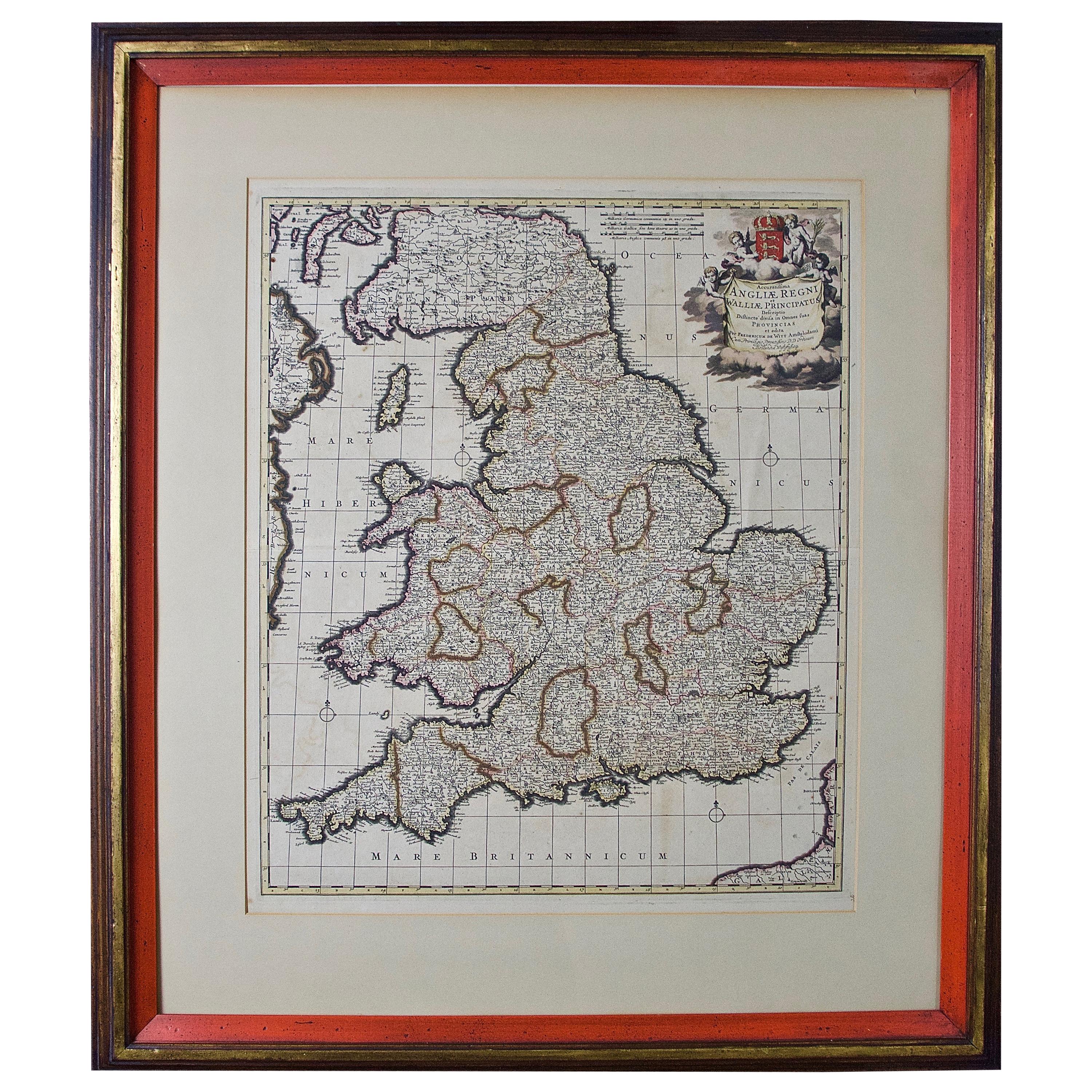
- Large 17th Century Hand Colored Map of England and the British Isles by de WitBy Frederick de WitLocated in Alamo, CAA large hand colored 17th century map of England and the British Isles by Frederick de Wit entitled "Accuratissima Angliæ Regni et Walliæ Principatus", published in Amsterdam in 1680. It is a highly detailed map of England, Scotland, the Scottish Isles...Category
Antique Late 17th Century Dutch Maps
MaterialsPaper
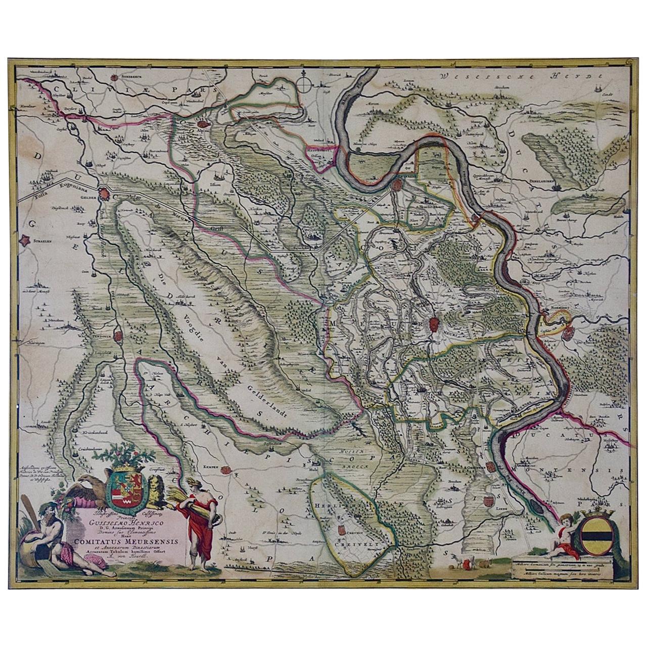
- Germany West of the Rhine: A Hand-colored 18th Century Map by de WitBy Frederick de WitLocated in Alamo, CAThis original 18th century hand-colored map of the county of Moers, Germany entitled "Illustrissimo Celsissmo Principi GUILIELMO HENRICO D.G. Arausionum Principi Domino suo Clementis...Category
Antique Early 18th Century Dutch Maps
MaterialsPaper
- Northern Scotland: A 17th Century Hand-colored Map by MercatorBy Gerard MercatorLocated in Alamo, CAThis is a framed hand-colored 17th century map of Northern Scotland by Gerard Mercator entitled "Scotiae pars Septentrionalis", published in Amsterdam in 1636. It is a highly detailed map of the northern part of Scotland, with the northwest Highlands and the cities Inverness and Aberdeen, as well as the Orkney Islands and the Hebrides. There is a decorative title cartouche in the upper left corner. The map is presented in an antiqued brown wood...Category
Antique 1630s Dutch Maps
MaterialsPaper
- "Africa Vetus": a 17th Century Hand-Colored Map by SansonBy Nicolas SansonLocated in Alamo, CAThis original hand-colored copperplate engraved map of Africa entitled "Africa Vetus, Nicolai Sanson Christianiss Galliar Regis Geographi" was originally created by Nicholas Sanson d...Category
Antique Late 17th Century French Maps
MaterialsPaper
- Greece, "Graeciae Antiquae"" A 17th Century Hand-colored Map by SansonBy Nicolas SansonLocated in Alamo, CAThis is an original 17th century hand colored copperplate engraved map of Greece entitled "Graeciae Antiquae Tabula Hanc Geographicam" by Nicolas d'Abbeville Sanson, engraved and pub...Category
Antique Mid-17th Century French Maps
MaterialsPaper
- Hand Colored 17th Century Visscher Map "Hollandiae" Southern HollandBy Nicolaes Visscher IILocated in Alamo, CAA hand colored 17th century map of the southern portions of Holland by Nicolaus (Nicolas) Visscher II entitled "Hollandiae pars Meridionalis, vulgo Zuyd-Holland", published in Amsterdam in 1678. The map shows the region between Breda, Heusden, Gornichem, Gouda, Dordrecht, and Willemstad. It includes a decorative cartouche in the lower left corner. The map is presented in an attractive maple colored wood frame with gold trim and a fabric mat. The Visscher family were one of the great cartographic families of the 17th century. Begun by Claes Jansz Visscher...Category
Antique Early 18th Century Dutch Maps
MaterialsPaper


You May Also Like
- Large Antique Map of France by De Wit, c.1680By Frederick de WitLocated in Langweer, NLAntique map titled 'Accuratissima Galliae Tabula vulgo Royaume de France'. Detailed map of France. Shows provinces, cities, rivers etc. Artists and Engravers: Frederick de Wit (1...Category
Antique 17th Century Maps
MaterialsPaper
- Antique Map of Friesland by De Wit, c.1690Located in Langweer, NLAntique map titled 'Tabula Comitatus Frisiae'. Old map of the province of Friesland, the Netherlands. With a small inset map of the Wadden area. Third state of the map by Schotan...Category
Antique 17th Century Maps
MaterialsPaper
- Antique Map of Overijssel by De Wit, c.1680Located in Langweer, NLAntique map titled 'Transisalania Provincia Vulgo Over-Yssel'. Original antique map of Overijssel, the Netherlands, showing the regio between Zutphen, Zwolle, Blokzijl, Coevorden, Ol...Category
Antique 17th Century Maps
MaterialsPaper
- Antique Map of Denmark by F. de Wit, 1680Located in Langweer, NLAntique map titled 'Dania Regnum'. Large, attractive map of Denmark, Sleschwig-Holstein and southern Sweden. Good detail throughout. Embellished with a title cartouche with the Danis...Category
Antique Late 17th Century Maps
MaterialsPaper
- Antique Map of Austria by F. de Wit, 1690Located in Langweer, NLAntique map titled 'Circuli Austriaci pars Septentrionalis in qua Archiducatus'. Decorative and detailed map of Austria by F. de Wit.Category
Antique Late 17th Century Maps
MaterialsPaper
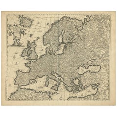
- Antique Map of Europe by F. de Wit, circa 1690Located in Langweer, NLAn attractive map of all Europe by Frederick de Wit. This detailed map has a decorative cartouche featuring the figure of "Europa" sitting on a bull.Category
Antique Late 17th Century Maps
MaterialsPaper


Recently Viewed
View AllMore Ways To Browse
Frederick Antique Furniture
Gold Maps
Gold Map
German 17th Century Furniture
17th Century German Furniture
Dutch 17th Century Large
Antique Pick Up
Pick Up Antique
Antique Furniture Pick Up
Armenian Antique
Antique Armenian
Sword 18th Century
Norwegian Plates
Persia 18th Century
Man With A Sword
Armenia Gold
Armenian Gold
17th Century Dutch Frame