Items Similar to Antique Map of Denmark by F. de Wit, 1680


Want more images or videos?
Request additional images or videos from the seller
1 of 5
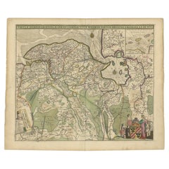
Antique Map of Denmark by F. de Wit, 1680
About the Item
Antique map titled 'Dania Regnum'. Large, attractive map of Denmark, Sleschwig-Holstein and southern Sweden. Good detail throughout. Embellished with a title cartouche with the Danish coat of arms. Contemporary coloring.
- Dimensions:Height: 20.99 in (53.3 cm)Width: 24.22 in (61.5 cm)Depth: 0.02 in (0.5 mm)
- Materials and Techniques:
- Period:Late 17th Century
- Date of Manufacture:1680
- Condition:Some fading in the top corners. Please study image carefully.
- Seller Location:Langweer, NL
- Reference Number:
About the Seller
5.0
Platinum Seller
These expertly vetted sellers are 1stDibs' most experienced sellers and are rated highest by our customers.
Established in 2009
1stDibs seller since 2017
1,916 sales on 1stDibs
Typical response time: <1 hour
- ShippingRetrieving quote...Ships From: Langweer, Netherlands
- Return PolicyA return for this item may be initiated within 14 days of delivery.
More From This SellerView All
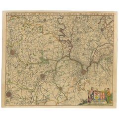
- Large Antique Map of France by De Wit, c.1680By Frederick de WitLocated in Langweer, NLAntique map titled 'Accuratissima Galliae Tabula vulgo Royaume de France'. Detailed map of France. Shows provinces, cities, rivers etc. Artists and Engravers: Frederick de Wit (1...Category
Antique 17th Century Maps
MaterialsPaper
- Antique Map of Flanders 'Belgium' by F. de Wit, circa 1680Located in Langweer, NLAntique map titled 'Comitatus Flandriae Tabula, in Lucem Edita'. Large map of Flanders, Belgium. Published by F. de Wit, circa 1680.Category
Antique Late 17th Century Maps
MaterialsPaper
- Antique Map of South Sweden 'Scandinavia' by F. de Wit, 1680Located in Langweer, NLAntique map titled 'Accurata Scaniae, Blekingae et Hallandiae Descriptio per F. de Wit Amstelodami'. This map shows South Sweden with an inset of Halmstad and vicinity. Contemporary ...Category
Antique Late 17th Century Maps
MaterialsPaper
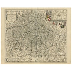
- Antique Map of Southern Germany by F. de Wit, circa 1680Located in Langweer, NLThis antique map depicts a portion of southern Germany that included the historic regions of Bavaria, the Palatinate, Prussia-Brandenburg, the Rhineland and Saxony. Regensberg, Freis...Category
Antique Late 17th Century Maps
MaterialsPaper
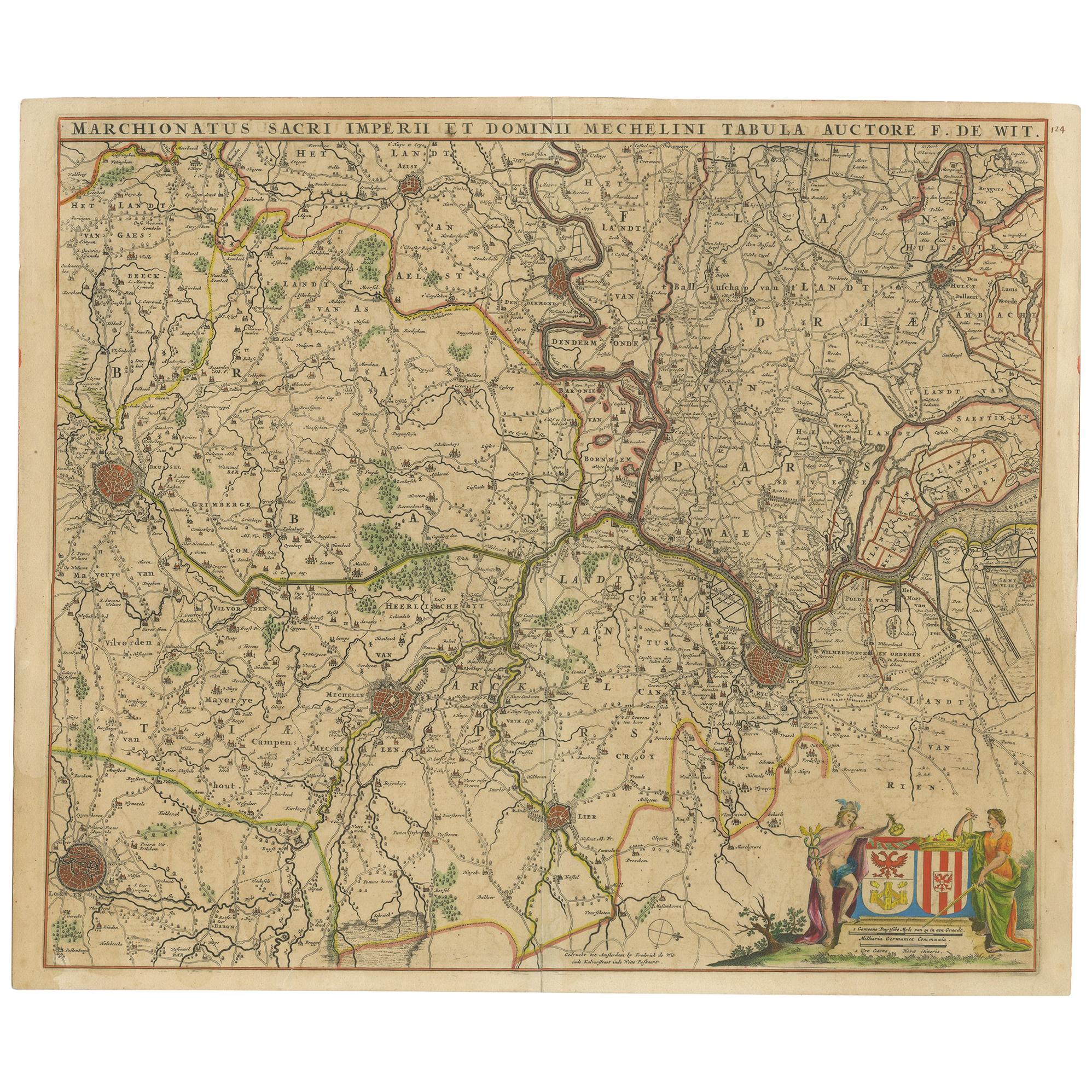
- Antique Map of Part of Flanders 'Belgium' by F. de Wit 'circa 1680'Located in Langweer, NLAntique map titled 'Marchionatus Sacri Imperii et Dominii Mechelini Tabula'. Large folio size map of the region around Mechelen, Leuven, Brussels, Dendermonde and Antwerp. Published ...Category
Antique Late 17th Century Maps
MaterialsPaper
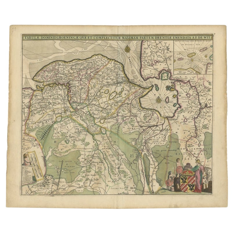
- Antique Map of The Dutch Province of Groningen by De Wit, c.1680Located in Langweer, NLAntique map titled 'Tabulae dominii Groeningae quae et complecitur maximam partem Drentiae Emendata'. Old map of the province of Groningen, the Netherlands. With an inset map of th...Category
Antique 17th Century Maps
MaterialsPaper


You May Also Like
- Germany West of the Rhine: A Hand-colored 18th Century Map by de WitBy Frederick de WitLocated in Alamo, CAThis original 18th century hand-colored map of the county of Moers, Germany entitled "Illustrissimo Celsissmo Principi GUILIELMO HENRICO D.G. Arausionum Principi Domino suo Clementis...Category
Antique Early 18th Century Dutch Maps
MaterialsPaper
- Large 17th Century Hand Colored Map of England and the British Isles by de WitBy Frederick de WitLocated in Alamo, CAA large hand colored 17th century map of England and the British Isles by Frederick de Wit entitled "Accuratissima Angliæ Regni et Walliæ Principatus", published in Amsterdam in 1680. It is a highly detailed map of England, Scotland, the Scottish Isles...Category
Antique Late 17th Century Dutch Maps
MaterialsPaper
- Antique Map of Italy by Andriveau-Goujon, 1843By Andriveau-GoujonLocated in New York, NYAntique Map of Italy by Andriveau-Goujon, 1843. Map of Italy in two parts by Andriveau-Goujon for the Library of Prince Carini at Palazzo Carini i...Category
Antique 1840s French Maps
MaterialsLinen, Paper
- Antique Map of Principality of MonacoBy Antonio Vallardi EditoreLocated in Alessandria, PiemonteST/619 - "Old Geographical Atlas of Italy - Topographic map of ex-Principality of Monaco" - ediz Vallardi - Milano - A somewhat special edition ---Category
Antique Late 19th Century Italian Other Prints
MaterialsPaper
- Antique Map of Paris, "Carte Routiere des Environs de Paris" 1841Located in Colorado Springs, COThis beautiful hand-colored road map of Paris was published in 1841. The map shows Paris and the surrounding area in a folding pocket map. Organized and detailed for travelers, this ...Category
Antique 1840s French Maps
MaterialsPaper
- Original Antique Map of Russia By Arrowsmith. 1820Located in St Annes, LancashireGreat map of Russia Drawn under the direction of Arrowsmith Copper-plate engraving Published by Longman, Hurst, Rees, Orme and Brown, 1820 Unframed.Category
Antique 1820s English Maps
MaterialsPaper


Recently Viewed
View AllMore Ways To Browse
Swedish And Danish Antiques
17th Swedish
17th Century Swedish
17th Century Danish
Swedish 17th Century Furniture
Map Sweden
Used Dania Furniture
Antique Map Denmark
Sweden Antique Map
Coat Of Arms Danish
George Fleet
Antique Railroad Maps
Map Of New Zealand
Antique Map Art Collectibles
Antique Maps Art Collectibles
James Cook Map
Old Antique Compass
Nautical Charts