Antique Railroad Maps

4
to
13
131
36
129
71
50
37
37
21
19
19
17
13
12
9
5
4
3
1
1
1
1
7
5
3
3
2
Sort By
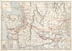
Original 1917 Railroad Map of Washington State railway map
Located in Spokane, WA
This is an Original Lithograph Vintage Railroad Map of Washington State; it is not a reproduction
Category

1910s Academic Antique Railroad Maps

Materials

Lithograph

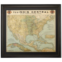
1899 Poole Brothers Antique Railroad Map of the Illinois Central Railroad
Located in Colorado Springs, CO
This is an 1899 railroad map of the Illinois Central and Yazoo and Mississippi Valley Railroads
Category

1890s American Antique Railroad Maps

Materials

Paper

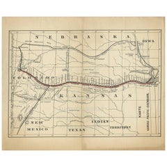
Antique Map of the Kansas Pacific Railroad, circa 1900
Located in Langweer, NL
Antique map titled 'Karte der Kansas-Pacific-Eisenbahn'. Lithographed map of the Kansas Pacific
Category

Early 20th Century Antique Railroad Maps

Materials

Paper

Antique Map of the Kansas Pacific Railroad, circa 1900
No Reserve
H 9.26 in W 11.23 in D 0.02 in
1859 "Map of the United States of America..." by J. H. Colton
By J.H. Colton
Located in Colorado Springs, CO
expanded to include original maps, guidebooks, atlases, and railroad maps. Joseph was succeeded by his sons
Category

1850s American Antique Railroad Maps

Materials

Paper

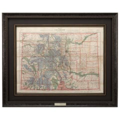
1907 Map of Colorado, Antique Topographical Map, by Louis Nell
Located in Colorado Springs, CO
creeks. Towns, villages, settlements, mining areas, railroads and townships are also highlighted. The map
Category

Early 1900s American Antique Railroad Maps

Materials

Paper

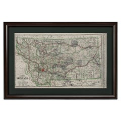
"Clason's Guide Map of Montana" by The Clason Map Company, Circa 1920s
Located in Colorado Springs, CO
transitioned to railroad and city maps of the local area. In the 1920’s, as cars became more commonplace, the
Category

1920s American Art Deco Antique Railroad Maps

Materials

Paper

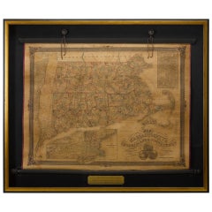
1854 Map of Massachusetts, Connecticut and Rhode Island, Antique Wall Map
Located in Colorado Springs, CO
This striking wall map was published in 1854 by Ensign, Bridgman & Fanning and has both full
Category

19th Century American Antique Railroad Maps

Materials

Paper

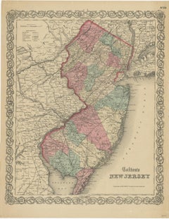
Antique Map of New Jersey
Located in Langweer, NL
Antique map titled 'Colton's New Jersey'. This rare hand colored map of New Jersey is a copper
Category

Mid-19th Century Antique Railroad Maps

Materials

Paper

Antique Map of New Jersey
H 17.52 in W 13.59 in D 0.02 in
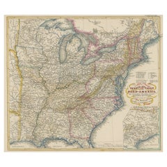
Antique Map of the Eastern United States with Inset Map of Texas
Located in Langweer, NL
. Inset map of the "southern principal part of Texas." Shows states, major cities, railroads, topography
Category

Mid-19th Century Antique Railroad Maps

Materials

Paper

Antique Map Colton's United States of America
Located in Langweer, NL
Antique map titled 'Colton's United States of America'. Show railroads, canals, state capitals
Category

Mid-19th Century Antique Railroad Maps

Materials

Paper

Antique Map Colton's United States of America
H 17.45 in W 27.45 in D 0.02 in
1908 "Map of Texas" by The Kenyon Company
Located in Colorado Springs, CO
Presented is an antique map of the state of Texas, printed as a pocket map in 1908 by The Kenyon
Category

Early 1900s American Antique Railroad Maps

Materials

Paper

Large Antique Map of the State of Texas, 1861
Located in Langweer, NL
Antique map titled 'Johnson's New Map of the State of Texas' Large map of Texas, shows railroads
Category

Mid-19th Century Antique Railroad Maps

Materials

Paper

Large Antique Map of the State of Texas, 1861
Free Shipping
H 18.04 in W 26.58 in D 0.02 in
1866 Ensign & Bridgman's Rail Road Map of the United States
Located in Colorado Springs, CO
Proposed or Completed railroads.” The inset map focuses on the railways and depots throughout New England
Category

1860s American Late Victorian Antique Railroad Maps

Materials

Paper

1855 "New-York City & County Map" by Charles Magnus
By Charles Magnus
Located in Colorado Springs, CO
railroads as well with steamships navigating the Hudson River. Centered on Manhattan, the map identifies
Category

1850s American Antique Railroad Maps

Materials

Paper

Antique Map of the State of Ohio by Titus '1871'
Located in Langweer, NL
Antique map titled 'Railroad & Township Map of the State of Ohio'. Original antique map of the
Category

Late 19th Century Antique Railroad Maps

Materials

Paper

Antique Map of The United States of North America, 1882
Located in Langweer, NL
This is a historical map titled "The United States of North America, Central Part" from the 1882
Category

1880s Antique Railroad Maps

Materials

Paper

Antique Map of The United States of North America, 1882
Free Shipping
H 14.97 in W 22.45 in D 0 in
Original Antique Coloured Map of Western Africa, Published in 1882
Located in Langweer, NL
This is a map of Western Africa from the 1882 Blackie & Son atlas. The map details the West African
Category

1880s Antique Railroad Maps

Materials

Paper

1865 "Johnson's Missouri and Kansas" Map by Johnson and Ward
Located in Colorado Springs, CO
Iowa, Illinois, and Arkansas. The map is beautifully detailed, with railroads, roads, rivers and creeks
Category

Mid-19th Century Antique Railroad Maps

Materials

Paper

Framed Mid-19th Century Wall Map of Long Island, the Hamptons
Located in Sag Harbor, NY
A Framed museum quality find. This large wall map dates to the mid-1800s. Detailed inset maps of
Category

Mid-19th Century American Antique Railroad Maps

Materials

Linen, Paper

1864 Johnson's Map of the World on Mercator's Projection, Ric.B009
Located in Norton, MA
An 1864 Johnson's map of the World on Mercator's Projection Ric.b009 About this Item
Category

19th Century Dutch Antique Railroad Maps

Materials

Paper

Cartographic Heritage: The 1901 Map of the Vizcaya Province in Spain
Located in Langweer, NL
coloring to represent elevation changes. The map includes cities, towns, rivers, and railroads, with key
Category

Early 1900s Antique Railroad Maps

Materials

Paper

1847 Ornamental Map of the United States & Mexico by H. Phelps
Located in Colorado Springs, CO
to the rest of the U.S. The map details a potential route for a railroad running from New York City
Category

1840s American Antique Railroad Maps

Materials

Paper

Antique Map of British North America, The Dominion of of Canada, 1882
Located in Langweer, NL
This map is titled "British North America, Dominion of Canada," from the 1882 Blackie Atlas. It
Category

1880s Antique Railroad Maps

Materials

Paper

Alicante in a 1901 Antique Map: Maritime Gateway of Spain's Costa Blanca
Located in Langweer, NL
An original antique map of the province of Alicante, dated 1901. It is part of the atlas series by
Category

Early 1900s Antique Railroad Maps

Materials

Paper

Maritime and Terrestrial Survey of Spanish Santander in 1901, An Original Map
Located in Langweer, NL
This antique map is a historical map of the province of Santander (currently known as Cantabria
Category

Early 1900s Antique Railroad Maps

Materials

Paper

Antique Map of The United States of North America, Pacific States, 1882
Located in Langweer, NL
The map is from the same 1882 Blackie Atlas and focuses on the Pacific States of the United States
Category

1880s Antique Railroad Maps

Materials

Paper

Antique Map of Russia 'in Europe' by W. & A.K. Johnston, circa 1850
By W. & A.K. Johnston
Located in Langweer, NL
Detailed map of the region with a decorative piano key border. This map shows towns, railroads
Category

Mid-19th Century Antique Railroad Maps

Materials

Paper

1859 "Colton's New Map of the State of Texas..." by Johnson & Browning
Located in Colorado Springs, CO
Staked Plain. The map offers exceptional detail, and locates railroads, forts, post offices, roads
Category

1850s American Antique Railroad Maps

Materials

Paper

1863 "Lloyd's New Map of the United States, the Canadas, and New Brunswick"
Located in Colorado Springs, CO
Presented is “Lloyd's New Map of the United States, the Canadas and New Brunswick, From the latest
Category

1860s American Antique Railroad Maps

Materials

Linen, Wood, Paper

1873 "Map of the States of California and Nevada" by Chas. Drayton Gibbes
Located in Colorado Springs, CO
Presented is Warren Holt and Charles Drayton Gibbes' 1873 “Map of California and Nevada.” This map
Category

1870s American Antique Railroad Maps

Materials

Paper

Antique 1844 J Calvin Smith JH Colton Midwest United States Survey Map 27"
By J.H. Colton
Located in Dayton, OH
Antique framed black and white map of seven Midwestern American states. Guide Through Ohio
Category

1840s Antique Railroad Maps

Materials

Paper

1837 Mitchell's "Tourist's Pocket Map of the State of Virginia" by J.H. Young
Located in Colorado Springs, CO
This is J. H. Young's pocket map of the Virginia, which shows county development current to 1835
Category

1830s American Antique Railroad Maps

Materials

Paper

Antique Map of North America with Vignette of the Statue of Liberty, New York
Located in Langweer, NL
Antique map titled 'Amérique du Nord'. Original antique map of North America. Meticulous
Category

Late 19th Century Antique Railroad Maps

Materials

Paper

1840 "New Map of the City of New York With Part of Brooklyn & Williamsburg"
Located in Colorado Springs, CO
Presented is a hand-colored, engraved folding map titled "New Map of the City of New York With Part
Category

1840s American Antique Railroad Maps

Materials

Paper

Antique Map of the Eastern United States with Only the Northern Part of Florida
Located in Langweer, NL
. Inset map of the "southern principal part of Texas." Shows states, major cities, railroads, topography
Category

Mid-19th Century Antique Railroad Maps

Materials

Paper

Beira Alta: A Cartographic Journey Through Portugal's Heartland in 1903
Located in Langweer, NL
The uploaded image is a historical map of the Beira Alta region in Portugal. The map is detailed
Category

Early 1900s Antique Railroad Maps

Materials

Paper

1889 "The Pacific States and Territories"
Located in Colorado Springs, CO
Presented is an uncommon 1889 map of the western United States, titled “The Pacific States and
Category

1880s American Antique Railroad Maps

Materials

Paper

1889 "The Pacific States and Territories"
H 16.25 in W 14.25 in D 1 in
Isles of Enchantment: The Balearic Archipelago in 1902
Located in Langweer, NL
The Balearic Islands, Spain, from the year 1902. The title on the map is "ISLAS BALEARES 1902
Category

Early 1900s Antique Railroad Maps

Materials

Paper

Isles of Enchantment: The Balearic Archipelago in 1902
Free Shipping
H 14.77 in W 20.08 in D 0 in
1879 "United States of America, Western Part" by O. J. Stuart
Located in Colorado Springs, CO
This colorful original map, titled “United States of America, Western Part,” was issued in Volume
Category

1870s American Antique Railroad Maps

Materials

Paper

Zamora: A Mosaic of Romanesque Heritage and Natural Wonders in Spain, 1901
Located in Langweer, NL
This authentic antique print is a historical map of the province of Zamora, Spain, from the year
Category

Early 1900s Antique Railroad Maps

Materials

Paper

1912 "Panoramic View of New York City and Vicinity" by Jacob Ruppert
Located in Colorado Springs, CO
This is an attractive and very scarce map of New York, published by the Yorkville brewer Jacob
Category

1910s American Antique Railroad Maps

Materials

Paper

Antique Plan of the City of Calcutta 'India' by Letts, 1883
Located in Langweer, NL
Beautiful colored plan showing buildings (with key), Fort William, race ground, canals, railroads
Category

Late 19th Century Antique Railroad Maps

Materials

Paper

1877 "Geological and Geographical Atlas of Colorado" by F. V. Hayden
Located in Colorado Springs, CO
Triangulations, Drainage, an Economic Map, and a General Geological map. The second series consists of twelve
Category

1870s American Antique Railroad Maps

Materials

Paper

Framed Original Land Map Survey of Tyler Park, Jersey City Railroad
Located in Lambertville, NJ
A framed and matted historical map of Tyler park jersey city New Jersey Railroad. The paper on
Category

1870s American Antique Railroad Maps

Materials

Canvas, Glass, Wood

Hardesty, Sectional & Township Map of Ohio, Very Large
Located in Norwich, GB
Rand, McNally & Co.'s New Sectional And Township Map of Ohio 24.8 x 24.3 inches folding into 6
Category

1880s American Antique Railroad Maps

Materials

Paper

Map of Indonesia, Semarang, Kartasoera, Soerabaya by Schley
By Jakob van der Schley
Located in Norwich, GB
' Map of the Road between Semarang and Kartasura by Van Schley. Published 1763. Semarang is the
Category

1760s Indonesian Georgian Antique Railroad Maps

Materials

Paper

Advertising Puzzle USA Map Sherwin Williams Paint, 19th Century
Located in Fulton, CA
. Reverse of puzzle has map of United States. Features advertising for quick dry paint for coaches, house
Category

Late 19th Century American Late Victorian Antique Railroad Maps

Materials

Composition

Antique 1901 National Publishing Company's Road Map of New Jersey Geological
Located in Dayton, OH
The National Publishing Company's road map of New Jersey, showing all county and township divisions
Category

Early 1900s Victorian Antique Railroad Maps

Materials

Paper

Personal Memoirs of P. H. Sheridan, First Edition, Two-Volume Set, 1888
Located in Colorado Springs, CO
is highly illustrated, with 27 maps and 17 plates. The book is presented beautifully rebound in
Category

1880s American Antique Railroad Maps

Materials

Leather, Paper

Vicinity of Flemington
By Julius Bien
Located in Florham Park, NJ
. Chromolithography. New York, 1883 - 1889 17 maps. 34” x 25” Paper Size. A lithographer and map engraver, Bien
Category

Late 19th Century Academic Antique Railroad Maps

Materials

Lithograph

Bergen, Hudson, and Essex
By Julius Bien
Located in Florham Park, NJ
. Chromolithography. New York, 1883 - 1889 17 maps. 34” x 25” Paper Size. A lithographer and map engraver, Bien
Category

Late 19th Century Academic Antique Railroad Maps

Materials

Lithograph

Egg Harbor and Vicinity (New Jersey)
By Julius Bien
Located in Florham Park, NJ
. Chromolithography. New York, 1883 - 1889 17 maps. 34” x 25” Paper Size. A lithographer and map engraver, Bien
Category

Late 19th Century Academic Antique Railroad Maps

Materials

Lithograph

Monmouth Shore
By Julius Bien
Located in Florham Park, NJ
. Chromolithography. New York, 1883 - 1889 34” x 25” Paper Size. A lithographer and map engraver, Bien arrived
Category

Late 19th Century Academic Antique Railroad Maps

Materials

Lithograph

'Kettle Falls, Columbia River' original color lithograph by John Mix Stanley
By John Mix Stanley
Located in Milwaukee, WI
: to produce topographical maps, to document flora and fauna, and to document natural resources to
Category

1850s Romantic Antique Railroad Maps

Materials

Lithograph

'Lieutenant Crovers Despatch – Return of Governor Stevens to Fort Benton'
By John Mix Stanley
Located in Milwaukee, WI
: to produce topographical maps, to document flora and fauna, and to document natural resources to
Category

1850s Romantic Antique Railroad Maps

Materials

Lithograph

'Victor's Camp - Hell Gate Ronde' original John Mix Stanley lithograph
By John Mix Stanley
Located in Milwaukee, WI
: to produce topographical maps, to document flora and fauna, and to document natural resources to
Category

1850s Romantic Antique Railroad Maps

Materials

Lithograph

'Maple River' original color lithograph by John Mix Stanley
By John Mix Stanley
Located in Milwaukee, WI
: to produce topographical maps, to document flora and fauna, and to document natural resources to
Category

1850s Romantic Antique Railroad Maps

Materials

Lithograph

'Camp Red River Hunters' original lithograph by John Mix Stanley
By John Mix Stanley
Located in Milwaukee, WI
: to produce topographical maps, to document flora and fauna, and to document natural resources to
Category

1850s Romantic Antique Railroad Maps

Materials

Lithograph

'Distribution of Goods to the Assiniboines' original John Mix Stanley lithograph
By John Mix Stanley
Located in Milwaukee, WI
: to produce topographical maps, to document flora and fauna, and to document natural resources to
Category

1850s Romantic Antique Railroad Maps

Materials

Lithograph

'Distribution of Goods to the Gros Ventres' lithograph by John Mix Stanley
By John Mix Stanley
Located in Milwaukee, WI
: to produce topographical maps, to document flora and fauna, and to document natural resources to
Category

1850s Romantic Antique Railroad Maps

Materials

Lithograph

  • 1
Get Updated with New Arrivals
Save "Antique Railroad Maps", and we’ll notify you when there are new listings in this category.

Antique Railroad Maps For Sale on 1stDibs

An assortment of antique railroad maps is available at 1stDibs. Each of these unique antique railroad maps was constructed with extraordinary care, often using paper. Antique railroad maps have long been popular, with older editions for sale from the 19th Century and newer versions made as recently as the 20th Century.

How Much are Antique Railroad Maps?

The average selling price for at 1stDibs is $1,350, while they’re typically $111 on the low end and $9,800 highest priced.

Read More

Pamela Shamshiri Shares the Secrets behind Her First-Ever Book and Its Effortlessly Cool Interiors

The sought-after designer worked with the team at Hoffman Creative to produce a monograph that beautifully showcases some of Studio Shamshiri's most inspiring projects.

Moroccan Artworks and Objects Take Center Stage in an Extraordinary Villa in Tangier

Italian writer and collector Umberto Pasti opens the doors to his remarkable cave of wonders in North Africa.

Montecito Has Drawn Royalty and Celebrities, and These Homes Are Proof of Its Allure

Hollywood A-listers, ex-pat aristocrats and art collectors and style setters of all stripes appreciate the allure of the coastal California hamlet — much on our minds after recent winter floods.

Whaam! Blam! Pow! — a New Book on Pop Art Packs a Punch

Publishing house Assouline and writer Julie Belcove have teamed up to trace the history of the genre, from Roy Lichtenstein, Andy Warhol and Yayoi Kusama to Mickalene Thomas and Jeff Koons.

The Sparkling Legacy of Tiffany & Co. Explained, One Jewel at a Time

A gorgeous new book celebrates — and memorializes — the iconic jeweler’s rich heritage.

What Makes a Gem-Encrusted Chess Set Worth $4 Million?

The world’s most opulent chess set, weighing in at 513 carats, is literally fit for a king and queen.

Tauba Auerbach’s Geometric Pop-Up Book Is Mighty Rare, Thanks to a Hurricane

This sculptural art book has an epic backstory of its own.

Step inside the Storied Mansions of Palm Beach’s Most Effervescent Architect

From Spanish-style courtyards to fanciful fountains, these acclaimed structures abound in surprising and elegant details.