Items Similar to Alicante in a 1901 Antique Map: Maritime Gateway of Spain's Costa Blanca
Want more images or videos?
Request additional images or videos from the seller
1 of 7
Alicante in a 1901 Antique Map: Maritime Gateway of Spain's Costa Blanca
About the Item
An original antique map of the province of Alicante, dated 1901. It is part of the atlas series by D. Benito Chias y Carbo, featuring cartographic elements.
Here are some characteristics of the map:
It outlines the borders of Alicante province within Spain, differentiating it from neighboring regions such as Valencia.
Blue lines represent the water bodies, such as rivers that traverse the province, possibly including the Segura River.
Red lines indicate the roads and railway systems connecting towns and cities within the province, as well as linking Alicante to other regions.
Cities and towns are marked, with the capital city of Alicante given prominence.
The map includes a legend (Signos Convencionales) explaining the symbols used to denote provincial capitals, roads, railroads, boundaries, and other features and a kilometer scale is provided to gauge distances between points on the map.
The coat of arms of Alicante is displayed, higlighted with gold, featuring a castle and water, reflecting the province's historical significance and its coastal location.
- Dimensions:Height: 14.77 in (37.5 cm)Width: 20.08 in (51 cm)Depth: 0 in (0.02 mm)
- Materials and Techniques:
- Period:1900-1909
- Date of Manufacture:1902
- Condition:Good condition. Central vertical folding lines as issued. Aged paper with typically warm, yellowish-brown hue, especially around the edges and folding line.
- Seller Location:Langweer, NL
- Reference Number:
About the Seller
5.0
Platinum Seller
These expertly vetted sellers are 1stDibs' most experienced sellers and are rated highest by our customers.
Established in 2009
1stDibs seller since 2017
1,919 sales on 1stDibs
Typical response time: <1 hour
- ShippingRetrieving quote...Ships From: Langweer, Netherlands
- Return PolicyA return for this item may be initiated within 14 days of delivery.
More From This SellerView All
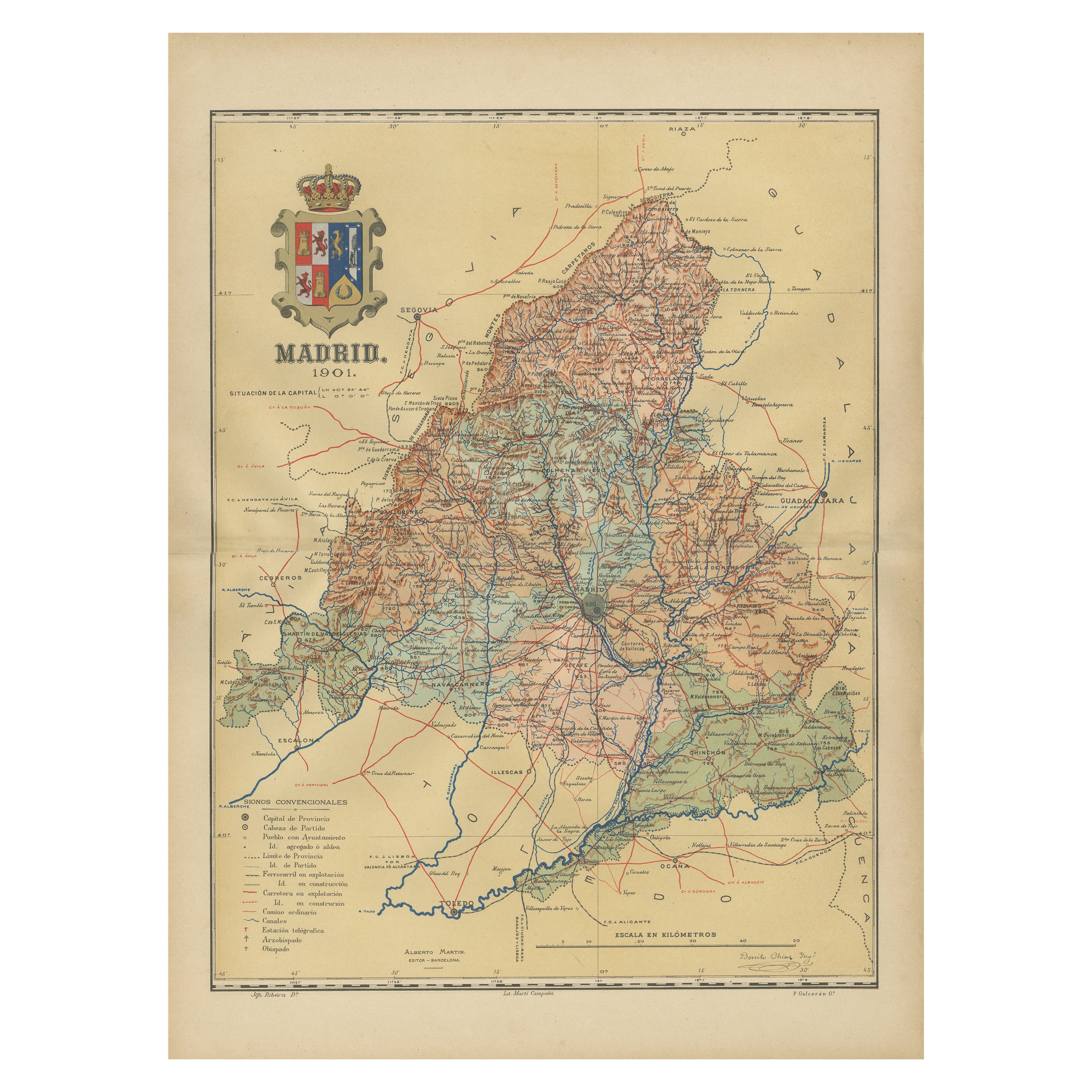
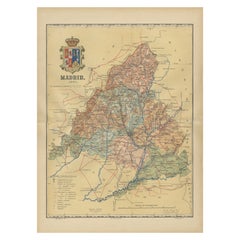
- Madrid 1901: A Historical Map of Spain's Capital ProvinceLocated in Langweer, NLThe map is of the province of Madrid, the capital region of Spain, as it appeared in 1901. Here are the key features it displays: The map shows the central part of Spain, with the Guadarrama mountain range prominently visible, marking the natural border to the north of Madrid. Blue lines likely indicate rivers, including the Manzanares River, which flows through Madrid, and the Jarama River, a tributary to the Tagus. Red lines depict the roads and railways, outlining the infrastructure that connects Madrid's various towns and cities within the province and beyond. Symbols and labels mark the locations of cities, towns, and villages, with Madrid itself likely being the focal point. Dotted lines may represent the administrative divisions within the province. The map includes a legend (Signos Convencionales) that explains the symbols used for provincial capitals, roads, railways, and other geographic features. The coat of arms of Madrid, featuring a bear and a strawberry tree (madroño), is prominently featured, symbolizing the city's and the province's historical coat of arms. About the province of Madrid: Madrid is not only the capital of Spain but also the heart of the Iberian Peninsula, both geographically and politically. The city is renowned for its rich repositories of European art, including the Prado Museum's works by Goya, Velázquez, and other Spanish masters. The province of Madrid is characterized by a blend of historical and modern elements, with a rich cultural life that includes theater, opera, and flamenco, as well as gastronomy that features a mix of traditional Spanish dishes and international cuisine...Category
Antique Early 1900s Maps
MaterialsPaper
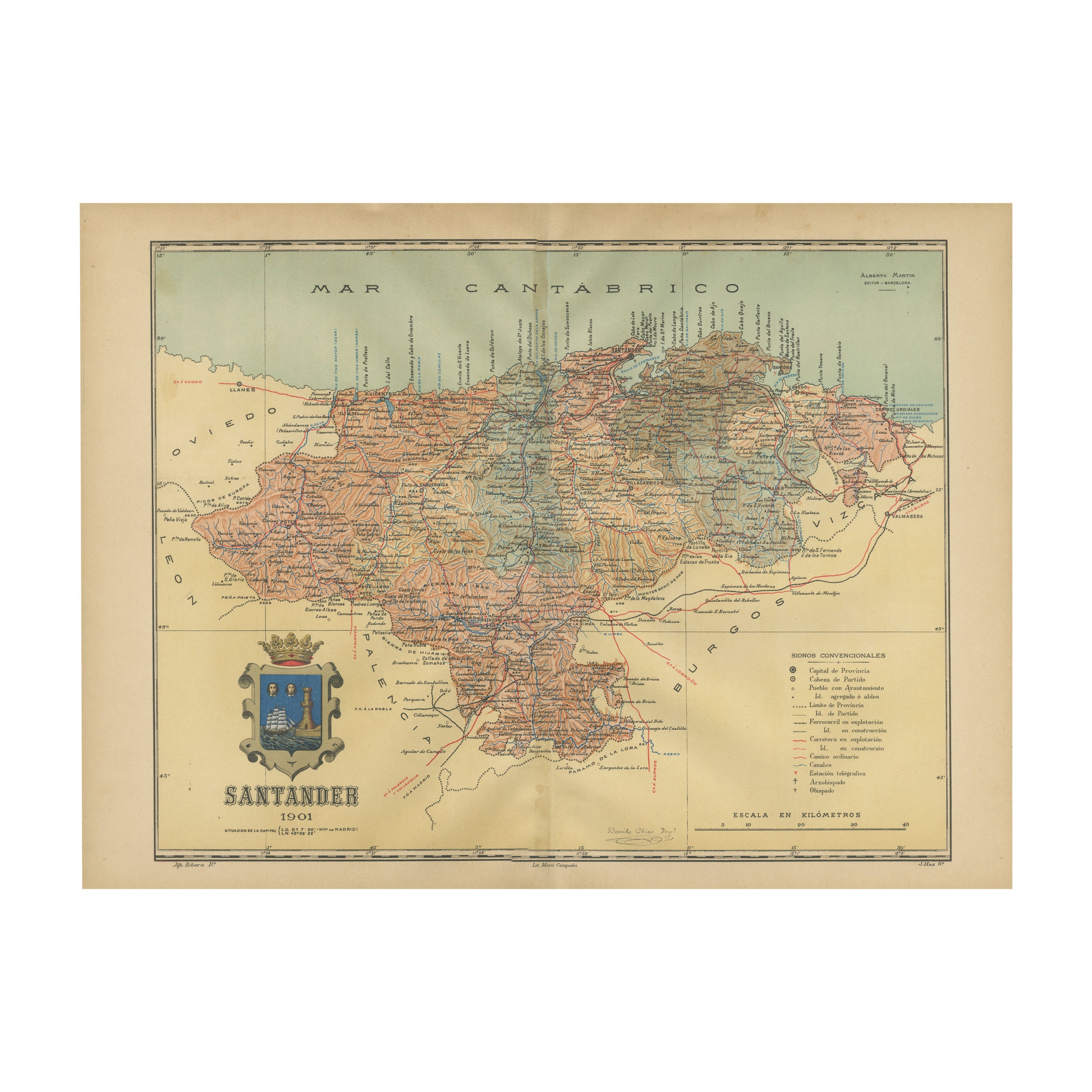
- Maritime and Terrestrial Survey of Spanish Santander in 1901, An Original MapLocated in Langweer, NLThis antique map is a historical map of the province of Santander (currently known as Cantabria) from the year 1901. Santander is located along the northern coast of Spain, bordering...Category
Antique Early 1900s Maps
MaterialsPaper
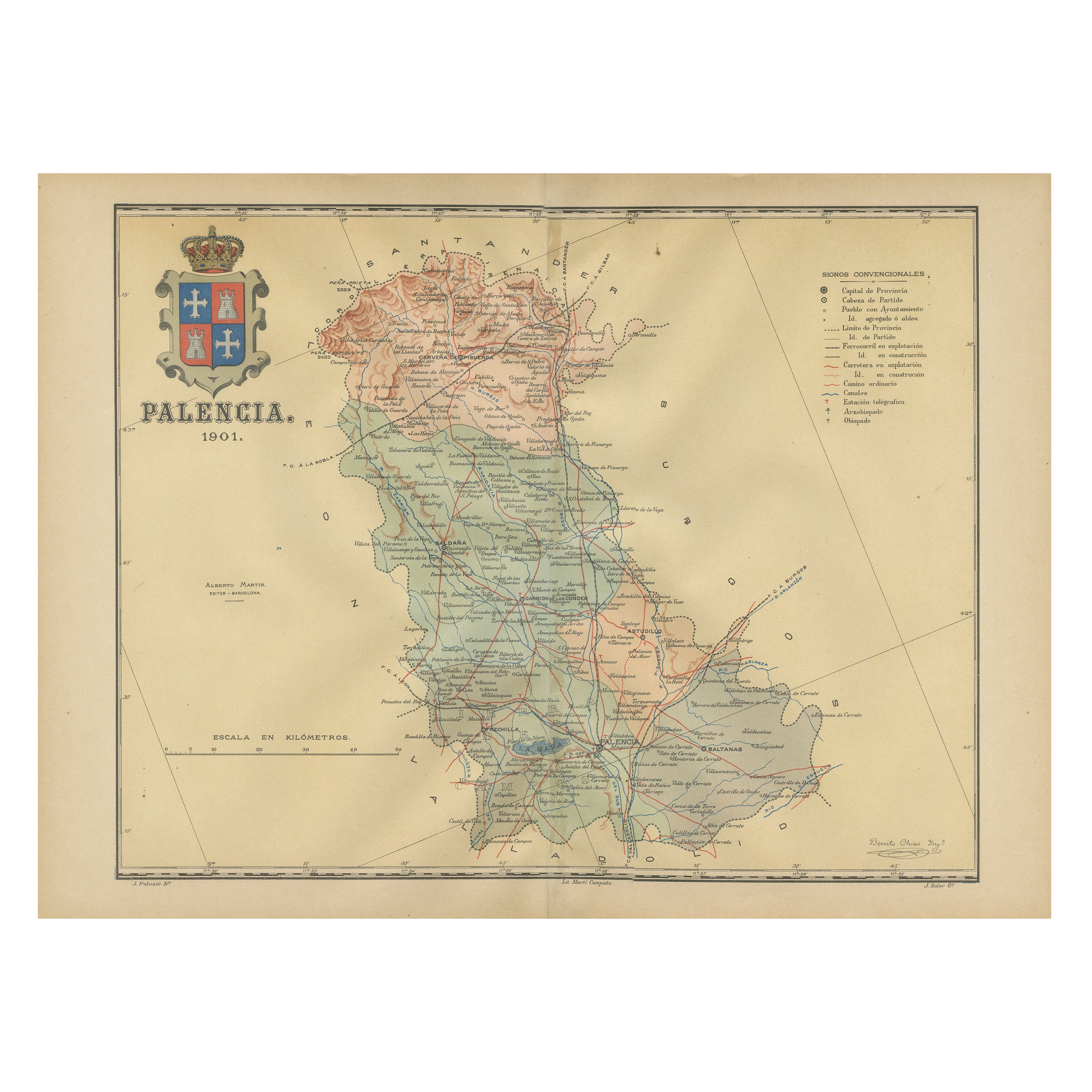
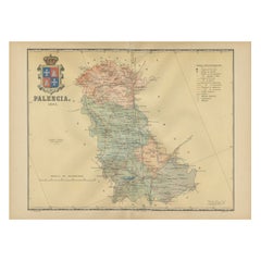
- Original Antique Map of Palencia Province, in Northern Spain, 1901Located in Langweer, NLThis historical map is of Palencia, a province in the northern part of Spain. Palencia is situated within the autonomous community of Castilla y León. It is bordered by the provinc...Category
Antique Early 1900s Maps
MaterialsPaper
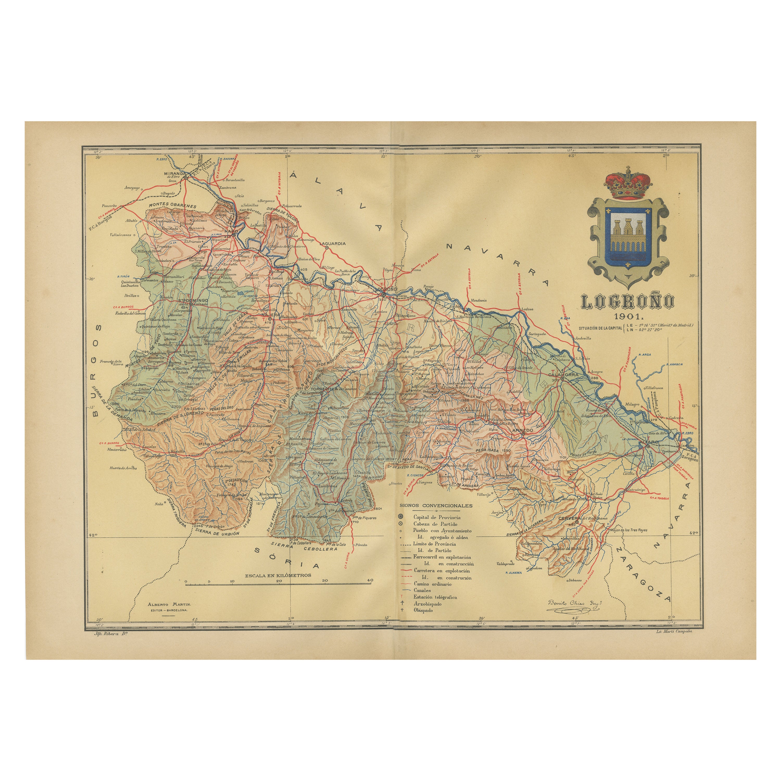
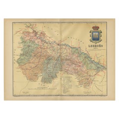
- La Rioja 1901: A Cartographic Journey Through Spain's Renowned Wine CountryLocated in Langweer, NLThe map for sale illustrates the province of La Rioja, with its capital Logroño, as of the year 1901. The map details various geographic and man-made features: - **Topography**: It ...Category
Antique Early 1900s Maps
MaterialsPaper
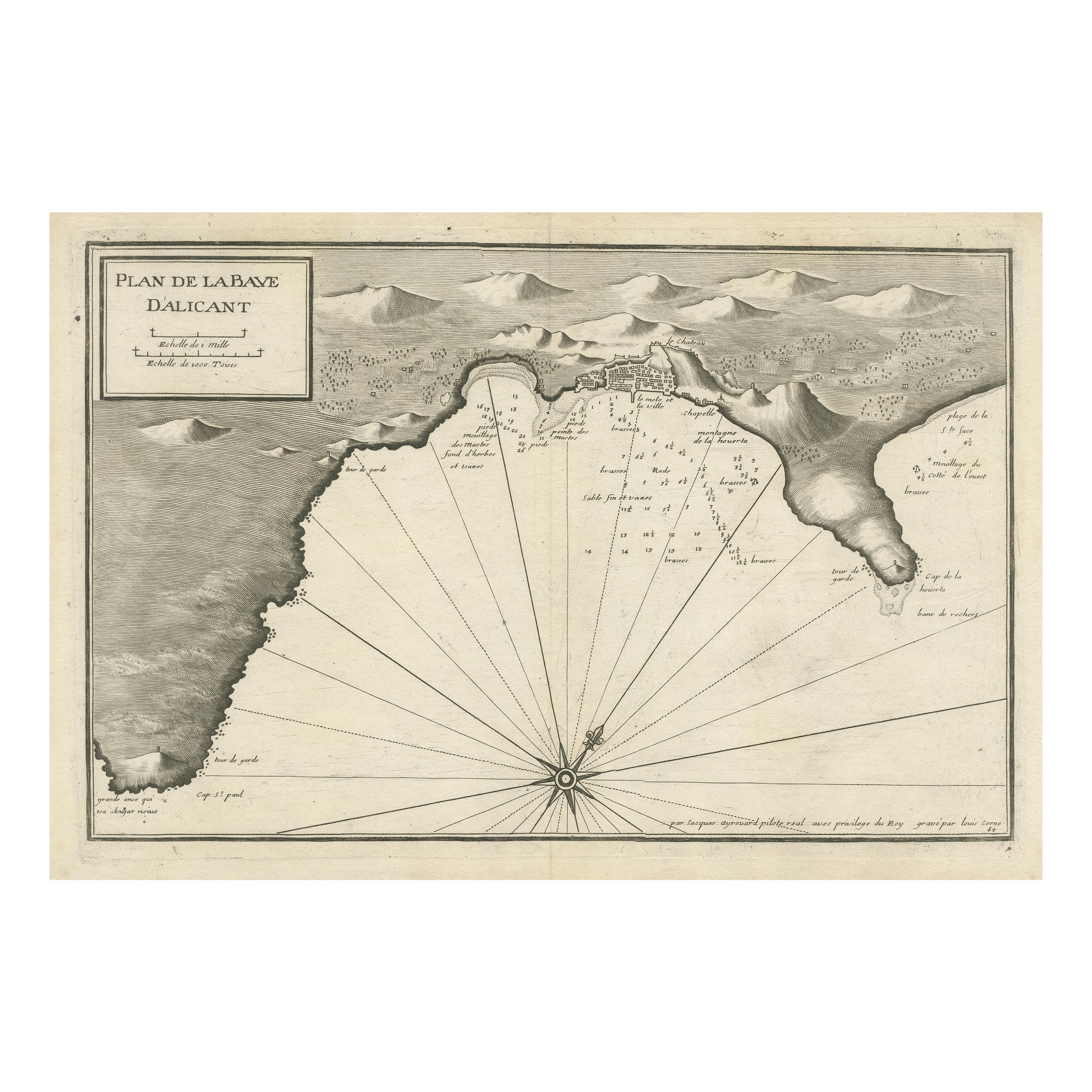
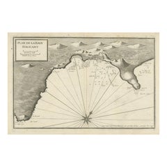
- Antique Plan of Alicante Bay, SpainLocated in Langweer, NLAntique map titled 'Plan de la Baye d'Alicant'. Black and white harbor chart /port plan of Alicante Bay, Spain. This map originates from the scarce atlas 'Recueil de Plusiers Plans d...Category
Antique Mid-18th Century Maps
MaterialsPaper
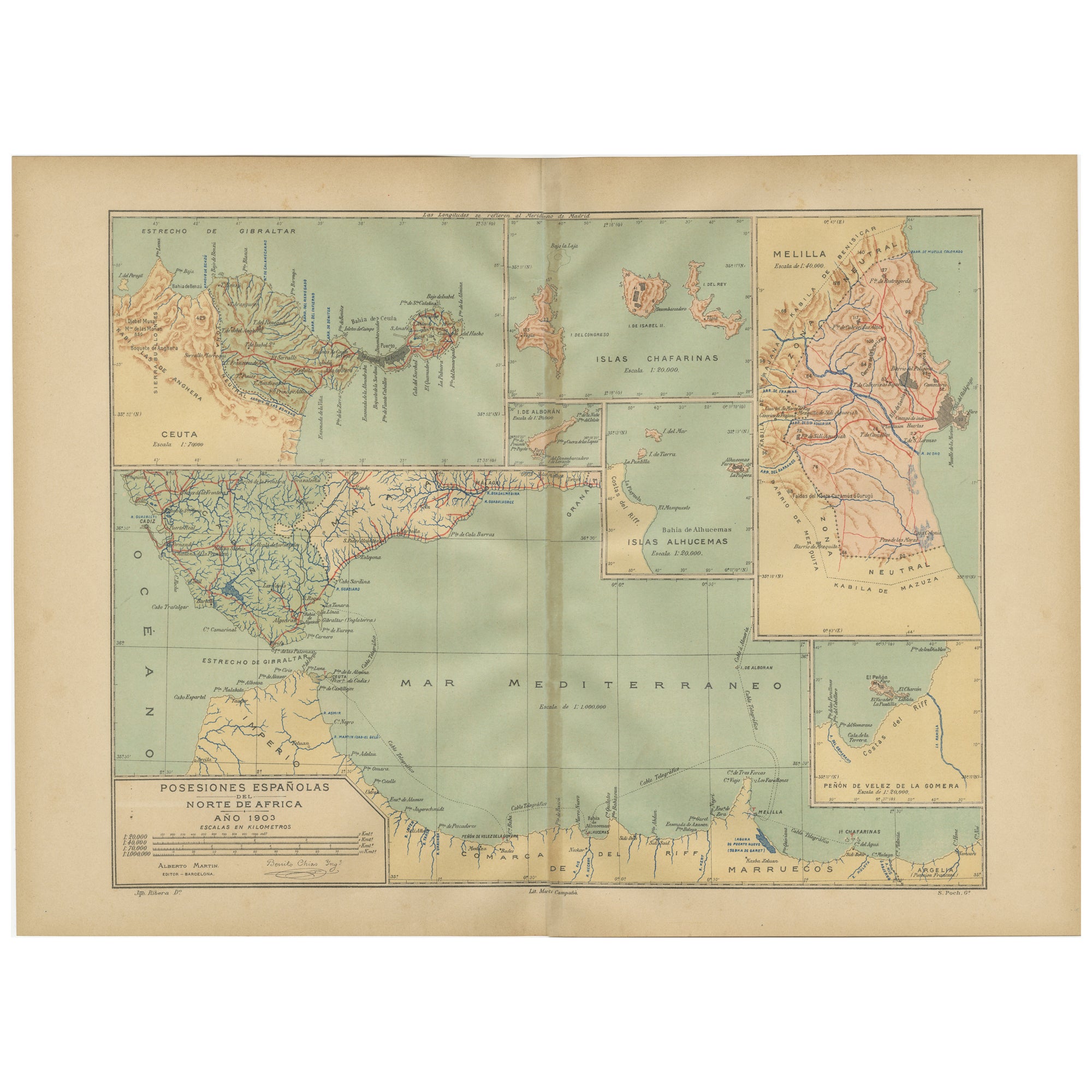
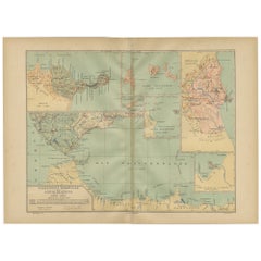
- Crossroads of Continents: Spain's North African Enclaves in 1903Located in Langweer, NLThe image for sale is a historical map of Spanish possessions in North Africa, dated 1903. The map includes the enclaves of Ceuta and Melilla, the Chafarinas Islands, the Alhucemas I...Category
Antique Early 1900s Maps
MaterialsPaper

You May Also Like
- Antique 1901 National Publishing Company's Road Map of New Jersey GeologicalLocated in Dayton, OHThe National Publishing Company's road map of New Jersey, showing all county and township divisions, cities villages and post-offices, railroads, ste...Category
Antique Early 1900s Victorian Prints
MaterialsPaper
- Original Antique Map of Spain and Portugal, circa 1790Located in St Annes, LancashireSuper map of Spain and Portugal Copper plate engraving by A. Bell Published, circa 1790. Unframed.Category
Antique 1790s English Other Maps
MaterialsPaper
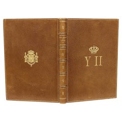
- Ortega-Morejon, Cuentos De Color De Lila, Queen Isabella II of Spain's Copy 1887Located in Hillsborough, NJAuthor: ORTEGA-MOREJON, Jose Maria De. Title: Cuentos De Color De Lila Y Fragmentos Sin Color. Publisher: Madrid: Miguel Ginesta, Impresor De La Real Casa, 1887. Description: First Edition, presentation copy, from the library of Queen Isabella II of Spain. 1 vol., 8-3/8" x 5-15/16", inscribed on the half-title to Queen Isabella by Ortega-Morejon "Isabel II, gloriosa Soberana de los espanoles", bound in full tan morocco, ribbed gilt decorated spine, covers ruled in gilt, gilt crown and initials of the Queen to the front cover, gilt crest to the rear cover, gilt dentelles, white silk morie doublures and endpapers, all edges gilt. Condition: Internally clean and bright, hinges fine, head and foot of spine fine, overall Very good. Additional information: Isabella II (10 October 1830 – 9 April 1904), was Queen of Spain from 29 September 1833 until 30 September 1868. Shortly before her birth, the King Ferdinand VII...Category
Antique 1880s Spanish Books
MaterialsLeather
- Original Antique Map of Spain and Portugal by Thomas Clerk, 1817Located in St Annes, LancashireGreat map of Spain and Portugal Copper-plate engraving Drawn and engraved by Thomas Clerk, Edinburgh. Published by Mackenzie And Dent, 1817 Unframed.Category
Antique 1810s English Maps
MaterialsPaper
- Original Antique Map of Spain and Portugal, Engraved By Barlow, 1806Located in St Annes, LancashireGreat map of Spain And Portugal Copper-plate engraving by Barlow Published by Brightly & Kinnersly, Bungay, Suffolk. 1806 Unframed.Category
Antique Early 1800s English Maps
MaterialsPaper
- Antique Pair of English Maritime Colored Etchings 1806.Located in Vero Beach, FLAntique Pair of English Maritime Colored Etchings 1806. English hand-colored etchings of a 90 Gun Ship at Spithead and a Collier with a view of the S...Category
Antique 19th Century English Romantic Nautical Objects
MaterialsGlass, Giltwood, Paper


Recently Viewed
View AllMore Ways To Browse
Map Of Old Armenia
Teak Wood Sphere
Nova Guinea Maps
Antique Map Of Illinois
Petite Point Hand Bag
Antique Map Of Southeastern Us
Antique Map Alabama
Antique Map Of Sydney
Malay Archipelago Map
Fiji Map
Map Prussia Germany
Small Map
The Malay Archipelago
Bad Bentheim
Johannes Janssonius On Sale
Albania Map
Antique Map Argentina
Antique Map Of Argentina