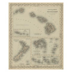
Fiji Map

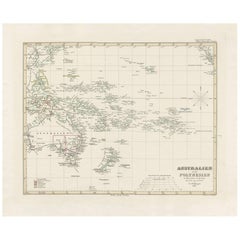
Antique Map of Australia, New Zealand and Oceania by F. von Stülpnagel, 1850
Located in Langweer, NL
Antique map titled 'Australien und Polynesien in Mercators Projection'. A map of Australia, New
Category

Antique Mid-19th Century Maps

Materials

Paper

People Also Browsed

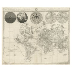
Antique Detailed World Map Drawn on Mercator's Projection, 1700
Located in Langweer, NL
Antique world map titled 'Carte generale du monde, ou description du monde terrestre & Aquatique - Generale Waereld kaart, of beschryving van de land en water waereld'. This is Pierr...
Category

Antique 17th Century Maps

Materials

Paper

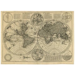
Antique Bible World Map by R. & J. Wetstein, 1743
Located in Langweer, NL
Antique world map titled 'De Werelt Caart'. A scarce and richly detailed double hemisphere world map that was probably based on an earlier work by Cornelis Dankerts. This map has t...
Category

Antique Mid-18th Century Maps

Materials

Paper

Antique Bible World Map by R. & J. Wetstein, 1743
Free Shipping
H 15.52 in W 21.26 in D 0.02 in
Antique Map of North and East Asia, 1751
Located in Langweer, NL
Map 2: 'Carte des parties nord et est de L'Asie'. (Map of the Northern parts and East Asia.) Five maps on one sheet, showing California, Alaska and Siberia, Korea and Japan. South to...
Category

Antique 18th Century Maps

Materials

Paper

Antique Map of North and East Asia, 1751
H 18.35 in W 14.97 in D 0 in
Antique Map of the Pacific Ocean by Anson, 1765
Located in Langweer, NL
Antique map titled 'Carte de la Mer du Sud ou Mer Pacifique - Kaart van de Zuyd-Zee of stille oceaan (..)'. Nautical chart of the Pacific Ocean depicting the trade routes used by Spa...
Category

Antique 18th Century Maps

Materials

Paper

Antique Map of the World on Mercator Projection by Anson, 1749
Located in Langweer, NL
Antique map titled 'Nieuwe Wereld Kaart waar in de Reizen van den Hr. Anson rondsom de Wereld'. Original antique map of the world on Mercator's Projection from a Dutch edition of Ans...
Category

Antique 18th Century Maps

Materials

Paper

Map Silk Embroidered Western Eastern Hemisphere New Old World Asia America Afri
Located in BUNGAY, SUFFOLK
A rare, late-18th century, silk, embroidered, double hemisphere, world map, blackwork, sampler, showing the tracks of captain cook’s three voyages - Illustrating public understand...
Category

Antique 18th Century British Georgian Maps

Materials

Silk

Antique Map of the World in two Hemispheres by Keizer & de Lat, 1788
Located in Langweer, NL
Antique map titled 'Kaart van de Twee platte Warelds Bollen (..)'. Interesting world map in two hemispheres. California shown as a labeled island with place names and an indented nor...
Category

Antique Late 18th Century Maps

Materials

Paper

Antique Double Hemisphere World Map with California as an Island, 1710
Located in Langweer, NL
Description: Antique map titled 'De Werelt Caart'. First state (out of three) antique double hemisphere world map from a Dutch bible by Cornelis Dankerts (Danckerts), engraved by Alb...
Category

Antique 1710s Maps

Materials

Paper

Antique Map of the Bay of Terney by La Pérouse, 1797
Located in Langweer, NL
Antique map titled 'Plan de la Baie de Ternai'. Old map of the north eastern coast of Russia. This map originates from 'Atlas du voyage de La Perouse'. Artists and Engravers: Jean-Fr...
Category

Antique 18th Century Maps

Materials

Paper

Antique Miniature Map of the Western Hemisphere, with California as an Island
Located in Langweer, NL
Antique miniature map titled 'Nouveau Continent avec plusieurs Isles et Mers'. Decorative map of the Western Hemisphere, published by Alain Manesson Mallet. The map shows California ...
Category

Antique Late 17th Century Maps

Materials

Paper

Antique Map of the World with California as an Island, 1788
Located in Langweer, NL
Description: Antique map titled 'De wareld in een ronde gedaante van de Noord Pool te zien - De Wareld verbeeld in de gedaante van een hard'. This interesting composition contains th...
Category

Antique 1780s Maps

Materials

Paper

Map of Australia, New Zealand, Part of China, Japan and Southeast Asia, 1857
Located in Langweer, NL
German Antique map titled 'Australien'. Map of Australia, New Zealand, part of China, Japan and Southeast Asia. In the upper right is a bit of the California coast by San Francisco. ...
Category

Antique 19th Century Maps

Materials

Paper

Original Antique Map of the Western Part of NEW MEXICO & CALIFORNIA
Located in Langweer, NL
Title: "Map of the Western Part of NEW MEXICO and CALIFORNIA According to the Latest Discoveries by the Jesuits and Others" Description: This exquisite original Dutch map, titled "...
Category

Antique 1760s Maps

Materials

Paper

Antique Map of the North Pole & Sangihe Archipelago by Keizer & de Lat, 1788
Located in Langweer, NL
Antique map titled 'De Noord Pool waar in aangetoont werd alle de Nieuwe Landen (..) - De Eilanden van Sangir Sjauw en Pangasare (..)'. Interesting map that includes a map of the Nor...
Category

Antique Late 18th Century Maps

Materials

Paper

California, Alaska and Mexico: 18th Century Hand-Colored Map by de Vaugondy
By Didier Robert de Vaugondy
Located in Alamo, CA
This an 18th century hand-colored map of the western portions of North America entitled "Carte de la Californie et des Pays Nord-Ouest separés de l'Asie par le détroit d'Anian, extra...
Category

Antique 1770s French Maps

Materials

Paper

Unique Antique Projection of the World with Twice California as an Island, c1703
Located in Langweer, NL
Description: Antique map of the world. Printed for Scherer's 'Atlas Novus' (1702-1710). On this old engraving you can find California as an Island twice! Rare! Artists and Eng...
Category

Antique Early 1700s Maps

Materials

Paper

Recent Sales

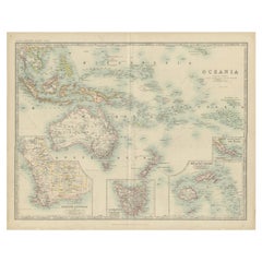
Antique Map of Oceania by Johnston, c.1865
Located in Langweer, NL
Antique map Australia titled 'Oceania'. Old map of Oceania with insets of Western Australia
Category

Antique 19th Century Maps

Materials

Paper

Antique Map of Oceania by Johnston, c.1865
H 19.49 in W 24.41 in D 0 in
Antique Map of Hawaii, New Zealand, Fiji and Surrounding Islands
Located in Langweer, NL
Original antique map of Hawaii, New Zealand, Fiji, Tonga, Samoa, French Polynesia, Marquesas, and
Category

Antique Late 19th Century Maps

Materials

Paper

Antique Map of Christmas Island or now the Republic of Kiribati, 1803
Located in Langweer, NL
Antique map Kiribati titled 'Kersmis-Eiland'. Antique map of Christmas Island, also known as
Category

Antique 19th Century Maps

Materials

Paper

Antique Map of Oceania by Johnston (1909)
Located in Langweer, NL
, Tasmania, the Fiji Islands and New Guinea. This map originates from the ‘Royal Atlas of Modern Geography
Category

Early 20th Century Maps

Materials

Paper

Antique Map of Oceania by Johnston (1909)
H 19.49 in W 24.41 in D 0.02 in
Get Updated with New Arrivals
Save "Fiji Map", and we’ll notify you when there are new listings in this category.

Read More

Pamela Shamshiri Shares the Secrets behind Her First-Ever Book and Its Effortlessly Cool Interiors

The sought-after designer worked with the team at Hoffman Creative to produce a monograph that beautifully showcases some of Studio Shamshiri's most inspiring projects.

Moroccan Artworks and Objects Take Center Stage in an Extraordinary Villa in Tangier

Italian writer and collector Umberto Pasti opens the doors to his remarkable cave of wonders in North Africa.

Montecito Has Drawn Royalty and Celebrities, and These Homes Are Proof of Its Allure

Hollywood A-listers, ex-pat aristocrats and art collectors and style setters of all stripes appreciate the allure of the coastal California hamlet — much on our minds after recent winter floods.

Whaam! Blam! Pow! — a New Book on Pop Art Packs a Punch

Publishing house Assouline and writer Julie Belcove have teamed up to trace the history of the genre, from Roy Lichtenstein, Andy Warhol and Yayoi Kusama to Mickalene Thomas and Jeff Koons.

The Sparkling Legacy of Tiffany & Co. Explained, One Jewel at a Time

A gorgeous new book celebrates — and memorializes — the iconic jeweler’s rich heritage.

What Makes a Gem-Encrusted Chess Set Worth $4 Million?

The world’s most opulent chess set, weighing in at 513 carats, is literally fit for a king and queen.

Tauba Auerbach’s Geometric Pop-Up Book Is Mighty Rare, Thanks to a Hurricane

This sculptural art book has an epic backstory of its own.

Step inside the Storied Mansions of Palm Beach’s Most Effervescent Architect

From Spanish-style courtyards to fanciful fountains, these acclaimed structures abound in surprising and elegant details.