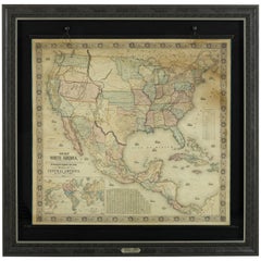
Nebraska Map

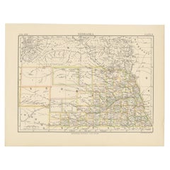
Antique Map of Nebraska
Located in Langweer, NL
Antique map titled 'Nebraska'. Original antique map of Nebraska, United States. This print
Category

Antique Late 19th Century Maps

Materials

Paper

Antique Map of Nebraska
H 8.27 in W 10.63 in D 0.02 in
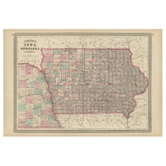
Antique Map of Iowa and Nebraska by Johnson, '1872'
Located in Langweer, NL
Antique map titled 'Johnson's Iowa and Nebraska'. Original map of Iowa and Nebraska. This map
Category

Antique Late 19th Century Maps

Materials

Paper

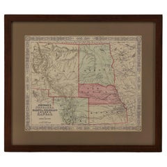
1865 "Johnson's Nebraska, Dakota, Colorado, Idaho & Kansas" Map, Johnson & Ward
Located in Colorado Springs, CO
Presented is an original 1865 "Johnson's Nebraska, Dakota, Colorado, Idaho & Kansas” map. This map
Category

Antique Mid-19th Century Maps

Materials

Paper

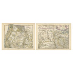
Set of two Antique Maps of the region of Oregon, Idaho, Wyoming, Nebraska & Iowa
Located in Langweer, NL
Set of two individual antique maps of part of the United States. It shows the region and
Category

Antique Late 19th Century Maps

Materials

Paper

1864 Map of North America, Antique Hand-Colored Map, by Adolphe Hippolyte Dufour
Located in Colorado Springs, CO
Offered is a map of North America entitled Amerique du Nord from 1864. This rare, separately
Category

Antique 1860s French Maps

Materials

Paper

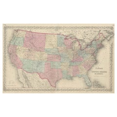
Antique Map Colton's United States of America
Located in Langweer, NL
Antique map titled 'Colton's United States of America'. Show railroads, canals, state capitals
Category

Antique Mid-19th Century Maps

Materials

Paper

Antique Map Colton's United States of America
H 17.45 in W 27.45 in D 0.02 in
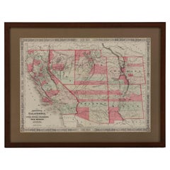
1865 "Johnson's California, Utah, Nevada, Colorado, New Mexico, Arizona" Map
Located in Colorado Springs, CO
, New Mexico, and Arizona” map. First published in 1864, this map was issued as pages 66 and 67 in the
Category

Antique Mid-19th Century Maps

Materials

Paper

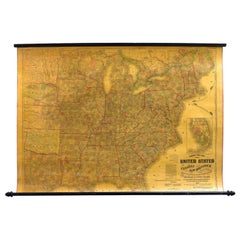
1863 "Lloyd's New Map of the United States, the Canadas, and New Brunswick"
Located in Colorado Springs, CO
Presented is “Lloyd's New Map of the United States, the Canadas and New Brunswick, From the latest
Category

Antique 1860s American Maps

Materials

Linen, Wood, Paper

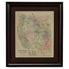
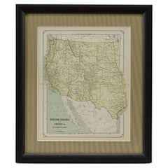
1889 "The Pacific States and Territories"
Located in Colorado Springs, CO
Presented is an uncommon 1889 map of the western United States, titled “The Pacific States and
Category

Antique 1880s American Maps

Materials

Paper

1889 "The Pacific States and Territories"
H 16.25 in W 14.25 in D 1 in
1879 "United States of America, Western Part" by O. J. Stuart
Located in Colorado Springs, CO
This colorful original map, titled “United States of America, Western Part,” was issued in Volume
Category

Antique 1870s American Maps

Materials

Paper

People Also Browsed

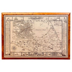
Vintage Map of Nantucket Town by Ruth Haviland Sutton, 1946
Located in Nantucket, MA
Vintage Map of Nantucket Town by Ruth Haviland Sutton, 1946, a classic vintage tourist map of Nantucket Island showing historic landmarks and geographic details along with decorative...
Category

Vintage 1940s American Other Maps

Materials

Paper

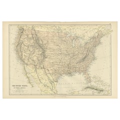
Antique Map of The United States of North America, 1882
Located in Langweer, NL
This is a historical map titled "The United States of North America, Central Part" from the 1882 Blackie Atlas. It depicts the continental United States with a high level of detail, ...
Category

Antique 1880s Maps

Materials

Paper

Antique Map of The United States of North America, 1882
Free Shipping
H 14.97 in W 22.45 in D 0 in
Original Antique Hand-colored Map of the United States, circa 1845
Located in Langweer, NL
Antique map titled 'United States'. Old map of the United States, includes the last part of the North West Territory (present day Wisconsin and part of Minnesota). It also marks Ft. ...
Category

Antique Mid-19th Century Maps

Materials

Paper

Large Original Antique Map of Arizona, Usa, C.1900
Located in St Annes, Lancashire
Fabulous map of Arizona Original color. Engraved and printed by the George F. Cram Company, Indianapolis. Published, C.1900. Unframed. Free shipping.
Category

Antique 1890s American Maps

Materials

Paper

Large Original Antique Map of Arizona, Usa, C.1900
No Reserve
H 22 in W 15 in D 0.07 in
Antique Decorative Coloured Map of North America, 1882
Located in Langweer, NL
This original antique map of North America is from the Blackie & Son Atlas published in 1882. Here are several points of interest about this map: 1. **Political Borders**: The map l...
Category

Antique 1880s Maps

Materials

Paper

Antique Decorative Coloured Map of North America, 1882
No Reserve
H 14.97 in W 22.45 in D 0 in
Large Original Antique Map of Ohio, Usa, C.1900
Located in St Annes, Lancashire
Fabulous map of Ohio Original color. Engraved and printed by the George F. Cram Company, Indianapolis. Published, C.1900. Unframed. Free shipping.
Category

Antique 1890s American Maps

Materials

Paper

Large Original Antique Map of Ohio, Usa, C.1900
No Reserve
H 22 in W 15 in D 0.07 in
Large Original Antique Map of New Mexico, Usa, C.1900
Located in St Annes, Lancashire
Fabulous map of New Mexico. Original color. Engraved and printed by the George F. Cram Company, Indianapolis. Published, C.1900. Unframed. Free shipping.
Category

Antique 1890s American Maps

Materials

Paper

Antique Map of Western States, Michigan, Wisconsin, Iowa by A & C. Black, 1870
Located in Langweer, NL
Antique map titled 'Western States, Michigan, Wisconsin, Minnesota, Iowa with portions of Illinois & Indiana'. Original antique map of Western States, Michigan, Wisconsin, Minnesota,...
Category

Antique Late 19th Century Maps

Materials

Paper

Large Original Antique Map of Wisconsin, USA, circa 1900
Located in St Annes, Lancashire
Fabulous map of Wisconsin Original color Engraved and printed by the George F. Cram Company, Indianapolis. Published, circa 1900 Unframed  
Category

Antique 1890s American Maps

Materials

Paper

1856 U.S. Coast Survey Map of Chesapeake Bay and Delaware Bay
Located in Colorado Springs, CO
Presented is U.S. Coast Survey nautical chart or maritime map of Chesapeake Bay and Delaware Bay from 1856. The map depicts the region from Susquehanna, Maryland to the northern Oute...
Category

Antique 1850s American Maps

Materials

Paper

1866 Ensign & Bridgman's Rail Road Map of the United States
Located in Colorado Springs, CO
Presented is an 1866 issue of “Ensign & Bridgeman’s Rail Road Map of the United States, showing Depots & Stations.” First published in 1856, this is the third edition, following anot...
Category

Antique 1860s American Late Victorian Maps

Materials

Paper

Large Original Antique Map of Georgia, USA, circa 1900
Located in St Annes, Lancashire
Fabulous map of Georgia Original color Engraved and printed by the George F. Cram Company, Indianapolis. Published, circa 1900 Unframed  
Category

Antique 1890s American Maps

Materials

Paper

Antique Map of The United States of North America, Pacific States, 1882
Located in Langweer, NL
The map is from the same 1882 Blackie Atlas and focuses on the Pacific States of the United States of America during that period. Here are some details and historical context about t...
Category

Antique 1880s Maps

Materials

Paper

First Edition of Historical Work on ". Indians of North America" by Paul Kane
Located in Middletown, NY
Kane, Paul (1810-1871) Wanderings of an Artist Among the Indians of North America; From Canada to Vancouver Island and Oregon Through the Hudson's Bay Company Territory, and Back Ag...
Category

Antique Mid-19th Century English Books

Materials

Leather, Paper

"Clason's Guide Map of Montana" by The Clason Map Company, Circa 1920s
Located in Colorado Springs, CO
Presented is “Clason's Guide Map of Montana,” published in the early 1920s by the Clason Map Company. Issued as a folding map, this map identifies county boundaries, county seats, Na...
Category

Vintage 1920s American Art Deco Maps

Materials

Paper

1840 Map of the City of Washington Published by William M. Morrison
Located in Colorado Springs, CO
This map, printed in 1840, is a detailed representation of Washington, D.C. in the mid-19th century. The map shows block numbers, wards, and government buildings as well as details o...
Category

Antique 1840s American Federal Maps

Materials

Paper

Recent Sales

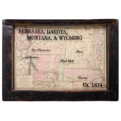
1874 Antique Map of Nebraska, Dakota, Montana, and Wyoming
Located in Colorado Springs, CO
Presented is an original map of Nebraska, Dakota, Montana, and Wyoming from 1874. This authentic
Category

Antique 1870s American Maps

Materials

Paper

1854 Map of Partial North America, Antique Wall Map by Jacob Monk
Located in Colorado Springs, CO
"New Map of that Portion of North America, exhibiting the United States and Territories, The
Category

Antique 1850s American Maps

Materials

Paper

1858 "Mitchell's New National Map Exhibiting the United States" Hanging Wall Map
By Samuel Augustus Mitchell 1
Located in Colorado Springs, CO
Presented is a beautifully engraved, large hanging wall map of the United States, Mexico, and West
Category

Antique 1850s American Maps

Materials

Paper

Atwood's Pictorial Map of the United States, circa 1854
Located in Colorado Springs, CO
This is the 1854 J. M. Atwood ornamental engraved map of the United States published by Ensign
Category

Antique 1850s American Maps

1856 Hanging "Map of the United States from the Latest Authorities"
Located in Colorado Springs, CO
Minnesota, Nebraska, Kansas Territory, Indian Territory and Texas. Inset maps in the lower right include a
Category

Antique 1850s American Maps

Materials

Linen, Wood, Paper

1857 Wall Map of the United States by Fanning, Bridgman & Ensign
By Thayer, Bridgman and Fanning
Located in Colorado Springs, CO
Presented is a scarce American wall map of the United States and Mexico issued by Ensign, Bridgman
Category

Antique 1850s American Maps

Materials

Paper

1855 Pictorial Map of the United States, Pub by Ensign, Bridgman & Fanning
Located in Colorado Springs, CO
This is a large and highly decorative 1855 wall map of the United States. Issued by Ensign
Category

Antique 1850s American Maps

Materials

Paper

1856 a New Map of the Union with the Adjacent Islands and Countries
Located in Colorado Springs, CO
an untitled inset map of portions of Missouri, Kansas, and Nebraska. During the 1840s, the push to
Category

Antique 1850s American Maps

1854 "New Map of That Portion of North America" Published by Jacob Monk
Located in Colorado Springs, CO
“New Map of that Portion of North America, exhibiting the United States and Territories, The
Category

Antique 1850s American Maps

Materials

Paper

1857 Antique Coltons General Atlas World State Country Map Description Book
Located in Dayton, OH
. Western Americana maps include: ""Nebraska and Kansas Territories,"" ""Oregon and Washington,"" ""Utah and
Category

Antique 1850s Victorian Books

Materials

Leather, Paper

Original Antique Map of Nebraska, circa 1890
Located in St Annes, Lancashire
Great map of Nebraska Original color. Published, circa 1890 Repairs to minor edge tears
Category

Antique 1890s English Other Maps

Materials

Paper

Original Antique Map of Nebraska, circa 1890
Free Shipping
H 16.5 in W 11.75 in D 0.07 in
Antique Map of Kansas and Nebraska by Johnson, '1872'
Located in Langweer, NL
Antique map titled 'Johnson's Kansas and Nebraska'. Original map of Kansas and Nebraska. This map
Category

Antique Late 19th Century Maps

Materials

Paper

Original Antique Map of The American State of Nebraska, 1889
Located in St Annes, Lancashire
Great map of Nebraska Drawn and Engraved by W. & A.K. Johnston Published By A & C Black
Category

Antique 1880s Scottish Victorian Maps

Materials

Paper

Antique Map of Nebraska, Dakota, Idaho, Montana and Wyoming by Johnson '1872'
Located in Langweer, NL
Antique map titled 'Johnson's Nebraska (..)'. Original map of Nebraska, Dakota, Idaho, Montana and
Category

Antique Late 19th Century Maps

Materials

Paper

Original Antique City Plan of Omaha, Nebraska, USA, circa 1900
By Rand McNally & Co.
Located in St Annes, Lancashire
Fabulous colorful map of Omaha, Nebraska Original color By Rand, McNally & Co. Published
Category

Antique Early 1900s American Maps

Materials

Paper

Eduardo Chavez Vintage 1977 Bronze Sculpture "Ouray"
Located in Denver, CO
Department's Section of Painting and Sculpture for post offices in Geneva, Nebraska (Building a Sod House, 1941
Category

Vintage 1970s American Mid-Century Modern Abstract Sculptures

Materials

Bronze

Monumental Pair of Cary's Library Globes
Located in New York, NY
, ending in spade feet on brass casters. The terrestrial globe is mapped with detailed
Category

Antique 19th Century English Globes

Materials

Mahogany

Get Updated with New Arrivals
Save "Nebraska Map", and we’ll notify you when there are new listings in this category.

Nebraska Map For Sale on 1stDibs

With a vast inventory of beautiful furniture at 1stDibs, we’ve got just the nebraska map you’re looking for. Each nebraska map for sale was constructed with extraordinary care, often using paper, fabric and linen.

Finding the Right collectibles-curiosities for You

Antique and vintage collectibles and curiosities can bring whimsy and wonder to any interior. 

Decorating with old scientific instruments, historical memorabilia and vintage musical instruments, as well as other authentic collectibles and curiosities that can be found on 1stDibs, presents an opportunity to create a unique, natural history museum-like atmosphere in your home that can provoke conversation as often as it pays tribute to how far we’ve come in understanding our world. 

And bringing collectibles and curiosities into your space is actually on trend — Wunderkammern, or curiosity cabinets, were all the rage in Europe during the 1500s and continued to have adherents there and in the U.S. in the following centuries. Today, however, they’re experiencing a real surge in popularity and influencing how many interior designers are furnishing and decorating homes — combining contemporary with antique, scientific with tribal, earthly with extraterrestrial, Les Lalanne tables with Flemish tapestries.

The original Wunderkammern were entire rooms filled with objects demonstrating their owners’ worldly knowledge: A proper one included artificiala or preciosa (objets d’art); naturalia (such as skeletons, shells, minerals); exotica (taxidermy or dried plants); and scientifica (scientific instruments), frequently alongside religious relics and ancient artifacts.

Pay tribute to a history of rich and diverse musical traditions that have taken shape all over the world by decorating your home with a collection of antique and vintage musical instruments — with a little help from strong hanging wire or some wall hooks, vintage brass instruments such as a gong, French horn or trumpet can help elevate a home office or complement the efforts you’ve made to ensure a welcoming vibe in your home’s entryway. Bells or antique wind instruments can add provocative metallic contrasts to dark woods as tabletop decorative objects.  

Create an intriguing focal point with Georgian scientific instruments, such as stick barometers with mahogany cases or lacquered brass telescopes. These items stem from an era named for the monarchies of the four King Georges, who ruled England in succession starting in 1714 (plus King William’s reign, which lasted until 1837). Just as there was beautiful jewelry produced during the period that today is coveted by collectors, there is much to be found in the collectibles and curiosities realm too.

Wanderlust, nostalgia and a shared love of good design are contributing factors to certain trends in decorating — just as vintage trunks and luggage have reappeared as furniture or home accents in a bedroom or foyer, decorating with globes, maps or nautical objects is similarly rooted in the allure of travel and a penchant for the stylish finishing touch that collectibles bring to our homes.

Find a wide range of antique and vintage collectibles and curiosities on 1stDibs.

Read More

Pamela Shamshiri Shares the Secrets behind Her First-Ever Book and Its Effortlessly Cool Interiors

The sought-after designer worked with the team at Hoffman Creative to produce a monograph that beautifully showcases some of Studio Shamshiri's most inspiring projects.

Moroccan Artworks and Objects Take Center Stage in an Extraordinary Villa in Tangier

Italian writer and collector Umberto Pasti opens the doors to his remarkable cave of wonders in North Africa.

Montecito Has Drawn Royalty and Celebrities, and These Homes Are Proof of Its Allure

Hollywood A-listers, ex-pat aristocrats and art collectors and style setters of all stripes appreciate the allure of the coastal California hamlet — much on our minds after recent winter floods.

Whaam! Blam! Pow! — a New Book on Pop Art Packs a Punch

Publishing house Assouline and writer Julie Belcove have teamed up to trace the history of the genre, from Roy Lichtenstein, Andy Warhol and Yayoi Kusama to Mickalene Thomas and Jeff Koons.

The Sparkling Legacy of Tiffany & Co. Explained, One Jewel at a Time

A gorgeous new book celebrates — and memorializes — the iconic jeweler’s rich heritage.

What Makes a Gem-Encrusted Chess Set Worth $4 Million?

The world’s most opulent chess set, weighing in at 513 carats, is literally fit for a king and queen.

Tauba Auerbach’s Geometric Pop-Up Book Is Mighty Rare, Thanks to a Hurricane

This sculptural art book has an epic backstory of its own.

Step inside the Storied Mansions of Palm Beach’s Most Effervescent Architect

From Spanish-style courtyards to fanciful fountains, these acclaimed structures abound in surprising and elegant details.