Items Similar to Cartographic Heritage: The 1901 Map of the Vizcaya Province in Spain
Want more images or videos?
Request additional images or videos from the seller
1 of 6
Cartographic Heritage: The 1901 Map of the Vizcaya Province in Spain
About the Item
This is a historical map of the province of Vizcaya (Biscay) in Spain, dated 1901. The title on the map is "VIZCAYA. 1901." It shows the topographical details of the region with contour lines and coloring to represent elevation changes. The map includes cities, towns, rivers, and railroads, with key locations such as Bilbao marked as the capital of the province. The coastline along the Cantabrian Sea is well defined. There are various symbols used to denote features such as railroads, telegraph stations, and roads. The map also includes a scale in kilometers, a legend explaining the symbols used (denoted as "Signos Convencionales"), and an inset detailing the provincial coat of arms. The surrounding areas of Santander, Burgos, Álava, and Guipúzcoa are also partially visible. The map is detailed and likely served for administrative or navigational purposes at the beginning of the 20th century.
The province of Vizcaya, known in Basque as Bizkaia, is rich in cultural, historical, and geographical significance. Here are some interesting facts about this area:
1. **Cultural Identity**: Vizcaya is one of the provinces that make up the Basque Country, an autonomous community in northern Spain. The Basque Country has its own language (Euskera), unique cultural traditions, and a distinct identity within Spain.
2. **Bilbao**: The capital city of Vizcaya is Bilbao, which underwent a significant transformation at the end of the 20th century. The city is famous for the Guggenheim Museum Bilbao, designed by architect Frank Gehry, which is a masterpiece of contemporary architecture and helped to revitalize the city.
3. **Industrial History**: Vizcaya was at the heart of the Industrial Revolution in Spain. The region was a major center for iron ore mining and steel production, which fueled its economic growth.
4. **Natural Landscapes**: The province features diverse landscapes, from the rugged coastline of the Bay of Biscay to the verdant mountains and valleys inland. The Urdaibai Biosphere Reserve is a UNESCO-recognized area of great ecological importance.
5. **Gastronomy**: Vizcaya is renowned for its culinary traditions, including pintxos (small snacks similar to tapas) and high-quality seafood. The region is also part of the Rioja Alavesa wine-producing area, known for its excellent wines.
6. **Language**: The Basque language, Euskera, is one of the oldest languages in Europe and is unrelated to any other known language. It is a central part of Vizcaya's cultural heritage.
7. **Suspension Bridge**: The Vizcaya Bridge, also known as the Puente Colgante, links the towns of Portugalete and Getxo over the Ibaizabal estuary. It's the world's oldest transporter bridge and was declared a World Heritage Site by UNESCO.
8. **Sporting Tradition**: The region has a strong affinity for sports, especially the traditional Basque games like pelota and rural sports, and football, with Athletic Bilbao being one of the most significant and historical football clubs in Spain.
9. **Historical Sites**: Vizcaya is home to numerous historical sites, from prehistoric settlements to medieval churches and modernist architecture, reflecting the region's rich history.
10. **Festivals**: The region is known for its vibrant festivals, such as the Semana Grande/Aste Nagusia of Bilbao, which is a big week-long festival with concerts, bullfights, and fireworks.
These facts reflect the multifaceted nature of Vizcaya, blending a rich cultural heritage with natural beauty and modern innovation.
- Dimensions:Height: 14.77 in (37.5 cm)Width: 20.08 in (51 cm)Depth: 0 in (0.02 mm)
- Materials and Techniques:
- Period:1900-1909
- Date of Manufacture:1901
- Condition:Good condition. Central vertical folding lines as issued. Aged paper with typically warm, yellowish-brown hue, especially around the edges and folding lines, adding to its patina. Check the images carefully.
- Seller Location:Langweer, NL
- Reference Number:
About the Seller
5.0
Platinum Seller
These expertly vetted sellers are 1stDibs' most experienced sellers and are rated highest by our customers.
Established in 2009
1stDibs seller since 2017
1,919 sales on 1stDibs
Typical response time: <1 hour
- ShippingRetrieving quote...Ships From: Langweer, Netherlands
- Return PolicyA return for this item may be initiated within 14 days of delivery.
More From This SellerView All
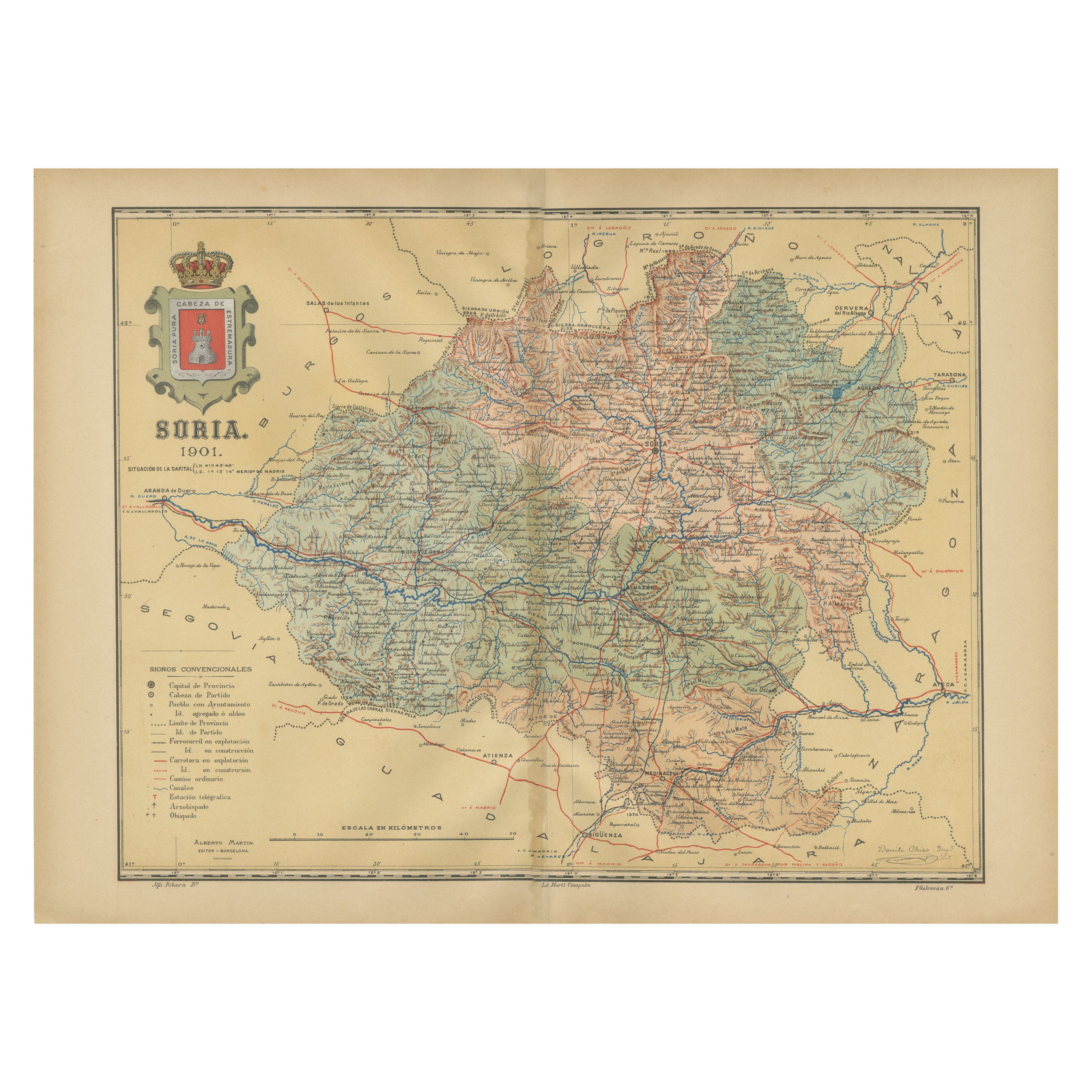
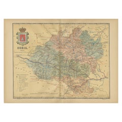
- Map of Soria Province, 1901: Detailed Cartography of Northeastern SpainLocated in Langweer, NLThe map is a historical map of the province of Soria from 1901. A decorative coat of arms enhances the aesthetic of the map, signifying the historical and cultural significance of ...Category
Antique Early 1900s Maps
MaterialsPaper
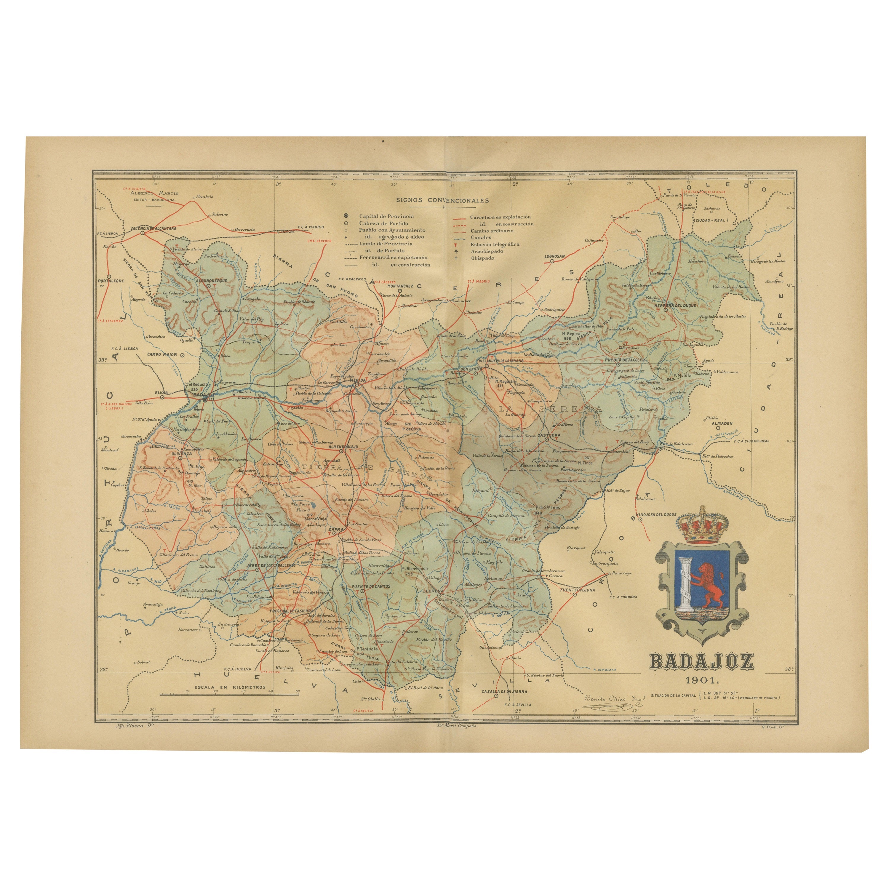
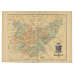
- Badajoz 1901: A Cartographic Record of Extremadura's Largest Province in SpainLocated in Langweer, NLThis original antique map for sale is of the province of Badajoz, part of the autonomous community of Extremadura in Spain, dated 1901. It illustrates several important features: Th...Category
Antique Early 1900s Maps
MaterialsPaper
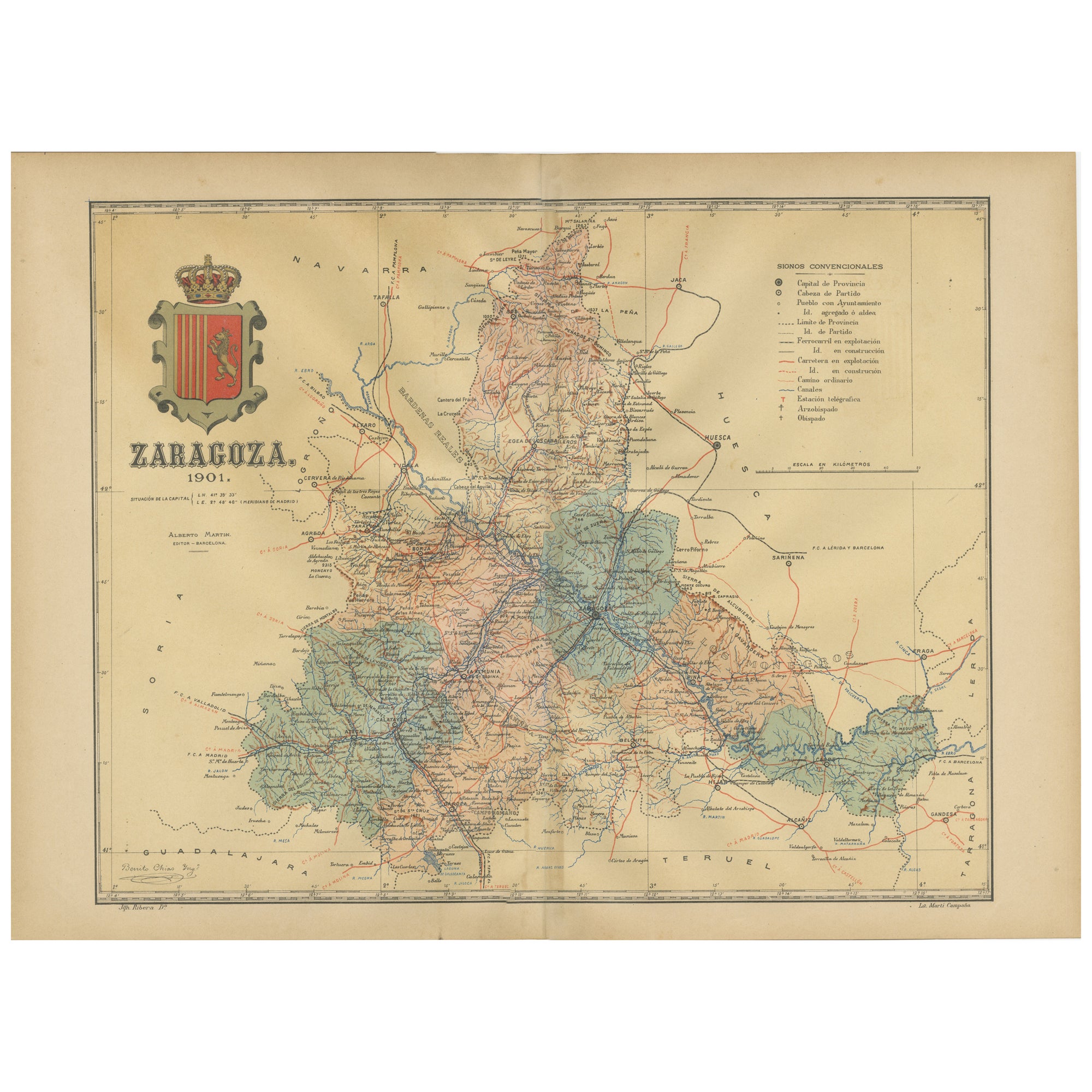
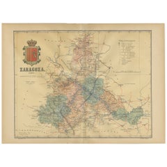
- Zaragoza: Crossroads of Heritage - The 1901 Cartographic ChronicleLocated in Langweer, NLThe print on sale is a historical map of the province of Zaragoza, Spain, dated 1901. The title on the map is "ZARAGOZA. 1901." This map details the geo...Category
Antique Early 1900s Maps
MaterialsPaper
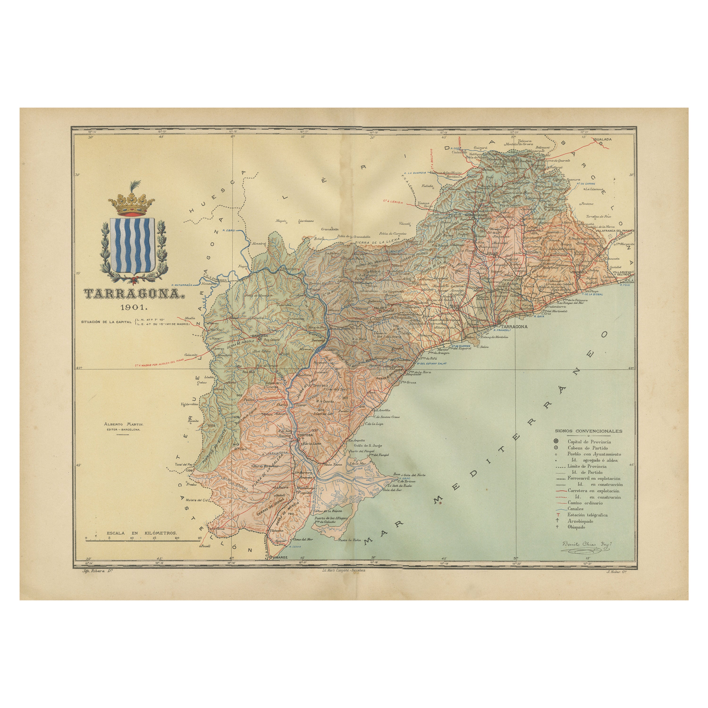
- A Catalonian Cartographic Depiction of Tarragona Province, 1901Located in Langweer, NLThis image depicts a historical map of the province of Tarragona, which is in the northeastern part of Spain, within the autonomous community of Catalonia. The map is dated 1901, sug...Category
Antique Early 1900s Maps
MaterialsPaper
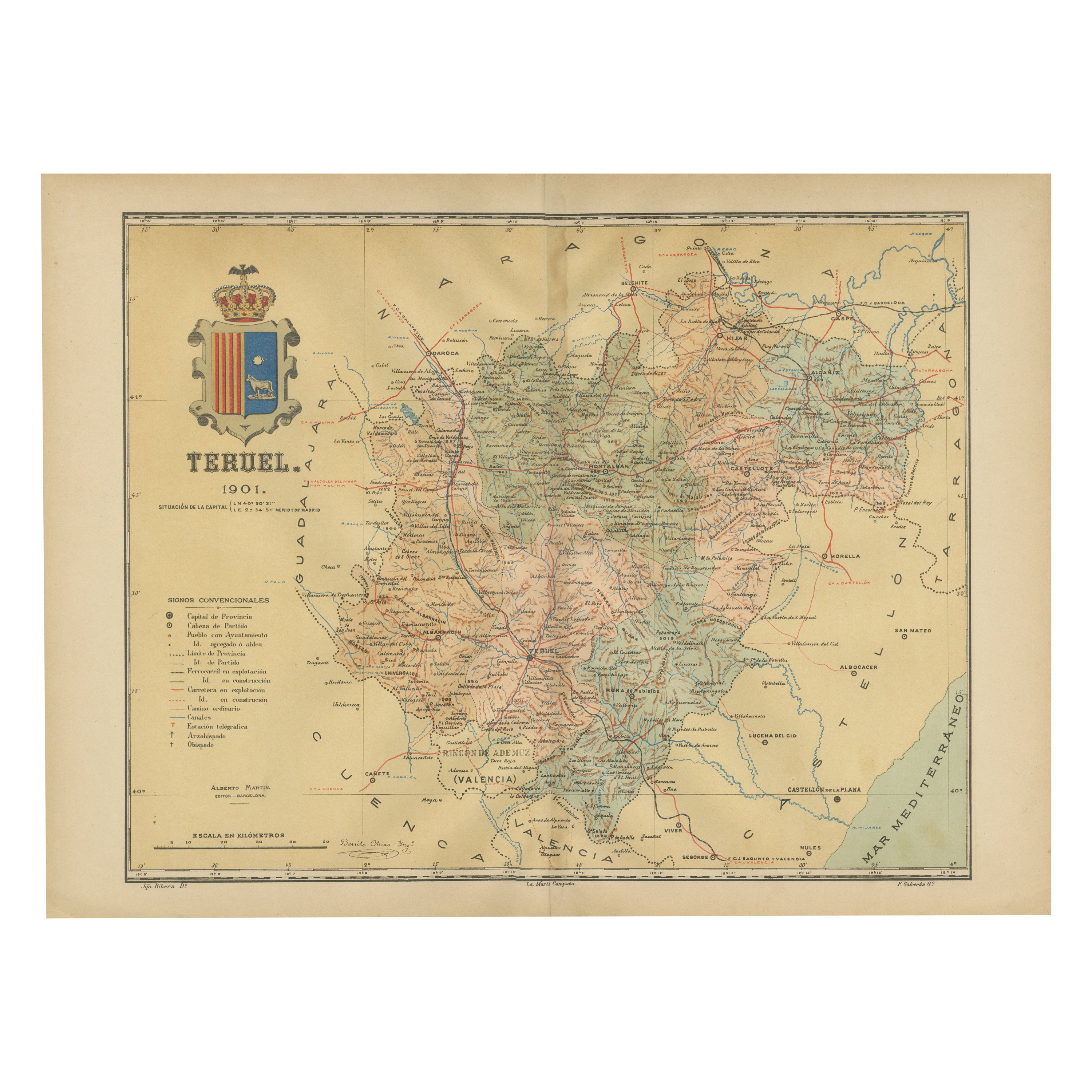
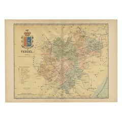
- Teruel 1901: A Cartographic Depiction of Heritage and Natural Splendor in SpainLocated in Langweer, NLOriginal antique map of Teruel in Spain, with highlighted gold. The province of Teruel, located in the region of Aragon in eastern Spain, is known for several unique features: 1. **Mudejar Architecture**: Teruel is famous for its well-preserved Mudejar architecture, which is a style that is a fusion of Christian and Islamic design. This includes notable examples like the Tower of El Salvador and the Teruel Cathedral, both of which are UNESCO World Heritage sites. 2. **Dinopolis**: It hosts Dinópolis, a paleontological park that is one of the largest of its kind in Europe, featuring dinosaur fossils and interactive...Category
Antique Early 1900s Maps
MaterialsPaper
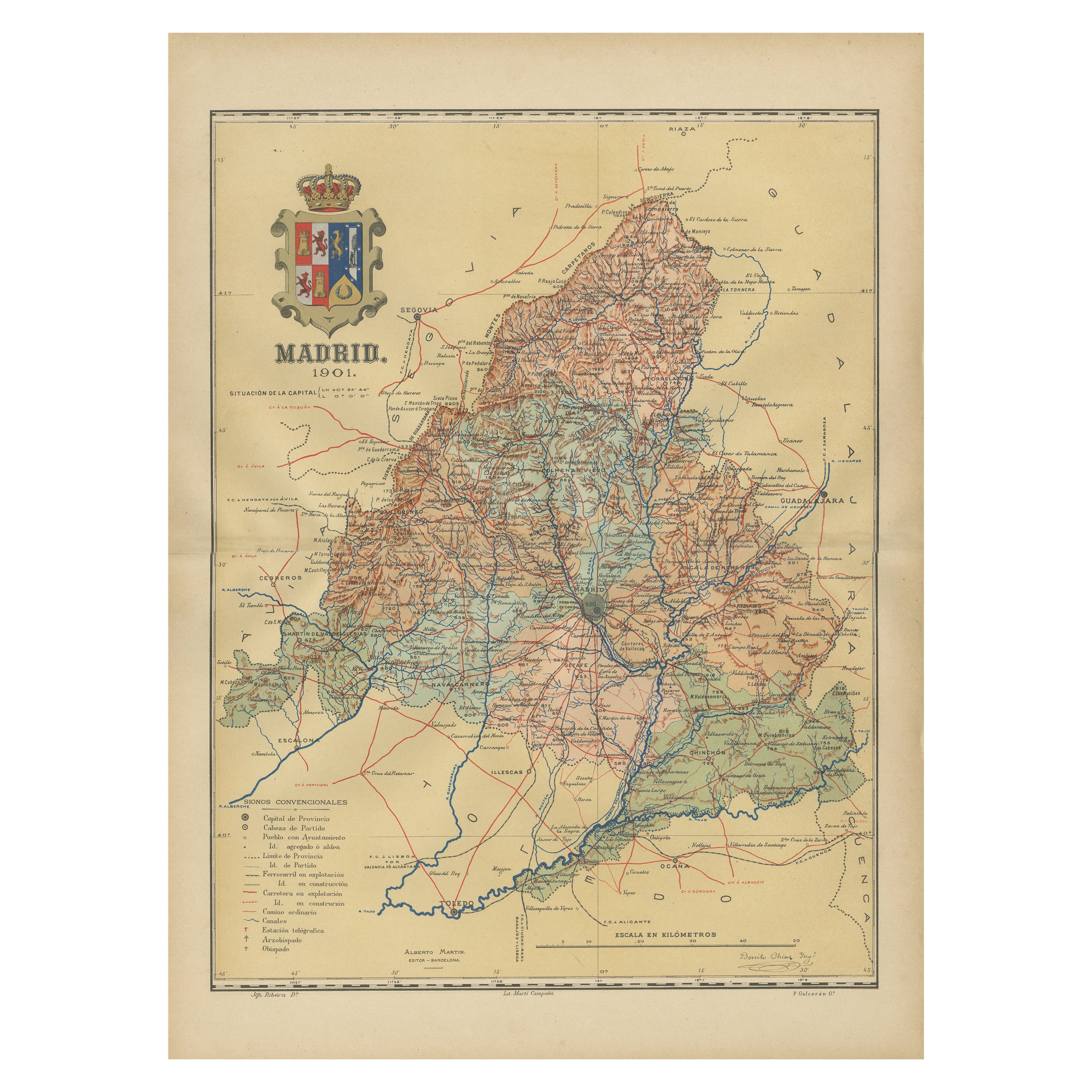
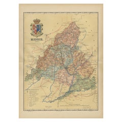
- Madrid 1901: A Historical Map of Spain's Capital ProvinceLocated in Langweer, NLThe map is of the province of Madrid, the capital region of Spain, as it appeared in 1901. Here are the key features it displays: The map shows the central part of Spain, with the Guadarrama mountain range prominently visible, marking the natural border to the north of Madrid. Blue lines likely indicate rivers, including the Manzanares River, which flows through Madrid, and the Jarama River, a tributary to the Tagus. Red lines depict the roads and railways, outlining the infrastructure that connects Madrid's various towns and cities within the province and beyond. Symbols and labels mark the locations of cities, towns, and villages, with Madrid itself likely being the focal point. Dotted lines may represent the administrative divisions within the province. The map includes a legend (Signos Convencionales) that explains the symbols used for provincial capitals, roads, railways, and other geographic features. The coat of arms of Madrid, featuring a bear and a strawberry tree (madroño), is prominently featured, symbolizing the city's and the province's historical coat of arms. About the province of Madrid: Madrid is not only the capital of Spain but also the heart of the Iberian Peninsula, both geographically and politically. The city is renowned for its rich repositories of European art, including the Prado Museum's works by Goya, Velázquez, and other Spanish masters. The province of Madrid is characterized by a blend of historical and modern elements, with a rich cultural life that includes theater, opera, and flamenco, as well as gastronomy that features a mix of traditional Spanish dishes and international cuisine...Category
Antique Early 1900s Maps
MaterialsPaper

You May Also Like
- Antique Oarsman's Map of the River Thames, English, Cartography, Published 1912Located in Hele, Devon, GBThis is an antique copy of The Oarsman's and Angler's Map of the River Thames - New Edition. An English, bound map book, published in English by Edward Stanford, London, this new edi...Category
Early 20th Century British Other Books
MaterialsPaper
- Antique Lithography Map of Cheshire, English, Framed, Cartography, VictorianLocated in Hele, Devon, GBThis is an antique lithography map of Cheshire. An English, framed atlas engraving of cartographic interest, dating to the mid 19th century and lat...Category
Antique Mid-19th Century British Victorian Maps
MaterialsWood
- Antique 18th Century Map of the Province of Pensilvania 'Pennsylvania State'Located in Philadelphia, PAA fine antique of the colony of Pennsylvania. Noted at the top of the sheet as a 'Map of the province of Pensilvania'. This undated and anonymous map is thought to be from the Gentleman's Magazine, London, circa 1775, although the general appearance could date it to the 1760's. The southern boundary reflects the Mason-Dixon survey (1768), the western boundary is placed just west of Pittsburgh, and the northern boundary is not marked. The map has a number of reference points that likely refer to companion text and appear to be connected to boundaries. The western and southern boundaries are marked Q, R, S, for example. A diagonal line runs from the Susquehanna R to the Lake Erie P. A broken line marked by many letters A, B, N, O, etc., appears in the east. There are no latitude or longitude markings, blank verso. Framed in a shaped contemporary gilt wooden frame and matted under a cream colored matte. Bearing an old Graham Arader Gallery...Category
Antique 18th Century British American Colonial Maps
MaterialsPaper
- Antique Lithography Map, Isle of Wight, English, Framed, Engraving, CartographyLocated in Hele, Devon, GBThis is an antique lithography map of the Isle of Wight. An English, framed atlas engraving of cartographic interest, dating to the early 19th century and later. Superb lithography ...Category
Antique Early 19th Century British Regency Maps
MaterialsWood
- Very Large Vintage Map of Canada, German, Education, Institution, CartographyLocated in Hele, Devon, GBThis is a very large vintage map of Canada. A German, quality printed educational or institution map, dating to the mid 20th century, circa 1965....Category
Mid-20th Century German Maps
MaterialsPaper
- Antique Lithography Map, Isle of Thanet, Kent, English, Cartography, VictorianLocated in Hele, Devon, GBThis is an antique lithography map of The Isle of Thanet in Kent. An English, framed atlas engraving of cartographic interest, dating to the mid 19th century and later. Superb litho...Category
Antique Mid-19th Century British Victorian Maps
MaterialsWood


Recently Viewed
View AllMore Ways To Browse
Map Of Old Armenia
Teak Wood Sphere
Nova Guinea Maps
Antique Map Of Illinois
Petite Point Hand Bag
Antique Map Of Southeastern Us
Antique Map Alabama
Antique Map Of Sydney
Malay Archipelago Map
Gambia Antique Map
Uruguay Antique Map
Guyana Antique Map
Ruscelli Map
Masque Theatre No
Nova Scotia Map
Antique Map Tuscany
Berkshire Antique Map
Cornwall Map