Items Similar to Hardesty, Sectional & Township Map of Ohio, Very Large
Want more images or videos?
Request additional images or videos from the seller
1 of 8
Hardesty, Sectional & Township Map of Ohio, Very Large
About the Item
Rand, McNally & Co.'s New Sectional And Township Map of Ohio
24.8 x 24.3 inches folding into 6 sections. Colour printed in part.
Chicago, 1880.
Scale: 1:633,600
Fine early large scale map which was also issued in pocket form.
With above average quality, this map by Hardesty paid close attention to development in the region. Towns and railroads abound, but also attention to rivers and drainage are addressed.
Overall very good condition. Light marginal toning, minor loss / wear along folded corner crease.
- Dimensions:Height: 24.8 in (63 cm)Width: 23.8 in (60.46 cm)Depth: 0.1 in (2.54 mm)
- Materials and Techniques:
- Place of Origin:
- Period:
- Date of Manufacture:1880
- Condition:Wear consistent with age and use.
- Seller Location:Norwich, GB
- Reference Number:1stDibs: LU7031230730832
About the Seller
No Reviews Yet
Vetted Seller
These experienced sellers undergo a comprehensive evaluation by our team of in-house experts.
Established in 1992
1stDibs seller since 2022
8 sales on 1stDibs
- ShippingRetrieving quote...Ships From: Norwich, United Kingdom
- Return PolicyA return for this item may be initiated within 14 days of delivery.
More From This SellerView All
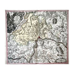
- 1750 Schaffhausen, Seutter, Large and Detailed Map SwitzerlandBy Matthew SeutterLocated in Norwich, GBSandrart Joachim, von (1606-1688) Effigies antiquae Romae. redacta a Pyrrho Ligorio Romano, per XIIII Regiones, in quas Urbem divisit Imp. Caesar August. Nuremberg, Germany, pu...Category
Antique 1670s Italian Baroque Prints
MaterialsPaper
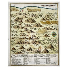
- Map of Indonesia, Semarang, Kartasoera, Soerabaya by SchleyBy Jakob van der SchleyLocated in Norwich, GB'Carte du Chemin entre Samarang et Cartasoera, kaart van den weg tusschen Samarang en Cartasoera' Map of the Road between Semarang and Kartasura by Van Schley. Published 1763. ...Category
Antique 1760s Indonesian Georgian Prints
MaterialsPaper
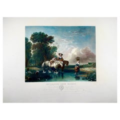
- Returning from Market, a.W. Calcott, Very Large 55cm Coloured EngravingLocated in Norwich, GBReturning from Market Measures: 400 x 550 mm. An original engraving after by Sir A. W. Callcott, R.A, and engraved by William Finden. Colour printed with additional hand co...Category
Antique 1840s English Prints
MaterialsPaper
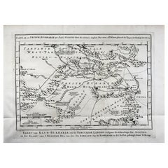
- Schley, Xinjiang Uygur Zizhiqu, Tien Shan, Sinkiang, Map of ChinaBy Jacques-Nicolas BellinLocated in Norwich, GBJ.V. Schley Carte de la petite Bukharie et pays voisins ; Kaart van Klyn-Bukharia, en de nabuurige landen Xinjiang Uygur Zizhiqu (China), Tien Shan, Sinkiang. Relief shown pict...Category
Antique 1740s Dutch Prints
MaterialsPaper
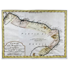
- Krevelt, Map, Coast of Brazil, South America, Amazon, Hand ColouredLocated in Norwich, GBCarte Du Bresil Prem. Partie Depuis la Riviere des Amazones jusqu' à la Baie de Tous les Saints Pour servir à l'Histoire des Etablissemens Europeens. A. v. Krevelt, sculpsit, ...Category
Antique Late 18th Century French Prints
MaterialsPaper
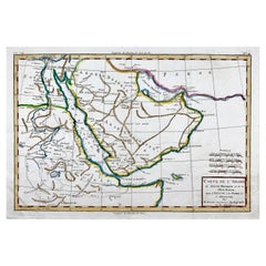
- Bonne, Map of Middle East, Persia, Red Sea, Egypt, Nubia Hand ColouredLocated in Norwich, GBRigobert Bonne. Carte de L'Arabia du Golfe Persique et de la Mer Rouge, avec l’Egypte, la Nubia et l’Abissinie From Bonne's Atlas de toutes les parties connues du Globe Terres...Category
Antique 1780s French Prints
MaterialsPaper
You May Also Like
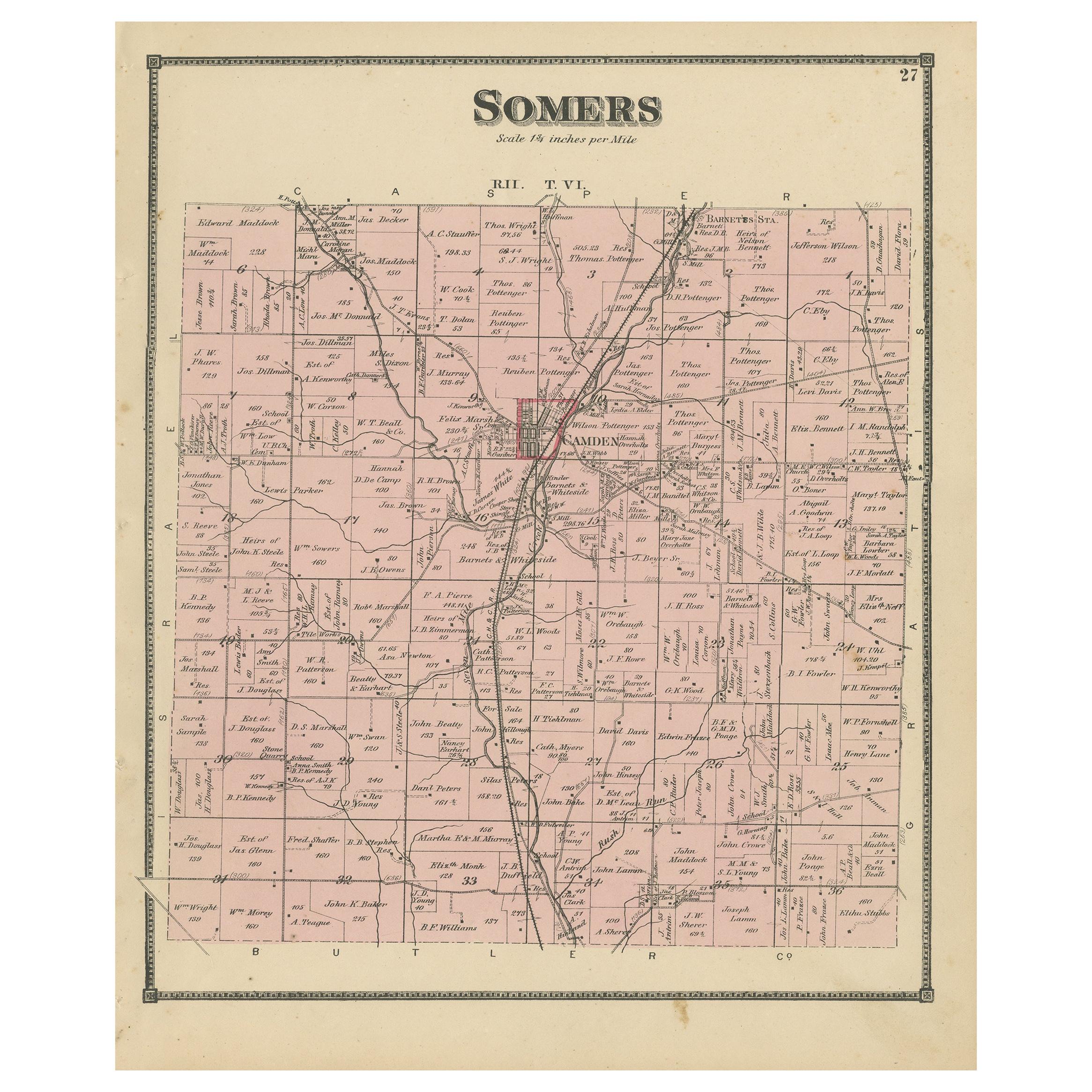
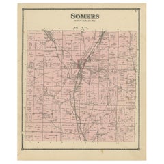
- Antique Map of the Somers Township of Ohio by Titus, 1871Located in Langweer, NLAntique map titled 'Somers'. Original antique map of Somers, Ohio. This map originates from 'Atlas of Preble County Ohio' by C.O. Titus. Published, 1871.Category
Antique Late 19th Century Maps
MaterialsPaper
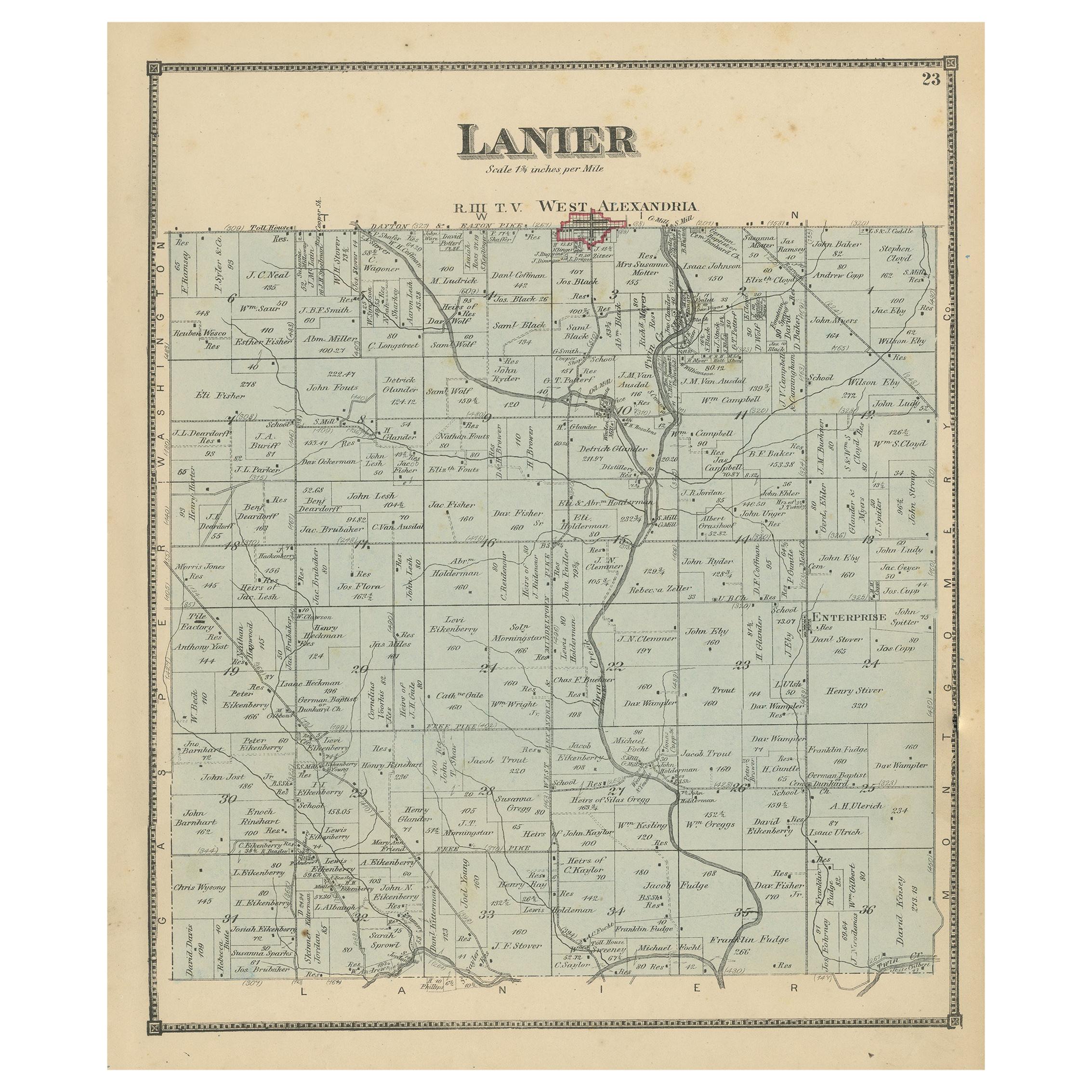
- Antique Map of the Lanier Township of Ohio by Titus, 1871Located in Langweer, NLAntique map titled 'Lanier'. Original antique map of Lanier, Ohio. This map originates from 'Atlas of Preble County Ohio' by C.O. Titus. Published, 1871.Category
Antique Late 19th Century Maps
MaterialsPaper
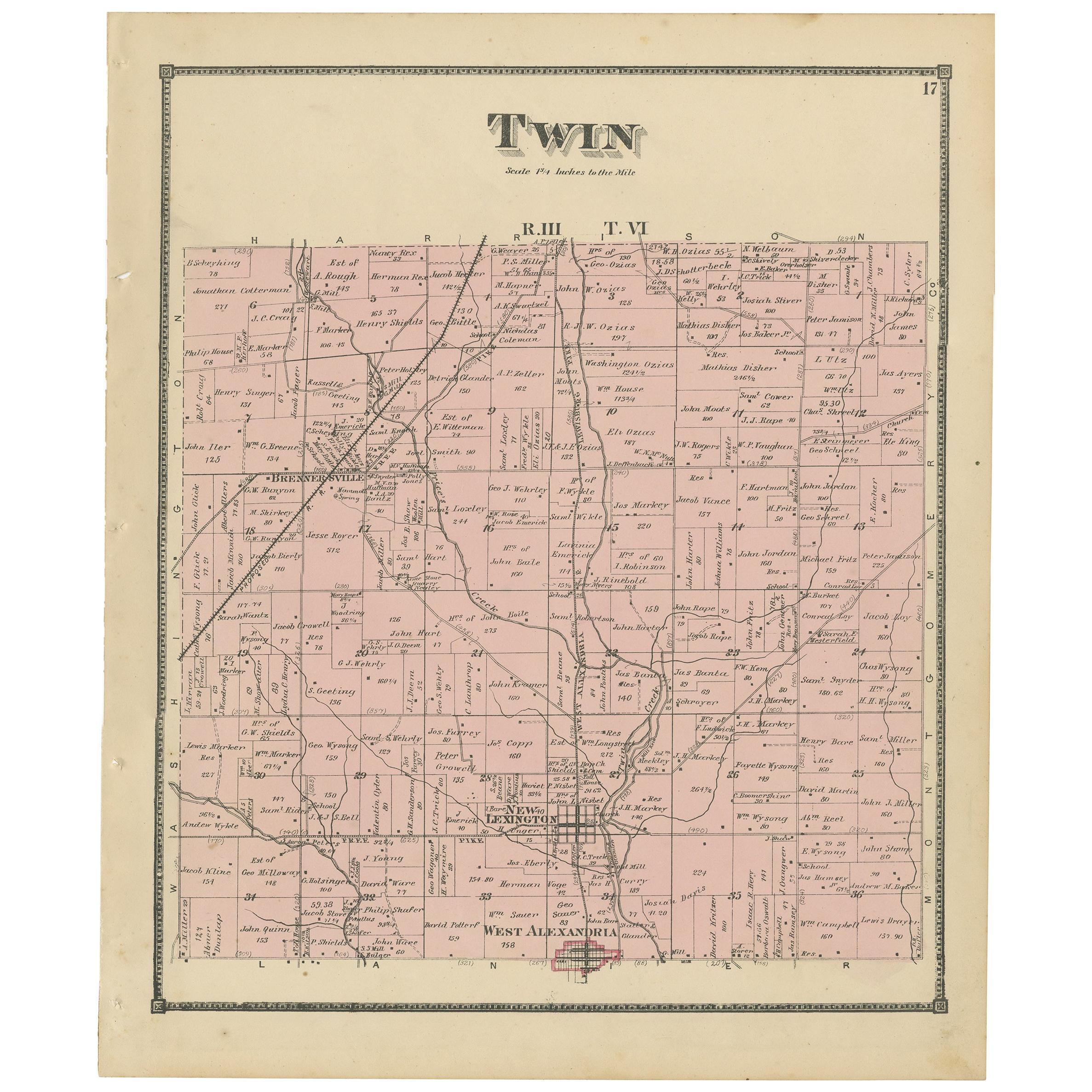
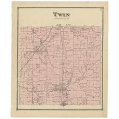
- Antique Map of the Twin Township of Ohio by Titus '1871'Located in Langweer, NLAntique map titled 'Twin'. Original antique map of Twin, Ohio. This map originates from 'Atlas of Preble County Ohio' by C.O. Titus. Published 1871.Category
Antique Late 19th Century Maps
MaterialsPaper
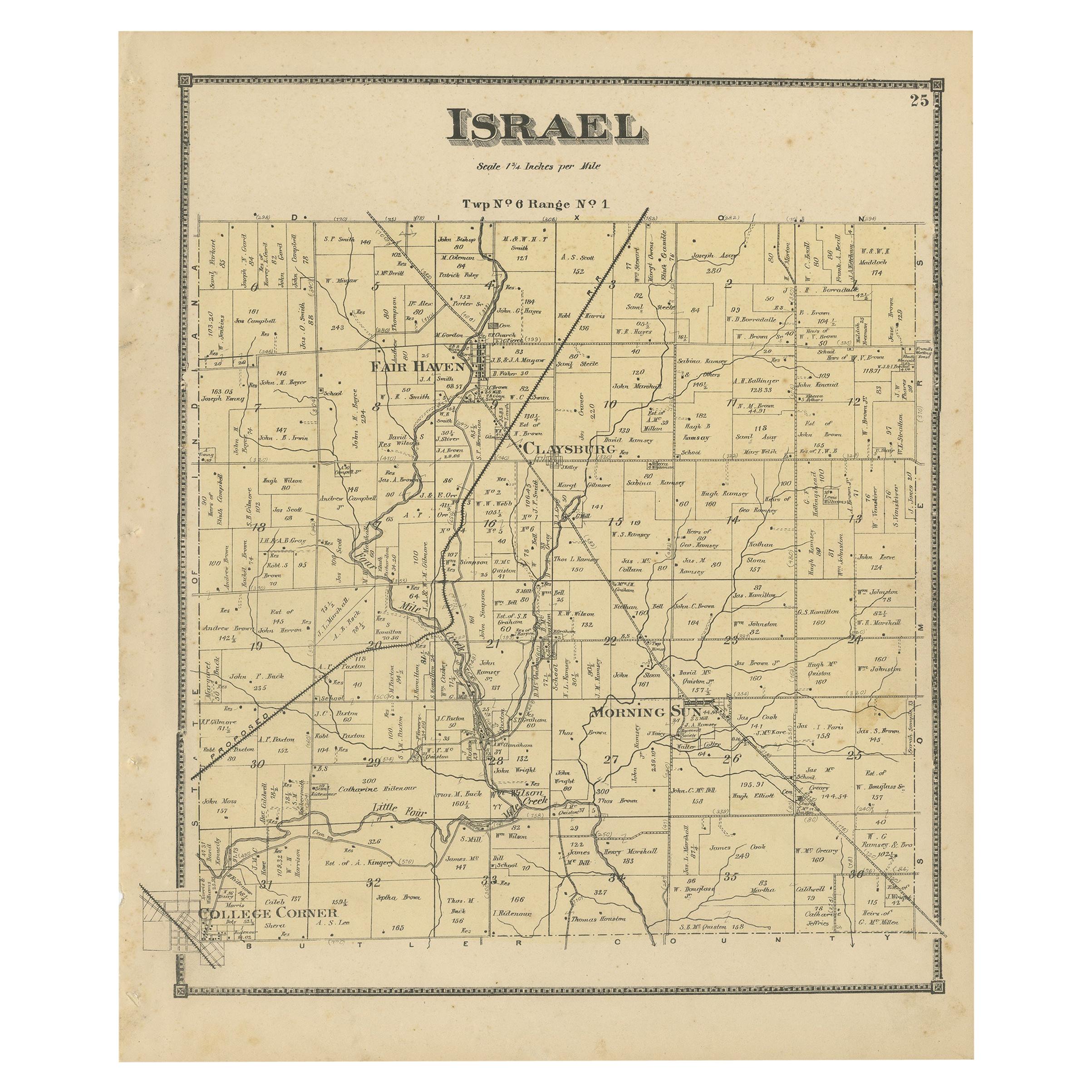
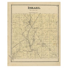
- Antique Map of the Israel Township of Ohio by Titus '1871'Located in Langweer, NLAntique map titled 'Israel'. Original antique map of Israel, Ohio. This map originates from 'Atlas of Preble County Ohio' by C.O. Titus. Published 1871.Category
Antique Late 19th Century Maps
MaterialsPaper
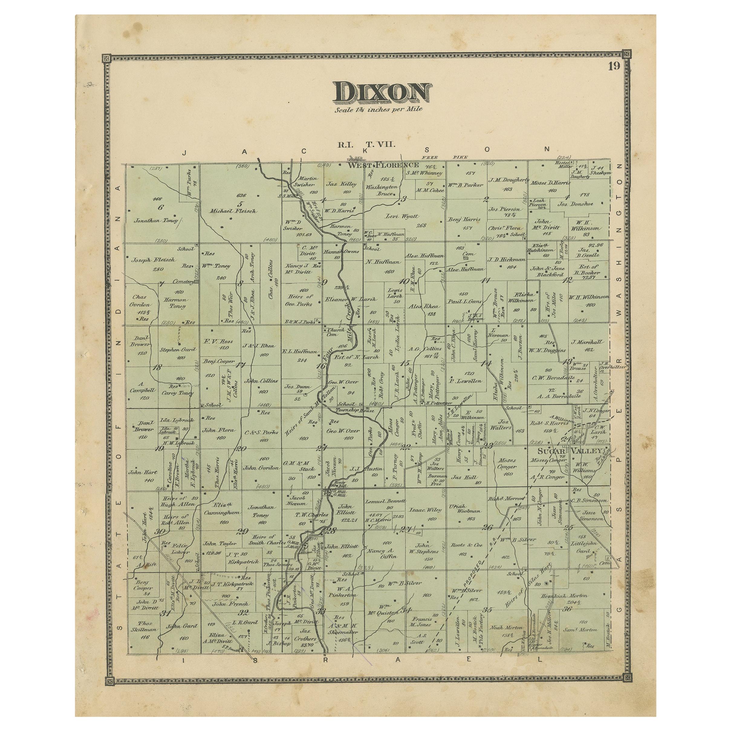
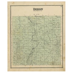
- Antique Map of the Dixon Township of Ohio by Titus, 1871Located in Langweer, NLAntique map titled 'Dixon'. Original antique map of Dixon, Ohio. This map originates from 'Atlas of Preble County Ohio' by C.O. Titus. Published 1871.Category
Antique Late 19th Century Maps
MaterialsPaper
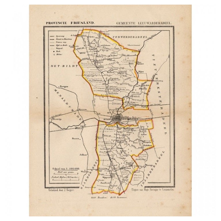
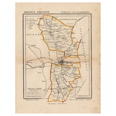
- Antique Map of Leeuwarderadeel, Township in Friesland, The Netherlands, 1868Located in Langweer, NLAntique map titled 'Provincie Friesland - Gemeente Leeuwarderadeel'. Map of the township of Leeuwarderadeel including Leeuwarden, Wirdum, Stiens and many other villages. This map ori...Category
Antique 19th Century Maps
MaterialsPaper

Recently Viewed
View AllMore Ways To Browse
Antique Sectionals
Antique Sectional
Chicago Large Map
Rand Mcnally Antique Maps
Antique Map Chicago
Antique Maps Chicago
Antique Map Of Chicago
Antique Chicago Maps
Chicago Antique Maps
Antique Ohio Maps
Antique Maps Ohio
Ohio Map
Map Of Ohio
Antique Railroad Scale
Sphere Ring
Mid Century Wall Sculptures 1960s
Collectors Cabinet Antique Furniture
French Brass Display Cabinet