Antique Ohio Maps

13
to
4
37
19
44
32
12
12
8
5
5
3
2
2
2
1
1
1
1
1
1
1
1
1
6
1
1
1
1
Sort By
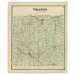
Antique Map of Gratis 'Ohio' by Titus '1871'
Located in Langweer, NL
Antique map titled 'Gratis'. Original antique map of Gratis, Ohio. This map originates from 'Atlas
Category

Late 19th Century Antique Ohio Maps

Materials

Paper

Antique Map of Gratis 'Ohio' by Titus '1871'
H 14.97 in W 12.41 in D 0.02 in
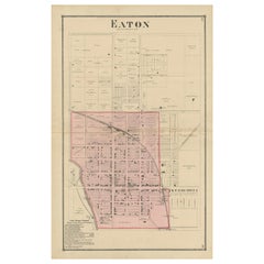
Antique Map of Eaton 'Ohio' by Titus, 1871
Located in Langweer, NL
Antique map titled 'Eaton'. Original antique map of Eaton, Ohio. This map originates from 'Atlas of
Category

Late 19th Century Antique Ohio Maps

Materials

Paper

Antique Map of Eaton 'Ohio' by Titus, 1871
H 24.02 in W 14.97 in D 0.02 in
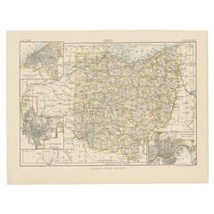
Antique Map of Ohio, with Inset Maps of Cleveland, Columbus and Cincinnati
Located in Langweer, NL
Antique map titled 'Ohio'. Original antique map of Ohio, United States. With inset maps of
Category

Late 19th Century Antique Ohio Maps

Materials

Paper

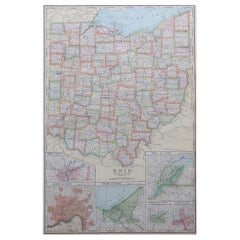
Large Original Antique Map of Ohio, Usa, C.1900
Located in St Annes, Lancashire
Fabulous map of Ohio Original color. Engraved and printed by the George F. Cram Company
Category

1890s American Antique Ohio Maps

Materials

Paper

Large Original Antique Map of Ohio, Usa, C.1900
No Reserve
H 22 in W 15 in D 0.07 in
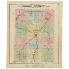
Antique Map of Preble County 'Ohio' by Titus, 1871
Located in Langweer, NL
Antique map titled 'Outline Plan of Prble County, Ohio'. Original antique map of Preble County
Category

Late 19th Century Antique Ohio Maps

Materials

Paper

Antique Map of Preble County 'Ohio' by Titus, 1871
No Reserve
H 14.97 in W 12.41 in D 0.02 in
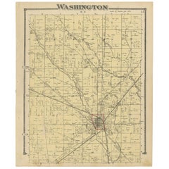
Antique Map of Washington County 'Ohio' by Titus, 1871
Located in Langweer, NL
Antique map titled 'Washington'. Original antique map of Washington, Ohio. This map originates from
Category

Late 19th Century Antique Ohio Maps

Materials

Paper

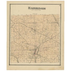
Antique Map of Harrison County 'Ohio' by Titus, 1871
Located in Langweer, NL
Antique map titled 'Harrison'. Original antique map of Harrison, Ohio. This map originates from
Category

Late 19th Century Antique Ohio Maps

Materials

Paper

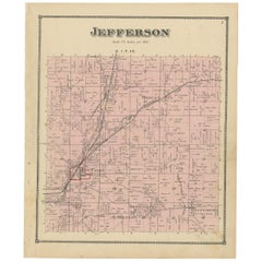
Antique Map of Jefferson County 'Ohio' by Titus, 1871
Located in Langweer, NL
Antique map titled 'Jefferson'. Original antique map of Jefferson, Ohio. This map originates from
Category

Late 19th Century Antique Ohio Maps

Materials

Paper

Antique Map of Jefferson County 'Ohio' by Titus, 1871
No Reserve
H 14.97 in W 12.41 in D 0.02 in
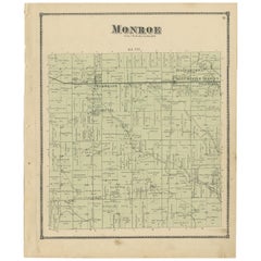
Antique Map of Monroe County 'Ohio' by Titus '1871'
Located in Langweer, NL
Antique map titled 'Monroe'. Original antique map of Monroe, Ohio. This map originates from 'Atlas
Category

Late 19th Century Antique Ohio Maps

Materials

Paper

Antique Map of Monroe County 'Ohio' by Titus '1871'
No Reserve
H 14.97 in W 12.41 in D 0.02 in
Antique Map of the State of Ohio by Titus '1871'
Located in Langweer, NL
Antique map titled 'Railroad & Township Map of the State of Ohio'. Original antique map of the
Category

Late 19th Century Antique Ohio Maps

Materials

Paper

Antique Map of the Lanier Township of Ohio by Titus, 1871
Located in Langweer, NL
Antique map titled 'Lanier'. Original antique map of Lanier, Ohio. This map originates from 'Atlas
Category

Late 19th Century Antique Ohio Maps

Materials

Paper

Antique Map of the Israel Township of Ohio by Titus '1871'
Located in Langweer, NL
Antique map titled 'Israel'. Original antique map of Israel, Ohio. This map originates from 'Atlas
Category

Late 19th Century Antique Ohio Maps

Materials

Paper

Antique Map of the Twin Township of Ohio by Titus '1871'
Located in Langweer, NL
Antique map titled 'Twin'. Original antique map of Twin, Ohio. This map originates from 'Atlas of
Category

Late 19th Century Antique Ohio Maps

Materials

Paper

Antique Map of the Dixon Township of Ohio by Titus, 1871
Located in Langweer, NL
Antique map titled 'Dixon'. Original antique map of Dixon, Ohio. This map originates from 'Atlas of
Category

Late 19th Century Antique Ohio Maps

Materials

Paper

Antique Map of the Somers Township of Ohio by Titus, 1871
Located in Langweer, NL
Antique map titled 'Somers'. Original antique map of Somers, Ohio. This map originates from 'Atlas
Category

Late 19th Century Antique Ohio Maps

Materials

Paper

Large Original Antique Map of Ohio by Rand McNally, circa 1900
By Rand McNally & Co.
Located in St Annes, Lancashire
Fabulous monochrome map with red outline color Original color By Rand, McNally & Co
Category

Early 1900s American Edwardian Antique Ohio Maps

Materials

Paper

Antique Map of Camden and Sonora, 1871
Located in Langweer, NL
Antique map titled 'Camden, Sonora'. Original antique map of villages and communities of Ohio. This
Category

Late 19th Century Antique Ohio Maps

Materials

Paper

Antique Map of Camden and Sonora, 1871
H 14.97 in W 12.41 in D 0.02 in
Antique Map of Winchester, Eldorado & Orangeburg, 1871
Located in Langweer, NL
communities of Ohio. This map originates from 'Atlas of Preble County Ohio' by C.O. Titus. Published, 1871.
Category

Late 19th Century Antique Ohio Maps

Materials

Paper

Antique Map of West Alexandria, Manchester & Enterprise, 1871
Located in Langweer, NL
communities of Ohio. This map originates from 'Atlas of Preble County Ohio' by C.O. Titus. Published, 1871.
Category

Late 19th Century Antique Ohio Maps

Materials

Paper

Antique Map of Euphemia, Lewisburg & West Florence, 1871
Located in Langweer, NL
communities of Ohio. This map originates from 'Atlas of Preble County Ohio' by C.O. Titus. Published 1871.
Category

Late 19th Century Antique Ohio Maps

Materials

Paper

Antique Map of Gasper, Hamburg and West Elkton, 1871
Located in Langweer, NL
of Ohio. This map originates from 'Atlas of Preble County Ohio' by C.O. Titus. Published 1871.
Category

Late 19th Century Antique Ohio Maps

Materials

Paper

Antique Map of New Paris and Morning Sun, 1871
Located in Langweer, NL
Ohio. This map originates from 'Atlas of Preble County Ohio' by C.O. Titus. Published 1871.
Category

Late 19th Century Antique Ohio Maps

Materials

Paper

Antique Map of New Paris and Morning Sun, 1871
No Reserve
H 14.97 in W 12.41 in D 0.02 in
Antique Map of the United States by Titus '1871'
Located in Langweer, NL
map originates from 'Atlas of Preble County Ohio' by C.O. Titus. Published 1871.
Category

Late 19th Century Antique Ohio Maps

Materials

Paper

Antique Map of the United States by Titus '1871'
No Reserve
H 16.54 in W 26.78 in D 0.02 in
Antique Map of College Corner, Sugar Valley, New Lexington & Verona '1871'
Located in Langweer, NL
villages and communities of Ohio. This map originates from 'Atlas of Preble County Ohio' by C.O. Titus
Category

Late 19th Century Antique Ohio Maps

Materials

Paper

Antique Map of New Westville, Gettysburg, New Hope & Fair Haven, 1871
Located in Langweer, NL
villages and communities of Ohio. This map originates from 'Atlas of Preble County Ohio' by C.O. Titus
Category

Late 19th Century Antique Ohio Maps

Materials

Paper

"The United States from the Latest Authorities" Antique Wall Map, 1835
Located in Colorado Springs, CO
Strong was a regarded book publisher, yet this wall map and one of other map of Ohio, Indiana, Illinois
Category

1830s American Antique Ohio Maps

Materials

Paper

Antique 1844 J Calvin Smith JH Colton Midwest United States Survey Map 27"
By J.H. Colton
Located in Dayton, OH
Antique framed black and white map of seven Midwestern American states. Guide Through Ohio
Category

1840s Antique Ohio Maps

Materials

Paper

Large Original Antique City Plan of Cincinnati, USA, circa 1900
By Rand McNally & Co.
Located in St Annes, Lancashire
Fabulous colorful map of Cincinnati, Ohio. Original color By Rand, McNally & Co. Published
Category

Early 1900s American Antique Ohio Maps

Materials

Paper

Hardesty, Sectional & Township Map of Ohio, Very Large
Located in Norwich, GB
Rand, McNally & Co.'s New Sectional And Township Map of Ohio 24.8 x 24.3 inches folding into 6
Category

1880s American Antique Ohio Maps

Materials

Paper

Ohio, Southern Part. USA. Century Atlas state antique vintage map
Located in Melbourne, Victoria
'The Century Atlas. Ohio, Southern Part' Original antique map, 1903. Central fold as issued. Map
Category

Early 20th Century Victorian Antique Ohio Maps

Materials

Lithograph

Ohio, Northern Part. USA. Century Atlas state antique vintage map
Located in Melbourne, Victoria
'The Century Atlas. Ohio, Northern Part' Original antique map, 1903. Central fold as issued. Map
Category

Early 20th Century Victorian Antique Ohio Maps

Materials

Lithograph

Spring 69
By Nancy Genn
Located in San Francisco, CA
incorporates collaged fragments of maps and undecipherable scripts. Meanwhile, she continued to make use of a
Category

Early 20th Century Abstract Expressionist Antique Ohio Maps

Materials

Lithograph

Spring 69
Spring 69
H 23.75 in W 34.65 in D 0.01 in
6, 19th Century hand-colored maps printed by Anthony Finley of Philadelphia 1824
Located in San Antonio, TX
nascent American cartographic world. Maps in series: Maryland, Vermont, Maine, Massachusetts, Ohio and
Category

Early 19th Century Academic Antique Ohio Maps

Materials

Lithograph, Pastel

L' Amerique Septentrionale (North America with California as an Island)
Located in New York, NY
Original and rare 1702 map of North America showing California as a island stretching as far north
Category

Early 1700s Realist Antique Ohio Maps

Materials

Engraving

A Rare And Important Tall Case Clock By Jacob Hoster, Hanover Pa
By Jacob Hostetter
Located in Sharon, MA
1831 New Lisbon, Ohio). Hostetter who served as Pennsylvania congressman from 1818-1821, trained his
Category

19th Century American Antique Ohio Maps

1839 Map of the State of Ohio, Antique Tourist's Pocket Map by J.H. Young
By Samuel Augustus Mitchell 1
Located in Colorado Springs, CO
Presented is an early pocket map of Ohio, circa 1839. This map was produced by Samuel Augustus
Category

1830s American Antique Ohio Maps

Materials

Paper

1865 "Johnson's Kentucky and Tennessee" Map by Johnson and Ward
Located in Colorado Springs, CO
Arkansas, Illinois, Alabama, Georgia, North Carolina, Virginia, Ohio, and Indiana. The map is beautifully
Category

Mid-19th Century Antique Ohio Maps

Materials

Paper

Antique Map "Routes Between New York & Washington" New York Baltimore Washington
Located in Colorado Springs, CO
This charming and colorful map depicts the east coast from New York City south to Washington D.C
Category

1830s American Antique Ohio Maps

Materials

Paper

“Washington, the Beautiful Capital of the Nation” Bird's-Eye View Map, 1923
Located in Colorado Springs, CO
below the map. Above the map is a second title: "Baltimore and Ohio, America's First Railroad
Category

1920s Antique Ohio Maps

Antique Map of Virginia, Showing the Location of Civil War Battle Fields, 1902
Located in Colorado Springs, CO
Ohio Railway run through the center of the map. The map features a small inset map of the Chesapeake
Category

Early 1900s American Antique Ohio Maps

Materials

Paper

Giltwood Framed and Matted Map / Ohio
Located in Tarry Town, NY
Giltwood framed and matted library / study room map of Ohio. Each map is in great condition. Frame
Category

Early 20th Century Antique Ohio Maps

Materials

Giltwood, Paper

"Journal of Major George Washington to Robert Dinwiddie" Limited Edition, 1865
Located in Colorado Springs, CO
Sabin, 1865. Limited edition. Includes folding map and housed in custom archival slipcase. This 1865
Category

1860s American Antique Ohio Maps

Materials

Paper

Plan of Louisville, KY. and the Vicinity.
Located in New York, NY
A very rare map and view of the city of Louisville, KY., and Vicinity is an undated stone engraving
Category

1850s American Realist Antique Ohio Maps

Materials

Engraving

China Camp Coastal Landscape Painting, California Artist Davis Francis Schwartz
Located in San Francisco, CA
art schools at Dayton and Cleveland, Ohio. He then spent 3 years in Montreal studying under Adam S
Category

Early 20th Century American Antique Ohio Maps

Materials

Paint

Antique Map of Ohio by Johnson, 1872
Located in Langweer, NL
Antique map titled 'Johnson's Ohio'. Original map of Ohio. This map originates from 'Johnson's New
Category

Late 19th Century Antique Ohio Maps

Materials

Paper

Antique Map of Ohio by Johnson, 1872
H 18.12 in W 26.38 in D 0.02 in
Original Antique Map of Ohio, circa 1890
Located in St Annes, Lancashire
Great map of Ohio (in 2 parts) Original color. Published, circa 1890 Repairs to few minor
Category

1890s English Other Antique Ohio Maps

Materials

Paper

Original Antique Map of Ohio, circa 1890
1 bid
No Reserve
H 16.5 in W 11.75 in D 0.07 in
Large Original Antique Map of Ohio, USA, 1894
By Rand McNally & Co.
Located in St Annes, Lancashire
Fabulous map of Ohio. Original color. By Rand, McNally & Co. Published, 1894. Unframed
Category

1890s American Antique Ohio Maps

Materials

Paper

Large Original Antique Map of Ohio, USA, 1894
No Reserve
H 20.5 in W 27 in D 0.07 in
Antique Map of Jackson County 'Ohio' by Titus, 1871
Located in Langweer, NL
Antique map titled 'Jackson'. Original antique map of Jackson, Ohio. This map originates from
Category

Late 19th Century Antique Ohio Maps

Materials

Paper

Original Antique Map of The American State of Ohio, 1889
Located in St Annes, Lancashire
Great map of Ohio Drawn and Engraved by W. & A.K. Johnston Published By A & C Black
Category

1880s Scottish Victorian Antique Ohio Maps

Materials

Paper

Original Antique Map of The American State of Ohio, 1889
1 bid
No Reserve
H 8 in W 11 in D 0.07 in
Original Antique City Plan of Toledo, Ohio, USA, 1894
By Rand McNally & Co.
Located in St Annes, Lancashire
Fabulous colorful map of Toledo Original color By Rand, McNally & Co. Published, 1894
Category

1890s American Antique Ohio Maps

Materials

Paper

Original Antique City Plan of Toledo, Ohio, USA, 1894
No Reserve
H 13.25 in W 20.5 in D 0.07 in
Original Antique City Plan of Toledo, Ohio USA, circa 1900
By Rand McNally & Co.
Located in St Annes, Lancashire
Fabulous colorful map of Toledo Original color By Rand, McNally & Co. Published circa 1900
Category

Early 1900s American Antique Ohio Maps

Materials

Paper

Original Antique City Plan of Toledo, Ohio USA, circa 1900
Free Shipping
H 14 in W 20.5 in D 0.07 in
Original Antique City Plan of Cleveland, Ohio, USA, circa 1900
By Rand McNally & Co.
Located in St Annes, Lancashire
Fabulous colorful map of Cleveland Original color By Rand, McNally & Co. Published, circa
Category

Early 1900s American Antique Ohio Maps

Materials

Paper

Antique Map of the Middle Atlantic States by Russell, 1794
Located in Langweer, NL
, Pennsylvania, Delaware and the Territory N.W. of Ohio'. Uncommon map of the Middle Atlantic States, including
Category

Late 18th Century Antique Ohio Maps

Materials

Paper

Antique Map of the United States of North America ‘East’ by A.K. Johnston, 1865
Located in Langweer, NL
, Alabama, Florida, Virginia, North Carolina, South Carolina, Tennessee, Kentucky, Ohio and more. This map
Category

Mid-19th Century Antique Ohio Maps

Materials

Paper

1896 Antique Howes Historical Collections of Ohio Illustrated Engravings Laning
Located in Dayton, OH
, monuments, curiosities, antiquities, portraits, maps, ect. The Ohio Centennial Edition, by Henry Howe, LL. D
Category

1890s Victorian Antique Ohio Maps

Materials

Leather, Paper

Very Large Collection of Antiquarian Leather Bound Books
Located in Bridgeport, CT
Faust, Shakespeare, Irvings' Works, Longfellow's Complete Poetical Works, Fine Editions Press, Ohio
Category

19th Century Edwardian Antique Ohio Maps

"Prouts Neck, Maine"
By Jesse Leach France
Located in Southampton, NY
measurements 18 by 21 inches Jesse Leach France was born on October 8, 1862, in Cincinnati, Ohio, the son of
Category

1910s Post-Impressionist Antique Ohio Maps

Materials

Oil, Board

Large Decorated Stoneware Crock
Located in Sheffield, MA
of cobalt slip in the typical floral design. The Weaver pottery is shown on an 1869 map of Ohio River
Category

19th Century American Antique Ohio Maps

Get Updated with New Arrivals
Save "Antique Ohio Maps", and we’ll notify you when there are new listings in this category.

Antique Ohio Maps For Sale on 1stDibs

An assortment of antique ohio maps is available at 1stDibs. Each of these unique antique ohio maps was constructed with extraordinary care, often using paper, giltwood and wood. Antique ohio maps have long been popular, with older editions for sale from the 19th Century and newer versions made as recently as the 20th Century. Antique ohio maps are generally popular furniture pieces, but Victorian style is often sought at 1stDibs. Antique ohio maps have been a part of the life’s work for many furniture makers, but those produced by Rand McNally & Co. and Samuel Augustus Mitchell are consistently popular.

How Much are Antique Ohio Maps?

The average selling price for at 1stDibs is $282, while they’re typically $25 on the low end and $2,800 highest priced.

Read More

Pamela Shamshiri Shares the Secrets behind Her First-Ever Book and Its Effortlessly Cool Interiors

The sought-after designer worked with the team at Hoffman Creative to produce a monograph that beautifully showcases some of Studio Shamshiri's most inspiring projects.

Moroccan Artworks and Objects Take Center Stage in an Extraordinary Villa in Tangier

Italian writer and collector Umberto Pasti opens the doors to his remarkable cave of wonders in North Africa.

Montecito Has Drawn Royalty and Celebrities, and These Homes Are Proof of Its Allure

Hollywood A-listers, ex-pat aristocrats and art collectors and style setters of all stripes appreciate the allure of the coastal California hamlet — much on our minds after recent winter floods.

Whaam! Blam! Pow! — a New Book on Pop Art Packs a Punch

Publishing house Assouline and writer Julie Belcove have teamed up to trace the history of the genre, from Roy Lichtenstein, Andy Warhol and Yayoi Kusama to Mickalene Thomas and Jeff Koons.

The Sparkling Legacy of Tiffany & Co. Explained, One Jewel at a Time

A gorgeous new book celebrates — and memorializes — the iconic jeweler’s rich heritage.

What Makes a Gem-Encrusted Chess Set Worth $4 Million?

The world’s most opulent chess set, weighing in at 513 carats, is literally fit for a king and queen.

Tauba Auerbach’s Geometric Pop-Up Book Is Mighty Rare, Thanks to a Hurricane

This sculptural art book has an epic backstory of its own.

Step inside the Storied Mansions of Palm Beach’s Most Effervescent Architect

From Spanish-style courtyards to fanciful fountains, these acclaimed structures abound in surprising and elegant details.