Items Similar to Antique Map of Eaton 'Ohio' by Titus, 1871
Want more images or videos?
Request additional images or videos from the seller
1 of 5
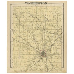
Antique Map of Eaton 'Ohio' by Titus, 1871
About the Item
Antique map titled 'Eaton'. Original antique map of Eaton, Ohio. This map originates from 'Atlas of Preble County Ohio' by C.O. Titus. Published 1871.
- Dimensions:Height: 24.02 in (61 cm)Width: 14.97 in (38 cm)Depth: 0.02 in (0.5 mm)
- Materials and Techniques:
- Period:
- Date of Manufacture:1871
- Condition:Original folding line. Shows some wear and foxing. General age-related toning. Please study images carefully.
- Seller Location:Langweer, NL
- Reference Number:
About the Seller
5.0
Platinum Seller
These expertly vetted sellers are 1stDibs' most experienced sellers and are rated highest by our customers.
Established in 2009
1stDibs seller since 2017
1,922 sales on 1stDibs
Typical response time: <1 hour
- ShippingRetrieving quote...Ships From: Langweer, Netherlands
- Return PolicyA return for this item may be initiated within 14 days of delivery.
More From This SellerView All
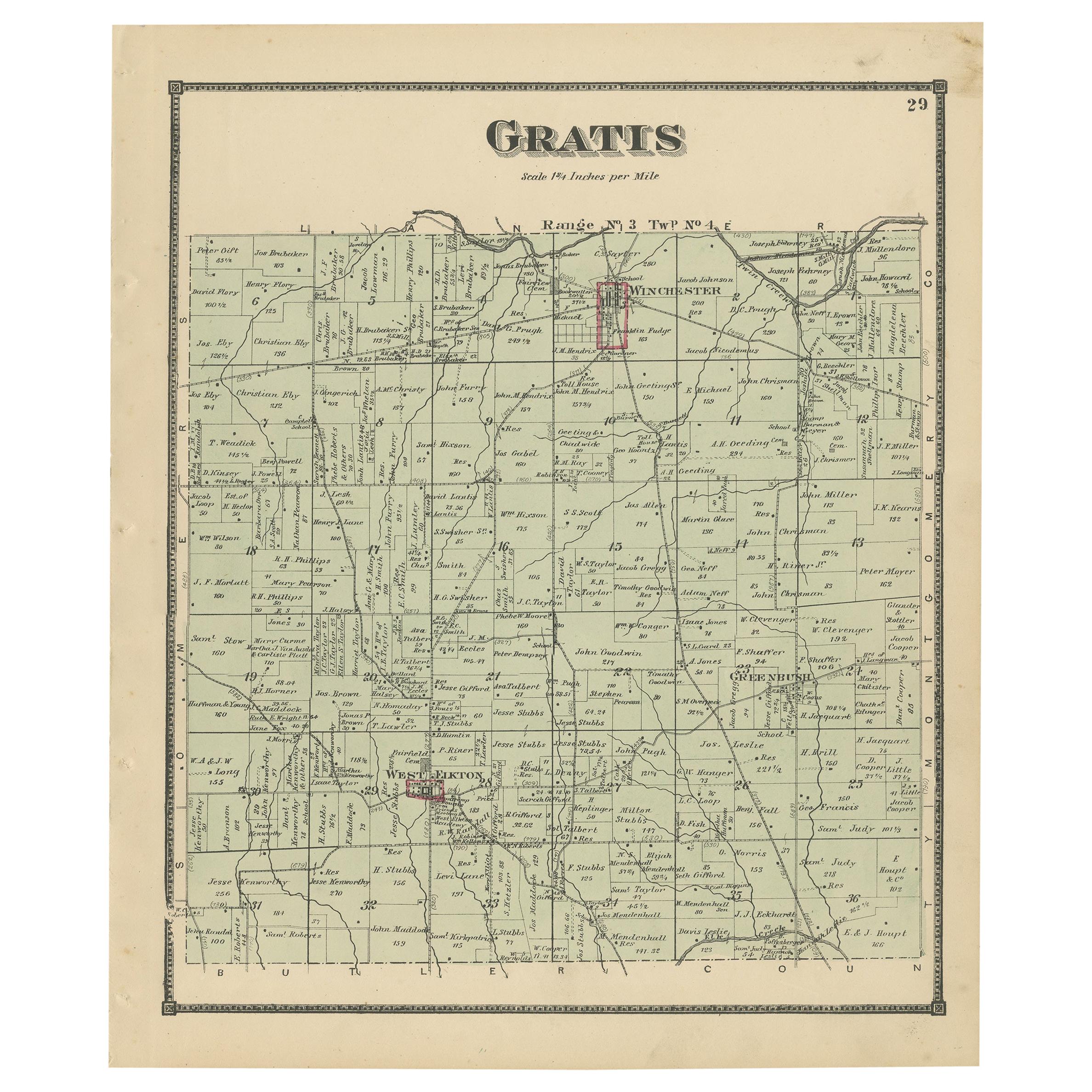
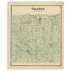
- Antique Map of Gratis 'Ohio' by Titus '1871'Located in Langweer, NLAntique map titled 'Gratis'. Original antique map of Gratis, Ohio. This map originates from 'Atlas of Preble County Ohio' by C.O. Titus. Published 1871.Category
Antique Late 19th Century Maps
MaterialsPaper
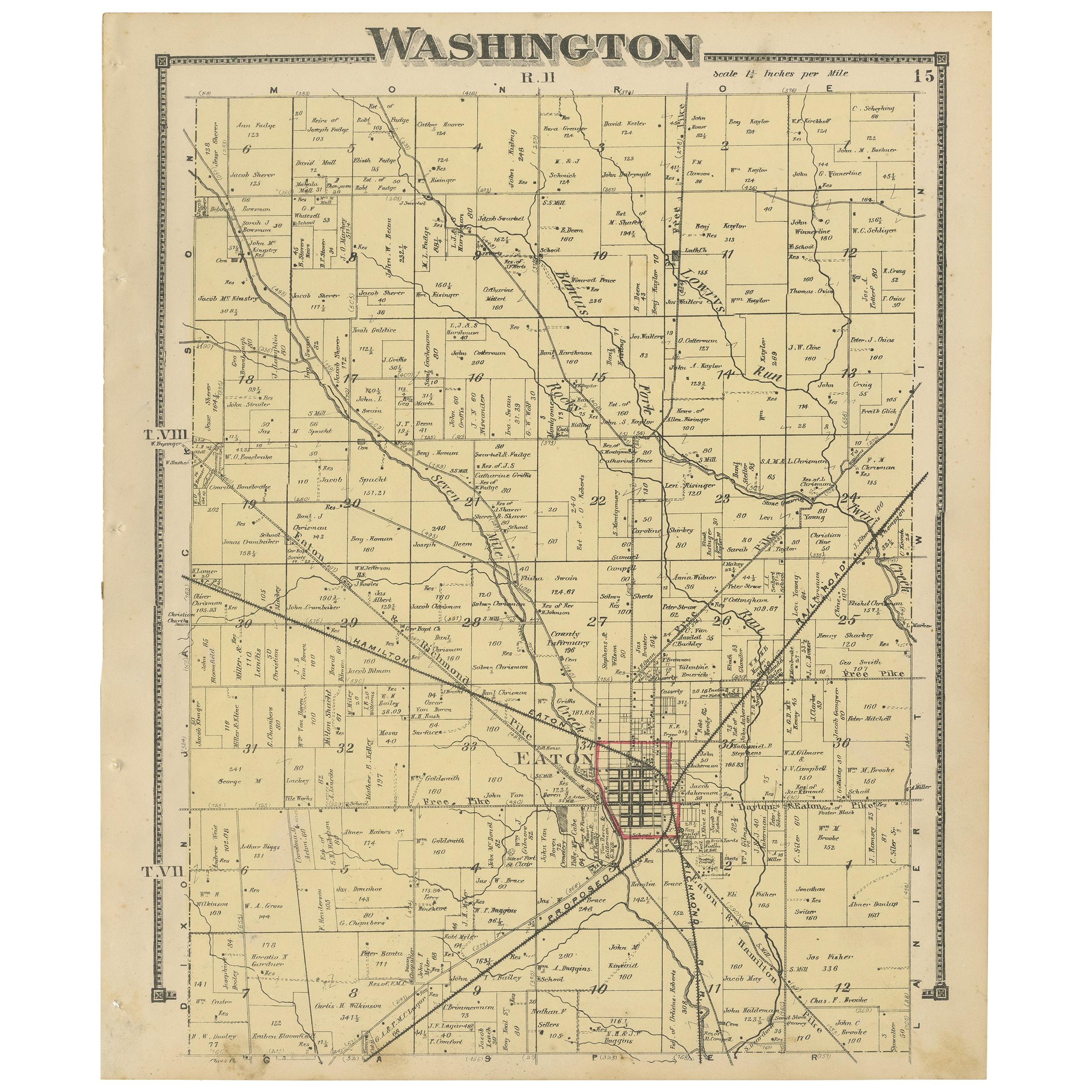
- Antique Map of Washington County 'Ohio' by Titus, 1871Located in Langweer, NLAntique map titled 'Washington'. Original antique map of Washington, Ohio. This map originates from 'Atlas of Preble County Ohio' by C.O. Titus. Published, 1871.Category
Antique Late 19th Century Maps
MaterialsPaper
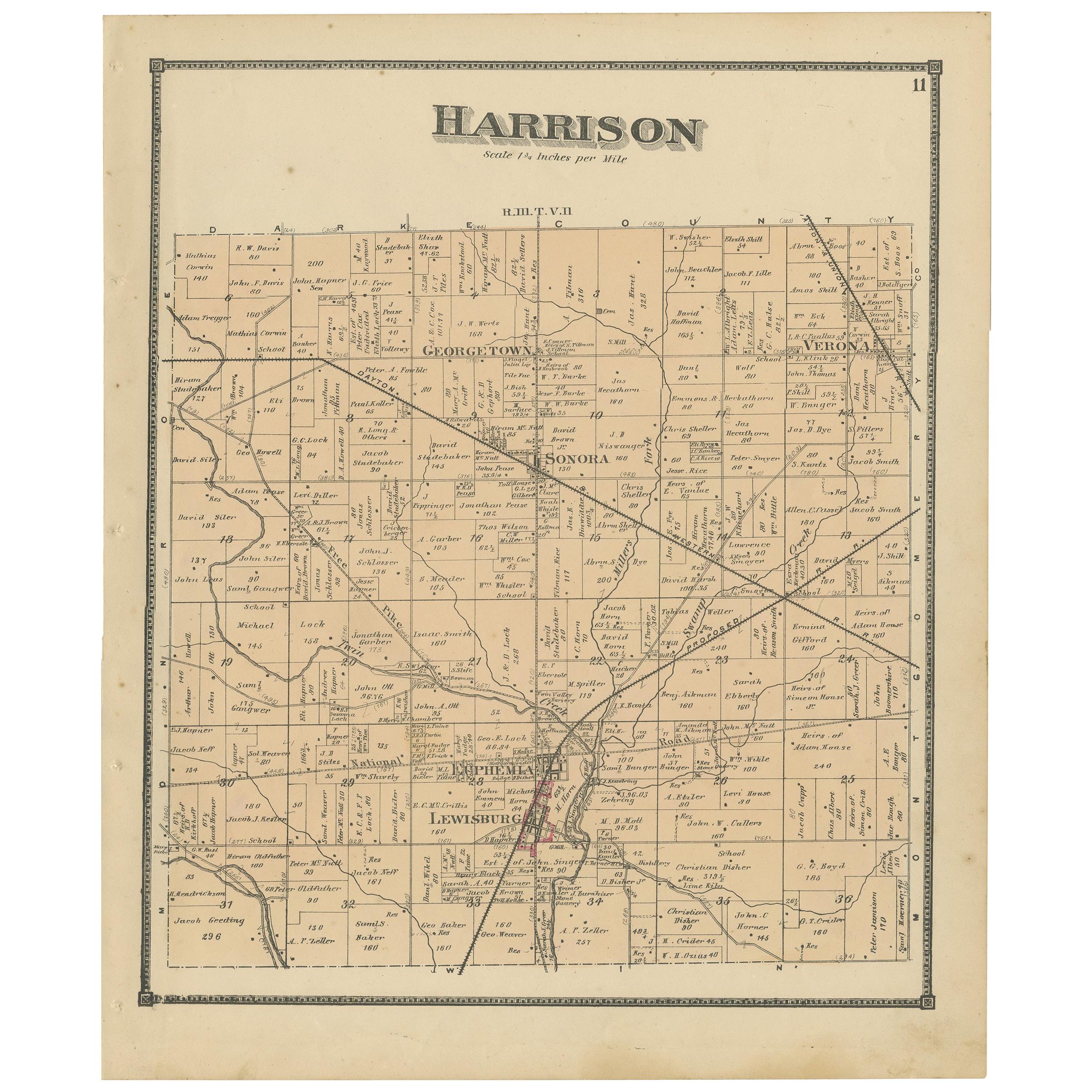
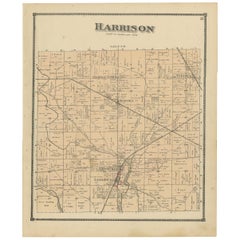
- Antique Map of Harrison County 'Ohio' by Titus, 1871Located in Langweer, NLAntique map titled 'Harrison'. Original antique map of Harrison, Ohio. This map originates from 'Atlas of Preble County Ohio' by C.O. Titus. Published, 1871.Category
Antique Late 19th Century Maps
MaterialsPaper
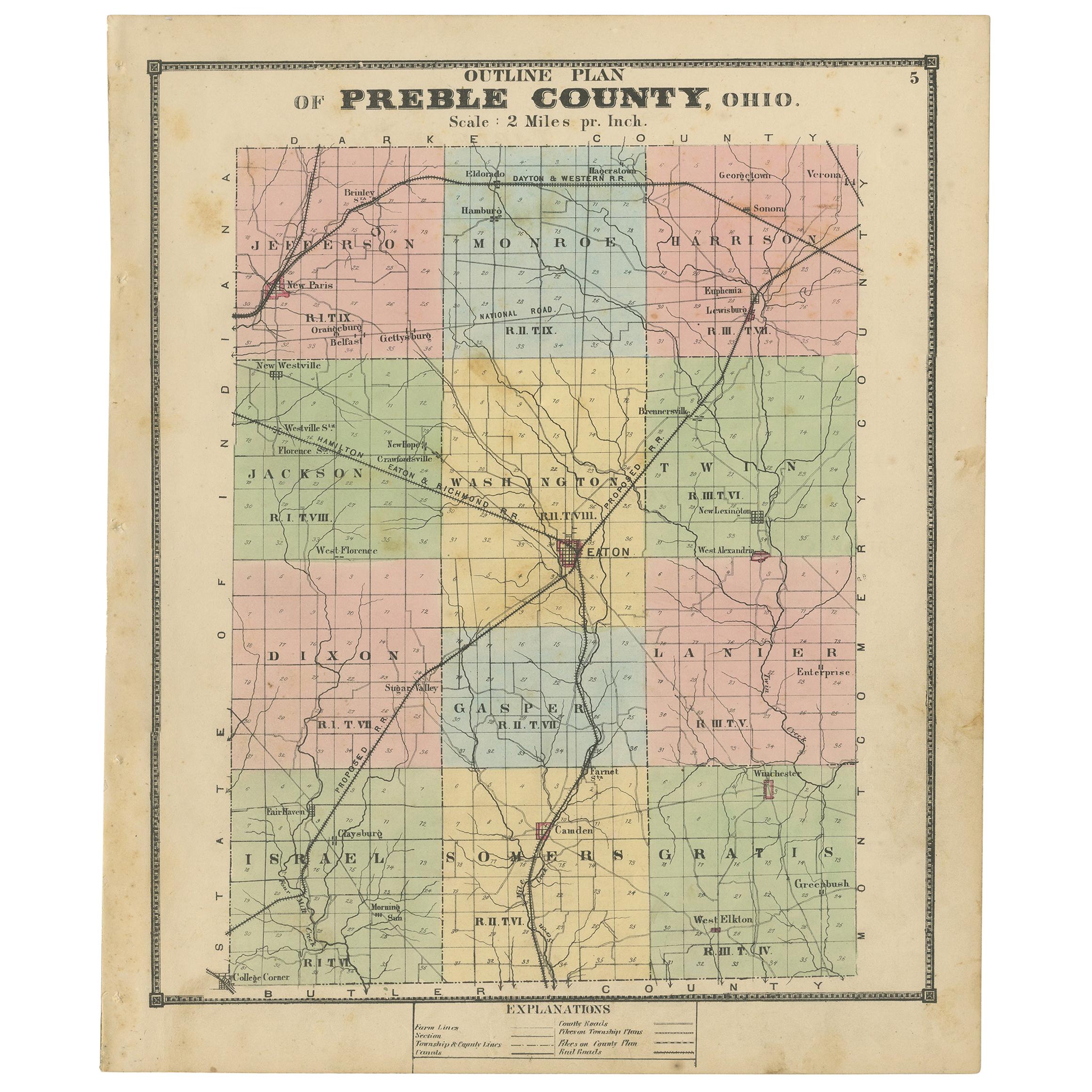
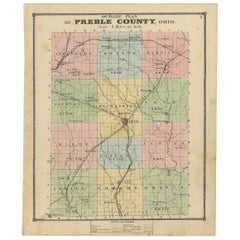
- Antique Map of Preble County 'Ohio' by Titus, 1871Located in Langweer, NLAntique map titled 'Outline Plan of Prble County, Ohio'. Original antique map of Preble County, Ohio. This map originates from 'Atlas of Preble County Ohio' by C.O. Titus. Published ...Category
Antique Late 19th Century Maps
MaterialsPaper
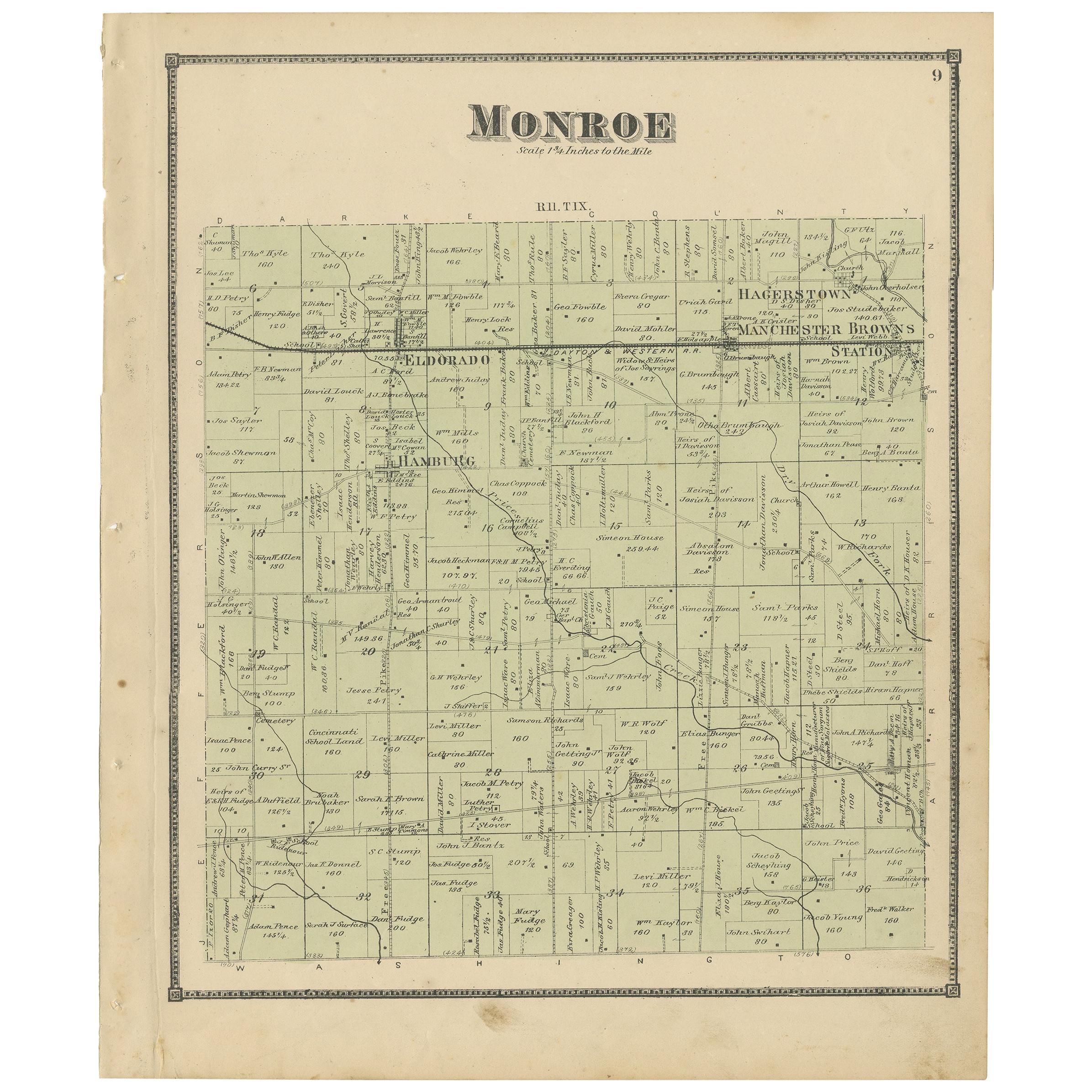
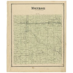
- Antique Map of Monroe County 'Ohio' by Titus '1871'Located in Langweer, NLAntique map titled 'Monroe'. Original antique map of Monroe, Ohio. This map originates from 'Atlas of Preble County Ohio' by C.O. Titus. Published 1871.Category
Antique Late 19th Century Maps
MaterialsPaper
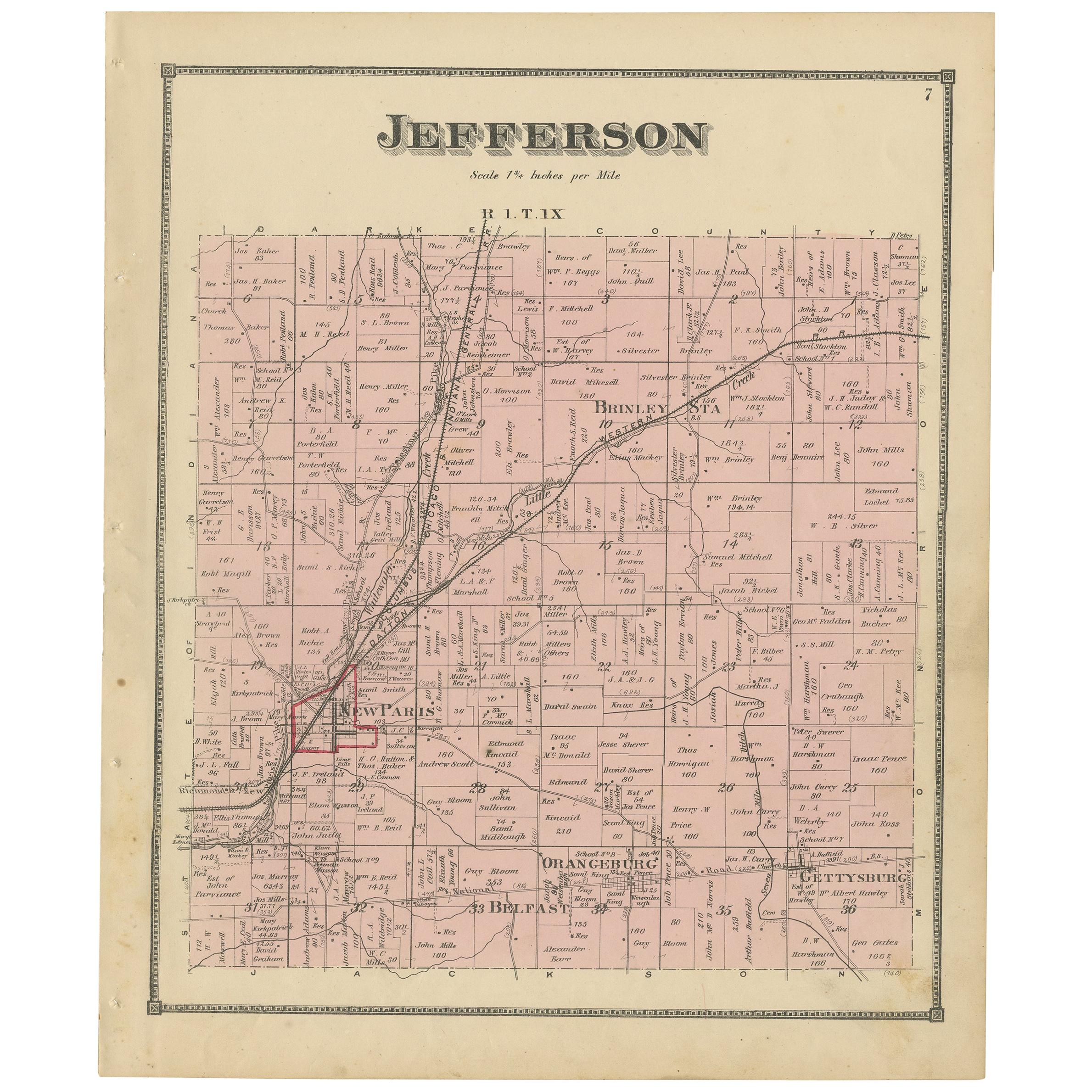
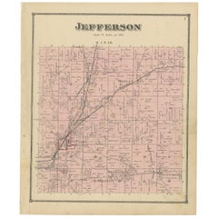
- Antique Map of Jefferson County 'Ohio' by Titus, 1871Located in Langweer, NLAntique map titled 'Jefferson'. Original antique map of Jefferson, Ohio. This map originates from 'Atlas of Preble County Ohio' by C.O. Titus. Published 1871.Category
Antique Late 19th Century Maps
MaterialsPaper
You May Also Like
- Antique Map of Italy by Andriveau-Goujon, 1843By Andriveau-GoujonLocated in New York, NYAntique Map of Italy by Andriveau-Goujon, 1843. Map of Italy in two parts by Andriveau-Goujon for the Library of Prince Carini at Palazzo Carini i...Category
Antique 1840s French Maps
MaterialsLinen, Paper
- Antique Map of Principality of MonacoBy Antonio Vallardi EditoreLocated in Alessandria, PiemonteST/619 - "Old Geographical Atlas of Italy - Topographic map of ex-Principality of Monaco" - ediz Vallardi - Milano - A somewhat special edition ---Category
Antique Late 19th Century Italian Other Prints
MaterialsPaper
- Original Antique Map of Russia By Arrowsmith. 1820Located in St Annes, LancashireGreat map of Russia Drawn under the direction of Arrowsmith Copper-plate engraving Published by Longman, Hurst, Rees, Orme and Brown, 1820 Unframed.Category
Antique 1820s English Maps
MaterialsPaper
- Original Antique Map of Sweden, Engraved by Barlow, 1806Located in St Annes, LancashireGreat map of Sweden Copper-plate engraving by Barlow Published by Brightly & Kinnersly, Bungay, Suffolk. 1806 Unframed.Category
Antique Early 1800s English Maps
MaterialsPaper
- Original Antique Map of Belgium by Tallis, Circa 1850Located in St Annes, LancashireGreat map of Belgium Steel engraving Many lovely vignettes Published by London Printing & Publishing Co. ( Formerly Tallis ), C.1850 Origin...Category
Antique 1850s English Maps
MaterialsPaper
- Original Antique Map of China by Thomas Clerk, 1817Located in St Annes, LancashireGreat map of China Copper-plate engraving Drawn and engraved by Thomas Clerk, Edinburgh. Published by Mackenzie And Dent, 1817 Unframed.Category
Antique 1810s English Maps
MaterialsPaper


