Antique Chicago Maps
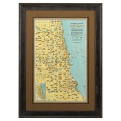
Pictorial Map of Chicago, circa 1926
Located in Colorado Springs, CO
This is a colorful folding pocket map of the city of Chicago, published by The Clason Map Co
Category
1920s American Antique Chicago Maps
Materials
Paper
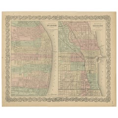
Antique Map of St. Louis and Chicago
Located in Langweer, NL
Antique map titled 'The City of St. Louis Missouri - The City of Chicago Illinois'. Dual map on
Category
Mid-19th Century Antique Chicago Maps
Materials
Paper
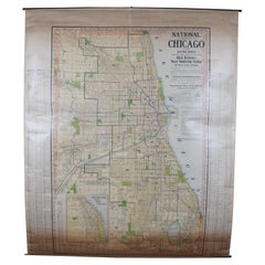
Antique Chicago Illinois National Map Commercial Rollup Classroom Census Map 47"
Located in Dayton, OH
of Illinois, Edition 1073. Verso shows the National Map of Chicago and Suburbs - Official Ward
Category
Early 20th Century North American Antique Chicago Maps
Materials
Paper
H 47 in W 41 in D 0.05 in
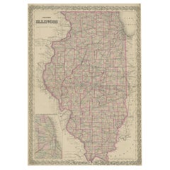
Colton's Map of Illinois, with an Inset of Chicago
Located in Langweer, NL
States. With an inset map of of Cook County & Vicinity of Chicago. Published 1867.
Joseph Hutchins
Category
Mid-19th Century Antique Chicago Maps
Materials
Paper
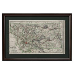
"Clason's Guide Map of Montana" by The Clason Map Company, Circa 1920s
Located in Colorado Springs, CO
Presented is “Clason's Guide Map of Montana,” published in the early 1920s by the Clason Map
Category
1920s American Art Deco Antique Chicago Maps
Materials
Paper
H 23.13 in W 33.88 in D 1.5 in
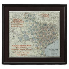
1908 "Map of Texas" by The Kenyon Company
Located in Colorado Springs, CO
Presented is an antique map of the state of Texas, printed as a pocket map in 1908 by The Kenyon
Category
Early 1900s American Antique Chicago Maps
Materials
Paper
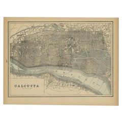
Rare Antique Map of Calcutta 'Kolkata' in India, 1893
Located in Langweer, NL
Chicago, and maps of every state and territory of the United States and Canada, and general maps of the
Category
19th Century Antique Chicago Maps
Materials
Paper
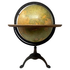
Antique American "Rand Menally Co." Chicago Table-Top Globe on Stand, Circa 1900
Located in New Orleans, LA
Antique American "Rand Menally Co.," Chicago table-top globe on stand with map made By "G.W. Bacon
Category
Early 20th Century American Antique Chicago Maps
Materials
Metal
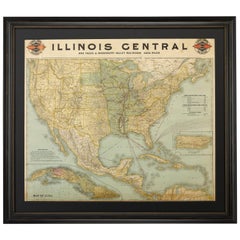
1899 Poole Brothers Antique Railroad Map of the Illinois Central Railroad
Located in Colorado Springs, CO
This is an 1899 railroad map of the Illinois Central and Yazoo and Mississippi Valley Railroads
Category
1890s American Antique Chicago Maps
Materials
Paper
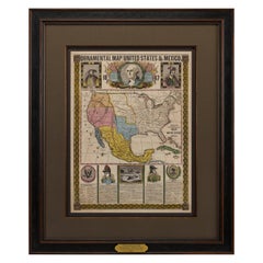
1847 Ornamental Map of the United States & Mexico by H. Phelps
Located in Colorado Springs, CO
Offered is an original 1847 ornamental map of the U.S. entitled "Ornamental Map of the United
Category
1840s American Antique Chicago Maps
Materials
Paper
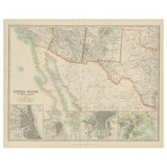
Antique Map of the United States of North America by Johnston '1909'
Located in Langweer, NL
America ( South West Sheet ). With inset maps of Chicago, San Francisco, Philadelphia and Boston. This map
Category
Early 20th Century Antique Chicago Maps
Materials
Paper
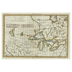
Old Map of the Great Lakes and Upper Mississippi Valley, Northern America, c1780
Located in Langweer, NL
many others. Chicago (Chicagou) and Detroit both appear as forts. The Great Lakes are mapped with a
Category
1780s Antique Chicago Maps
Materials
Paper
H 10.32 in W 14.85 in D 0 in
Antique Rand McNally & Company Schoolmap. Ancient Oriental Empires. Historical
By Rand McNally & Co.
Located in ROTTERDAM, ZH
This is a real unique map made by the famous Rand McNally Company. This rare schoolmap is probably
Category
1920s American American Classical Antique Chicago Maps
Materials
Fabric, Paper
H 43.31 in W 64.18 in D 1.19 in
Early 20th Century American Library Globe
Located in Norwell, MA
Fine library globe with makers logo from Atlas School Supply Co., Chicago. Hardwood base with rich
Category
1920s North American Antique Chicago Maps
Materials
Wood
'Map of Milwaukee' color lithograph published by George F. Cram of Chicago
Located in Milwaukee, WI
This is an original color lithograph map of the City of Milwaukee, published in 1895 by the Chicago
Category
1890s Other Art Style Antique Chicago Maps
Materials
Lithograph
Chicago - Lithograph on Paper from "Brockhaus Encyclopedia - 1905
Located in Roma, IT
a toponomastic map of the Chicago city, a historical piece to collect!
In good conditions, except
Category
Early 1900s Modern Antique Chicago Maps
Materials
Lithograph
H 12.13 in W 9.85 in D 0.04 in
Hardesty, Sectional & Township Map of Ohio, Very Large
Located in Norwich, GB
sections. Colour printed in part.
Chicago, 1880.
Scale: 1:633,600
Fine early large scale map which
Category
1880s American Antique Chicago Maps
Materials
Paper
Rare French Bronze Sculpture “Last Days of Napoleon” after Vincenzo Vela
By Vincenzo Vela 1
Located in Shippensburg, PA
chair his left nervously clutched rests on a map of Europe of 1814 spread on his lap, that Europe whose
Category
19th Century French Romantic Antique Chicago Maps
Materials
Bronze
H 11 in W 10.18 in D 6.25 in
La Port De Cannes, 1930. Vieux Port, French Riviera. Côte d'Azur. Paul Delvaux.
By Paul Delvaux
Located in Sutton Poyntz, Dorset
Map of Belgium for the 1958 Brussels World’s Fair, which is visible today in the archives of the Royal
Category
Early 20th Century Romantic Antique Chicago Maps
Materials
Paper, Watercolor
H 23.82 in W 33.27 in D 0.79 in
Ecce Homo Plate X
By Werner Drewes
Located in Fairlawn, OH
painting at Columbia and held two other positions: director of the WPA/FAP Graphic Arts Project and map
Category
1920s Bauhaus Antique Chicago Maps
Materials
Woodcut
Ecce Homo VII
By Werner Drewes
Located in Fairlawn, OH
painting at Columbia and held two other positions: director of the WPA/FAP Graphic Arts Project and map
Category
1920s Expressionist Antique Chicago Maps
Materials
Woodcut
People Also Browsed
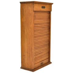
Antique American Oak Poole Bros Railway Ticket Roll Top Tambour Cabinet Chicago
Located in Portland, OR
Antique American oak roll/tambour top Railway ticket cabinet, circa 1920, by Poole Bros., of Chicago.
The cabinet having a locking tabour roll, that runs free and smooth, enclosed ar...
Category
Early 20th Century American American Craftsman Antique Chicago Maps
Materials
Oak
H 32.5 in W 16.75 in D 8.5 in
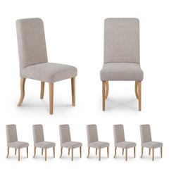
Set of 6 Modern Chicago Dining Chairs, Oak Handmade in Portugal by Greenapple
By Greenapple
Located in Lisboa, PT
Modern set of 6 Chicago Dining Chairs, Contemporary Collection, Handcrafted in Portugal - Europe by Greenapple.
Wooden chairs in American Oak upholstered in grey cotton bouclé fabri...
Category
21st Century and Contemporary Portuguese Modern Antique Chicago Maps
Materials
Oak, Cotton
H 39.38 in W 18.51 in D 19.69 in
Sertão Side Table
By Gabriela Campos, Estúdio Mais Alma
Located in Rio De Janeiro, RJ
Good Design Award Furniture 2022
A' Design Award Bronze - Furniture 2023
This piece is a tribute of the work Abaporu (1928), by Tarsila do Amaral, who played a key role in the emer...
Category
21st Century and Contemporary Brazilian Antique Chicago Maps
Materials
Wood
Restored Rattan & Wicker Swivel Bar Stool w/ Iron Base, Seng of Chicago
Located in Van Nuys, CA
Rattan and wicker bar stool with swivel iron bases by Seng of Chicago. This chair features a wicker seat and back and rests in a rattan frame mounted to an iron swivel base. This de...
Category
1950s Antique Chicago Maps
Materials
Rattan
Pair of Antique Koch’s Chicago Porcelain Adjustable Reclining Barber Chairs
Located in New Orleans, LA
Pair Of Antique Kochs, Chicago Porcelain reclining Adjustable Barber Chairs
Single pedestal swivel barbers chair on circular chrome and white enamel base with pivoting footrest, whit...
Category
1910s American Machine Age Antique Chicago Maps
Materials
Steel
H 46 in W 25.25 in D 45 in
Jim Rose Legacy Collection - One-Drawer Plank Top Side Table, Steel Furniture
By Jim Rose
Located in Chicago, IL
Jim Rose - Legacy Collection
One-drawer plank top table
found steel with natural rust patina
Measures: 27.50 H x 31.50 W x 27.50 D in
69.85 H x 80.01 W x 69.85 D cm
JR0229
Jim Rose
...
Category
2010s American Mid-Century Modern Antique Chicago Maps
Materials
Steel
H 27.5 in W 31.5 in D 27.5 in
The Loop I (the artist's memories of days at Chicago's Art Institute)
By Richard Gilbert
Located in New Orleans, LA
The Loop I was created in a small edition of 15. The Loop is a vibrant area featuring eclectic eateries, shops, theaters and parks. Comprised mostly of high-rises, it’s also home to ...
Category
1990s Modern Antique Chicago Maps
Materials
Etching
"Garage, " Mixed-Media Sculpture, 2019
Located in Chicago, IL
Entitled “Garage,” this work by Chicago artist Patrick Fitzgerald is one of a series of “track paintings” that materialize the imagined tracks navigated by his miniature soap-box car...
Category
21st Century and Contemporary Outsider Art Antique Chicago Maps
Materials
Mixed Media, Board, Acrylic, Color Pencil, Graphite
Asian American George Suyeoka Studio Prototype Chair in the Style of Nakashima
By George Nakashima
Located in Cincinnati, OH
A studio crafted oiled black American walnut sculptural chair in the manner of George Nakashima designed and made by Japanese American George Suyeoka, furniture builder, artist , wri...
Category
Mid-20th Century American American Craftsman Antique Chicago Maps
Materials
Wood, Walnut
H 28 in W 19.5 in D 22.5 in
Sailor's Woolie of the American Protected Cruiser "USS Chicago", circa 1885
Located in Nantucket, MA
Antique Sailor's Woolie of the American Protected Cruiser "USS Chicago", circa 1885, a sailor's hand crafted folk art woolwork picture of a bark-rigged auxiliary steam sailor with in...
Category
1880s American Folk Art Antique Chicago Maps
Materials
Wool
H 21 in W 19.38 in D 1.25 in
John Himmelfarb Block Print
Located in Chicago, IL
This is a wonderful original 1 of 5 block prints of Chicago artist John Himmelfarb depicting his many small characters in his unique style
This was done 2001
Category
Early 2000s North American Antique Chicago Maps
Materials
Paper
David N. Ebner, American Studio Craft Artist, "Brookhaven Chair"
By David N. Ebner
Located in Bellport, NY
"The Brookhaven Chair" by American studio Craft artist, David N. Ebner, appears to dance, the legs are so graceful, yet very strong.
Pigmented maplewood. Other woods are available. ...
Category
21st Century and Contemporary American American Craftsman Antique Chicago Maps
Materials
Maple
Swivel Barrel Chair by American Studio Craft Artist, David N. Ebner
By David N. Ebner
Located in Bellport, NY
The Swivel Barrel Chair from American Studio Craft Artist David N. Ebner. Upholstered in an Italian Suede calf skin. Wenge wood frame,The swivel base is constructed of a heavy duty b...
Category
21st Century and Contemporary American American Craftsman Antique Chicago Maps
Materials
Suede, Wood
Vintage Modern Contemporary Kinetic Art Mobile Wall Sculpture by Amidei 1980s
By Amidei
Located in Troy, MI
Unique wall sculpture by Chicago artist Amidei 1987
Kinetic pendulums with alternating deep red and smoked Lucite discs that oscillate against a white abstract textured canvas
Frame...
Category
Late 20th Century American Modern Antique Chicago Maps
Materials
Metal
Miniature Rooms Book, The Thorne Rooms at the Art Institute of Chicago, 1983
By Modern History
Located in Atlanta, GA
"Miniature Rooms: The Thorne Rooms at the Art Institute of Chicago," by Kathleen Aguilar and Michael Anderson.
Generations of visitors to the Art Institute of Chicago have been fasci...
Category
1980s American Modern Antique Chicago Maps
Materials
Paper
Original Vintage Poster Suriname South America Chicago New York Miami Paramaribo
Located in London, GB
Original vintage travel poster for Suriname South America featuring a view of people in a traditional village with flags flying by a river fast flowing over rocks and people rowing i...
Category
1960s American Antique Chicago Maps
Materials
Paper
H 24.81 in W 16.54 in D 0.04 in
Recent Sales
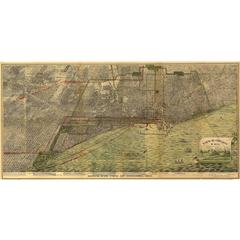
Bird's-Eye View of Chicago, 1893
By Peter Roy
Located in Houston, TX
An exceptional bird's-eye view of the Chicago area, this map is largely uncolored, though some
Category
1890s American Antique Chicago Maps
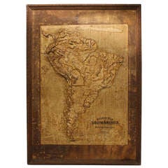
Large Late 1800's Raised Relief Map Of South America
Located in Chicago, IL
Large Late 1800's raised Relief Map of South America by Central School Supply House in Chicago
Category
19th Century American Antique Chicago Maps
Materials
Paper, Wood
1887 Engraving of Old World Buildings Framed
By George F. Cram
Located in Pataskala, OH
line on cotton rag mat.
Title/Content of map: 1887 Cram Comparison of Tall Buildings Globally
Category
1880s American Mid-Century Modern Antique Chicago Maps
Materials
Paper
1772 Map of Part of "West Florida"
Located in New York, NY
Original 1772 hand-colored copper plate engraving full title "A Map of Part of West Florida, from
Category
1770s Realist Antique Chicago Maps
Materials
Engraving
Map of Washington City District of Columbia Seat of the Federal Government
By Albert Boschke
Located in La Jolla, CA
Albert Boschke’s suppressed wall map of Washington City, District of Columbia.
One of the most
Category
1850s American American Empire Antique Chicago Maps
Materials
Paper
1909 Double-Sided Map of Texas and Oklahoma by The George F. Cram Company
Located in San Antonio, TX
The original Uncle and Nephew business, which sold maps and atlases, was named Blanchard & Cram
Category
Early 1900s Academic Antique Chicago Maps
Materials
Lithograph, Pastel
H 11.5 in W 14.5 in D 0.07 in
Painting of a Cotton Picker by William Aiken Walker
By William Aiken Walker
Located in Alexandria, VA
mainly of drawing maps and sketches of Charleston's defenses, until he was mustered out at the end of
Category
1870s American Antique Chicago Maps
Materials
Composition
1922 Map of Chicago, Rand McNally Standard Railway Map
Located in Colorado Springs, CO
Presented is an original Rand McNally railway map of the city of Chicago. The map was produced in
Category
1920s American Antique Chicago Maps
Materials
Paper
1899 Lindrooth Map of Lincoln Park, Chicago
Located in Colorado Springs, CO
This is a colorful map of Lincoln Park in Chicago by J. H. Lindrooth. Lindrooth was a civil
Category
1890s American Antique Chicago Maps
1903 Chicago Street Map by J.M. Matthews Co.
Located in Colorado Springs, CO
Presented is an original 1903 map of the city of Chicago, Illinois. The map was issued in the 1903
Category
Early 1900s American Antique Chicago Maps
Materials
Paper
1847 Guide Map of the U.S., from Phelps's Travellers Guide, Antique Map
Located in Colorado Springs, CO
Philadelphia, Boston and Baltimore, with smaller maps of Pittsburgh, Cincinnati, Chicago and St. Louis.
A
Category
1840s American Antique Chicago Maps
Materials
Paper
1846 "Traveller's Guide and Map of the United States" Antique Wall Map by Ensign
Located in Colorado Springs, CO
Ensign's Traveller's Guide and map of the United States, containing the roads, distances, Steam
Category
1840s American Antique Chicago Maps
Materials
Paper
H 42.25 in W 53 in D 3.75 in
California Survey Map in Antique Windowpane Frame, circa 1855
Located in Colorado Springs, CO
This large and remarkably detailed map delineates the progress of public surveys throughout the
Category
1850s Antique Chicago Maps
Northeastern Virginia and Vicinity of Washington Civil War Map
Located in Colorado Springs, CO
This is an attractive and highly detailed Civil War map of Northern Virginia, which shows the
Category
1890s American Antique Chicago Maps
1906 "Tourists Guide to Colorado Springs, Manitou, Colorado City..." Map
Located in Colorado Springs, CO
Presented is "Clason's Guide Map to Colorado Springs, Manitou, Colorado City and Pike's Peak Region
Category
Early 1900s American Antique Chicago Maps
Materials
Paper
1911 Rand-McNally Pocket Map and Shippers' Guide of Montana
Located in Colorado Springs, CO
& Co. The folding pocket map was published in Chicago and printed as a color lithograph. This
Category
1910s Antique Chicago Maps
Materials
Paper
1845 United States Hanging Wall Map by T & E. H. Ensign
Located in Colorado Springs, CO
"Ensign's Traveller's Guide and Map of the United States, Containing the Roads, Distances, Steam
Category
1840s American Antique Chicago Maps
Materials
Paper
New York City Map with Surrounding Burroughs in Antique Windowpane, circa 1875
Located in Colorado Springs, CO
Chicago. And the glass has been hand-painted on the surface with the map's title, date and publisher
Category
1870s Antique Chicago Maps
H 33 in W 29 in D 2 in
New York City and Surrounding Burroughs Map by Joesph Colton, circa 1865
Located in Colorado Springs, CO
building in Chicago. And the glass has been hand-painted on the surface with the map's title, date and
Category
1860s Antique Chicago Maps
Large Pacific Ocean Pull Down Classroom Map c.1943
By A.J. Nystrom & Co
Located in San Francisco, CA
large vintage pull down classroom map of the Pacific Ocean and adjacent countries on two large original
Category
Early 20th Century American Industrial Antique Chicago Maps
Materials
Wood, Paper
Antique Replogle Standard Globe, circa 1949
By Replogle Globes
Located in San Francisco, CA
by hand in his apartment in Chicago, using maps from England. His vision was to make globes a common
Category
Early 20th Century Industrial Antique Chicago Maps
Materials
Brass, Metal
History of the Expedition of Captains Lewis and Clark, 1804-1806, circa 1902
Located in Colorado Springs, CO
reprinted edition of the 1814 originals - includes all portraits and maps. Introduction by James Hosmer and
Category
Early 1900s Antique Chicago Maps
China Camp Coastal Landscape Painting, California Artist Davis Francis Schwartz
Located in San Francisco, CA
, developed a deep love of nature, and living things. He studied at the Art Institute of Chicago, and then at
Category
Early 20th Century American Antique Chicago Maps
Materials
Paint
H 13 in W 16.5 in D 1.5 in
The Bankers' Directory and List of Attorneys "Blue Book." July, 1904, Edition.
Located in New York, NY
, interleaved with numerous illustrated ads. Illustrated with 90 colour maps of the United States, Canada and
Category
Early 1900s Antique Chicago Maps
Materials
Paper
"Scotland's Gift Golf, " Signed Limited Edition Book by Charles Blair Macdonald
Located in Colorado Springs, CO
Chicago Golf Club, the National Golf Links on Long Island, and Mid-Ocean at Bermuda.
Macdonald was a
Category
1920s Antique Chicago Maps
French Antique Bronze Sculpture “Last Days of Napoleon” by Vincenzo Vela
By Vincenzo Vela 1
Located in Shippensburg, PA
the chair his left nervously clutched rests on a map of Europe of 1814 spread on his lap, that Europe
Category
19th Century French Romantic Antique Chicago Maps
Materials
Bronze
H 7.25 in W 6.75 in D 4.13 in
Memoirs of My Life by John Fremont, First Edition with Fremont Inscription, 1887
Located in Colorado Springs, CO
-1849, 1853-1854. Published in Chicago and New York: Belford, Clarke, 1887. Housed in a custom cloth
Category
1880s Antique Chicago Maps
H 11 in W 3.5 in D 8.25 in
"At the Service of Mankind" Vintage Wwi Red Cross Poster by Lawrence Wilbur
Located in Colorado Springs, CO
Chicago by Edwards & Deutsch Litho. Co.
The poster was created to promote the first Red Cross
Category
1910s Antique Chicago Maps
Materials
Paper
H 31.5 in W 21.25 in D 1.5 in
Declaration of Independence Broadside Published by Horace Thayer, circa 1860
Located in Colorado Springs, CO
border on bottom is "Published by Horace Thayer, No 18 Beekman St. New York and Rufus Blanchard, Chicago
Category
1860s Antique Chicago Maps
From Manassas to Appomattox, by James Longstreet, First Edition, Signed
Located in Colorado Springs, CO
enduring as the life of W. A. Jenkins, Chicago, Oct. 3. 1896.” Both men entered the Fifth Regiment Kansas
Category
1890s Antique Chicago Maps
Materials
Paper
H 9.38 in W 6.38 in D 2.38 in
32 STARS, COMMEMORATING MINNESOTA STATEHOOD
Located in York County, PA
1892-93 for the Minnesota Pavillon at the 1893 Chicago World’s Fair (The World Columbian Exposition
Category
19th Century American Antique Chicago Maps
32 Stars, Commemorating Minnesota Statehood American Flag
Located in York County, PA
1893 Chicago World’s Fair (The World Columbian Exposition). The zigzag stitch used to appliqué the
Category
Late 19th Century American Antique Chicago Maps
"Southern Gentleman" Unusal White Subject. Known for his African American
By William Aiken Walker
Located in San Antonio, TX
preparing maps for the Confederacy.
From 1876 to 1905, Walker regarded New Orleans as his home. There he
Category
1870s Realist Antique Chicago Maps
Materials
Oil
Oil Painting Portrait of Lord Edward Grenfell, 1st Baron St Just (1870-1941)
By Oswald Birley
Located in London, GB
Battle of the Somme). Birley focussed on making maps and models of positions to be assaulted by First
Category
Early 20th Century Victorian Antique Chicago Maps
Materials
Oil
Large 1907 Vintage Relief Map of World by Atlas School Supply of Chicago
By Atlas School Supply
Located in Lafayette, IN
Remarkably original, 1907 relief map of world by the Atlas School Supply Co. of Chicago, Illinois
Category
Early 20th Century American Industrial Antique Chicago Maps
Materials
Oak, Paper
Large 1907 Vintage Relief Map of Europe by Atlas School Supply of Chicago
By Atlas School Supply
Located in Lafayette, IN
Remarkably original, 1907 Relief map of Europe by the Atlas School Supply Co. of Chicago, Illinois
Category
Early 20th Century American Industrial Antique Chicago Maps
Materials
Oak, Paper
Large 1907 Vintage Relief Map of Africa by Atlas School Supply of Chicago
By Atlas School Supply
Located in Lafayette, IN
Remarkably original, 1907 Relief map of Africa by the Atlas School Supply Co. of Chicago, Illinois
Category
Early 20th Century American Industrial Antique Chicago Maps
Materials
Paper, Oak
Large 1907 Vintage Relief Map of Asia by Atlas School Supply of Chicago
By Atlas School Supply
Located in Lafayette, IN
Remarkably original, 1907 Relief map of Asia by the Atlas School Supply Co. of Chicago, Illinois
Category
Early 20th Century American Industrial Antique Chicago Maps
Materials
Paper, Oak
Large 1907 Vintage Relief Map of United States by Atlas School Supply of Chicago
By Atlas School Supply
Located in Lafayette, IN
Remarkably original, 1907 Relief map of the United States by the Atlas School Supply Co. of Chicago
Category
Early 20th Century American Industrial Antique Chicago Maps
Materials
Oak, Paper
H 34 in W 48 in D 2.5 in
1906 Map of Colorado by Rand McNally & Co., Antique County and Township Map
By Rand McNally & Co.
Located in Colorado Springs, CO
Rand McNally & Co. The folding pocket map was published and engraved in Chicago and is hand-colored
Category
Early 1900s American Antique Chicago Maps
Materials
Paper
Large Original Antique City Plan of Chicago, USA. 1894
By Rand McNally & Co.
Located in St Annes, Lancashire
Fabulous colorful map of Chicago
Original color
By Rand, McNally & Co.
Published, 1894
Category
1890s American Antique Chicago Maps
Materials
Paper
1 bid
No Reserve
H 26.75 in W 20.5 in D 0.07 in
Antique Art Deco Period 12-Inch Library Globe by Replogle
By Replogle Globes
Located in Philadelphia, PA
Library Globe / (a scale and a key) / Replogle Globes, Chicago, Illinois.'
Measurements:
Diameter: ca
Category
Early 20th Century American Art Deco Antique Chicago Maps
Materials
Paper
Ginn & Company's Classical Atlas by Ginn & Company, First Edition
Located in valatie, NY
Ginn & Company's Classical Atlas by Ginn & Company. Ginn & Company Publishers, Boston, NY, Chicago
Category
1880s American Antique Chicago Maps
Materials
Paper
'View of the City of Oconomowoc, Wis.' giclée after 1885 original lithograph
Located in Milwaukee, WI
maps were concentrated in the Chicago-Milwaukee area because of the proximity to the artists' center of
Category
1880s Victorian Antique Chicago Maps
Materials
Paper, Giclée, Lithograph
Expedition of Captains Lewis and Clark, Limited Number 1 of 75, circa 1904
Located in Colorado Springs, CO
. Introduction and Index by James K. Hosmer. Chicago: A. C. McClure & Co., 1904. Limited Centennial edition. Two
Category
Early 1900s American Antique Chicago Maps
Materials
Paper
H 10.25 in W 8 in D 5.63 in
Farming Rice Fields Scene Meiji Period Scroll Japan 19c Artist Suzuki Shonen
Located in Amsterdam, Noord Holland
] . 1893 (1893) Chicago World's Fair Sell the "in the snow cold crow view", "Shunkei landscape view" to. At
Category
Mid-19th Century Japanese Meiji Antique Chicago Maps
Materials
Silk
H 75.6 in W 20.6 in D 0.04 in
After Henri Matisse - Blue Nude
By (after) Henri Matisse
Located in Collonge Bellerive, Geneve, CH
times. The coming of the railway had put Bohain on the industrial map, but people still traveled
Category
1920s Abstract Impressionist Antique Chicago Maps
Materials
Lithograph
Henri Matisse - The Saint Michel Bridge - Original Etching
By Henri Matisse
Located in Collonge Bellerive, Geneve, CH
on the industrial map, but people still traveled everywhere on foot or horseback.
Matisse’s father
Category
1920s Modern Antique Chicago Maps
Materials
Etching
H 13 in W 10 in D 0.1 in
Vegetables
By (after) Henri Matisse
Located in Collonge Bellerive, Geneve, CH
on the industrial map, but people still traveled everywhere on foot or horseback.
Matisse’s father
Category
1920s Modern Antique Chicago Maps
Materials
Lithograph
A Large Complete 1890's Set of McLoughlin Bros Picture Blocks with Storage Box
By McLoughlin Brothers
Located in Fort mill, SC
outside of the map makers in Chicago or London by a company who effectively created the board game as we
Category
1890s American American Empire Antique Chicago Maps
Materials
Wood, Paper
H 3.5 in W 20.5 in D 8.5 in
1900s Relief Map of North America
Located in Chicago, IL
1900s relief map of North America by Atlas School Supply Chicago Il.
Category
Early 20th Century American Antique Chicago Maps
Materials
Oak, Paper
Schoolroom Topographic Map of Germany with Contiguous France, Italy, Switzerland
Located in Madison, WI
Classroom pulldown topographic map of German with contiguous territories of France, Italy and
Category
1920s German Antique Chicago Maps
Materials
Steel
H 72 in W 77 in D 3 in
Framed Print of World Maps
By George F. Cram
Located in Pittsburgh, PA
& Publisher in Chicago, Illinois.
Category
Early 20th Century American International Style Antique Chicago Maps
Materials
Paper
American Art Deco Medal Commemorating Century of Progress International Expo
By Emil Zettler
Located in New York, NY
Exposition Chicago
With the symbolism of the exposition on the obverse and a map of the exposition on the
Category
Early 20th Century American Art Deco Antique Chicago Maps
Materials
Bronze
19th Century Terrestrial 18 Inch Globe by Webber Costello Co
Located in Peterborough, Northamptonshire
19th century floor standing terrestrial 18 inch globe on stand by Webber Costello Co Chicago
Category
Early 20th Century Great Britain (UK) Antique Chicago Maps
Get Updated with New Arrivals
Save "Antique Chicago Maps", and we’ll notify you when there are new listings in this category.
Antique Chicago Maps For Sale on 1stDibs
At 1stDibs, there are several options of antique chicago maps available for sale. Frequently made of paper, oak and wood, all antique chicago maps available were constructed with great care. Antique chicago maps have long been popular, with older editions for sale from the 19th Century and newer versions made as recently as the 20th Century. Antique chicago maps are generally popular furniture pieces, but Industrial style is often sought at 1stDibs. Antique chicago maps have been a part of the life’s work for many furniture makers, but those produced by Peter Roy and Rand McNally & Co. are consistently popular.
How Much are Antique Chicago Maps?
Antique chicago maps can differ in price owing to various characteristics — the average selling price at 1stDibs is $787, while the lowest priced sells for $200 and the highest can go for as much as $2,900.
More Ways To Browse
Charles Morin Fine Art
John Mont
Adam Camp
Antique Map Of New Orleans
Antique Maps Of New Orleans
Miniature Bicycle
Shark Boats
Rugby Club
New Orleans Antique Maps
Antique Maps South Carolina
Where Can You Engrave A Watch
Antique Map South Carolina
Antique South Carolina Map
Antique New Orleans Maps
Yacht Master 40 Blue
Cable Car Gold Charm
Kansas Map
Antique South Carolina Maps
