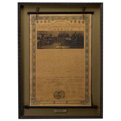
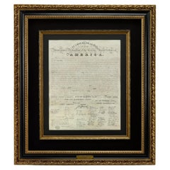
Declaration of Independence Broadside Published by Horace Thayer, circa 1860
View Similar Items

Want more images or videos?
Request additional images or videos from the seller
1 of 2
Declaration of Independence Broadside Published by Horace Thayer, circa 1860
About the Item
- Dimensions:Height: 54 in (137.16 cm)Width: 40 in (101.6 cm)Depth: 4 in (10.16 cm)
- Period:
- Date of Manufacture:1860
- Condition:Wear consistent with age and use.
- Seller Location:Colorado Springs, CO
- Reference Number:Seller: PR1611stDibs: LU90976118473
About the Seller
4.9
Platinum Seller
These expertly vetted sellers are 1stDibs' most experienced sellers and are rated highest by our customers.
Established in 2010
1stDibs seller since 2011
400 sales on 1stDibs
More From This SellerView All
- 1818 Declaration of Independence Broadside Engraved by Benjamin Owen TylerLocated in Colorado Springs, COThis is a stunning 1818 engraving of the Declaration of Independence, the first engraved broadside of our nation’s founding document. The year 1815 saw the conclusion of the United S...Category
Antique 1810s American Federal Prints
MaterialsPaper
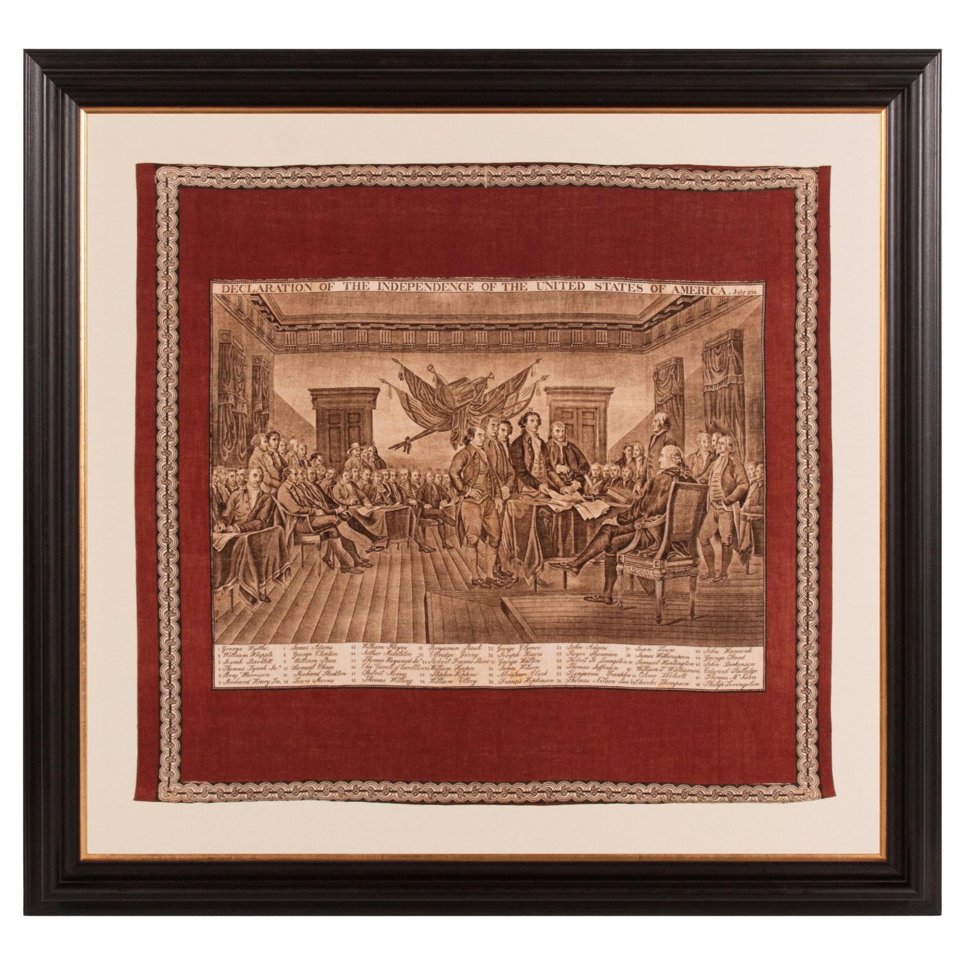
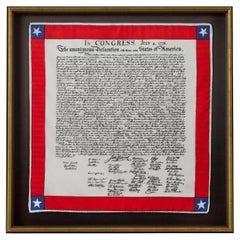
- Declaration of Independence Printed ScarfLocated in Colorado Springs, COPresented is a patriotic silk scarf, celebrating the Declaration of Independence. At center of the silk scarf design is artistic rendering of the Declaration of Independence. The famous text and signatures are printed in black ink on white silk. A border of bright red encloses the text, with a five-pointed white star set against a blue square appearing at each corner. This is a newly made silk scarf, printed to celebrate our Nation's foundational text. The United States Declaration of Independence...Category
21st Century and Contemporary American Tapestries
MaterialsSilk
- 1840 Map of the City of Washington Published by William M. MorrisonLocated in Colorado Springs, COThis map, printed in 1840, is a detailed representation of Washington, D.C. in the mid-19th century. The map shows block numbers, wards, and government buildings as well as details o...Category
Antique 1840s American Federal Maps
MaterialsPaper
- 1842 Wall Map of the United States by J. H. Young, Published by S. A. MitchellLocated in Colorado Springs, COPresented is an 1842 hanging “Map of the United States,” engraved by J. H. Young and published by Samuel Augustus Mitchell, Philadelphia. This is a beautiful example of the rare 1842...Category
Antique 1840s American Maps
MaterialsPaper
- "Taylor and His Generals, " First Edition, Published by E. H. Butler & Co., 1847Located in Colorado Springs, COTaylor and his Generals. New York: E.H. Butler & Co., 1847. First Edition. Rebound in quarter leather and marble paper boards. Housed in custom slipcase. Presented is the 1847 First Edition of Taylor and His Generals. Published by E.H. Butler & Company, the book has numerous portraits and engravings throughout. It has been beautifully rebound in quarter leather and marble paper boards. The spine has gilt embossed decoration stating that it’s a first edition. The book is housed in a custom-built archival slipcase with a photo of Taylor on the front. Written and published before Taylor ran for the Presidency, this book would have been a powerful propaganda tool for the soon-to-be 12th President of the United States. The full title page describes the work as “Taylor and His Generals; A Biography of Major-General Zachary Taylor; And Sketches of the Lives of Generals Worth, Wool, and Twiggs with a full account of the Actions of their Various Divisions in Mexico Up to the Present Time; Together with a Sketch of the Major-General Winfield Scott and an Account of his Divisions in Mexico.” Taylor fought and commanded troops in the War of 1812, Black Hawk War, and the Second of the Seminole Wars before playing a major role in the victory of the Mexican-American War. The book takes the reader through the early life of Taylor and his military career with a particular focus on his surprising victory at the Battle of Buena Vista. Generals Worth, Wool, and Twiggs that served under Taylor and Major-General Scott each get a chapter dedicated to their own history and military careers The Battle of Buena Vista took place in February of 1847 during the Mexican-American War. With only about 5,000 soldiers, Taylor repelled General Antonio Lopez de Santa Anna...Category
Antique 1840s American Books
MaterialsPaper
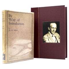
- By Way of Introduction, Signed by A.A. Milne, Circa 1929Located in Colorado Springs, COMilne, A.A., By Way of Introduction. London: Methuen & Co., Ltd., 1929. First edition, first printing, signed on title page. Original printed dust jacket with a custom, clamshell case. This is a first edition of A.A. Milne's By Way of Introduction. Milne has signed the book on the title page in blue ink. The book is presented with its original beige dust jacket. It was published out of London by Methuen & Co., Ltd., in 1929. This book features a collection of introductions written by Alan Alexander Milne (1882-1956). The collection of essays and excerpts were written for various publications and compiled by Milne. The work shows off his accessible and sometimes humorous writing style, recognizable from his children's books. There is a selection of his critical work included in the volume, as well a piece about his philosophical approach to writing children's books throughout his career, and even a few details about his Winnie the Pooh character, Christopher Robin. Milne was best known for his children's book series Winnie the Pooh. Included in the back of the book is a loose pamphlet advertising the Pooh series as "the most popular gift books...Category
Vintage 1920s American Books
MaterialsPaper


You May Also Like
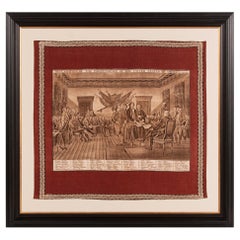
- Large Scale Printed Kerchief of the Signing of the Declaration of IndependenceLocated in York County, PARare, large scale Kerchief with a beautifully engraved image of John Trumbull’s “declaration of independence,” likely made in...Category
Antique Mid-19th Century American Political and Patriotic Memorabilia
MaterialsCotton
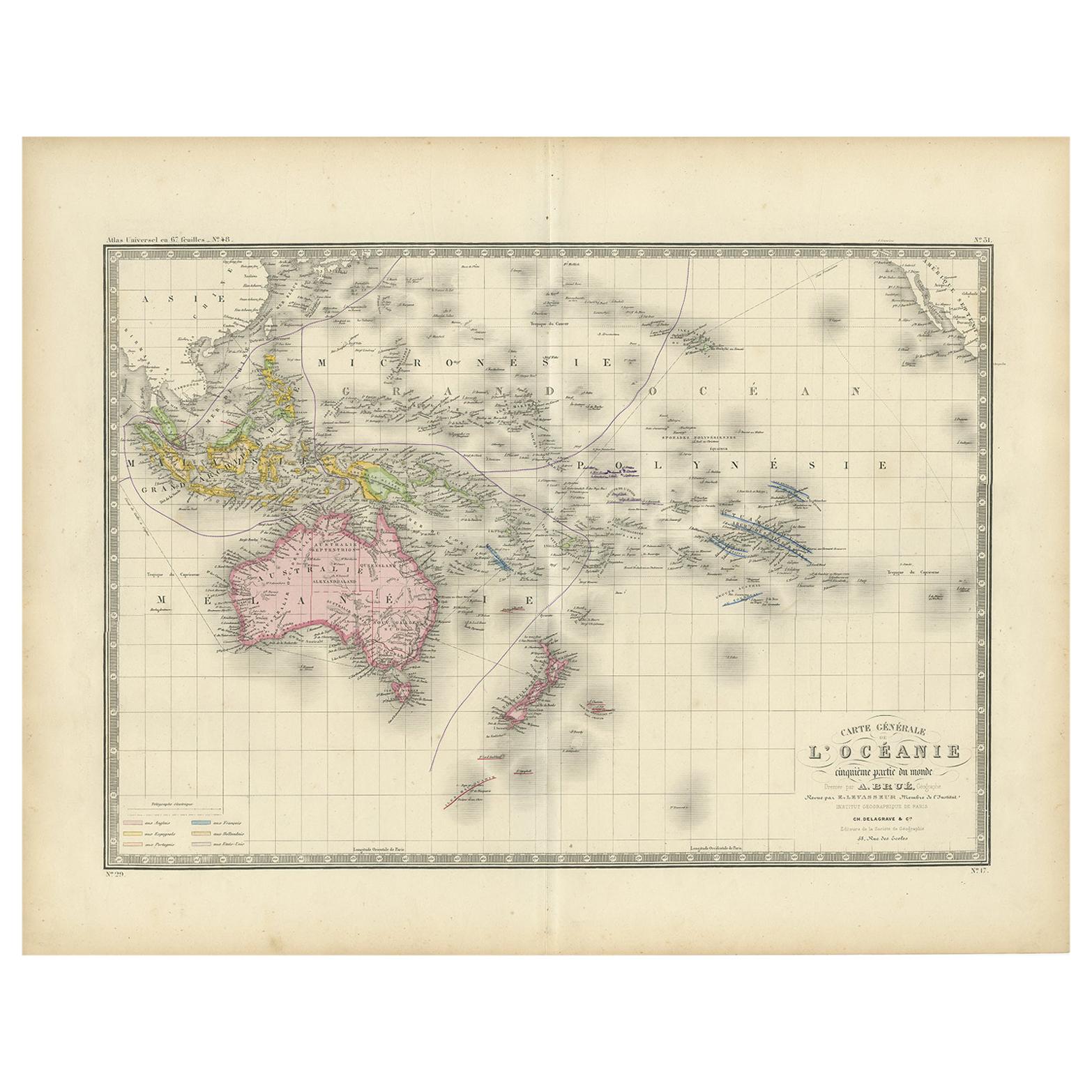
- Antique Map of Oceania by Levasseur, circa 1860Located in Langweer, NLAntique map titled 'Carte générale de l'Océanie'. Large map of Oceania including New Zealand, Australia, Polynesia, Micronesia and the East Indies. This map originates from 'Atlas Un...Category
Antique Mid-19th Century Maps
MaterialsPaper
 $218 Sale Price20% Off
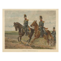
 - Antique Print of Generals of the Dutch/Belgian Army 1855-1860, Published in 1900Located in Langweer, NLAntique print, titled: 'Generaal. Generale Staf 1855-1860.' - This plate shows Generals of the Dutch/Belgian army 1855-1860. From ´De uniformen van de Nederlansche Zee- en Landmacht hier te lande en in de kolonien, naar aquarellen of teekeningen van J. Hoynck van Papendrecht, W.C. Staring en J.P. de Veer´. Published in The Netherlands 1900. Artists and Engravers: Made by 'P. W. van de Weyer' after 'J. Hoynck van Papendrecht'. Jan Hoynck van Papendrecht (1858 - 1933) was a Dutch painter and illustrator, famed for his military art. In 1900, the famous book The Uniforms of the Dutch Navy...Category
Antique Early 1900s Prints
MaterialsPaper
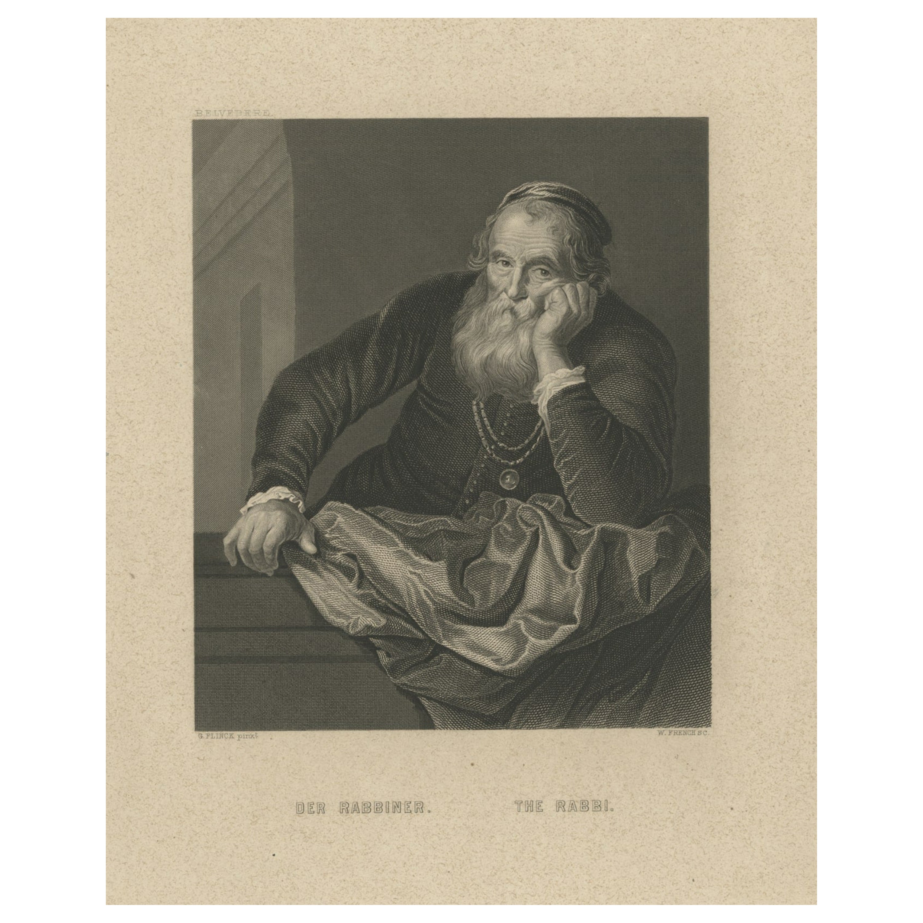
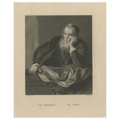
- Original Antique Print of a Rabbi, Published circa 1850Located in Langweer, NLDescription: Antique print titled 'Der Rabbiner - The Rabbi'. Original antique print of a rabbi. Published circa 1850. Artists and Engravers: Engraved by W. French after a painti...Category
Antique Mid-19th Century Prints
MaterialsPaper
 $139 Sale Price20% Off
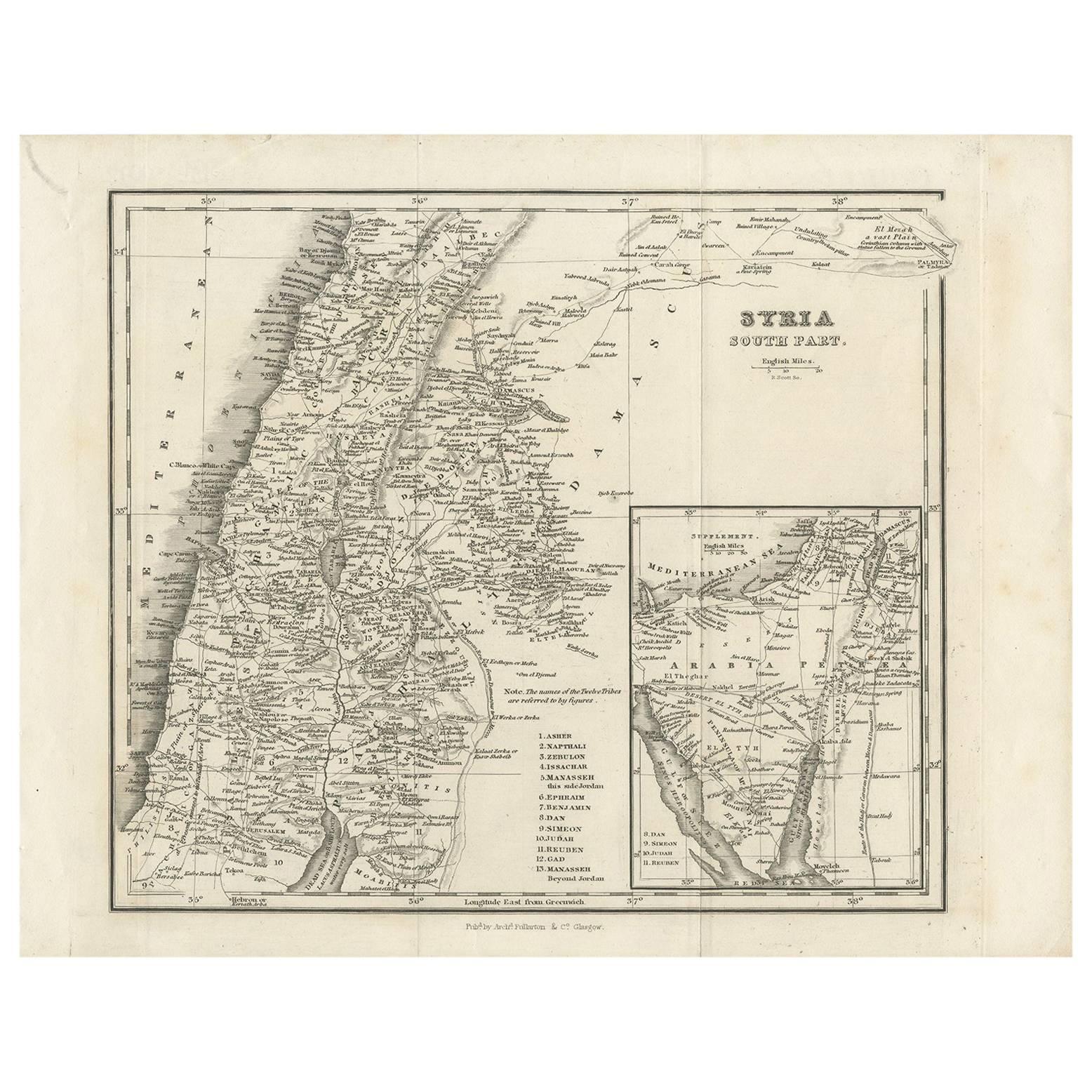
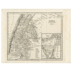
 - Antique Map of Southern Syria by Fullarton & Co, circa 1860Located in Langweer, NLAntique map titled 'Syria south part'. Published by Fullarton & Co, Glasgow, circa 1860. - **Title**: Syria South Part - **Publisher**: Fullarton & Co, Glasgow - **Date of Publicati...Category
Antique Mid-19th Century Maps
MaterialsPaper
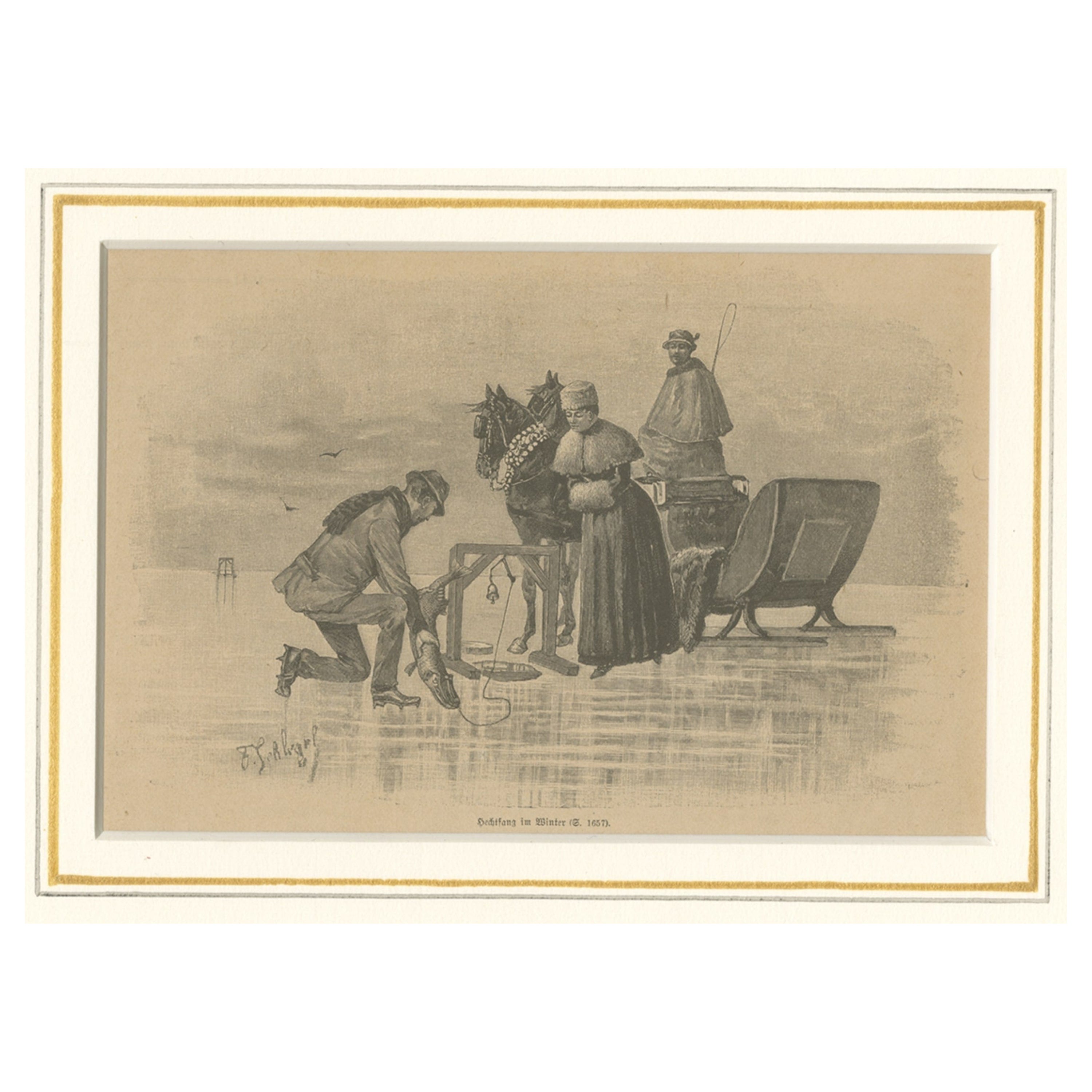
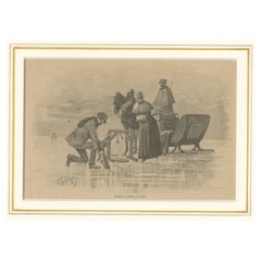
- Original Antique Print of Ice Fishing, Published, circa 1900Located in Langweer, NLAntique print titled 'Hechtfang im Winter'. Original antique print of ice fishing. Published circa 1900. Artists and Engravers: Anonymous. Condition:...Category
Antique Early 1900s Prints
MaterialsPaper
Recently Viewed
View AllMore Ways To Browse
Horace Brown
Travel Memorabilia
United States Declaration Of Independence
Antique New York City Maps
Antique Maps New York City
Antique Map New York City
Historic Memorabilia
Antique Map Of New York City
Antique Maps Of New York City
Wall Hanging Display Case
Pocket Map
4th Order
New York City Map Lithograph
George Washington Memorabilia
Fulton Sign
J Owens
Historic Antique Maps
Antique Broadside