Pocket Map
2
to
9
85
70
66
39
37
33
26
22
19
15
13
11
9
9
8
7
6
6
6
6
5
5
4
4
4
4
4
3
3
3
3
3
3
3
2
2
2
2
2
2
2
2
1
1
1
1
1
7
2
2
2
2
Sort By
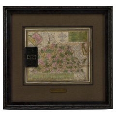
1837 Mitchell's "Tourist's Pocket Map of the State of Virginia" by J.H. Young
Located in Colorado Springs, CO
This is J. H. Young's pocket map of the Virginia, which shows county development current to 1835
Category
Antique 1830s American Maps
Materials
Paper
H 24.25 in W 25.75 in D 1.75 in
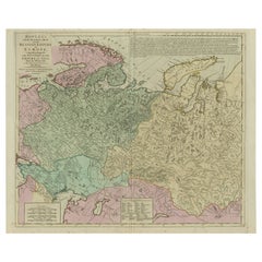
Antique Map of the Russian Empire in Europe, ca.1780
Located in Langweer, NL
Description: Antique map titled 'Bowles's New Pocket Map of the Russian Empire in Europe
Category
Antique 1780s Maps
Materials
Paper
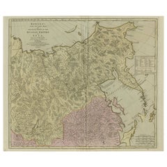
Large and Detailed Map of the Russian Empire in Asia, ca.1780
Located in Langweer, NL
Description: Antique map titled 'Bowles's New Pocket Map of the East Part of the Russian Empire in
Category
Antique 1780s Maps
Materials
Paper
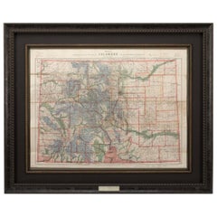
1907 Map of Colorado, Antique Topographical Map, by Louis Nell
Located in Colorado Springs, CO
This highly detailed pocket map is a topographical map of the state of Colorado by Louis Nell from
Category
Antique Early 1900s American Maps
Materials
Paper
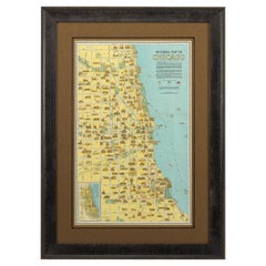
Pictorial Map of Chicago, circa 1926
Located in Colorado Springs, CO
This is a colorful folding pocket map of the city of Chicago, published by The Clason Map Co
Category
Vintage 1920s American Maps
Materials
Paper
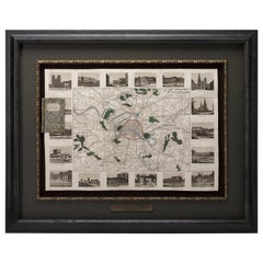
Antique Map of Paris, "Carte Routiere des Environs de Paris" 1841
Located in Colorado Springs, CO
surrounding area in a folding pocket map. Organized and detailed for travelers, this map shows rivers, towns
Category
Antique 1840s French Maps
Materials
Paper
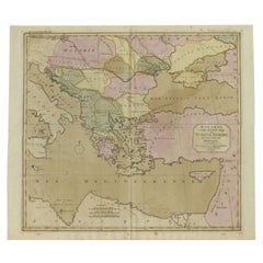
Antique Map of Turkey in Europe, c.1780
Located in Langweer, NL
Antique map titled 'Bowles's new pocket map of Turky in Europe divided into its Provinces'. Large
Category
Antique 18th Century Maps
Materials
Paper
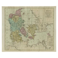
Large Antique Map of Denmark by Bowles, c.1780
By Thomas
Located in Langweer, NL
Antique map titled 'Bowles's new pocket map of the Kingdom of Denmark (..)' Large map of Denmark
Category
Antique 18th Century Maps
Materials
Paper
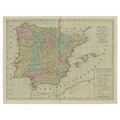
Antique Map of Spain and Portugal by Bowles, c.1780
Located in Langweer, NL
"Antique map titled 'Bowles's New Pocket Map of the Kingdom of Spain and Portugal according to De
Category
Antique 18th Century Maps
Materials
Paper
Antique Map of the Southern Netherlands by Bowles, c.1780
Located in Langweer, NL
Antique map titled ‘Bowles's New Pocket Map of the ten Catholick Provinces of the Lower Countries
Category
Antique 18th Century Maps
Materials
Paper
18th Century Portugal Original Antique Engraving by Bowles
Located in Langweer, NL
Antique map titled 'Bowles's New Pocket Map of Portugal, Laid Down According to the Sr. Nolin
Category
Antique 18th Century Maps
Materials
Paper
Antique Map of Germany from a 17th Century Pocket Atlas, 1685
Located in Langweer, NL
Antique map titled 'Nova Totius Germaniae descriptio.' Miniature map of Germany, from the pocket
Category
Antique 17th Century Maps
Materials
Paper
1908 "Map of Texas" by The Kenyon Company
Located in Colorado Springs, CO
Presented is an antique map of the state of Texas, printed as a pocket map in 1908 by The Kenyon
Category
Antique Early 1900s American Maps
Materials
Paper
Charming Decorative Miniature Map of Russia, from an Old Pocket Atlas, 1685
Located in Langweer, NL
Antique map titled 'Russia cum Consinijs'.'
Charming miniature map of Russia, from the pocket
Category
Antique 1680s Maps
Materials
Paper
H 5.12 in W 5.4 in D 0 in
Antique Map of Swabia, 1685
Located in Langweer, NL
Antique map titled 'Sueviae quae cis Codanum fuit finum Antiqua defcriptio.' Miniature map of
Category
Antique 17th Century Maps
Materials
Paper
Antique Map of France by Cluver, 1685
Located in Langweer, NL
Antique map titled 'Galliae Veteris Descriptio.' Charming miniature map of France from the pocket
Category
Antique 17th Century Maps
Materials
Paper
Antique Map of Switzerland by Cluver, 1685
Located in Langweer, NL
Antique map titled 'Helvetiae Conterminarumque Terrarii, antiqua descriptio.' Miniature map of
Category
Antique 17th Century Maps
Materials
Paper
Charming Scarce Small Antique Map of Asia, 1837
Located in Langweer, NL
Antique map titled ‘Asia‘. Scarce and charming little mid-19th century antique map of Asia
Category
Antique 19th Century Maps
Materials
Paper
Charming 18th Century Miniature Map of Greece, 1685
Located in Langweer, NL
Antique map titled 'Graeciae Descriptio.' Charming miniature map of Greece from the pocket atlas
Category
Antique 17th Century Maps
Materials
Paper
Antique Map of Northwest Italy by Cluver, 1685
Located in Langweer, NL
Antique map titled 'Ligures, Taurini, etc.' Miniature map of northwest Italy. From the pocket atlas
Category
Antique 17th Century Maps
Materials
Paper
Antique Map of Northern Italy by Cluver, 1685
Located in Langweer, NL
Antique map titled 'Histri, Carni, Veneti item Rhaetiae Pars.' Charming miniature map of northern
Category
Antique 17th Century Maps
Materials
Paper
Original Antique Miniature Map of Persia, Published, ca.1601
Located in Langweer, NL
Antique miniature map titled 'Persia'. Small map of Persia published in the Epitome, or pocket
Category
Antique Early 1600s Maps
Materials
Paper
1633 Map Entitled "Beauvaisis Comitatus Belova Cium, Ric.0002
Located in Norton, MA
following year the maps were reengraved in miniature form and issued as a pocket Atlas Minor. After the
Category
Antique 17th Century Dutch Maps
Materials
Paper
Antique Map of Pannonia and Illyria by Cluver, 1685
Located in Langweer, NL
Antique map titled 'Pannonia et Illyricum.' Charming miniature map of Pannonia and Illyria, from
Category
Antique 17th Century Maps
Materials
Paper
Road Map, John Ogilby, No 54, London, Yarmouth, Britannia
By John Ogilby
Located in BUNGAY, SUFFOLK
-sixth year, as a publisher of maps and geographical accounts.
Ogilby was born outside Dundee, in
Category
Antique 1670s English Baroque Maps
Materials
Paper
Antique Map of the Islands of Corsica and Sardinia, 1685
Located in Langweer, NL
maps on one sheet, showing the islands Corsica and Sardinia from the pocket atlas 'Introductionis in
Category
Antique 17th Century Maps
Materials
Paper
Original Copperplate Engraved Detailed Map of South Africa, ca.1680
Located in Langweer, NL
Antique map titled 'Pays et Coste des Caffres Empires de Monomotapa (..)'.
Detailed map of
Category
Antique 1680s Maps
Materials
Paper
Antique Map of Southern Germany and Switzerland by Cluver, 1685
Located in Langweer, NL
map of south Germany and Switzerland in Celtic times, From the pocket atlas 'Introductionis in
Category
Antique 17th Century Maps
Materials
Paper
Antique Map of the Low Countries and Surroundings in Europe, 1685
By Philipp Clüver
Located in Langweer, NL
Mose ac Rheni.' Miniature map of the Low Countries and part of Germany and France. From the pocket
Category
Antique 17th Century Maps
Materials
Paper
Charming Miniature Map of Thrace or Thrake in Southeast Europe, 1685
Located in Langweer, NL
Antique map titled 'Thraciae Descriptio.'
Charming miniature map of Thrace, from the pocket
Category
Antique 1680s Maps
Materials
Paper
Antique Map of North Africa showing Egypt, Mauritania and Africa Minor, 1672
Located in Langweer, NL
, showing Egypt, Mauritania and Africa Minor. This map originates from the pocket atlas 'Introductionis in
Category
Antique 17th Century Maps
Materials
Paper
H 5.63 in W 5.12 in D 0 in
Small Antique Map of England and Wales as It Was During the Heptarchy
Located in Langweer, NL
after the departure of the Romans, from 500-850 AD. It is based on Sanson's pocket atlas map and
Category
Antique Mid-18th Century Maps
Materials
Paper
Antique Miniature Map of the Maluku Islands by Van Esveldt & Holtrop 'c.1790'
Located in Langweer, NL
(Moluccas), an archipelago in eastern Indonesia. This map originates from an extremely rare pocket atlas by
Category
Antique Late 18th Century Maps
Materials
Paper
H 4.93 in W 6.3 in D 0.02 in
Map Road Strip Britannia Sheet 2 John Ogilby London Aberistwith Islip Bramyard
By John Ogilby
Located in BUNGAY, SUFFOLK
of England and Wales.
Strip map Islip to Bramyard, on a scale of approximately one inch to the mile
Category
Antique 17th Century English Baroque Maps
Materials
Paper
H 14.38 in W 19.3 in D 0.79 in
Map Road John Ogilby Britannia No 74 Ipswich to Norwich Cromer Framed
By John Ogilby
Located in BUNGAY, SUFFOLK
his sixty-sixth year, as a publisher of maps and geographical accounts.
Ogilby was born outside
Category
Antique 1670s English Baroque Maps
Materials
Paper
Road Map John Ogilby No 75 Kings Lyn Harwich, Britannia Framed Wallhanging
By John Ogilby
Located in BUNGAY, SUFFOLK
, as a publisher of maps and geographical accounts.
Ogilby was born outside Dundee, in 1600, the
Category
Antique 1670s European Baroque Maps
Materials
Paper
H 15.75 in W 19.69 in D 0.6 in
Antique Map of Gabon, Angola and the Congo Region in Africa c.1680
Located in Langweer, NL
Antique map titled 'Royaume de Congo'.
Map of Gabon, the Congo and Angola from Cape Lopez and Sao
Category
Antique 17th Century Maps
Materials
Paper
Free Shipping
H 9.65 in W 14.57 in D 0 in
Antique Map of the Congo, Gabon and Angola by N. Sanson, circa 1700
Located in Langweer, NL
Attractive map of Gabon, the Congo and Angola from Cape Lopez and Sao Tomé to approximately the
Category
Antique Early 18th Century Maps
Materials
Paper
Road Map No43 London to Kings Lynn, Royston to Downham, John Ogilby, Britannia
By John Ogilby
Located in BUNGAY, SUFFOLK
John Ogilby (British 1600-1676) Cosmographer and Geographick Printer to Charles II.
A road map
Category
Antique Late 17th Century British Charles II Maps
Materials
Paper
H 20.48 in W 24.41 in D 0.4 in
Road Map John Ogilby London St David's Britannia No 15 Abingdon Monmouth Framed
By John Ogilby
Located in BUNGAY, SUFFOLK
John Ogilby (British 1600-1676) Cosmographer and Geographick Printer to Charles II. A road map from
Category
Antique 1670s English Baroque Maps
Materials
Paper
H 20.48 in W 24.41 in D 0.6 in
Antique Map of the Region Between the Rhine and Elbe River by Cluver, 1685
Located in Langweer, NL
Antique map titled 'Populorum Germanium inter Rhenum et Albim descriptio, ut inter Caesaris aevum
Category
Antique 17th Century Maps
Materials
Paper
H 5.12 in W 5.71 in D 0 in
Road Map Britannia No 32 the Road from London to Barnstable John Ogilby Framed
By John Ogilby
Located in BUNGAY, SUFFOLK
A road map from Britannia, by John Ogilby Esq., Cosmographer and Geographick Printer to Charles II
Category
Antique Late 17th Century English Charles II Maps
Materials
Paper
H 20.48 in W 24.41 in D 0.6 in
Road Map Britannia No 15 London to St Davids John Ogilby Brown Gilt Frame
By John Ogilby
Located in BUNGAY, SUFFOLK
Lechlade, to Fairford, to Barnsley to Gloucester showing Monmouth as the destination. A road map from
Category
Antique Late 17th Century British Charles II Maps
Materials
Paper
H 22.05 in W 26.19 in D 0.6 in
Road Map Britannia No 25 London to the Lands End, John Ogilby Brown Gilded Frame
By John Ogilby
Located in BUNGAY, SUFFOLK
Senan in Cornwall. By John Ogilby His Majesties Cosmographer. A road map from Britannia, 1675/6. No 25
Category
Antique Late 17th Century British Charles II Maps
Materials
Paper
H 22.05 in W 26.19 in D 0.6 in
Road Map Britannia 1675/6 No 5 Road London to Barwick, London Stilton Grey Frame
By John Ogilby
Located in BUNGAY, SUFFOLK
John Ogilby (British 1600-1676) cosmographer and geographick printer to Charles II.
A road map from
Category
Antique Late 17th Century British Charles II Maps
Materials
Paper
H 22.84 in W 25.99 in D 0.4 in
Antique 1765 Wine Country Folding Map of France, Bordeau etc.
Located in Paonia, CO
where to dine, where to sleep, times to leave on the train, etc. . A very detailed folding pocket map
Category
1760s Other Art Style Landscape Prints
Materials
Etching
Pair of Miniature Globes Lane’s on Tripod Bases, London post 1833, ante 1858
By Lane's
Located in Milano, IT
reconstruction of the entire history of the Lane family. They were manufacturers of globes - especially pocket
Category
Antique 1840s English Early Victorian Maps
Materials
Paper, Wood
Fendi Green Map Print Synthetic Pocket Detail Bermuda Shorts L
By Fendi
Located in Dubai, Al Qouz 2
Beachy vacations call for a stylish pair of shorts like this. Stitched using high-quality fabric, this pair of shorts is styled with classic details and has a superb length. Wear it ...
Category
2010s Italian Bermuda Shorts
Antique Engraved Hand Colored Colton & Co. Pocket Book Map of South Carolina
By G.W. & C.B. Colton
Located in Charleston, SC
of pocket book: "Maps, Atlases and Guide Books by G. W. & C B. Colton & Co. " (successors to J.H
Category
Antique Late 19th Century American Prints
Materials
Paper
H 13.75 in W 16.5 in D 0.25 in
FW2001 Galliano London Map Jacket FR38
By John Galliano for Christian Dior, Christian Dior
Located in PARIS, FR
polyurethane canvas with a London map motif redrawn with graffiti, stencils... coated on the outside, high
Category
Early 2000s French Jackets
Pocket Globe, Nicholas Lane, London, post 1779
By Nicholas Lane
Located in Milano, IT
traced on the map. The pocket globe was likely created after the death of Captain Cook on February 14
Category
Antique 1780s English Other Models and Miniatures
Materials
Leather, Wood, Paper
Pocket Globe by Nathaniel Hill, London 1754
Located in Milano, IT
Nathaniel Hill
Pocket globe
London, 1754
The globe is contained in its original case, which itself
Category
Antique 1750s English George II Globes
Materials
Shagreen, Paper
A truly delightful miniature terrestrial pocket globe
By Nathaniel Mills
Located in ZWIJNDRECHT, NL
A truly delightful miniature terrestrial pocket globe in a celestial case, 3 inches / 6.8 cm. The
Category
Antique Mid-18th Century British Dutch Colonial Globes
Materials
Other
English Pocket Globe, London, Circa 1775-1798
By Herman Moll
Located in Milano, IT
Pocket globe
London, between 1775 and 1798
Re-edition of the globe of Hermann Moll (1678-1732
Category
Antique Late 18th Century English George III Globes
Materials
Shagreen, Paper
Hardesty, Sectional & Township Map of Ohio, Very Large
Located in Norwich, GB
was also issued in pocket form.
With above average quality, this map by Hardesty paid close
Category
Antique 1880s American Prints
Materials
Paper
Dolce & Gabbana 'Underground Map' Printed Pattern Denim Jeans
By D&G by DOLCE & GABBANA
Located in Sheffield, GB
2000's Dolce & Gabbana mid rise denim jeans, depicting Underground Route Maps throughout of various
Category
Early 2000s Italian Jeans
Christian Lacroix 1990's High Waisted Map Patterned Jeans
By Christian Lacroix
Located in Sheffield, GB
throughout.
Features:
Zip & Button fasten
Classic x4 pocket design
Made in Italy
100% Cotton
Sizing
Category
20th Century Italian Jeans
Chanel Vintage Multicolor Canvas Embellished Printed Map Of Paris Shoulder Bag
By Chanel
Located in Miami, FL
Chanel Vintage Multicolor Map Of Paris Shoulder Bag
Orange
Printed
Gold-Tone Hardware
Chain-Link
Category
Early 2000s French Tote Bags
H 7.5 in W 10.75 in D 3 in
1990's Vintage Moschino 'Map of Italy' Silky Souvenir Short Sleeved Shirt
By Moschino, Franco Moschino
Located in Sheffield, GB
Vintage 1990's Moschino short sleeved shirt, depicting maps of Italy, with intricate regional
Category
20th Century Shirts
Pair of George III 3 inch pocket globes by J & W Cary, one dated 1791
Located in Lymington, Hampshire
cartouche ‘Cary’s Pocket Globe, Agreeable to the Latest Discoveries. Pubd. by J. & W. Cary, Strand, April
Category
Antique 1790s English Globes
Materials
Shagreen
- 1
Get Updated with New Arrivals
Save "Pocket Map", and we’ll notify you when there are new listings in this category.
Pocket Map For Sale on 1stDibs
With a vast inventory of beautiful furniture at 1stDibs, we’ve got just the pocket map you’re looking for. A pocket map — often made from paper, animal skin and shagreen — can elevate any home. You’ve searched high and low for the perfect pocket map — we have versions that date back to the 18th Century alongside those produced as recently as the 20th Century are available. Each pocket map bearing Georgian or Victorian hallmarks is very popular. A well-made pocket map has long been a part of the offerings for many furniture designers and manufacturers, but those produced by Cary’s, G.W. & C.B. Colton and Lane's are consistently popular.
How Much is a Pocket Map?
A pocket map can differ in price owing to various characteristics — the average selling price 1stDibs is $3,150, while the lowest priced sells for $138 and the highest can go for as much as $12,230.
More Ways To Browse
Patek Philippe Gondolo 18k
Patek Philippe Chronograph 18k
Patek Philippe Chronograph Black
Split Second Chronograph
Patek Philippe Engine Watch
Breguet Marine
Patek Philippe Engraving
Antique Constellation Map
Antique Map Drawer
Map File
Alaska Antique Map
Antique Alaska Maps
Antique Map Poland
John Tyler
Chest Tile Top
Antique Pocket Watch Display Case
Antique Map Of Texas
Antique Map Sicily
