Alaska Antique Map
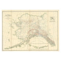
Antique Map of Alaska '1904'
Located in Langweer, NL
An antique map titled 'Map of Alaska Compiled Under the Direction of R.U. Goode, Geographer,' which
Category
Early 20th Century Alaska Antique Map
Materials
Paper
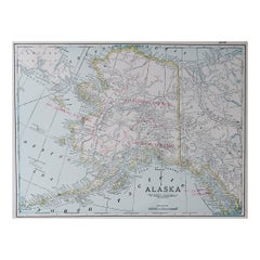
Large Original Antique Map of Alaska, USA, C.1900
Located in St Annes, Lancashire
Fabulous map of Alaska
Original color
Engraved and printed by the George F. Cram Company
Category
1890s American Alaska Antique Map
Materials
Paper
California, Alaska and Mexico: 18th Century Hand-Colored Map by de Vaugondy
By Didier Robert de Vaugondy
Located in Alamo, CA
day Alaska in the north to Baja California in the south. The map includes the Strait of Anian in the
Category
1770s French Alaska Antique Map
Materials
Paper
H 13.75 in W 16.63 in D 0.13 in
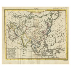
Antique Map of Asia from the Middle East to the Coast of Alaska, 1816
Located in Langweer, NL
Antique map titled ‘L’Asie‘. This is an original antique map of Asia, by Hérisson, taken from atlas
Category
19th Century Alaska Antique Map
Materials
Paper
1864 Map of North America, Antique Hand-Colored Map, by Adolphe Hippolyte Dufour
Located in Colorado Springs, CO
map at the lower left showing the edge of present day Alaska. The land of Alaska is labeled here as
Category
1860s French Alaska Antique Map
Materials
Paper
H 44.5 in W 33 in D 1.5 in
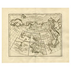
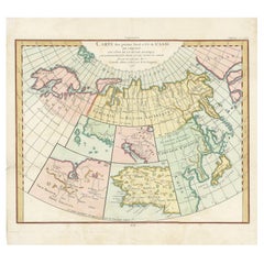
Antique Map of North and East Asia, 1751
Located in Langweer, NL
maps on one sheet, showing California, Alaska and Siberia, Korea and Japan. South to Korea the island
Category
18th Century Alaska Antique Map
Materials
Paper
Interesting Original Antique Hemisphere Map Showing the Latest Discoveries
Located in Langweer, NL
Antique world map titled 'A Map of the World from the best Authorities'. Detailed map of the World
Category
Late 18th Century Alaska Antique Map
Materials
Paper
No Reserve
H 13.39 in W 22.05 in D 0.02 in
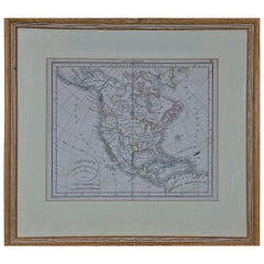
America "Amérique Septentrionale": A 19th Century French Map by Delamarche
By Maison Delamarche 1
Located in Alamo, CA
This framed mid 19th century map of North America entitled "Amérique Septentrionale" by Felix
Category
Mid-19th Century American Other Alaska Antique Map
Materials
Paper
H 20 in W 22.63 in D 0.88 in
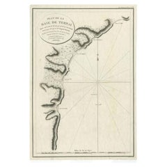
Antique Map of the Bay of Terney by La Pérouse, 1797
Located in Langweer, NL
Antique map titled 'Plan de la Baie de Ternai'. Old map of the north eastern coast of Russia. This
Category
18th Century Alaska Antique Map
Materials
Paper
Antique Map of North Europe and East Asia by Vaugondy, circa 1750
Located in Langweer, NL
Asia. Five maps on one sheet, showing California, Alaska and Syberia, Korea and Japan. South to Korea
Category
Mid-18th Century Alaska Antique Map
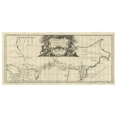
Antique Map with Details of Berings' Expedition into Russians' Far East, 1737
Located in Langweer, NL
first expedition to discover and partially map what is now Alaska. It opened the way to the lengthy
Category
1730s Alaska Antique Map
Materials
Paper
H 12.96 in W 22.64 in D 0 in
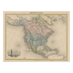
Antique Map of North America with Vignette of the Statue of Liberty, New York
Located in Langweer, NL
Antique map titled 'Amérique du Nord'. Original antique map of North America. Meticulous
Category
Late 19th Century Alaska Antique Map
Materials
Paper
Free Shipping
H 15.44 in W 20.4 in D 0.02 in
Antique Map of The Bay of D'Estaing located on the Russian island Sakhalin, 1798
Located in Langweer, NL
Antique map titled 'Plan of La Baie d'Estaing'.
This map shows the bay of D'Estaing located on
Category
1790s Alaska Antique Map
Materials
Paper
H 16.34 in W 14.38 in D 0 in
Miniature Terrestrial Globe Newton & Son London, Post 1833, Ante 1858
By Newton and Son
Located in Milano, IT
). Canada is called "British Territory" and Alaska "Russian Territory" (it would become part of the United
Category
1840s English Early Victorian Alaska Antique Map
Materials
Bronze
Alaska, North America. Century Atlas antique vintage map
Located in Melbourne, Victoria
'The Century Atlas. Alaska, North America.'
Original antique map, 1903.
Inset maps of 'Sitka
Category
Early 20th Century Victorian Alaska Antique Map
Materials
Lithograph
Alaska, United States of America, Century Atlas state antique vintage map
Located in Melbourne, Victoria
'The Century Atlas. Alaska.' Inset maps of 'Sitka, Glacier Bay' and Aleutian Is.'.
Original antique
Category
Early 20th Century Victorian Alaska Antique Map
Materials
Lithograph
H 11.62 in W 15.95 in
United States of America. Century Atlas antique map
Located in Melbourne, Victoria
'The Century Atlas. United States of America.'
Original antique map, 1903.
Inset map of 'Alaska
Category
Early 20th Century Victorian Alaska Antique Map
Materials
Lithograph
Antique Print of a Woman of Unalaska in the Aleutian Islands, Alaska, 1803
By Cook
Located in Langweer, NL
sell original antique maps to collectors, historians, educators and interior decorators all over the
Category
19th Century Alaska Antique Map
Materials
Paper
H 9.06 in W 5.52 in D 0 in
California: 18th Century Hand-colored Map by de Vaugondy
By Didier Robert de Vaugondy
Located in Alamo, CA
day Alaska in the north to Baja California in the south. The map includes the Strait of Anian in the
Category
1770s Alaska Antique Map
Materials
Engraving
Siberia as Explored by Behring: Original 18th Century Hand-colored Map by Bowen
Located in Alamo, CA
This is an original 18th century hand-colored map entitled "An Exact Chart of all the Countries
Category
Mid-18th Century Old Masters Alaska Antique Map
Materials
Engraving
North America: A Framed Hand-colored 19th Century German Map by Adolph Stieler
By Adolf Stieler
Located in Alamo, CA
This framed early 19th century map of North America entitled "Nord-Amerika" is plate No. LIV (No
Category
1830s Alaska Antique Map
Materials
Engraving
H 19.5 in W 22 in D 0.88 in
Antique Print of Canoes of Unalaska by Cook, 1803
By James Cook
Located in Langweer, NL
Antique print Alaska titled 'Kanos van Oonalashka'. Antique print depicting two canoes of Unalaska
Category
19th Century Alaska Antique Map
Materials
Paper
Encounter at Lituya Bay: French Explorers Among the Tlingit, 1786
Located in Langweer, NL
known today as Lituya Bay in Alaska. This area was explored by the French during the late 18th century
Category
Late 18th Century Alaska Antique Map
Materials
Paper
Free Shipping
H 8.08 in W 10.44 in D 0 in
Le Coste Nord Ovest Dell' America E Nord Est Dell' Asia Delineate Sulle Ultime O
Located in Bristol, CT
Alaska, the Bering Strait, and Siberia. Cassini issued this map in his 1798 atlas to illustrate the
Category
1790s Alaska Antique Map
Materials
Paper
Pocket Globe, Nicholas Lane, London, post 1779
By Nicholas Lane
Located in Milano, IT
inaccurately: Alaska is barely described, and the northeastern coasts appear to be connected to Greenland
Category
1780s English Other Alaska Antique Map
Materials
Leather, Wood, Paper
Antique Print of Two Japanese Vessels, 1799
Located in Langweer, NL
acquired in Alaska, dividing the profits among his men. Lapérouse sailed all the way south to the Spanish
Category
1790s Alaska Antique Map
Materials
Paper
Pocket Globe by Nathaniel Hill, London 1754
Located in Milano, IT
colonies. It shows California as a peninsula and the northwest coast of America as "unknown parts" (Alaska
Category
1750s English George II Alaska Antique Map
Materials
Shagreen, Paper
English Pocket Globe, London, Circa 1775-1798
By Herman Moll
Located in Milano, IT
region in his 1727 map. (Encyclopaedia Britannica, ed. 1902, under "States of Central Africa"); Tartary
Category
Late 18th Century English George III Alaska Antique Map
Materials
Shagreen, Paper
Captain James Cook: 18th C. Portrait by William Hodges After Cook's 2nd Voyage
By William Hodges
Located in Alamo, CA
to explore the eastern coast of Australia, and he was the first to map the New Zealand coastline. He
Category
1770s Alaska Antique Map
Materials
Engraving
People Also Browsed
Postmodern Smoked Wall Mirror with a Triple Chrome-Plated Metal Frame, Italy
Located in Bresso, Lombardy
Made in Italy, 1970s.
This mirror features a tripe chrome-plated metal frame and a smoked mirror.
It might show slight traces of use since it's vintage, but it can be considered as ...
Category
1970s Italian Post-Modern Alaska Antique Map
Materials
Chrome, Metal
H 31.5 in W 23.63 in D 1.19 in
Signed limited edition nude fine art print, Woman Model, Intimate - Caroline
By Ian Sanderson
Located in Barcelona, Barcelona
An original signed archival pigment print on Hahnemühle Photo Rag® Baryta 315 gsm paper by Scottish artist Ian Sanderson (1951- 2020) titled ‘ Caroline ‘
Signed by Ian Sanderson lo...
Category
1980s Contemporary Alaska Antique Map
Materials
Photographic Film, Archival Paper, Photographic Paper, Black and White, ...
Free Shipping
H 29.53 in W 19.69 in D 0.08 in
Porto Sofa - Standard with Armrest
By Project 213A
Located in Macieira de Sarnes, PT
Porto Sofa - Standard with Armrest
Designed by Project 213A in 2023
The Porto Modular sofa offers many possibilities in terms of customization. Its different modules can be arranged...
Category
2010s Portuguese Modern Alaska Antique Map
Materials
Faux Leather
Georgian English Sterling Silver Candlesticks
By John Winter & Co 1
Located in Jesmond, Newcastle Upon Tyne
An exceptional, fine and impressive pair of antique George III English sterling silver candlesticks; part of our Georgian ornamental silverware collection.
These exceptional antiq...
Category
1780s English George III Alaska Antique Map
Materials
Silver, Sterling Silver
Figurative photograph, Contemporary print, Romantic Nude woman- Lisa
By Ian Sanderson
Located in Barcelona, Barcelona
An original signed archival pigment print on Hahnemühle Photo Rag® Baryta 315 gsm paper by Scottish artist Ian Sanderson (1951- 2020) titled ‘ Lisa ‘ who was captured on film in 1989...
Category
1980s Contemporary Alaska Antique Map
Materials
Archival Paper, Archival Pigment, Black and White, Giclée, Photographic ...
Free Shipping
H 19.69 in W 13.39 in D 0.08 in
Worn-In Distressed Antique Persian Karaja Heriz Rug with Rustic Style
Located in Dallas, TX
72988 Worn-In Distressed Antique Persian Karaja Heriz Rug with Rustic Style. This hand-knotted wool distressed antique Persian Karaja Heriz rug with Mid-Century Modern style features...
Category
Early 20th Century Persian Rustic Alaska Antique Map
Materials
Wool
English 19th Century Georgian Mahogany Chest of Drawers
Located in Baton Rouge, LA
A stunning mahogany chest of drawers, made in early 19th century England, circa 1820. This five drawer case antique is made in the Georgian style and features a linear composition wi...
Category
19th Century English Georgian Alaska Antique Map
Materials
Brass
Antique Handwoven Navajo Rug, Early 20th Century
Located in San Francisco, CA
Antique Handwoven Navajo Rug, Early 20th Century
This scatter-sized Navajo rug with a design of linked diamonds in adjoining rows exemplifies the charm of Southwestern design. The m...
Category
Early 20th Century American Alaska Antique Map
Materials
Wool
Girafe Nº 2 by Alcino Silversmith 1902 Handcrafted in Sterling Silver
Located in Porto, 13
Giraffe nº 2 by Alcino Silversmith 1902 is a handcrafted piece in 925 Sterling Silver with twisted head, hammered and chiseled by excellent craftsmen, giving this piece a much higher...
Category
21st Century and Contemporary Portuguese Alaska Antique Map
Materials
Sterling Silver, Silver
Antique Kittinger 8-inch Terrestrial World Globe on a Mahogany Wooden Stand
By Kittinger Furniture Company
Located in Philadelphia, PA
A fine, antique 8 inch terrestrial globe.
Manufactured by Kittinger Company, Inc. (in collaboration with the publishers W. & A.K. Johnston, Ltd. of Edinburgh, Scotland).
On a turne...
Category
Early 20th Century Alaska Antique Map
Materials
Mahogany, Gesso, Wood, Paper
H 18 in W 11.5 in D 11.5 in
Still Life with Oriental Poppy
Located in Aberdeen Dyce, GB
Scottish modernist painter. President of Dundee Art Society 1947-49. Fellow of the Royal Scottish Society of Painters in Watercolour. Represented in the collections of Dundee's McMan...
Category
20th Century Modern Alaska Antique Map
Materials
Watercolor
1859 "Colton's New Map of the State of Texas..." by Johnson & Browning
Located in Colorado Springs, CO
Presented is "Colton's New Map of the State of Texas Compiled from De Cordova's Large Map", published in Alivin J. Johnson’s “New Illustrated Family Atlas.” The map was published in ...
Category
1850s American Alaska Antique Map
Materials
Paper
H 27.75 in W 38.5 in D 1.38 in
Gamekeeper Stalker in Scottish Highlands with Pony & Stag painting
Located in Cirencester, Gloucestershire
The Scottish Highlands
by Ben George Powell, British contemporary artist
signed
acrylic on board, unframed
board: 16 x 20 inches
provenance: private collection of this artists work,...
Category
21st Century and Contemporary Modern Alaska Antique Map
Materials
Acrylic
The Weaver- Original Oil-UK Awarded Artist-( feat. Scottish Tartan vs Camellia)
Located in London, GB
2024, Shizico Yi takes on an innovative project she named it "The Weaver," inspired by the heritage of family's Tartan, the rich lineage and history of the Clan. Within the patterns...
Category
2010s Abstract Expressionist Alaska Antique Map
Materials
Gesso, Oil, Acrylic
H 19.49 in W 15.56 in D 0.6 in
1877 "Geological and Geographical Atlas of Colorado" by F. V. Hayden
Located in Colorado Springs, CO
This is F. V. Hayden's Geological and Geographical Atlas of Colorado and Portions of Adjacent Territory, an unmatched geological record for its time. Published by the Department of t...
Category
1870s American Alaska Antique Map
Materials
Paper
A Tallis Map of British Guiana with Colonial Vignettes and Other Landmarks, 1851
Located in Langweer, NL
This Tallis map of British Guiana (now known as Guyana) is a richly decorated document, much like other maps from the esteemed cartographic publisher John Tallis & Company. The firm,...
Category
1850s Alaska Antique Map
Materials
Paper
H 14.26 in W 10.71 in D 0 in
Recent Sales
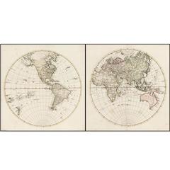
Rare 1790s Russian Map of the World
Located in La Jolla, CA
Rare set of Eastern Hemisphere and Western Hemisphere maps, with place names in Cyrillic, likely
Category
1790s Russian Alaska Antique Map
Materials
Paper
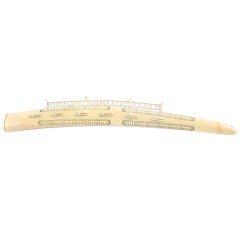
Northwest Coast Walrus Tusk Cribbage Board and Map
Located in Chicago, IL
carving at the top, the piece was done in 1909, Kings Island, Nome, Alaska.
Category
Early 20th Century Folk Art Alaska Antique Map
Materials
Ivory
World map on Mercator's projection by Bonne - Engraving - 18th Century
Located in Zeeland, Noord-Brabant
Terre (…).' - World map on Mercator's projection. Greenland and the Arctic are attached to North America
Category
1780s Contemporary Alaska Antique Map
Materials
Engraving
H 11.03 in W 16.26 in
L' Amerique Septentrionale (North America with California as an Island)
Located in New York, NY
Original and rare 1702 map of North America showing California as a island stretching as far north
Category
Early 1700s Realist Alaska Antique Map
Materials
Engraving
Arizona Mountains
By Paul Lauritz
Located in Graton, CA
desert landscapes. Early in his career, he was in Alaska.
He was raised in the picturesque Norwegian
Category
Early 20th Century Impressionist Alaska Antique Map
Materials
Oil
1844 Map of the World on Mercator's Projection by Atwood and Ensign, Antique Map
Located in Colorado Springs, CO
This 1844 large format world map is surrounded by several decorative elements including 91 flags of
Category
1840s American Alaska Antique Map
Materials
Paper
H 47.5 in W 60.5 in D 4 in
Antique Map of North America by Tallis 'c.1850'
Located in Langweer, NL
' (Alaska). This map originates from 'The History and Topography of the United States of America: edited by
Category
Mid-19th Century Alaska Antique Map
Materials
Paper
Map of American Indian Reservations 1884 in Period Walnut Frame
Located in San Francisco, CA
Washington: Department of the Interior. This interesting 1884 map presents the Indian Reservations
Category
1880s American Alaska Antique Map
Materials
Walnut, Paper
Pocket Globe John and William Cary, London 1791
By Cary’s
Located in Milano, IT
. The United States occupies only the eastern half of its current territory. Alaska is not described and
Category
1790s English George III Alaska Antique Map
Materials
Shagreen, Paper
IMPORTANT MAP OF THE N.W. PASSAGE, CALIFORNIA, ASIA - Am. Revolutionary War Time
Located in Santa Monica, CA
, che nell' AMERICA
(Wagner 654. Armstrong, From Sea Unto Sea, 32. Falk, Alaskan Maps, 1776-2. Kershaw
Category
1770s Old Masters Alaska Antique Map
Materials
Engraving
Our National Parks by John Muir, First Edition, 1901
Located in Colorado Springs, CO
illustrations and map diagrams throughout. The ten essays included had previously appeared as separately issued
Category
Early 1900s American Alaska Antique Map
Antique World Map on Mercator's Projection, 1782
Located in Langweer, NL
Antique map titled 'Carte Reduite des Terres et des Mers du Globe Terrestre.'
World map on
Category
1780s Alaska Antique Map
Materials
Paper
Antique Map of North America by Tallis 'c.1850'
Located in Langweer, NL
' (Alaska). This map originates from 'The History and Topography of the United States of America: edited by
Category
Mid-19th Century Alaska Antique Map
Materials
Paper
Antique Map of American Northwest, 1752
Located in Houston, TX
"discovered" by the great navigators and explorers. Map covers area from todays Portland to Alaska and from
Category
18th Century and Earlier Other Art Style Alaska Antique Map
Materials
Ink, Paper, Watercolor
Northwest Coast Walrus Tusk Cribbage Board and Map
Located in Chicago, IL
carving at the top, the piece was done in 1909, Kings Island, Nome, Alaska.
Category
Early 20th Century Folk Art Alaska Antique Map
Materials
Ivory
Antique Mid-19th Century Wall Map of North America by Lienhart Holle
Located in Vienna, AT
A extremely rare wall map for schools, with a colored key for the possessions of European countries
Category
19th Century German Biedermeier Alaska Antique Map
Free Shipping
H 44.1 in W 54.73 in D 0.79 in
1700 World Map
Located in New York, NY
Original 1700 hand-colored engraving of a double hemisphere map of the world. Designed by Denis
Category
Early 1700s Realist Alaska Antique Map
Materials
Engraving
Antique Mid-19th Century Wall Map of North America by Lienhart Holle, 1870
By Lienhart Holle
Located in St. Margarethen, AT
An extremely rare wall map for schools, with a colored key for the possessions of European
Category
1870s European Other Alaska Antique Map
Materials
Paper
H 54.73 in W 44.1 in D 0.08 in
Get Updated with New Arrivals
Save "Alaska Antique Map", and we’ll notify you when there are new listings in this category.
Alaska Antique Map For Sale on 1stDibs
At 1stDibs, there are many versions of the ideal alaska antique map for your home. Each alaska antique map for sale was constructed with extraordinary care, often using paper, animal skin and shagreen. Whether you’re looking for an older or newer alaska antique map, there are earlier versions available from the 18th Century and newer variations made as recently as the 20th Century. Each alaska antique map bearing Georgian or Victorian hallmarks is very popular. Cook, Didier Robert de Vaugondy and Herman Moll each produced at least one beautiful alaska antique map that is worth considering.
How Much is a Alaska Antique Map?
The average selling price for a alaska antique map at 1stDibs is $649, while they’re typically $85 on the low end and $14,087 for the highest priced.
